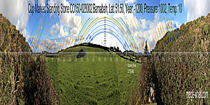
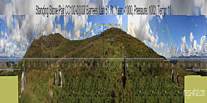
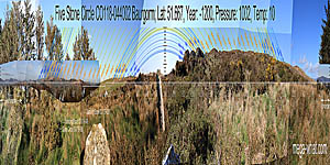
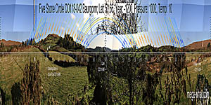
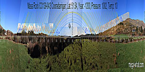
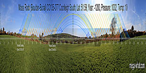
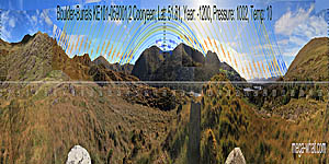
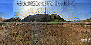
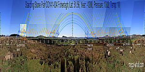
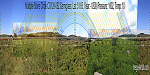
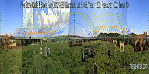
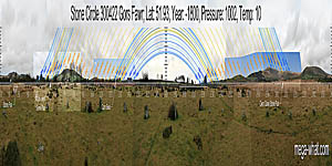
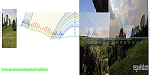
See the shape of the horizon and how it dances with patterns in the sky. Understand the significance of place. Try it Yourself! Go Outside and look. Do the slow earthly dance that puts you in place and time with heaven. See approximate symmetries. See specific accuracies. Communicate with moon and sun. Know where you are. Know when you are. Take the time. Find a magic place ☺
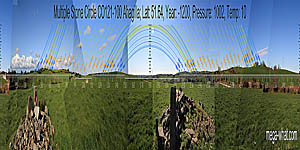
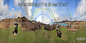
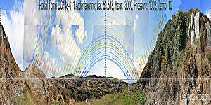
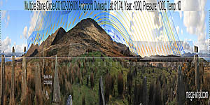
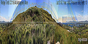
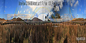
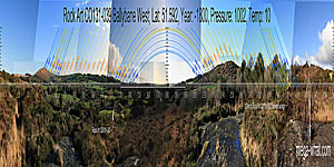
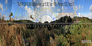
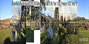
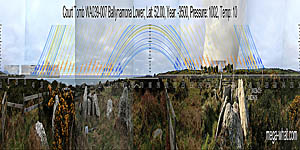
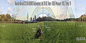
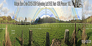
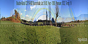
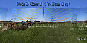
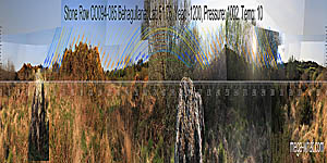
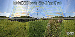
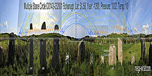
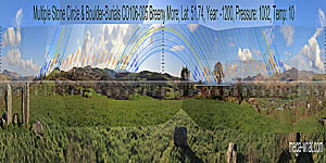
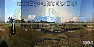
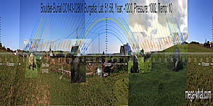
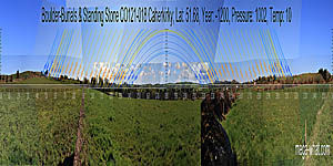
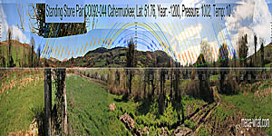
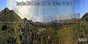
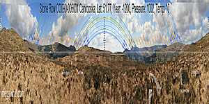
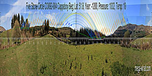
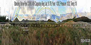
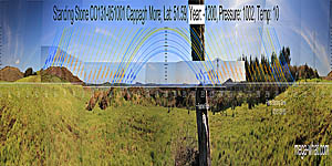
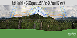
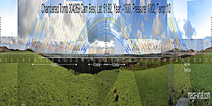
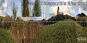
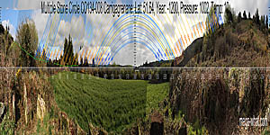
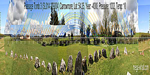
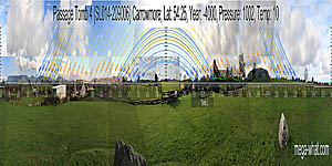
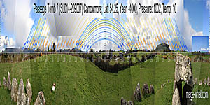
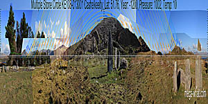
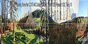
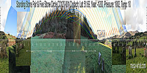
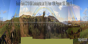
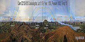
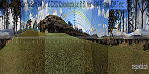
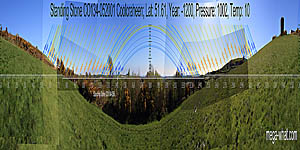
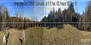
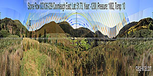
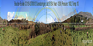
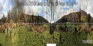
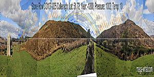
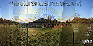
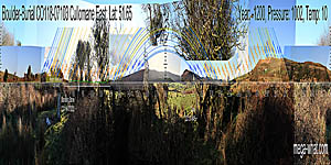
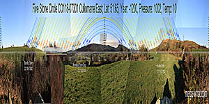
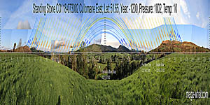
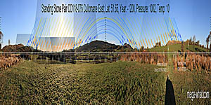
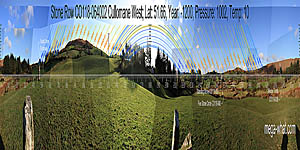
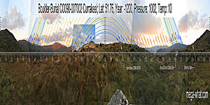
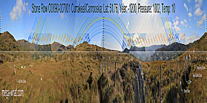
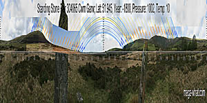
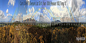
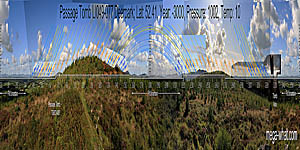
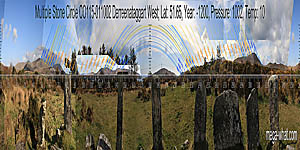
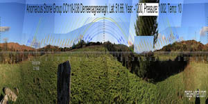
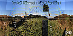
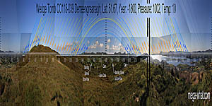
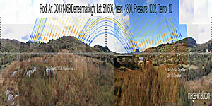
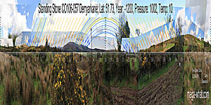
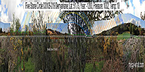
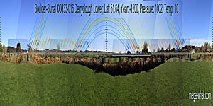
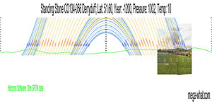
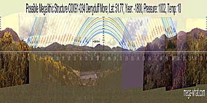
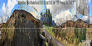
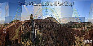
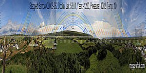
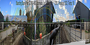
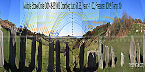
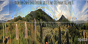
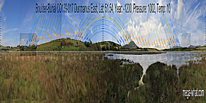
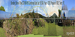
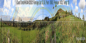
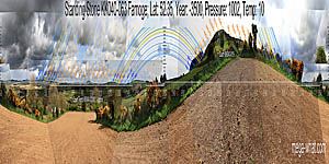
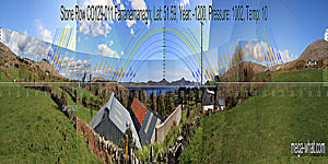
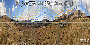
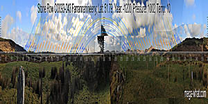
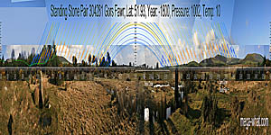
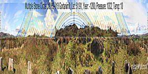
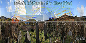
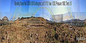
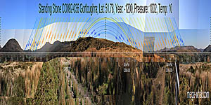
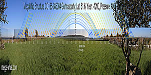
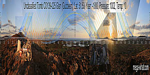
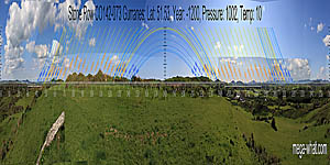
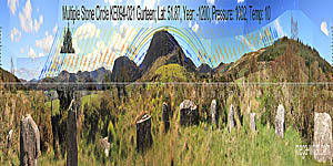
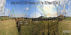
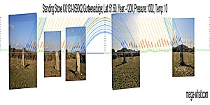
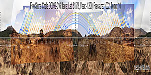
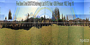
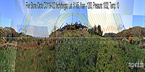
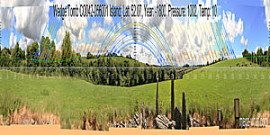
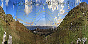
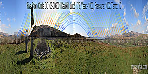
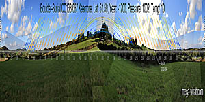
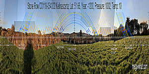
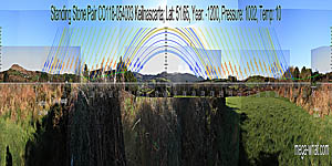
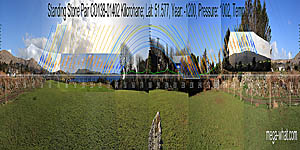
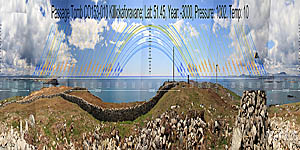
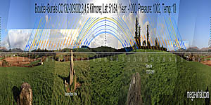
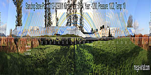
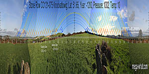
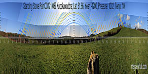
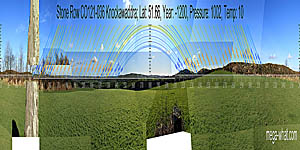
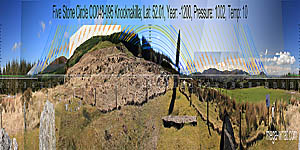
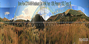
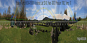
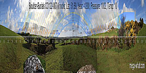
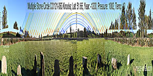
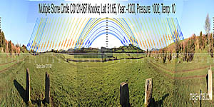
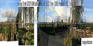
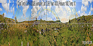
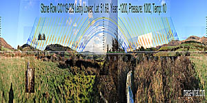
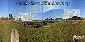
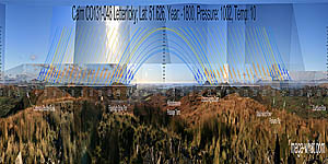
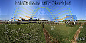
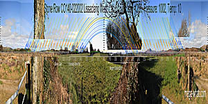
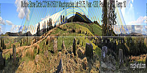
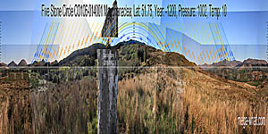
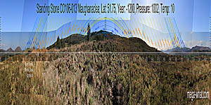
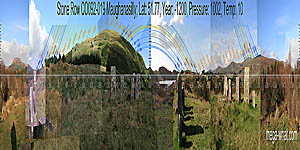
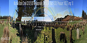
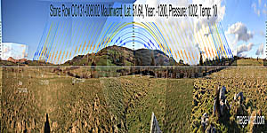
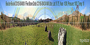
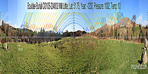
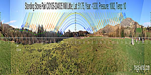
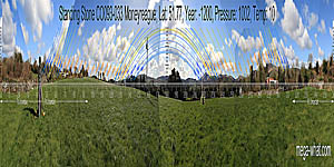
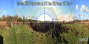
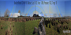
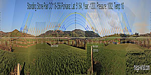
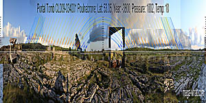
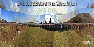
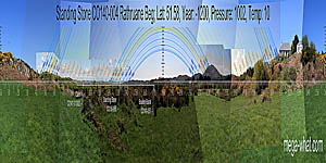
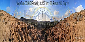
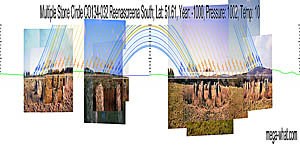
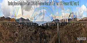
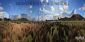
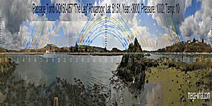
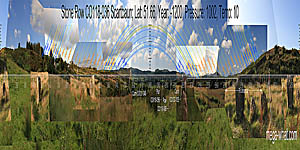
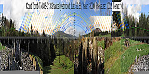
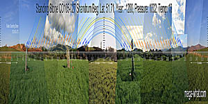
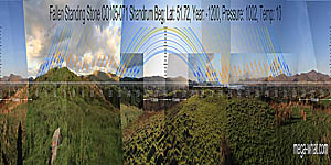
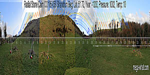
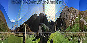
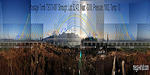
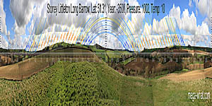
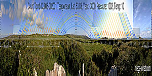
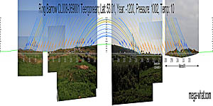
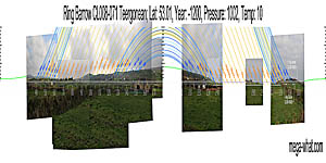
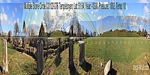
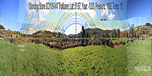
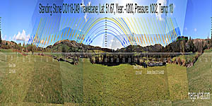
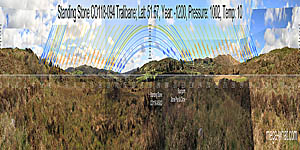
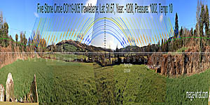
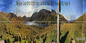
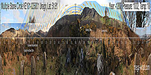
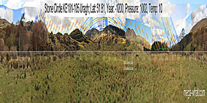
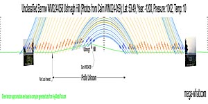
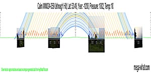
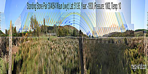
These 360° thumbs give an overview of the physical relationship between heaven and earth at surveyed ancient sacred places. Can you see what they were doing? Some are more obvious than others. All show the limitations imposed by practical reality and many of them are more subtly accurate than first appearances might suggest. Can you imagine trying to find such a place by yourself?
- Vertical scale is x4 to make it easier to see the patterns.
- Orange Solar trajectories split the tropical year into 48 "Tweeks" (7.6 day mean) that are better regarded as quarter-months.
- Solid Blue Lunar lines split cyclical lunistice position variation into 16 periods of about 14 months each.
- Lunistices are the most northerly and southerly moons of the month [More].
- Also see Technical Notes on the Pictures
181 Surveyed Sites by Location Name. Change to: 900px wide pics | 1800px wide pics