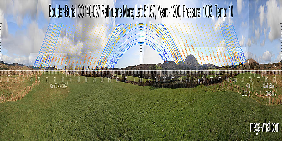
 South is indicated by a high point at the end of a ridge. North is on a hilltop.
The south-eastern lunistice range spans a hilltop. The south-western lunistice range spans a dip in a block of high ground.
The north-eastern lunistice range runs across an undulating block of high ground. The north-western lunistice range spans a break on a rising slope.

Vertical scale x4, maxpic 3200x1600.
Orange lines mark the annual solar round. Lunistice positions over the 18.6 year lunar nodal cycle are blue. More about the Solar Calendar More about the Lunar Calendar More about this placeLook North
Rathruane Boulder-Burial: 360° S centred
 South is indicated by a high point at the end of a ridge. North is on a hilltop.
The south-eastern lunistice range spans a hilltop. The south-western lunistice range spans a dip in a block of high ground.
The north-eastern lunistice range runs across an undulating block of high ground. The north-western lunistice range spans a break on a rising slope.
- Rathruane Standing Stone is 800m north (346°)
- Coolcoulaghta Boulder-Burial is 4.1km north (342°)
- Cooradarrigan Boulder-Burials are 4.3km south-west (218°)
- Lisheen Boulder-Burial is 8.7km south-east (124°)
| Home | Site Lists | Glossary | Survey Data |
Most archaeological monuments are on private property and where not otherwise indicated those wishing to visit a site should seek permission from the landowner.