
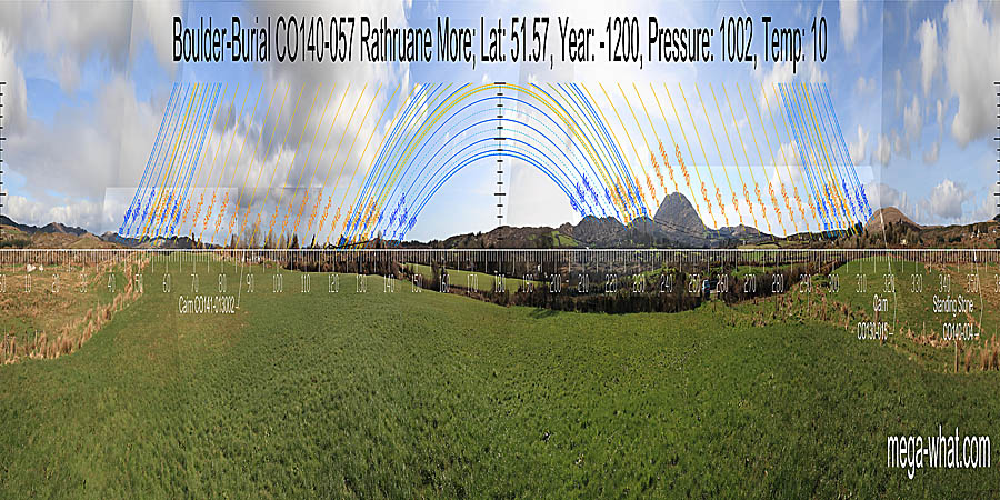
 Rathruane More Boulder-Burial is about 2.5km north-west of Ballydehob.
South is indicated by a high point at the end of a ridge [Pic].
![[Pic].](RathruaneMore-S.jpg)
North is on a hilltop [Pic].
![[Pic].](RathruaneMore-N.jpg)
 Officially listed as a "possible boulder burial", presumably on the basis that although it rests on four support stones thus architecturally conforming to type,
it is situated on a ridge of outcropping rock in a way that appears unsuitable for a burial.
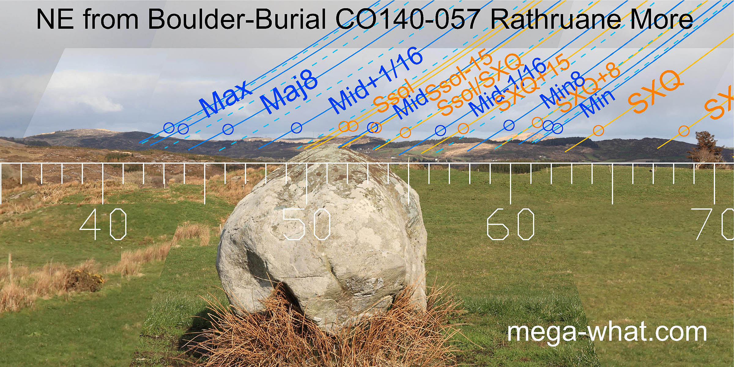
Unusually linear in shape (2.5x1.3x1.1m) with a pronounced ridge along its top mid-line that makes it an accurate pointer.
Officially listed as a "possible boulder burial", presumably on the basis that although it rests on four support stones thus architecturally conforming to type,
it is situated on a ridge of outcropping rock in a way that appears unsuitable for a burial.
Unusually linear in shape (2.5x1.3x1.1m) with a pronounced ridge along its top mid-line that makes it an accurate pointer.
To the north-east it indicates summer solstice sunrise on a hill that is rather lacking in distinctness but the accuracy of the pointer makes up for this.
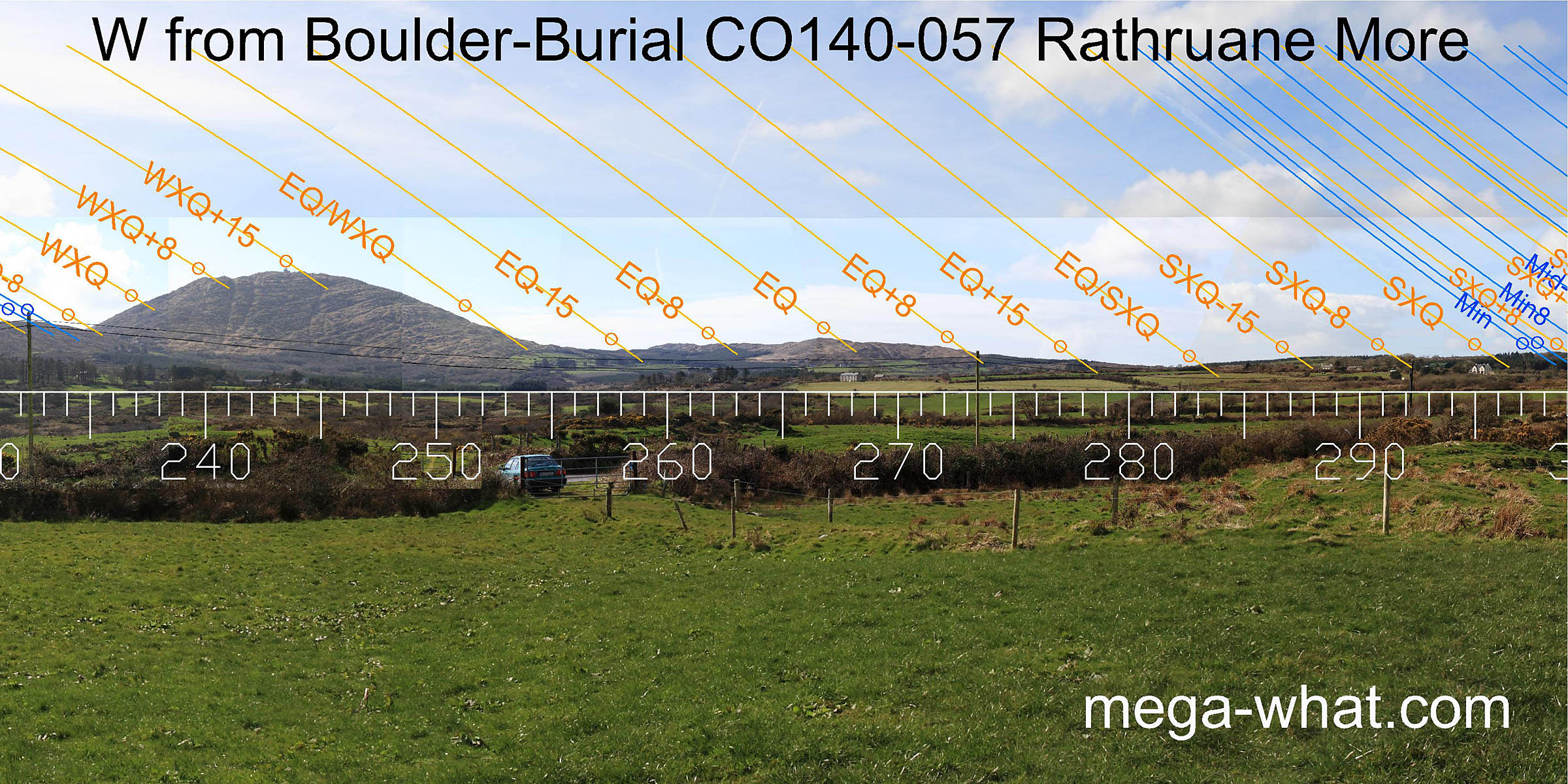
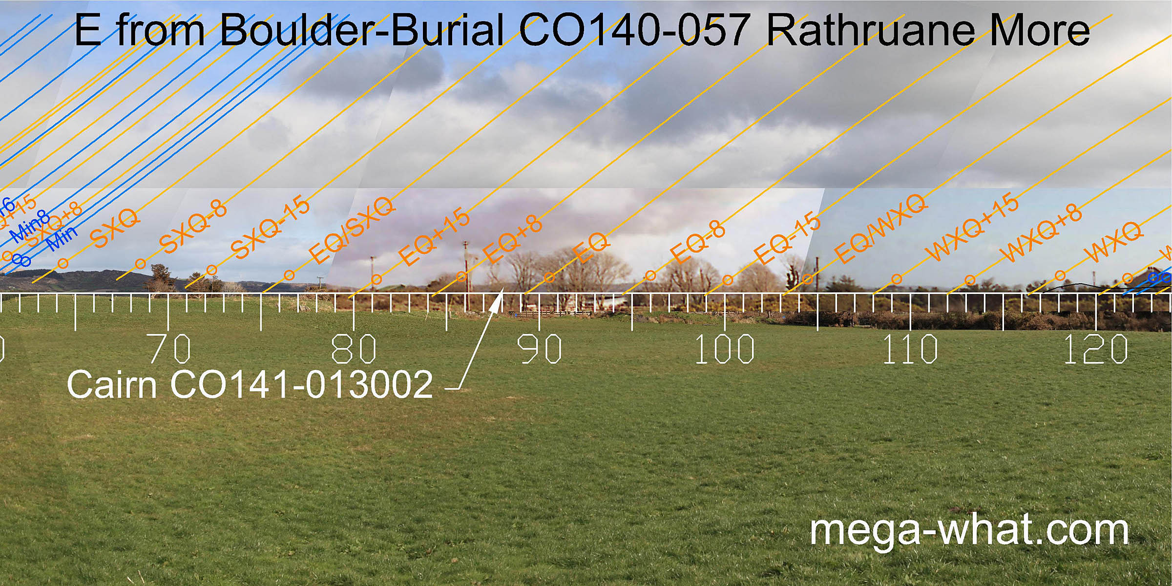 Views to the east are largely obscured by vegetation and buildings. Skeagh Cairn is on the horizon but is a couple of days north of the equinox.
 The winter cross-quarters are at the north foot of Knockomagh and major standstillLunistice positions vary cyclically over an 18.6 year period but are fairly static for more than a year at either end of the range
is at the end of a ridge.
The winter cross-quarters are at the north foot of Knockomagh and major standstillLunistice positions vary cyclically over an 18.6 year period but are fairly static for more than a year at either end of the range
is at the end of a ridge.
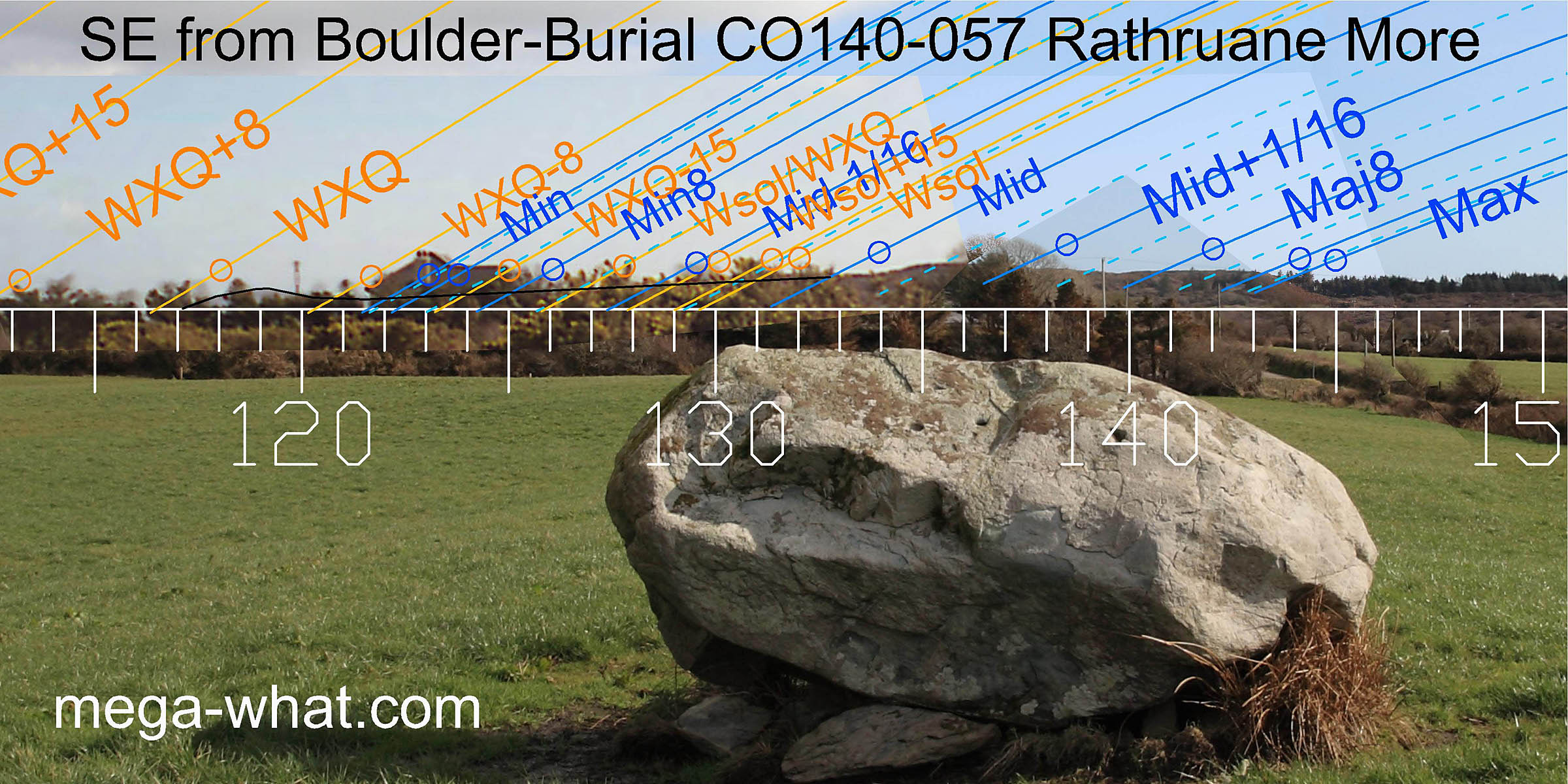
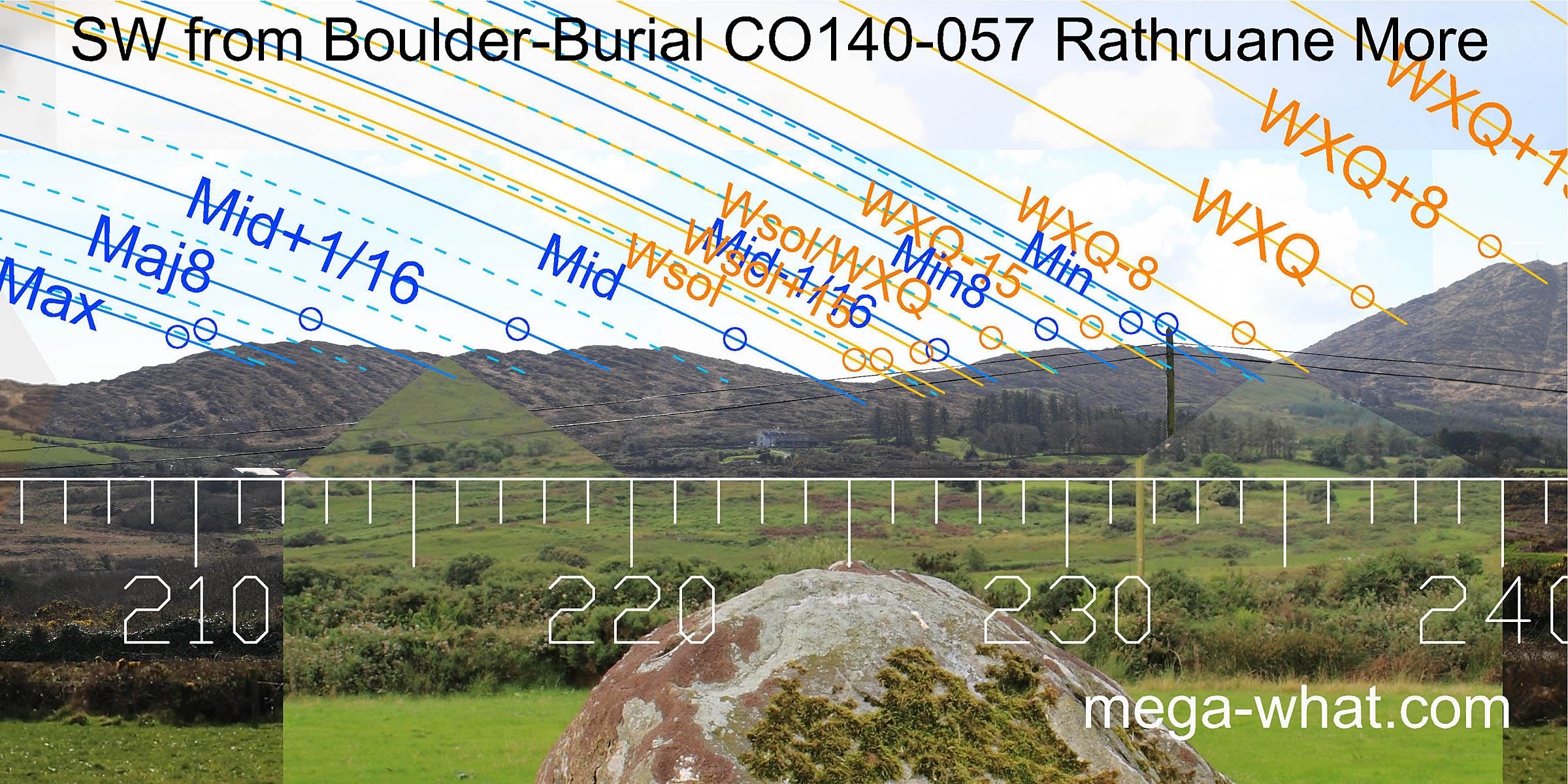 South-westwards is a rocky ridge which covers the span of the lunisticeLunistices are the most northerly and southerly moons of the month. The lunar equivalent of solstices - more.
range. The boulder axis indicates a large V dip in this which marks the winter solstice sunset.
South-westwards is a rocky ridge which covers the span of the lunisticeLunistices are the most northerly and southerly moons of the month. The lunar equivalent of solstices - more.
range. The boulder axis indicates a large V dip in this which marks the winter solstice sunset.
The month centred on the winter cross-quarters are also well defined on the southern slopes of Mount Gabriel.
 The equinox is marked by a minor top on the ridge.
The half-way to the cross-quarter markers are at the foot of Mt Gabriel's slope to the south and, to the north, at the lowest dip of the western horizon.
The equinox is marked by a minor top on the ridge.
The half-way to the cross-quarter markers are at the foot of Mt Gabriel's slope to the south and, to the north, at the lowest dip of the western horizon.
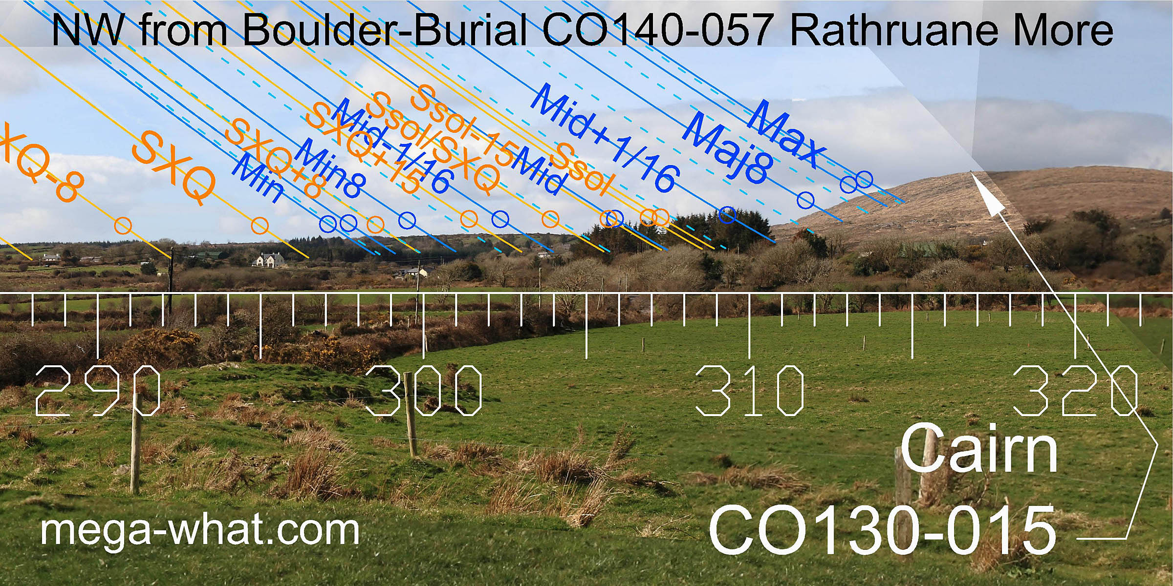 The minor end of the lunisticeLunistices are the most northerly and southerly moons of the month. The lunar equivalent of solstices - more.
range occurs at a break on the slope and the solstice is at another dip.
The major end of the lunisticeLunistices are the most northerly and southerly moons of the month. The lunar equivalent of solstices - more.
range is on the lower slopes of Mt Corrin and so Cairn CO130-015 on its top is not a marker from here.
The minor end of the lunisticeLunistices are the most northerly and southerly moons of the month. The lunar equivalent of solstices - more.
range occurs at a break on the slope and the solstice is at another dip.
The major end of the lunisticeLunistices are the most northerly and southerly moons of the month. The lunar equivalent of solstices - more.
range is on the lower slopes of Mt Corrin and so Cairn CO130-015 on its top is not a marker from here.
A Standing Stone is 800m away to the north-north-west and the two sites are intervisible. It is likely that this Standing Stone was an alternative observing position for the boulder-burial people as there are no other monuments in the locality.
- Coolcoulaghta Boulder-Burial is 4.1km north (342°)
- Cooradarrigan Boulder-Burials are 4.3km south-west (218°)
- Lisheen Boulder-Burial is 8.7km south-east (124°)
References
- Archaeological Survey of Ireland, record details. www.archaeology.ie/archaeological-survey-ireland
- POWER, D. et al. 1992 Archaeological Inventory of County Cork, Volume 1: West Cork. Dublin: Stationary Office. p33, no.137.