
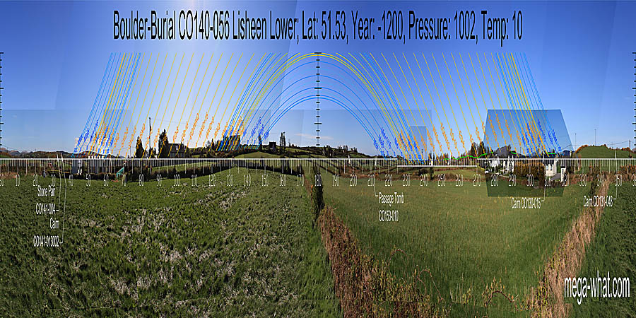
 Lisheen Boulder-Burial is between Ballydehob and Skibbereen, on the peninsula that forms the eastern side of Roaringwater bay.
South is on a low hill [Pic]. North is on a distant hill [Pic].
![[Pic].](Lisheen-S.jpg)
![[Pic].](Lisheen-N.jpg)
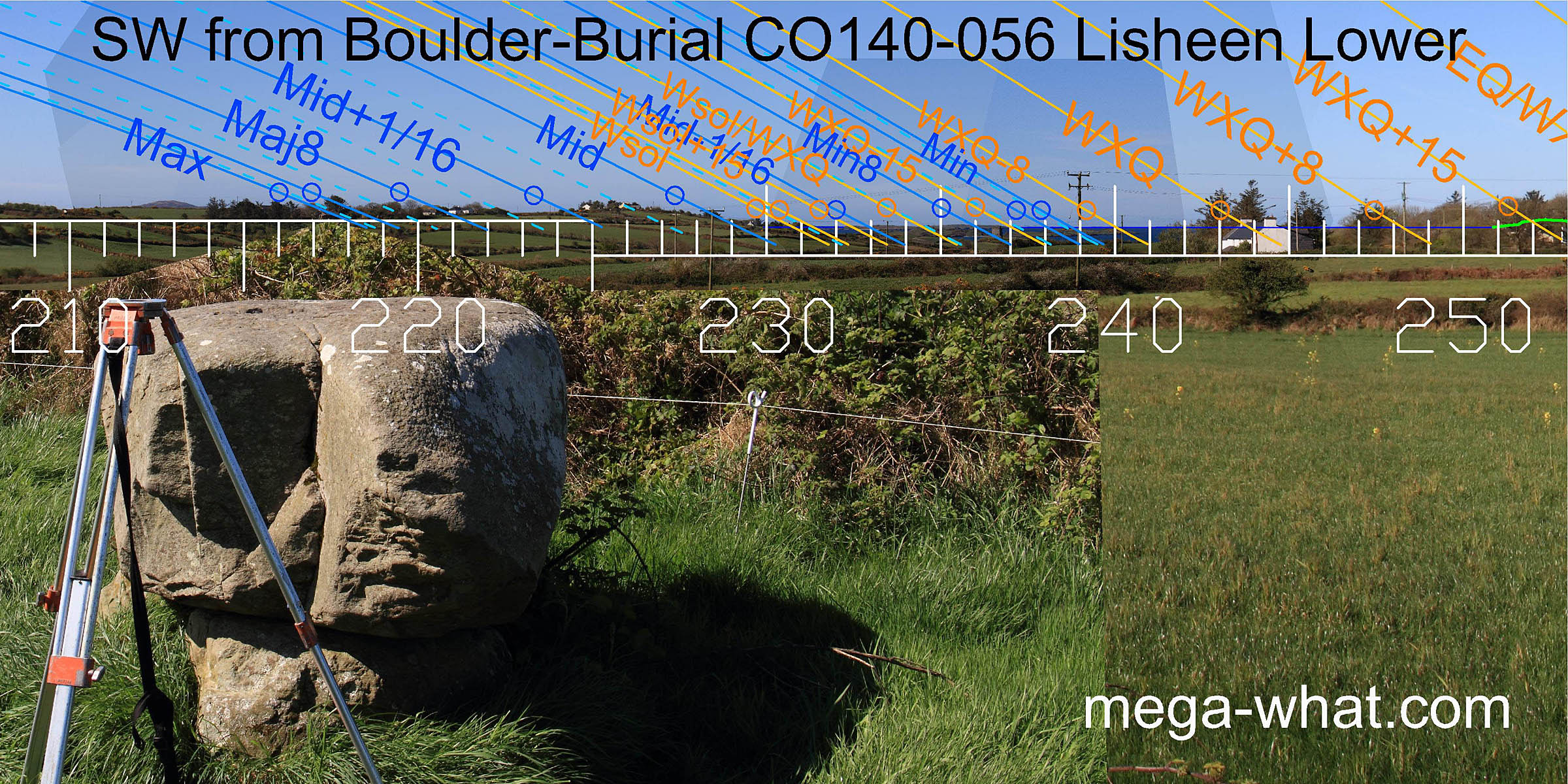 To the south-west, the axis of this boulder indicates the region of the moon's most extreme setting point.
Accurate survey is not possible due to trees and farm buildings on this part of the horizon. Winter solstice is roughly at the land / sea intersect but again accuracy is not possible due to trees.
However, there is no doubt about the utility of the islands in the bay as they provide various solar markers as well as covering the minor half of the
lunisticeLunistices are the most northerly and southerly moons of the month. The lunar equivalent of solstices - more. range.
To the south-west, the axis of this boulder indicates the region of the moon's most extreme setting point.
Accurate survey is not possible due to trees and farm buildings on this part of the horizon. Winter solstice is roughly at the land / sea intersect but again accuracy is not possible due to trees.
However, there is no doubt about the utility of the islands in the bay as they provide various solar markers as well as covering the minor half of the
lunisticeLunistices are the most northerly and southerly moons of the month. The lunar equivalent of solstices - more. range.
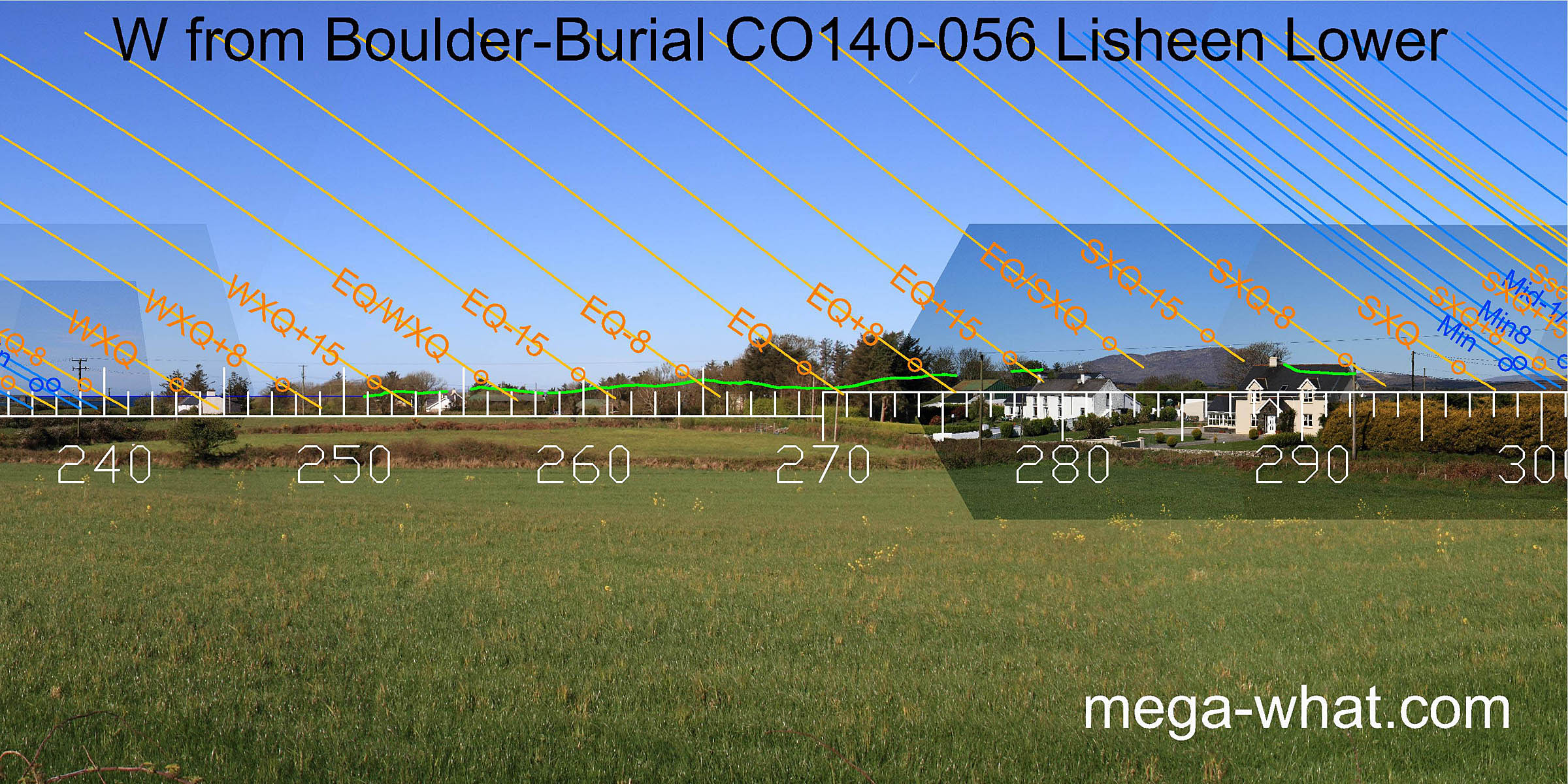
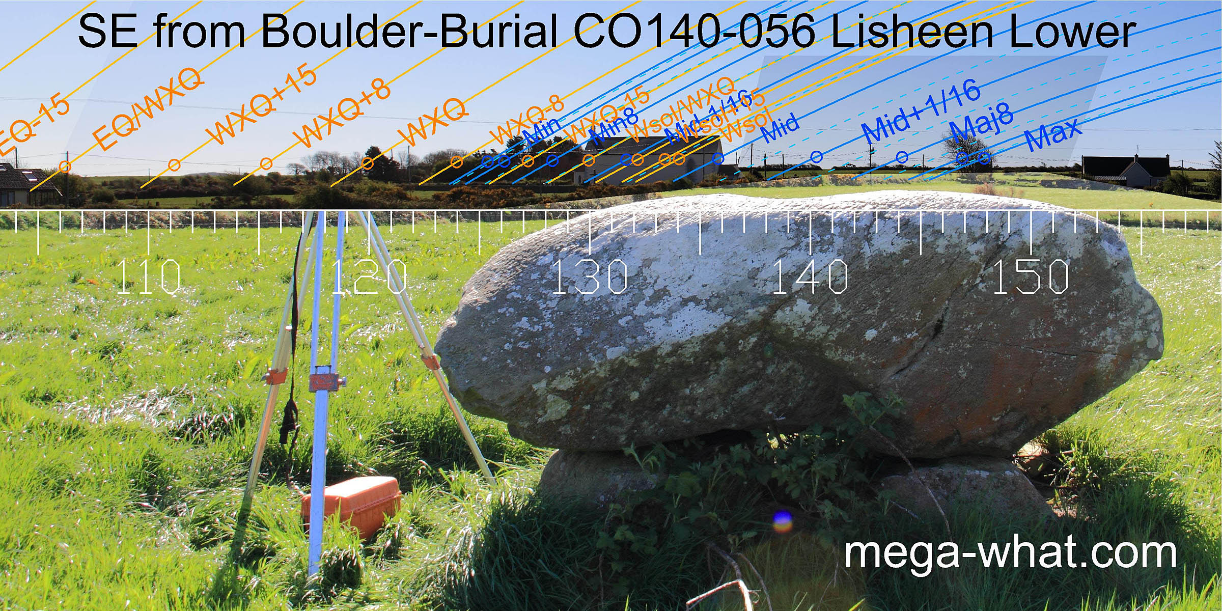
Most of the west is unsurveyable due to trees and buildings but clearly the part that can be seen is very useful. The green lines are a computer generated approximation of the hidden horizon. They show that the equinox is in a dip and both the equinox / cross-quarter midpoints are on tops.
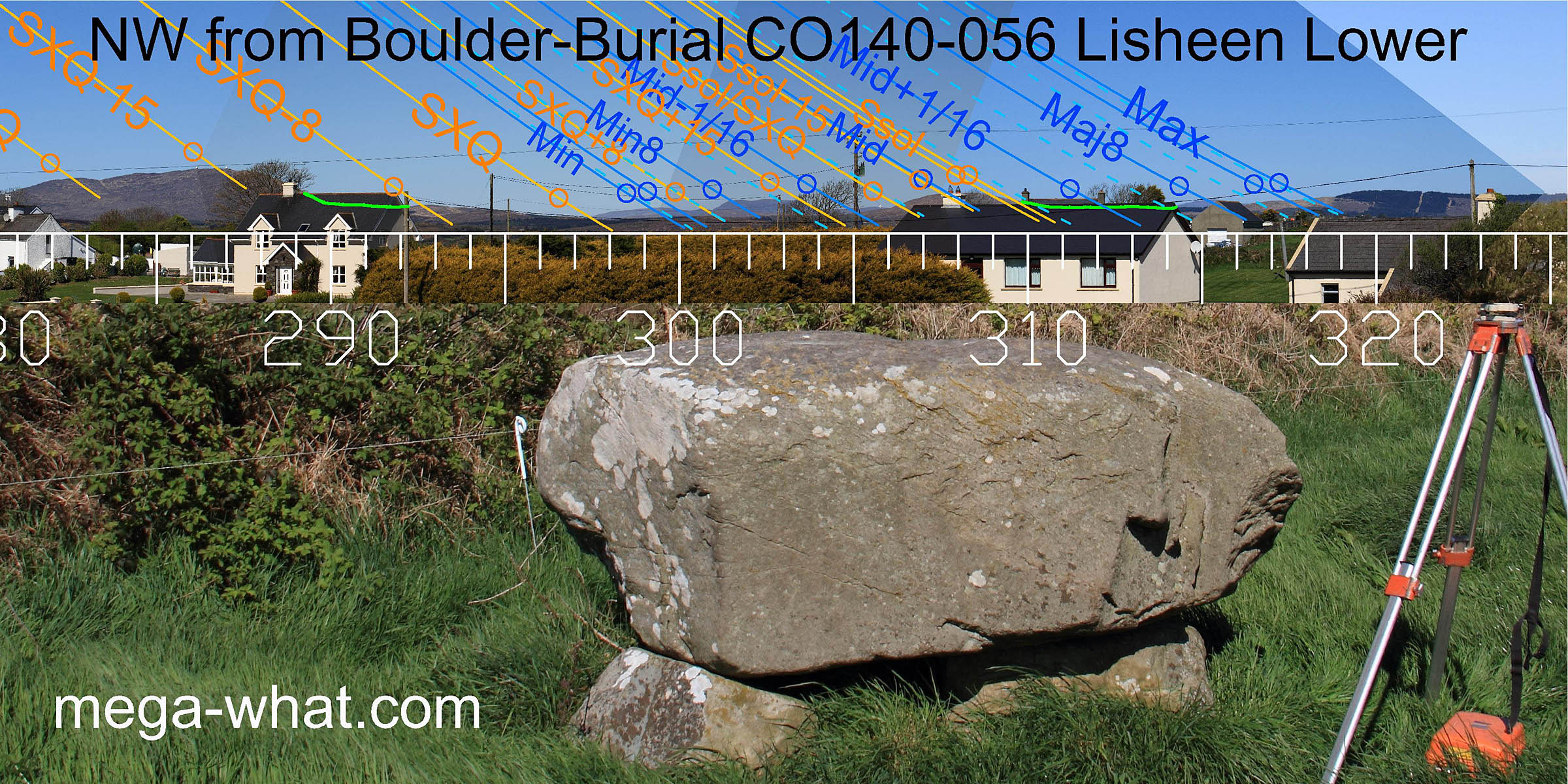 Further to the north-west more key landscape points coincide with significant solar and lunar events and the solstice is on top of Mt Corrin.
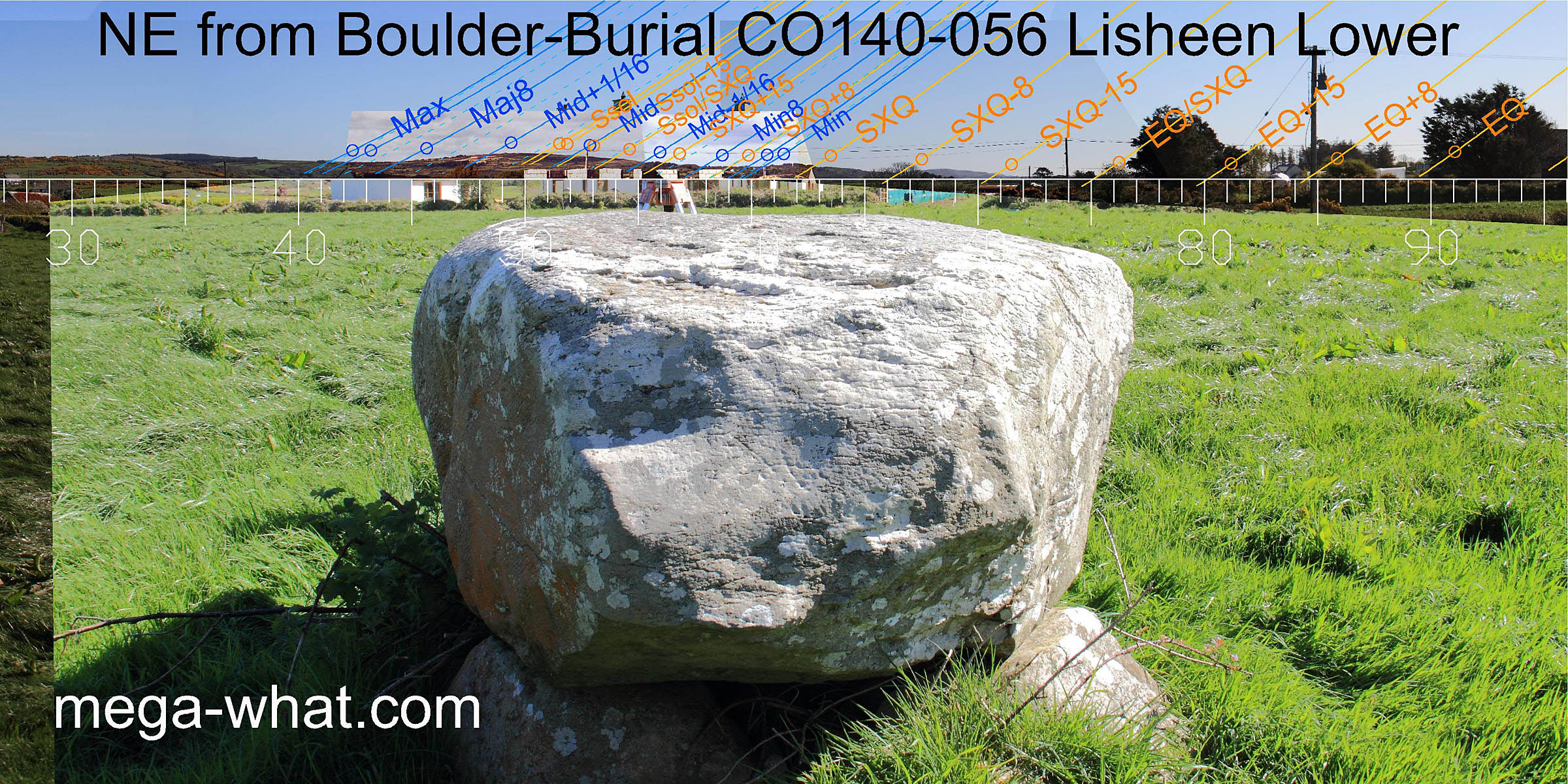 Due to the shape of the boulder its apparent axis to to the north-east is at a different angle to the south-west one but once again it indicates the lunar extreme position,
at the bottom of a dip to the west of Knockonna. the lunar minor eighth is at the east base of the hill and the minor end of the cycle at the end of a flat section, at the base of the next rise.
The lunisticeLunistices are the most northerly and southerly moons of the month. The lunar equivalent of solstices - more.
range thus spans Knockonna but the hilltop marks summer solstice rather than the lunar midpoint.
The cross-quarter is at the east base of the next small hill and the half-way point between it and the solstice is at a prominent hump on Knockonna's eastern flank.
Due to the shape of the boulder its apparent axis to to the north-east is at a different angle to the south-west one but once again it indicates the lunar extreme position,
at the bottom of a dip to the west of Knockonna. the lunar minor eighth is at the east base of the hill and the minor end of the cycle at the end of a flat section, at the base of the next rise.
The lunisticeLunistices are the most northerly and southerly moons of the month. The lunar equivalent of solstices - more.
range thus spans Knockonna but the hilltop marks summer solstice rather than the lunar midpoint.
The cross-quarter is at the east base of the next small hill and the half-way point between it and the solstice is at a prominent hump on Knockonna's eastern flank.
Foherlagh Stone Pair and Skeagh Cairn are on the horizon in this direction but beyond the lunar limit.
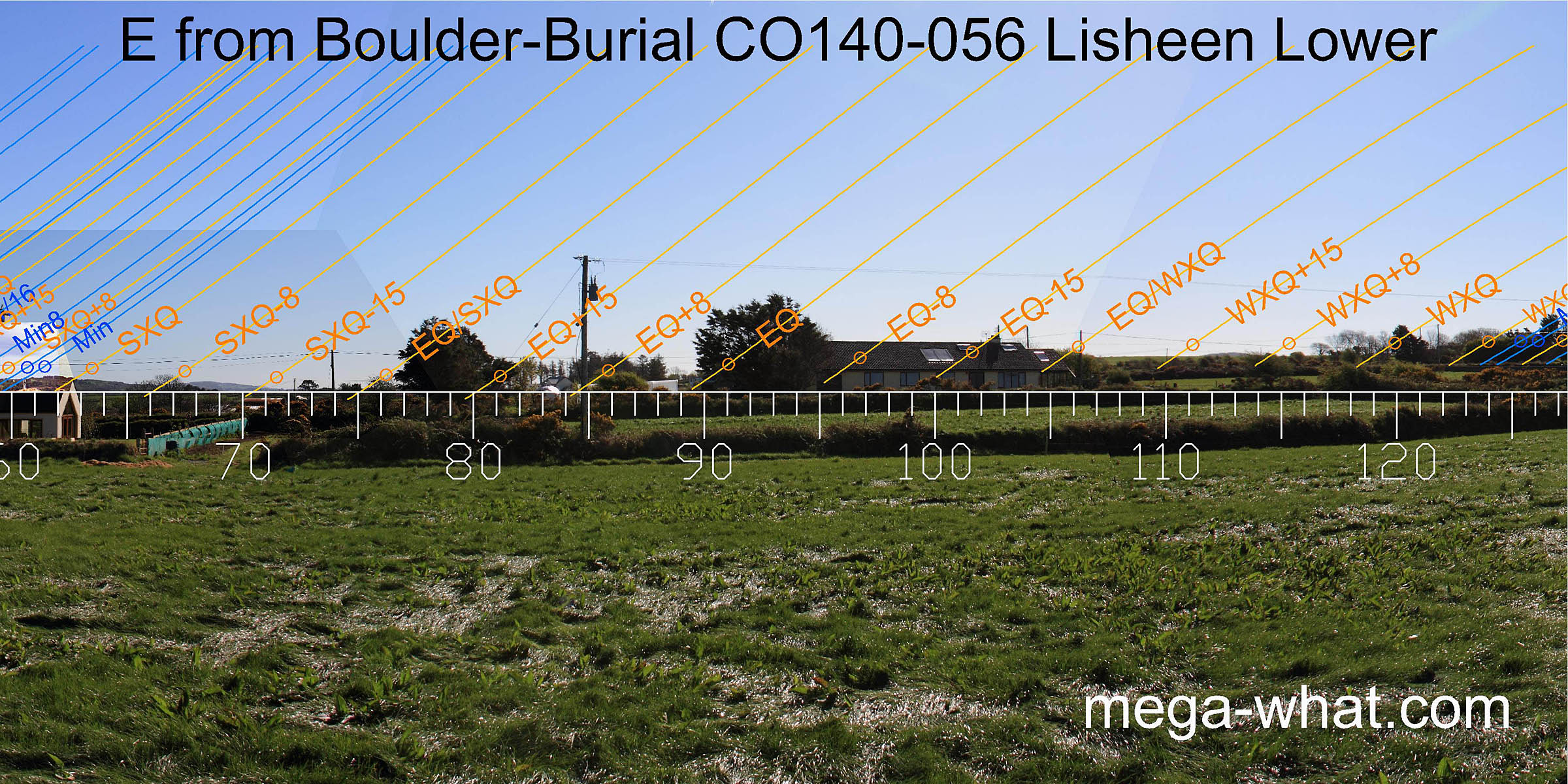 Unfortunately, this view from the site is now lost. Further east is already obscured by trees and buildings, then the horizon becomes a smooth and fairly local ridge running into the south-east.
 Just 770m away to the east but not seemingly not quite intervisible is another boulder-burial at Bawngare which has a very good south-east horizon,
that they have gone to some trouble to make even better.
Just 770m away to the east but not seemingly not quite intervisible is another boulder-burial at Bawngare which has a very good south-east horizon,
that they have gone to some trouble to make even better.
- Bawngare Boulder-Burial is 770m east (108°)
- Foherlagh Stone Pair is on the horizon, 4.7km north-east (32°)
- Rathruane Boulder-Burial is 8.7km north-west (304°)
References
- Archaeological Survey of Ireland, record details. www.archaeology.ie/archaeological-survey-ireland
- Ó'NUALLÁIN, SEÁN 1978 Boulder-Burials. Proceedings of the Royal Irish Academy 78c:75-114, p94, no.29.
- POWER, D. et al. 1992 Archaeological Inventory of County Cork, Volume 1: West Cork. Dublin: Stationary Office. p32, no.126.