
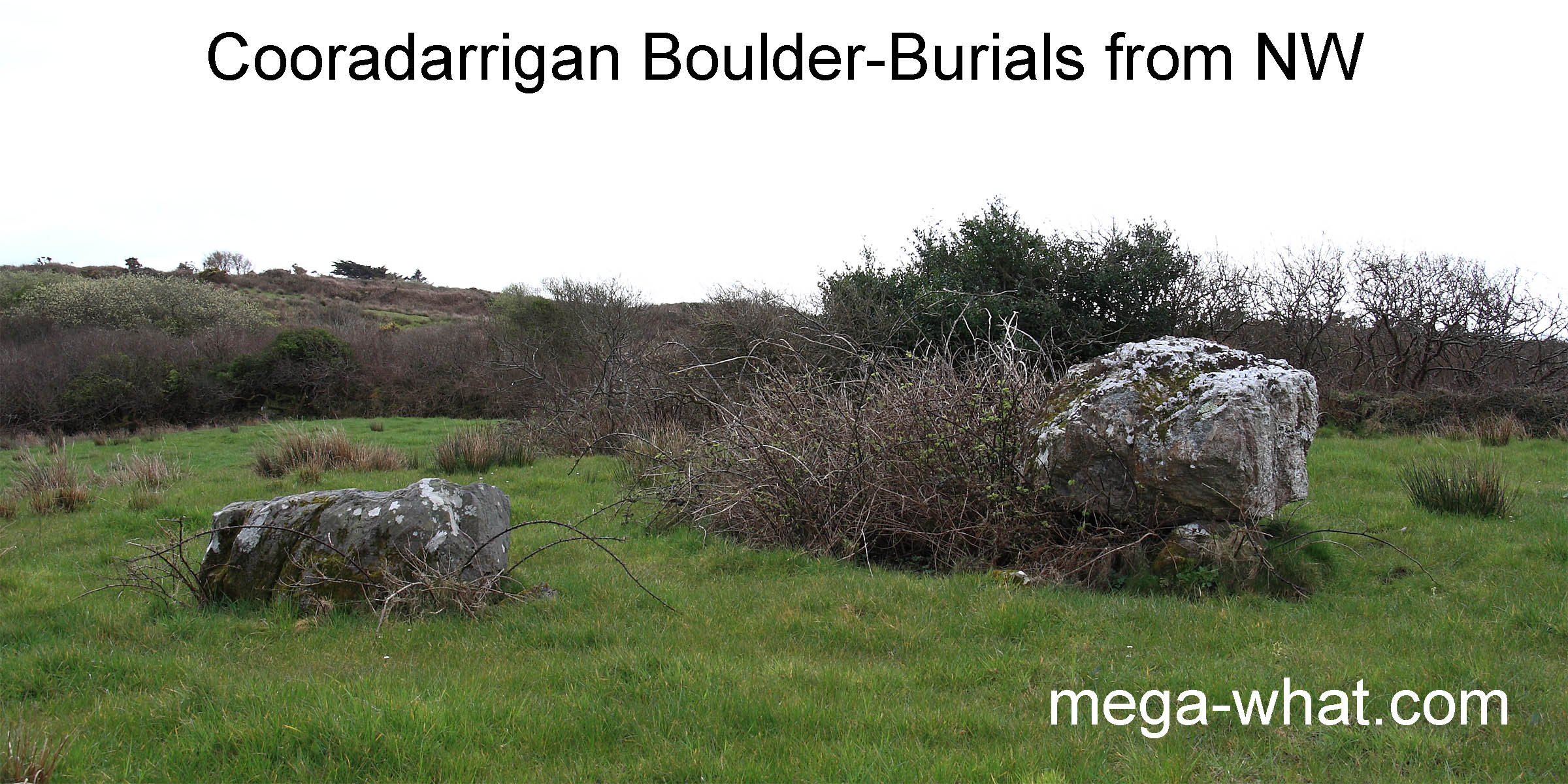
 Cooradarrigan Boulder-Burials are about 1.5km north of Schull, West Cork and were excavated in 1988 (O'Brien 1992).
No artefacts or evidence of burial were found but both monuments covered pits.
Cooradarrigan Boulder-Burials are about 1.5km north of Schull, West Cork and were excavated in 1988 (O'Brien 1992).
No artefacts or evidence of burial were found but both monuments covered pits.
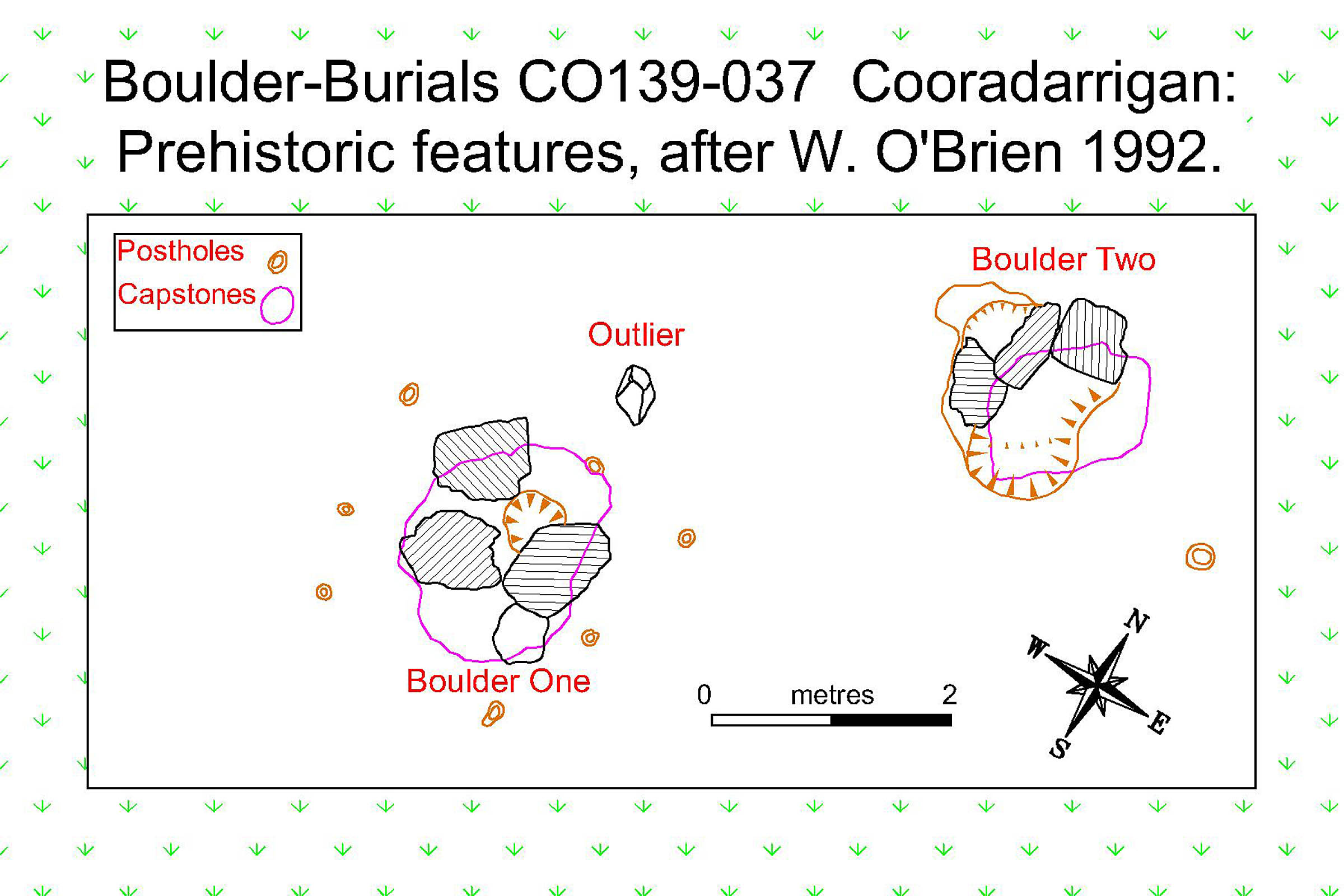 Charcoal from the one under Boulder One gave a date of 1426-1266 cal B.C. 2-sigma. The small outlying stone might perhaps represent a base mark.
The seven stake-holes are intriguing. Were they a ritual enhancement or were they used as sighting / position markers before the boulders were placed?
Charcoal from the one under Boulder One gave a date of 1426-1266 cal B.C. 2-sigma. The small outlying stone might perhaps represent a base mark.
The seven stake-holes are intriguing. Were they a ritual enhancement or were they used as sighting / position markers before the boulders were placed?
 South is in the sea over the left end of an island [Pic].
![[Pic].](Cooradarrigan-S.jpg)
North is on a south facing slope, over a nearer hilltop [Pic].
![[Pic].](Cooradarrigan-N.jpg)
The eastern luni-solar sequence runs up from the southern dip and ends on a top, with summer solstice sunrise in a dip just before it. The western sequence ends before the final top but summer solstice sunset is on the penultimate top.
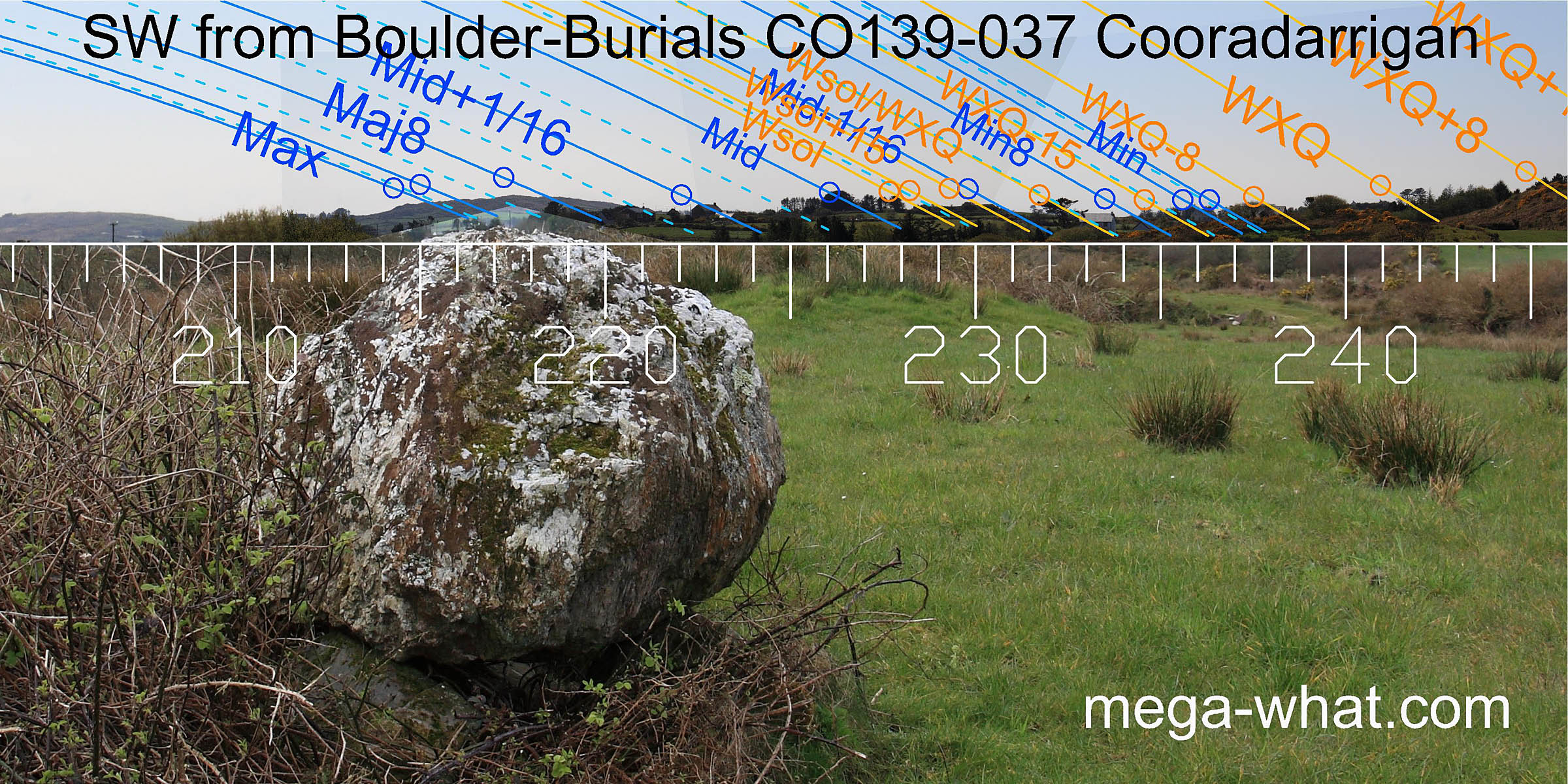
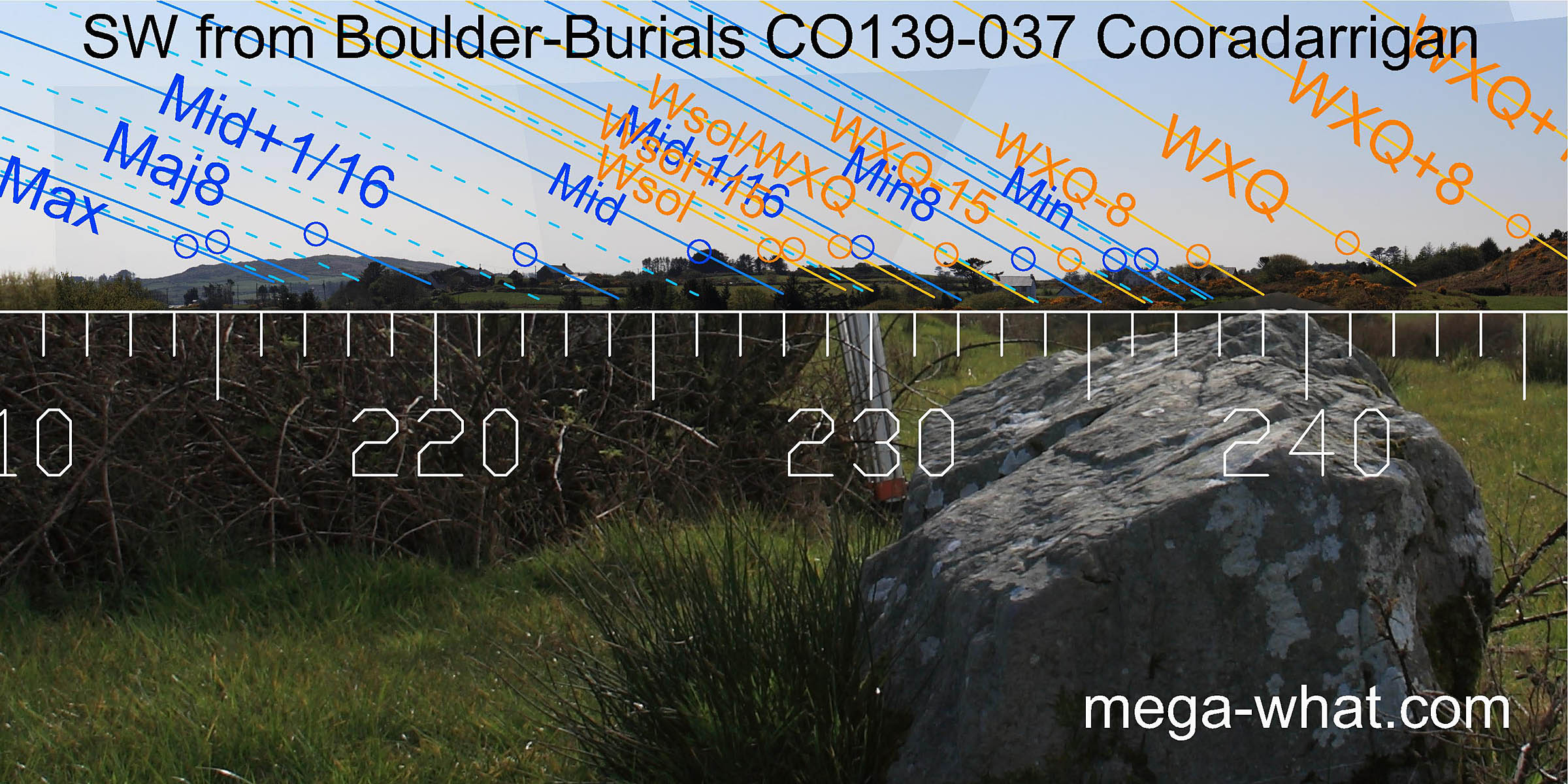 The shape and orientation of Boulder One lead the eye towards a hill in the south-west, the south end of which marks most extreme southerly moonset.
Top of the hill is the major eighth and the landscape runs nicely on to the lunar minor eighth in the bottom of the dip that marks the beginning of the slope up to Mt. Gabriel.
Boulder Two indicates the minor end of the lunisticeLunistices are the most northerly and southerly moons of the month. The lunar equivalent of solstices - more.
range.
The shape and orientation of Boulder One lead the eye towards a hill in the south-west, the south end of which marks most extreme southerly moonset.
Top of the hill is the major eighth and the landscape runs nicely on to the lunar minor eighth in the bottom of the dip that marks the beginning of the slope up to Mt. Gabriel.
Boulder Two indicates the minor end of the lunisticeLunistices are the most northerly and southerly moons of the month. The lunar equivalent of solstices - more.
range.
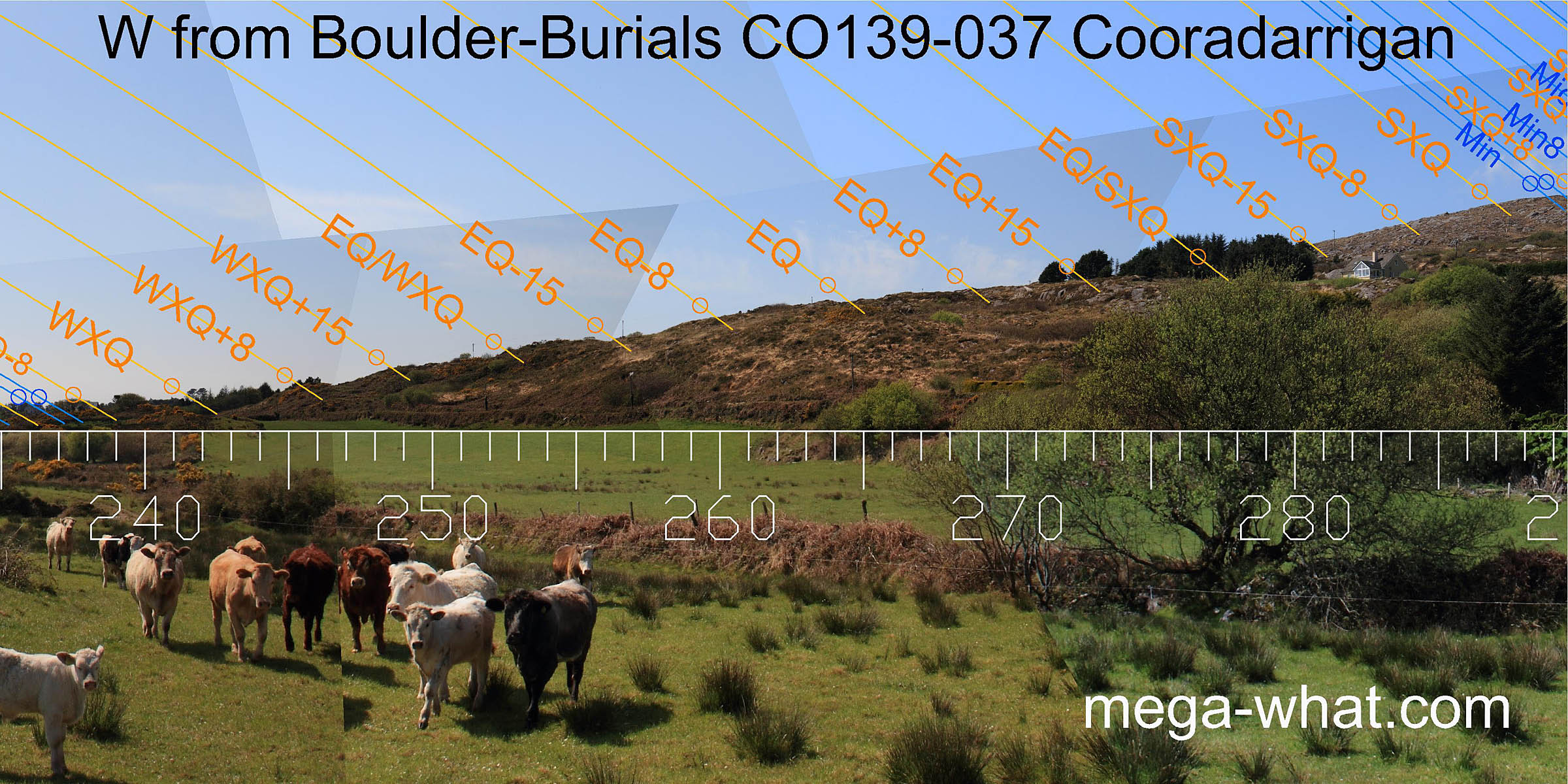 The west / north-western skyline provides a number of key points in the solar cycle.
winter cross-quarters are at the foot of the slope. The first major notch / step is half-way between equinox and summer cross-quarter but currently obscured by non-native trees.
 The upper slopes have a more subtle oscillation but the major step is essentially a lunar eighth.
Thus the western horizon shows an overall tendency towards precision in the prediction of eclipses at cross-quarters.
The upper slopes have a more subtle oscillation but the major step is essentially a lunar eighth.
Thus the western horizon shows an overall tendency towards precision in the prediction of eclipses at cross-quarters.
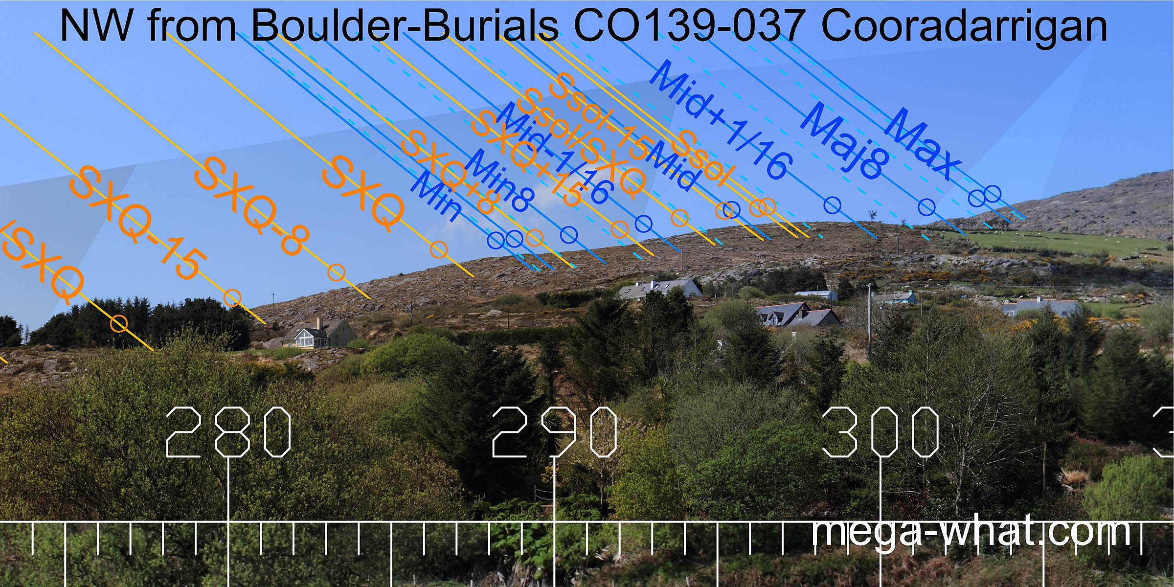
 To the north-east, a rise in the ground provides a skyline suitable for measuring lunisticeLunistices are the most northerly and southerly moons of the month. The lunar equivalent of solstices - more.
rises and the northern part of the solar cycle.
This is the nearest horizon and thus the most susceptible to exact observer position.
To the north-east, a rise in the ground provides a skyline suitable for measuring lunisticeLunistices are the most northerly and southerly moons of the month. The lunar equivalent of solstices - more.
rises and the northern part of the solar cycle.
This is the nearest horizon and thus the most susceptible to exact observer position.
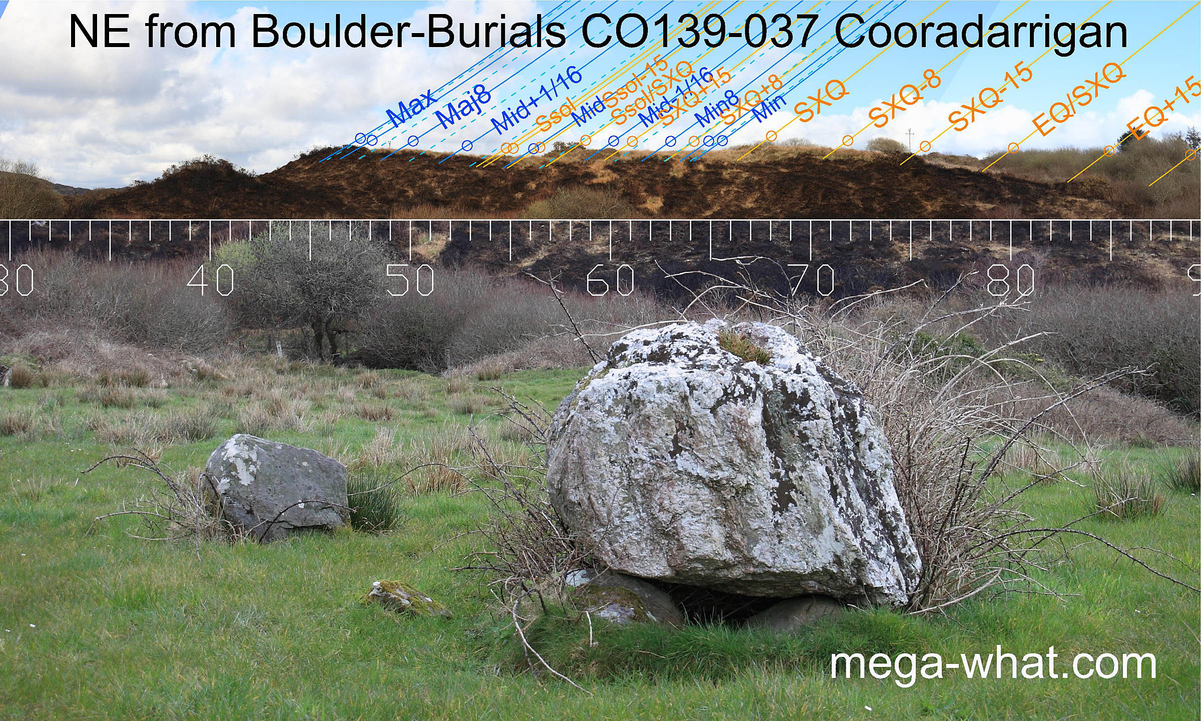
Major standstill and cross-quarter are on the tops. Solstice is in the dip but the bottom is a half-month from it. The adjacent high point/step is the solstice/cross-quarter midpoint.
 The east is largely obscured but a hilltop is visible beyond the nearer ground at 110°.
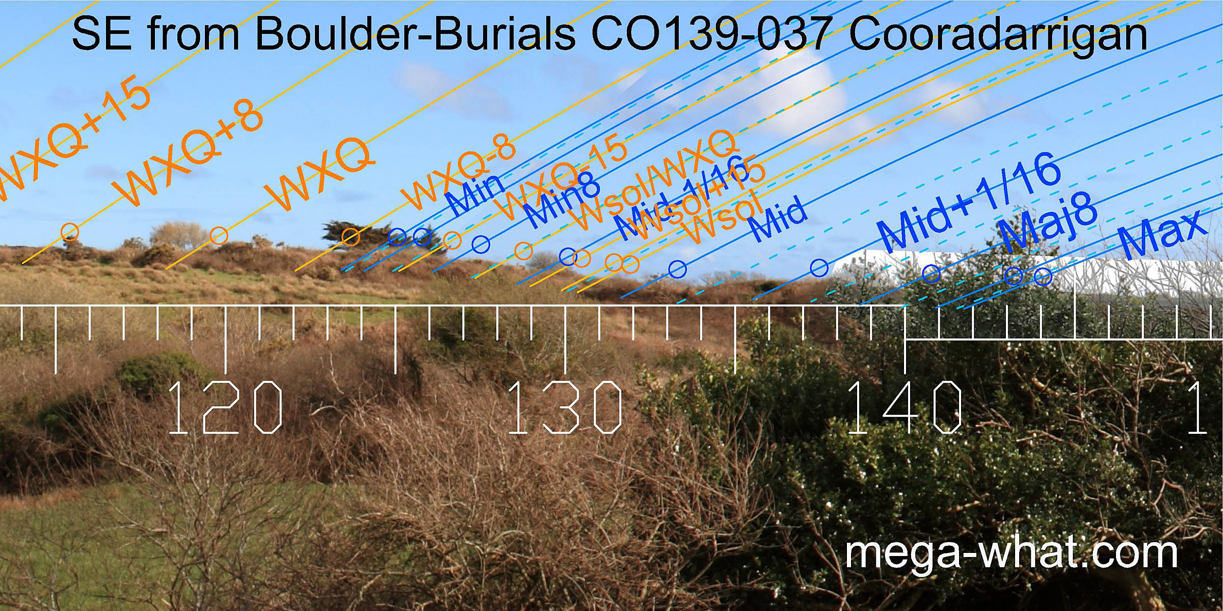
The south-east is similarly obscured by vegetation and field boundaries but the overall shape is clear nonetheless.
Copper was mined on Mt. Gabriel primarily during the period c.1700-c.1500 BC (O'Brien 1994), slightly earlier than the date obtained for these Boulder-Burials. This site is the middle one of three at the mountain's south foot:
- A possible Standing Stone is about 230m to the south-west.
- A Standing Stone Pair is about 330m to the north-east.
- O'Brien (1992,12) reported a "possible destroyed stone circle in Derryconnell townland (Nat. Museum of Ireland files)". This lost site, further to the east, is contextually credible and might perhaps be recovered using Whole Horizon Analysis Techniques. From such a location the lunisticeLunistices are the most northerly and southerly moons of the month. The lunar equivalent of solstices - more. range would spread further along Mt. Gabriel's ridge top.
- Standing Stone CO139-036 near the coast to the south remains unsurveyed.
- Rathruane Boulder-Burial is 4.3km north-east (38°)
- Dunmanus Boulder-Burial is 8.3km west (272°)
References
- Archaeological Survey of Ireland, record details. www.archaeology.ie/archaeological-survey-ireland
- POWER, D. et al. 1992 Archaeological Inventory of County Cork, Volume 1: West Cork. Dublin: Stationary Office. p31, no.113.
- O'BRIEN, BILLY 1989 Cork 1989:010 Cooradarrigan. www.excavations.ie
- O'BRIEN, WILLIAM 1992 Boulder-Burials: A Later Bronze Age Megalith Tradition in South-West Ireland. Journal of the Cork Historical and Archaeological Society 9:11-35.
- O'BRIEN, WILLIAM 1994 Mount Gabriel: Bronze Age Mining in Ireland. Galway: Galway University Press.