
 The Standing Stones at Coolcraheen and Derryduff are about 4km from Rosscarbery and twice that from Clonakilty. They are intervisible and about 1.7km apart as the crow flies.
At Derryduff, a large stone stands on a broad flat hilltop, its long axis is NE/SW (226°). There is a useful horizon to the northwest but all else seemed rather flat and featureless and has not yet been surveyed. However, the remainder of the horizon has been calculated using SRTM 30m data and the full panorama may be seen here: [PanPic].
![[PanPic]](Derryduff-Pan2400x1200.jpg)
The Coolcraheen site lies to its north-west, on the far side of the valley at the foot of the next hill and near an ornamental tower. The tower may be seen in the picture, beyond the Standing Stone but the Coolcraheen stone is concealed.
 At Coolcraheen, just south of the obvious ruined ornamental tower, a tall thin stone may be found lying where it has fallen.
In the same field is a large modern Standing Stone that was erected when the land was reclaimed. Do not be confused by it.
At Coolcraheen, just south of the obvious ruined ornamental tower, a tall thin stone may be found lying where it has fallen.
In the same field is a large modern Standing Stone that was erected when the land was reclaimed. Do not be confused by it.
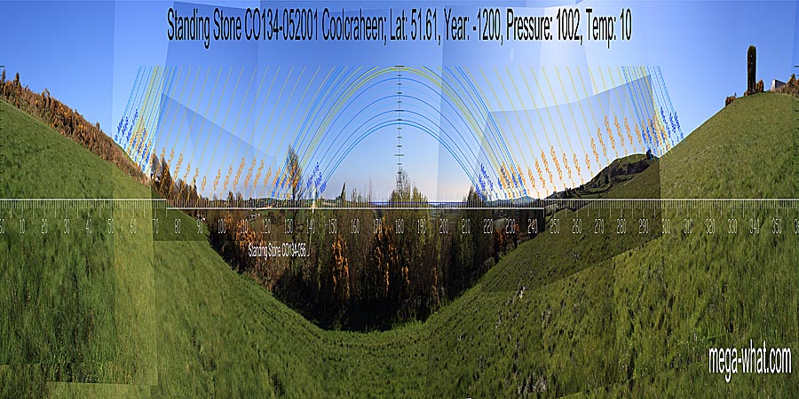
From the fallen bronze-age Coolcraheen stone: North is on the local hilltop [Pic], Derryduff Standing Stone marks major standstillLunistice positions vary cyclically over an 18.6 year period but are fairly static for more than a year at either end of the range moonrise in the south-east and South is in the sea [Pic].
![[Pic],](Coolcraheen-N.jpg)
![[Pic]](Coolcraheen-S.jpg)
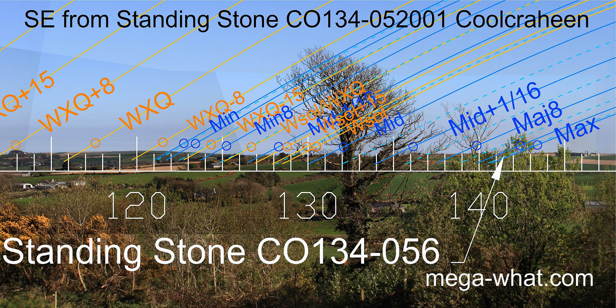 From this location, Derryduff Standing Stone presents its widest profile but is now mostly concealed by a field wall.
It is difficult to see without optical aid but its top is visible and can be made out with the naked eye.
From this location, Derryduff Standing Stone presents its widest profile but is now mostly concealed by a field wall.
It is difficult to see without optical aid but its top is visible and can be made out with the naked eye.
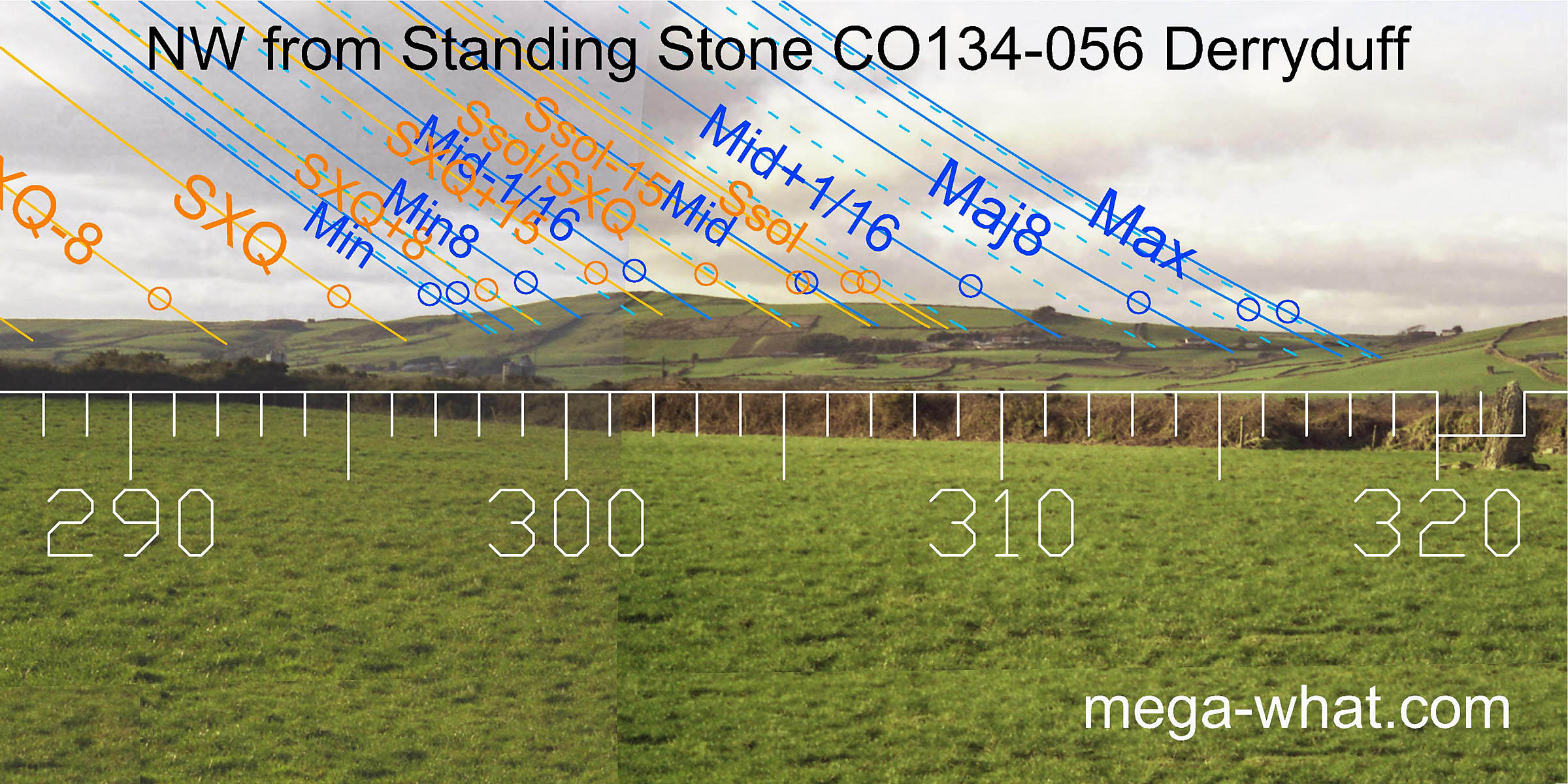
The winter solstice and centre part of the lunisticeLunistices are the most northerly and southerly moons of the month. The lunar equivalent of solstices - more. range are in a dip between two hills. The minor end of the lunisticeLunistices are the most northerly and southerly moons of the month. The lunar equivalent of solstices - more. cycle runs up the slope towards the top of the hill that has winter cross-quarter sunrises on it.
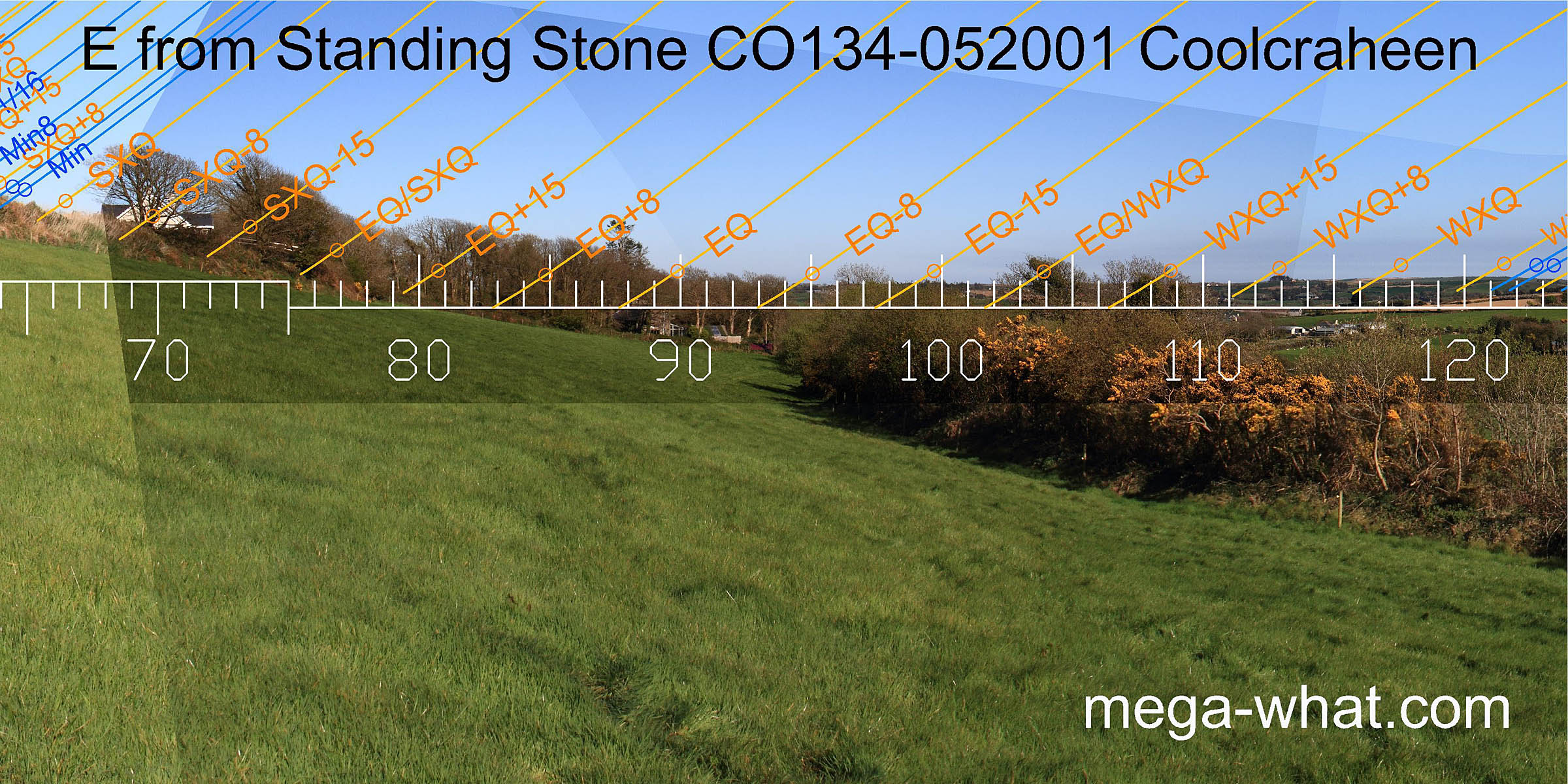
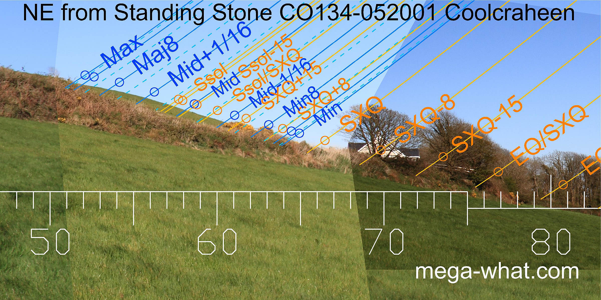 The east is largely obscured by vegetation but somewhere not far from the equinox is the dip of the local valley and the intersect between local and more distant horizons.
The north-eastern skyline is very local.
The east is largely obscured by vegetation but somewhere not far from the equinox is the dip of the local valley and the intersect between local and more distant horizons.
The north-eastern skyline is very local.
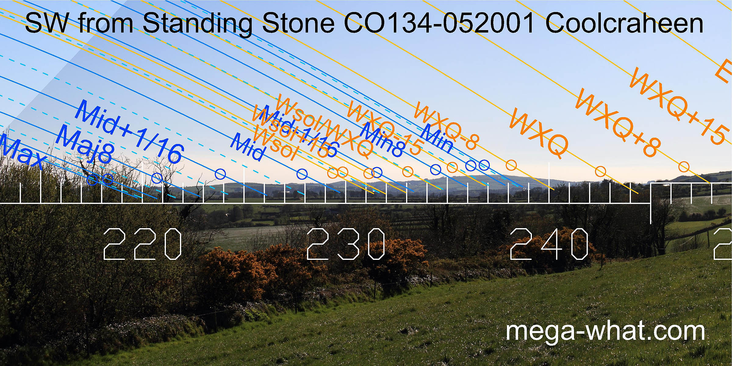 The south-west offers some distant hills which serve as useful markers for the lunisticeLunistices are the most northerly and southerly moons of the month. The lunar equivalent of solstices - more.
range and the winter part of the solar cycle.
The south-west offers some distant hills which serve as useful markers for the lunisticeLunistices are the most northerly and southerly moons of the month. The lunar equivalent of solstices - more.
range and the winter part of the solar cycle.
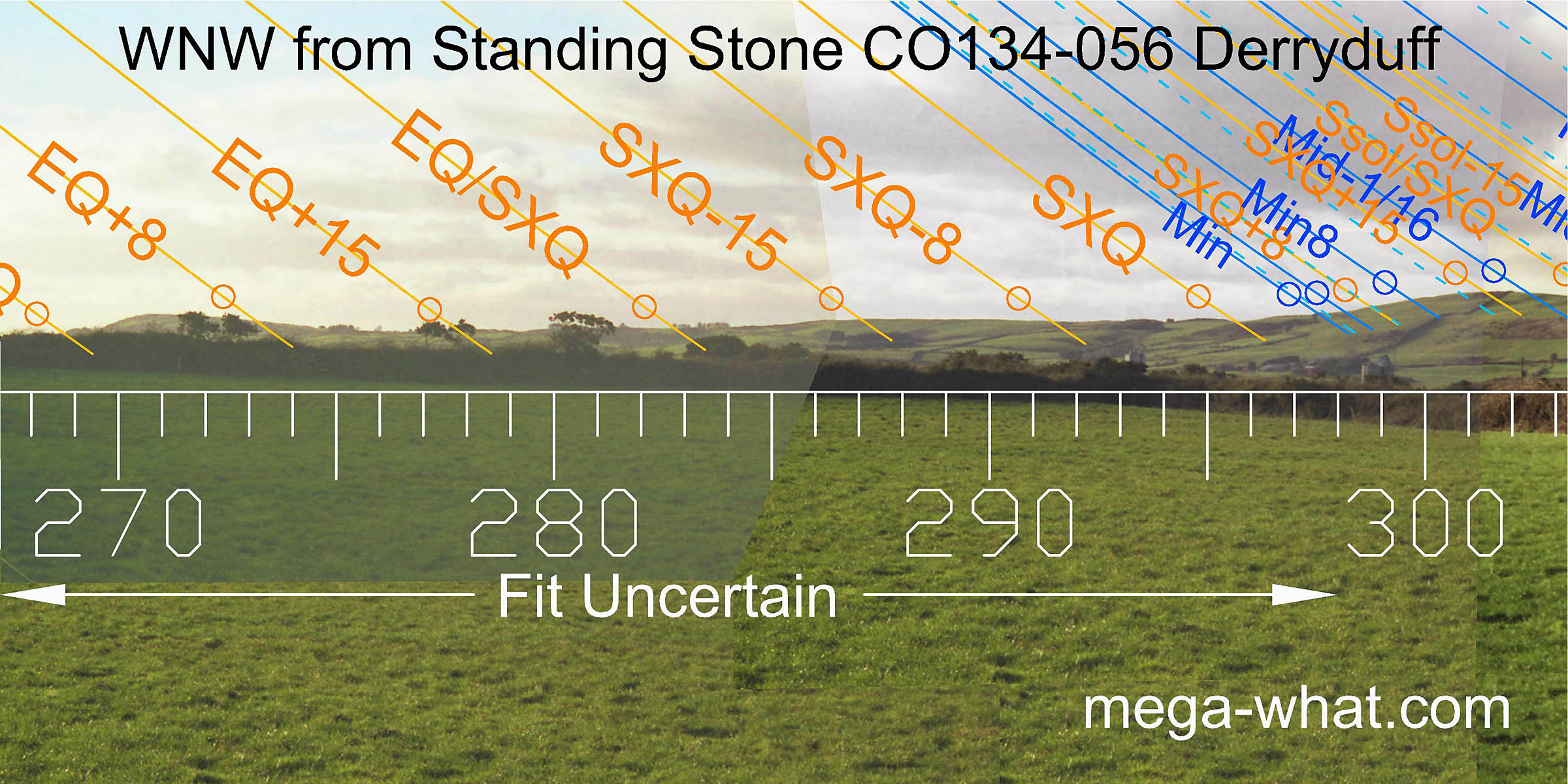
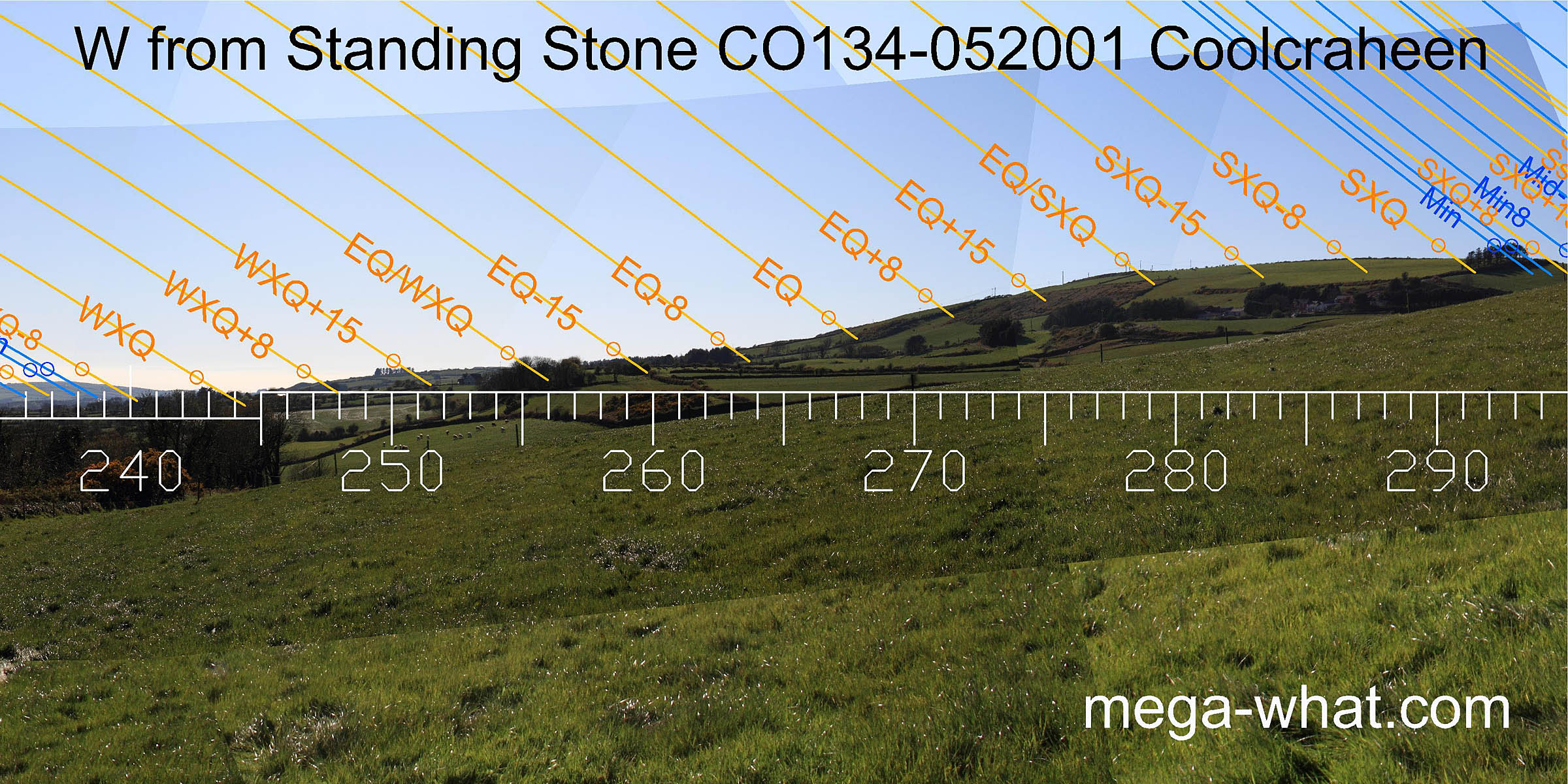 Winter cross-quarters are in the dip that separates distant and nearer horizons. Summer cross-quarters are on top of the nearer hill.
The western end of the hilltop marks the half way point between equinox and summer cross-quarter, the basal points of the hill to either side are both five weeks away from it.
They mark half-month south of the equinox and half-month north of the cross-quarters.
Winter cross-quarters are in the dip that separates distant and nearer horizons. Summer cross-quarters are on top of the nearer hill.
The western end of the hilltop marks the half way point between equinox and summer cross-quarter, the basal points of the hill to either side are both five weeks away from it.
They mark half-month south of the equinox and half-month north of the cross-quarters.
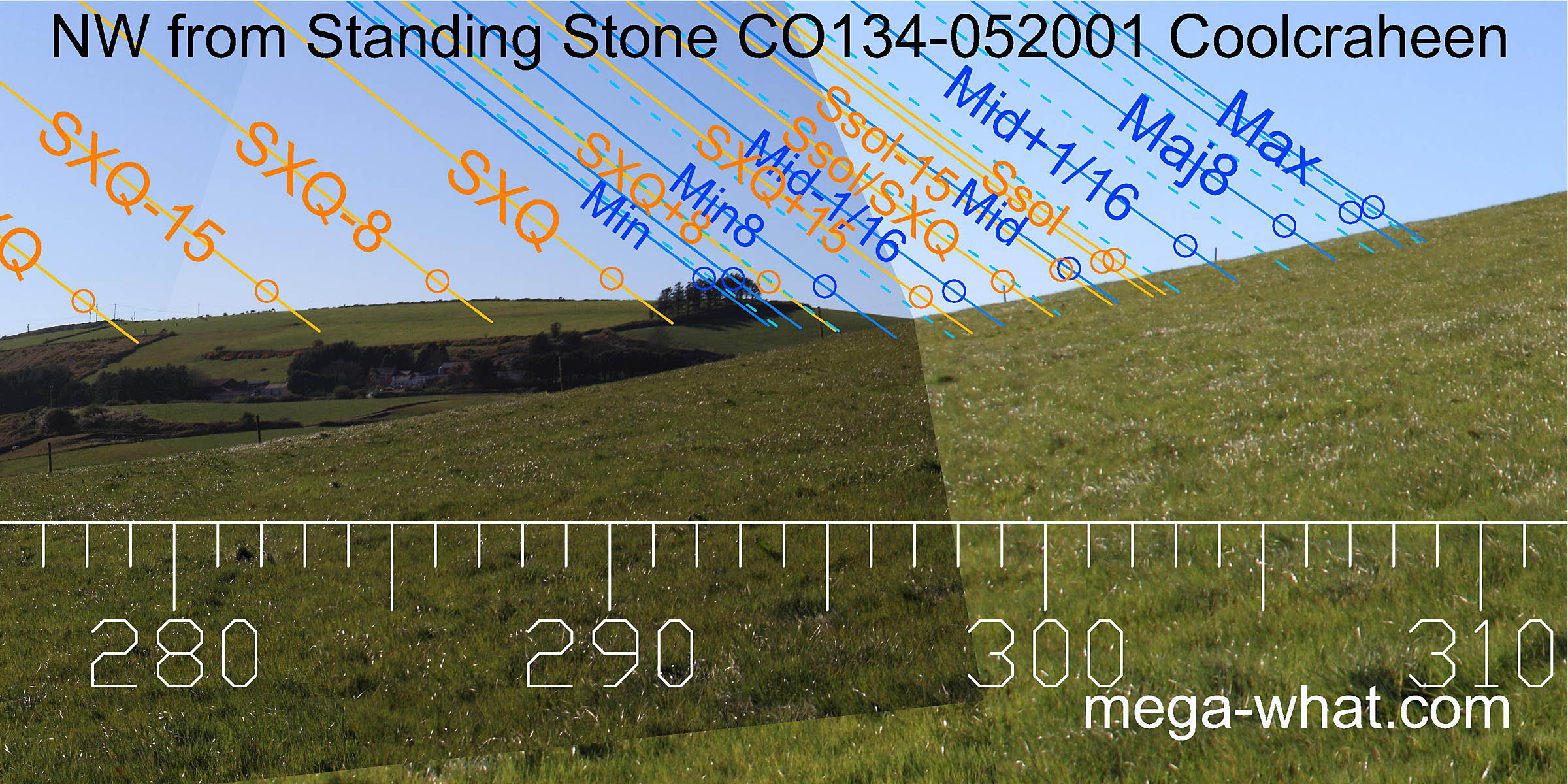 Note that the half-month north of the summer cross-quarters (SXQ+15) is marked by the top of this same hill when viewed from the Standing Stone at Derryduff.
From there the remainder of the north-western quadrant falls on usable horizon whereas from here it finishes on a steep local hillslope.
However, the intersection of far and near is quite close and therefore very susceptible to exact observer position.
Note that the half-month north of the summer cross-quarters (SXQ+15) is marked by the top of this same hill when viewed from the Standing Stone at Derryduff.
From there the remainder of the north-western quadrant falls on usable horizon whereas from here it finishes on a steep local hillslope.
However, the intersection of far and near is quite close and therefore very susceptible to exact observer position.
- Bohonagh Stone Circle is 3.2km south (175°)
- Reenascreena Stone Circle is 4.2km west (282°)
- Ballyvackey Stone Circle is 4.6km north-east (55°)
References
- Archaeological Survey of Ireland, record details. www.archaeology.ie/archaeological-survey-ireland
- POWER, D. et al. 1992 Archaeological Inventory of County Cork, Volume 1: West Cork. Dublin: Stationary Office. p50:no.296, p53:no.338.