
 It has been acknowledged for many years that the axis of this thirteen stone circle indicates sunset on the equinox but the whole profile of Burgatia hill was used to map the year.
The intersect of the foot of the hill with more distant horizons marks the limits of a month centred on the solstice, both north and south, summer and winter.
It has been acknowledged for many years that the axis of this thirteen stone circle indicates sunset on the equinox but the whole profile of Burgatia hill was used to map the year.
The intersect of the foot of the hill with more distant horizons marks the limits of a month centred on the solstice, both north and south, summer and winter.
The line from between the portals to the axial stone does indeed indicate the equinox [Pic] but the axis of the portals themselves indicates the next stone south of the axial and the equinox / winter cross-quarter midpoint [Pic].
![[Pic]](BohonaghMSC-Wax.jpg)
![[Pic].](BohonaghMSC-WaxP.jpg)
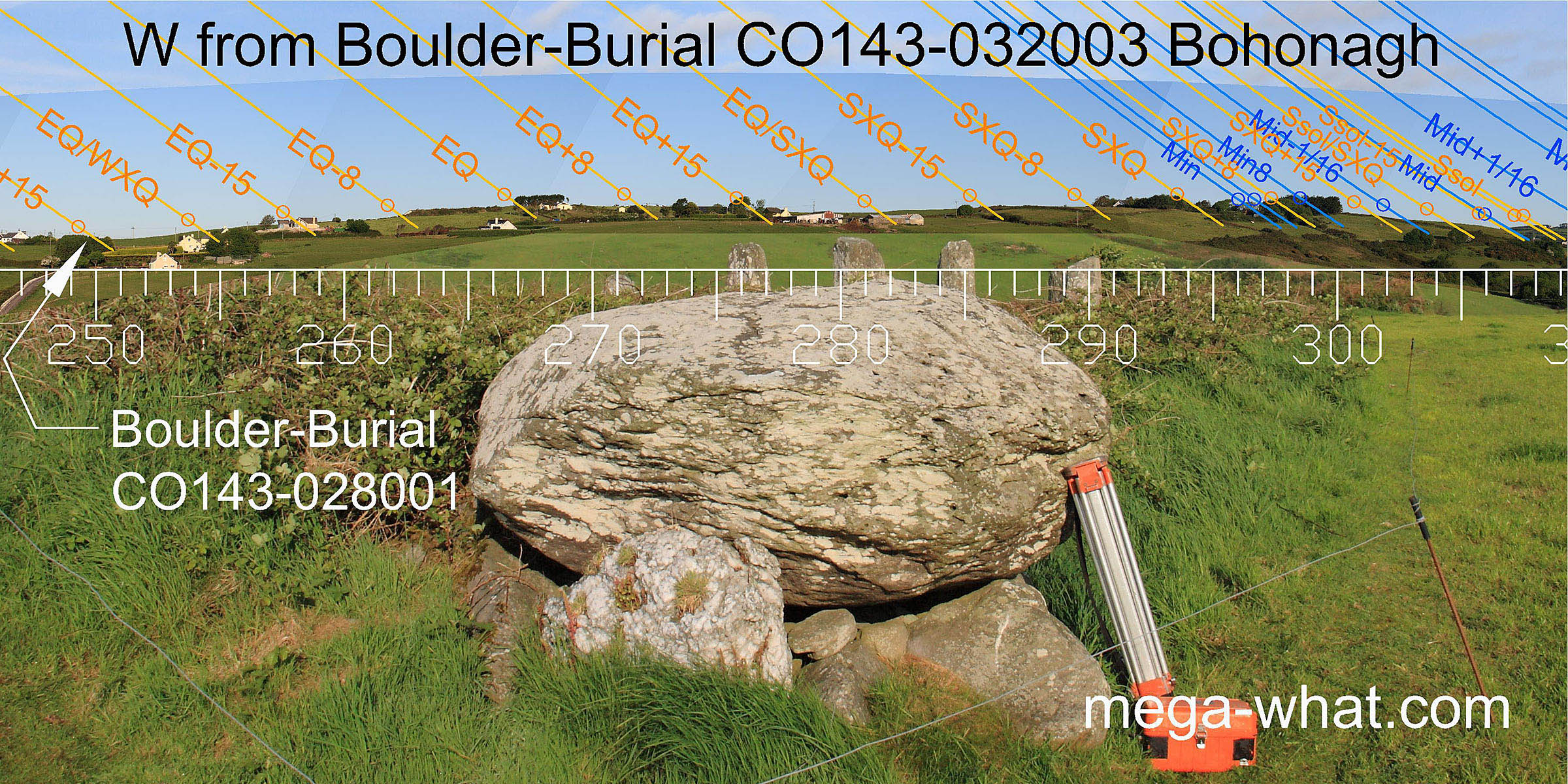
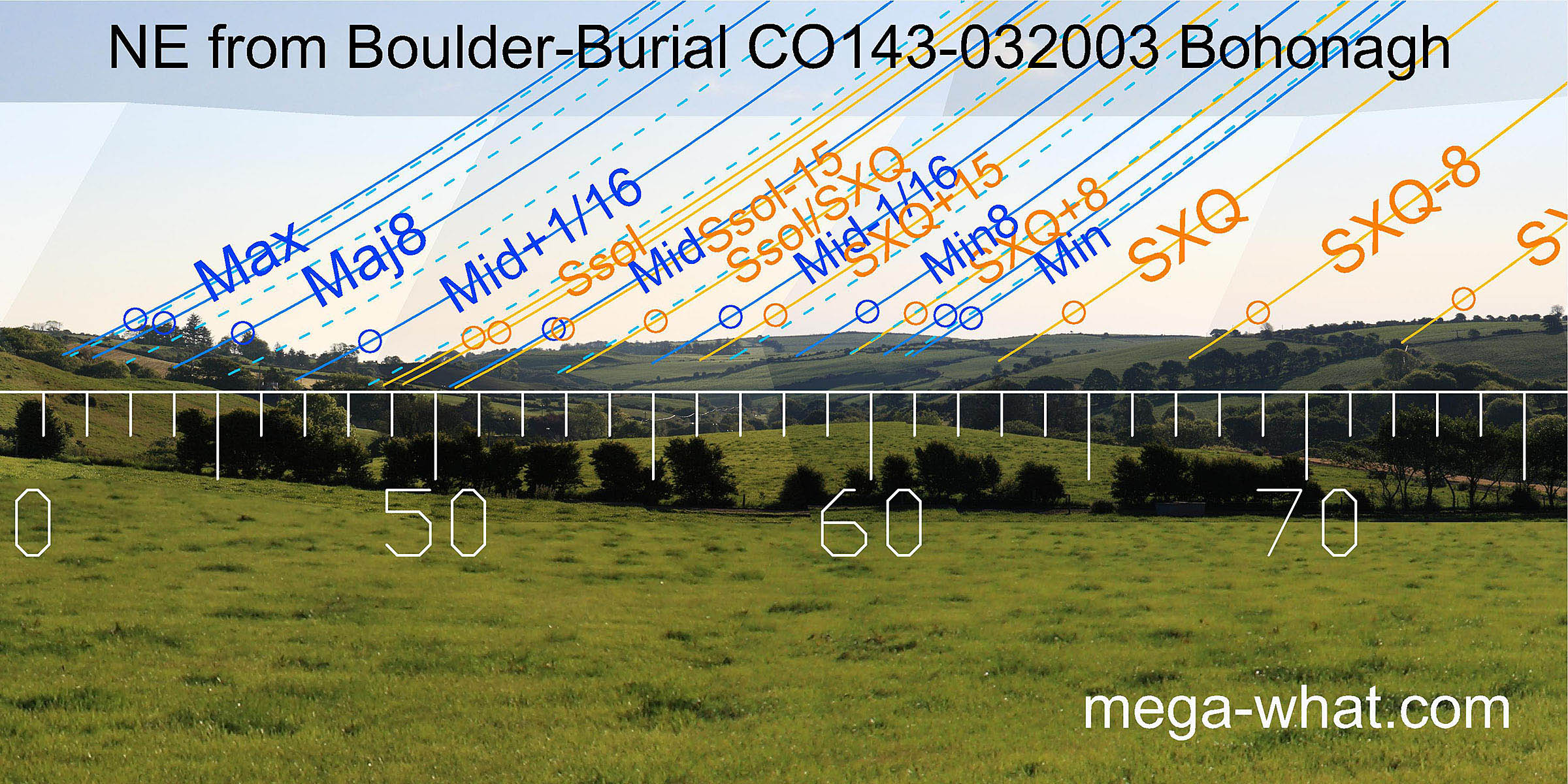
 North is on a hill slope from the Boulder-Burial [Pic].
From the Circle it is additionally indicated by an intersect of far / local horizons and by a pointed stone that is lower than those either side of it [Pic].
North is on a hill slope from the Boulder-Burial [Pic].
From the Circle it is additionally indicated by an intersect of far / local horizons and by a pointed stone that is lower than those either side of it [Pic].
![[Pic].](BohonaghBB-N.jpg)
![[Pic].](BohonaghMSC-N.jpg)
South is in a dip, close to the left-hand land / sea intersect from the Boulder-Burial [Pic]. From the Circle it is further from the land and in a gap between two stones, the original left one of which is missing [Pic].
![[Pic].](BohonaghBB-S.jpg)
![[Pic].](BohonaghMSC-S.jpg)
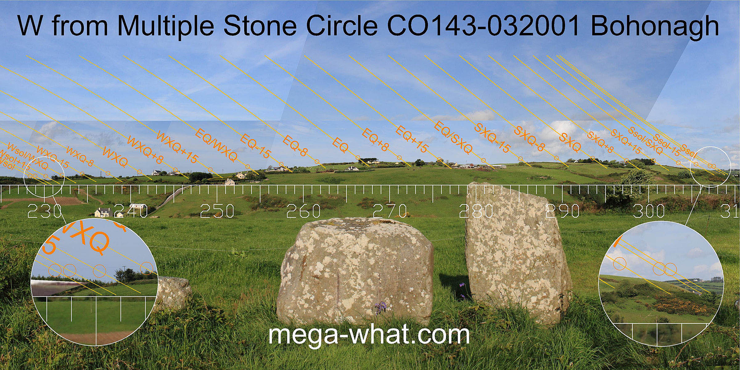
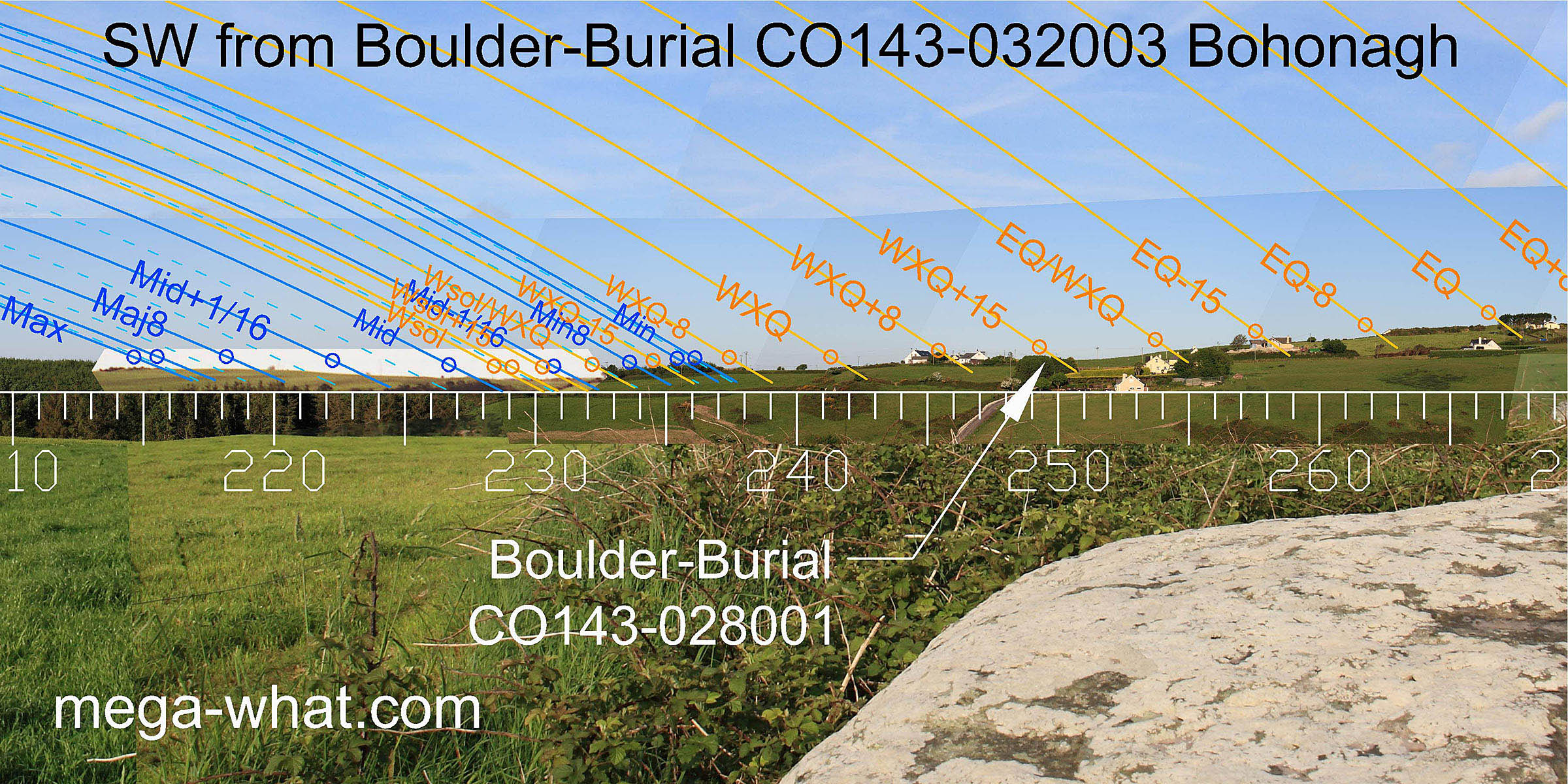
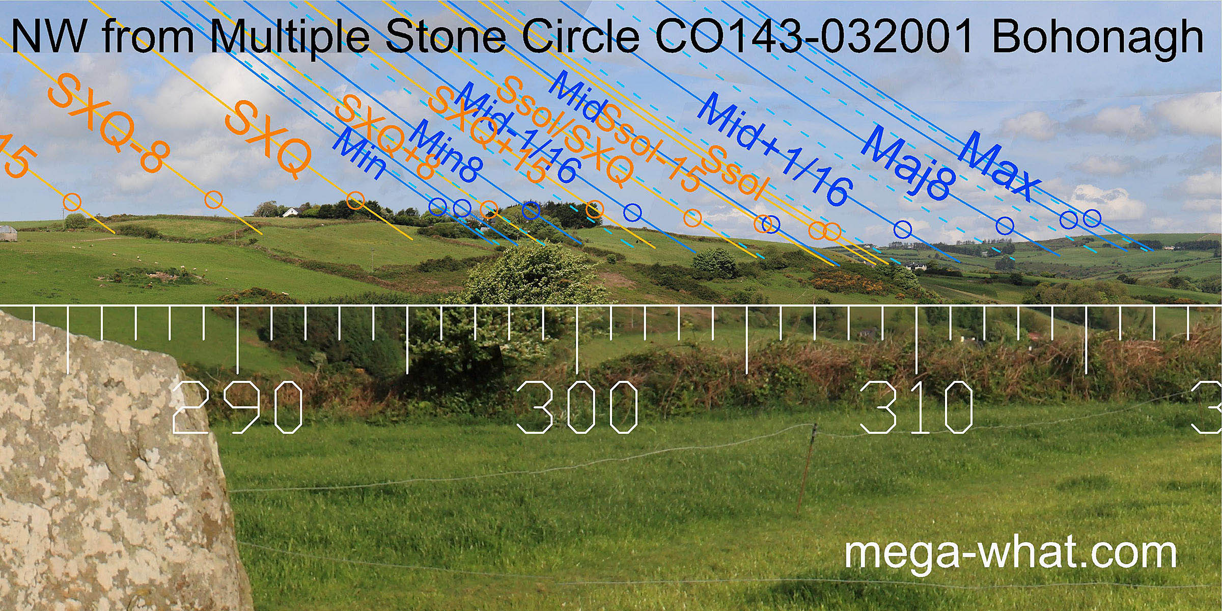
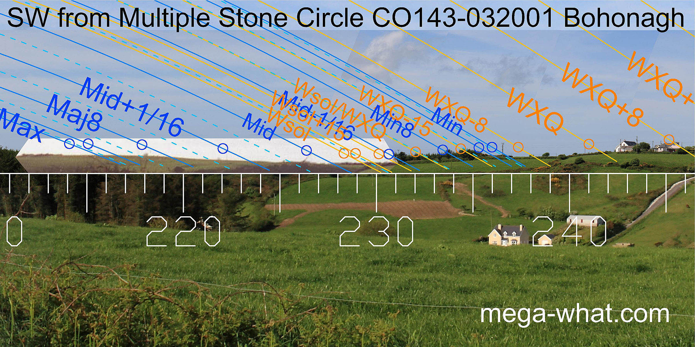 To the south-west, the lunar midpoint is in the bottom of the dip with the lunar major and minor standstills on the higher ground to either side.
From the position of the Boulder-Burial about 20m further east this same dip marks winter solstice. There is a corresponding shift in the significance of other points.
 Excavation showed that some of the basal stones of the boulder-burial lay on or cut through a spread of small stones that covered a slightly larger area.
So this exact place was seemingly important before the boulder-burial was built.
Excavation showed that some of the basal stones of the boulder-burial lay on or cut through a spread of small stones that covered a slightly larger area.
So this exact place was seemingly important before the boulder-burial was built.
On the hill, about 750m away is Burgatia Boulder-Burial. It would probably be on the skyline if not for vegetation.
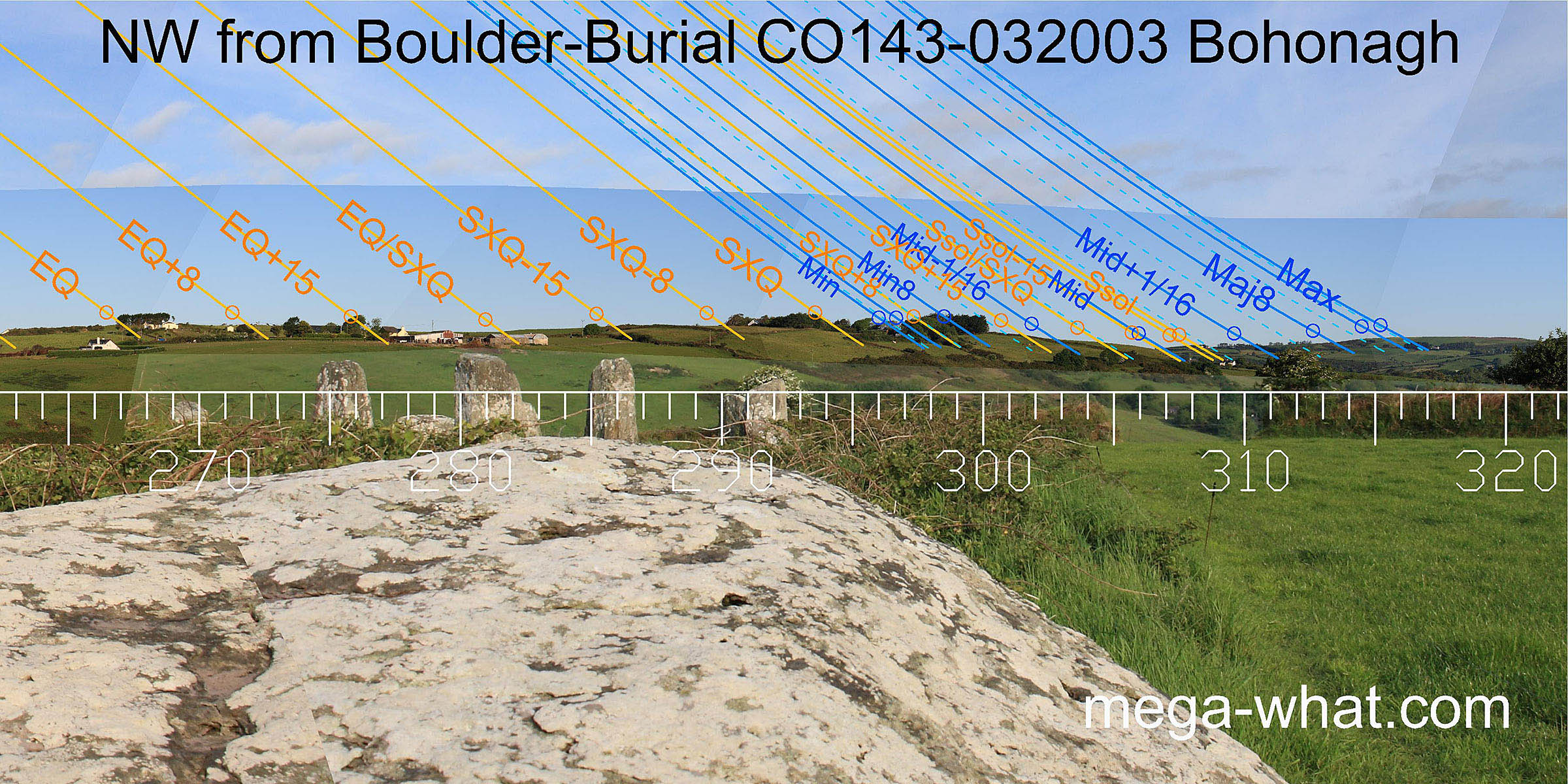
 The capstone of the boulder-burial, though polygonal, has a point which indicates the west and the open side of the support stone arrangement is to the north-west.
In these directions, there are some minor differences caused by the change in viewing position, but nothing of major importance.
From the boulder, symmetry about the hill is lost and the equinox is not quite so accurately marked as from the circle but other things improve.
The capstone of the boulder-burial, though polygonal, has a point which indicates the west and the open side of the support stone arrangement is to the north-west.
In these directions, there are some minor differences caused by the change in viewing position, but nothing of major importance.
From the boulder, symmetry about the hill is lost and the equinox is not quite so accurately marked as from the circle but other things improve.
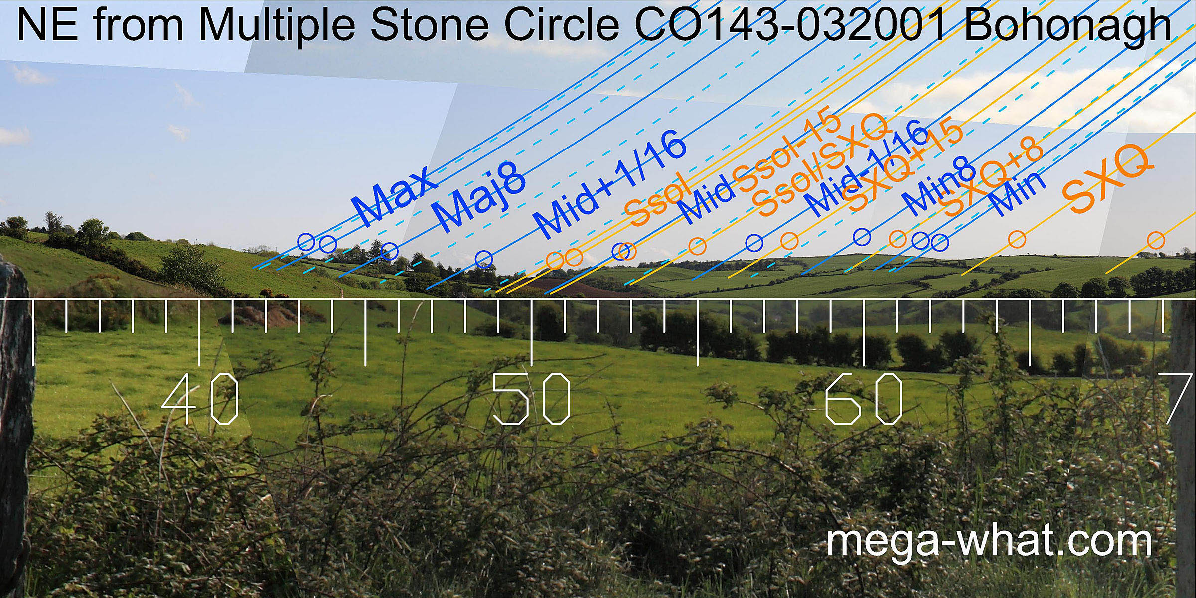
 The north-eastern view is emphasised from within the circle by a prominent large gap between the north portal (stone 13) and the next side-stone (12).
Currently masked by trees, the sharp V notch of the Ownahinchy river valley is a half-month off the summer solstice from the circle. From the boulder-burial the shift is such that it marks the solstice itself.
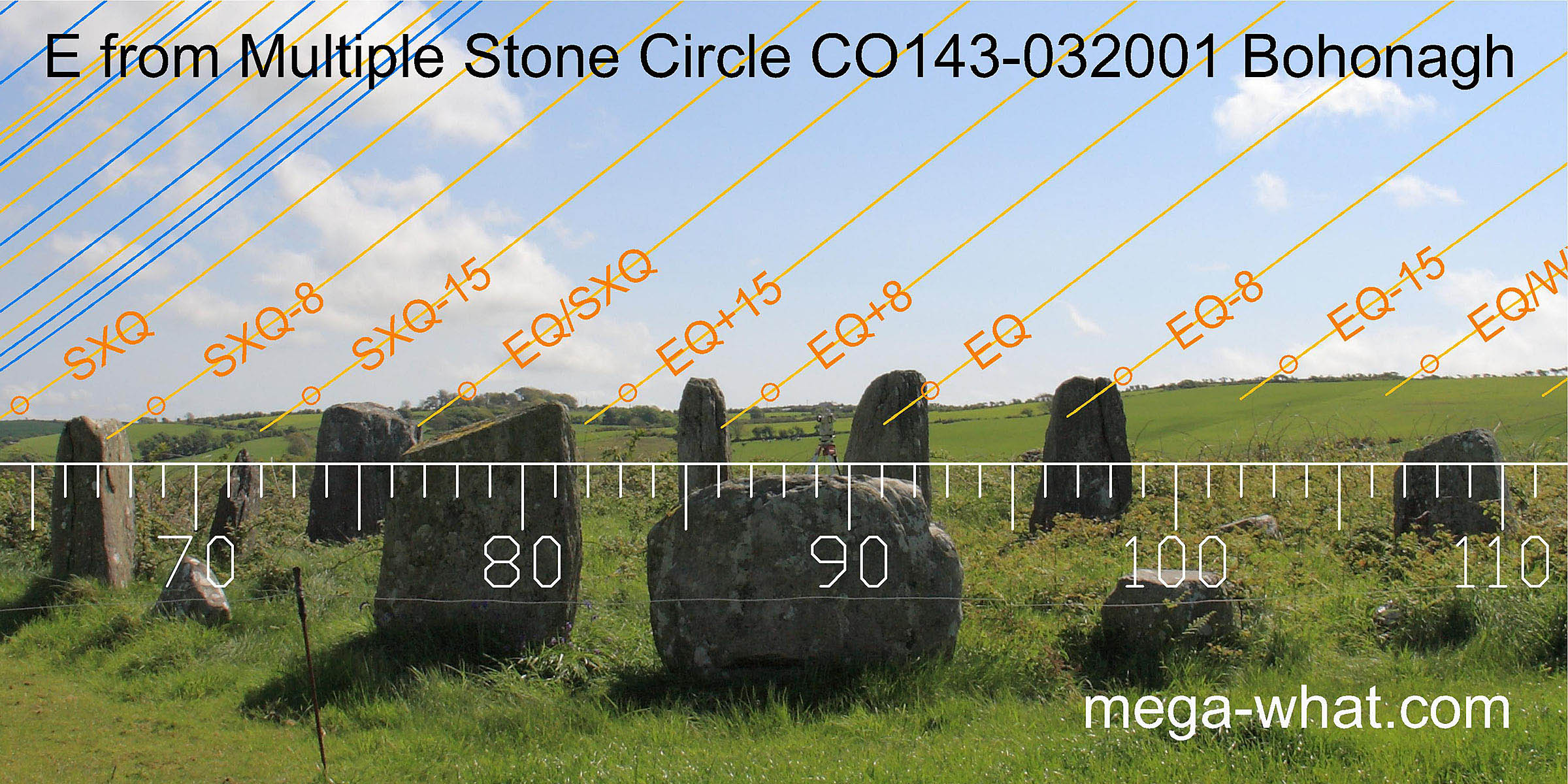
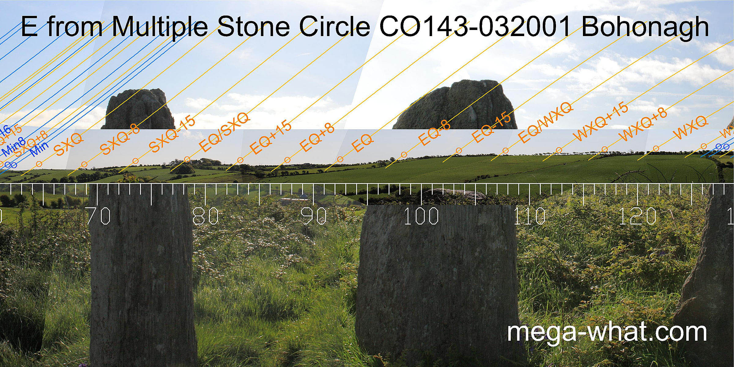
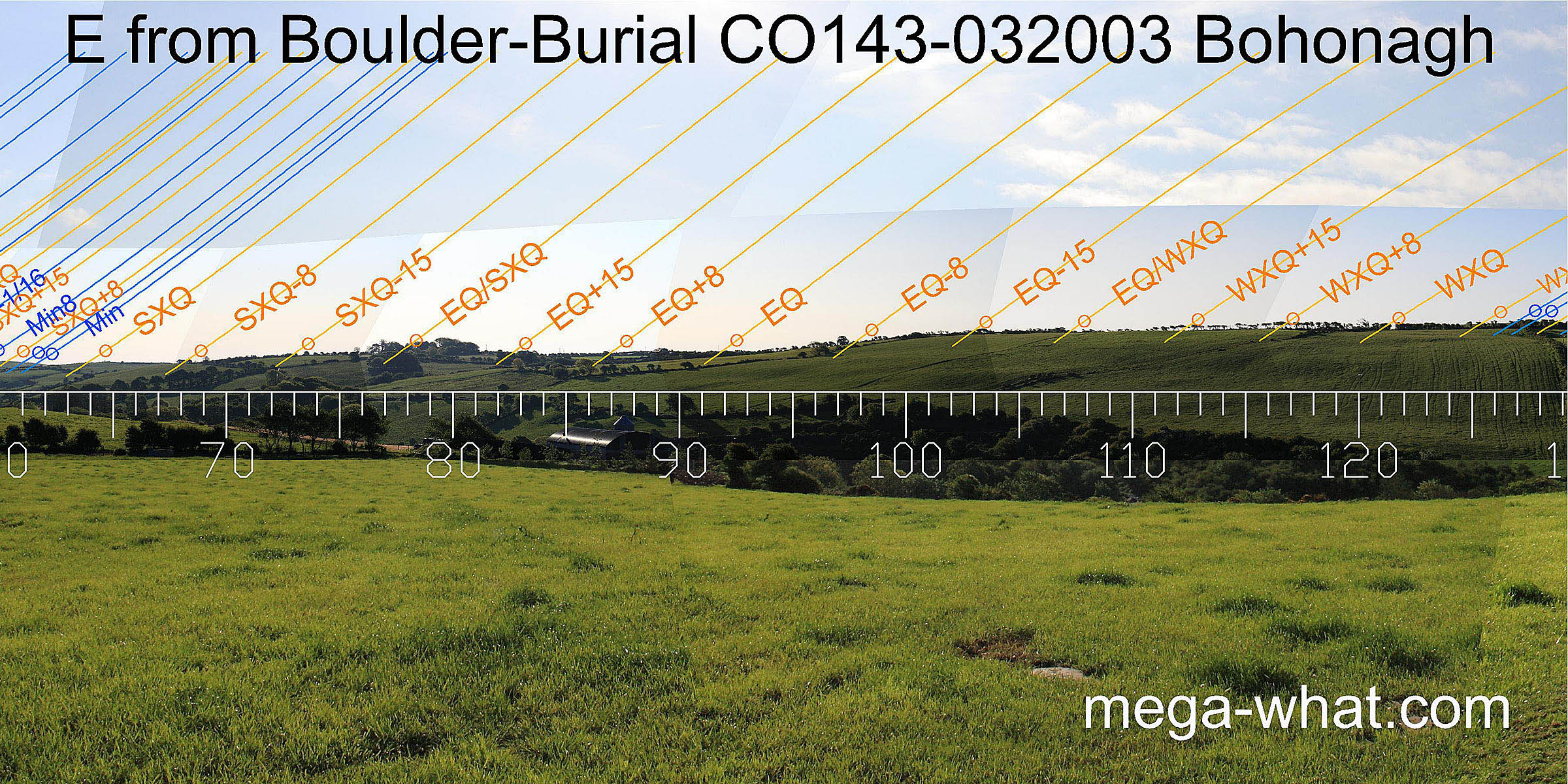 Gently rolling horizons to the east do not provide much of obvious use until we get to the very south-east, where the highest point of the ridge marks the minor end of the
lunisticeLunistices are the most northerly and southerly moons of the month. The lunar equivalent of solstices - more.
cycle, though the circle axis may be said to indicate the week preceding autumn equinox as well as the equinox itself.
Gently rolling horizons to the east do not provide much of obvious use until we get to the very south-east, where the highest point of the ridge marks the minor end of the
lunisticeLunistices are the most northerly and southerly moons of the month. The lunar equivalent of solstices - more.
cycle, though the circle axis may be said to indicate the week preceding autumn equinox as well as the equinox itself.
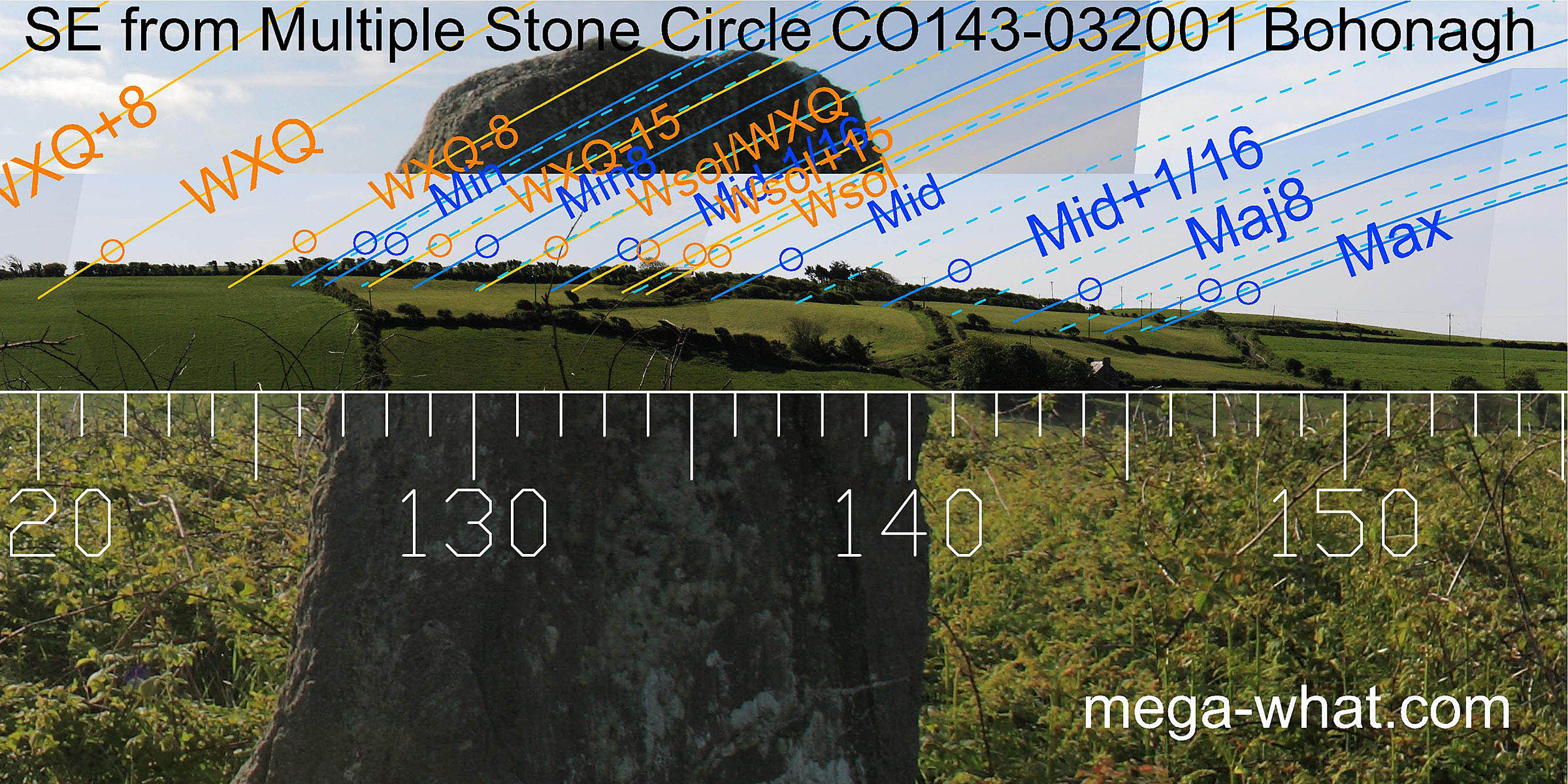
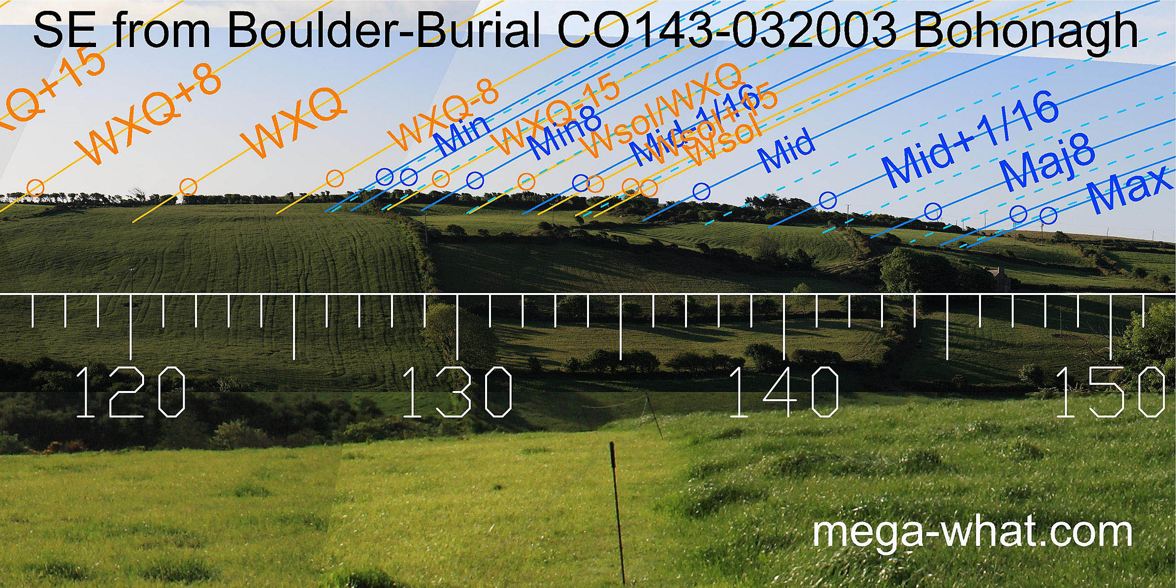 The southern basal step of the ridge-top marks major standstillLunistice positions vary cyclically over an 18.6 year period but are fairly static for more than a year at either end of the range
, with the difference between the two monument positions again being significant and useful.
The southern basal step of the ridge-top marks major standstillLunistice positions vary cyclically over an 18.6 year period but are fairly static for more than a year at either end of the range
, with the difference between the two monument positions again being significant and useful.
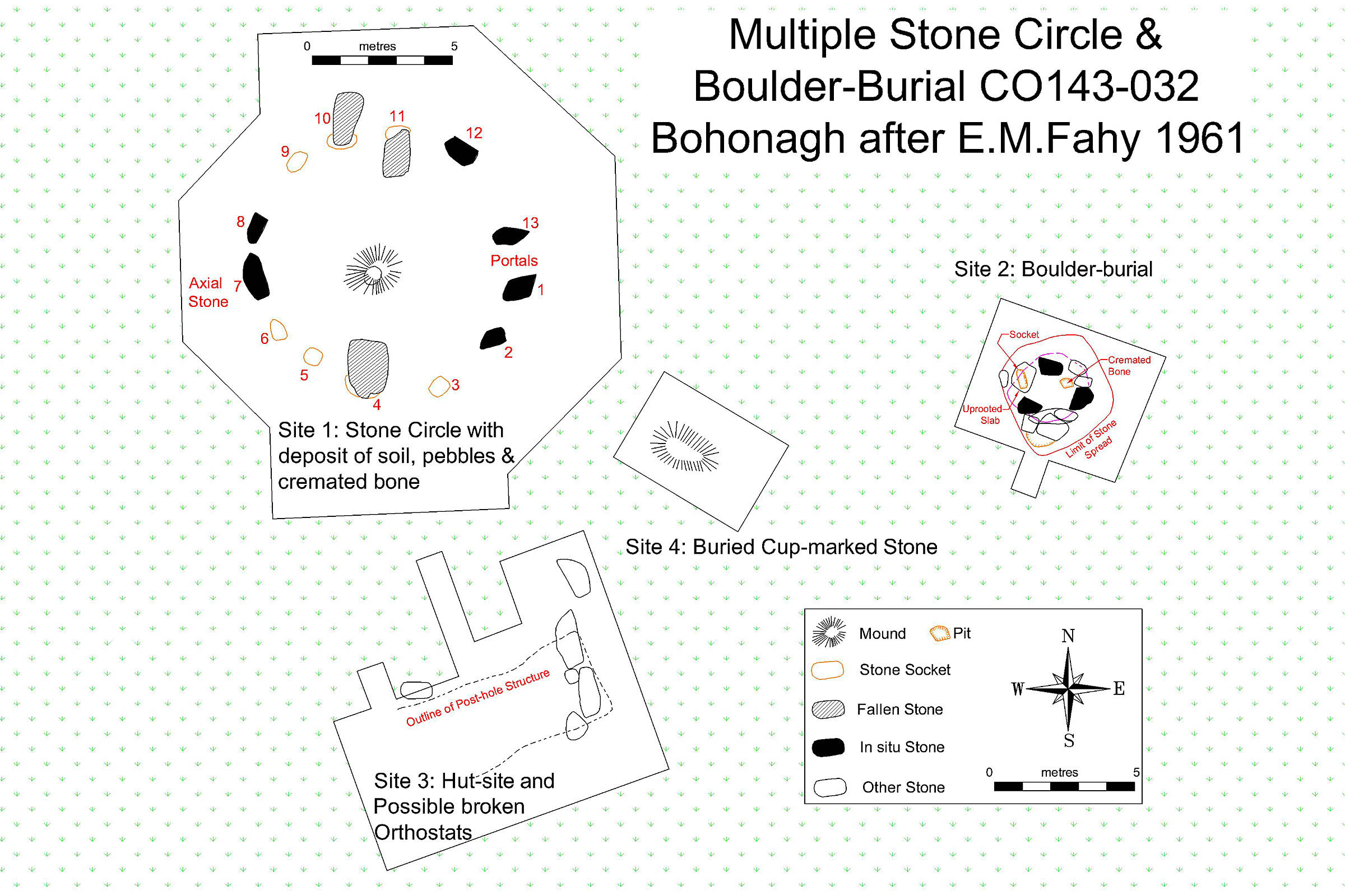 Bohonagh was excavated in 1959 (Fahy 1961) but did not yield any dates. The area of the circle had been cleared to a rock floor.
A ritual deposition containing some small fragments of cremated bone was mounded in the centre.
Four stones missing from the circle (positions now marked by small boulders) are probably represented by the cup-marked stone and other broken stones found outside it.
A hutsite discovered to the south of the circle contained a couple of pieces of flint but no occupation debris.
Whether or not there was any association between the hut and the monuments is impossible to say.
However, its position is such that were it standing, it would not have obscured any sightlines from the circle though it would have been in the way of observations made from the boulder-burial.
A shallow pit containing a few fragments of cremated bone was found under the boulder, leading to the re-naming of this class of monument on the assumption that they were proven to be tombs.
Bohonagh was excavated in 1959 (Fahy 1961) but did not yield any dates. The area of the circle had been cleared to a rock floor.
A ritual deposition containing some small fragments of cremated bone was mounded in the centre.
Four stones missing from the circle (positions now marked by small boulders) are probably represented by the cup-marked stone and other broken stones found outside it.
A hutsite discovered to the south of the circle contained a couple of pieces of flint but no occupation debris.
Whether or not there was any association between the hut and the monuments is impossible to say.
However, its position is such that were it standing, it would not have obscured any sightlines from the circle though it would have been in the way of observations made from the boulder-burial.
A shallow pit containing a few fragments of cremated bone was found under the boulder, leading to the re-naming of this class of monument on the assumption that they were proven to be tombs.
The positions of boulder and circle both offer slightly different optimisations of the available horizons that complement each other. Each has its own advantages and disadvantages but neither is sufficiently superior to justify the suggestion that it might have been the first monument on the site.
- This is one of three Cork-Kerry Stone Circles excavated by Fahy. The other two are Reenascreena and Drombeg.
- A similar relationship between a boulder-burial and a multiple stone circle may be found at Ballyvackey.
- Coolcraheen Standing Stone, from where another standing stone is in a significant position on the horizon, is 3.2km to the north (355°)
References
- Archaeological Survey of Ireland, record details. www.archaeology.ie/archaeological-survey-ireland
- FAHY, E.M. 1961 A Stone Circle, Hut and Dolmen at Bohonagh, Co. Cork. Journal of the Cork Historical and Archaeological Society 66:93-104.
- FINLAY, F. 1973 The Rock Art of Cork and Kerry. Unpublished M.A. Thesis, Cork University Library. pp116-117.
- Ó'NUALLÁIN, SEÁN 1975 The Stone Circle Complex of Cork and Kerry. Journal of the Royal Society of Antiquaries of Ireland 105:83-131, No.4.
- Ó'NUALLÁIN, SEÁN 1978 Boulder-Burials. Proceedings of the Royal Irish Academy 78c:75-114, p95, no.33.
- Ó'NUALLÁIN, SEÁN 1984 A Survey of Stone Circles in Cork and Kerry. Proceedings of the Royal Irish Academy 84c:1-77, p24, no.36.
- POWER, D. et al. 1992 Archaeological Inventory of County Cork, Volume 1: West Cork. Dublin: Stationary Office. p20:no.44, p97:no.811, p29:no.102.
- RUGGLES, C.L.N. 1999 Astronomy in Prehistoric Britain and Ireland. Newhaven & London: Yale University Press. No.ASC51.
- RUGGLES, C.L.N. & PRENDERGAST, F. 1996 A New Archaeoastronomical Investigation of the Irish Axial-Stone Circles. Proceedings of the 2nd SEAC [European Society for Astronomy in Culture] Conference, Bochum, 1994. Bochum: Astronomisches Institut der Ruhr-Universität. pp5-13.
- SOMERVILLE, BOYLE T. 1930 Five Stone Circles of West Cork. Journal of the Cork Historical and Archaeological Society 35:70-85.