
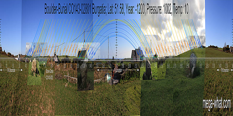
 Burgatia Boulder-Burial can be found close to the roadside, on Burgatia hill, about 2km east of Rosscarbery.
Views from the site are somewhat impeded by several houses and their garden vegetation.
Burgatia Boulder-Burial can be found close to the roadside, on Burgatia hill, about 2km east of Rosscarbery.
Views from the site are somewhat impeded by several houses and their garden vegetation.
South is on a sea horizon [Pic].
![[Pic].](Burgatia-S.jpg)
North is on a slope [Pic].
![[Pic].](Burgatia-N.jpg)
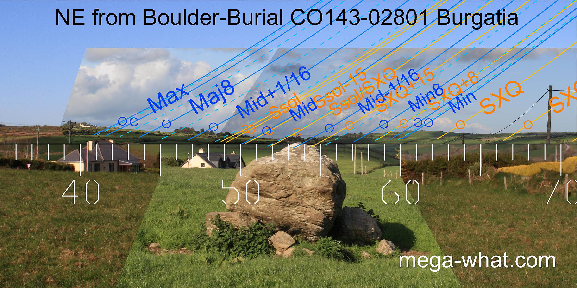 To the north-east is a dip that is half-way between summer cross-quarters and the summer solstice. A hilltop to the right of it has lunar minor
standstillLunistice positions vary cyclically over an 18.6 year period but are fairly static for more than a year at either end of the range
on its top and the cross-quarter at its foot.
Major standstill is at the top of the the left-hand slope. A large Standing Stone (CO134-073), now fallen and moved to the side of the field is up there too.
That site and this one are intervisible so the stone might have been on the skyline from here, perhaps half a degree beyond the lunar maximum.
To the north-east is a dip that is half-way between summer cross-quarters and the summer solstice. A hilltop to the right of it has lunar minor
standstillLunistice positions vary cyclically over an 18.6 year period but are fairly static for more than a year at either end of the range
on its top and the cross-quarter at its foot.
Major standstill is at the top of the the left-hand slope. A large Standing Stone (CO134-073), now fallen and moved to the side of the field is up there too.
That site and this one are intervisible so the stone might have been on the skyline from here, perhaps half a degree beyond the lunar maximum.
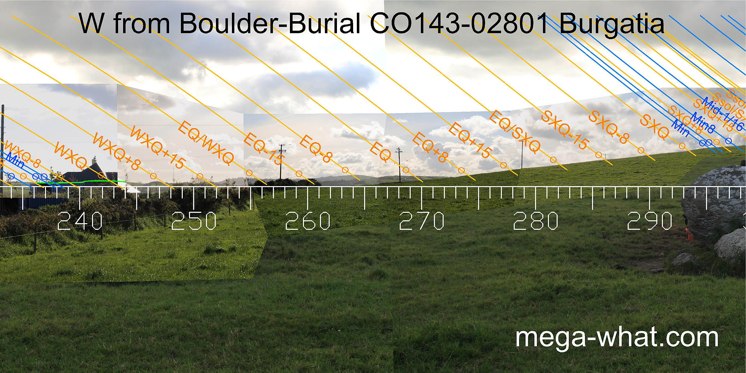
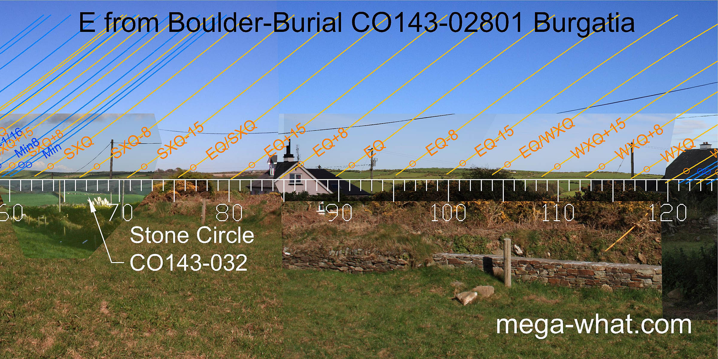 Much of the eastern horizon is obscured but consists in the main of wide, low hills.
Bohonagh Stone Circle is c.750m to the east-north-east and this site would possibly be on the horizon from there but for the intervening vegetation.
Much of the eastern horizon is obscured but consists in the main of wide, low hills.
Bohonagh Stone Circle is c.750m to the east-north-east and this site would possibly be on the horizon from there but for the intervening vegetation.
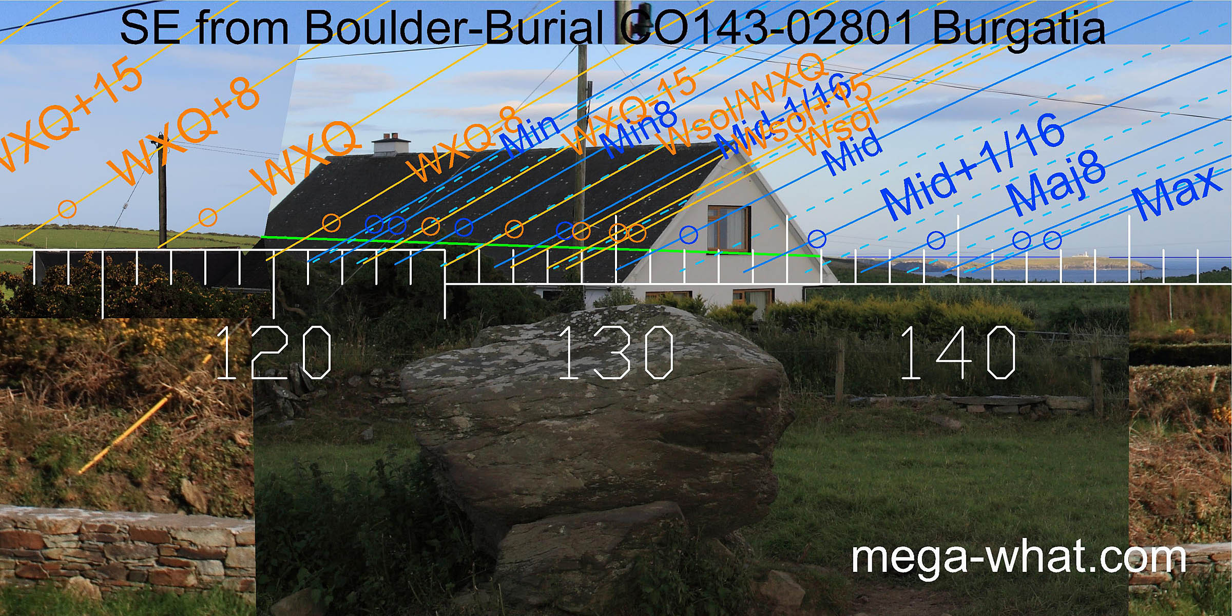 To the south-east, the lunar limit is on sea horizon just above Galley Head peninsula. The major eighth is just before the slope down into a wide dip.
The sixteenth starts at the lowest point of the dip and clears the horizon at the top of the slope out of the dip.
The major standstill rises at the top of the slope and clears the horizon just before the sea/land intersect.
To the south-east, the lunar limit is on sea horizon just above Galley Head peninsula. The major eighth is just before the slope down into a wide dip.
The sixteenth starts at the lowest point of the dip and clears the horizon at the top of the slope out of the dip.
The major standstill rises at the top of the slope and clears the horizon just before the sea/land intersect.
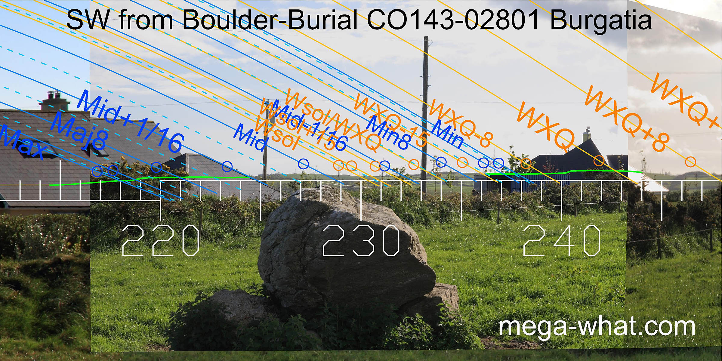
To the south-west, the axis of the boulder indicates the region of the winter solstice and the lunar midpoint.
 The hilly horizon continues usefully round to the west where the quarter-months away from the equinox get better markers than the equinox itself.
The cross-quarter is at the base of a slight step.
The hilly horizon continues usefully round to the west where the quarter-months away from the equinox get better markers than the equinox itself.
The cross-quarter is at the base of a slight step.
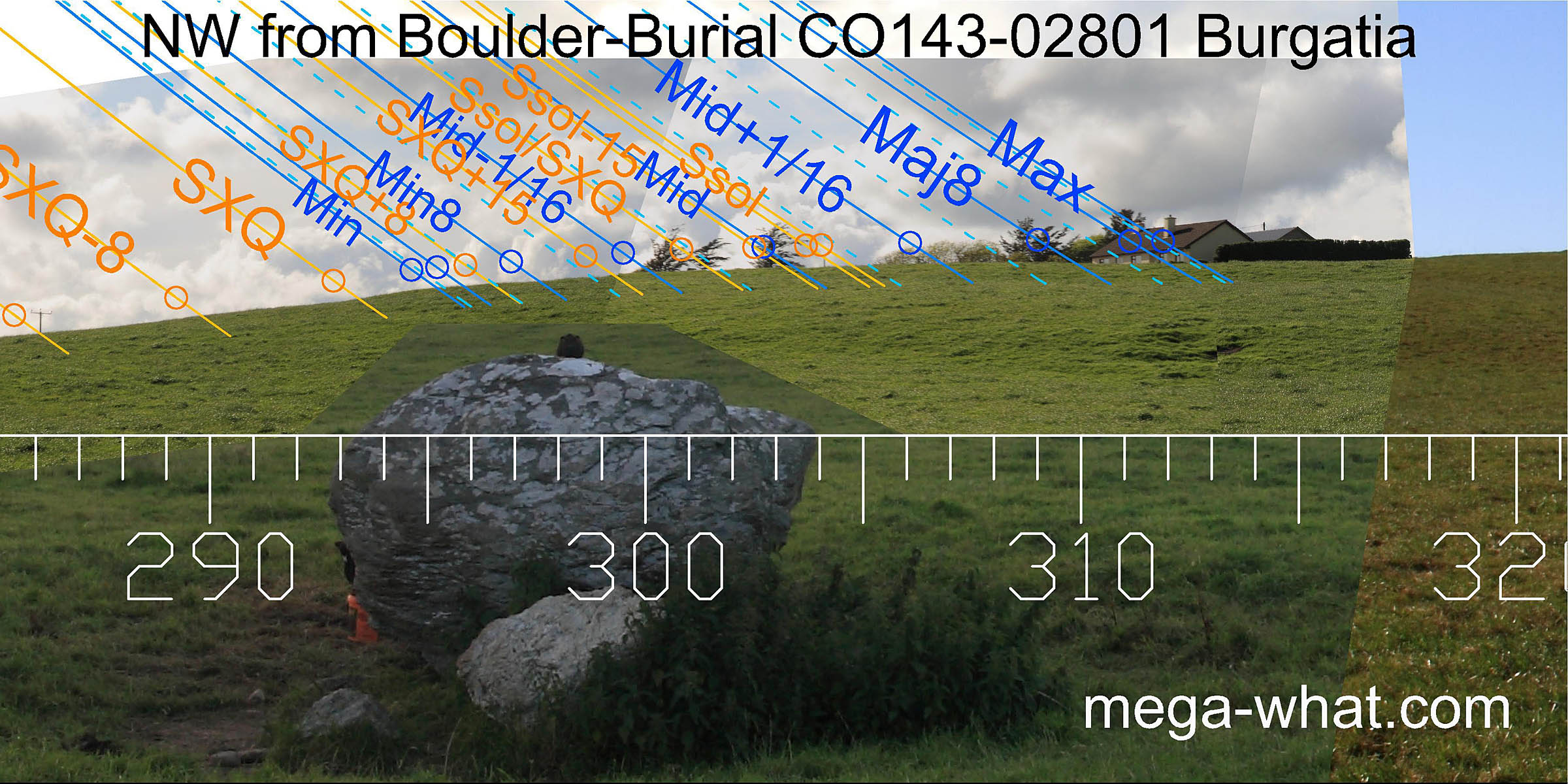 North-westwards is the upper part of Burgatia hill.
This profile has undoubtedly been smoothed by 3000 years of agricultural activity but a change of slope towards the top is still discernible and it marks the minor end of the
lunisticeLunistices are the most northerly and southerly moons of the month. The lunar equivalent of solstices - more. cycle.
The most extreme northerly moonset position is at another slope change, now occupied by a bungalow. Beyond that, a ringfort obscures the hilltop.
North-westwards is the upper part of Burgatia hill.
This profile has undoubtedly been smoothed by 3000 years of agricultural activity but a change of slope towards the top is still discernible and it marks the minor end of the
lunisticeLunistices are the most northerly and southerly moons of the month. The lunar equivalent of solstices - more. cycle.
The most extreme northerly moonset position is at another slope change, now occupied by a bungalow. Beyond that, a ringfort obscures the hilltop.
- Bohonagh Boulder-Burial is 747m east (69°)
- Keamore Boulder-Burial is 10.6km west (278°)
- Caherkirky Boulder-Burials are 11.5km north (5°)
- Derryclough Boulder-Burial is 14.1km north-west (298°)
References
- Archaeological Survey of Ireland, record details. www.archaeology.ie/archaeological-survey-ireland
- Ó'NUALLÁIN, SEÁN 1978 Boulder-Burials. Proceedings of the Royal Irish Academy 78c:75-114, p95, No.32.
- POWER, D. et al. 1992 Archaeological Inventory of County Cork, Volume 1: West Cork. Dublin: Stationary Office. p30, no.104.