
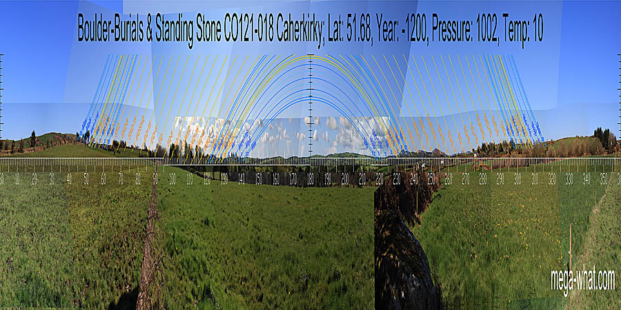
 The Boulder-Burials & Standing Stone at Caherkirky are north-west of Clonakilty, about 2km east of Ballingurteen.
There is a large boulder-burial with a capstone that has been partially displaced, also a smaller one lying close to the ground with one support visible.
Beside this last is a Standing Stone that is a large slab, decorated with twenty or so shallow cup-marks.
Its long axis c.55° is roughly towards the lunar midpoint to the north-east or the minor end of the lunistice
Lunistices are the most northerly and southerly moons of the month. The lunar equivalent of solstices - more. range to the south-west.
There are several quartz boulders at the base of the field boundary wall.
The Boulder-Burials & Standing Stone at Caherkirky are north-west of Clonakilty, about 2km east of Ballingurteen.
There is a large boulder-burial with a capstone that has been partially displaced, also a smaller one lying close to the ground with one support visible.
Beside this last is a Standing Stone that is a large slab, decorated with twenty or so shallow cup-marks.
Its long axis c.55° is roughly towards the lunar midpoint to the north-east or the minor end of the lunistice
Lunistices are the most northerly and southerly moons of the month. The lunar equivalent of solstices - more. range to the south-west.
There are several quartz boulders at the base of the field boundary wall.
Survey was of necessity from south of the field boundary as well as from the vicinity of the monuments.
 North is on a slight rise within a dip [Pic].
![[Pic].](Caherkirky-N.jpg)
South is indicated by the basal step of a hill [Pic].
![[Pic].](Caherkirky-S.jpg)
Summer solstice is marked by steps, both rising and setting. Winter solstice sets into a step and seems to rise up a slope but the basal step is obscured.
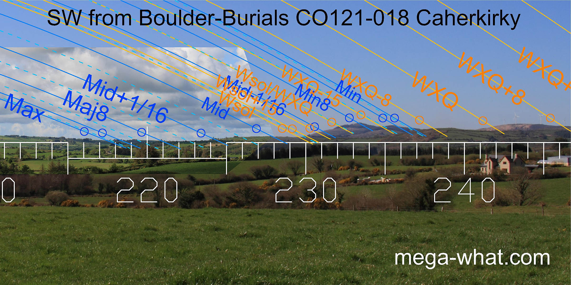 The south-west horizon is the primary target of this site which is one of a number that make use of the profile of Carrig Fadda.
The overall fit of both solar and lunisticeLunistices are the most northerly and southerly moons of the month. The lunar equivalent of solstices - more.
cycles is very good with winter solstice sunset at the foot of the hill and lunar minor eighth on its top as the most obvious features.
The south-west horizon is the primary target of this site which is one of a number that make use of the profile of Carrig Fadda.
The overall fit of both solar and lunisticeLunistices are the most northerly and southerly moons of the month. The lunar equivalent of solstices - more.
cycles is very good with winter solstice sunset at the foot of the hill and lunar minor eighth on its top as the most obvious features.
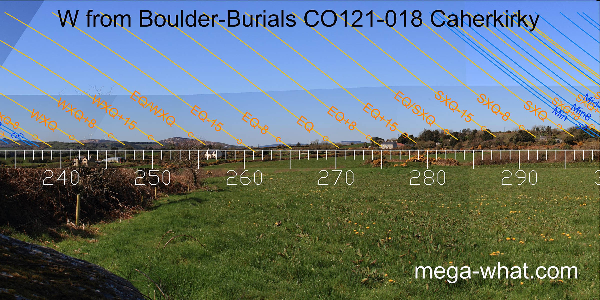 The western horizon forms a dip with usefully varied profile. Cairn CO121-016, 920m away to the east, was destroyed just before I got there.
Recorded as 13.7m x 8.0m x 1.5m high and probably considerably denuded by then, it would have needed to be about 4m high to cut the horizon when viewed from here.
The western horizon forms a dip with usefully varied profile. Cairn CO121-016, 920m away to the east, was destroyed just before I got there.
Recorded as 13.7m x 8.0m x 1.5m high and probably considerably denuded by then, it would have needed to be about 4m high to cut the horizon when viewed from here.
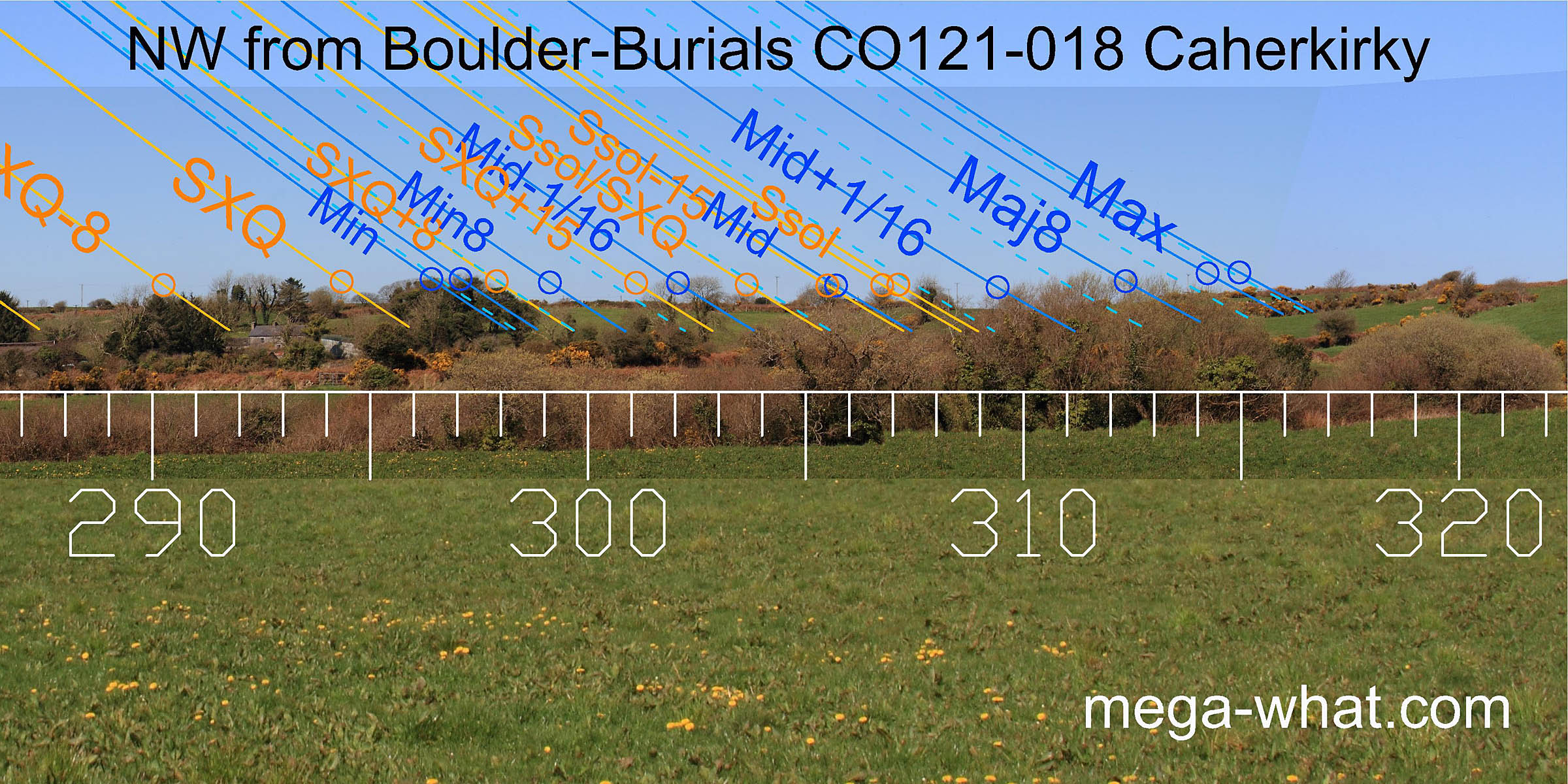 A very bland ridge occupies the north-west but the two easily discernible possibilities, namely a low hilltop and a dip / break, do make useful markers.
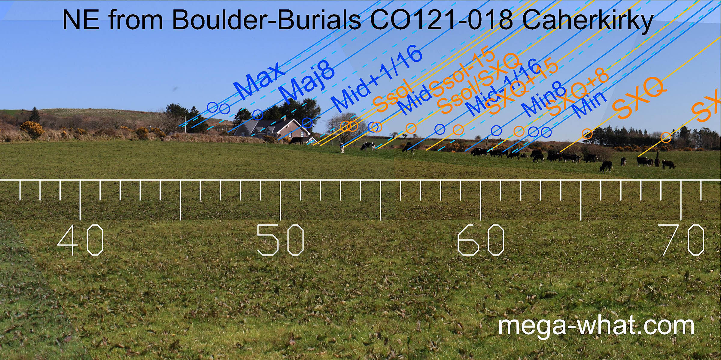 To the north-east, the summer solstice is marked by the step at the base of a slope and the major end of the lunisticeLunistices are the most northerly and southerly moons of the month. The lunar equivalent of solstices - more.
range is at the top of this slope. Summer cross-quarters are marked by another step.
To the north-east, the summer solstice is marked by the step at the base of a slope and the major end of the lunisticeLunistices are the most northerly and southerly moons of the month. The lunar equivalent of solstices - more.
range is at the top of this slope. Summer cross-quarters are marked by another step.
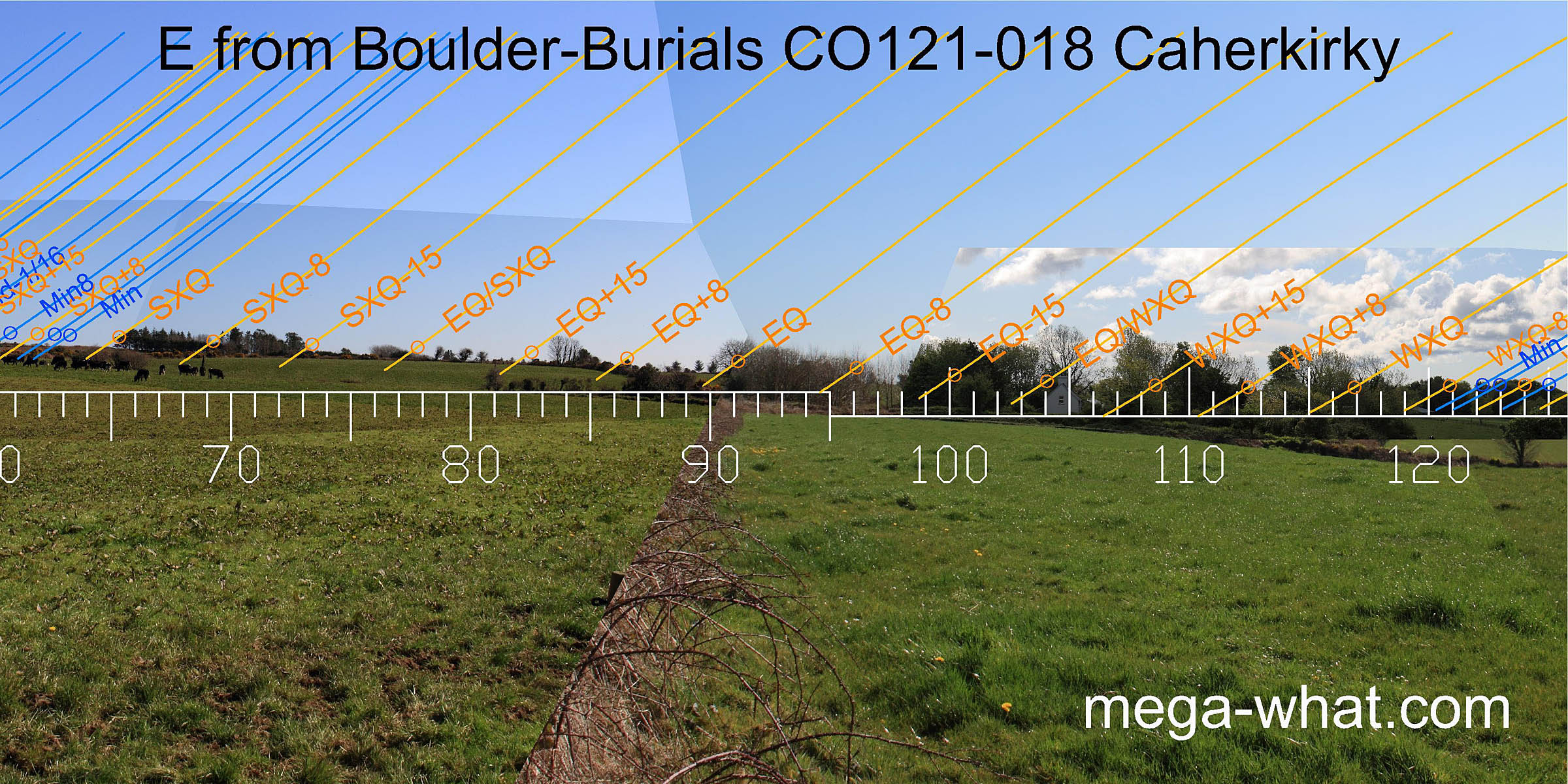 The east is mostly obscured. Being the closest horizon sector it is the most susceptible to exact observer position.
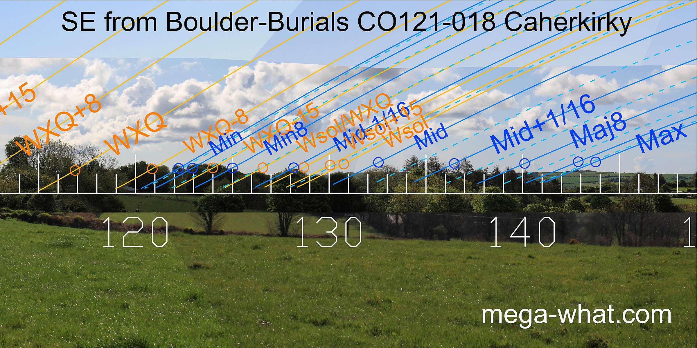 The south-east is also largely obscured by trees and the nearby hedge. It looks as though the minor half of the
lunisticeLunistices are the most northerly and southerly moons of the month. The lunar equivalent of solstices - more.
range spans the bottom of the local valley with the solstice rising up the slope of a distant ridge. On this distant ridge, the major eighth is in a dip and
major standstillLunistice positions vary cyclically over an 18.6 year period but are fairly static for more than a year at either end of the range
is on a hilltop.
The south-east is also largely obscured by trees and the nearby hedge. It looks as though the minor half of the
lunisticeLunistices are the most northerly and southerly moons of the month. The lunar equivalent of solstices - more.
range spans the bottom of the local valley with the solstice rising up the slope of a distant ridge. On this distant ridge, the major eighth is in a dip and
major standstillLunistice positions vary cyclically over an 18.6 year period but are fairly static for more than a year at either end of the range
is on a hilltop.
- Knocks Boulder-Burials are 4.3km east (75°)
- Ballyvackey Boulder-Burial & Stone Circle are 6.2km south-east (148°)
- Bohonagh Boulder-Burial & Stone Circle are 11.2km south (181°)
- Derryclough Boulder-Burial is 14.3km west (250°)
References
- Archaeological Survey of Ireland, record details. www.archaeology.ie/archaeological-survey-ireland
- POWER, D. et al. 1992 Archaeological Inventory of County Cork, Volume 1: West Cork. Dublin: Stationary Office. p31: no.105, p47, no.260.
- Ó'NUALLÁIN, SEÁN 1978 Boulder-Burials. Proceedings of the Royal Irish Academy 78c:75-114, p92, no.21.