
 This thirteen stone circle was excavated in 1960 (Fahy 1962) and is unusual in being surrounded by a ditch and bank (but it should be noted that the ground is wet).
Charcoal from under the bank and from the cremation have since given dates of 1214-998 and 1004-844 cal B.C. 2-sigma respectively (O'Brien 1992:33).
This thirteen stone circle was excavated in 1960 (Fahy 1962) and is unusual in being surrounded by a ditch and bank (but it should be noted that the ground is wet).
Charcoal from under the bank and from the cremation have since given dates of 1214-998 and 1004-844 cal B.C. 2-sigma respectively (O'Brien 1992:33).
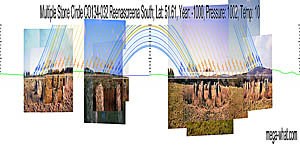
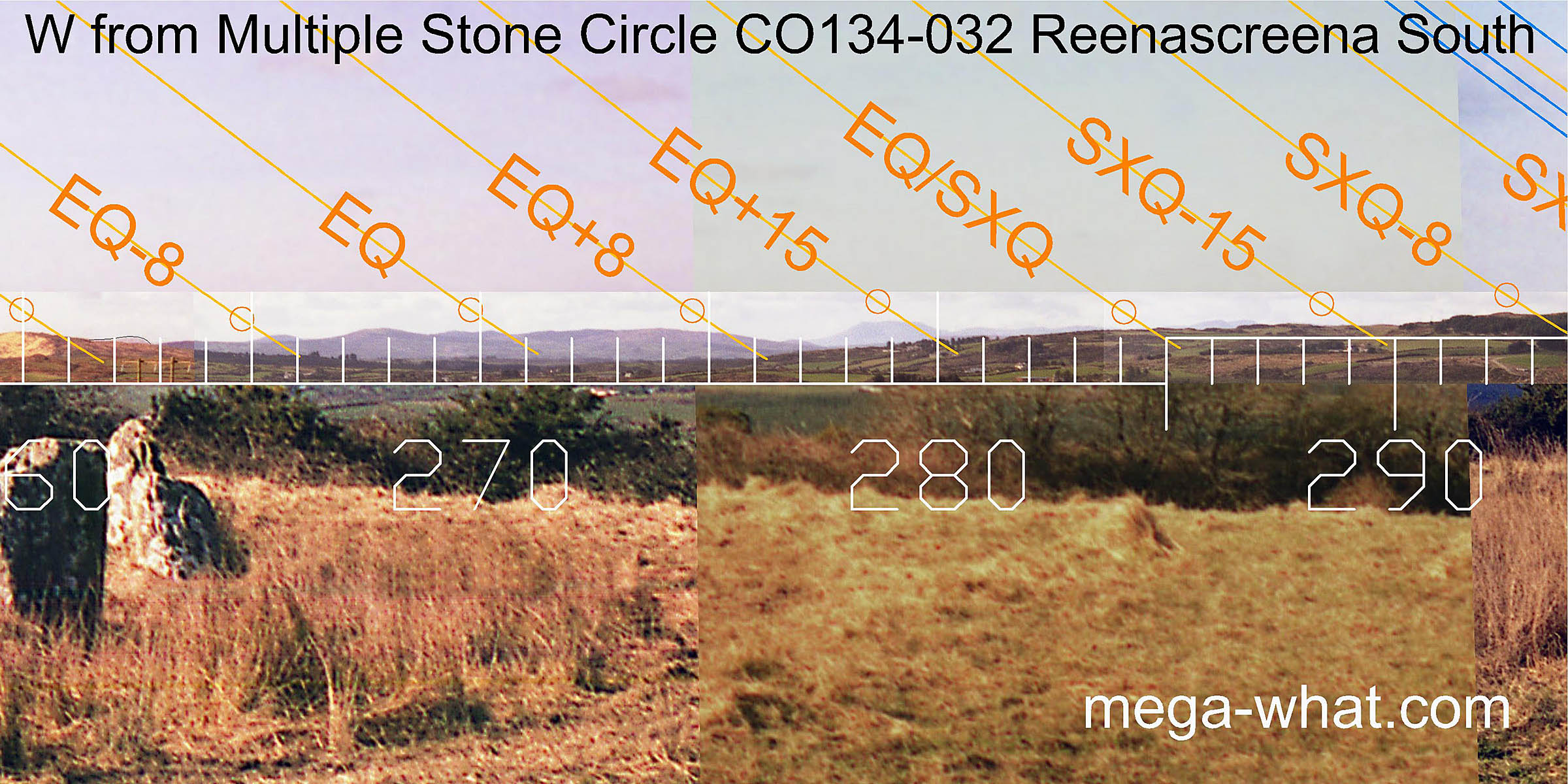
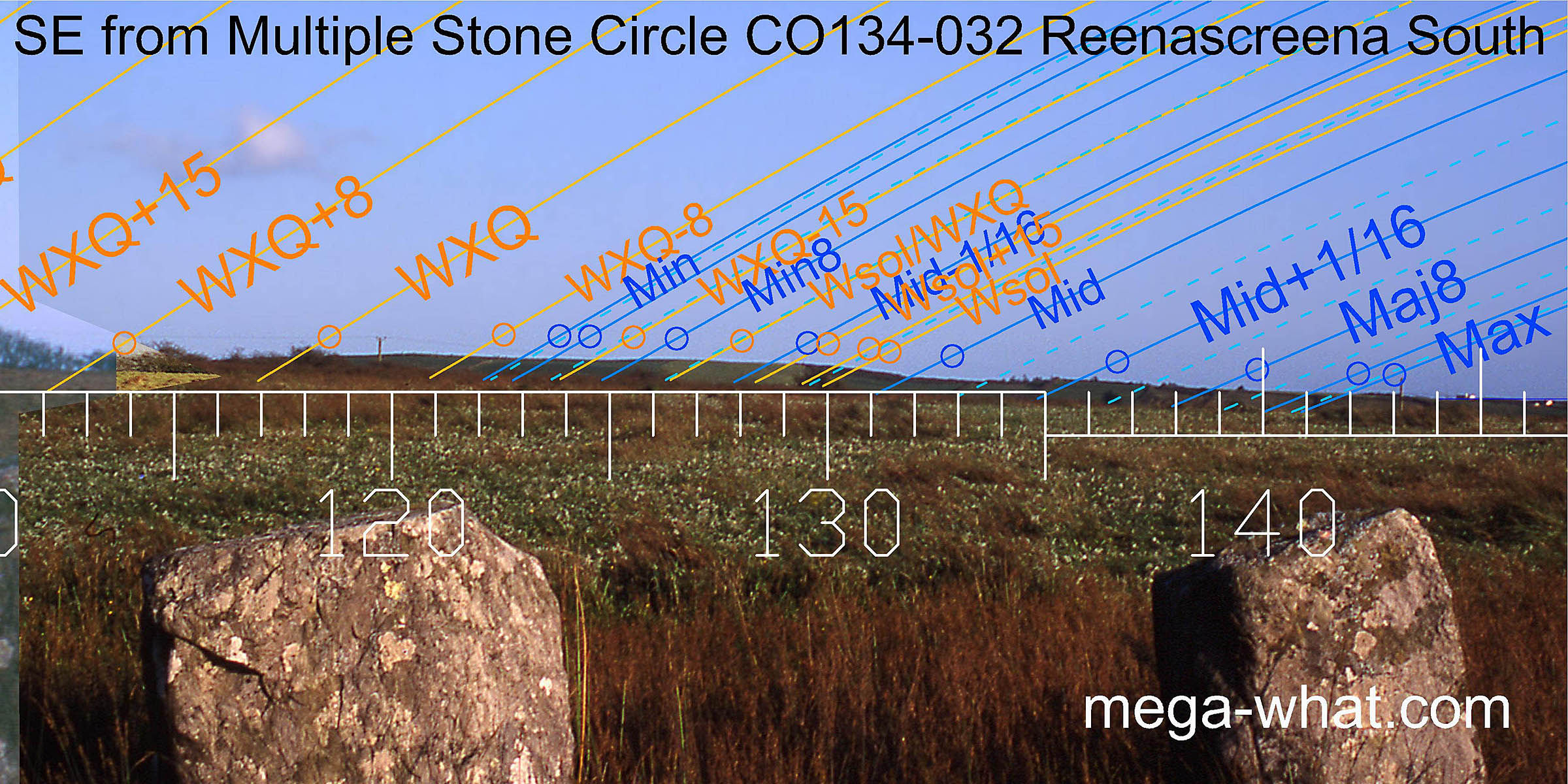
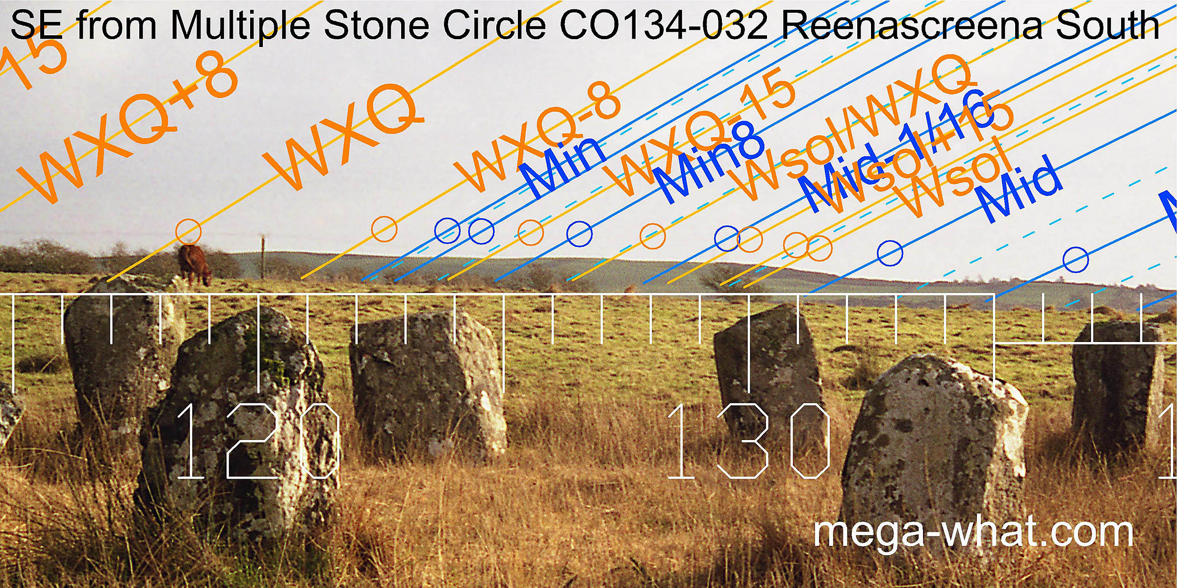
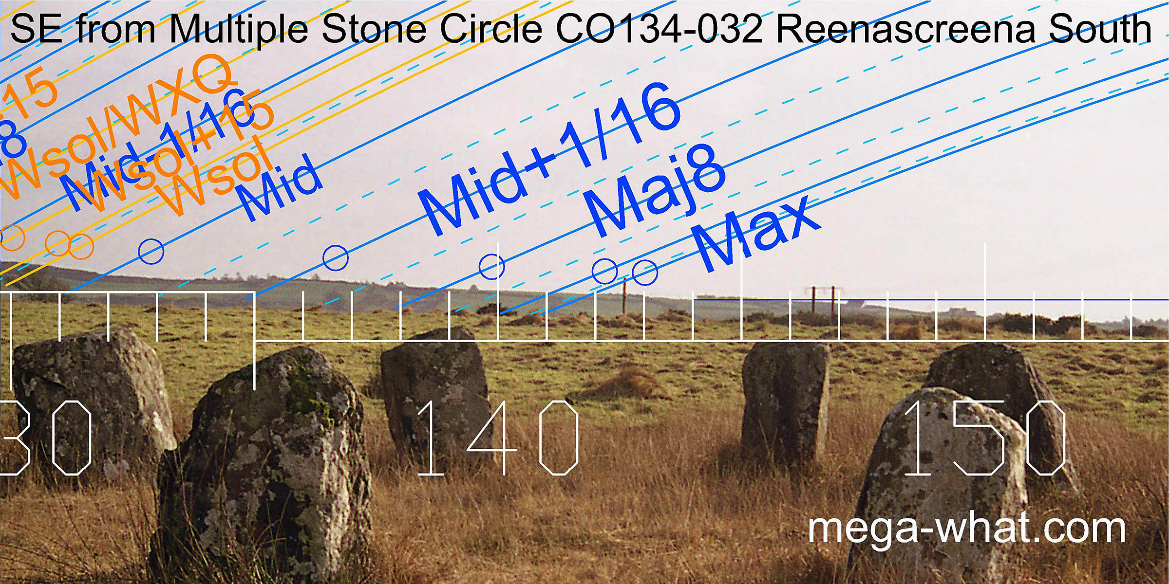
An early survey, these panoramic views have been cobbled together from photos that were never intended for that particular purpose. Green lines approximate hidden horizon segments. South seems to be at a land/sea intersect [Pic]. North is near a bit of a dip [Pic].
![[Pic]](Reenascreena-S.jpg)
![[Pic].](Reenascreena-N.jpg)
Hedges around the field made survey rather tricky.
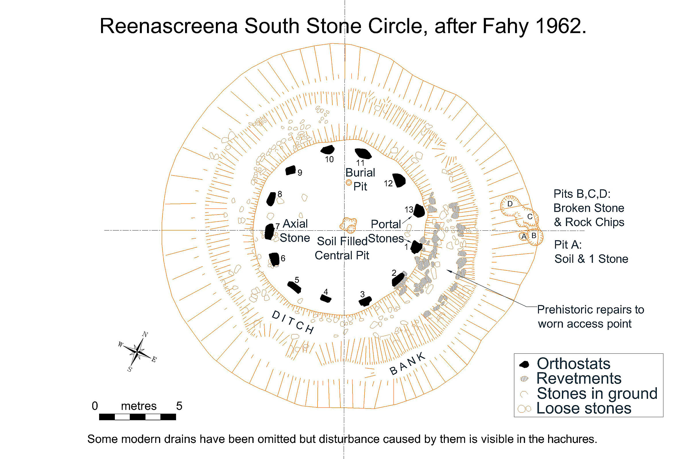 The ground within the circle seems to have been levelled and the cremation pit is well off centre.
The remaining pits are all on the monument axis and may represent traces of setting up arrangements though a purely ritual purpose is possible.
Some contain broken rocks, as also seen at Drombeg, so they well be may be practical but positional choice is interesting.
Identification of the source of these rock chips woud be useful.
The ground within the circle seems to have been levelled and the cremation pit is well off centre.
The remaining pits are all on the monument axis and may represent traces of setting up arrangements though a purely ritual purpose is possible.
Some contain broken rocks, as also seen at Drombeg, so they well be may be practical but positional choice is interesting.
Identification of the source of these rock chips woud be useful.
A most interesting feature revealed by the excavation is the mending of the ditch walls with stone. This wearing away and subsequent repair of an access point conclusively demonstrates repeated usage of the site for non-burial purposes during prehistoric times.
 It has been said that the axis of this circle has no orientational significance.
It has also been said that the axis of this circle indicates the winter cross-quarters.
In fact, this is one of a number of sites that demonstrate the significance, to the builders of these monuments,
of dates which are both half a month from the solar sixteenths and one quarter of a month away from the major solar dates recognised by us.
It also demonstrates how our understanding has been hindered by pre-conceived ideas.
It has been said that the axis of this circle has no orientational significance.
It has also been said that the axis of this circle indicates the winter cross-quarters.
In fact, this is one of a number of sites that demonstrate the significance, to the builders of these monuments,
of dates which are both half a month from the solar sixteenths and one quarter of a month away from the major solar dates recognised by us.
It also demonstrates how our understanding has been hindered by pre-conceived ideas.
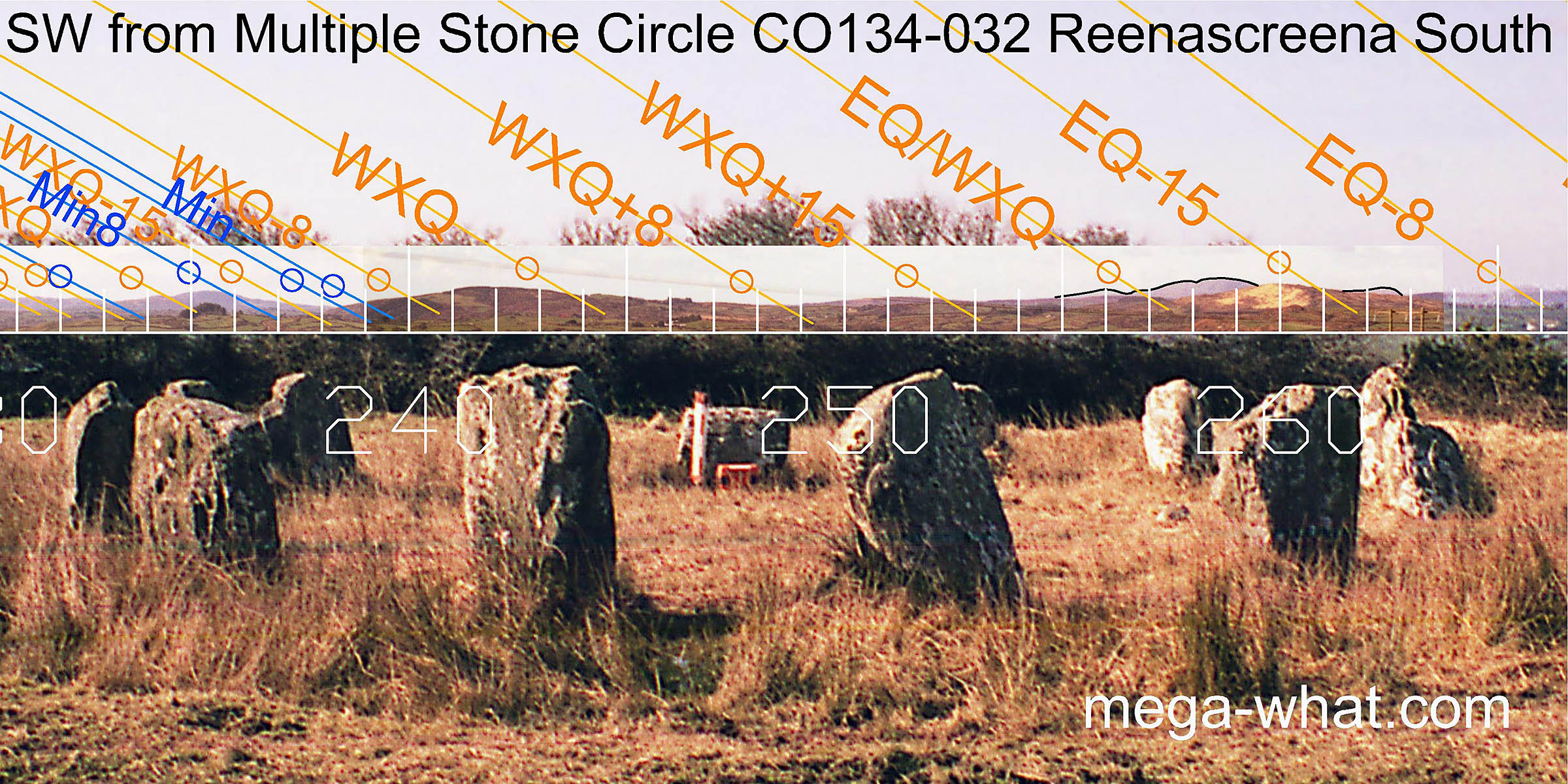
Axial orientation to the south-west is one quarter-month north of the winter cross-quarters and is marked by a prominent dip in the horizon.
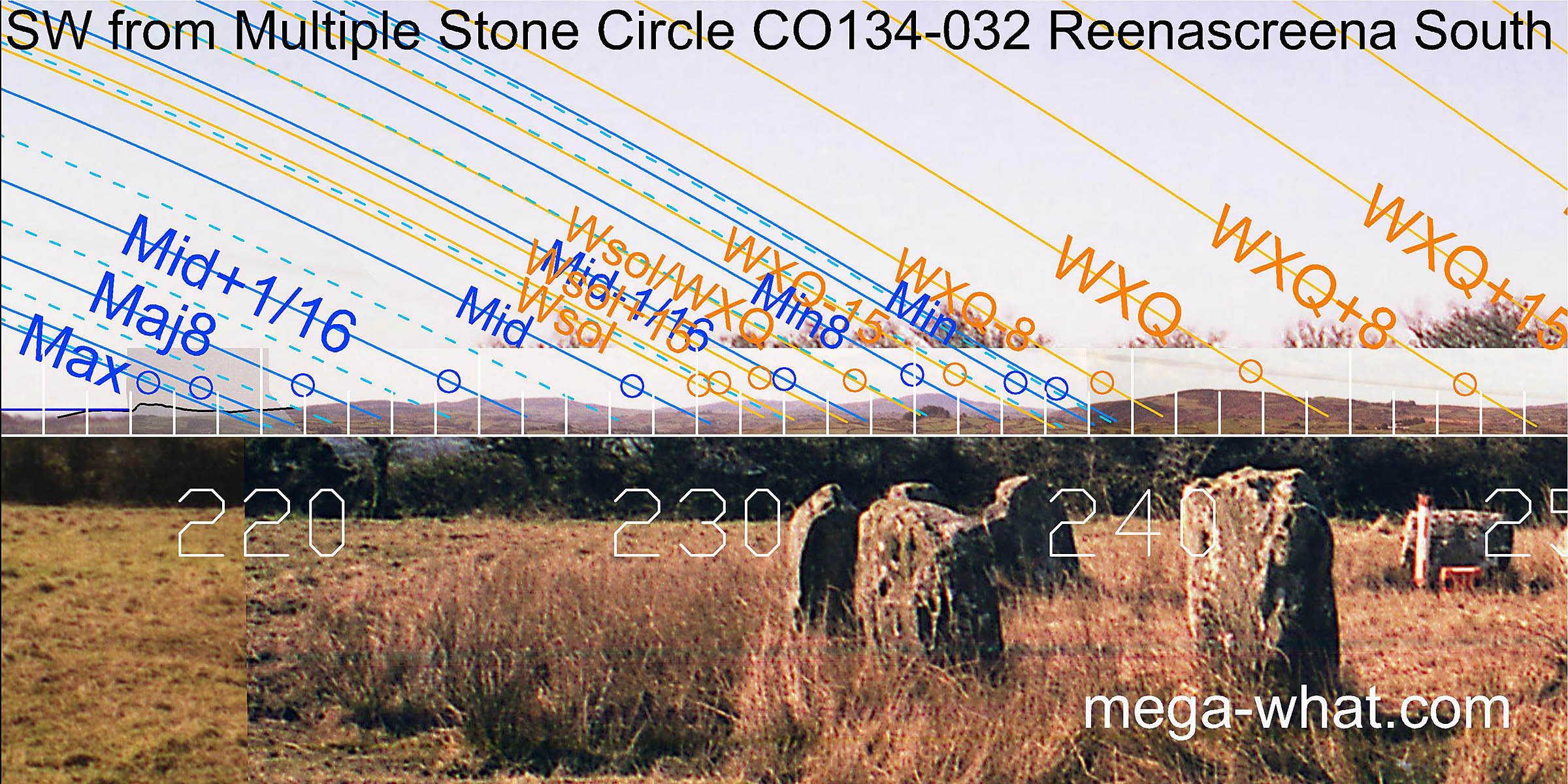 Further to the south-west, the most extreme southerly setting point of the moon falls at the bottom of a saddle in a range of distant hills
and the minor end of the lunisticeLunistices are the most northerly and southerly moons of the month. The lunar equivalent of solstices - more.
cycle is at the intersection of these hills with nearer ones.
This nearer section is indicated by the monument axis, particularly the central saddle, which as previously stated is a quarter-month north of the winter cross-quarters.
Further to the south-west, the most extreme southerly setting point of the moon falls at the bottom of a saddle in a range of distant hills
and the minor end of the lunisticeLunistices are the most northerly and southerly moons of the month. The lunar equivalent of solstices - more.
cycle is at the intersection of these hills with nearer ones.
This nearer section is indicated by the monument axis, particularly the central saddle, which as previously stated is a quarter-month north of the winter cross-quarters.
 More distant hills, framed by nearer ground, provide useful markers for the month centred on the equinox.
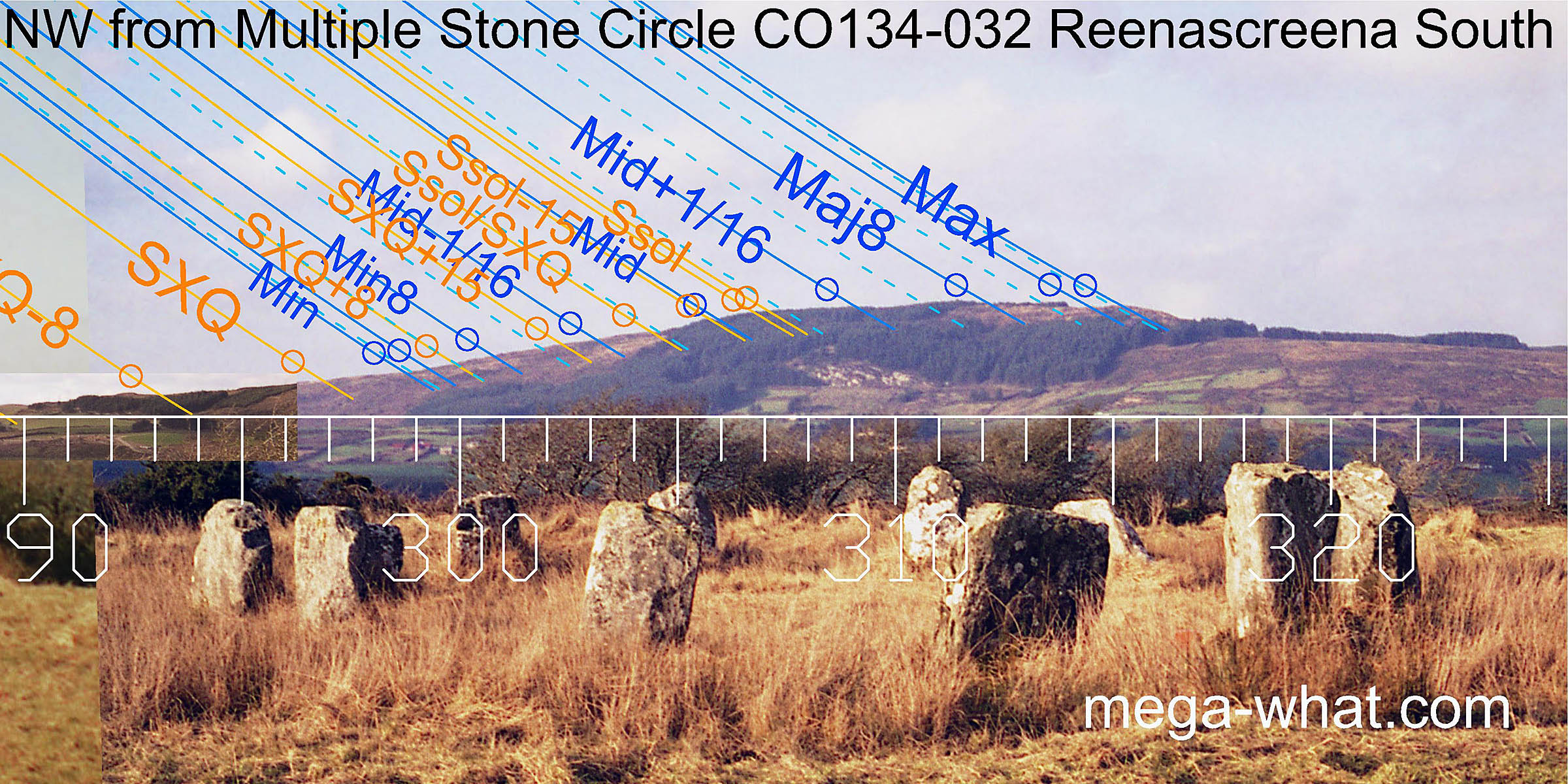 Carrig Fadda is prominent to the north-west and has been well fitted to the pattern.
The northerly moonset range begins at a break near the foot of the western slope and ends at the edge of the summit.
Summer solstice sunset is at the western end of the hilltop.
Carrig Fadda is prominent to the north-west and has been well fitted to the pattern.
The northerly moonset range begins at a break near the foot of the western slope and ends at the edge of the summit.
Summer solstice sunset is at the western end of the hilltop.
The spacing of the sidestones seems to have been deliberately arranged to emphasise this north-west / south-east axis.
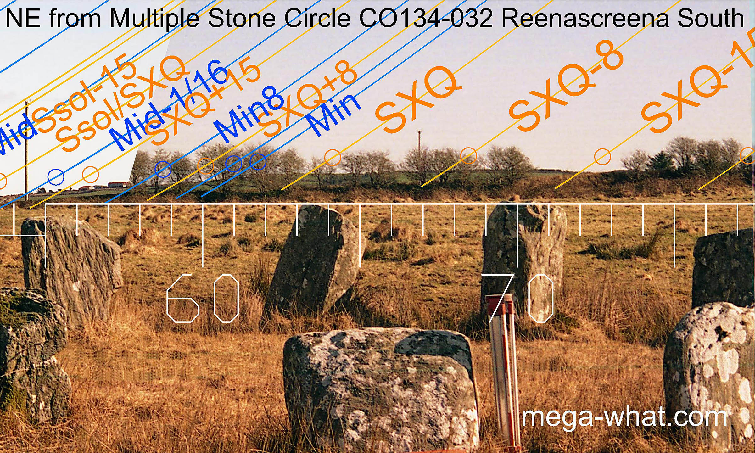 Axial orientation to the north-east is on the local hilltop, one quarter-month south of the summer cross-quarters,
nicely matching the south-western axial orientation of one quarter-month south of the winter cross-quarters.
Axial orientation to the north-east is on the local hilltop, one quarter-month south of the summer cross-quarters,
nicely matching the south-western axial orientation of one quarter-month south of the winter cross-quarters.
The cross-quarter sun rises from the northern end of the hilltop and the days a half-month either side of it are at changes in the slope to either side.
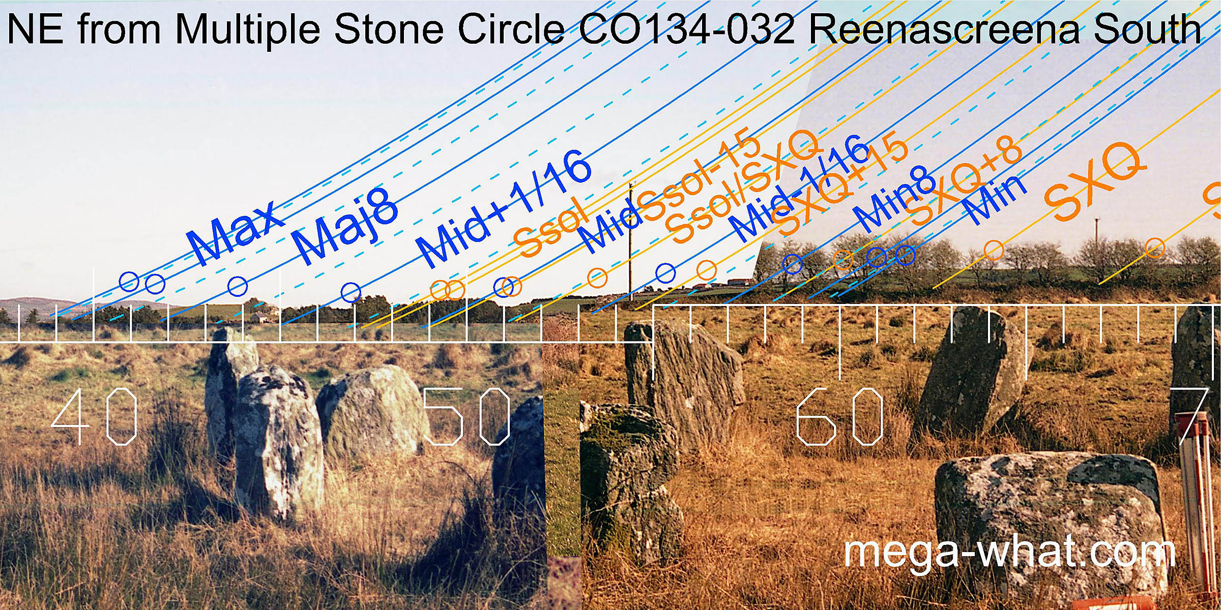 Further to the north of the axis much of the horizon is currently obscured and unsurveyable
but the more distant hills used as markers for the major end of the lunisticeLunistices are the most northerly and southerly moons of the month. The lunar equivalent of solstices - more.
range can be seen from the circle.
Further to the north of the axis much of the horizon is currently obscured and unsurveyable
but the more distant hills used as markers for the major end of the lunisticeLunistices are the most northerly and southerly moons of the month. The lunar equivalent of solstices - more.
range can be seen from the circle.
 A section to the south of the axial hilltop is obscured but the south-east is visible.
The landscape there is gently rolling but nonetheless has been well fitted to the winter part of the solar cycle and the southern rises of the moon.
A section to the south of the axial hilltop is obscured but the south-east is visible.
The landscape there is gently rolling but nonetheless has been well fitted to the winter part of the solar cycle and the southern rises of the moon.
The minor end of the lunisticeLunistices are the most northerly and southerly moons of the month. The lunar equivalent of solstices - more. cycle is at a break in the slope, the midpoint is at a step and the major end is on the last hump before the sea horizon.
 This is one of three Cork-Kerry Stone Circles excavated by Fahy.
The other two are Bohonagh and Drombeg.
This is one of three Cork-Kerry Stone Circles excavated by Fahy.
The other two are Bohonagh and Drombeg.
Coolcraheen Standing Stone, from where another standing stone is in a significant position on the horizon, is 4.2km east (102°)
References
- Archaeological Survey of Ireland, record details. www.archaeology.ie/archaeological-survey-ireland
- FAHY, E.M. 1962 A Recumbent-stone Circle at Reenascreena South, Co. Cork. Journal of the Cork Historical and Archaeological Society 67:59-69.
- O'BRIEN, WILLIAM 1992 Boulder-Burials: A Later Bronze Age Megalith Tradition in South-West Ireland. Journal of the Cork Historical and Archaeological Society 9:11-35.
- Ó'NUALLÁIN, SEÁN 1975 The Stone Circle Complex of Cork and Kerry. Journal of the Royal Society of Antiquaries of Ireland 105:83-131, no.42.
- Ó'NUALLÁIN, SEÁN 1984 A Survey of Stone Circles in Cork and Kerry. Proceedings of the Royal Irish Academy 84c:1-77, p23, no.34.
- POWER, D. et al. 1992 Archaeological Inventory of County Cork, Volume 1: West Cork. Dublin: Stationary Office. p23, no.61.
- RUGGLES, C.L.N. 1999 Astronomy in Prehistoric Britain and Ireland. Newhaven & London: Yale University Press. No.ASC48.
- RUGGLES, C.L.N. & PRENDERGAST, F. 1996 A New Archaeoastronomical Investigation of the Irish Axial-Stone Circles. Proceedings of the 2nd SEAC [European Society for Astronomy in Culture] Conference, Bochum 1994. Bochum: Astronomisches Institut der Ruhr-Universität. pp5-13.
- SOMERVILLE, BOYLE T. 1930 Five Stone Circles of West Cork. Journal of the Cork Historical and Archaeological Society 35:70-85.