
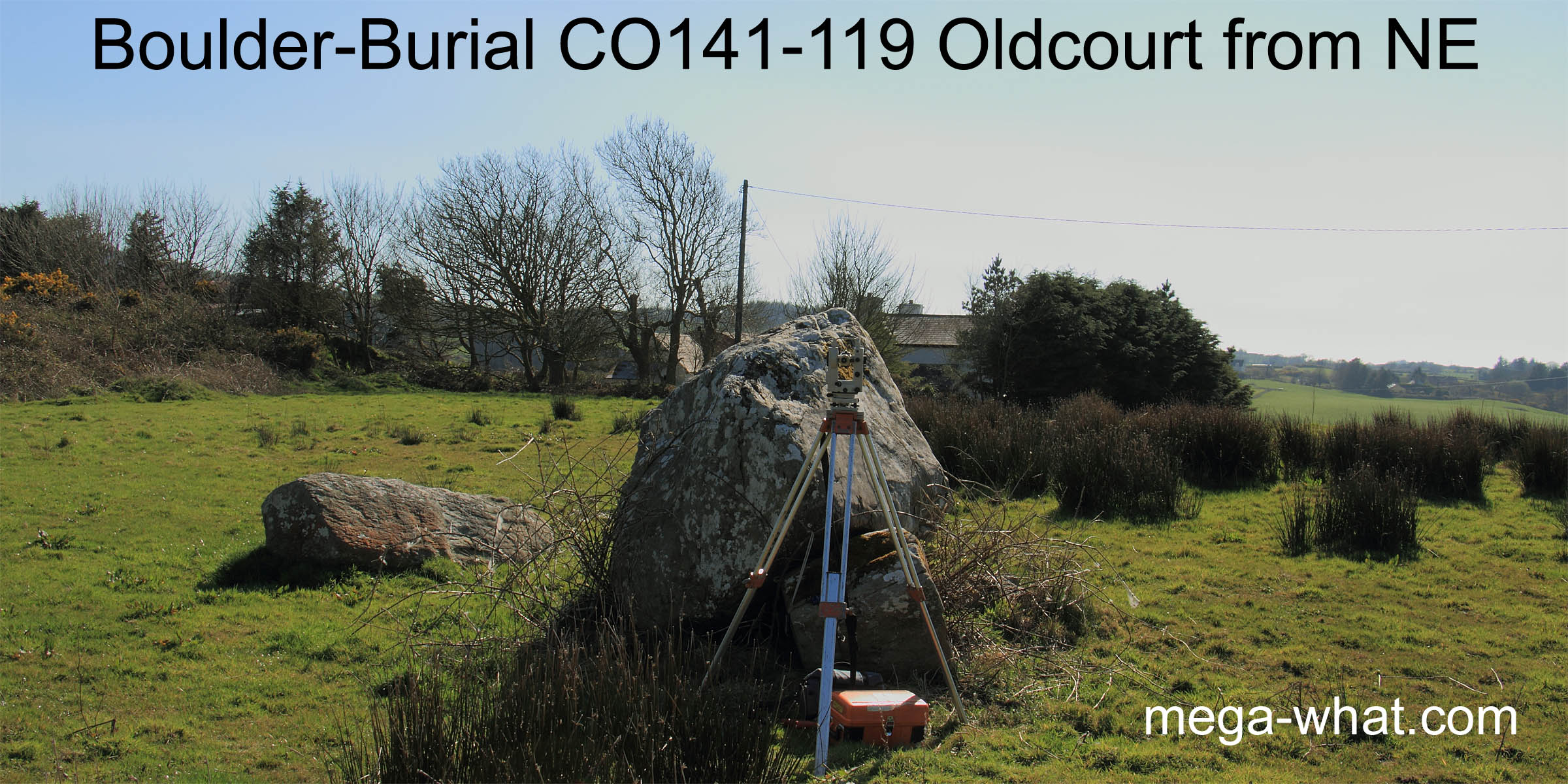
 Oldcourt Boulder-Burial is between Skibbereen and Baltimore. The capstone has tilted to the south-east.
Two large support stones are visible on the north-western side but the third seems to be missing.
Just to the south is a much smaller prostrate stone. Ó'Nualláin thought this might be a fallen Standing Stone but the excavation at
Cooradarrigan suggests that it is more likely to be a second "Boulder-Burial".
Oldcourt Boulder-Burial is between Skibbereen and Baltimore. The capstone has tilted to the south-east.
Two large support stones are visible on the north-western side but the third seems to be missing.
Just to the south is a much smaller prostrate stone. Ó'Nualláin thought this might be a fallen Standing Stone but the excavation at
Cooradarrigan suggests that it is more likely to be a second "Boulder-Burial".
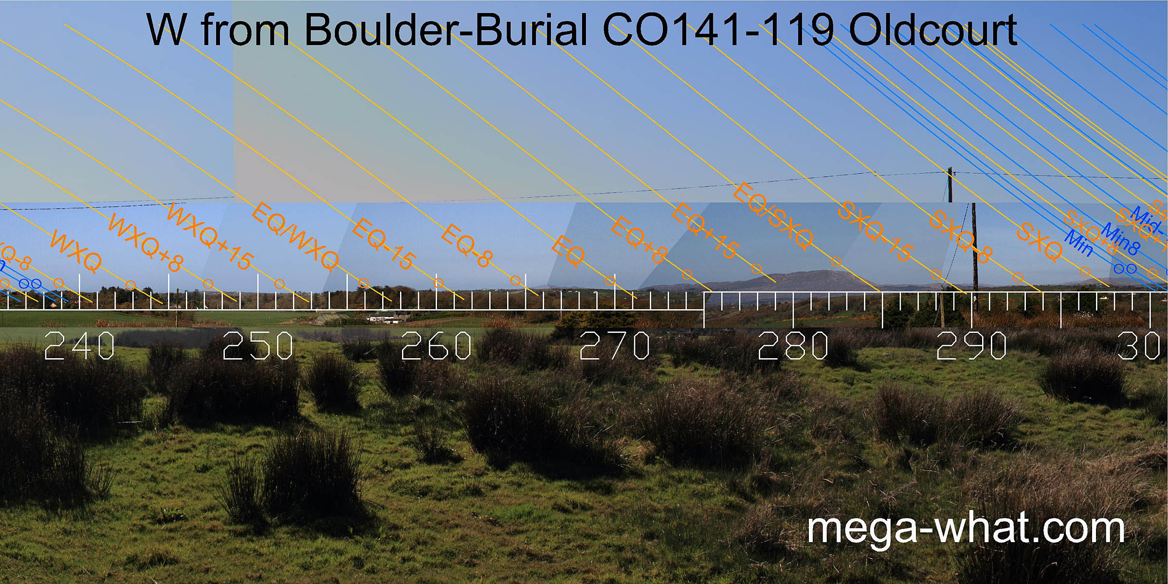
 South is on the prominent local hill of Knockomagh [Pic]. The eastern dip indicates the equinox / summer cross-quarter midpoint.
The western one, winter cross-quarter and the equinox itself. North is on a distant hilltop within a nearer dip [Pic].
South is on the prominent local hill of Knockomagh [Pic]. The eastern dip indicates the equinox / summer cross-quarter midpoint.
The western one, winter cross-quarter and the equinox itself. North is on a distant hilltop within a nearer dip [Pic].
![[Pic].](OldCourt-S.jpg)
![[Pic].](OldCourt-N.jpg)
Green lines approximate hidden horizon segments.
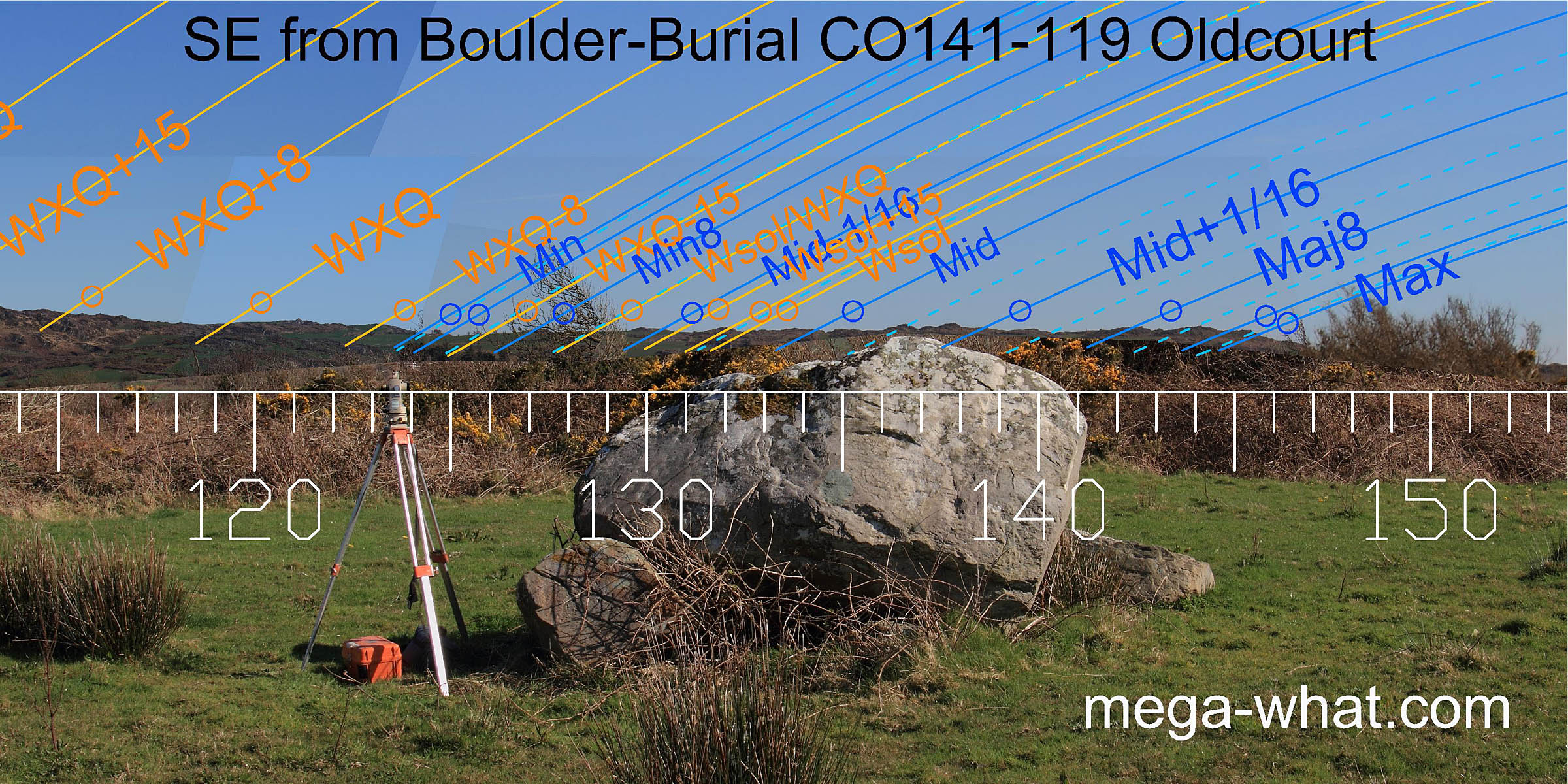
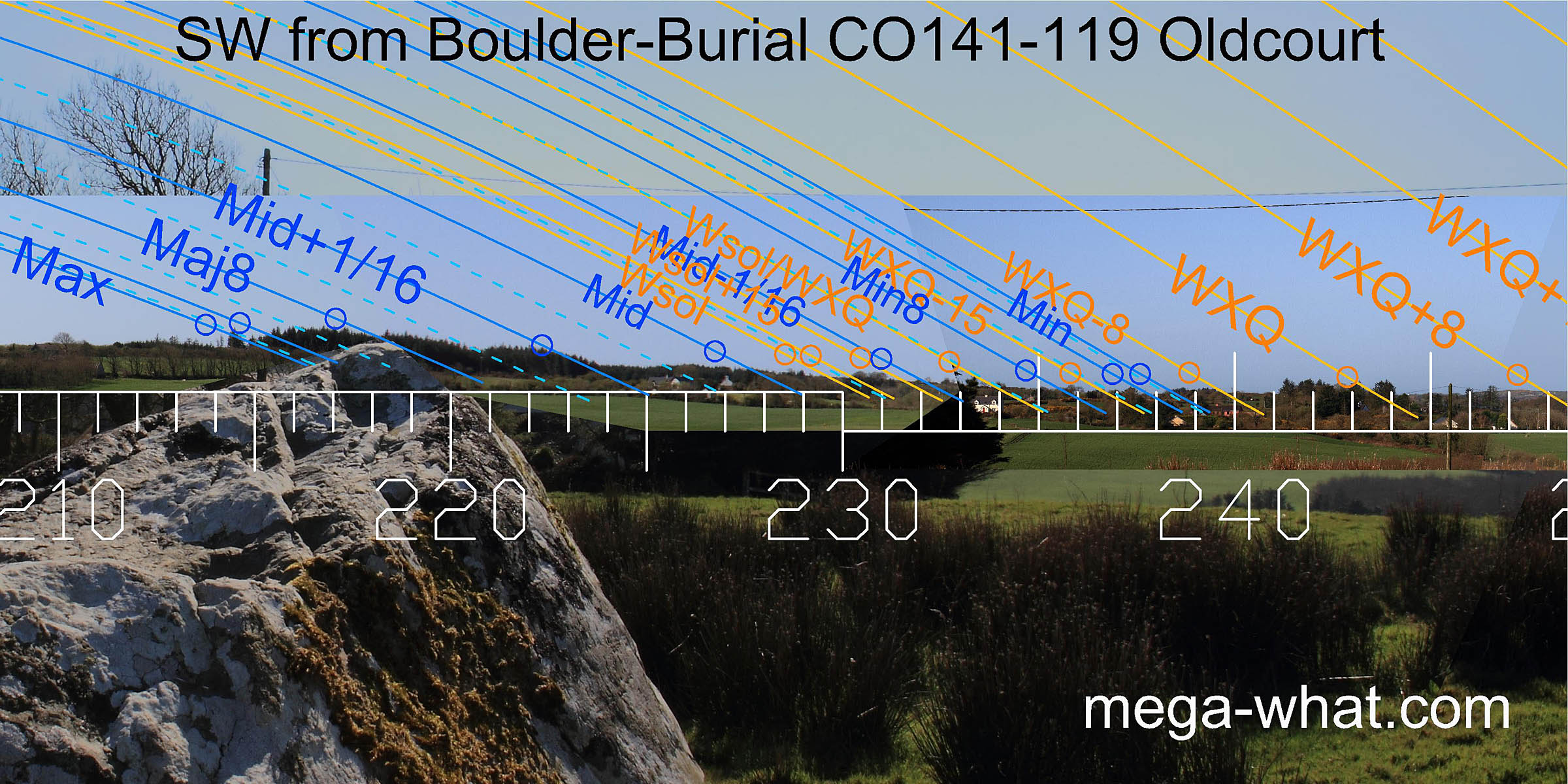 The boulder axis is north-east/south-west with the broad end to the south-west and normally one would expect that to be the prime focus.
Unfortunately this direction is partly obscured and haze on the day made much of the remainder very unclear. Clear Island and Sherkin should perhaps be visible here.
The boulder axis is north-east/south-west with the broad end to the south-west and normally one would expect that to be the prime focus.
Unfortunately this direction is partly obscured and haze on the day made much of the remainder very unclear. Clear Island and Sherkin should perhaps be visible here.
 To the west is Mt Gabriel with the equinox at its south foot and the equinox / cross-quarter midpoint at its northern one.
The summer cross-quarter itself is on Mt Corrin and bang on the Cairn.
To the west is Mt Gabriel with the equinox at its south foot and the equinox / cross-quarter midpoint at its northern one.
The summer cross-quarter itself is on Mt Corrin and bang on the Cairn.
The second boulder's reverse axis is roughly towards the winter cross-quarter / equinox midpoint.
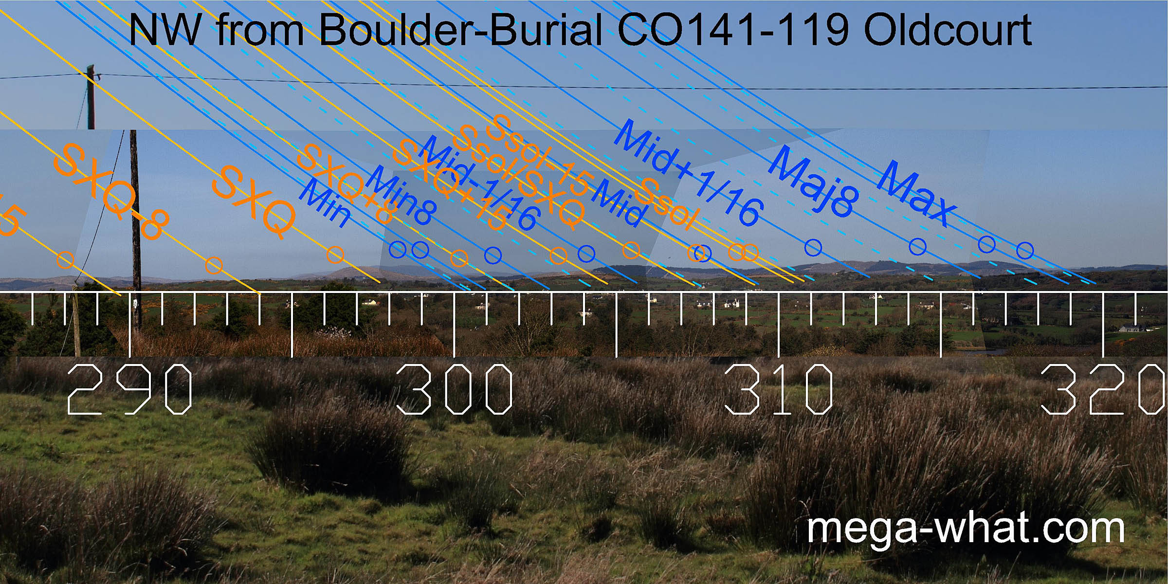 North-west is an undulating run of hills that make a good set of markers. Both ends are indicated by north basal steps and the central dip is the lunar midpoint.
 In the reverse axial direction, which is almost entirely obscured by bushes, a few points could be seen and the view was photographed from beyond the hedge.
The lunisticeLunistices are the most northerly and southerly moons of the month. The lunar equivalent of solstices - more.
range starts at the foot of some hills and a distant hilltop marks the lunar midpoint.
In the reverse axial direction, which is almost entirely obscured by bushes, a few points could be seen and the view was photographed from beyond the hedge.
The lunisticeLunistices are the most northerly and southerly moons of the month. The lunar equivalent of solstices - more.
range starts at the foot of some hills and a distant hilltop marks the lunar midpoint.
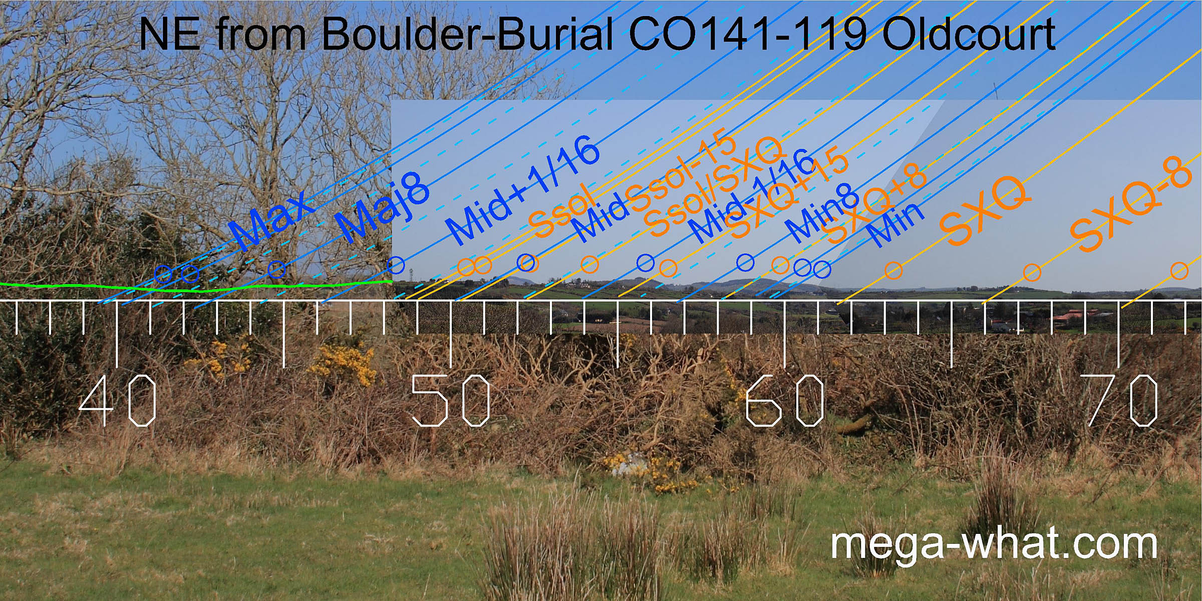
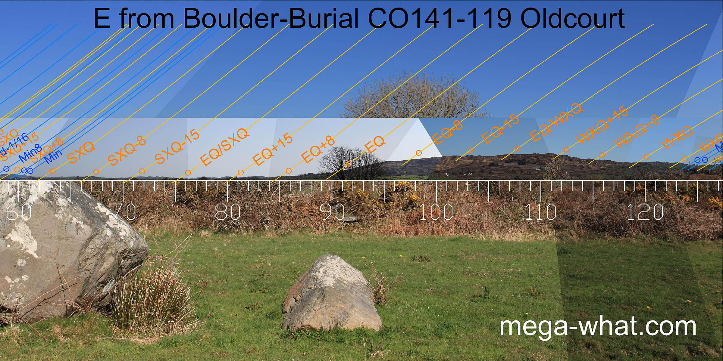 Eastwards is again largely obscured by nearby vegetation. A large part of this sector comprises Lick hill and its associated ridges which are rocky enough to provide a number of markers.
The second boulder axis looks very much like it is intended to indicate the equinox.
 On the south-east horizon, now slightly obscured by bushes in part, is a long flat section of the south ridge of Lick hill.
The step between the hillslope and the flat part is the minor standstillLunistice positions vary cyclically over an 18.6 year period but are fairly static for more than a year at either end of the range
while the south end of the flat part where it starts to fall away again is the major standstillLunistice positions vary cyclically over an 18.6 year period but are fairly static for more than a year at either end of the range.
It is quite rocky, with enough outcrops to provide a number of good markers.
On the south-east horizon, now slightly obscured by bushes in part, is a long flat section of the south ridge of Lick hill.
The step between the hillslope and the flat part is the minor standstillLunistice positions vary cyclically over an 18.6 year period but are fairly static for more than a year at either end of the range
while the south end of the flat part where it starts to fall away again is the major standstillLunistice positions vary cyclically over an 18.6 year period but are fairly static for more than a year at either end of the range.
It is quite rocky, with enough outcrops to provide a number of good markers.
This is the eastmost of a local group of four boulder-burial sites.
- Nearest but unsurveyed is Inishbeg.
- The other two, on the Lisheen peninsula are Bawngare and Lisheen.
- Keamore Boulder-Burial is 12.9km north-east (56°)
- Kilmore Boulder-Burials are 12.9km north (17°)
A cup-marked standing stone at Barnabah is 3km to the south.
References
- Archaeological Survey of Ireland, record details. www.archaeology.ie/archaeological-survey-ireland
- Ó'NUALLÁIN, SEÁN 1978 Boulder-Burials. Proceedings of the Royal Irish Academy 78c:75-114, p95, no.31.
- POWER, D. et al. 1992 Archaeological Inventory of County Cork, Volume 1: West Cork. Dublin: Stationary Office. p33, no.130.