
 Letterlicky Cairn is on a mountain ridge, about 6km south of Bantry and 1km east of the N71.
All that remains is a roughly circular area of stones about 19m in diameter.
Letterlicky Cairn is on a mountain ridge, about 6km south of Bantry and 1km east of the N71.
All that remains is a roughly circular area of stones about 19m in diameter.
It is on a high point of a ridge and is on the horizon from a number of other prehistoric sites. The location is significant from several of them but from only one does the presence of a cairn seem to be critical:
- Colomane East Boulder-Burial: 3.7km away to the north-east and possibly an intended backsight. From there the cairn marks major standstillLunistice positions vary cyclically over an 18.6 year period but are fairly static for more than a year at either end of the range and the top on which the cairn stands is foreshortened so that it is not a good mark in its own right.
- Gortacloona Standing Stone: 4.0km away to the north-west and the cairn marks a lunar sixteenth.
- Parkana Anomalous Stone Pair: 2.6km away to the west-north-west and the cairn is used but the top on which it stands is a viable marker in its own right.
- Maulinward Stone Row: 2.8km away to the north-west and the cairn is used but the top on which it stands is a viable marker in its own right.
- Scartbaun Stone Row: 3.8km away to the north-north-west but the cairn is beyond the moon's most extreme rising position, having a declination of -32.9°.
- Foherlagh Standing Stone Pair: 8.3km away to the south-east and the cairn is beyond the lunar limit with a declination of 31.4°.
 Above is my original asessment, with new photos. Followed by the much more recent survey.
South is on the sea, above the lowest part of the coastline [Pic]. North is indicated by hills on both far and nearer ridges [Pic].
![[Pic].](Letterlicky-S.jpg)
![[Pic].](Letterlicky-N.jpg)
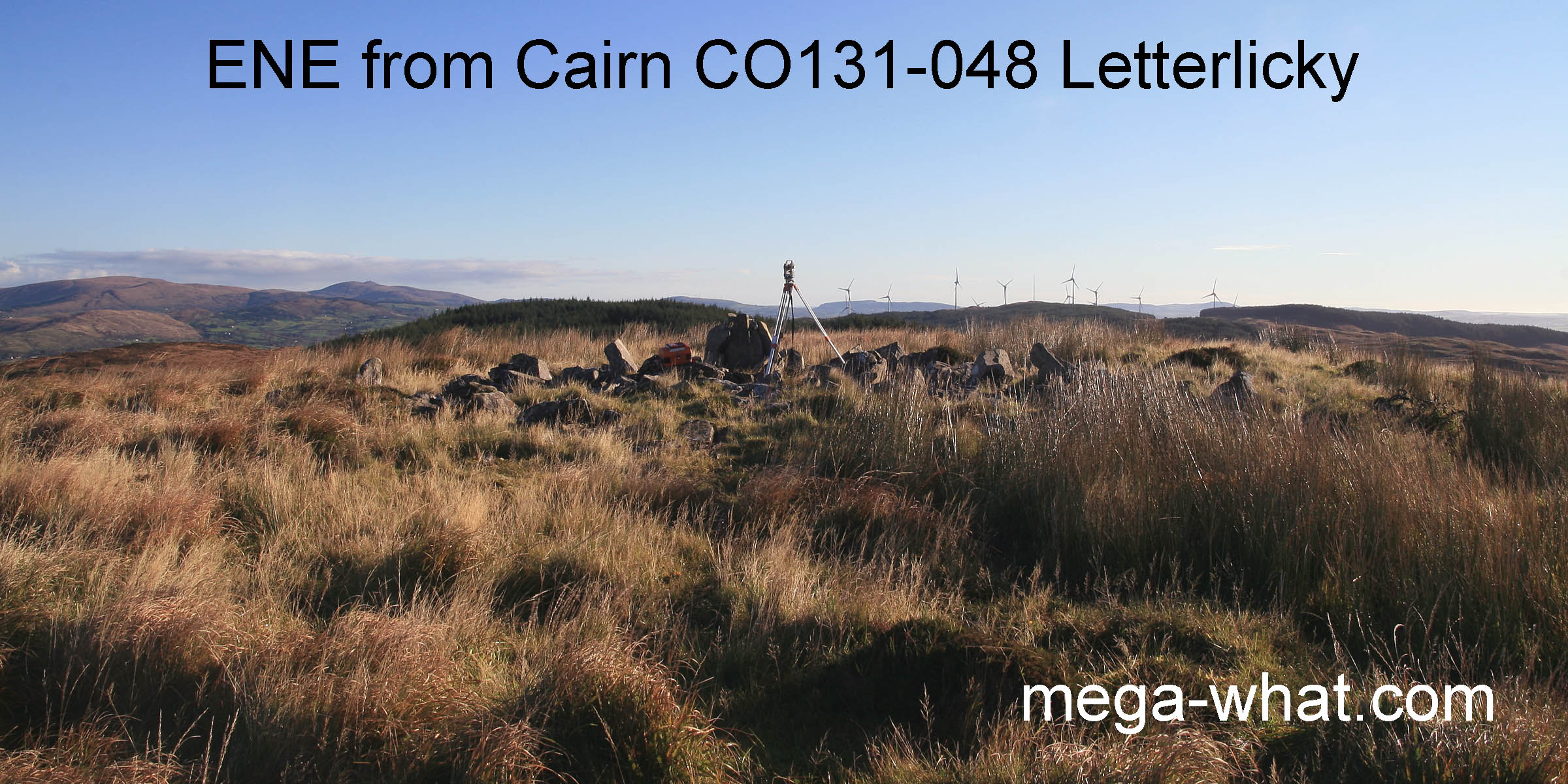
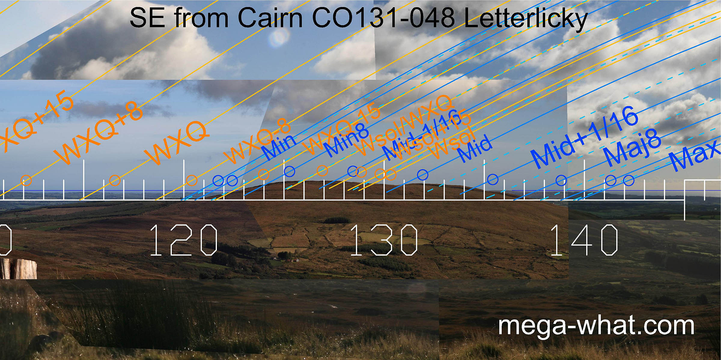
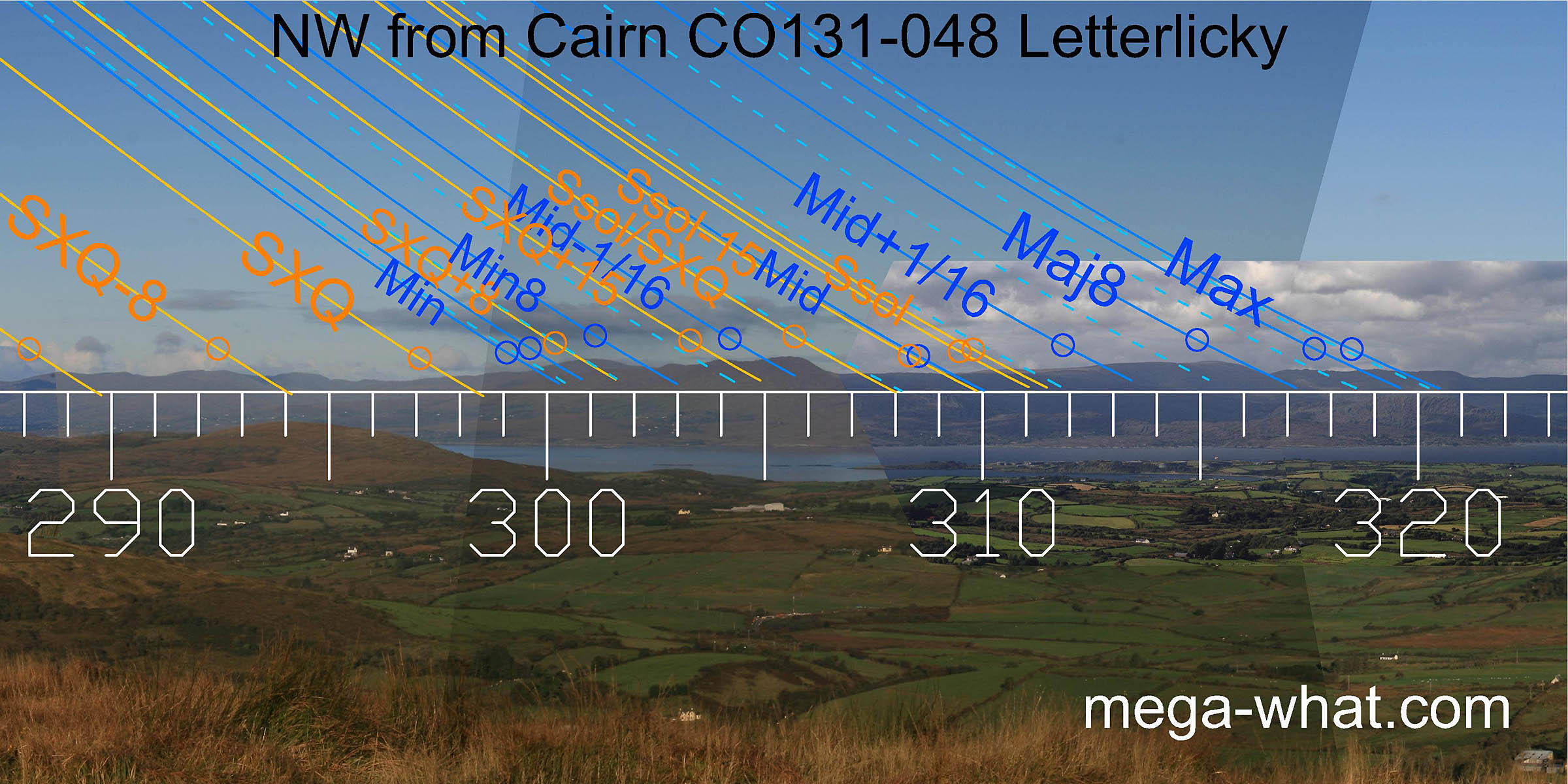
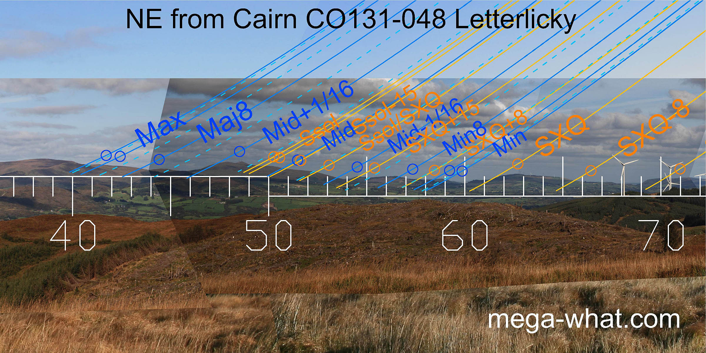 To the north-east some local forestry obscures some detail. It looks like the minor end of the lunisticeLunistices are the most northerly and southerly moons of the month. The lunar equivalent of solstices - more.
range is in the dip between two hills.
The major end is at basal step and various intermediate points have useful markers. The summer cross-quarters are on a hilltop, the solstice at a basal step.
To the north-east some local forestry obscures some detail. It looks like the minor end of the lunisticeLunistices are the most northerly and southerly moons of the month. The lunar equivalent of solstices - more.
range is in the dip between two hills.
The major end is at basal step and various intermediate points have useful markers. The summer cross-quarters are on a hilltop, the solstice at a basal step.
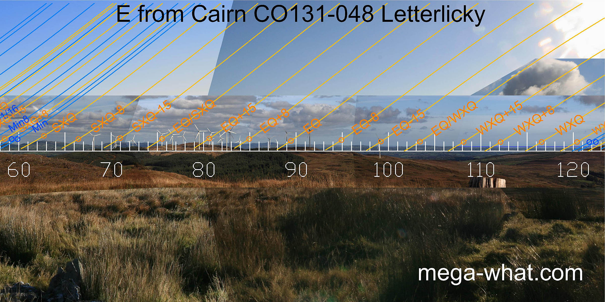 The east has a usefully undulating profile that provides many good markers until the land/sea intersect at a half-month north of the winter cross-quarters.
 To the south-east, Mount Kid cuts the sea horizon at a half-month south of the winter cross-quarters.
So the sun rises from the sea for the month centred on the winter cross-quarter, then the hilltop is half-way to the solstice which itself occurs just before the central dip
that marks the lunar midpoint.
To the south-east, Mount Kid cuts the sea horizon at a half-month south of the winter cross-quarters.
So the sun rises from the sea for the month centred on the winter cross-quarter, then the hilltop is half-way to the solstice which itself occurs just before the central dip
that marks the lunar midpoint.
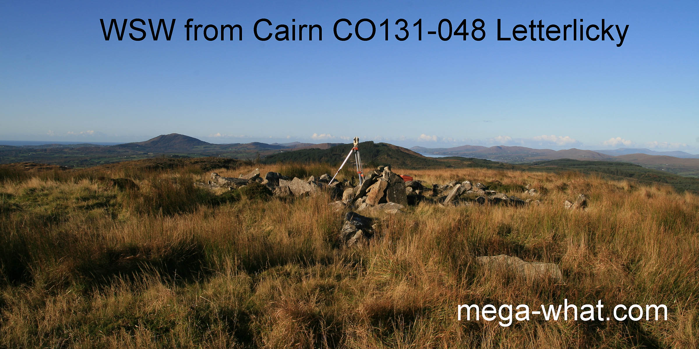
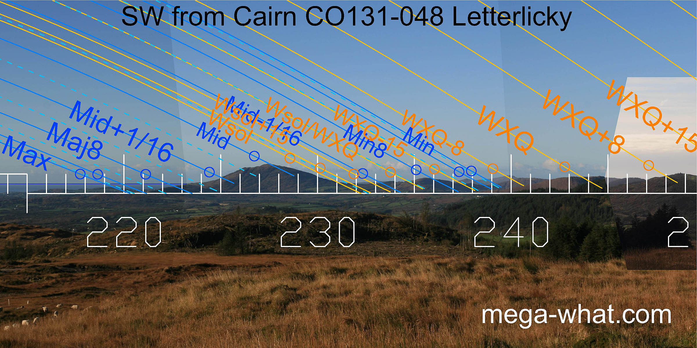 In the south-west, the major end of the lunisticeLunistices are the most northerly and southerly moons of the month. The lunar equivalent of solstices - more.
range is again over the sea but measurable by reference to the coastal profile while the midpoint is on the hilltop.
Winter solstice sunsets conveniently fall on the lower northern slopes for extra precision.
In the south-west, the major end of the lunisticeLunistices are the most northerly and southerly moons of the month. The lunar equivalent of solstices - more.
range is again over the sea but measurable by reference to the coastal profile while the midpoint is on the hilltop.
Winter solstice sunsets conveniently fall on the lower northern slopes for extra precision.
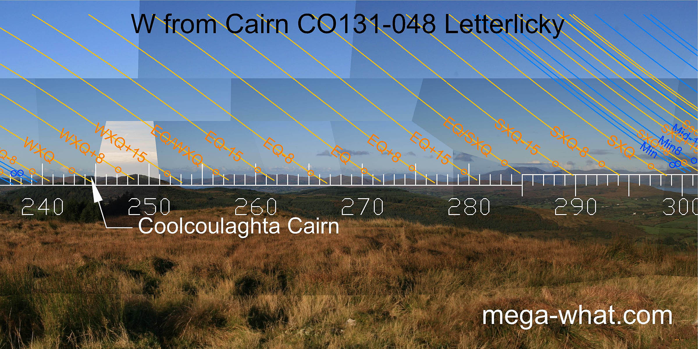 The west has a usefully undulating profile that provides many good markers.
Coolcoulaghta Cairn is on Mt Corrin at the seaward end of the ridge and is likely related to this one but somewhat earlier.
 The north-east is also useful though not in a dramatically obvious way. The lunar midpoint and both eighths are in dips.
References
- Archaeological Survey of Ireland, record details. www.archaeology.ie/archaeological-survey-ireland
- POWER, D. et al. 1992 Archaeological Inventory of County Cork, Volume 1: West Cork. Dublin: Stationary Office. p101, no.848.