
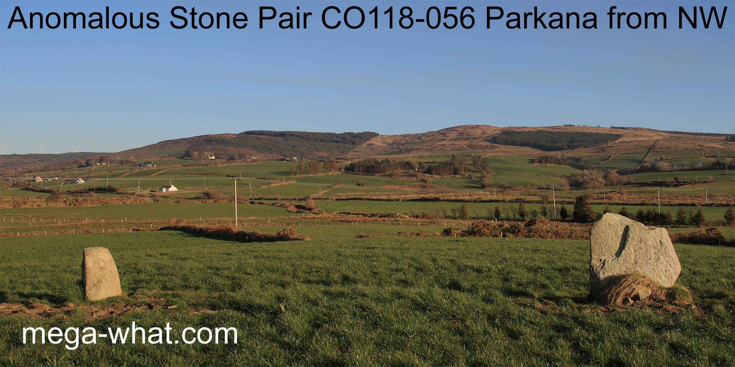
 Parkana Standing Stone Pair is between Bantry and Ballydehob, just west of the N71 and about 1km after its junction with the R586.
In the bottom of the valley, its on the north bank of the Durrus River.
Parkana Standing Stone Pair is between Bantry and Ballydehob, just west of the N71 and about 1km after its junction with the R586.
In the bottom of the valley, its on the north bank of the Durrus River.Classed as an Anomalous Pair because the stones are 6.4m apart.
 South is at the east end of a hilltop [Pic].
![[Pic].](Parkana-S.jpg)
North is indicated by a hilltop but not quite on it [Pic].
![[Pic].](Parkana-N.jpg)
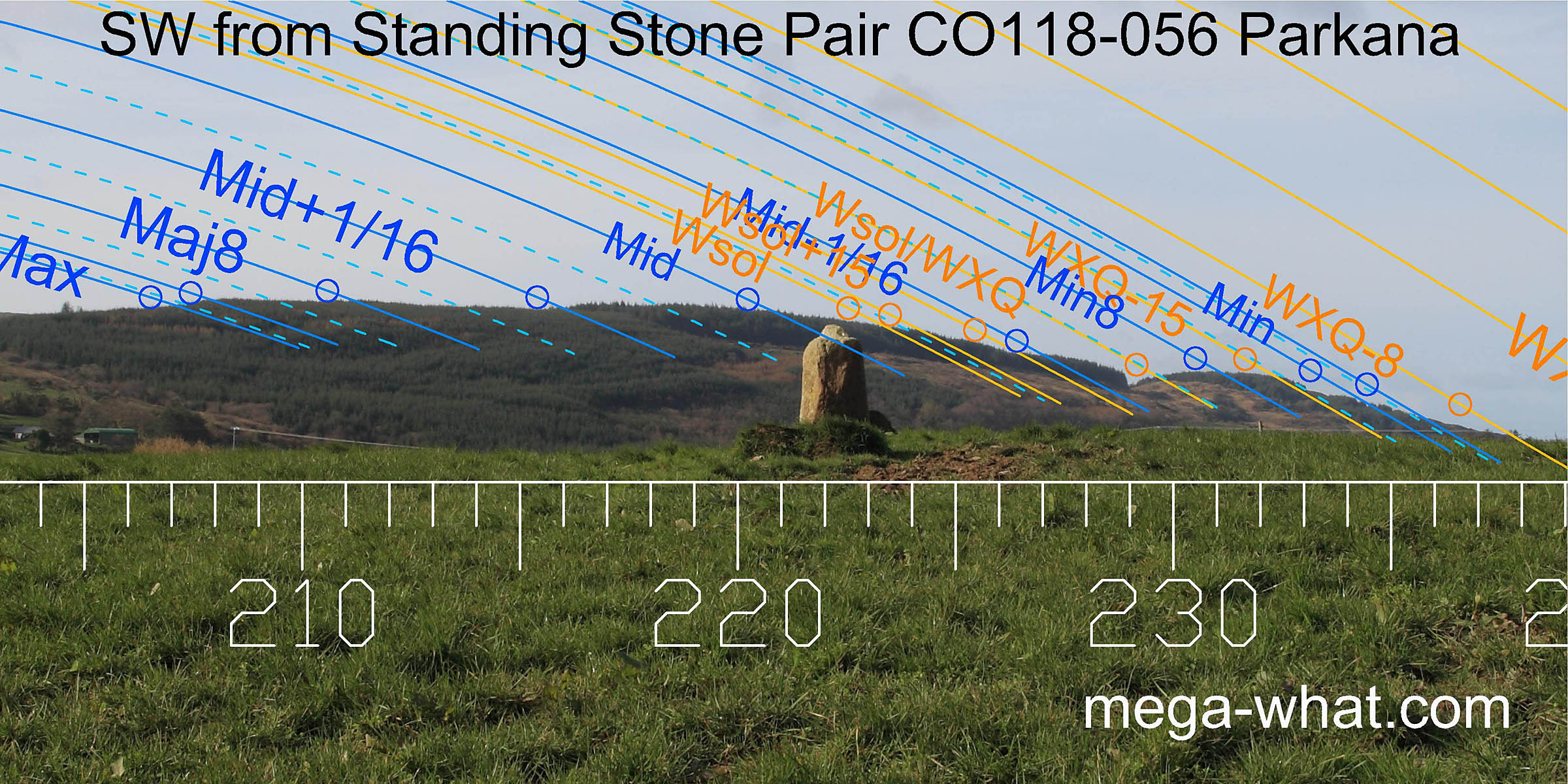 This is one of a small number of monuments designed to be used as an accurate sight where there is not a good natural marker on the indicated horizon.
In this case, by carefully lining up the stones, the winter solstice and/or the lunar midpoint can be found on the smooth ridge. Either side of it, lunar sixteenths are marked by changes in the horizon profile.
 The lunar eighths are both marked by highpoints and the limits of the cycle, both major and minor, are marked by steps in the slopes.
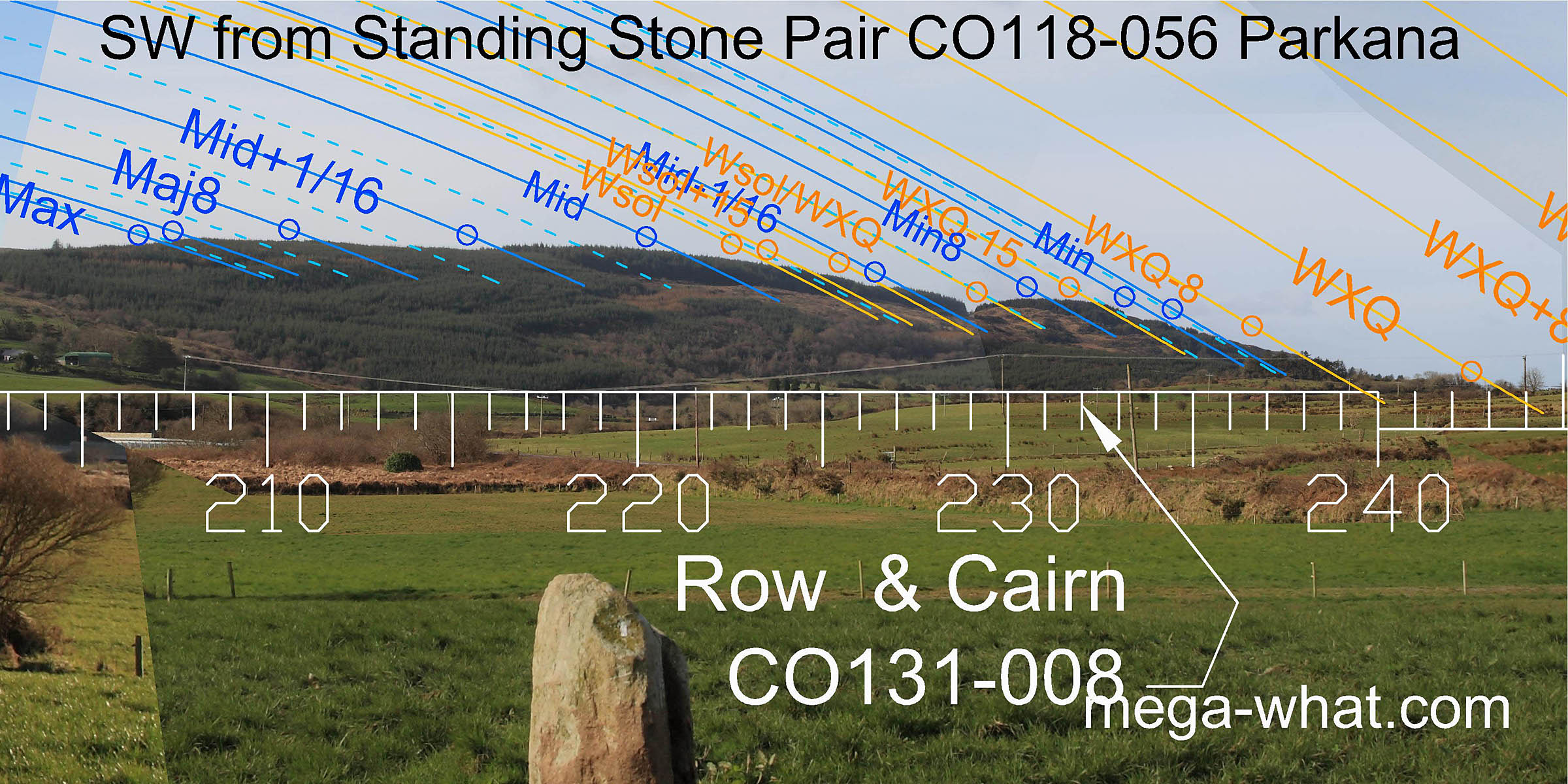
The foot of the hill is a quarter-month from the winter cross-quarters which occur in the lowest dip of the western horizon.
The lunar eighths are both marked by highpoints and the limits of the cycle, both major and minor, are marked by steps in the slopes.
The foot of the hill is a quarter-month from the winter cross-quarters which occur in the lowest dip of the western horizon.
 From the winter cross-quarters, the western horizon rises fairly smoothly to the zone around the summer cross-quarters.
Unfortunately this hilltop is now obscured by trees and buildings.
From the winter cross-quarters, the western horizon rises fairly smoothly to the zone around the summer cross-quarters.
Unfortunately this hilltop is now obscured by trees and buildings.
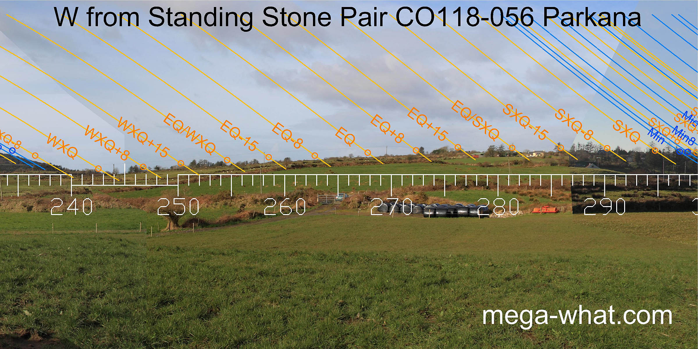
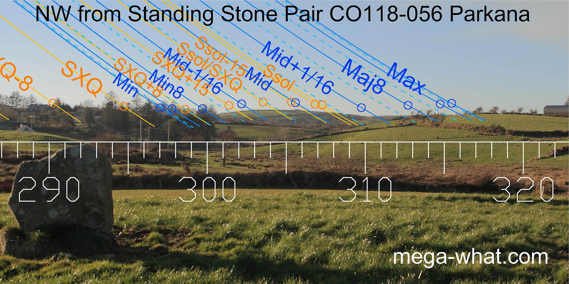 The north-west horizon has a fairly simple profile that matches the overall lunar pattern and gives a couple of key solar points. It is the only quadrant with no markers for the lunar eighths.
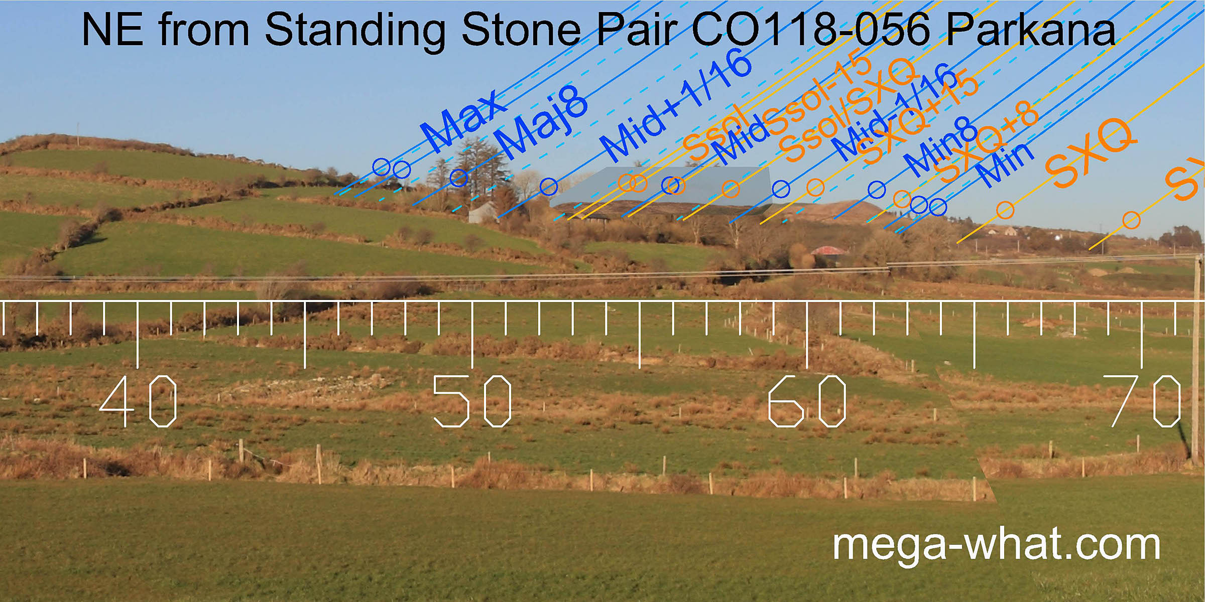 North-eastwards, the axis of the pair indicates a smooth hillslope beyond the lunar limit [Pic].
The north ridge of Spratt Hill, a key part of the horizon containing the summer solstice, is obscured by trees
but the lunar minor eighth on the summit and the minor end of the lunisticeLunistices are the most northerly and southerly moons of the month. The lunar equivalent of solstices - more.
range at the south basal step are plain to see.
North-eastwards, the axis of the pair indicates a smooth hillslope beyond the lunar limit [Pic].
The north ridge of Spratt Hill, a key part of the horizon containing the summer solstice, is obscured by trees
but the lunar minor eighth on the summit and the minor end of the lunisticeLunistices are the most northerly and southerly moons of the month. The lunar equivalent of solstices - more.
range at the south basal step are plain to see.
![[Pic].](Parkana-NEax.jpg)
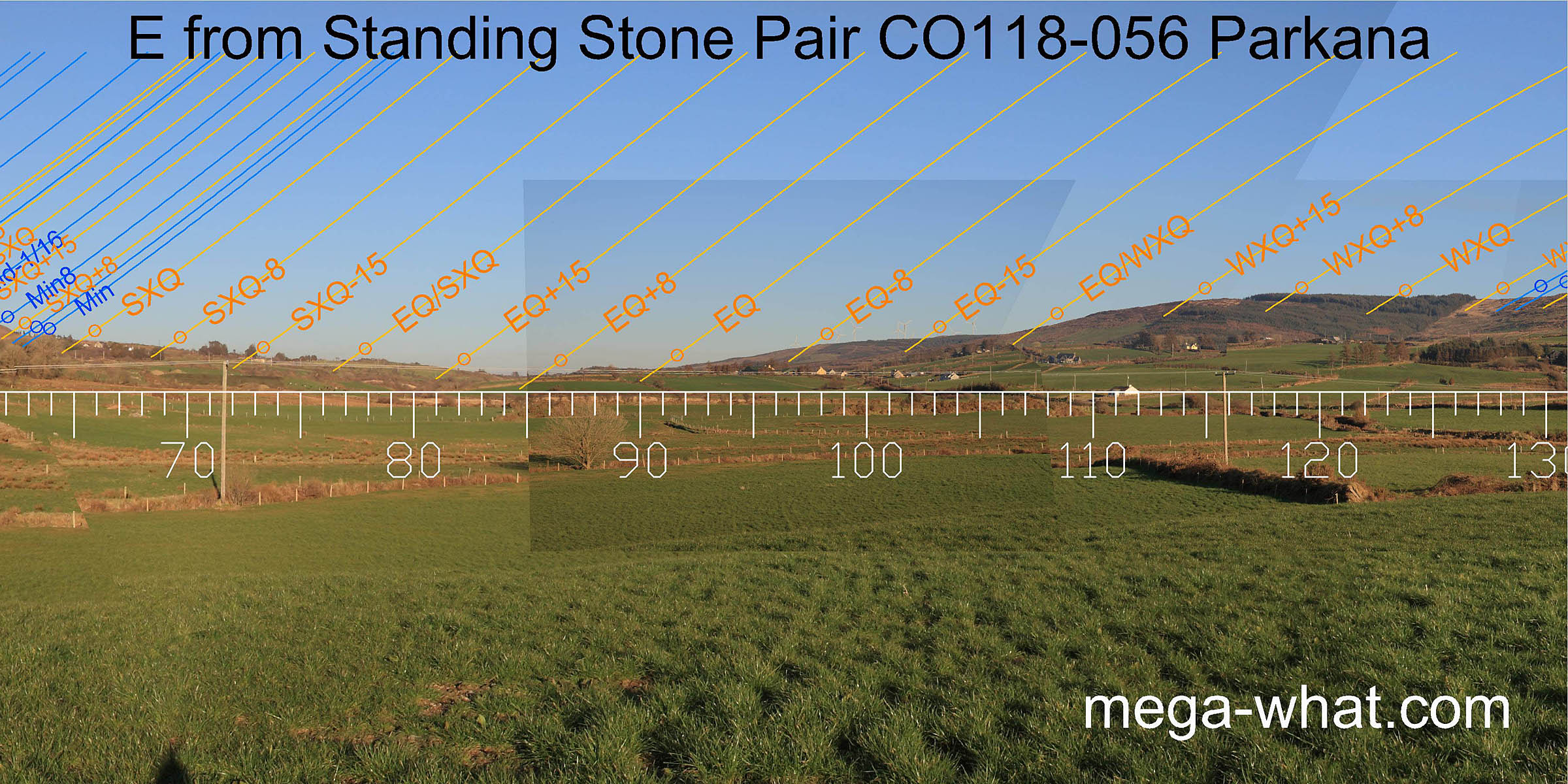 The valley to the east seems to be lacking in specific accuracy but gives a general idea of the central part of the year.
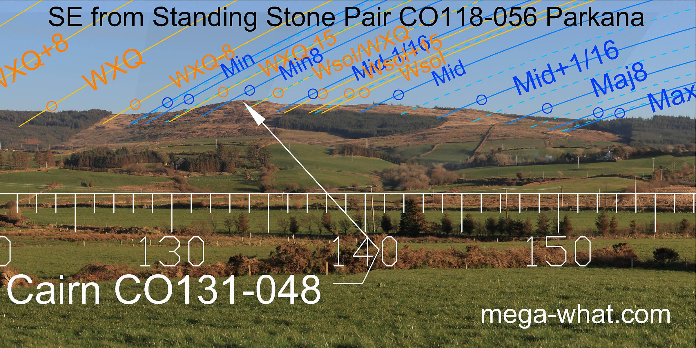 The south-east ridge offers a highly useable profile covering the lunisticeLunistices are the most northerly and southerly moons of the month. The lunar equivalent of solstices - more.
range. For the third time, the lunar minor eighth is marked by a hilltop.
This particular hilltop is the site of Letterlicky Cairn which was probably already there when this stone pair was built.
The south-east ridge offers a highly useable profile covering the lunisticeLunistices are the most northerly and southerly moons of the month. The lunar equivalent of solstices - more.
range. For the third time, the lunar minor eighth is marked by a hilltop.
This particular hilltop is the site of Letterlicky Cairn which was probably already there when this stone pair was built.
This stone pair seems to be one of a local group or series:
Two stone pairs are at Keilnascarta, less than a kilometre to the north-north-east.
Another stone pair is 2.2km to the south-west at Ballycommane and the only other surveyed stone pair seemingly designed for use as a sight is 8.3km to the south-west at Coolcoulaghta.
Nearest site of all, about 700m away to the south-west is Maulinward Stone Row.
References
- Archaeological Survey of Ireland, record details. www.archaeology.ie/archaeological-survey-ireland
- Ó'NUALLÁIN, SEÁN 1988 Stone Rows in the South of Ireland. Proceedings of the Royal Irish Academy 88c:179-256, p251, no.169.
- POWER, D. et al. 1992 Archaeological Inventory of County Cork, Volume 1: West Cork. Dublin: Stationary Office. p42, no.208.