
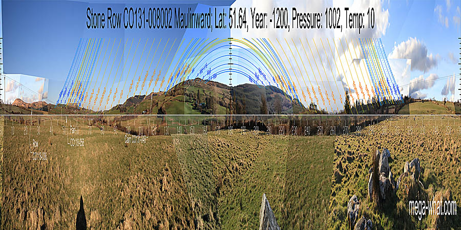
 Maulinward Stone Row is about 5km south of Bantry, on the north side of Durrus River and perhaps 500m west of the N71.
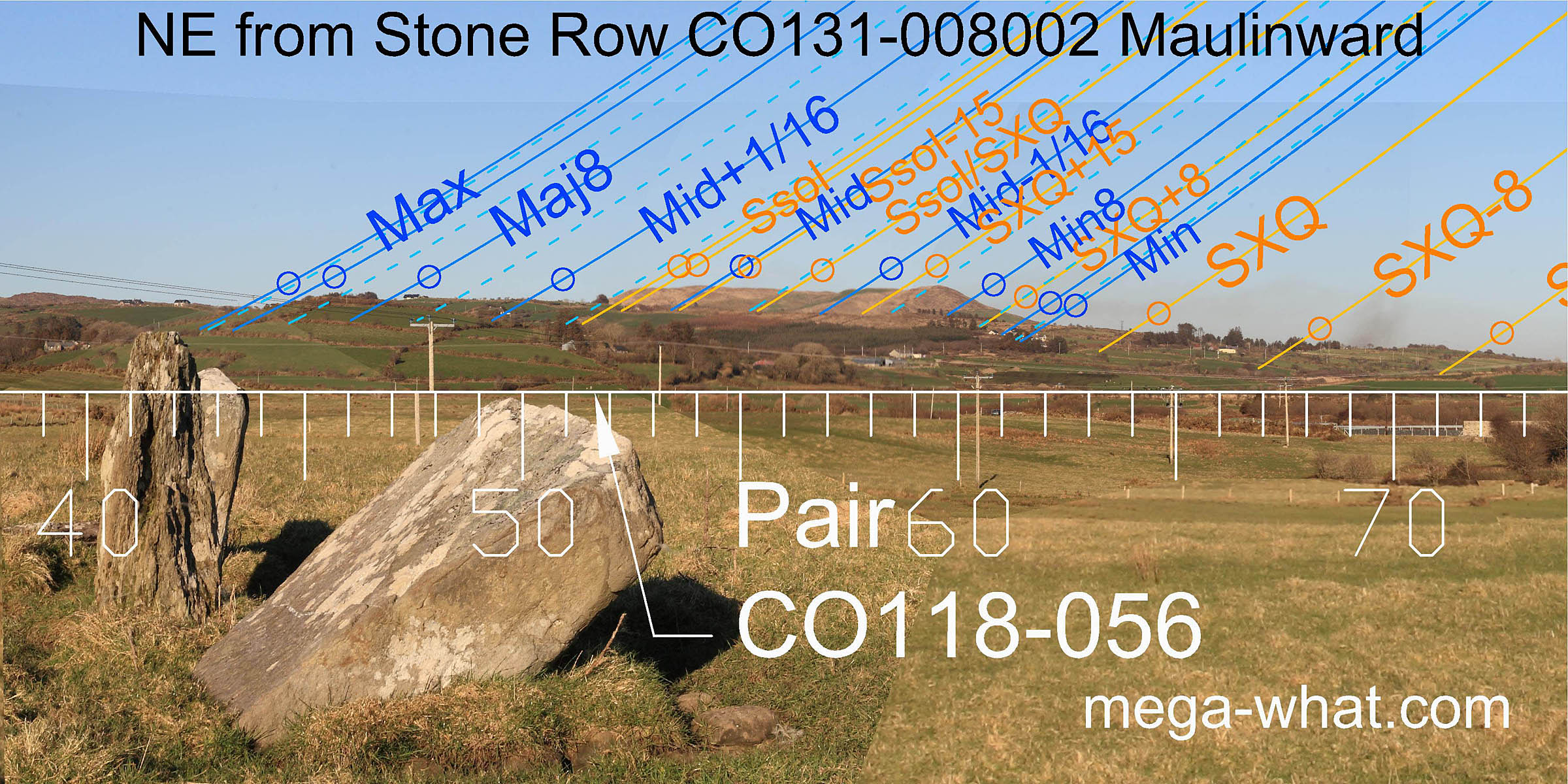
North is roughly indicated by a dip [Pic].
![[Pic].](Maulinward-N.jpg)
South is in a saddle [Pic].
![[Pic].](Maulinward-S.jpg)
 The row has three stones and there is a ruined cairn beside it.
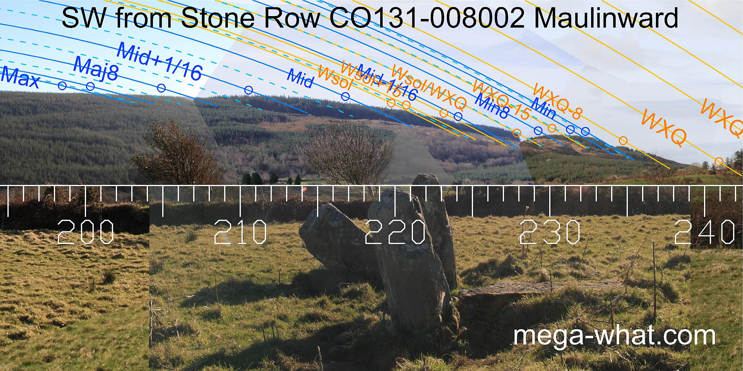
North-eastwards, the lunisticeLunistices are the most northerly and southerly moons of the month. The lunar equivalent of solstices - more. range is marked by a block of high ground consisting of two hills. Spratt Hill, 4km away, marks the minor half of the lunisticeLunistices are the most northerly and southerly moons of the month. The lunar equivalent of solstices - more. range and the summer solstice is at its north end. A notch formed by its intersection with a nearer (2.5km) ridge marks the lunar midpoint. Major standstillLunistice positions vary cyclically over an 18.6 year period but are fairly static for more than a year at either end of the range is at the intersection of the same ridge with an even nearer (1.3km) hill and therefore this marker has a more critical impact on the exact site of the row, the axis of which points even further to the north.
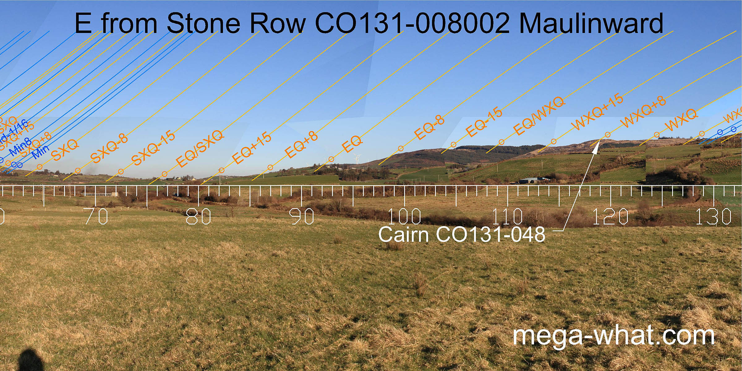 Eastwards up the valley, the equinox / cross-quarter midpoint is in the dip. Fit to either side of it is often fairly subtle but certainly does exist.
On the ridge, 2.8km away, Cairn 131-048, now ruined and probably an earlier monument, marks the quarter-month to the north of winter cross-quarters.
Eastwards up the valley, the equinox / cross-quarter midpoint is in the dip. Fit to either side of it is often fairly subtle but certainly does exist.
On the ridge, 2.8km away, Cairn 131-048, now ruined and probably an earlier monument, marks the quarter-month to the north of winter cross-quarters.
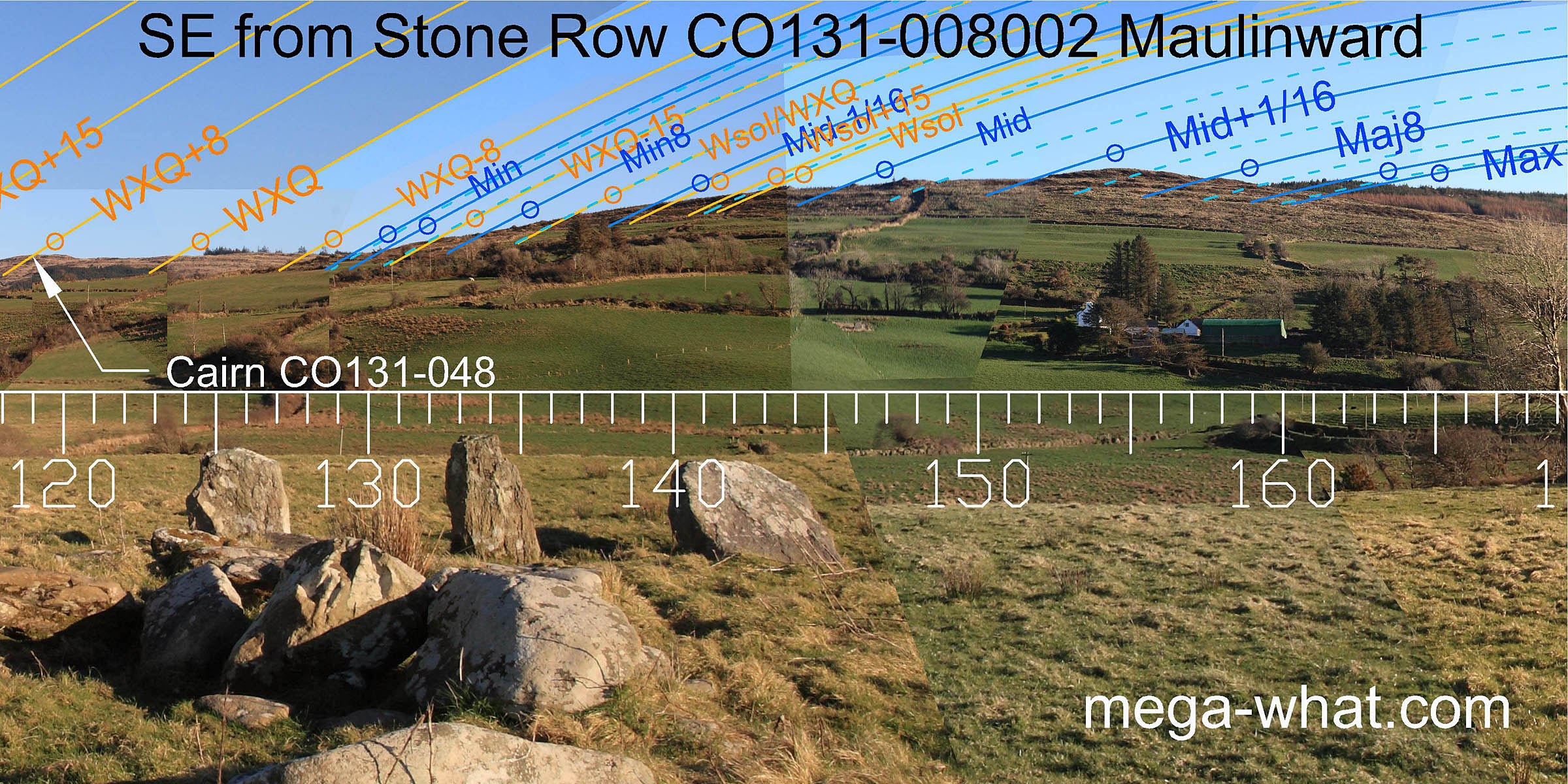 To the south-east the lunisticeLunistices are the most northerly and southerly moons of the month. The lunar equivalent of solstices - more.
range is again accurately delineated but the major standstillLunistice positions vary cyclically over an 18.6 year period but are fairly static for more than a year at either end of the range
is much closer this time, at 1.2km, and only 16° from due south because of the high horizon.
To the south-east the lunisticeLunistices are the most northerly and southerly moons of the month. The lunar equivalent of solstices - more.
range is again accurately delineated but the major standstillLunistice positions vary cyclically over an 18.6 year period but are fairly static for more than a year at either end of the range
is much closer this time, at 1.2km, and only 16° from due south because of the high horizon.
The stones beside the row are the remains of a cairn. The outline of the kerb and also the central chamber (which seems to be open to the north-west) may be seen.
 The south-western horizon is also high, which is why the row axis that indicates the general direction of solstice/lunar midpoint in this direction
must point beyond the lunar limit to the north-east. The minor standstillLunistice positions vary cyclically over an 18.6 year period but are fairly static for more than a year at either end of the range
gains extra precision by setting down a north facing slope.
The south-western horizon is also high, which is why the row axis that indicates the general direction of solstice/lunar midpoint in this direction
must point beyond the lunar limit to the north-east. The minor standstillLunistice positions vary cyclically over an 18.6 year period but are fairly static for more than a year at either end of the range
gains extra precision by setting down a north facing slope.
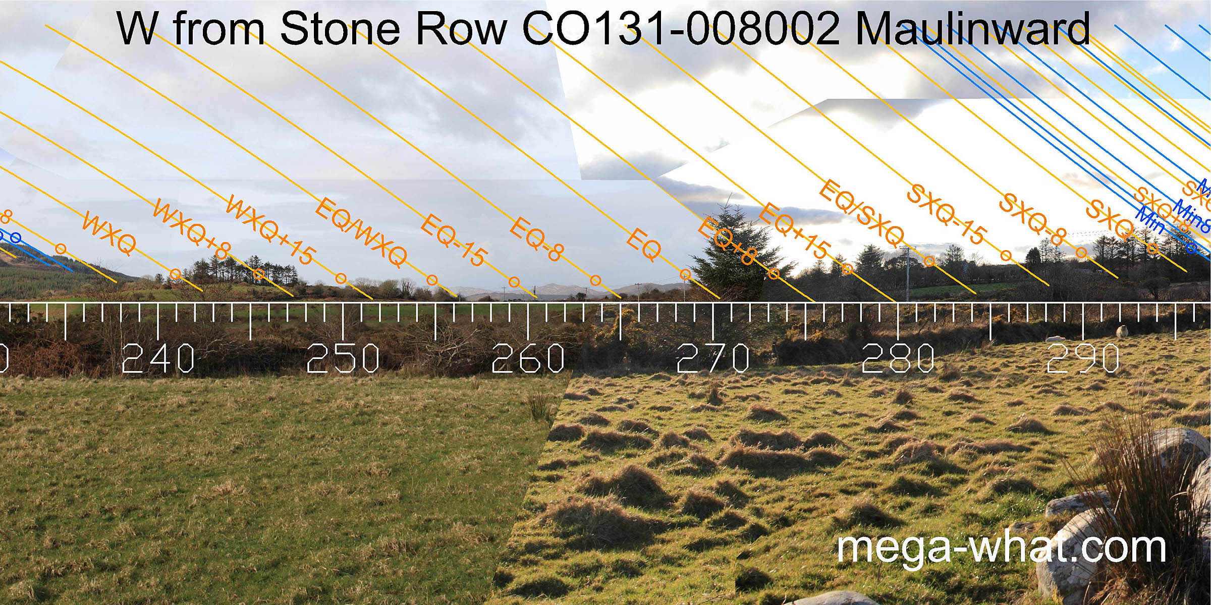 To the west, a view of the hills of the Muintirvara Peninsula provides some useful equinoctial accuracy.
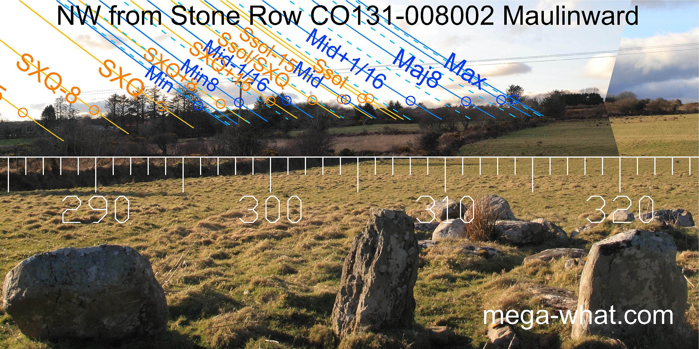 The north-west horizon is the smoothest but nonetheless use is made of the available features.
As this piece of ground is targeted, not only by this site but also the three others mentioned below, it is interesting to speculate that there might once have been some better landmarks on it.
The north-west horizon is the smoothest but nonetheless use is made of the available features.
As this piece of ground is targeted, not only by this site but also the three others mentioned below, it is interesting to speculate that there might once have been some better landmarks on it.
This site seems to be nearest to the coast of a local group of stone rows. The next is 1.4km to the north-north-east at Keilnascarta where there are also two stone pairs. Just 720m to the north-east in Parkana townland is another stone pair and there is a further one, accompanying a boulder-burial, 1.5km to the west at Ballycommane.
References
- Archaeological Survey of Ireland, record details. www.archaeology.ie/archaeological-survey-ireland
- LYNCH, ANN 1982 Astronomy and Stone Alignments in S.W. Ireland. In Archaeoastronomy in the Old World, edited by D. Heggie, pp.205-213. Cambridge: University Press.
- Ó'NUALLÁIN, SEÁN 1988 Stone Rows in the South of Ireland. Proceedings of the Royal Irish Academy 88c:179-256, p237, no.52.
- POWER, D. et al. 1992 Archaeological Inventory of County Cork, Volume 1: West Cork. Dublin: Stationary Office. p37: no.161, p101: no.851.
- RUGGLES, C.L.N. 1999 Astronomy in Prehistoric Britain and Ireland. Newhaven & London: Yale University Press. CKR86.
- RUGGLES, C.L.N. 1996 Stone Rows of Three or More Stones in South-West Ireland. Archaeoastronomy 21 (Journal of the History of Astronomy xxvii) S55-S71.
- RUGGLES, C.L.N. & Burl, H.A.W. 1995 Astronomical Influences on Prehistoric Ritual Architecture in North-Western Europe: The Case of the Stone Rows. Vistas in Astronomy 39:517-528. Oxford: Elsevier Science Ltd.