
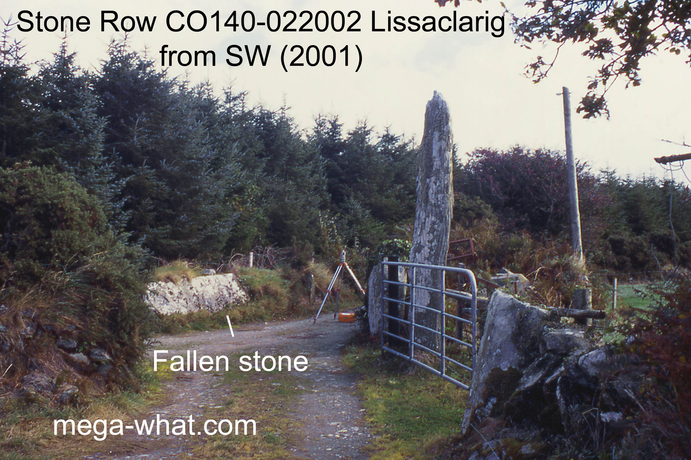
 Lissaclarig Stone Row is between Ballydehob and Skibbereen, about 1km north of Aghadown and conveniently situated in the walls adjoining a farm road.
It is listed as a three stone row with the largest upright being the south-west stone.
The gatepost north-east of this is the centre stone while the north-eastern stone lies prostrate in the wall on the other side of the track. Though still 4m long it has been decapitated.
The other stone gatepost axially south-west of these three is not regarded as belonging to the row.
Lissaclarig Stone Row is between Ballydehob and Skibbereen, about 1km north of Aghadown and conveniently situated in the walls adjoining a farm road.
It is listed as a three stone row with the largest upright being the south-west stone.
The gatepost north-east of this is the centre stone while the north-eastern stone lies prostrate in the wall on the other side of the track. Though still 4m long it has been decapitated.
The other stone gatepost axially south-west of these three is not regarded as belonging to the row.
 A nearby ringfort (CO140-022001) blocks views to the south-west. South is marked by a short section of sea horizon [Pic].
![[Pic].](Lissaclarig-S.jpg)
North is marked by a hill [Pic]. Green lines approximate hidden horizon segments.
![[Pic].](Lissaclarig-N.jpg)
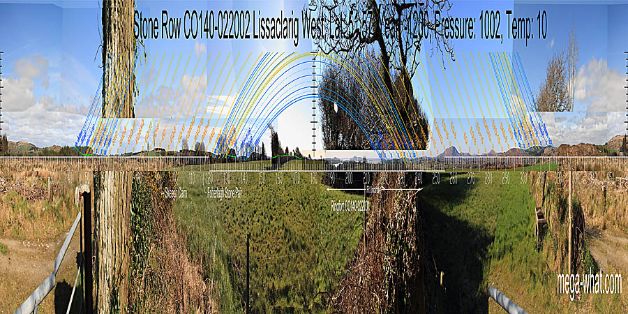
 To the north-east, major standstillLunistice positions vary cyclically over an 18.6 year period but are fairly static for more than a year at either end of the range
is on a hilltop and summer solstice is in a dip. Summer cross-quarters are in a dip with
minor standstillsLunistice positions vary cyclically over an 18.6 year period but are fairly static for more than a year at either end of the range
at the start of the next hill.
To the north-east, major standstillLunistice positions vary cyclically over an 18.6 year period but are fairly static for more than a year at either end of the range
is on a hilltop and summer solstice is in a dip. Summer cross-quarters are in a dip with
minor standstillsLunistice positions vary cyclically over an 18.6 year period but are fairly static for more than a year at either end of the range
at the start of the next hill.
The row axis seems to occupy the space between minor standstillsLunistice positions vary cyclically over an 18.6 year period but are fairly static for more than a year at either end of the range and the solstice / cross-quarter midpoint [Pic].
![[Pic]](Lissaclarig-NEax.jpg)
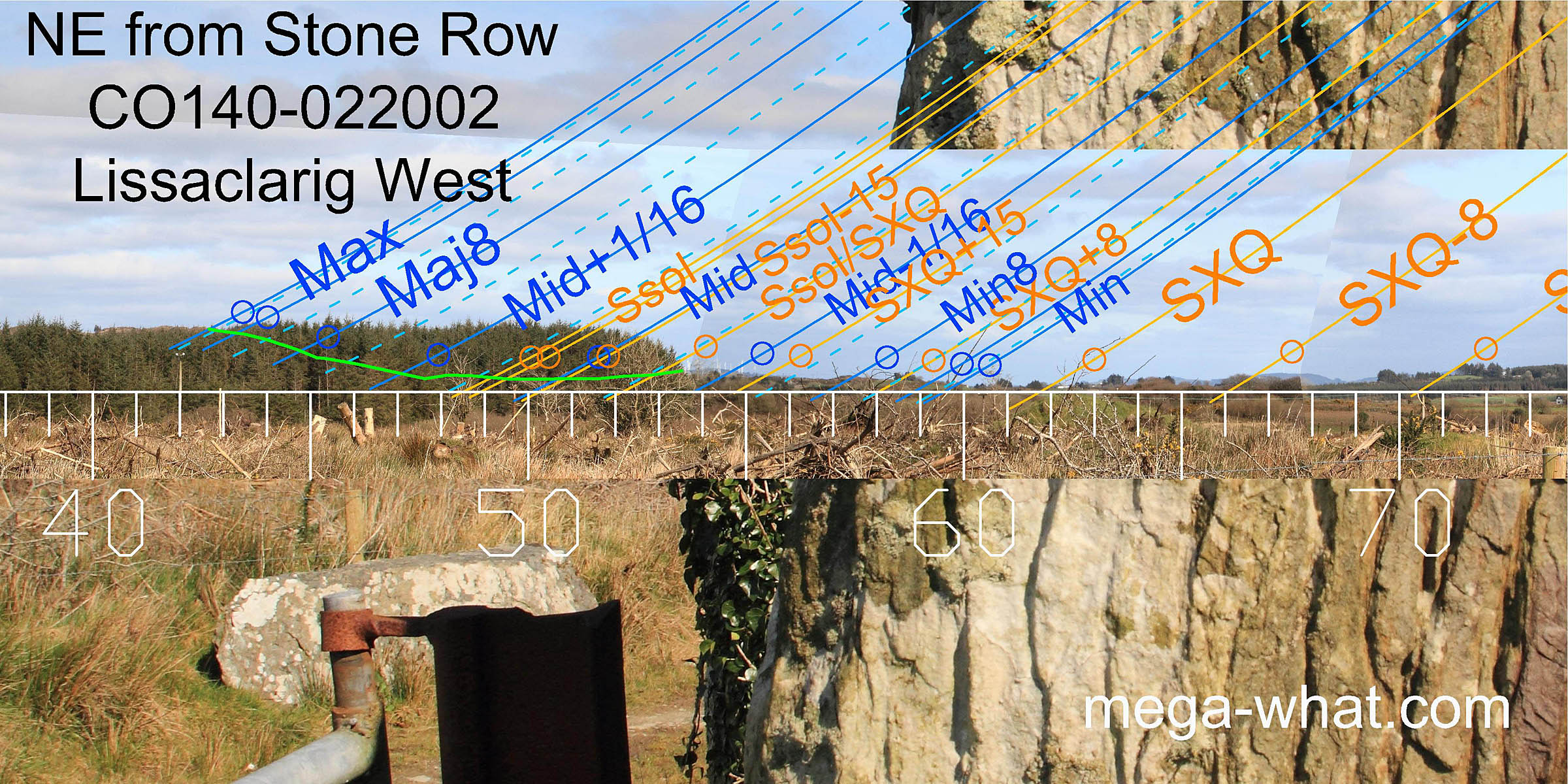
 Eastwards, Skeagh Cairn would seem to be equinoctial but it is hidden inside a forestry plantation.
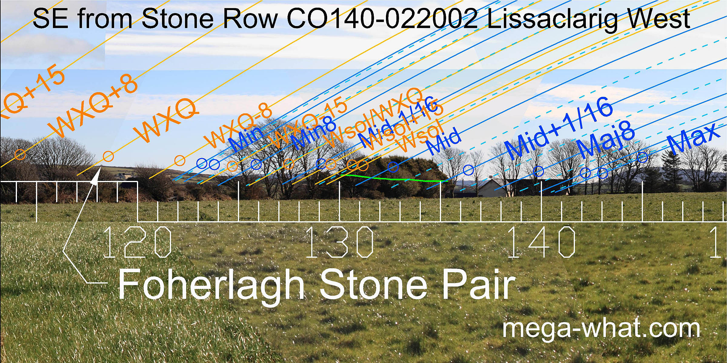
Foherlagh Standing Stone Pair is also on the horizon, in the winter cross-quarter position.
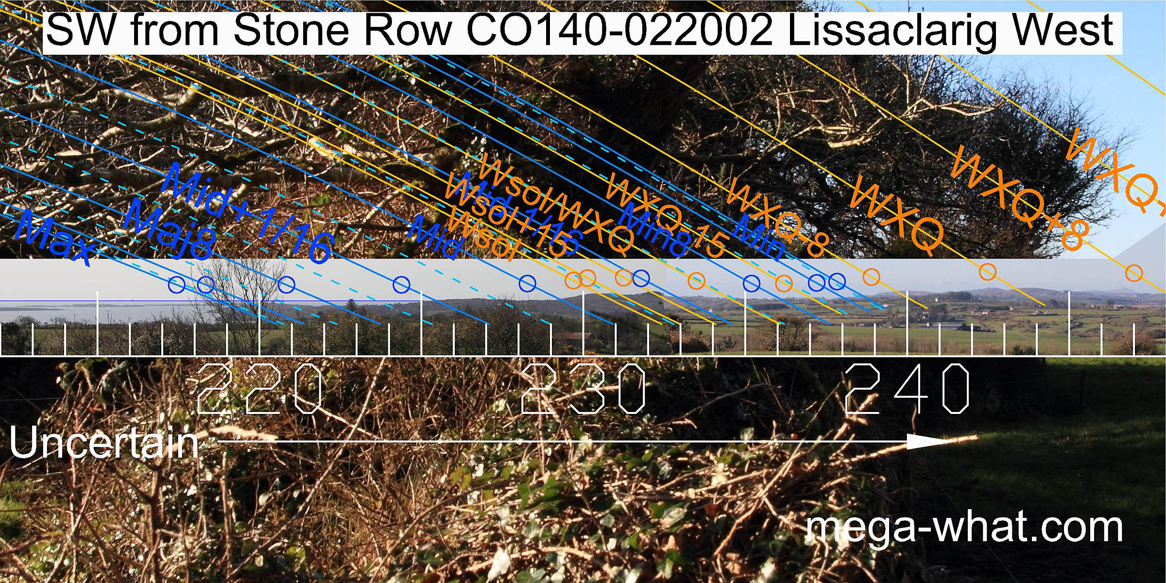
 To the south-east, the lunisticeLunistices are the most northerly and southerly moons of the month. The lunar equivalent of solstices - more.
zone spans a dip but detail is obscured.
To the south-east, the lunisticeLunistices are the most northerly and southerly moons of the month. The lunar equivalent of solstices - more.
zone spans a dip but detail is obscured.
South is in the sea [Pic].
 Views to the south-west are blocked by ringfort CO140-022001 but should be across Roaringwater Bay and the land on its western shores.
Major standstillLunistice positions vary cyclically over an 18.6 year period but are fairly static for more than a year at either end of the range
moon sets would be on the sea over the land's end, with winter solstice on the first significant rise.
Views to the south-west are blocked by ringfort CO140-022001 but should be across Roaringwater Bay and the land on its western shores.
Major standstillLunistice positions vary cyclically over an 18.6 year period but are fairly static for more than a year at either end of the range
moon sets would be on the sea over the land's end, with winter solstice on the first significant rise.
Hard to make out because of the ivy on the stones and the trees on the ringfort but the row axis seems to span the month centred on winter solstice [Pic].
![[Pic]](Lissaclarig-SWax.jpg)
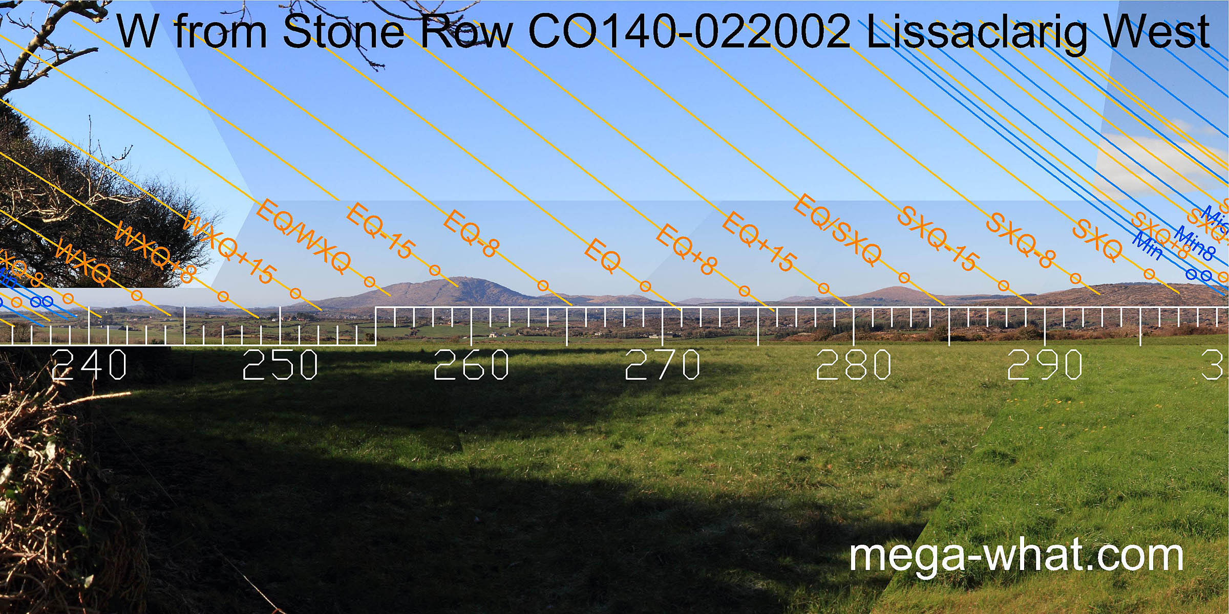 Westwards, the zone surrounding the equinox is well marked with the equinox itself in a central dip. Note that the two prominent hilltops are not markers themselves.
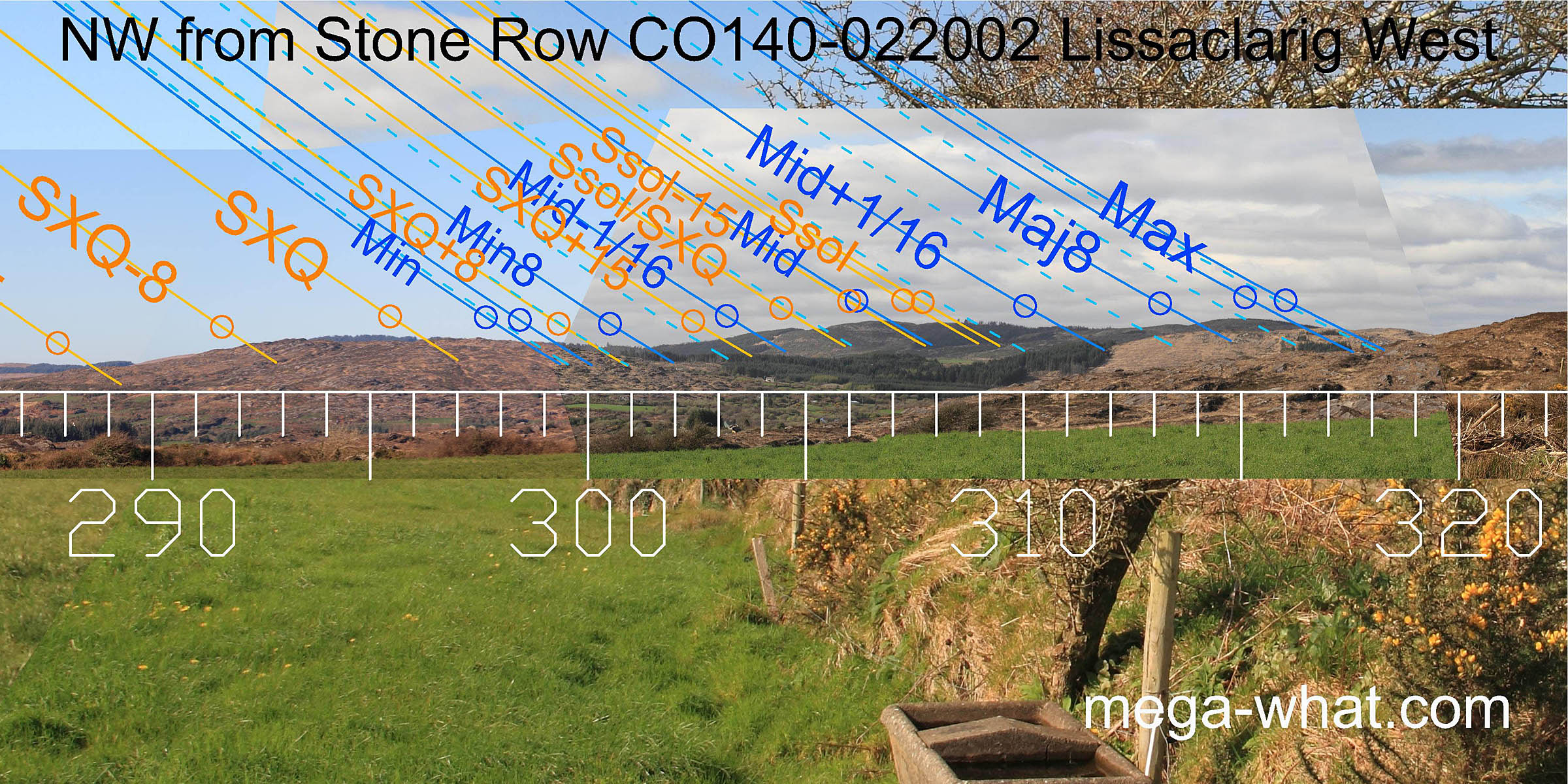 To the north-west, summer cross-quarters and the solstice are on hilltops. Lunar positions are also well marked.
This stone row is on a hilltop above another one at Murrahin North so a functional relationship between the two might be suspected. Especially as this one cuts the horizon when viewed from there.
- Murrahin Stone Row is 1.0km west (257°)
- Foherlagh Stone Pair is 2.5km south-east (120°)
- CappaghMore Standing Stones are 1.9km north (340°)
References
- Archaeological Survey of Ireland, record details. www.archaeology.ie/archaeological-survey-ireland
- Ó'NUALLÁIN, SEÁN 1988 Stone Rows in the South of Ireland. Proceedings of the Royal Irish Academy 88c:179-256, p237, no.53.
- POWER, D. et al. 1992 Archaeological Inventory of County Cork, Volume 1: West Cork. Dublin: Stationary Office. p37, no.159.
- RUGGLES, C.L.N. 1999 Astronomy in Prehistoric Britain and Ireland. Newhaven & London: Yale University Press. CKR89.
- RUGGLES, C.L.N. 1996 Stone Rows of Three or More Stones in South-West Ireland. Archaeoastronomy 21 (Journal of the History of Astronomy xxvii) S55-S71 (Listed as Lissacraig West).