
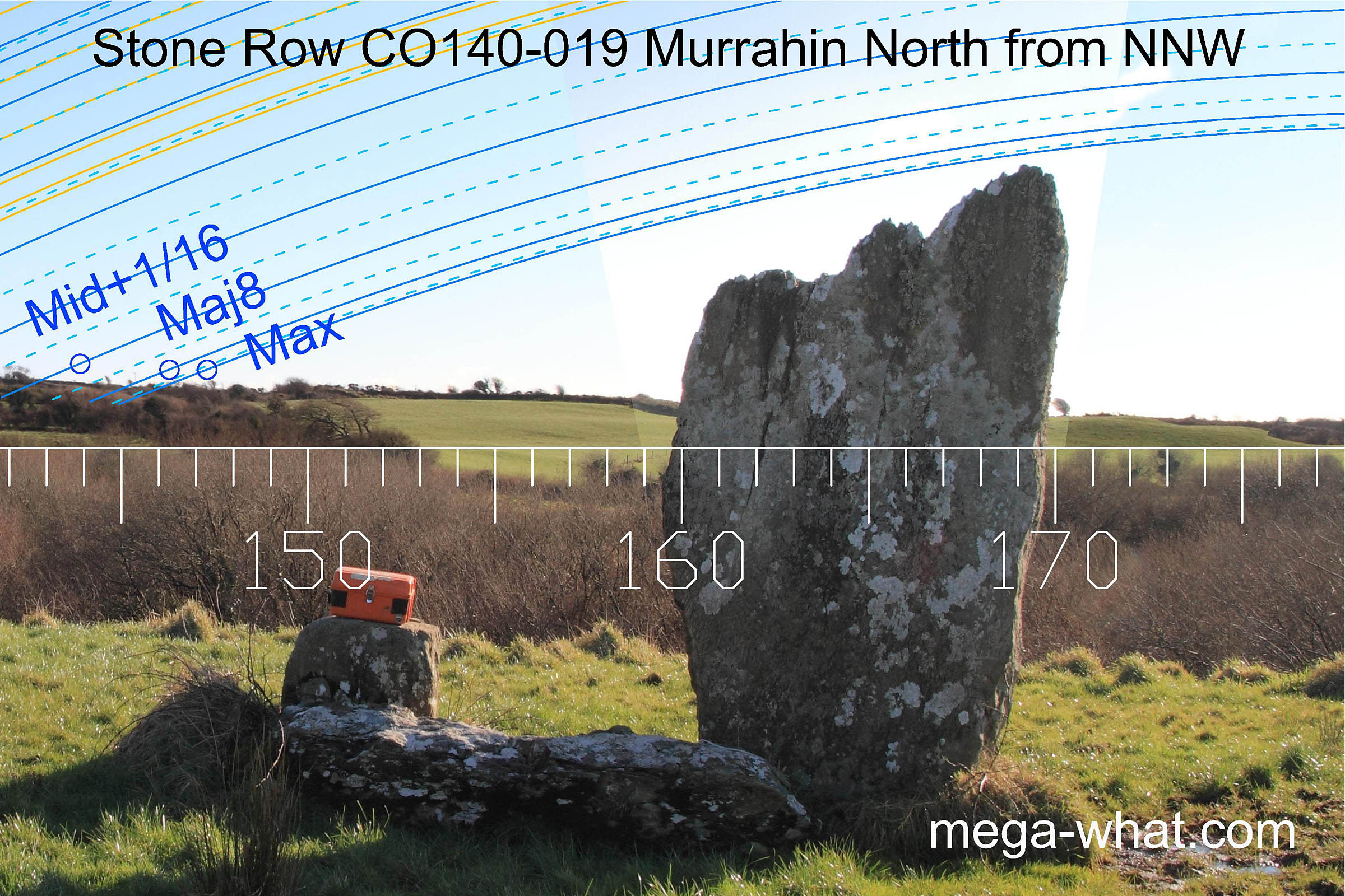
 Murrahin North Stone Row is between Ballydehob and Skibbereen, about 1.5km north of Aghadown.
A three stone row with only two stones still standing, the probable eastern stone lying beside the very small centre one.
Murrahin North Stone Row is between Ballydehob and Skibbereen, about 1.5km north of Aghadown.
A three stone row with only two stones still standing, the probable eastern stone lying beside the very small centre one.

South is in a dip [Pic]. North is at the foot of a hill [Pic].
![[Pic].](Murrahin-S.jpg)
![[Pic].](Murrahin-N.jpg)
Green lines approximate hidden horizon segments.
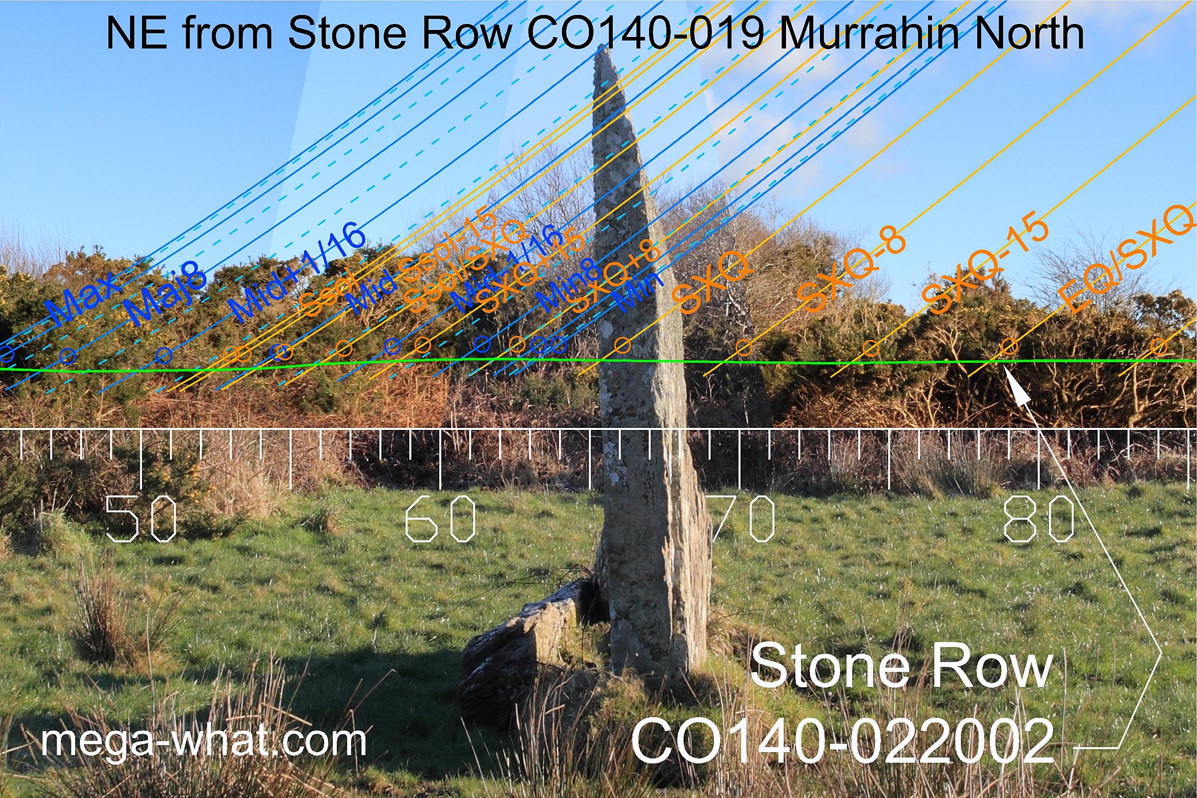
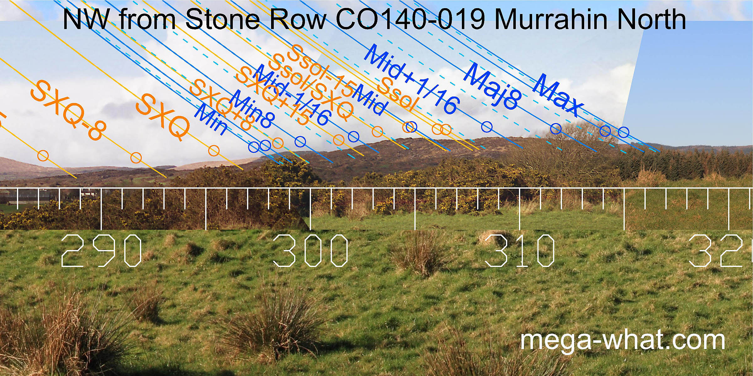
 The north-east is obscured by bushes but beyond them is a fairly flat horizon, now largely forested.
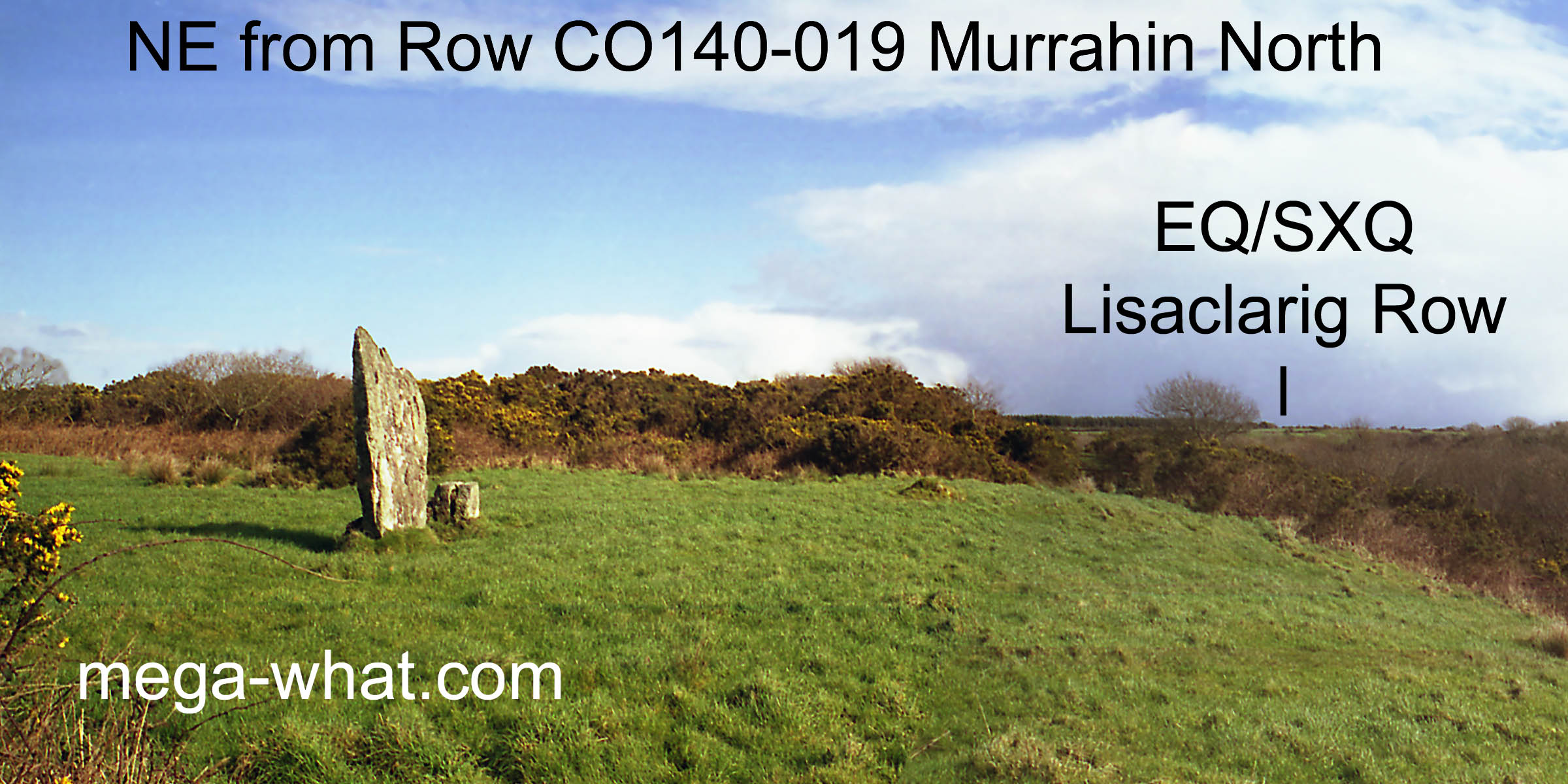
The stones of Lissaclarig Stone Row could be seen cutting the skyline 1.05km away at the equinox / summer cross-quarter position before the furze grew up.
The north-east is obscured by bushes but beyond them is a fairly flat horizon, now largely forested.
The stones of Lissaclarig Stone Row could be seen cutting the skyline 1.05km away at the equinox / summer cross-quarter position before the furze grew up.
 The eastern horizon is completely obscured.
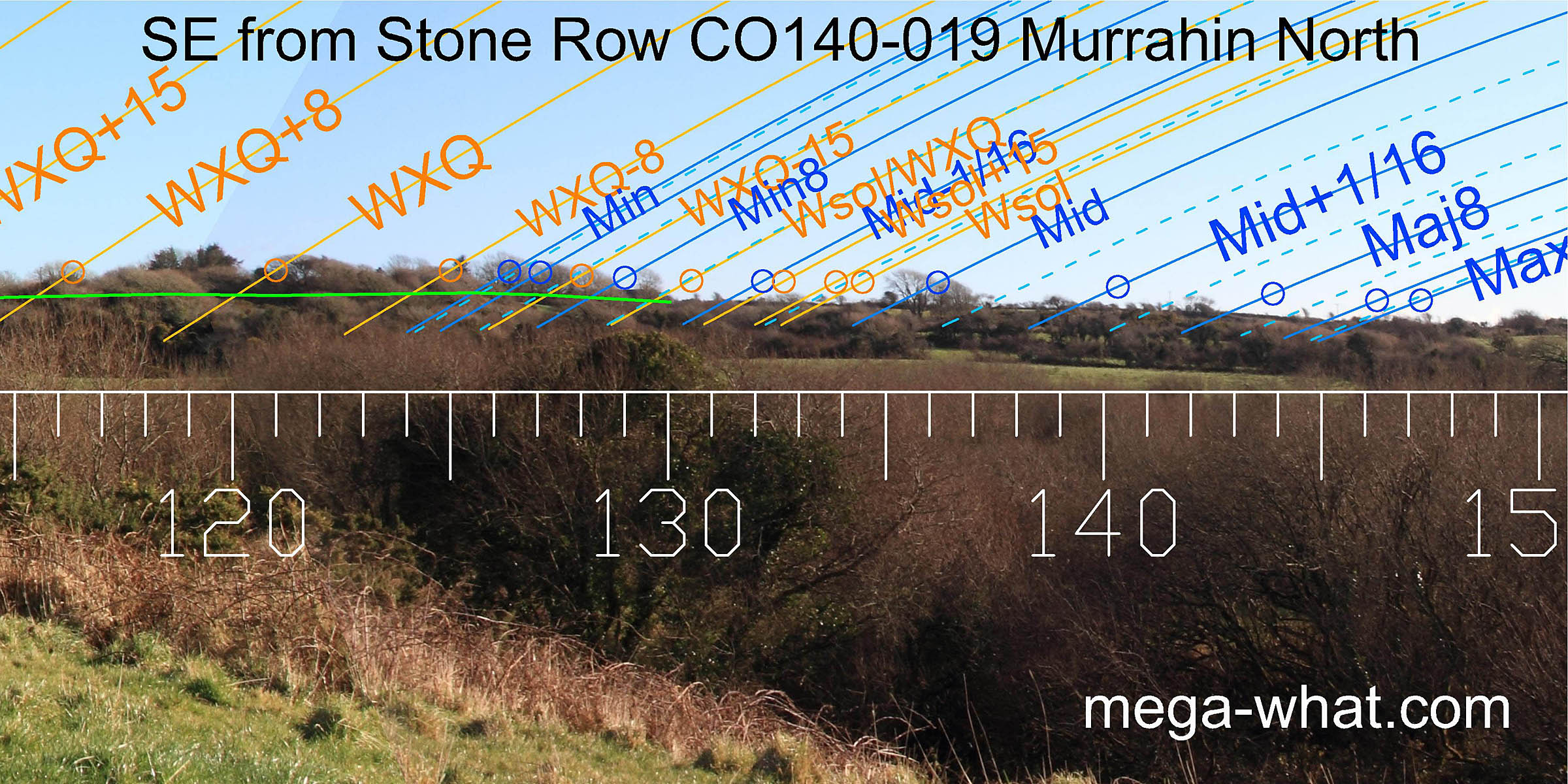 The south-east is not much better, with hedgerows and trees once again obscuring the horizon profile.
However, it looks like the solstice is indicated by a slight break in the slope and the major
standstillLunistice positions vary cyclically over an 18.6 year period but are fairly static for more than a year at either end of the range
by a bigger one.
The south-east is not much better, with hedgerows and trees once again obscuring the horizon profile.
However, it looks like the solstice is indicated by a slight break in the slope and the major
standstillLunistice positions vary cyclically over an 18.6 year period but are fairly static for more than a year at either end of the range
by a bigger one.
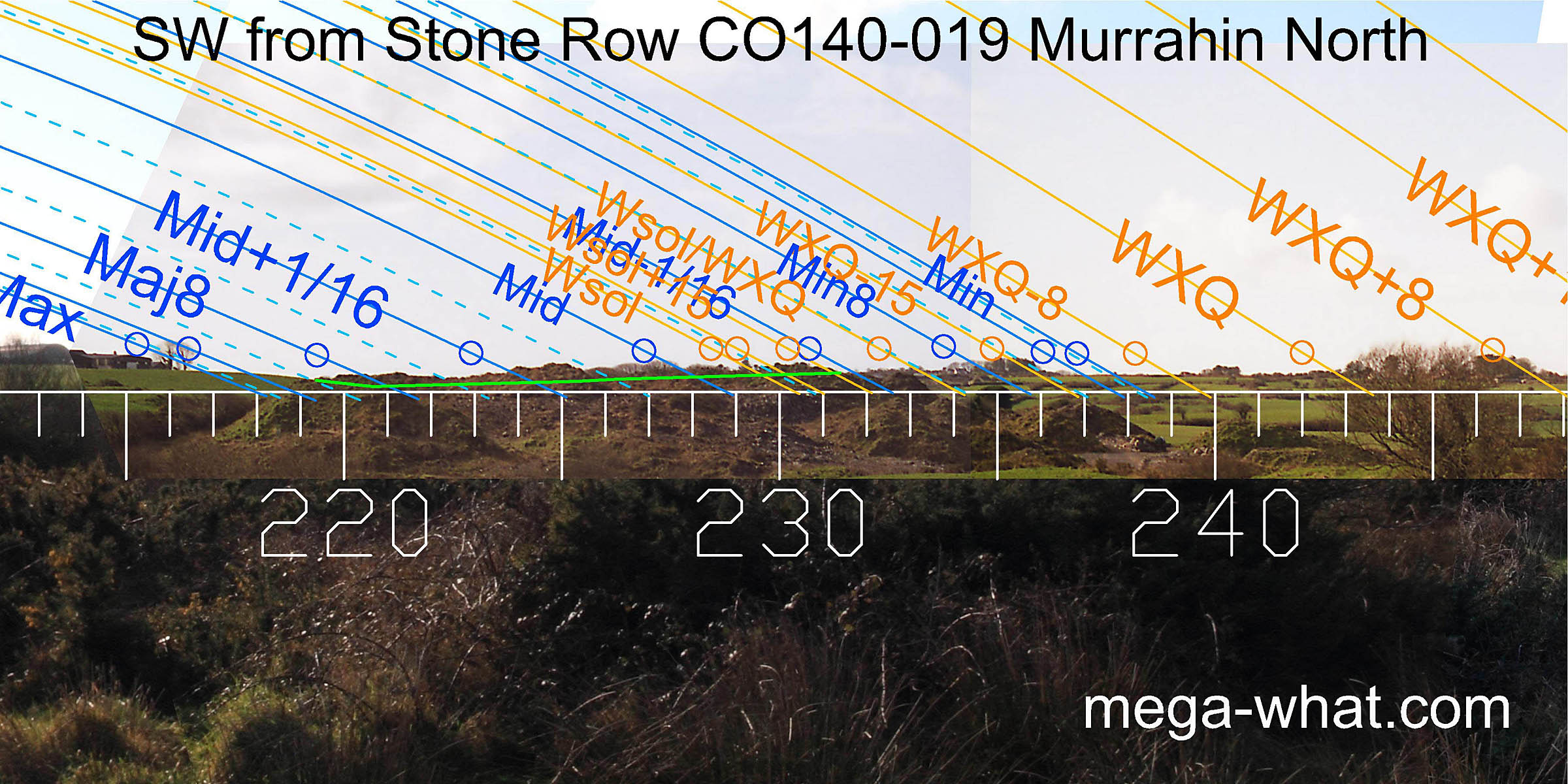 The south-west also has many trees but some useful sights were made there in 2003.
No photographs were taken at the time and this sector is now obscured by the spoil heap from a quarry.
The profile is fairly flat but the Leamawaddra River causes a small V notch which marks the major eighth.
The south-west also has many trees but some useful sights were made there in 2003.
No photographs were taken at the time and this sector is now obscured by the spoil heap from a quarry.
The profile is fairly flat but the Leamawaddra River causes a small V notch which marks the major eighth.
 The west is quite open and offers a sort of symmetry around a dip.
The two prominent hilltops are not used as markers but their outer feet are both a half-month from the cross-quarter..
The west is quite open and offers a sort of symmetry around a dip.
The two prominent hilltops are not used as markers but their outer feet are both a half-month from the cross-quarter..
Because the small central stone is fat, the tall stone may be aligned to give either WXQ+8 [Pic] or WXQ+15 [Pic] against the horizon.
![[Pic]](Murrahin-SWax2.jpg)
![[Pic]](Murrahin-SWax1.jpg)
 The minor end of the lunisticeLunistices are the most northerly and southerly moons of the month. The lunar equivalent of solstices - more.
range is at a high point on a far ridge, then the intersect with the nearer hill of Knockaphukeen provides a mark for the lunar minor eighth.
The major end of the lunisticeLunistices are the most northerly and southerly moons of the month. The lunar equivalent of solstices - more.
range is at another intersect notch at the other end of the hill and the double hilltop gives more key markers.
The minor end of the lunisticeLunistices are the most northerly and southerly moons of the month. The lunar equivalent of solstices - more.
range is at a high point on a far ridge, then the intersect with the nearer hill of Knockaphukeen provides a mark for the lunar minor eighth.
The major end of the lunisticeLunistices are the most northerly and southerly moons of the month. The lunar equivalent of solstices - more.
range is at another intersect notch at the other end of the hill and the double hilltop gives more key markers.
The only other Stone Row in the area is 1.05km away at Lissaclarig West and it almost certainly has a functional relationship with this one but views from there are largely obscured by trees. Between the two rows is a previously unrecorded Standing Stone (CO140-064) which may also be related to the two rows but that position remains unsurveyed.
- Lissaclarig Stone Row is 1.0km east (77°)
- Cappagh More Standing Stones are 2km north (10°)
- Maulinward Stone Row is 8.3km north-west (331°)
References
- Archaeological Survey of Ireland, record details. www.archaeology.ie/archaeological-survey-ireland
- Ó'NUALLÁIN, SEÁN 1988 Stone Rows in the South of Ireland. Proceedings of the Royal Irish Academy 88c:179-256, p237, no.54.
- POWER, D. et al. 1992 Archaeological Inventory of County Cork, Volume 1: West Cork. Dublin: Stationary Office. p37, no.162.
- RUGGLES, C.L.N. 1999 Astronomy in Prehistoric Britain and Ireland. Newhaven & London: Yale University Press. CKR90.
- RUGGLES, C.L.N. 1996 Stone Rows of Three or More Stones in South-West Ireland. Archaeoastronomy 21 (Journal of the History of Astronomy xxvii) S55-S71.