
 South is on a highpoint within the lowest dip.
This marker, currently crowned with low vegetation, is a rock outcrop at the end of the decorated slab [Pic].
To both sides of it the land rises to a highpoint, falls to a dip and rises to another top.
Then there is a final dip with North at the western side of it [Pic].
South is on a highpoint within the lowest dip.
This marker, currently crowned with low vegetation, is a rock outcrop at the end of the decorated slab [Pic].
To both sides of it the land rises to a highpoint, falls to a dip and rises to another top.
Then there is a final dip with North at the western side of it [Pic].
![[Pic].](Ballybane-040-S.jpg)
![[Pic].](Ballybane-040-N.jpg)
About 80m to the north-west and c.10m higher is a larger decorated slab [CO131-039] that was surveyed before this one.
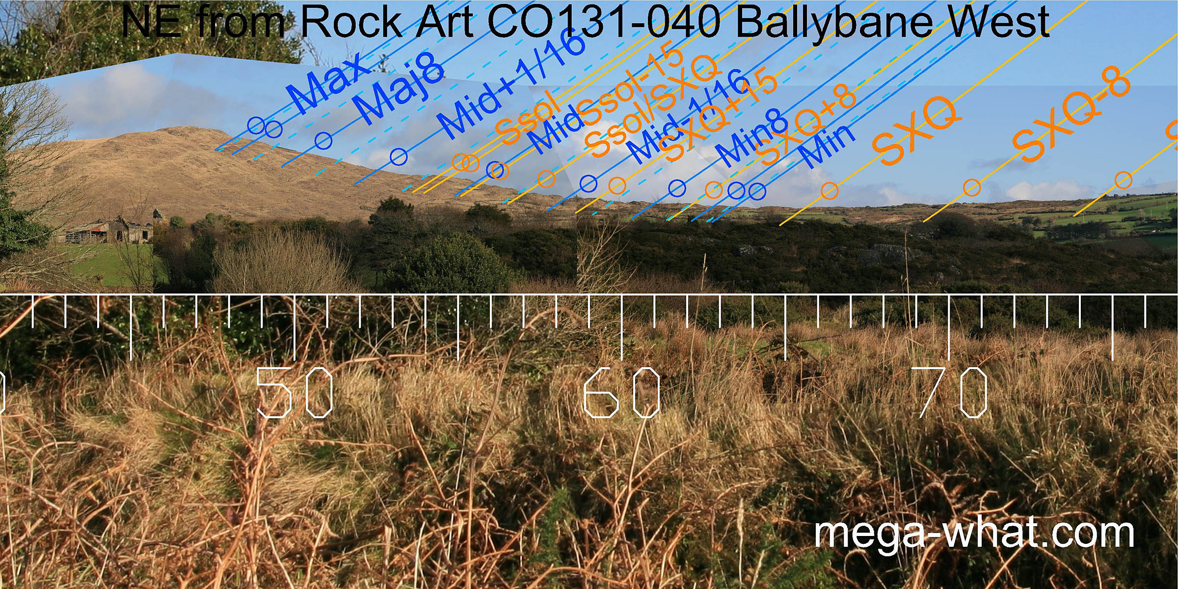 To the north-east, positions have shifted slightly southwards compared with the upper site.
The cross-quarters are south of the first hump of the rising ground rather than at its north foot. That place is now taken by the minor standstill of the moon.
To the north-east, positions have shifted slightly southwards compared with the upper site.
The cross-quarters are south of the first hump of the rising ground rather than at its north foot. That place is now taken by the minor standstill of the moon.
Summer solstice sunrise is at the top of the lower slope rather than on the break just above it and the major standstillLunistice positions vary cyclically over an 18.6 year period but are fairly static for more than a year at either end of the range of the moon occurs at the basal step of Mt.Kid summit, rather than on top of it.
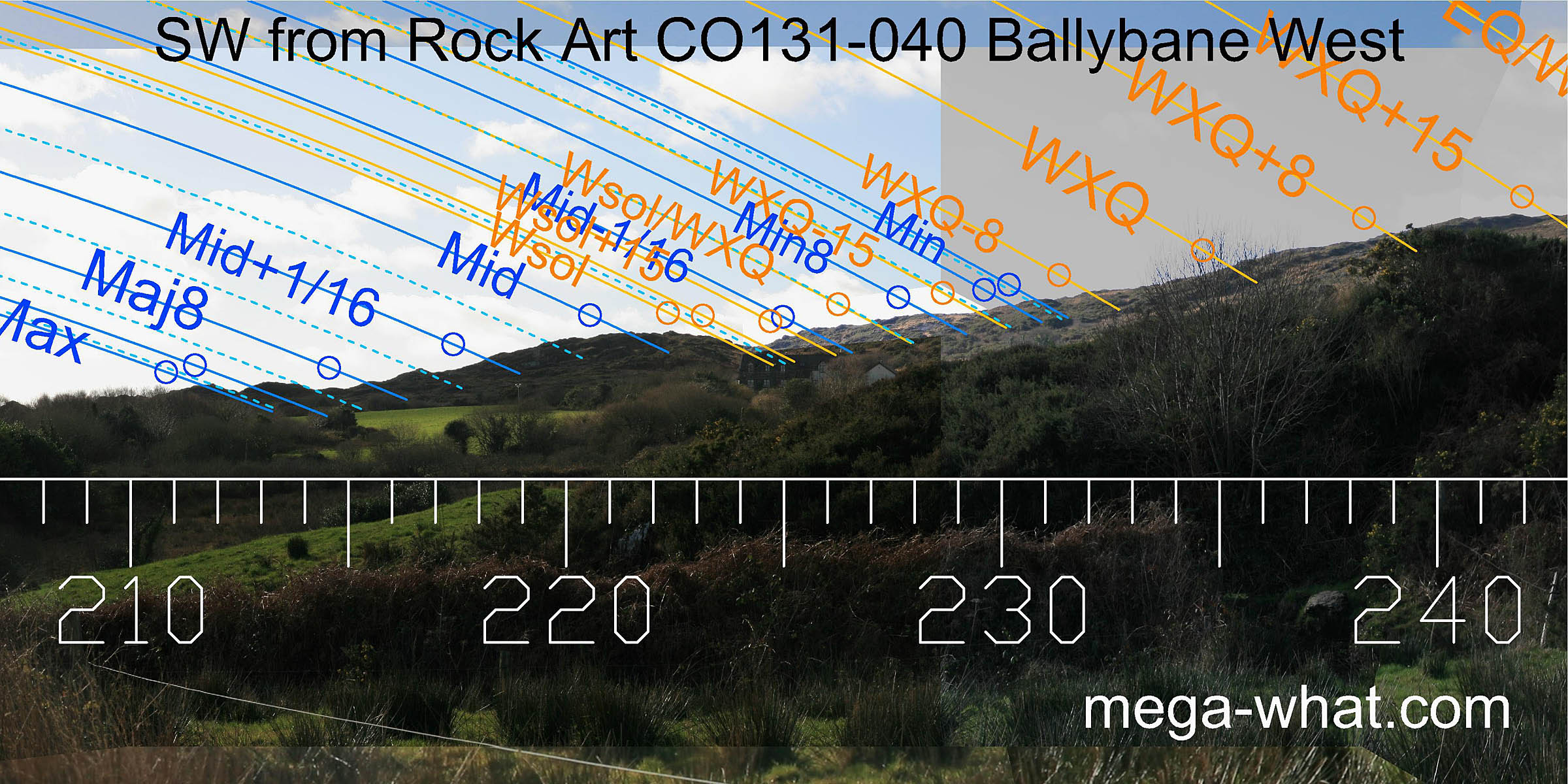
 Eastwards is a long ridge where the differences between the two sites are generally larger. Summer cross-quarters are at the start of the rising ground at the northern end.
Winter cross-quarters are again on the hilltop at the southern end. This hill marks the same date from both locations as movement between the sites is along a path towards it.
Eastwards is a long ridge where the differences between the two sites are generally larger. Summer cross-quarters are at the start of the rising ground at the northern end.
Winter cross-quarters are again on the hilltop at the southern end. This hill marks the same date from both locations as movement between the sites is along a path towards it.
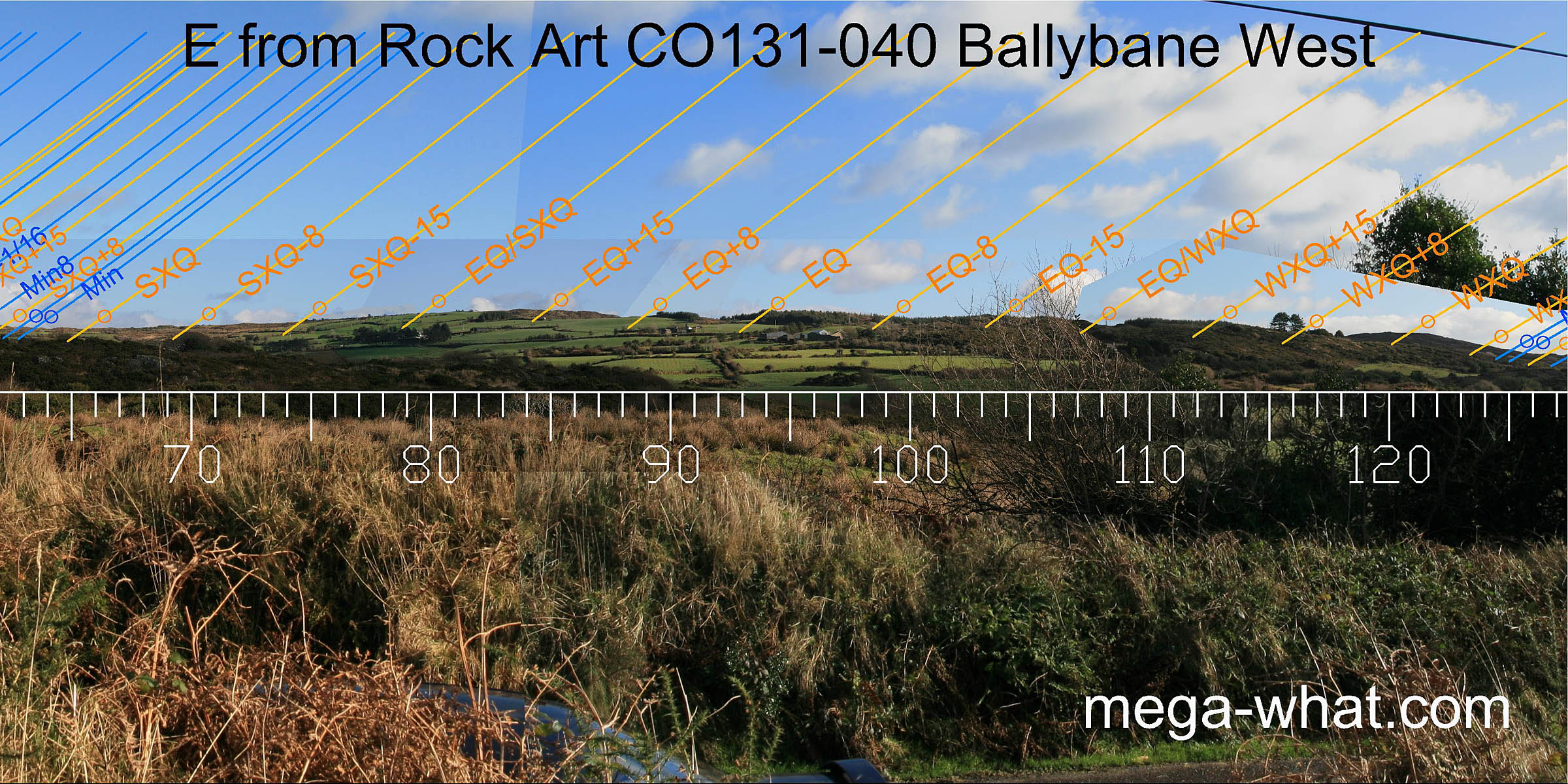
The equinox looks as if it might occur on a high point, as do its half-month brackets and also the half-month north of the cross-quarter. These intervals are all split by dips.
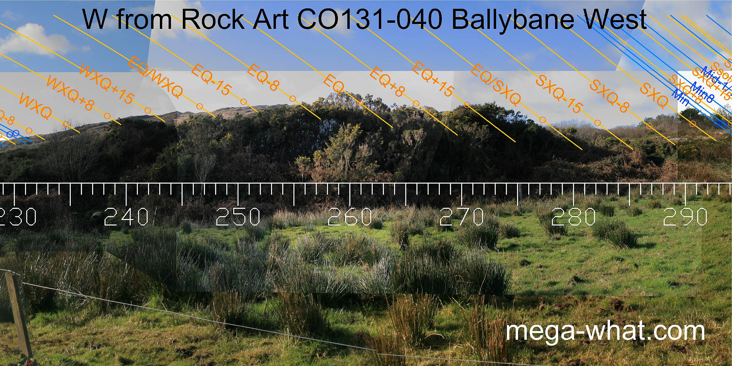
 To the south-east, as the ridge falls away from the hill marking the cross-quarters, changes are very slight.
The top of the lower slope is again half-way to the solstice which itself occurs at the bottom.
The minor end and midpoint of the lunisticeLunistices are the most northerly and southerly moons of the month. The lunar equivalent of solstices - more.
range are just off the ends of this section but this time the midpoint and the sixteenth beyond are usefully on a rocky ridge that was below the skyline from the upper site.
To the south-east, as the ridge falls away from the hill marking the cross-quarters, changes are very slight.
The top of the lower slope is again half-way to the solstice which itself occurs at the bottom.
The minor end and midpoint of the lunisticeLunistices are the most northerly and southerly moons of the month. The lunar equivalent of solstices - more.
range are just off the ends of this section but this time the midpoint and the sixteenth beyond are usefully on a rocky ridge that was below the skyline from the upper site.
Beyond that, the major eighth rises at another rock not on the horizon from above before again skimming the side of Knockomagh. The major end of the lunistice range is on the southern slope, position virtually unchanged as this is the most distant horizon.
 The south-west, being much closer, shows a pronounced southerly shift.
From here, the major end of the lunistice range fits well onto a usefully jagged section of the ridge and
the midpoint falls on the rounded top that marked the major eighth from the other site.
The south-west, being much closer, shows a pronounced southerly shift.
From here, the major end of the lunistice range fits well onto a usefully jagged section of the ridge and
the midpoint falls on the rounded top that marked the major eighth from the other site.
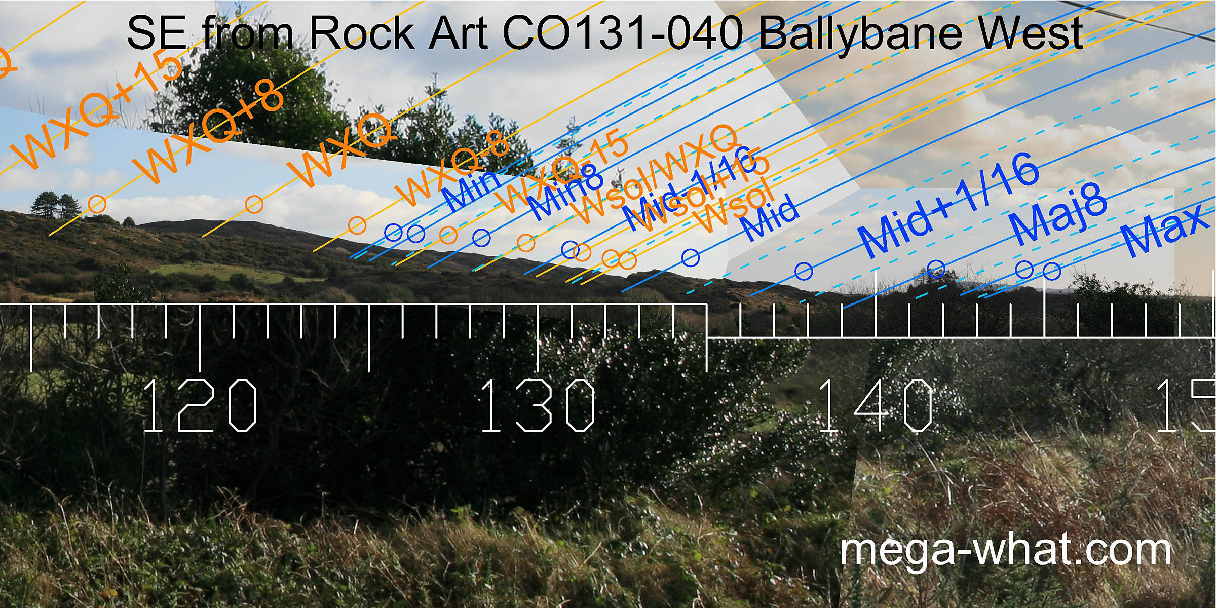
The solstice is then in the dip after this high point, with the sun's lower limb clipping the north slope for extra precision. The cross-quarters fall at the part of the slope occupied by the minor end of the lunistice cycle from the upper site.
 Westwards, the upper slope of the hill has a varied enough profile to give more usable markers.
The equinoctial zone occurs over an extremely local rock outcrop and is thus extremely position sensitive. In spite of the vertical face on its eastern side it is easy to walk to the top of the rock from the other side.
 It looks likely that the the upper decorated slab [CO131-039]
forms the part of the north-west horizon where summer sunsets and winter solstice full moonsets fall.
It looks likely that the the upper decorated slab [CO131-039]
forms the part of the north-west horizon where summer sunsets and winter solstice full moonsets fall.
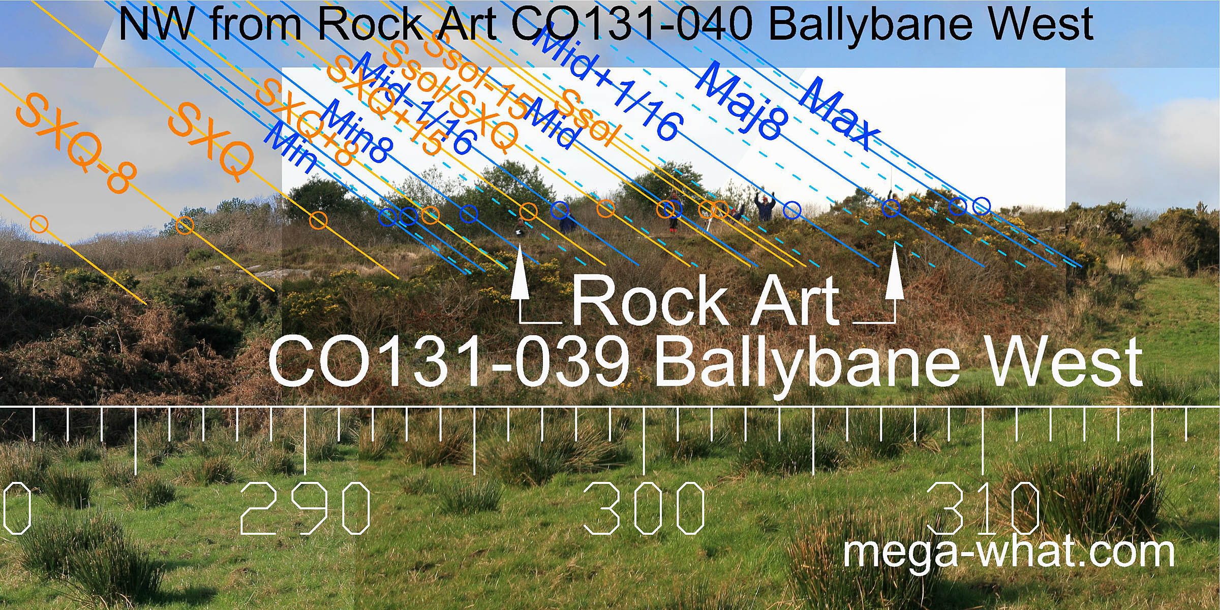
The intriguing possibility that positions of the decorations on the upper slab might be related to luni-solar setting points as seen from the lower slab required investigation. I enlisted the assistance of long standing rock art enthusiasts Finola Finlay & Robert Harris.
Robert stood on the westmost, southmost and eastmost of all the carvings. Finola is on the eastmost of a western group then the northmost motif of all, then the eastmost of a larger central group. The northmost motif is also the westmost of this central group and the tripod marks the site from which the upper slab's survey was done.
On the other side of this ridge (2.3km, 310°) is more rock art of similar type, CO131-069 Derreennaclogh.
The nearest megalithic monuments are:
- Standing stones CO131-051 Cappagh More (1.6km, 94°)
- Short stone row CO140-019 Murrahin North (2.5km, 149°)
- Cairn CO131-048 Letterlicky (3.7km, 173°)
- Standing stone CO140-004 Rathruane Beg (5.7km, 254°)
- Boulder-burial CO140-057 Rathruane More (5.8km, 246°)
References
- Archaeological Survey of Ireland, record details. www.archaeology.ie/archaeological-survey-ireland
- FINLAY, F. 1973 The Rock Art of Cork and Kerry. Unpublished M.A. Thesis, Cork University Library. pp103-105.
- FINLAY, F. & HARRIS, R. 2018 Unusual Rock Art near Bantry, West Cork: The Ballybane Group. Journal of the Bantry Historical & Archaeological Society, Volume 3. Available at Academia.edu/36634537
- POWER, D. et al. 1992 Archaeological Inventory of County Cork, Volume 1: West Cork. Dublin: Stationary Office. p96, no.801.