
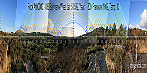
 Ballybane Rock Art is about 4km NNE of Ballydehob and quite a large slab, with carvings scattered across it rather than closely grouped.
It is a National Monument but there is no official parking or access.
Ballybane Rock Art is about 4km NNE of Ballydehob and quite a large slab, with carvings scattered across it rather than closely grouped.
It is a National Monument but there is no official parking or access.
South is at an intersect on the western side of the lowest dip [Pic]. To both sides of it the land rises to a highpoint, falls to a dip and rises to another top. Then there is a final dip with North at an intersect on the western side of it [Pic].
![[Pic].](Ballybane-039-S.jpg)
![[Pic].](Ballybane-039-N.jpg)
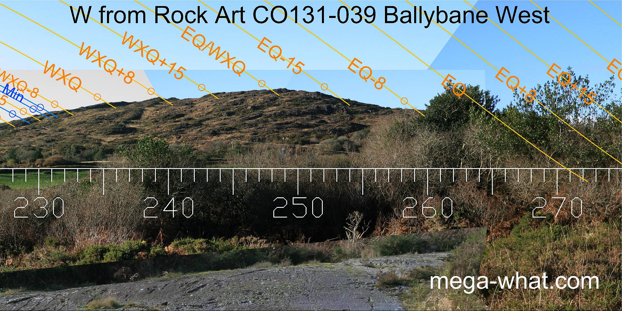
 Survey position was approximately central. A smaller decorated slab [CO131-040] is c.80m to the south-east and about 10m lower.
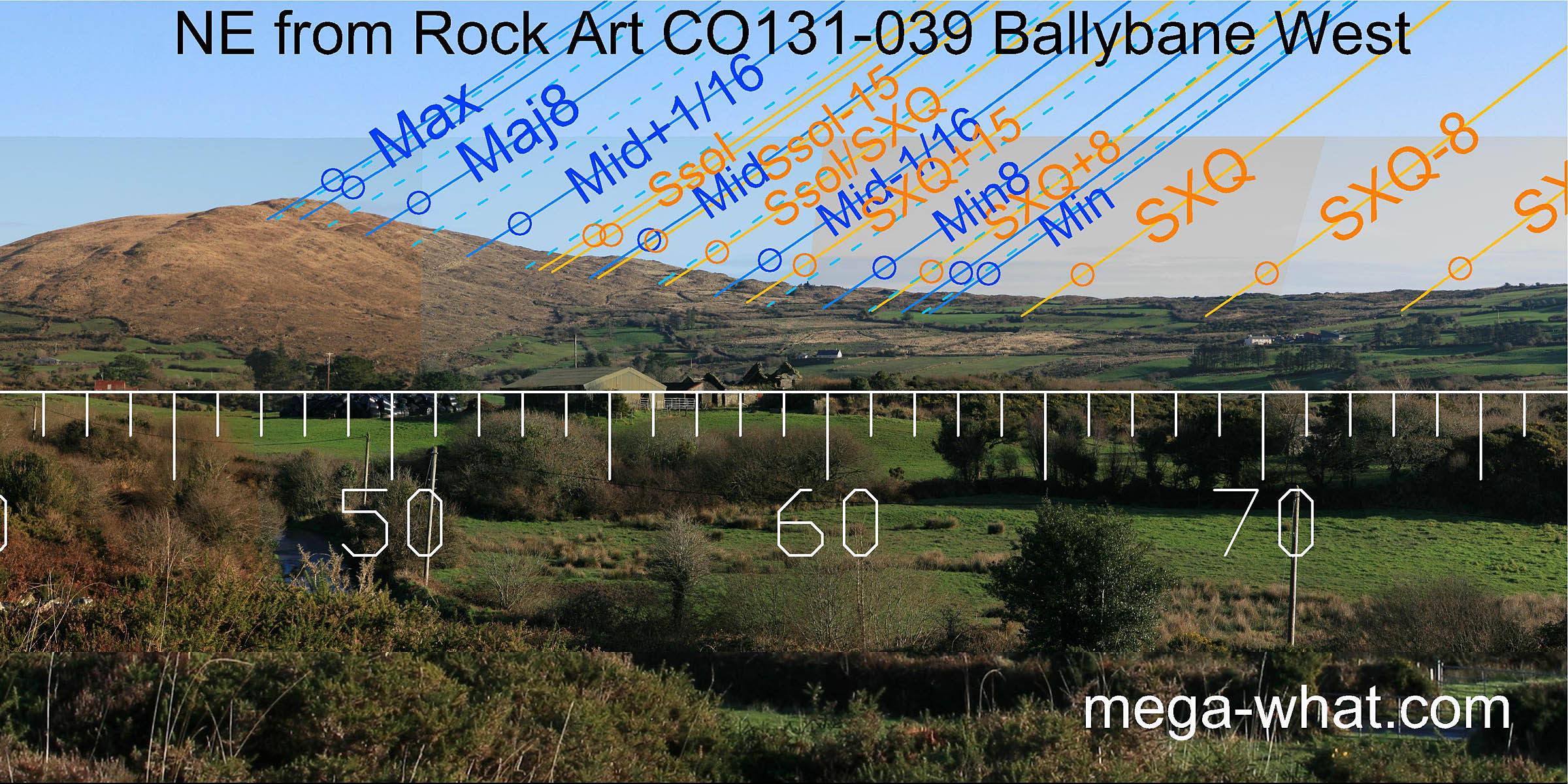
To the north-east, the cross-quarter is at the first hump of the rising ground with the lunar midpoint at the top of the first slope. The solstice is on the flat break that starts the upper slope and the major standstillLunistice positions vary cyclically over an 18.6 year period but are fairly static for more than a year at either end of the range of the moon occurs on the summit of Mt.Kid, c.3km away.
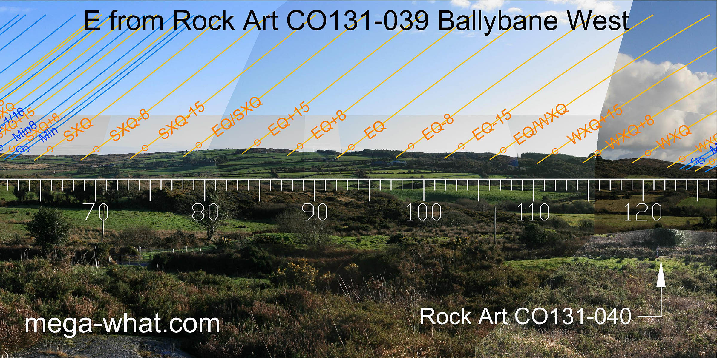 Eastwards is a long ridge. The summer cross-quarters are at the first hump of the rising ground at the northern end and the winter cross-quarters are on a hilltop at the southern end.
The equinox is in a dip in the middle.
Eastwards is a long ridge. The summer cross-quarters are at the first hump of the rising ground at the northern end and the winter cross-quarters are on a hilltop at the southern end.
The equinox is in a dip in the middle.
 To the south-east, the ridge falls away, the solstice is at the bottom of the hill that marks the cross-quarters.
The minor end of the lunisticeLunistices are the most northerly and southerly moons of the month. The lunar equivalent of solstices - more.
cycle is in a dip on the slope and the midpoint is just off the end of this section.
To the south-east, the ridge falls away, the solstice is at the bottom of the hill that marks the cross-quarters.
The minor end of the lunisticeLunistices are the most northerly and southerly moons of the month. The lunar equivalent of solstices - more.
cycle is in a dip on the slope and the midpoint is just off the end of this section.
The sixteenth beyond the midpoint is then in a dip and the major eighth rises along the side of a distant hill. This is Knockomagh, about 11.5km away and the major end of the lunistice range falls on its southern slope, with a thirty-secondth actually at the summit.
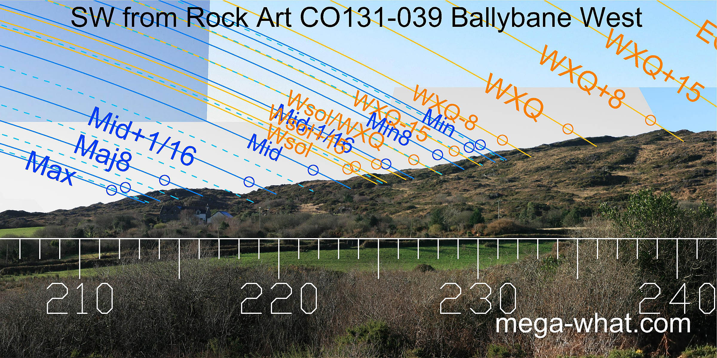 South-west is a rocky ridge that offers a usefully indented profile.
Like the south-east it seems to have been optimised for the sun, with the solstice at the foot and the cross-quarters at the top of a clearly defined section of slope.
South-west is a rocky ridge that offers a usefully indented profile.
Like the south-east it seems to have been optimised for the sun, with the solstice at the foot and the cross-quarters at the top of a clearly defined section of slope.
The lunar major eighth falls on the top of a large hump but other lunar points, while still measurable, do not occur at obviously prominent points.
This western ridge is quite close and thus is the sector most easily influenced by observer position.
 North of the winter cross-quarters, the hilltop is half-way to the equinox.
The equinox position itself is not visible however, as the entire north-western quadrant is obscured by trees but the bottom of the dip might be half-way to summer cross-quarter...
North of the winter cross-quarters, the hilltop is half-way to the equinox.
The equinox position itself is not visible however, as the entire north-western quadrant is obscured by trees but the bottom of the dip might be half-way to summer cross-quarter...
On the other side of this ridge (2.3km, 310°) is more rock art of similar type, CO131-069 Derreennaclogh.
The nearest megalithic monuments are:
- Standing Stones CO131-051 Cappagh More (1.6km, 94°)
- Short Stone Row CO140-019 Murrahin North (2.5km, 149°)
- Cairn CO131-048 Letterlicky (3.7km, 173°)
- Standing Stone CO140-004 Rathruane Beg (5.7km, 254°)
- Boulder-Burial CO140-057 Rathruane More (5.8km, 246°)
References
- Archaeological Survey of Ireland, record details. www.archaeology.ie/archaeological-survey-ireland
- FINLAY, F. 1973 The Rock Art of Cork and Kerry. Unpublished M.A. Thesis, Cork University Library. pp103-105.
- FINLAY, F. & HARRIS, R. 2018 Unusual Rock Art near Bantry, West Cork: The Ballybane Group. Journal of the Bantry Historical & Archaeological Society, Volume 3. Available at Academia.edu/36634537
- POWER, D. et al. 1992 Archaeological Inventory of County Cork, Volume 1: West Cork. Dublin: Stationary Office. p96, no.800.