
 Shandrum Beg Radial Stone Cairn is about 5km north-east of Bantry and close to the road.
South is on a slope and coincides with major standstillLunistice positions vary cyclically over an 18.6 year period but are fairly static for more than a year at either end of the range moonrise [Pic].
![[Pic].](ShandrumBegRSC-S.jpg)
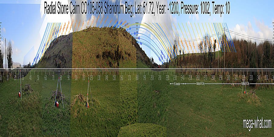
North is obscured [Pic].
![[Pic].](ShandrumBegRSC-N.jpg)
 It is 194m west-south-west of Standing Stone CO105-071 and, being in a dip, things do not look promising at first sight but
it is astronomically sited and the fact that it has no other monuments close by clearly demonstrates that the siting criteria are its own.
Its position may be explained by suggesting that its builders were late-comers to the area after the best locations were already taken.
It is 194m west-south-west of Standing Stone CO105-071 and, being in a dip, things do not look promising at first sight but
it is astronomically sited and the fact that it has no other monuments close by clearly demonstrates that the siting criteria are its own.
Its position may be explained by suggesting that its builders were late-comers to the area after the best locations were already taken.
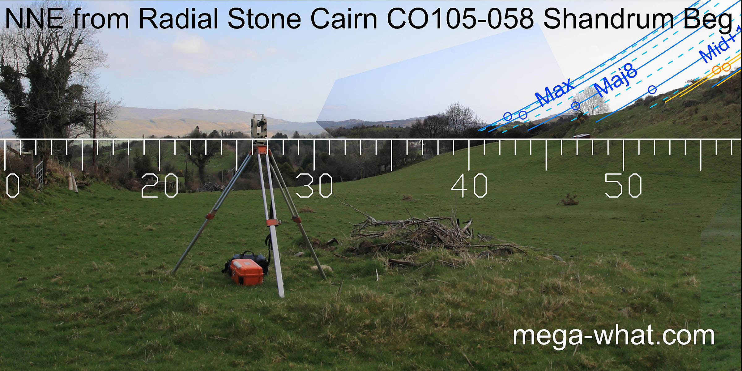
There is open horizon to the north and north-east but most of it is beyond the lunar limit. The lunar extreme turns around the notch that is the lowest point on the eastern horizon and the major eighth is on the hilltop above it. Just beyond that the horizon becomes the steep slope of the local hill which stretches things out.
 The solstice is at a step and the cross-quarter at the top of the slope. Another step between the two is the midpoint.
The bushes don't help but it looks like the minor lunar limit is in a dip near the top of the slope.
The lunar midpoint and both sixteenths run down steep slopes that are above steps.
The solstice is at a step and the cross-quarter at the top of the slope. Another step between the two is the midpoint.
The bushes don't help but it looks like the minor lunar limit is in a dip near the top of the slope.
The lunar midpoint and both sixteenths run down steep slopes that are above steps.
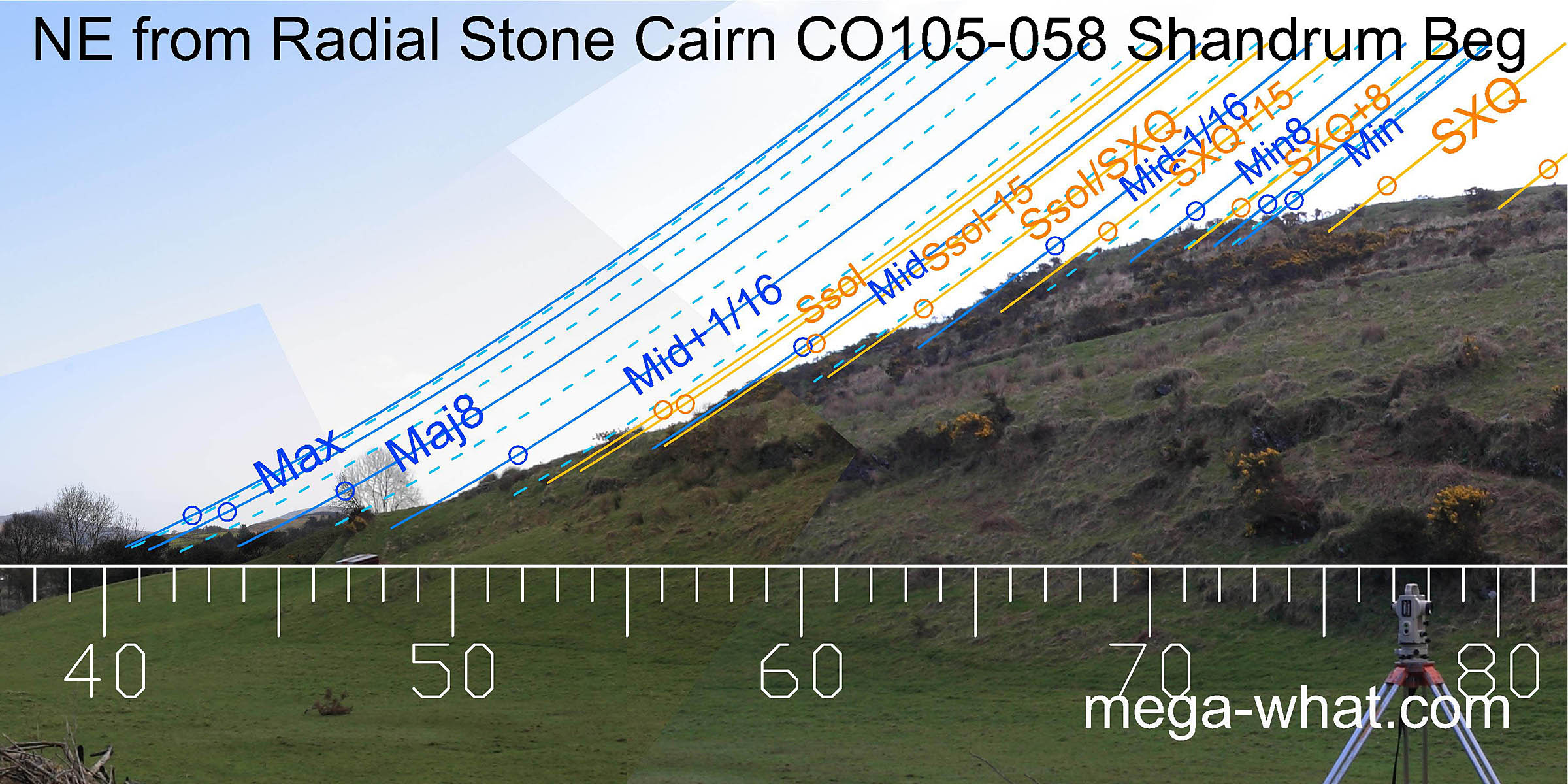
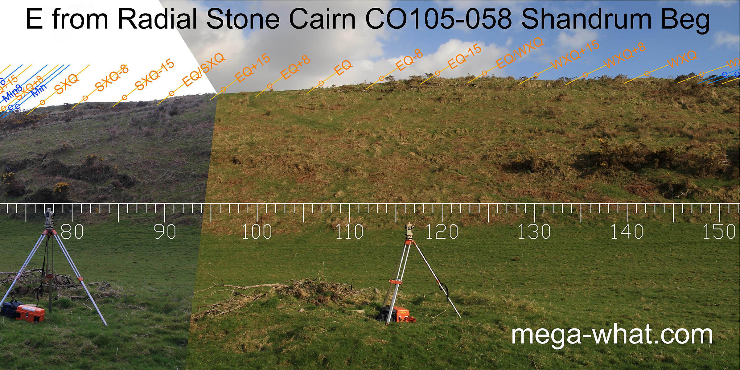 Eastwards is a long ridge that is high, close and not easy to survey. Again, the vegetation is not helpful.
It looks as though the cross-quarters are at either end of the ridge with the highest point being a half-month south of the equinox.
Eastwards is a long ridge that is high, close and not easy to survey. Again, the vegetation is not helpful.
It looks as though the cross-quarters are at either end of the ridge with the highest point being a half-month south of the equinox.
Perhaps Standing Stone CO105-071 would be visible up there were it upright.
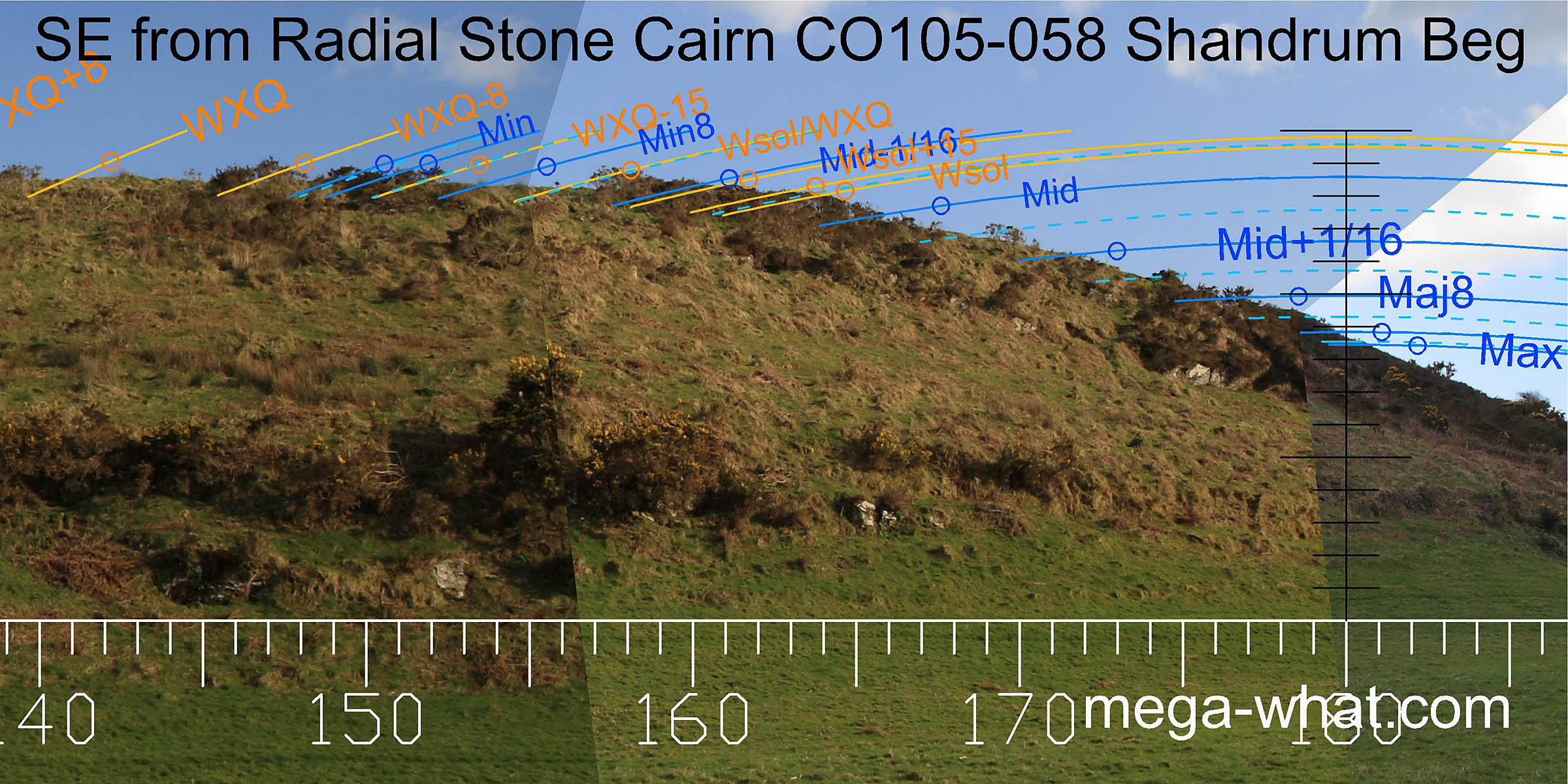 To the south-east, the lunisticeLunistices are the most northerly and southerly moons of the month. The lunar equivalent of solstices - more.
range is once again stretched out by being on a north facing slope.
This fact, combined with the height of the horizon means that the moon at major standstillLunistice positions vary cyclically over an 18.6 year period but are fairly static for more than a year at either end of the range
does not rise until it has passed its transit.
Above it the major eighth is marked by an obvious break in the slope.
To the south-east, the lunisticeLunistices are the most northerly and southerly moons of the month. The lunar equivalent of solstices - more.
range is once again stretched out by being on a north facing slope.
This fact, combined with the height of the horizon means that the moon at major standstillLunistice positions vary cyclically over an 18.6 year period but are fairly static for more than a year at either end of the range
does not rise until it has passed its transit.
Above it the major eighth is marked by an obvious break in the slope.
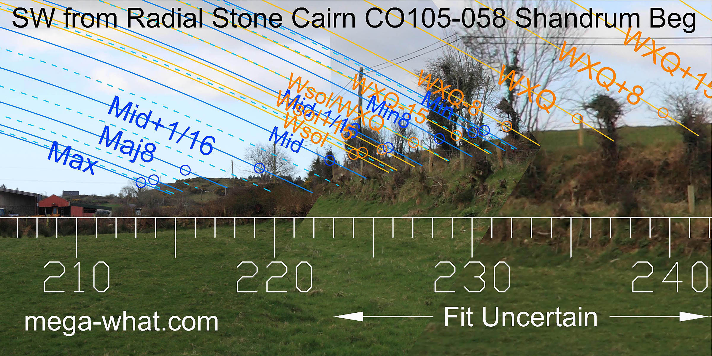 The view along the valley to the south-west provides another major eighth, on a hilltop.
South of it, the major standstillLunistice positions vary cyclically over an 18.6 year period but are fairly static for more than a year at either end of the range
now sets into a house roof and north of it the sixteenth is at the dip formed by the intersection of the hill with a nearer ridge.
The view along the valley to the south-west provides another major eighth, on a hilltop.
South of it, the major standstillLunistice positions vary cyclically over an 18.6 year period but are fairly static for more than a year at either end of the range
now sets into a house roof and north of it the sixteenth is at the dip formed by the intersection of the hill with a nearer ridge.
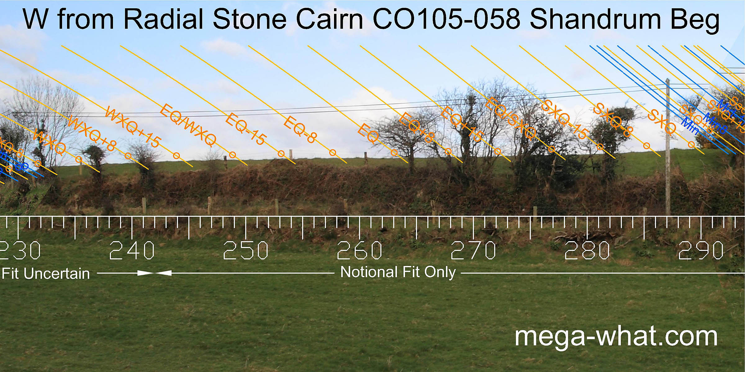
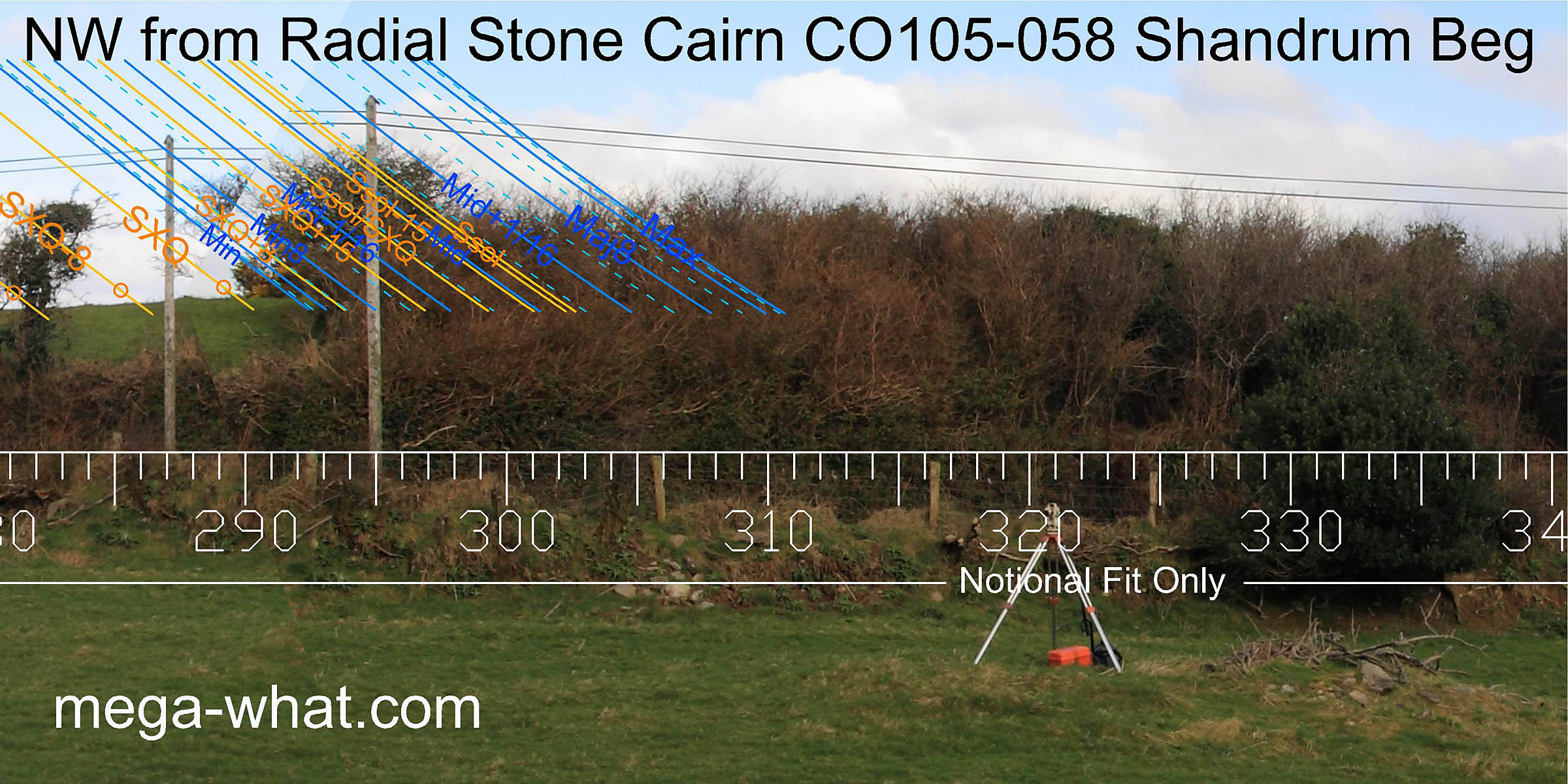 The west & north-west are very close and much obscured. They were not surveyed and thus this view is indicative only
but perhaps the lunisticeLunistices are the most northerly and southerly moons of the month. The lunar equivalent of solstices - more.
range runs over the highest part of the ridge.
The west & north-west are very close and much obscured. They were not surveyed and thus this view is indicative only
but perhaps the lunisticeLunistices are the most northerly and southerly moons of the month. The lunar equivalent of solstices - more.
range runs over the highest part of the ridge.
- A Standing Stone (fallen) is on the hilltop, 195m east (77°)
- Kealkill Radial Stone Cairn, Stone Circle & Pair (excavated) are 3.5km north-east (42°)
- Reenmeen Radial Stone Cairn (unexcavated) is 10.6km north-west (294°)
References
- Archaeological Survey of Ireland, record details. www.archaeology.ie/archaeological-survey-ireland
- RONAN, S. et al. 2009 Archaeological Inventory of County Cork, Volume 5. Dublin: Stationary Office. p108, no.15978.