
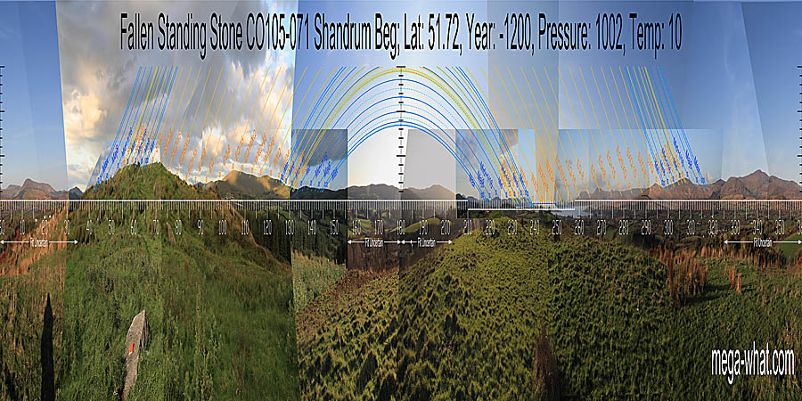
 This fallen Standing Stone is in the townland of Shandrum Beg, about 5km north-east of Bantry, not far from the road but on top of a hill.
South is in a dip in a block of high ground and further indicated by an intersection [Pic]. North is in a dip [Pic].
![[Pic].](ShandrumBegFST-S.jpg)
![[Pic].](ShandrumBegFST-N.jpg)
 This stone is on the opposite side of the hilltop from and perhaps 280m to the SW of Cappanaboul Stone Circle
and almost certainly an original outlier of it.
A further 400m or so to the south-west and visible from this area is Standing Stone CO105-027.
This stone is on the opposite side of the hilltop from and perhaps 280m to the SW of Cappanaboul Stone Circle
and almost certainly an original outlier of it.
A further 400m or so to the south-west and visible from this area is Standing Stone CO105-027.
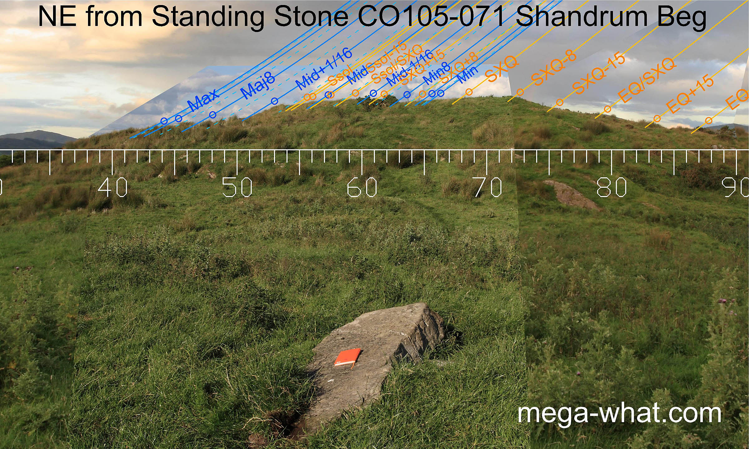
To the north-east, the very local hilltop is the most position sensitive horizon sector and the occurrance of the lunar minor eighth in the central dip nicely mirrors the hill's use from the stone circle on its other side.
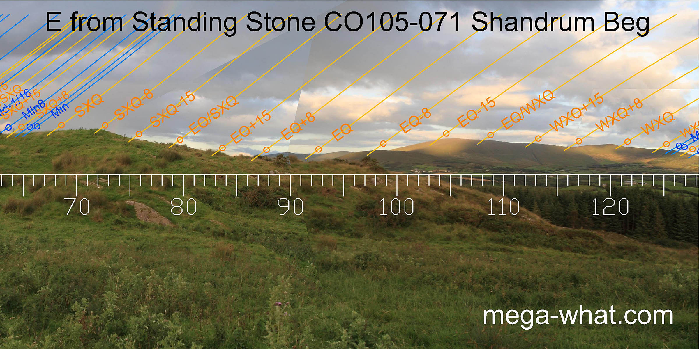 To the east, the equinox falls in the dip between two hills which are three days either side of it.
The ridge of Mullagh Mesha then provides solar measurement until its final high point, which acts as a marker for the minor end of the lunisticeLunistices are the most northerly and southerly moons of the month. The lunar equivalent of solstices - more. range.
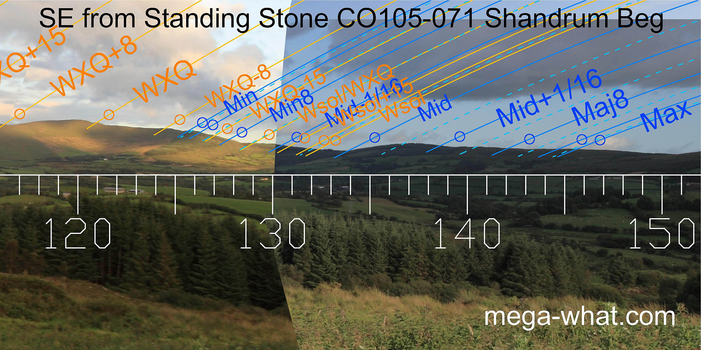 South-eastwards, the winter solstice occurs at a minor feature on the slope before the dip at the bottom of the slope provides an accurate mark for the lunar midpoint.
The major half of the lunisticeLunistices are the most northerly and southerly moons of the month. The lunar equivalent of solstices - more.
range then extends over the next hill and along the ridge.
South-eastwards, the winter solstice occurs at a minor feature on the slope before the dip at the bottom of the slope provides an accurate mark for the lunar midpoint.
The major half of the lunisticeLunistices are the most northerly and southerly moons of the month. The lunar equivalent of solstices - more.
range then extends over the next hill and along the ridge.
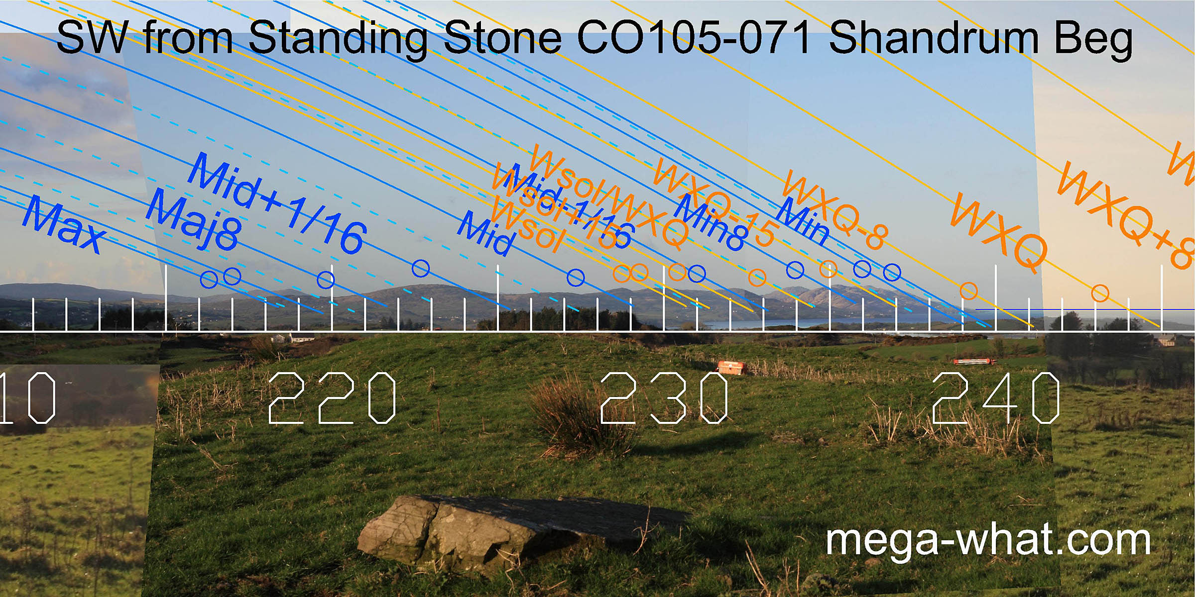 The elevated position gives good views to the south-west of distant horizons which provide a range of markers for both the entire lunar nodal cycle and the winter part of the solar cycle.
Winter cross-quarter falls in Bantry Bay but hilltops to side mark its half-month brackets.
The elevated position gives good views to the south-west of distant horizons which provide a range of markers for both the entire lunar nodal cycle and the winter part of the solar cycle.
Winter cross-quarter falls in Bantry Bay but hilltops to side mark its half-month brackets.
15m west of this stone is an artificially levelled area (22mx12m approx) that is clearly not recent and would serve no agricultural purpose. The ends of it are marked by the theodolite case and tripod in this picture. Its date and significance (if any) are unknown but its position would offer subtle differences on the north-western horizon and significant ones to the north-east [Pic].
![[Pic].](ShandrumBegFSTLA-NE.jpg)
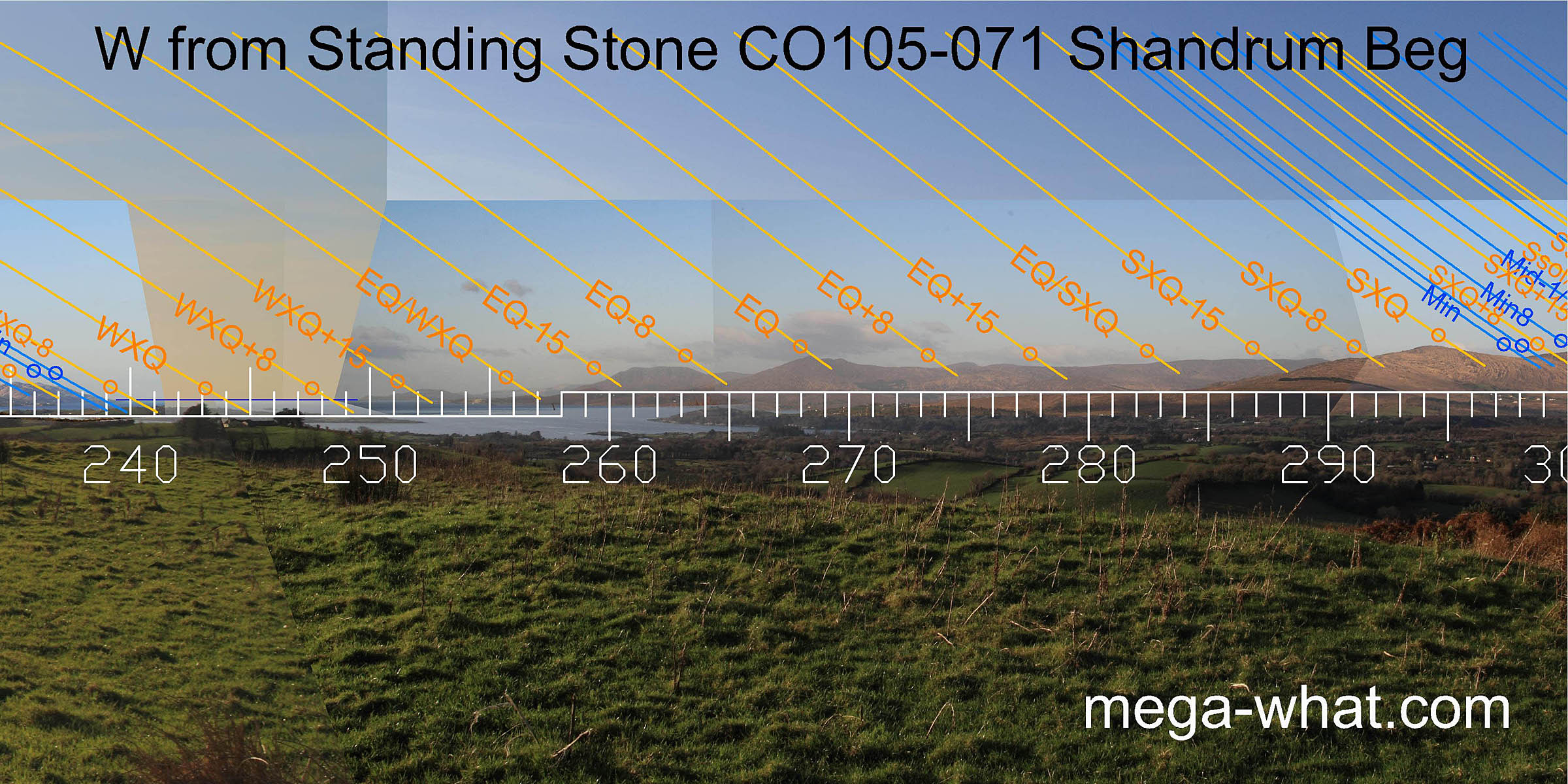 The most significant thing about the western horizon is that, from here, the pointed top of "The Sugarloaf" marks the equinox exactly (declination 0.0°).
This is interesting in combination with the three-day-either-side markers to the east from here and the two-days-either-side markers at Standing Stone CO105-027 nearby.
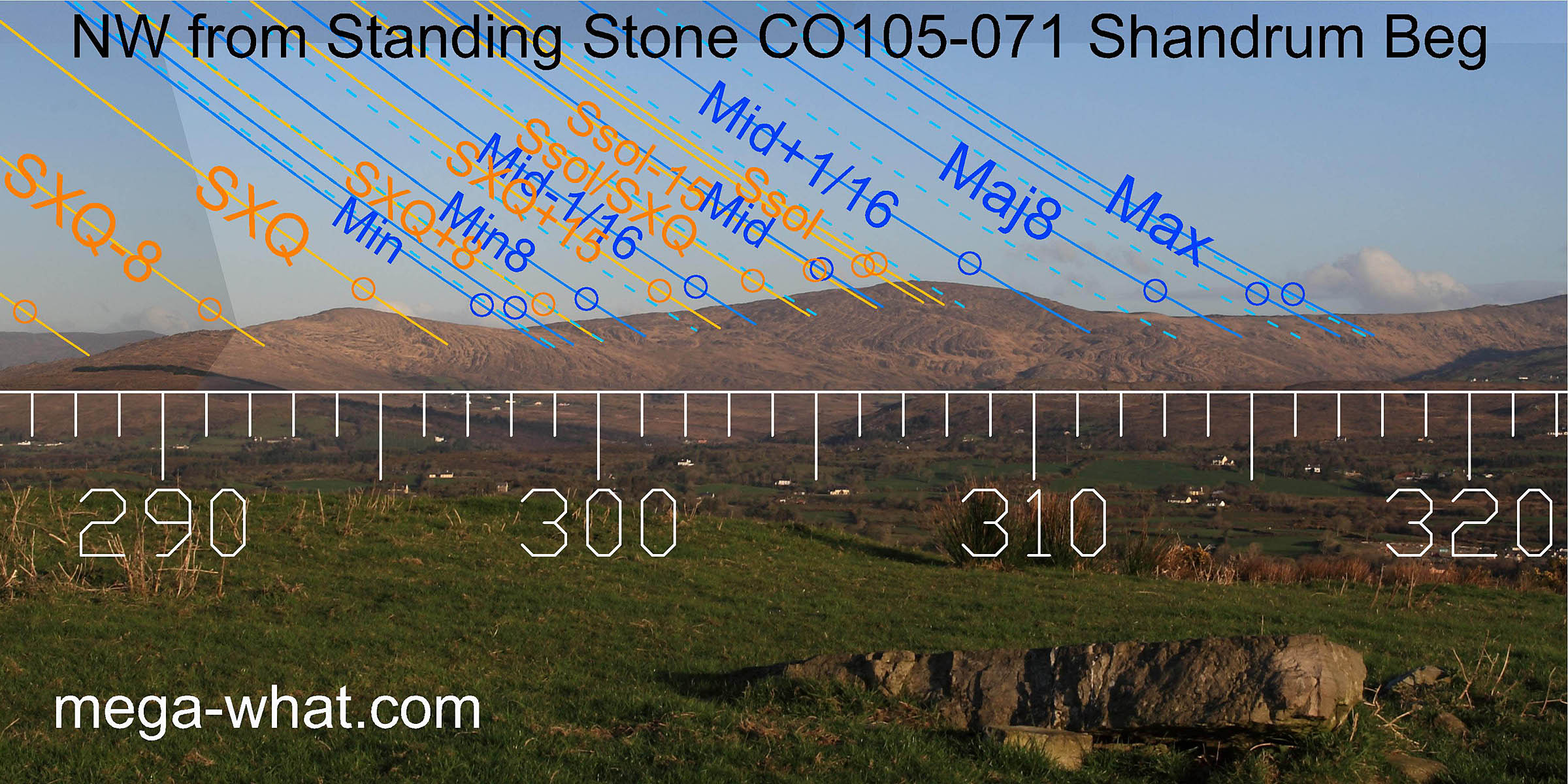 The north-west provides a number of good markers for the major half of the lunisticeLunistices are the most northerly and southerly moons of the month. The lunar equivalent of solstices - more.
range and also for the height of the summer.
The lunisticeLunistices are the most northerly and southerly moons of the month. The lunar equivalent of solstices - more.
range spreads over a hill, with the minor standstillLunistice positions vary cyclically over an 18.6 year period but are fairly static for more than a year at either end of the range
at the basal dip and summer solstice on the hilltop.
The north-west provides a number of good markers for the major half of the lunisticeLunistices are the most northerly and southerly moons of the month. The lunar equivalent of solstices - more.
range and also for the height of the summer.
The lunisticeLunistices are the most northerly and southerly moons of the month. The lunar equivalent of solstices - more.
range spreads over a hill, with the minor standstillLunistice positions vary cyclically over an 18.6 year period but are fairly static for more than a year at either end of the range
at the basal dip and summer solstice on the hilltop.
Nearby is a hutsite [Photo].
![[Photo].](img_1572.jpg)
In the valley below is Radial Stone Cairn CO105-058.
References
- Archaeological Survey of Ireland, record details. www.archaeology.ie/archaeological-survey-ireland
- RONAN, S. et al. 2009 Archaeological Inventory of County Cork, Volume 5. Dublin: Stationary Office. p38, no 15506.