
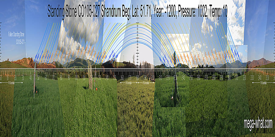
 Shandrum Beg Standing Stone is about 5km north-east of Bantry and fairly close to the road. This survey was done in August 2008.
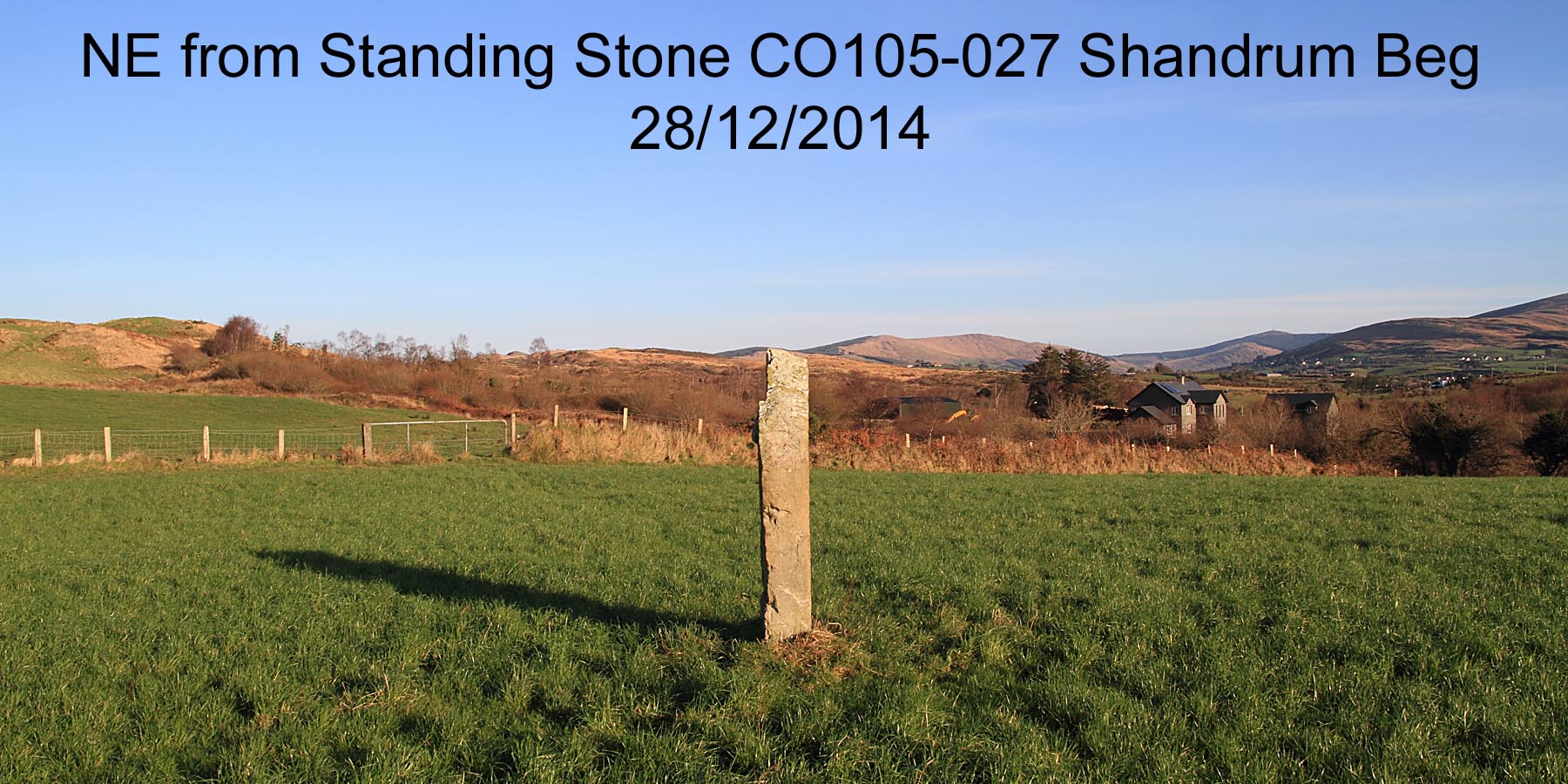
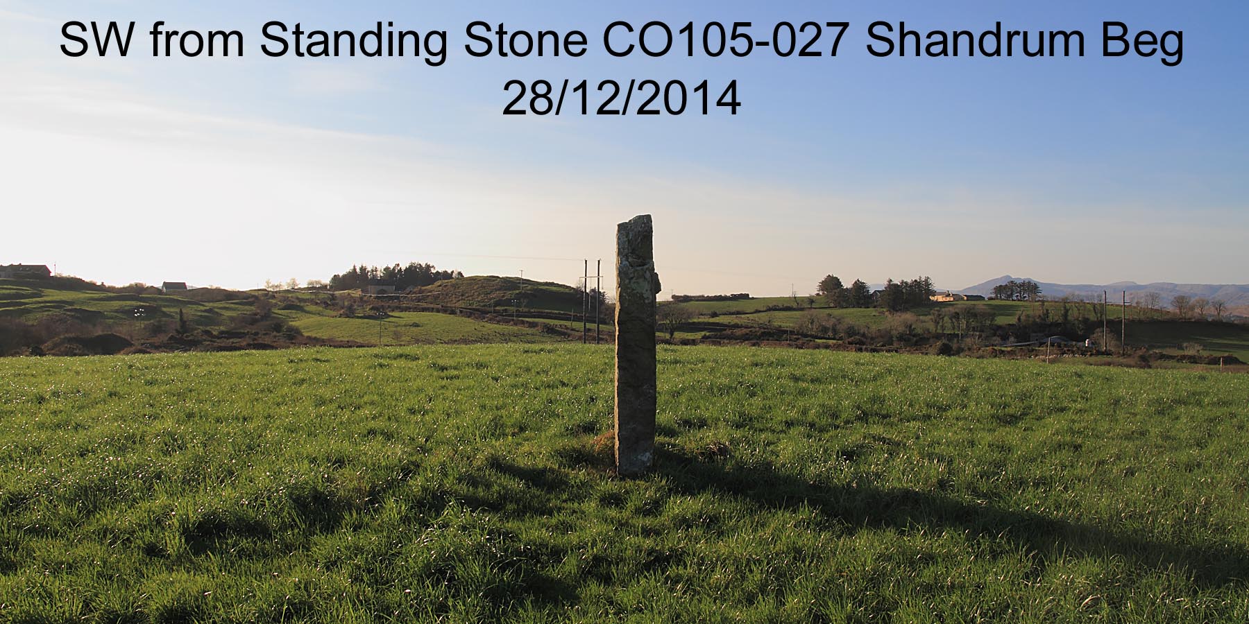
A re-visit in December 2014 found the NE quadrant usefully devoid of forestry but also discovered that the stone axis had changed by about 20°.
The position seems to be somewhat out as well. The 2008 stone placement is always used here but nonetheless we have a clear cautionary note regarding the interpretation of monument axes,
see the 2014 NE axis and 2014 SW axis.
Shandrum Beg Standing Stone is about 5km north-east of Bantry and fairly close to the road. This survey was done in August 2008.
A re-visit in December 2014 found the NE quadrant usefully devoid of forestry but also discovered that the stone axis had changed by about 20°.
The position seems to be somewhat out as well. The 2008 stone placement is always used here but nonetheless we have a clear cautionary note regarding the interpretation of monument axes,
see the 2014 NE axis and 2014 SW axis.
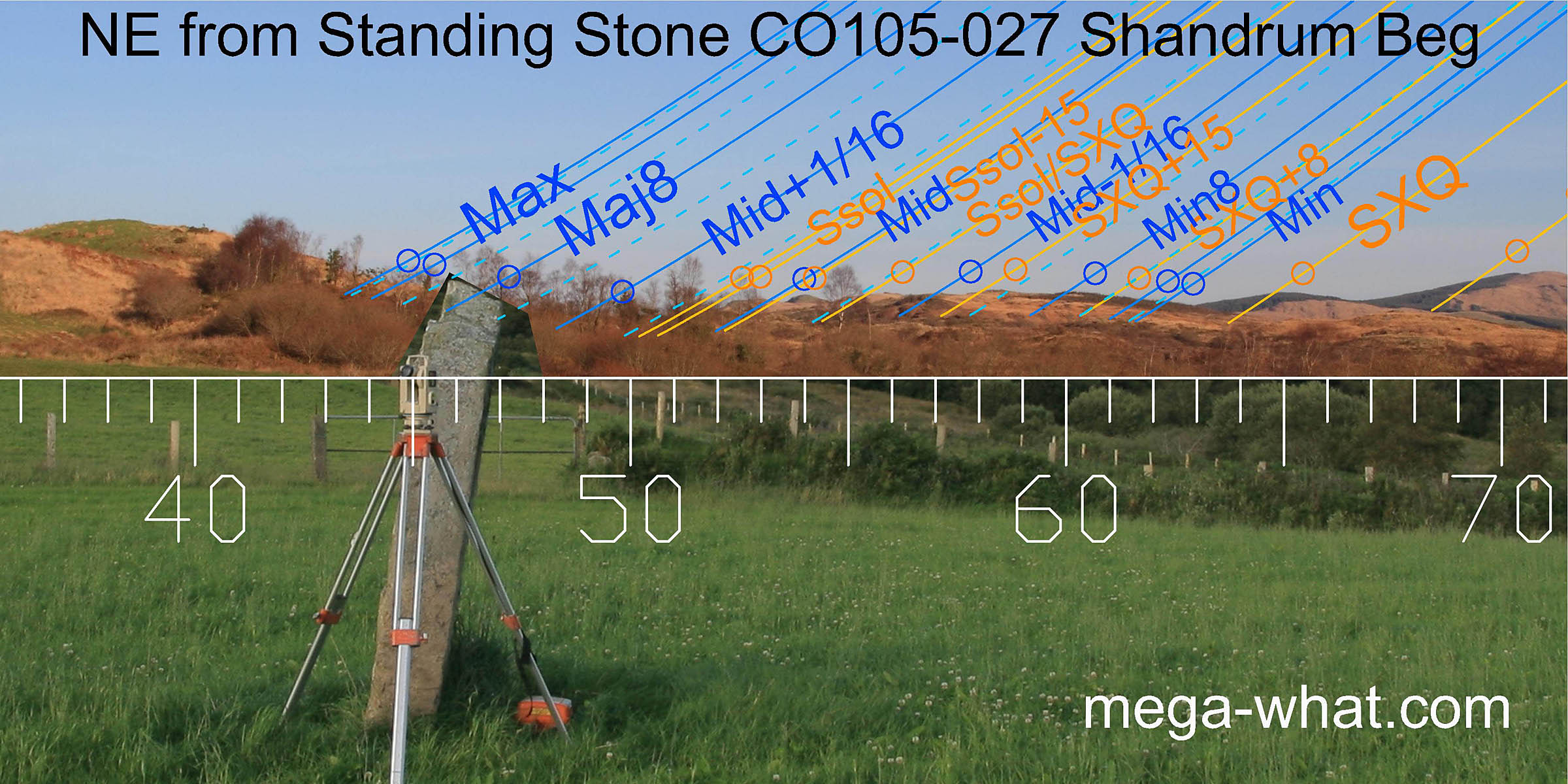
South is on a rise in a dip [Pic]. North is indicated by the intersection of local high ground with far hills [Pic].
![[Pic].](ShandrumBegST-S.jpg)
![[Pic].](ShandrumBegST-N.jpg)
 This site is 688m SW of Cappanaboul Stone Circle, which is on the other side of the hill at the left of this picture.
The stone's axis looks like it indicated the lunar maximum in this direction before the lean developed.
There is also a fallen Standing Stone on the level part of the ridge on this side of the hill that should probably be visible from here.
Both these Standing Stones are almost certainly outliers of the circle.
This site is 688m SW of Cappanaboul Stone Circle, which is on the other side of the hill at the left of this picture.
The stone's axis looks like it indicated the lunar maximum in this direction before the lean developed.
There is also a fallen Standing Stone on the level part of the ridge on this side of the hill that should probably be visible from here.
Both these Standing Stones are almost certainly outliers of the circle.
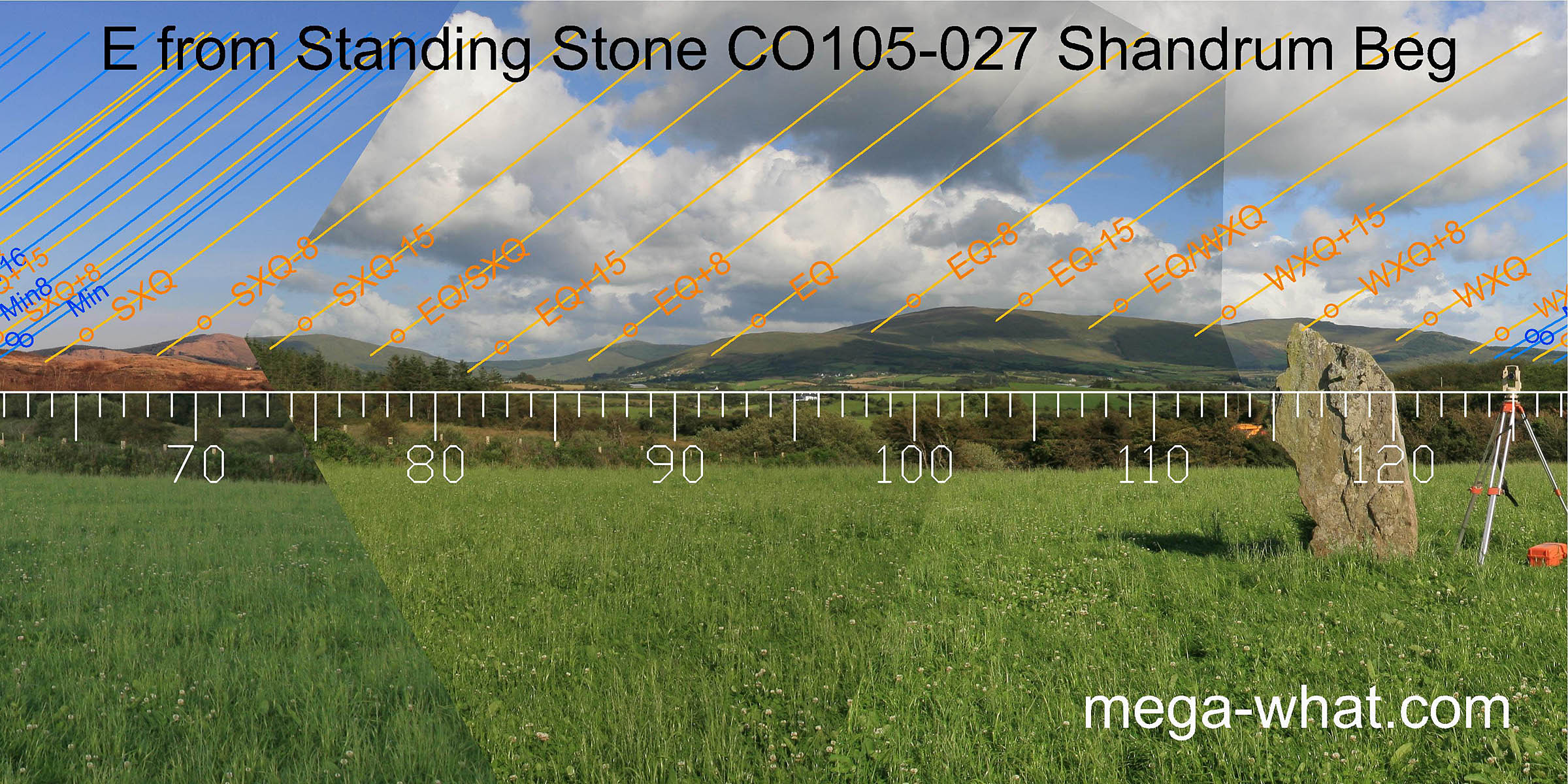 The eastern horizon lacks accuracy except for the halfway points between the equinox and the cross-quarters.
The summer one occurs at a notch formed by the intersection of two horizon layers and is thus quite position sensitive,
the winter one is in a small but obvious dip on the southern slope of Mullaghmesha.
The eastern horizon lacks accuracy except for the halfway points between the equinox and the cross-quarters.
The summer one occurs at a notch formed by the intersection of two horizon layers and is thus quite position sensitive,
the winter one is in a small but obvious dip on the southern slope of Mullaghmesha.
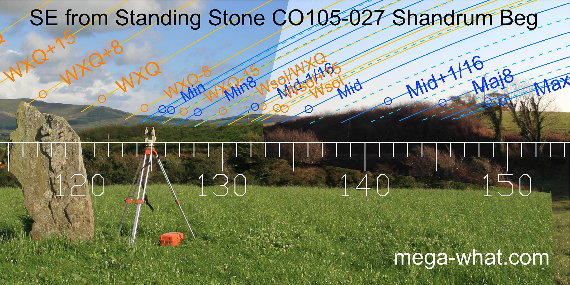 South-eastwards the horizon is much more useful, providing a number of good solar and lunar markers.
The major half of the lunisticeLunistices are the most northerly and southerly moons of the month. The lunar equivalent of solstices - more.
range occurs on local ground with the most extreme moonrise clearly intended to occur at the highest point although bushes now obscure it.
South-eastwards the horizon is much more useful, providing a number of good solar and lunar markers.
The major half of the lunisticeLunistices are the most northerly and southerly moons of the month. The lunar equivalent of solstices - more.
range occurs on local ground with the most extreme moonrise clearly intended to occur at the highest point although bushes now obscure it.
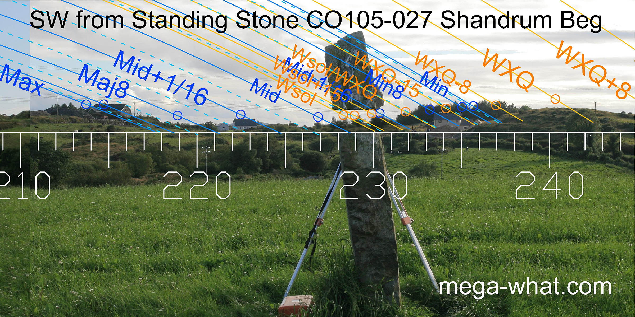 The south-western axis of the stone indicates the winter solstice. This quadrant is also quite a good one but now rather spoiled by trees and buildings.
At the lunar maximum, extensive landscaping for the house built there has considerably modified the horizon profile of the rocky top that was there before.
The hilltop marking the winter cross-quarters are quite close and is thus one of the determinants of this stone's exact position.
The south-western axis of the stone indicates the winter solstice. This quadrant is also quite a good one but now rather spoiled by trees and buildings.
At the lunar maximum, extensive landscaping for the house built there has considerably modified the horizon profile of the rocky top that was there before.
The hilltop marking the winter cross-quarters are quite close and is thus one of the determinants of this stone's exact position.
 The equinox sunset is on the Sugarloaf's south slope, with the top and bottom being a couple of days either side.
The half month brackets for the equinox occur, to the north on the second of two distant mountains,
and to the south it looks to be at the intersect of distant and nearer horizons though a tree now obscures.
The equinox sunset is on the Sugarloaf's south slope, with the top and bottom being a couple of days either side.
The half month brackets for the equinox occur, to the north on the second of two distant mountains,
and to the south it looks to be at the intersect of distant and nearer horizons though a tree now obscures.
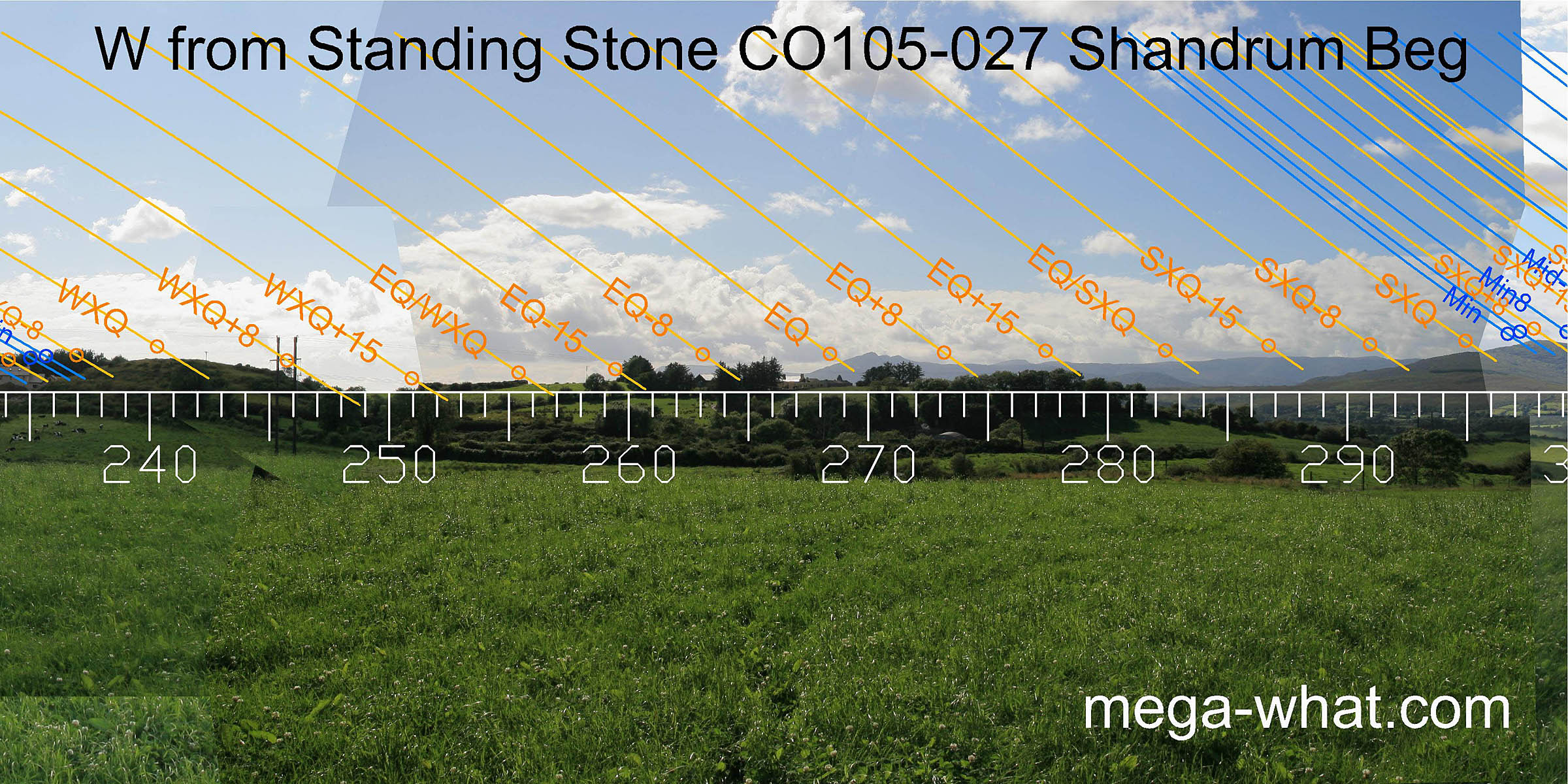
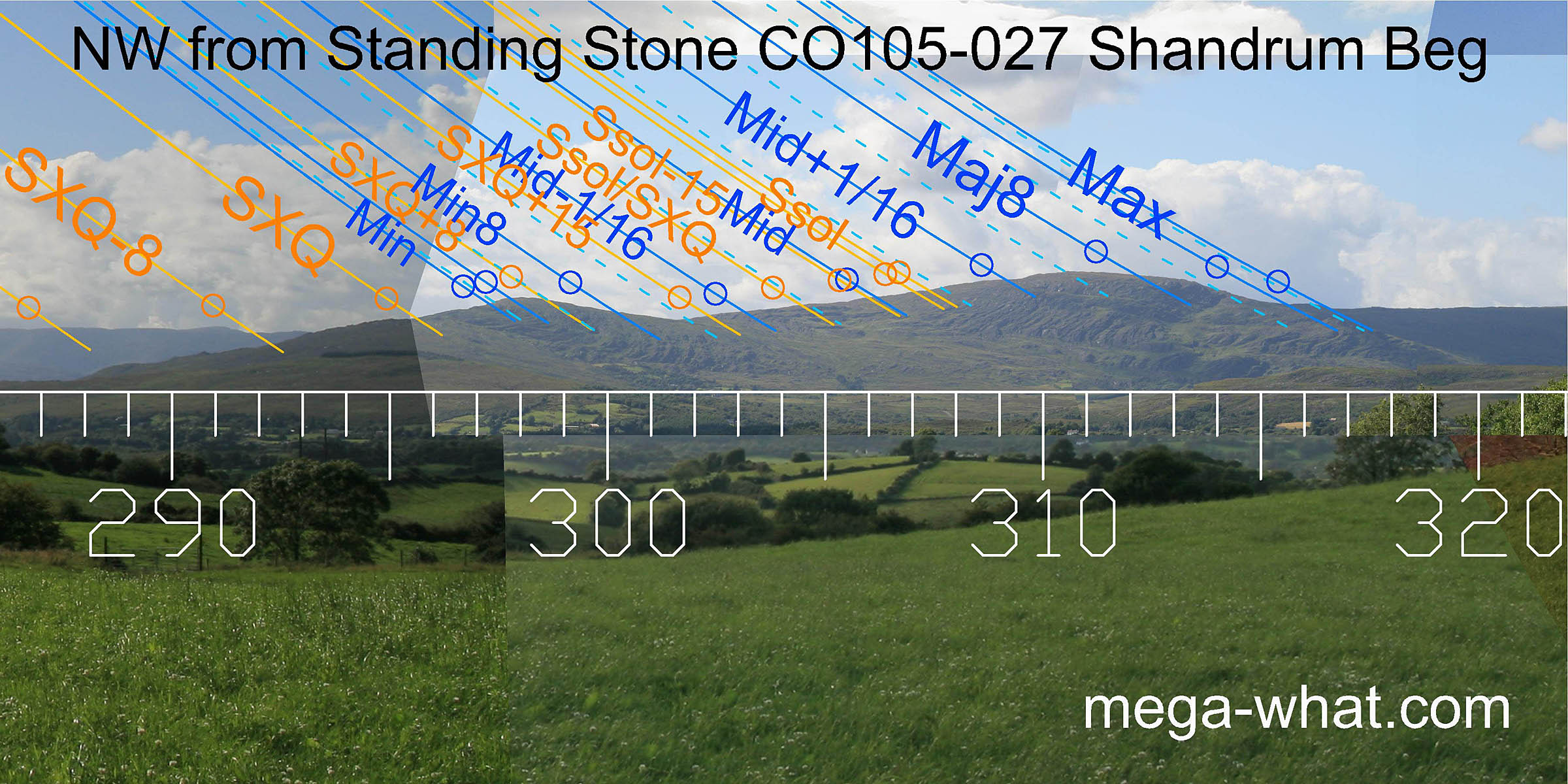 The north-west offers more good solar and lunar markers with the major end of the lunisticeLunistices are the most northerly and southerly moons of the month. The lunar equivalent of solstices - more.
range being particularly good and on a north slope to stretch it out. The major eighth occurs at a slight dip in the middle of the sloping hilltop but interestingly, the limits of the top
(being the highest point and the top of the north slope) coincide with the limits of the period centred on the eighth.
Likewise, the lunar minor eighth is also on a north slope and the prominent dip at the foot of the slope is at the limit of the period centred on it.
The north-west offers more good solar and lunar markers with the major end of the lunisticeLunistices are the most northerly and southerly moons of the month. The lunar equivalent of solstices - more.
range being particularly good and on a north slope to stretch it out. The major eighth occurs at a slight dip in the middle of the sloping hilltop but interestingly, the limits of the top
(being the highest point and the top of the north slope) coincide with the limits of the period centred on the eighth.
Likewise, the lunar minor eighth is also on a north slope and the prominent dip at the foot of the slope is at the limit of the period centred on it.
References
- Archaeological Survey of Ireland, record details. www.archaeology.ie/archaeological-survey-ireland
- POWER, D. et al. 1992 Archaeological Inventory of County Cork, Volume 1: West Cork. Dublin: Stationary Office. p65, no.479.