
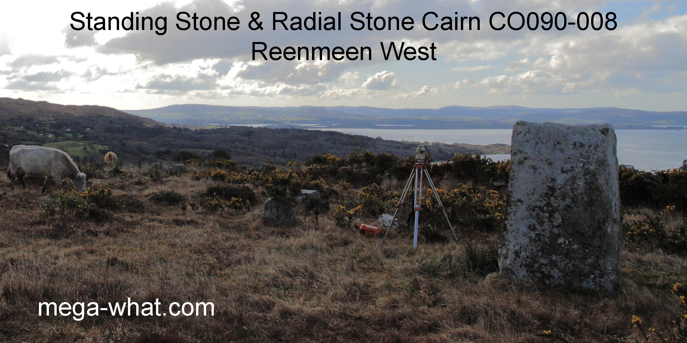
 Reenmeen Standing Stone & Radial Stone Cairn are a couple of kilometres north of Glengarriff. They are only 3m apart and at the southern limit of a five site local group of bronze age monuments.
None of the others are visible from here.
Reenmeen Standing Stone & Radial Stone Cairn are a couple of kilometres north of Glengarriff. They are only 3m apart and at the southern limit of a five site local group of bronze age monuments.
None of the others are visible from here.South is marked by a hilltop within a dip [Pic].
![[Pic].](Reenmeen-S.jpg)
North at a step in a distant ridge, above an intersect and a local rise [Pic].
![[Pic].](Reenmeen-N.jpg)
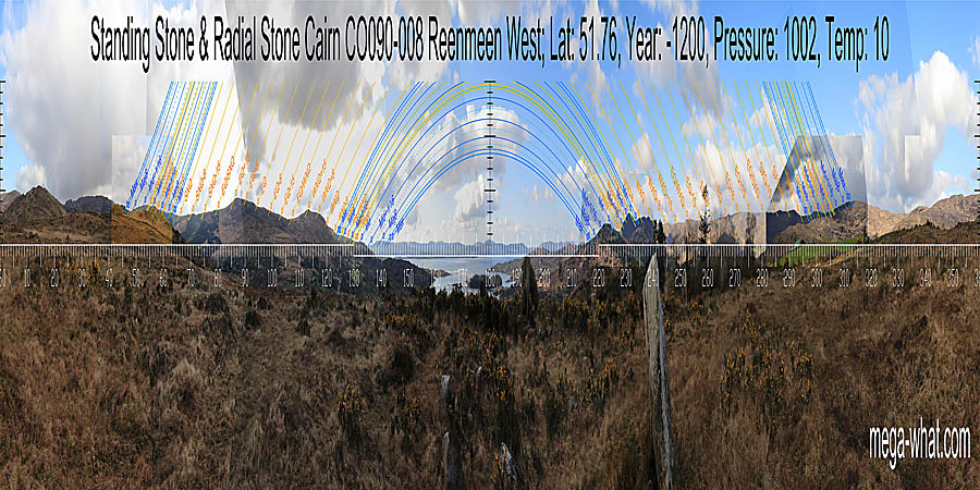
 To the north-east, clever use is made of the interaction of fairly distant horizons with some nearby higher ground. Each monument uses a slightly different local high point for the lunar midpoint.
As this sector is the determining factor for the exact position of the monuments it seems likely that the Standing Stone was there first because it makes better use of the local ground. It is therefore possible that the Standing Stone was erected by the same people who built the nearby Boulder-Burial while once again, as at Shandrum Beg 10.6km to the ESE, the Radial Stone Cairn people were last on the scene.
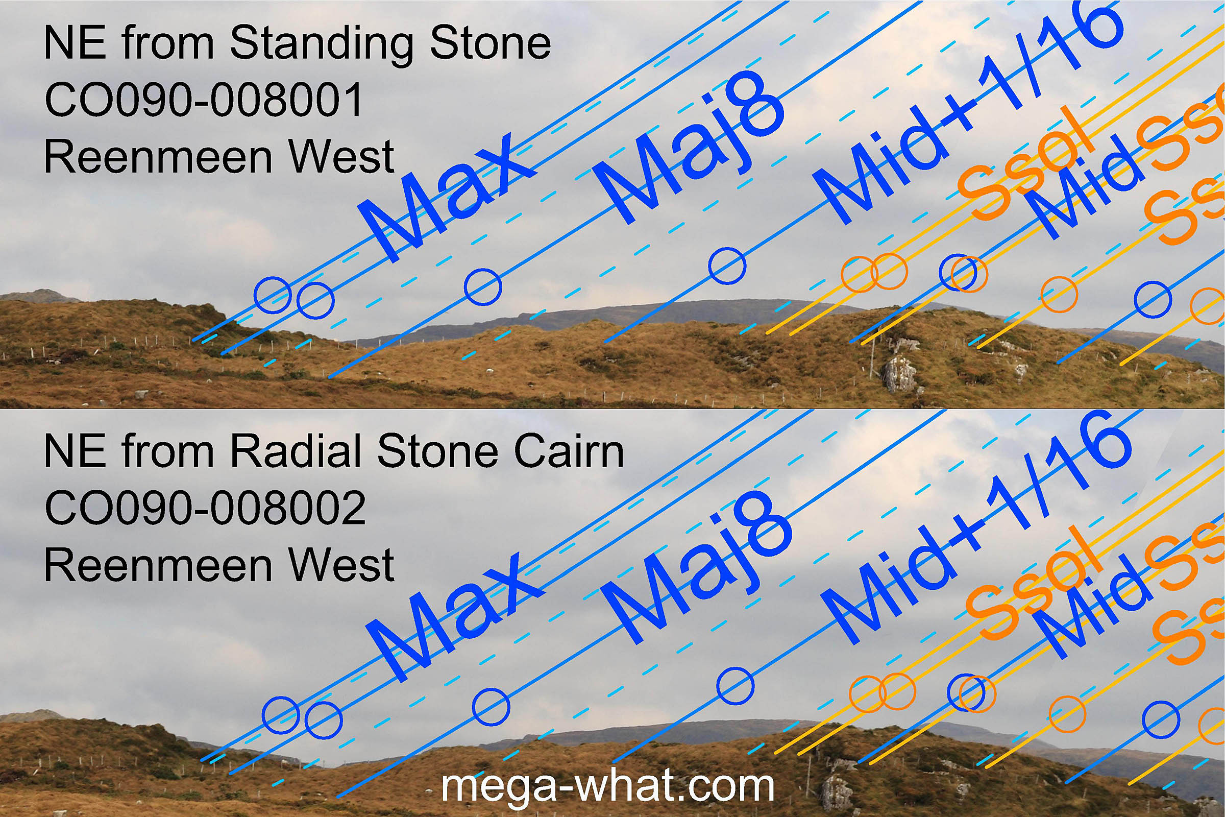
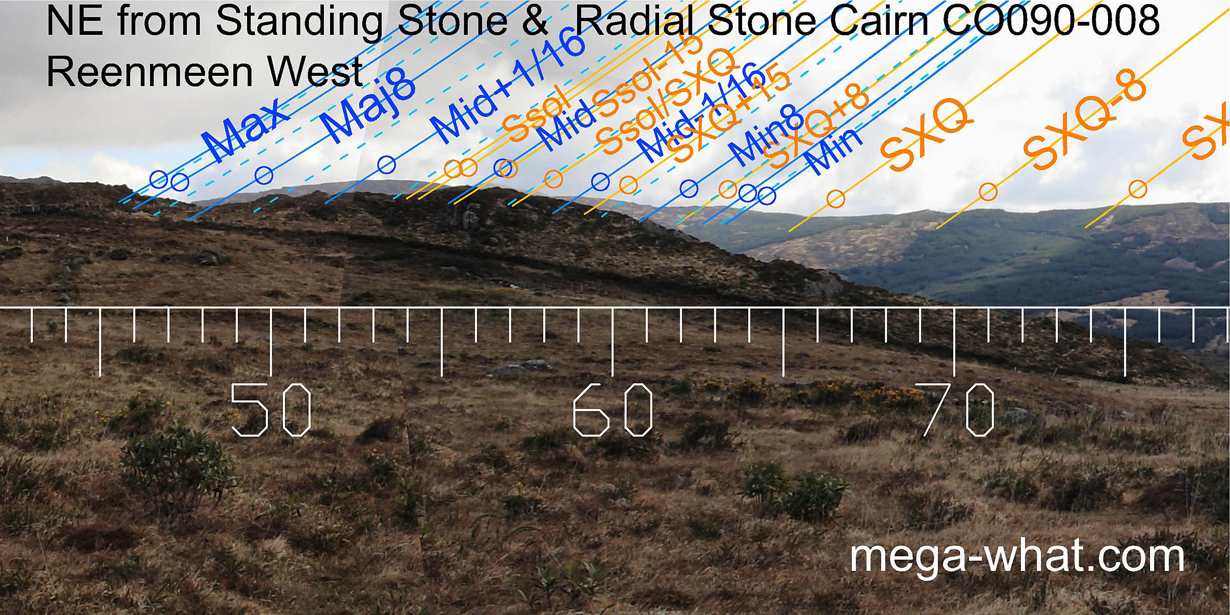 The sixteenth adjacent to the minor standstillLunistice positions vary cyclically over an 18.6 year period but are fairly static for more than a year at either end of the range,
the lunar minor eighth and major eighth all have good markers on the distant horizon.
As do the summer cross-quarter and the quarter-month to its south (before Bealtaine), and it looks like the last two could have been indicated by the Standing Stone axis [Pic].
The sixteenth adjacent to the minor standstillLunistice positions vary cyclically over an 18.6 year period but are fairly static for more than a year at either end of the range,
the lunar minor eighth and major eighth all have good markers on the distant horizon.
As do the summer cross-quarter and the quarter-month to its south (before Bealtaine), and it looks like the last two could have been indicated by the Standing Stone axis [Pic].
![[Pic].](Reenmeen-NEax.jpg)
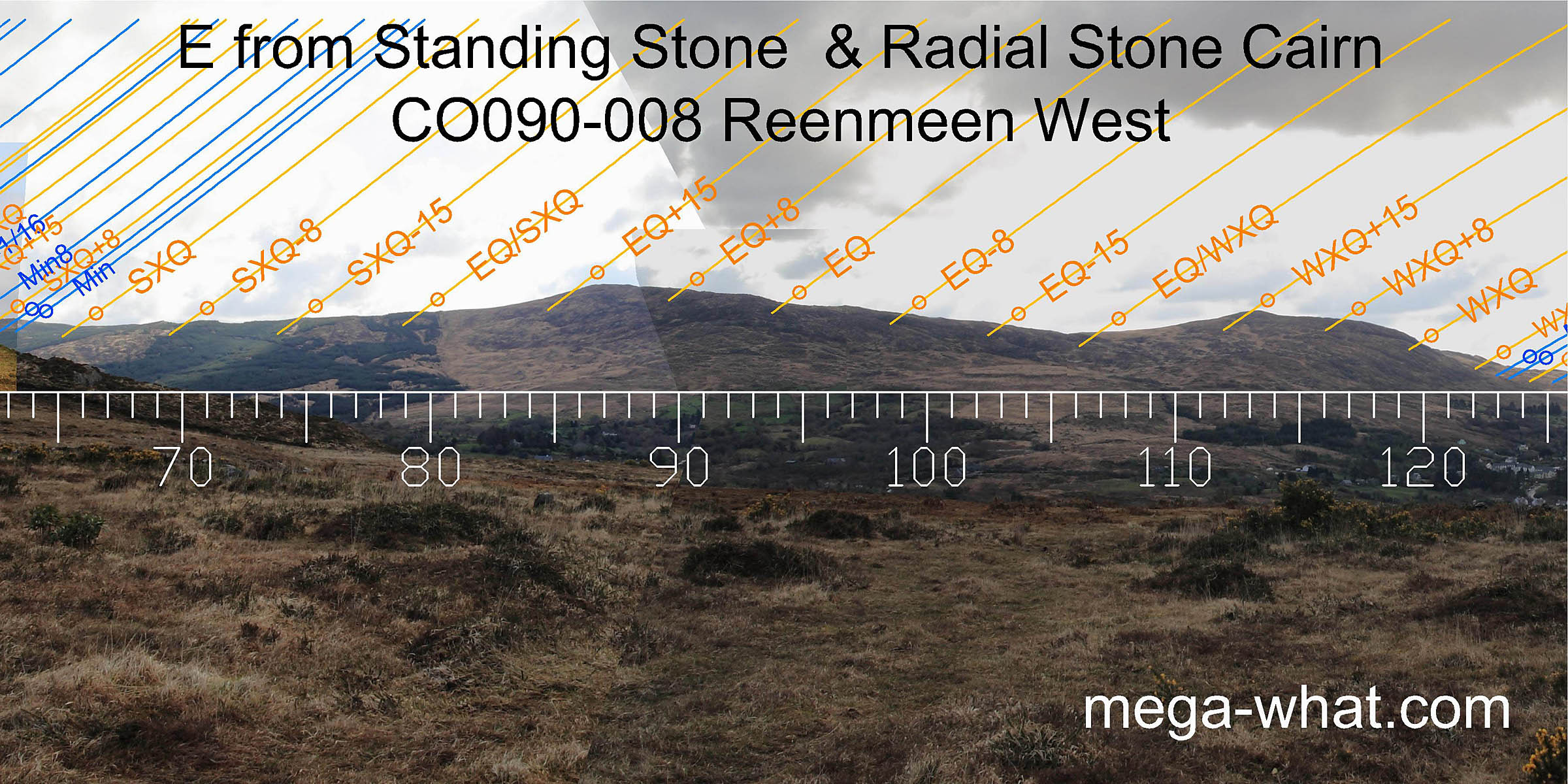 Eastwards, summer cross-quarters are in a dip. winter cross-quarters are at a break / step and the equinox is in a dip. The half-months to the north of these last two are marked by the hilltops.
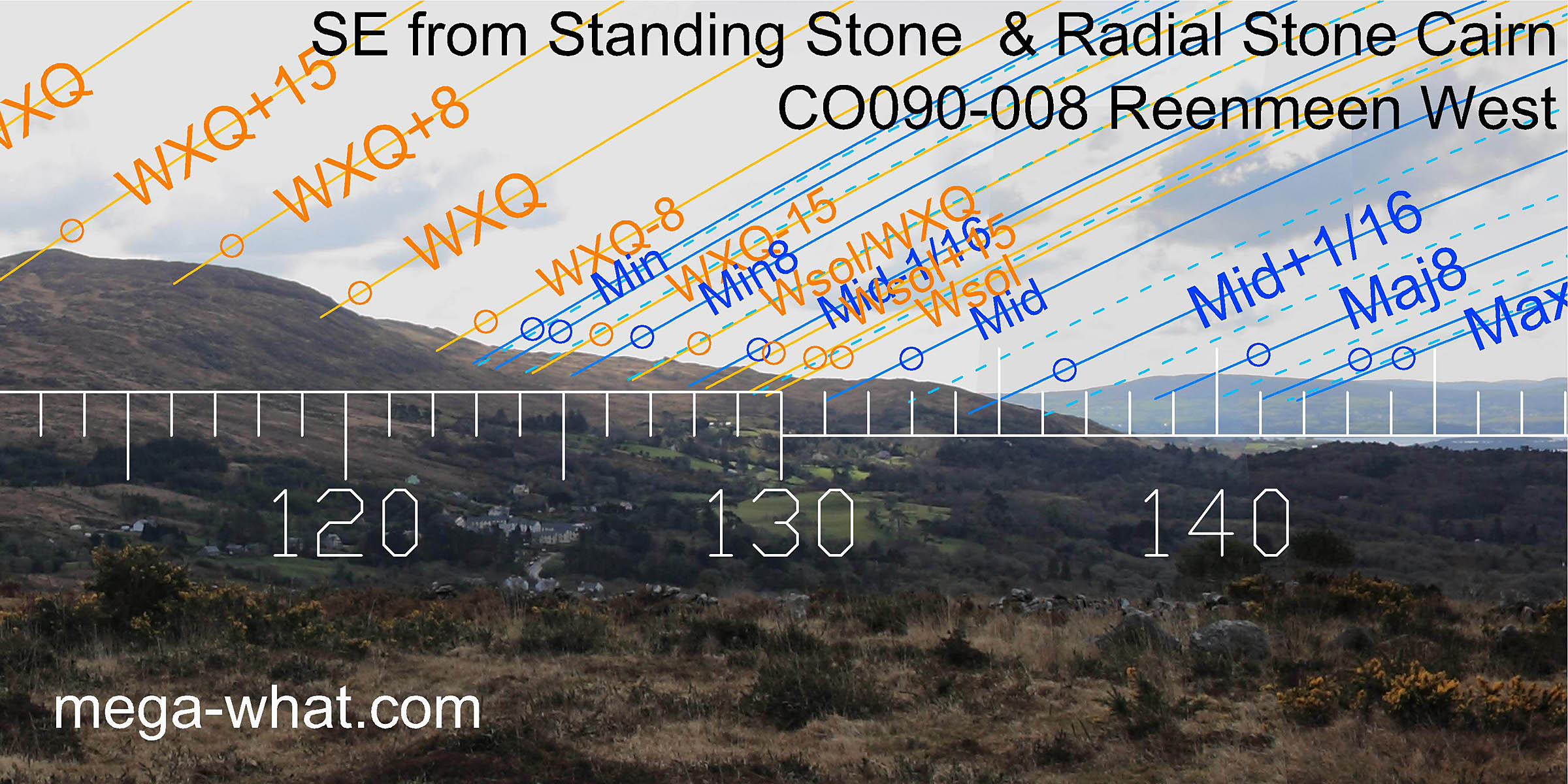 The south-eastern lunisticeLunistices are the most northerly and southerly moons of the month. The lunar equivalent of solstices - more.
zone is well marked.
The south-eastern lunisticeLunistices are the most northerly and southerly moons of the month. The lunar equivalent of solstices - more.
zone is well marked.
Minor standstillLunistice positions vary cyclically over an 18.6 year period but are fairly static for more than a year at either end of the range, winter solstice and major standstillLunistice positions vary cyclically over an 18.6 year period but are fairly static for more than a year at either end of the range are all in dips.
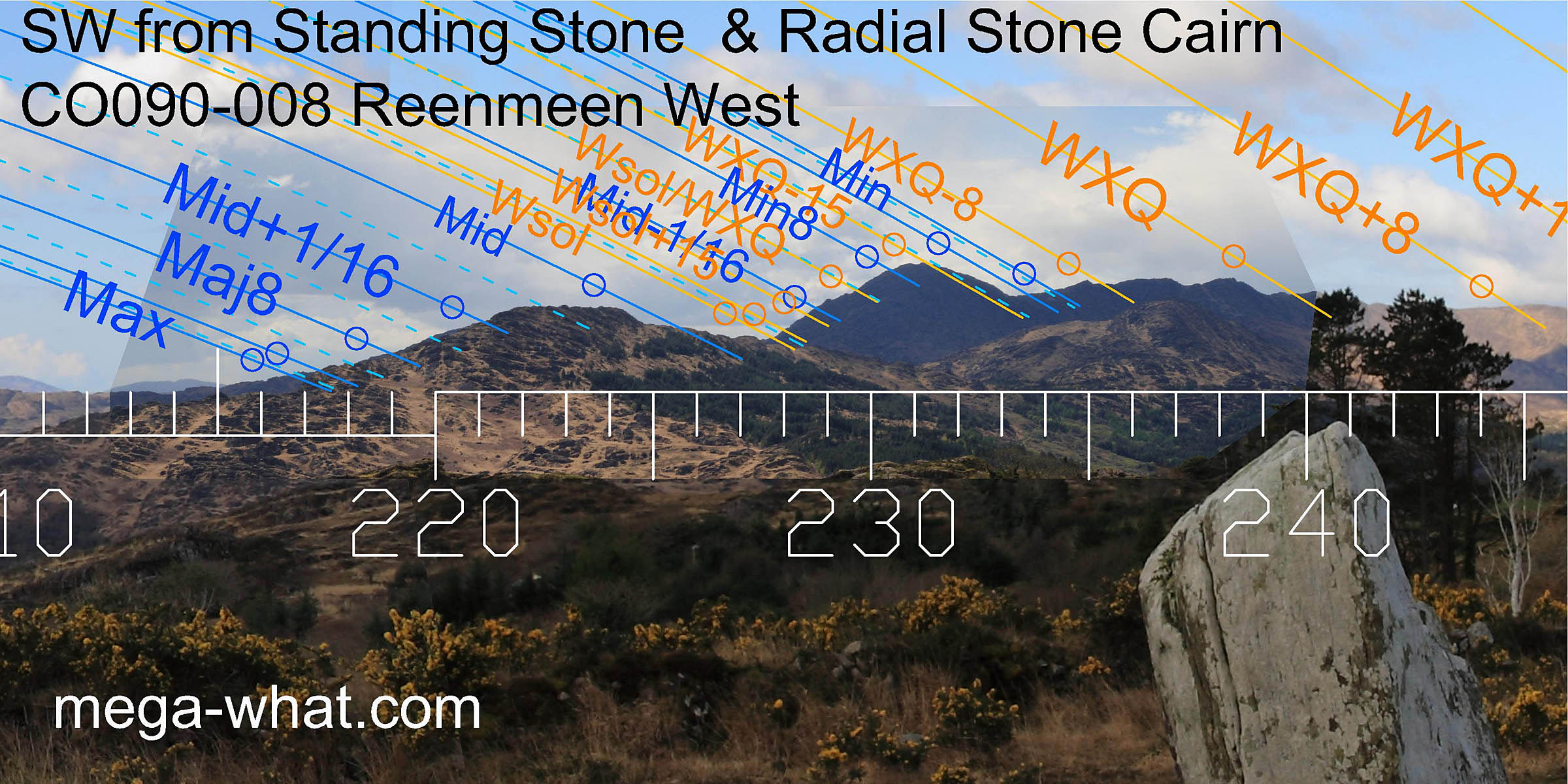 The south-western horizon again shows a good fit with both the lunisticeLunistices are the most northerly and southerly moons of the month. The lunar equivalent of solstices - more.
range and winter sunsets up to and including the cross-quarter.
It is interesting to note how the highest hilltop here marks the half-month south of the cross-quarter while the half-month to its north is marked by the equivalent south-eastern hilltop.
The south-western horizon again shows a good fit with both the lunisticeLunistices are the most northerly and southerly moons of the month. The lunar equivalent of solstices - more.
range and winter sunsets up to and including the cross-quarter.
It is interesting to note how the highest hilltop here marks the half-month south of the cross-quarter while the half-month to its north is marked by the equivalent south-eastern hilltop.
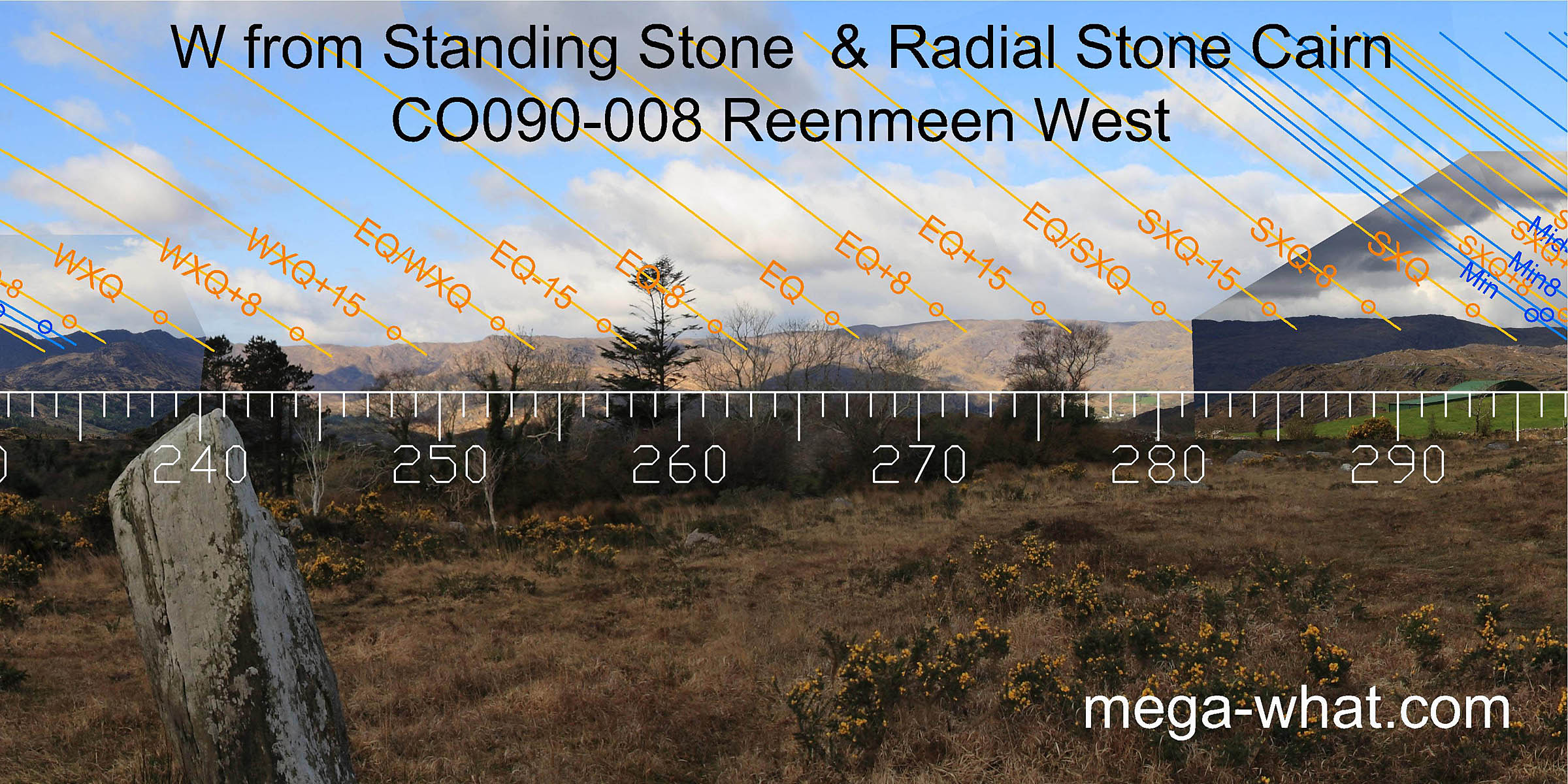 To the west, the central part of the year is once again less well marked though it is a little better than the east.
There are useful markers for the equinox and also the halfway points to both cross-quarters, the southern one being indicated by the Standing Stone's axis [Pic].
To the west, the central part of the year is once again less well marked though it is a little better than the east.
There are useful markers for the equinox and also the halfway points to both cross-quarters, the southern one being indicated by the Standing Stone's axis [Pic].
![[Pic].](Reenmeen-SWax.jpg)
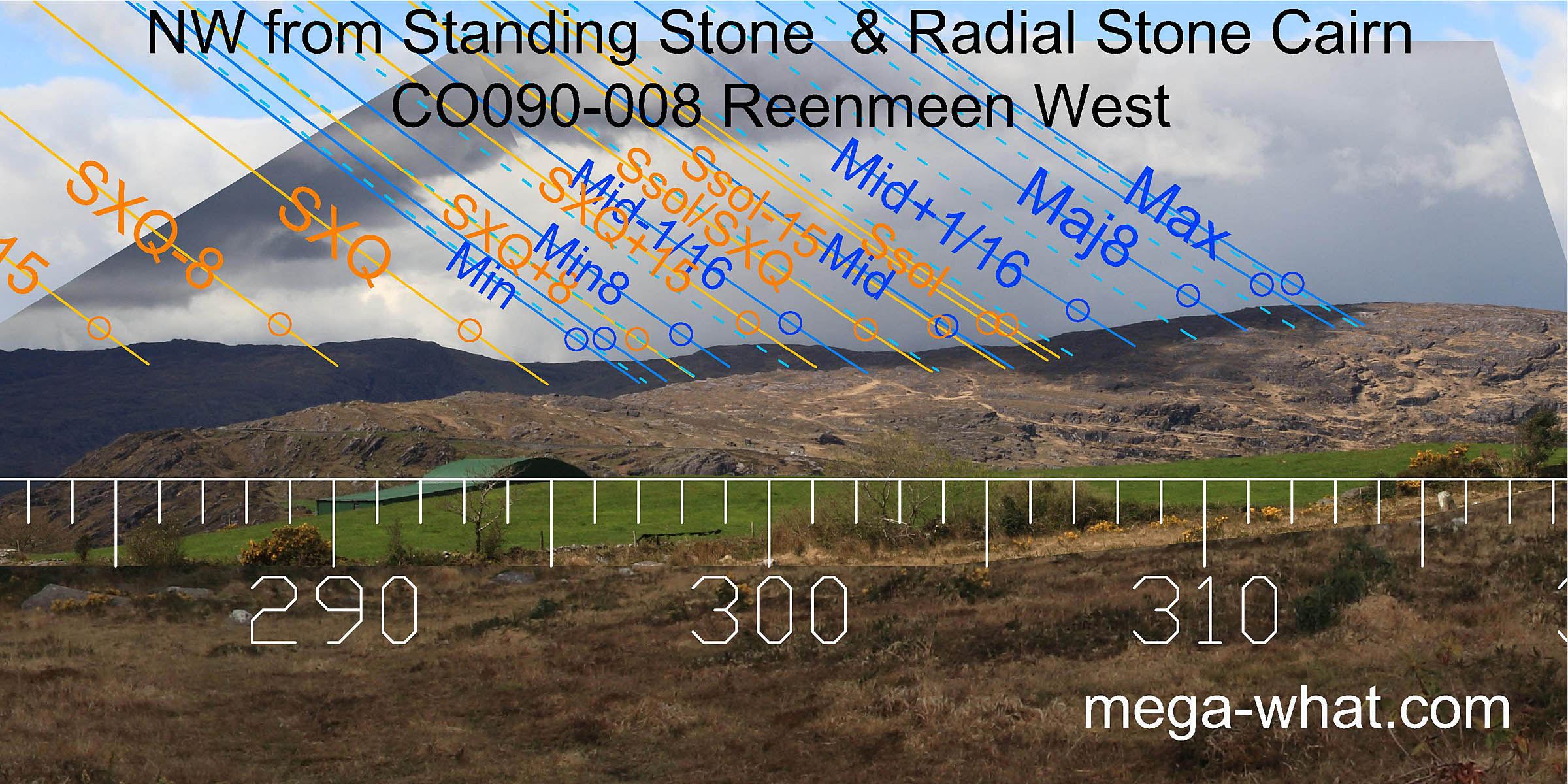 North-westwards there is again a good correlation between significant landscape features and luni-solar cycles.
Notably there is good pairing between the lunar eighths and the period around the cross-quarter.
North-westwards there is again a good correlation between significant landscape features and luni-solar cycles.
Notably there is good pairing between the lunar eighths and the period around the cross-quarter.
- Currakeal Stone Row is c.530m @ 18°
- Currakeal Boulder-Burial is c.560m @ 18°
- Canrooska Stone Row & Five Stone Circle are c.600m @ 10°
- Canrooska Standing Stone is c.800m @ 4°
- Shandrum Radial Stone Cairn is 10.6km south-east, near Kealkill.
References
- Archaeological Survey of Ireland, record details. www.archaeology.ie/archaeological-survey-ireland
- Ó'NUALLÁIN, SEÁN 1984 Grouped Standing Stones, Radial-Stone Cairns and Enclosures in the South of Ireland. Journal of the Royal Society of Antiquaries of Ireland 114:63-79, p77, no.16.
- POWER, D. et al. 1992 Archaeological Inventory of County Cork, Volume 1: West Cork. Dublin: Stationary Office, p64:no.469, p28:no.90.