
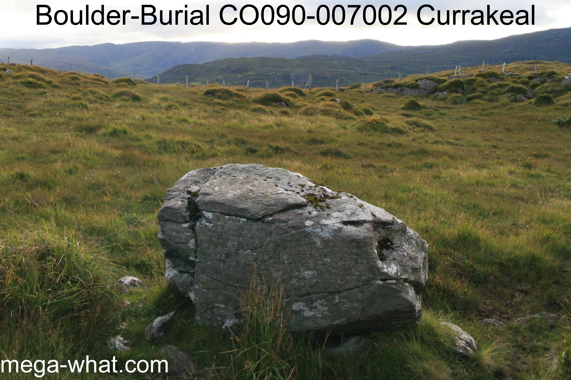
 Currakeal Boulder-Burial is a couple of kilometres north of Glengarriff and is part of a five site local monument group.
It is in a saddle, on slightly lower ground than the Stone Rows either side of it.
Currakeal Boulder-Burial is a couple of kilometres north of Glengarriff and is part of a five site local monument group.
It is in a saddle, on slightly lower ground than the Stone Rows either side of it.
South is in the centre of a dip of the local ridge that is c.50m away but marked by a nearer boulder (c.28m away) that cuts it [Pic].
![[Pic].](CurrakealBB-S.jpg)
North is in the centre of an intersect notch in the local hilltop [Pic].
![[Pic].](CurrakealBB-N.jpg)
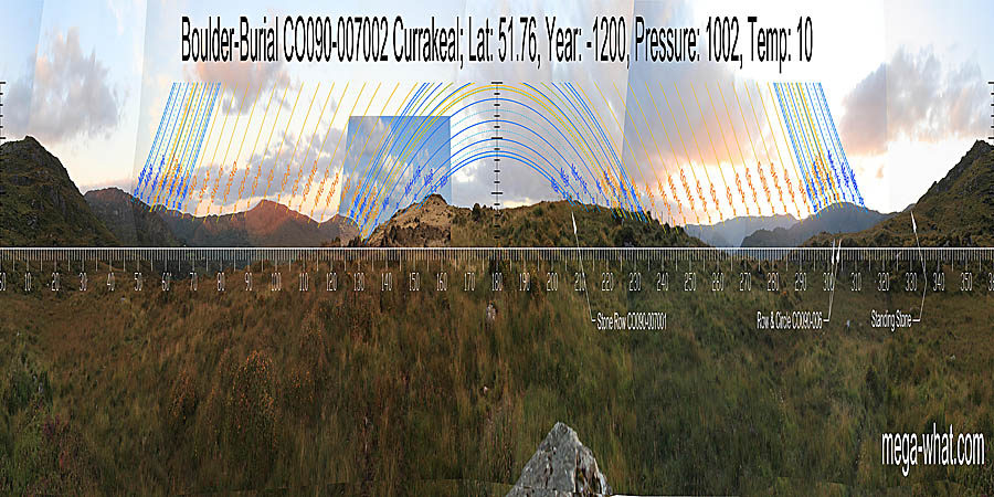
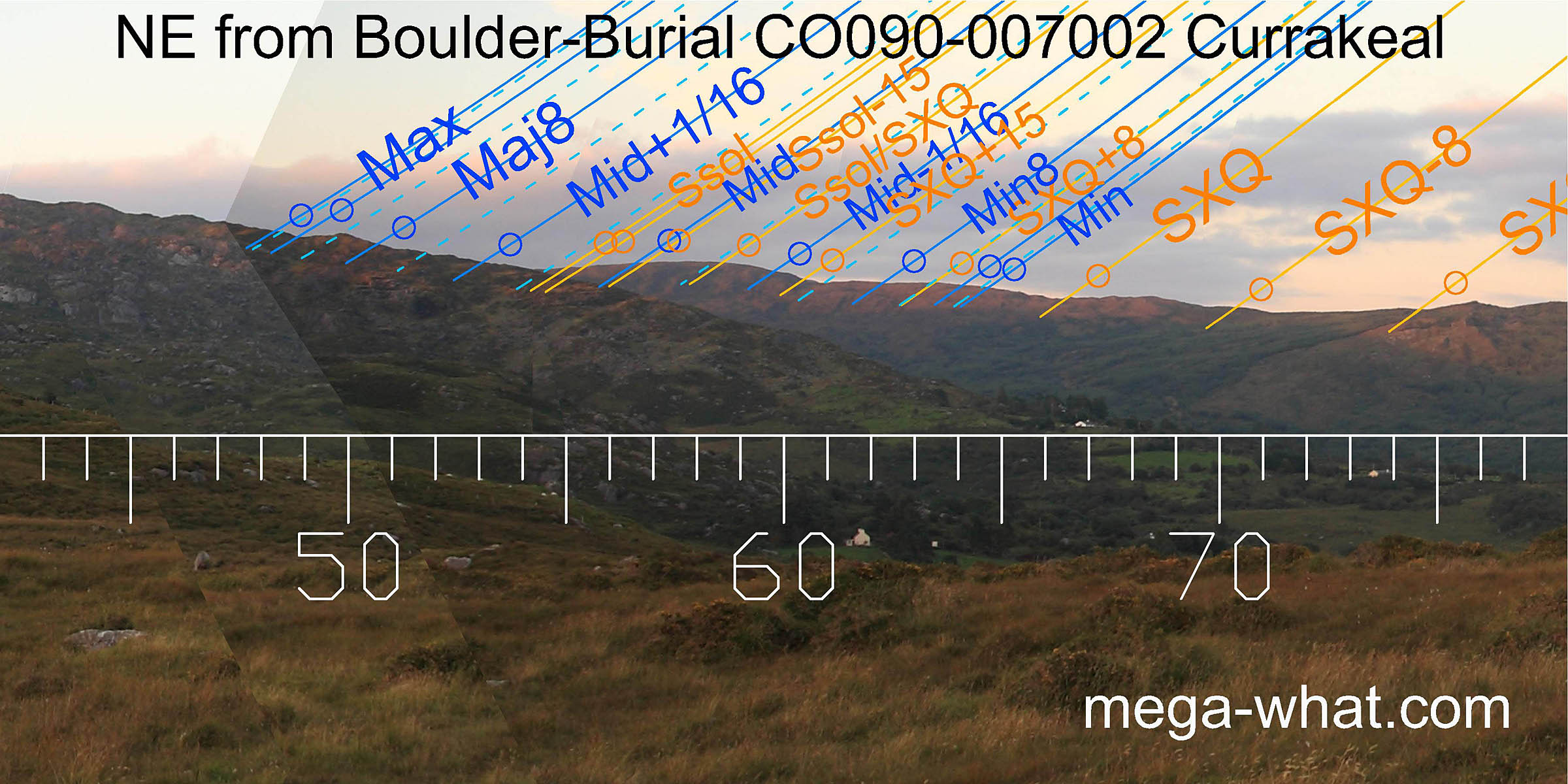 To the north-east, lunar major standstillLunistice positions vary cyclically over an 18.6 year period but are fairly static for more than a year at either end of the range
is at the same place on the nearer ridge as from
Currakeal Stone Row but the intersect notch is closer to the upper limb of summer solstice sunrise.
The period surrounding summer cross-quarters are marked with similar accuracy from both sites.
To the north-east, lunar major standstillLunistice positions vary cyclically over an 18.6 year period but are fairly static for more than a year at either end of the range
is at the same place on the nearer ridge as from
Currakeal Stone Row but the intersect notch is closer to the upper limb of summer solstice sunrise.
The period surrounding summer cross-quarters are marked with similar accuracy from both sites.
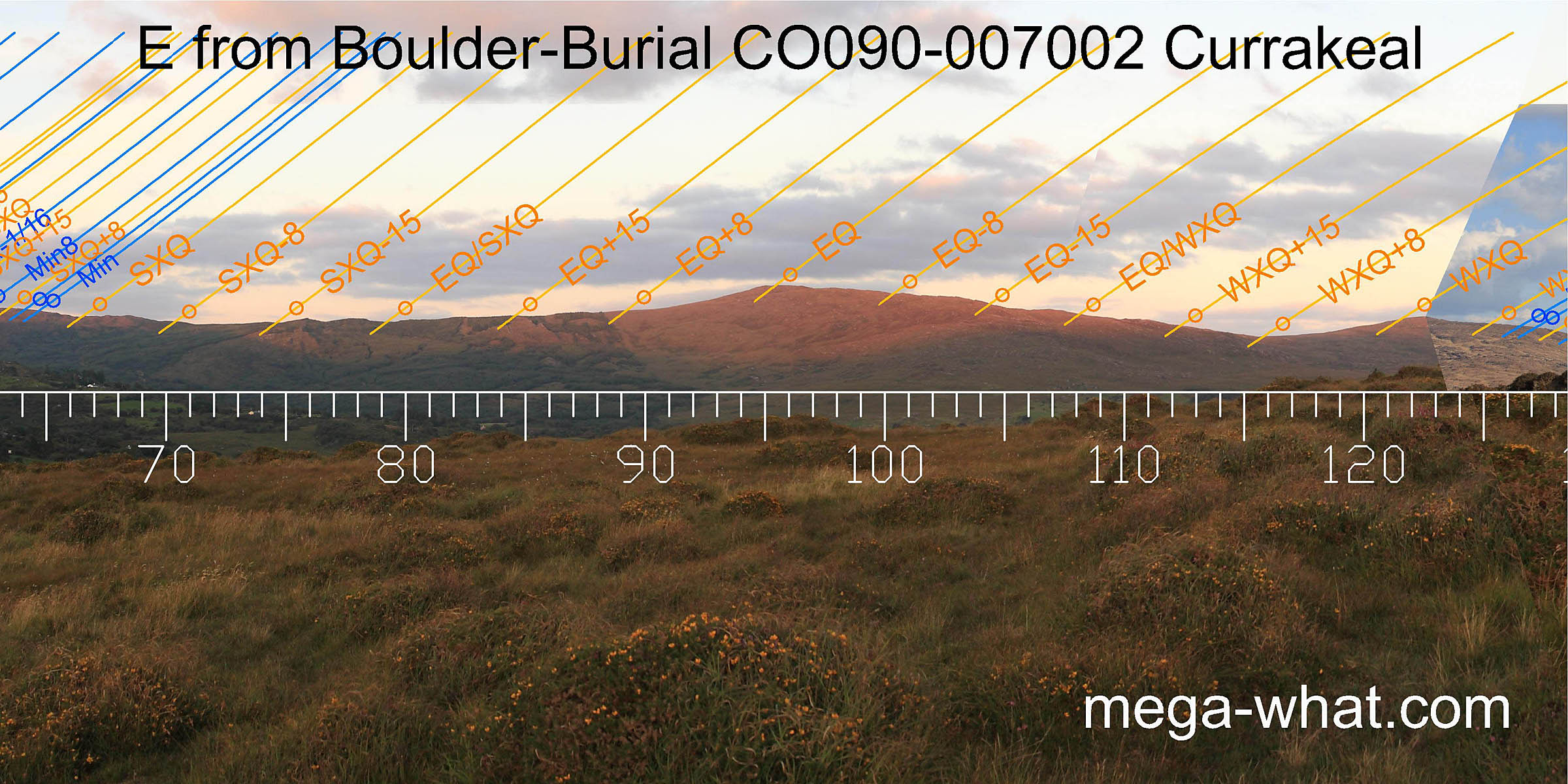 The eastern hill is more accurately equinoctial from here than from either of the two Stone Rows. Winter cross-quarters are on a hilltop and its north basal dip is a quarter-month from it.
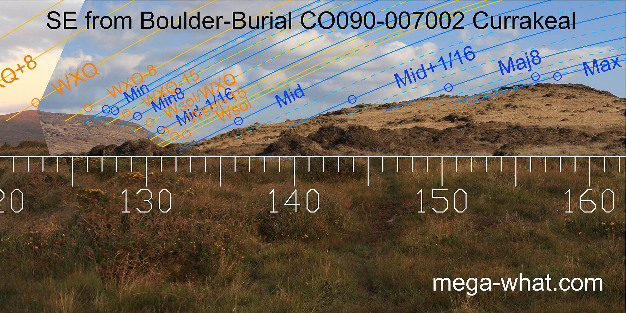 South-eastwards, winter solstice is in the intersect notch. This distant sector is much the same as from
Canrooska Stone Row because the positional displacement of the site is in that direction.
On the nearer ground however, c.200m away at its closest, the lunisticeLunistices are the most northerly and southerly moons of the month. The lunar equivalent of solstices - more.
range has shifted eastwards along with the observing position.
South-eastwards, winter solstice is in the intersect notch. This distant sector is much the same as from
Canrooska Stone Row because the positional displacement of the site is in that direction.
On the nearer ground however, c.200m away at its closest, the lunisticeLunistices are the most northerly and southerly moons of the month. The lunar equivalent of solstices - more.
range has shifted eastwards along with the observing position.
This photo was taken from the top of the boulder so as to see over some gorse bushes and nearer ground - the bottom of the saddle was measured from there too and it seems that using the top of the monument as an observing position was intended.
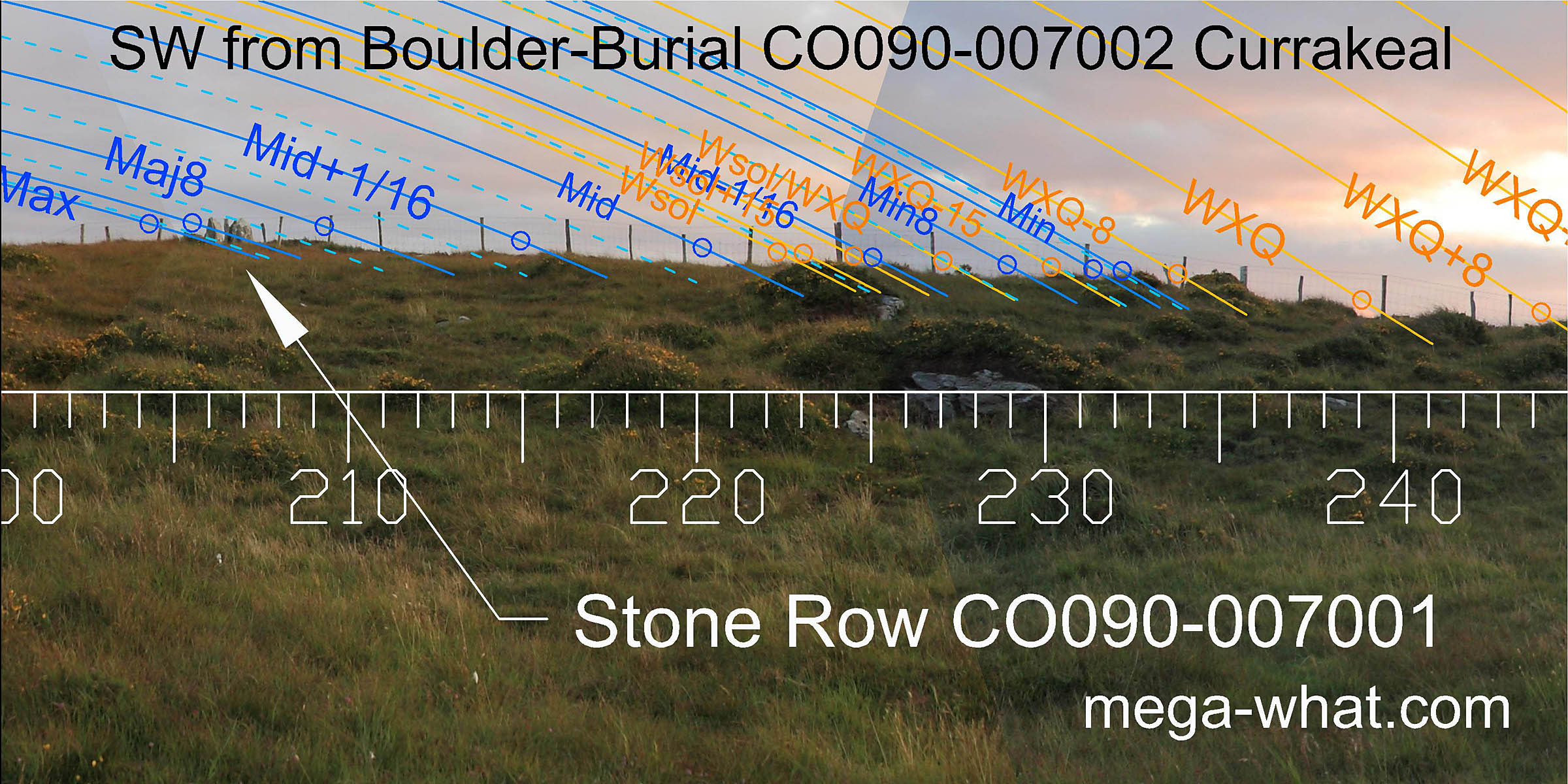 The south-western horizon is local and slightly distorted by a low bank that is c.40m away but the natural horizon would be only a few metres beyond it.
All the other sites have a distant view of great utility in this direction.
The south-western horizon is local and slightly distorted by a low bank that is c.40m away but the natural horizon would be only a few metres beyond it.
All the other sites have a distant view of great utility in this direction.
Currakeal Stone Row (c.48m away) is axially indicated by the boulder as well as being a horizon marker. This is the only case so far encountered where one major Cork / Kerry Complex monument is a visual target from another of a different type. Thus it appears that the Boulder-Burial was built later than the Stone Rows.
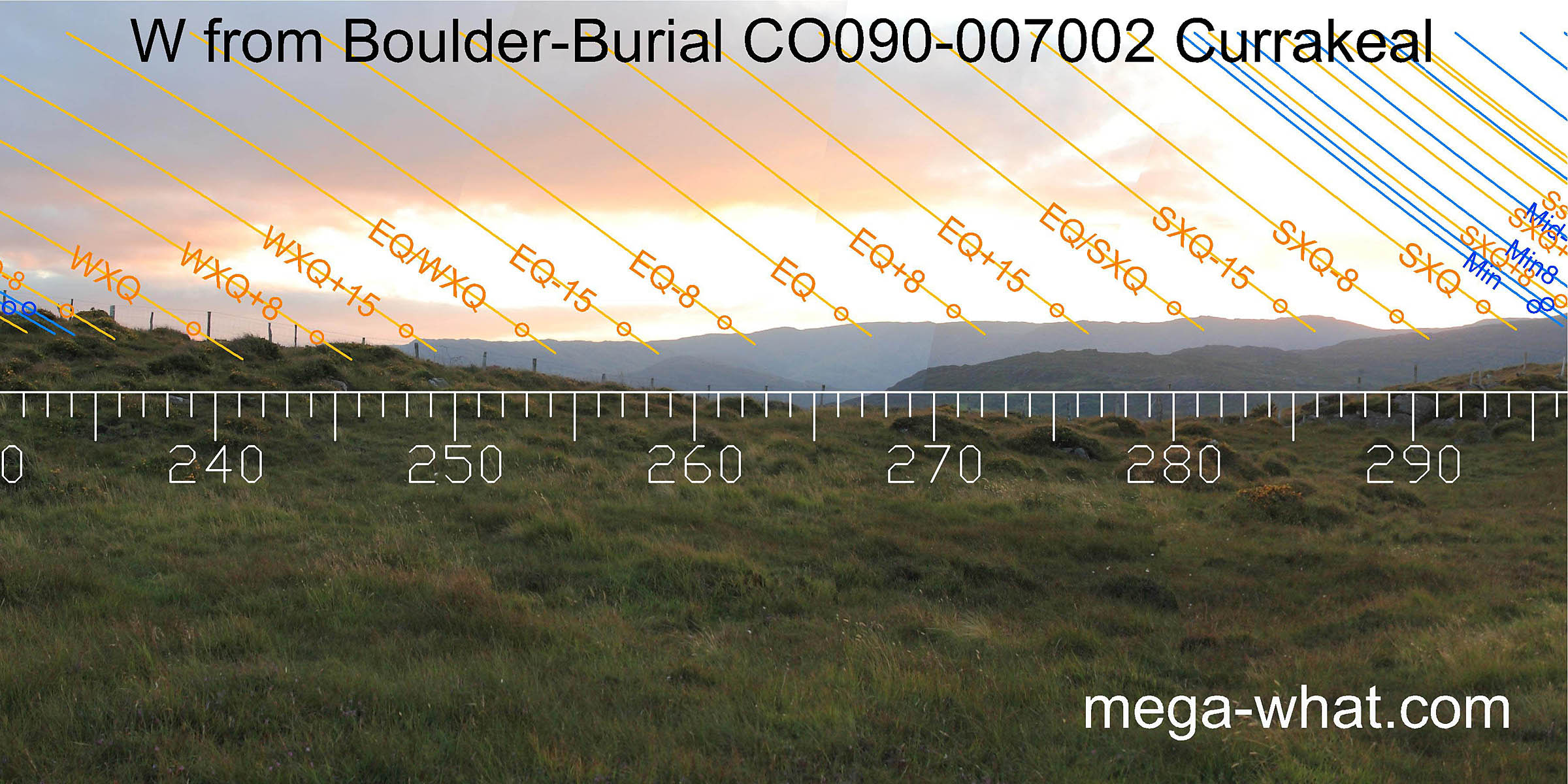 The view of distant western horizon is not significantly different to that from either of the two Stone Rows.
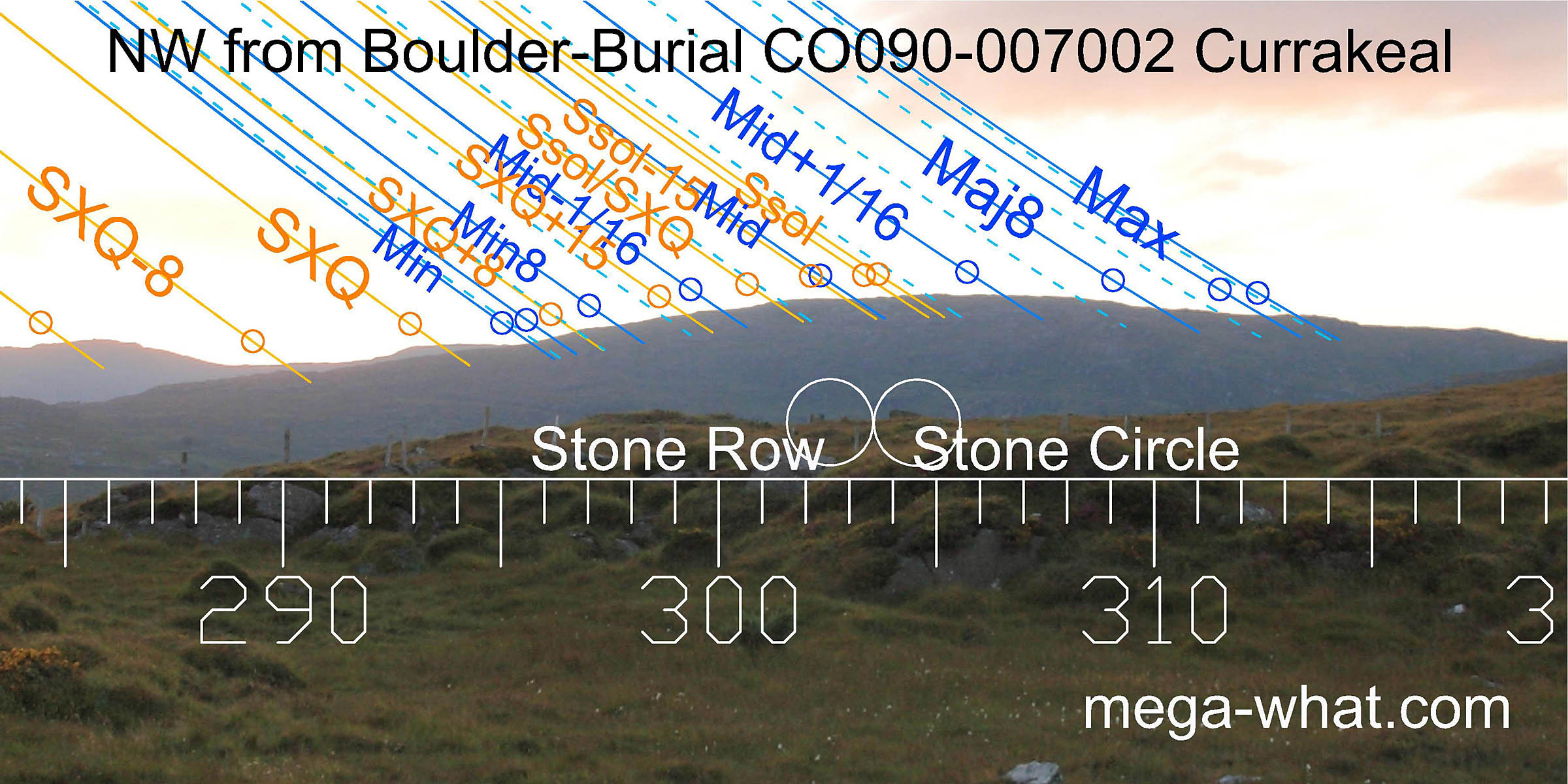 To the north-west, the theme is "lunar nodal cycle spanning the hilltop with summer solstice sunset in the middle".
The view from here is most similar to that from Currakeal Stone Row
but in this case, the terminal dip of the sequence is accurate for the sixteenth adjacent to the major limit rather than the
standstillLunistice positions vary cyclically over an 18.6 year period but are fairly static for more than a year at either end of the range
itself.
To the north-west, the theme is "lunar nodal cycle spanning the hilltop with summer solstice sunset in the middle".
The view from here is most similar to that from Currakeal Stone Row
but in this case, the terminal dip of the sequence is accurate for the sixteenth adjacent to the major limit rather than the
standstillLunistice positions vary cyclically over an 18.6 year period but are fairly static for more than a year at either end of the range
itself.
This site and a number of others form a compact local group:
- Currakeal Stone Row is c.30m to the south-south-west.
- Canrooska Stone Row & Five Stone Circle are c.90m to the north-west.
- Canrooska Standing Stone is about 280m to the north-north-west.
- Reenmeen Standing Stone is about 560m to the south-south-west and has a Radial Stone Cairn beside it.
The only other example to date of one major Cork / Kerry monument targeting another that is not a Standing Stone or a Cairn is Murrahin Stone Row which has Lissaclarig Stone Row on its horizon, 1.05km away, in a solar position.
References
- Archaeological Survey of Ireland, record details. www.archaeology.ie/archaeological-survey-ireland
- RONAN, S. et al. 2009 Archaeological Inventory of County Cork, Volume 5. Dublin: Stationary Office. p13, no.15332.