
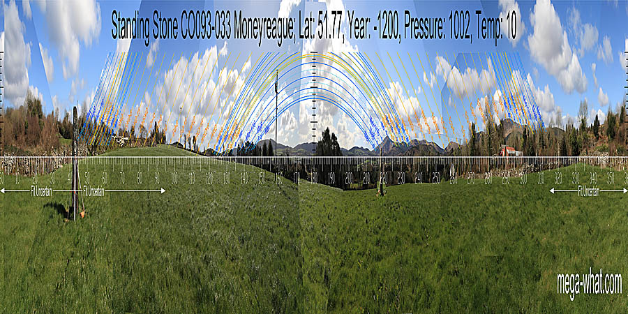
 Moneyreague Standing Stone is about a kilometre north of Togher bridge on the R585 between Kealkill and Macroom. It is a large stone that has been excavated and restored.
South is on a hilltop [Pic].
![[Pic].](Moneyreague-S.jpg)
North is on local high ground but detail is obscured [Pic].
![[Pic].](Moneyreague-N.jpg)
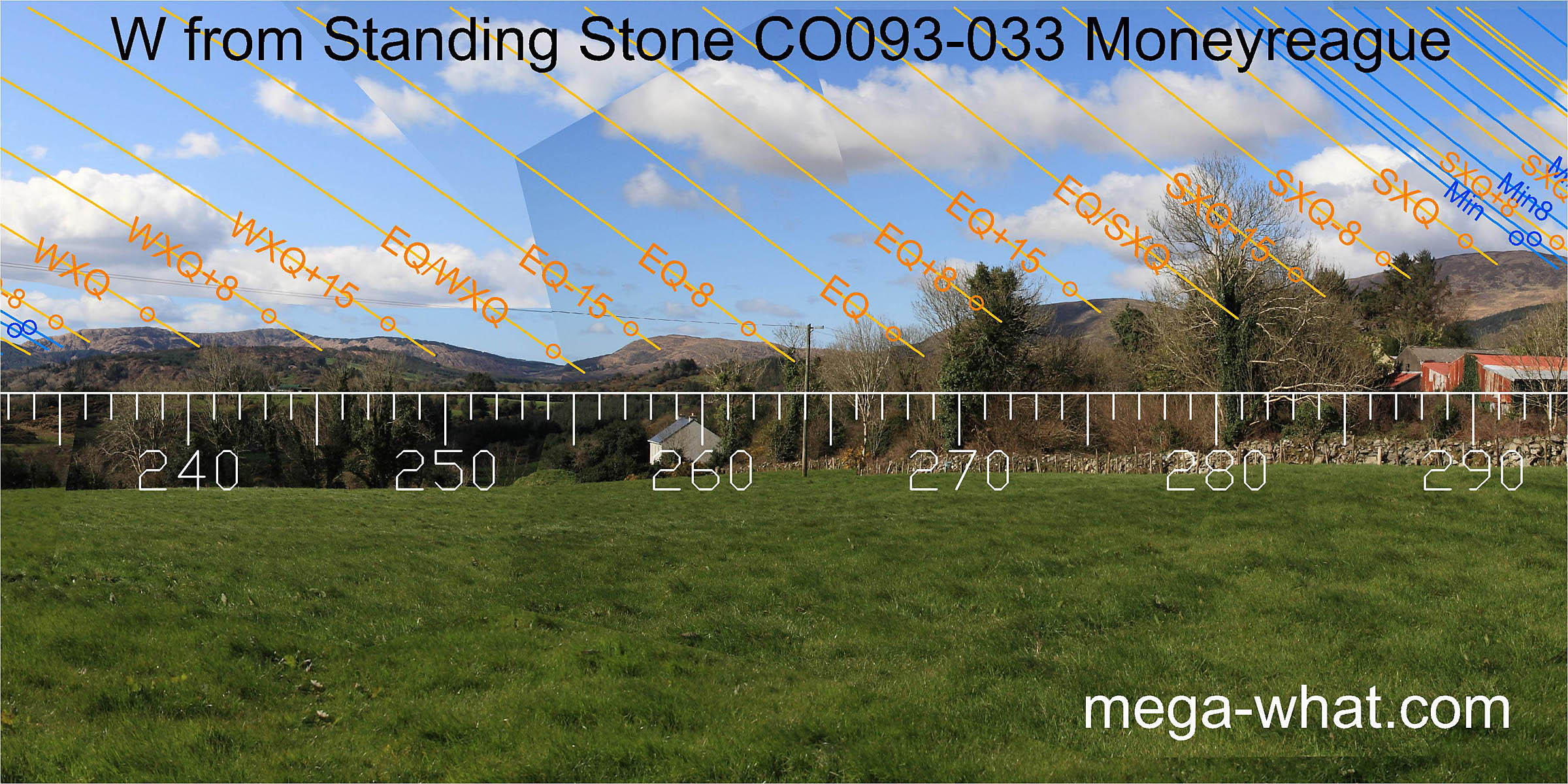
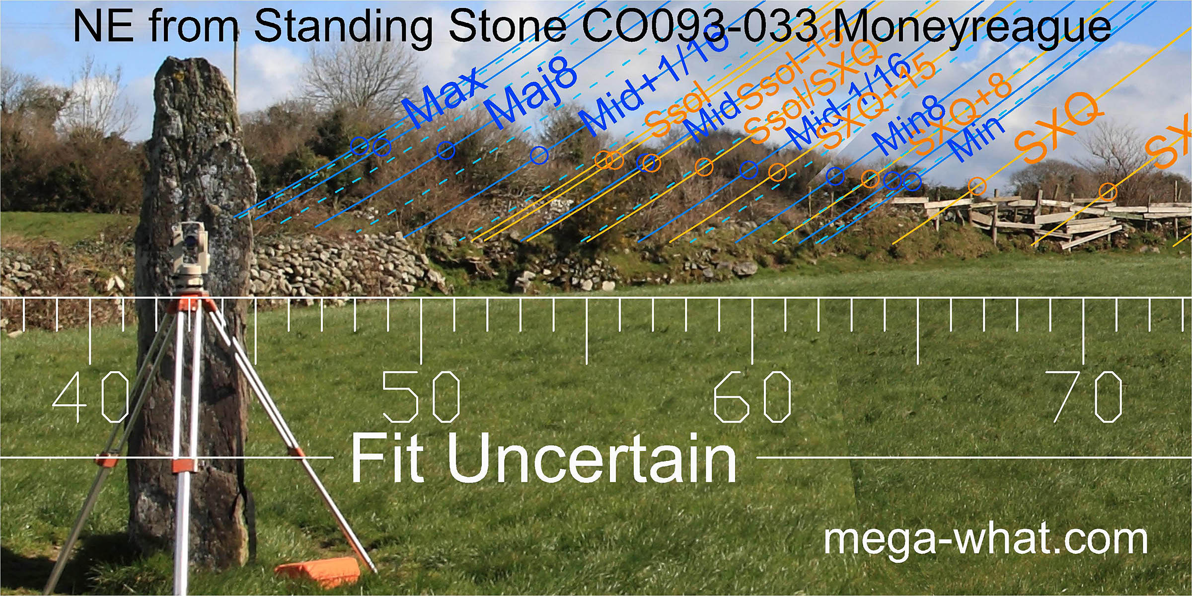 The north-east horizon is the nearest but completely obscured by trees and a wall.
Unsurveyable, it does not appear to be a quadrant of high utility - perhaps that is why the site only rates a standing stone and not a major monument.
The north-east horizon is the nearest but completely obscured by trees and a wall.
Unsurveyable, it does not appear to be a quadrant of high utility - perhaps that is why the site only rates a standing stone and not a major monument.
There will nonetheless be local undulations / intersects that may have been important to the choice of this exact location.
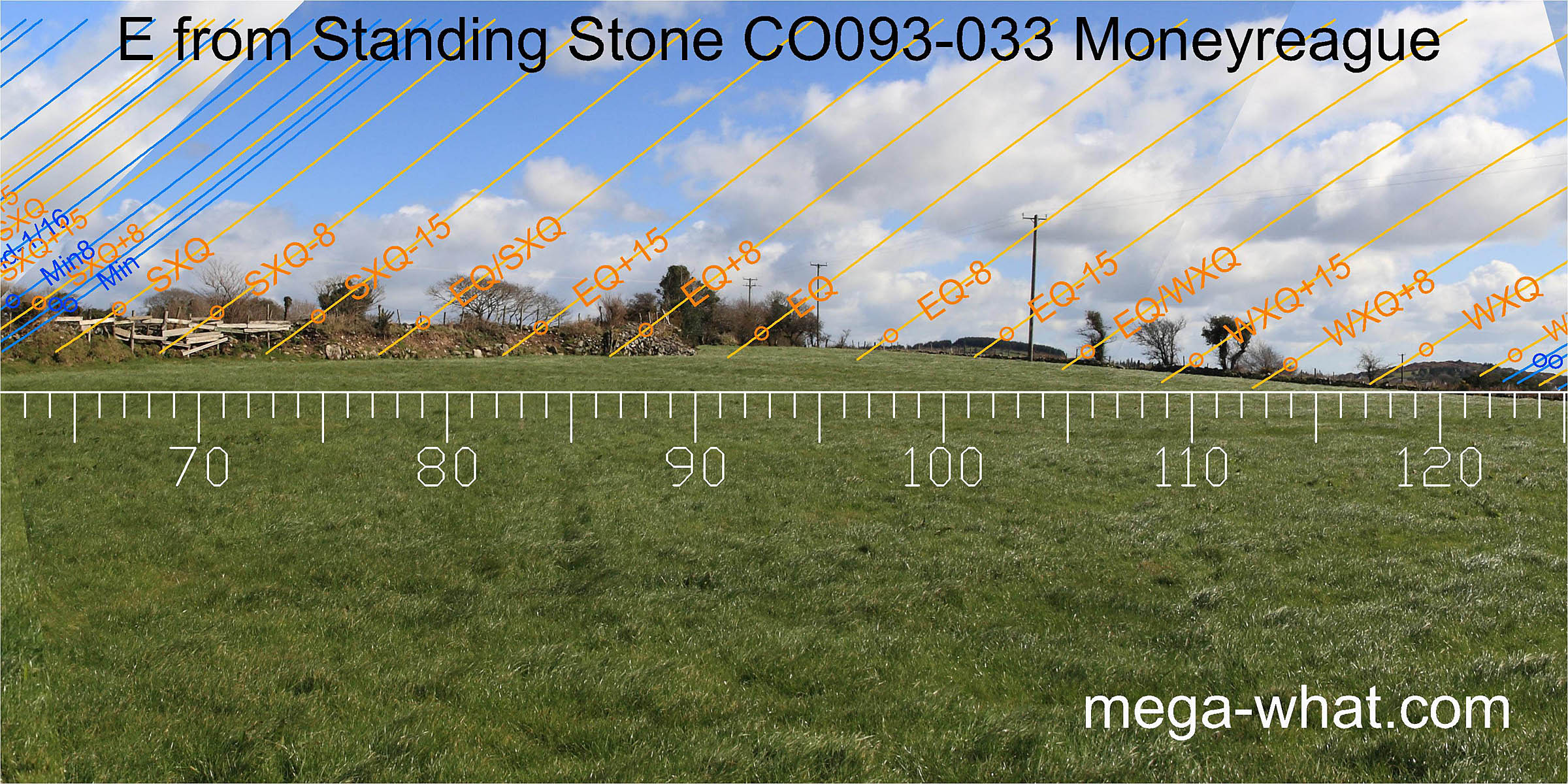 Surveyable horizon begins one quarter-month south of the equinox, more or less at the intersect of local ground with a more distant hill.
The south intersect of that hill is halfway between equinox and cross-quarter.
The next hill has prominent steps either side of its top and these mark the cross-quarter and its southern quarter-month bracket.
Surveyable horizon begins one quarter-month south of the equinox, more or less at the intersect of local ground with a more distant hill.
The south intersect of that hill is halfway between equinox and cross-quarter.
The next hill has prominent steps either side of its top and these mark the cross-quarter and its southern quarter-month bracket.
 The lunar minor eighth is in the dip at the hill's foot and the minor standstillLunistice positions vary cyclically over an 18.6 year period but are fairly static for more than a year at either end of the range
is at a step on its rocky southern slopes.
The lunar minor eighth is in the dip at the hill's foot and the minor standstillLunistice positions vary cyclically over an 18.6 year period but are fairly static for more than a year at either end of the range
is at a step on its rocky southern slopes.
More distant horizons then provide a useful profile which marks out the remaining key lunar points, starting with the hilltop that is both a half-month from the solstice and a lunar sixteenth. The other sixteenth and the major eighth are in the dips at the base of a small hill which sits between the larger hills either side of it (now behind the trees).
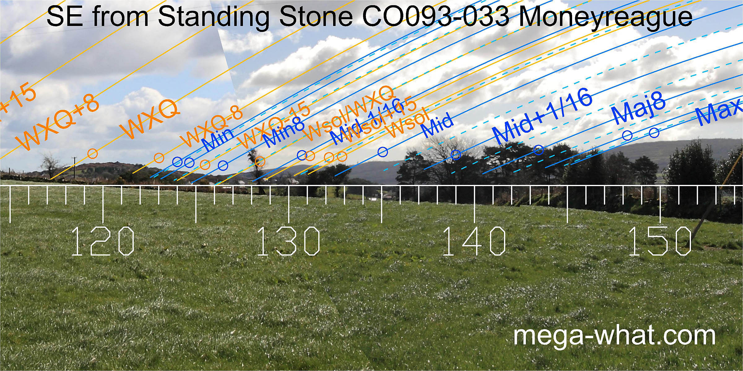
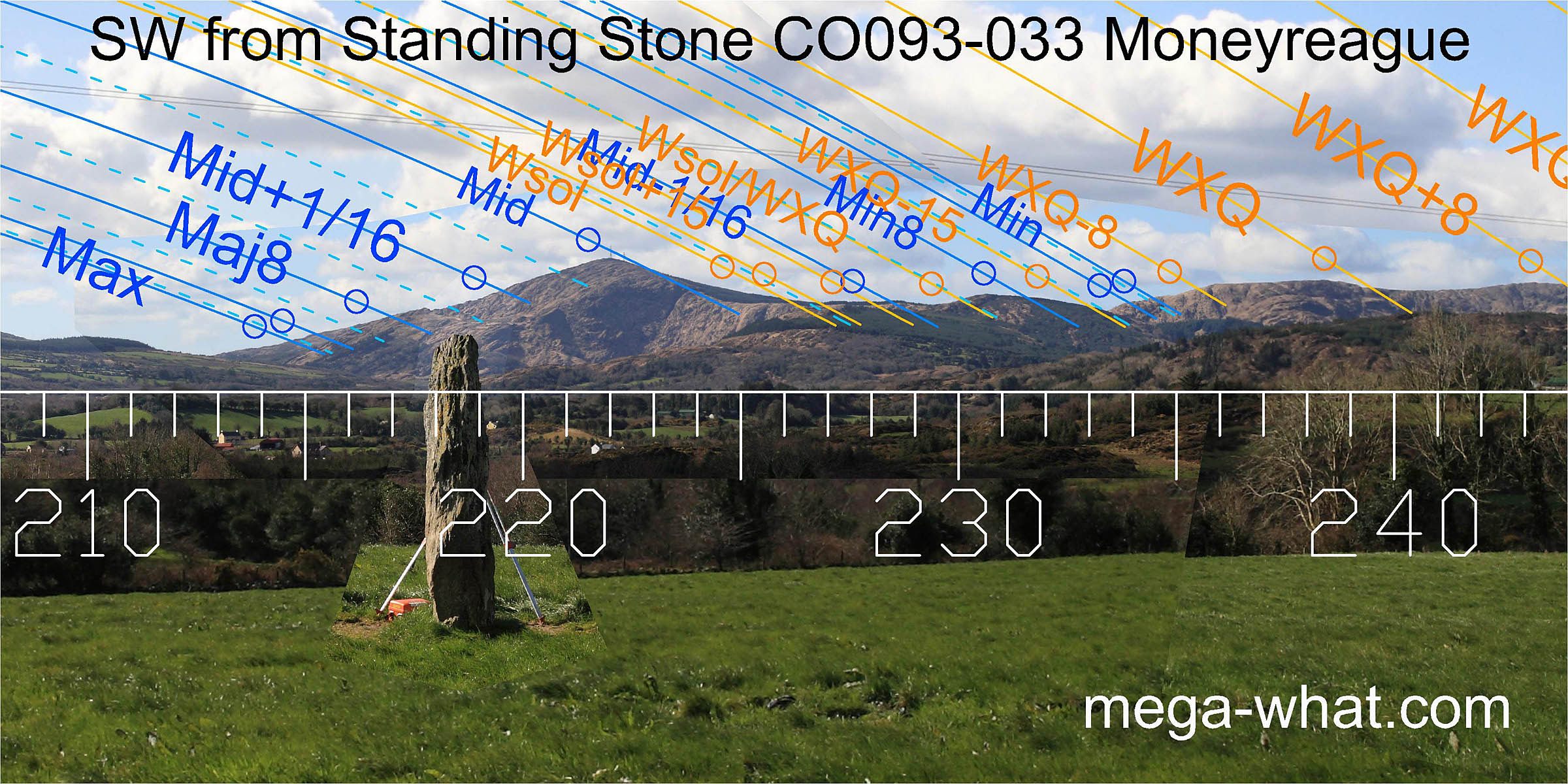 To the south-west, Nowen Hill is spectacularly prominent and has the lunar midpoint on its summit.
The lunar major standstillLunistice positions vary cyclically over an 18.6 year period but are fairly static for more than a year at either end of the range
is at a step towards the base of the southern slope but the major eighth does not actually have an obvious marker.
Instead, it lies halfway between the large rock hump above it and a smaller one below.
To the south-west, Nowen Hill is spectacularly prominent and has the lunar midpoint on its summit.
The lunar major standstillLunistice positions vary cyclically over an 18.6 year period but are fairly static for more than a year at either end of the range
is at a step towards the base of the southern slope but the major eighth does not actually have an obvious marker.
Instead, it lies halfway between the large rock hump above it and a smaller one below.
North of Nowen Hill top, virtually every high and low point makes a useful indicator.
 This excellent sequence continues right round to the equinox which occurs on the step at the base of a hill.
The main western dip is halfway between winter cross-quarter and equinox.
Summer cross-quarters are at the top of the south slope of the highest hill with that equinox / cross-quarter midpoint in the large dip between.
This excellent sequence continues right round to the equinox which occurs on the step at the base of a hill.
The main western dip is halfway between winter cross-quarter and equinox.
Summer cross-quarters are at the top of the south slope of the highest hill with that equinox / cross-quarter midpoint in the large dip between.
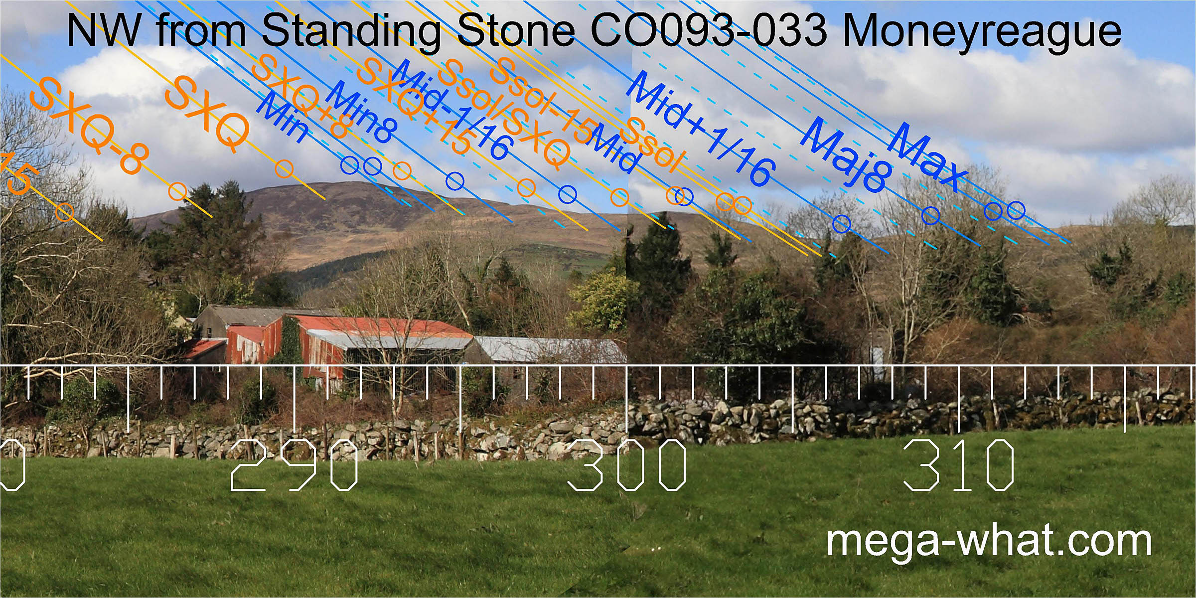 Lunar minor standstillLunistice positions vary cyclically over an 18.6 year period but are fairly static for more than a year at either end of the range
is at the top of the northern slope of the highest hill.
the lunar minor eighth is on top of a minor rise then the major step is a cross-quarter half-month / lunar sixtenth.
The crest of the next hill is the lunar midpoint / solstitial half-month.
The solstice sets down a slope to the step at the left side of a dip that bottoms with a lunar sixteenth at the foot of the next upslope.
The major eighth is obscured but major standstillLunistice positions vary cyclically over an 18.6 year period but are fairly static for more than a year at either end of the range
occurs at a step at the top of the slope.
Lunar minor standstillLunistice positions vary cyclically over an 18.6 year period but are fairly static for more than a year at either end of the range
is at the top of the northern slope of the highest hill.
the lunar minor eighth is on top of a minor rise then the major step is a cross-quarter half-month / lunar sixtenth.
The crest of the next hill is the lunar midpoint / solstitial half-month.
The solstice sets down a slope to the step at the left side of a dip that bottoms with a lunar sixteenth at the foot of the next upslope.
The major eighth is obscured but major standstillLunistice positions vary cyclically over an 18.6 year period but are fairly static for more than a year at either end of the range
occurs at a step at the top of the slope.
Excavation was undertaken prior to the re-erection of a displaced Standing Stone. A spread of redeposited upcast from the socket was visible to the north and south of the Standing Stone. Three features were cut into this, a substantial pit at the west base of the stone and two smaller pits to the north. At the north-west edge of the large pit was a 0.1m diameter stake-hole. Black sandy silt with occasional charcoal filled both it and the base of the pit. At the southern side of this pit a setting of four irregularly shaped large stones sealed a deposit of cremated human bone. This was covered by a dark brown sandy silt, with inclusions. At the extreme north-eastern end of the base of the stone socket was a post-hole. This was 0.41m in diameter, had straight sides and sloped sharply to a rounded base, reaching a maximum depth of 0.42m. The fill was similar to that of the socket.
Because of the similarity of the fills, the excavator considered the stakeholes to be contemporary to the pits they were cut into and suggested that the large post might have been used to hold the stone upright during the construction phase. It would however have been impossible to remove the post after the stone socket was backfilled without rocking it from side to side in order to loosen it and that would not leave the straight sided post hole that was recorded. Possibly both posts acted as markers. The smaller one, if not an earlier marker, then either indicating where the pit should be dug or used for checking that it was in the correct place before the deposition of bone. The larger post acting for a period in lieu of the Standing Stone, while the accuracy of the position was checked or the stone was collected.
Other sites are closer but as far as the survey goes:
- Inchireagh Five Stone Circle is 2km south (185°)
- Coolmountain Stone Circle is 2.4km north (358°)
- Cullenagh Stone Row is 7.3km south-west (211°)
- Kealkill Stone Circle, Stone Pair & Cairn are 14km west (257°)
References
- Archaeological Survey of Ireland, record details. www.archaeology.ie/archaeological-survey-ireland
- POWER, D. et al. 1997 Archaeological Inventory of County Cork, Volume 1: West Cork. Dublin: Stationary Office. p70, no.455.
- McCARTHY, MARGARET 2001 Cork 2001:223 Moneyreague. www.excavations.ie.