
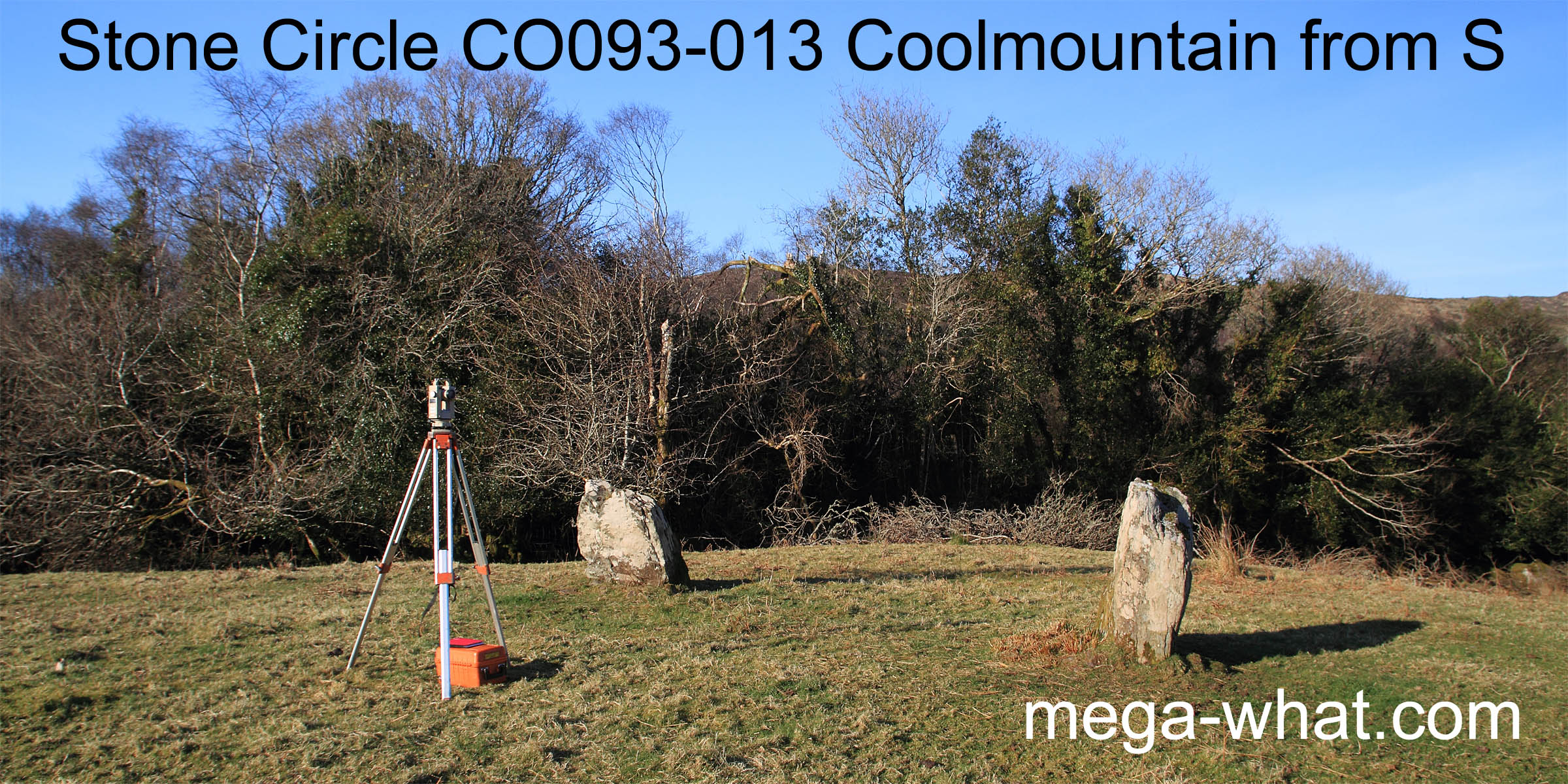
 Coolmountain Stone Circle is about 6km south-west of Inchigeelagh. Only two stones remain of a possible eleven with an estimated circle diameter c.9m.
It is on a low rise beside the Caha river in the headwaters of the Bandon River.
Coolmountain Stone Circle is about 6km south-west of Inchigeelagh. Only two stones remain of a possible eleven with an estimated circle diameter c.9m.
It is on a low rise beside the Caha river in the headwaters of the Bandon River.
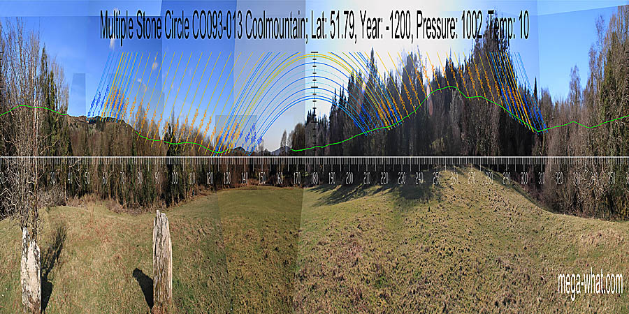 Views are largely obscured by trees and green lines approximate hidden horizon segments.
South was possibly indicated by a low hilltop [Pic].
![[Pic]](Coolmountain-S.jpg)
North seems to be on the left side of a high hill [Pic].
![[Pic]](Coolmountain-N.jpg)
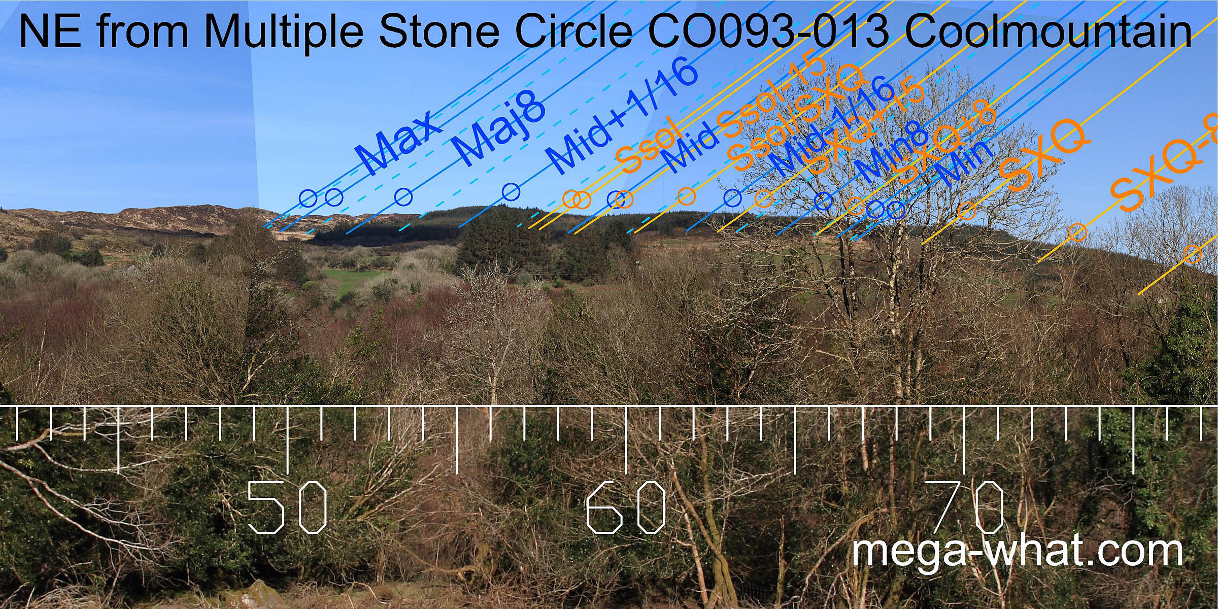 To the north-east, summer cross-quarter sunrise is at the south edge of a hilltop and the lunisticeLunistices are the most northerly and southerly moons of the month. The lunar equivalent of solstices - more.
zone runs along the ridge from there to finish at an obvious step / break.
Solstice sunrise is at a similar break.
To the north-east, summer cross-quarter sunrise is at the south edge of a hilltop and the lunisticeLunistices are the most northerly and southerly moons of the month. The lunar equivalent of solstices - more.
zone runs along the ridge from there to finish at an obvious step / break.
Solstice sunrise is at a similar break.
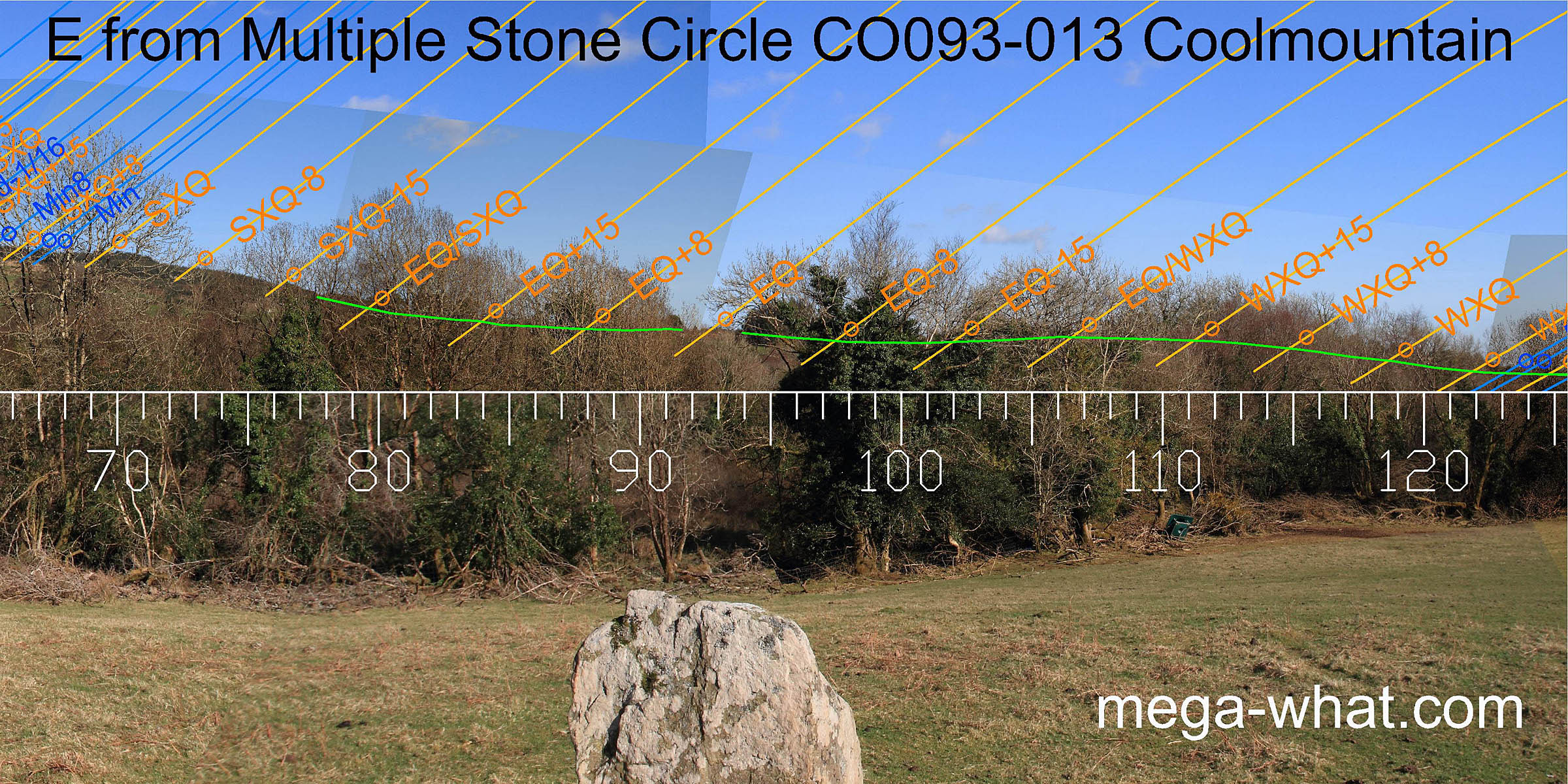 The east is largely obscured but the equinox looks to be at a step in the slope.
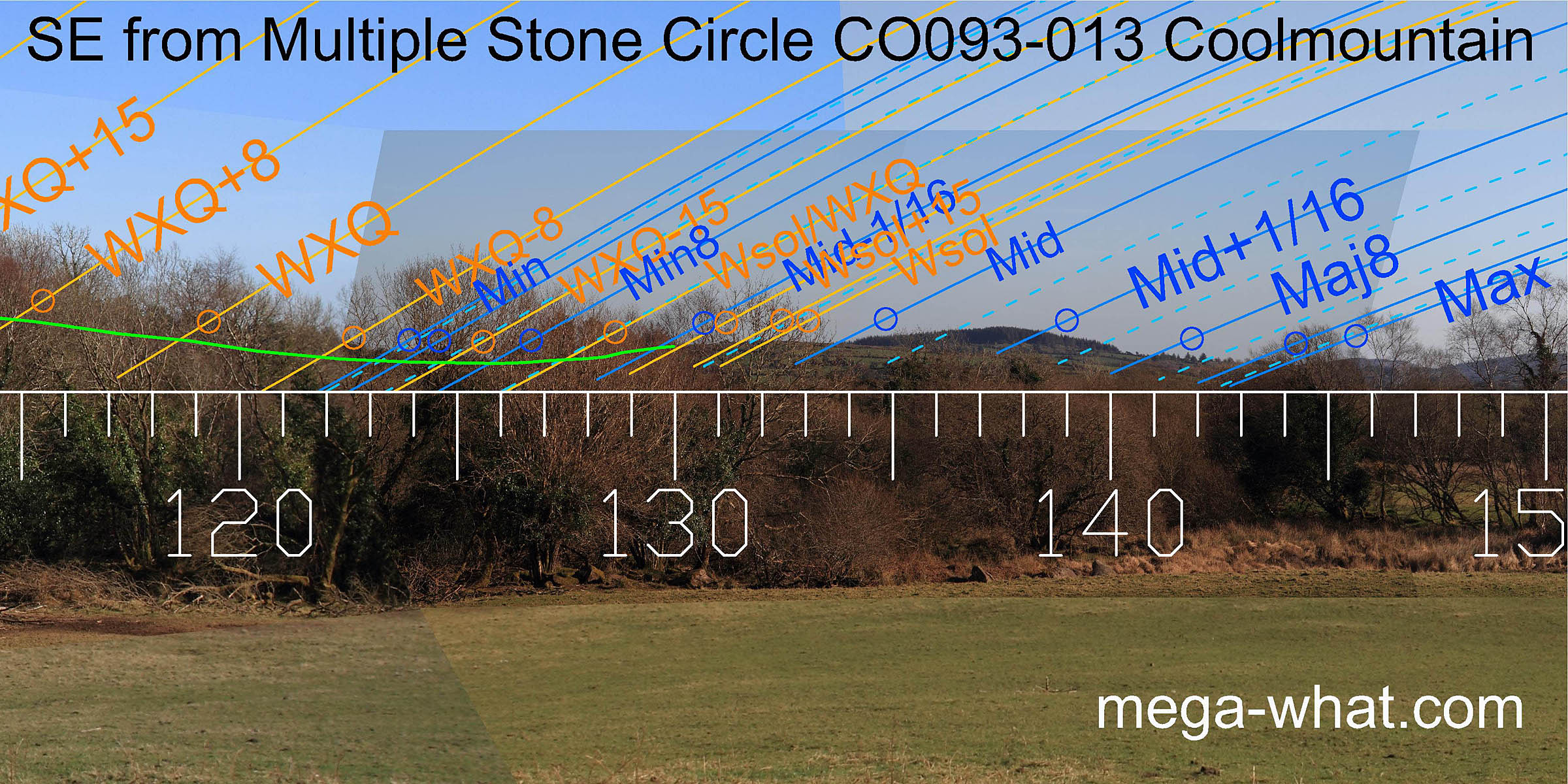 The south-eastern lunisticeLunistices are the most northerly and southerly moons of the month. The lunar equivalent of solstices - more.
zone spans a hilltop. Both major and minor standstillsLunistice positions vary cyclically over an 18.6 year period but are fairly static for more than a year at either end of the range
rise from dips. Winter solstice sunrise is on a subsidiary top.
The south-eastern lunisticeLunistices are the most northerly and southerly moons of the month. The lunar equivalent of solstices - more.
zone spans a hilltop. Both major and minor standstillsLunistice positions vary cyclically over an 18.6 year period but are fairly static for more than a year at either end of the range
rise from dips. Winter solstice sunrise is on a subsidiary top.
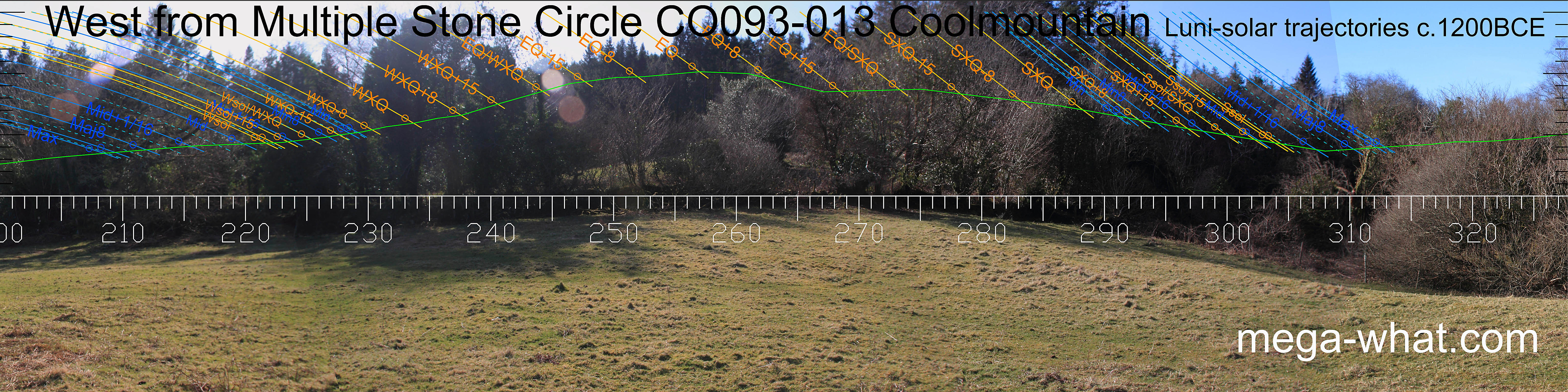 The west is completely obscured.
- Farrannahineeny Stone Row is 2.3km east (89°)
- Moneyreague Standing Stone (excavated) is 2.4km south (178°)
- Inchireagh Five Stone Circle is 4.5km south (182°)
- Maughanaclea Stone Circle & Boulder-Burials are 9.8km south-west (242°)
References
- Archaeological Survey of Ireland, record details. www.archaeology.ie/archaeological-survey-ireland
- POWER, D. et al. 1992 Archaeological Inventory of County Cork, Volume 1: West Cork. Dublin: Stationary Office. p21, no.48.
- Ó'NUALLÁIN, SEÁN 1984 A Survey of Stone Circles in Cork and Kerry. Proceedings of the Royal Irish Academy 84c:1-77, p17, no.17.
- RUGGLES, C.L.N. 1999 Astronomy in Prehistoric Britain and Ireland. Newhaven & London: Yale University Press. No.ASC27.