
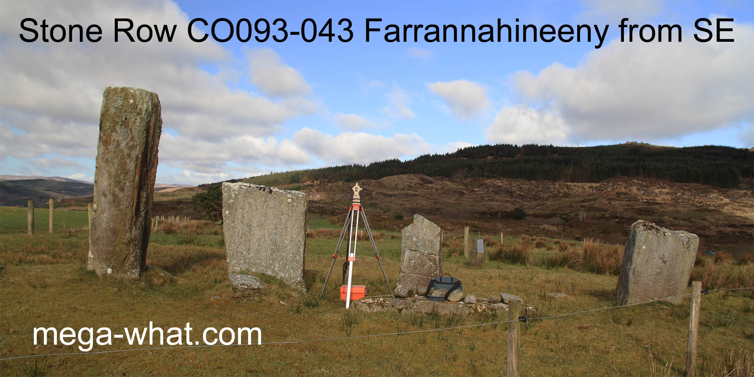
 Farrannahineeny Stone Row is a National Monument (no.374) and is owned by the state but there is no official access route or parking. The prostrate stone has, presumably, fallen from the wide space.
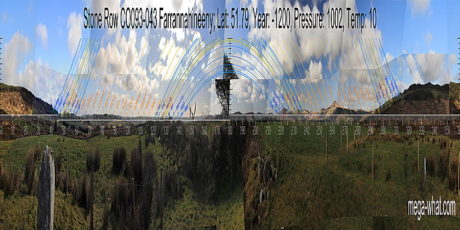 A large local hill has North its top [Pic] and lunisticeLunistices are the most northerly and southerly moons of the month. The lunar equivalent of solstices - more.
zones on its lower slopes.
A large local hill has North its top [Pic] and lunisticeLunistices are the most northerly and southerly moons of the month. The lunar equivalent of solstices - more.
zones on its lower slopes.
![[Pic]](Farrannahineeny-N.jpg)
South is roughly indicated by the intersect of the mountainous western horizon with the lower and more distant eastern one [Pic].
![[Pic]](Farrannahineeny-S.jpg)
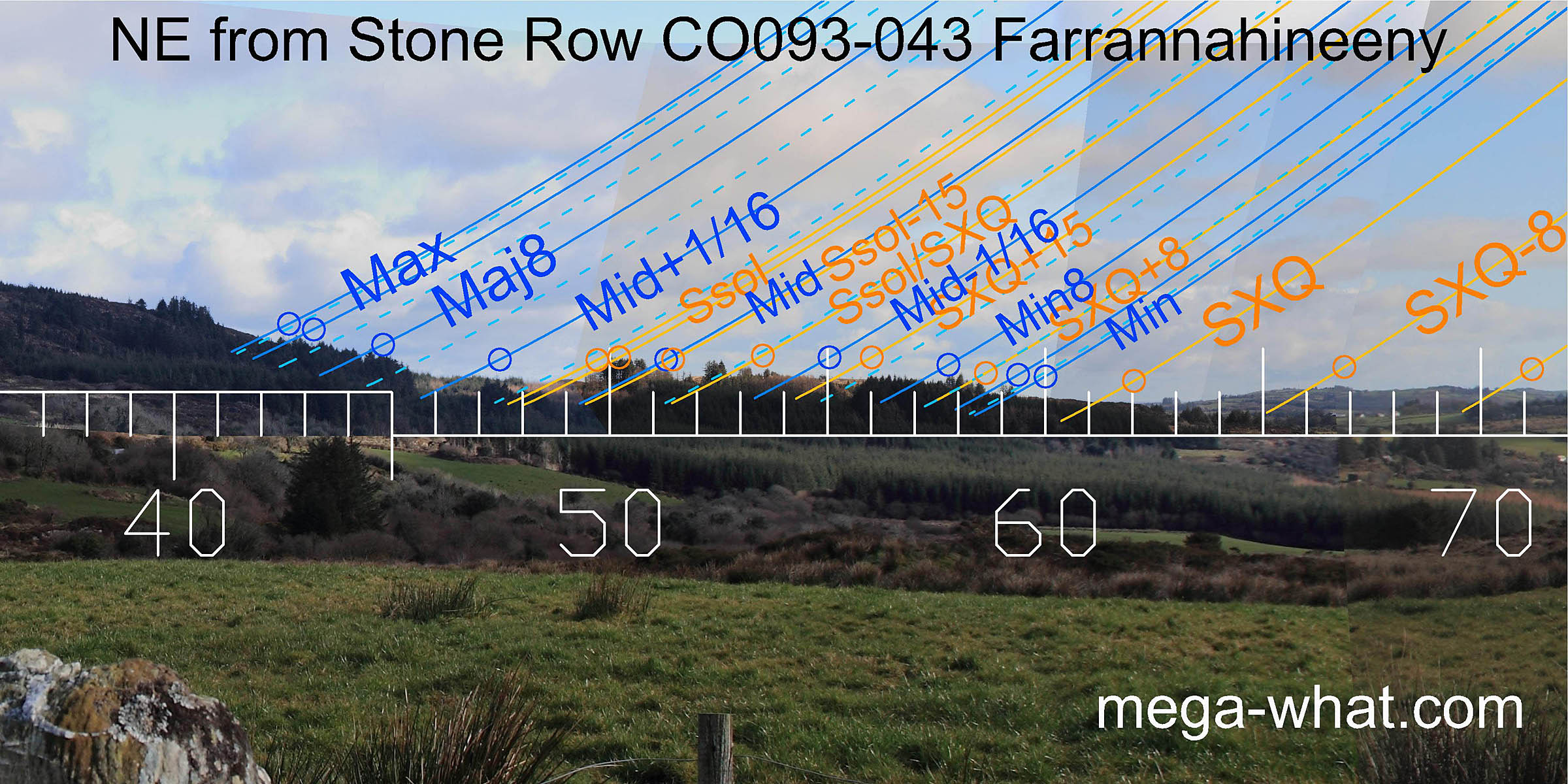
 To the north-east, summer cross-quarters are marked by the near / far intersect and and the lunisticeLunistices are the most northerly and southerly moons of the month. The lunar equivalent of solstices - more.
zone runs up the lower slopes of the local hill.
The top of the first rise is half-way to the solstice which itself is at an obvious hump in the following dip.
The row axis provides an accurate indicator for lunar major standstillLunistice positions vary cyclically over an 18.6 year period but are fairly static for more than a year at either end of the range
in this direction.
To the north-east, summer cross-quarters are marked by the near / far intersect and and the lunisticeLunistices are the most northerly and southerly moons of the month. The lunar equivalent of solstices - more.
zone runs up the lower slopes of the local hill.
The top of the first rise is half-way to the solstice which itself is at an obvious hump in the following dip.
The row axis provides an accurate indicator for lunar major standstillLunistice positions vary cyclically over an 18.6 year period but are fairly static for more than a year at either end of the range
in this direction.
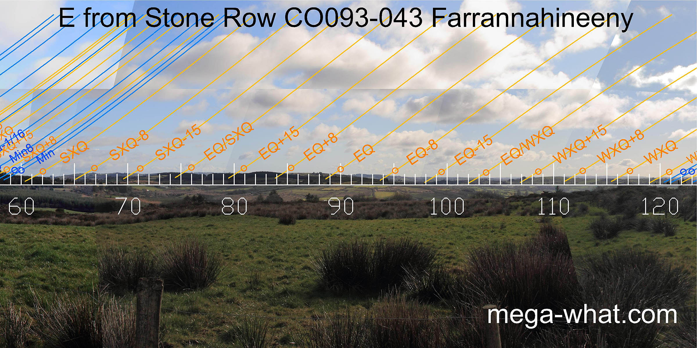 Eastwards, is a low and gently undulating distant horizon. The nearer hills in many cases provide better markers.
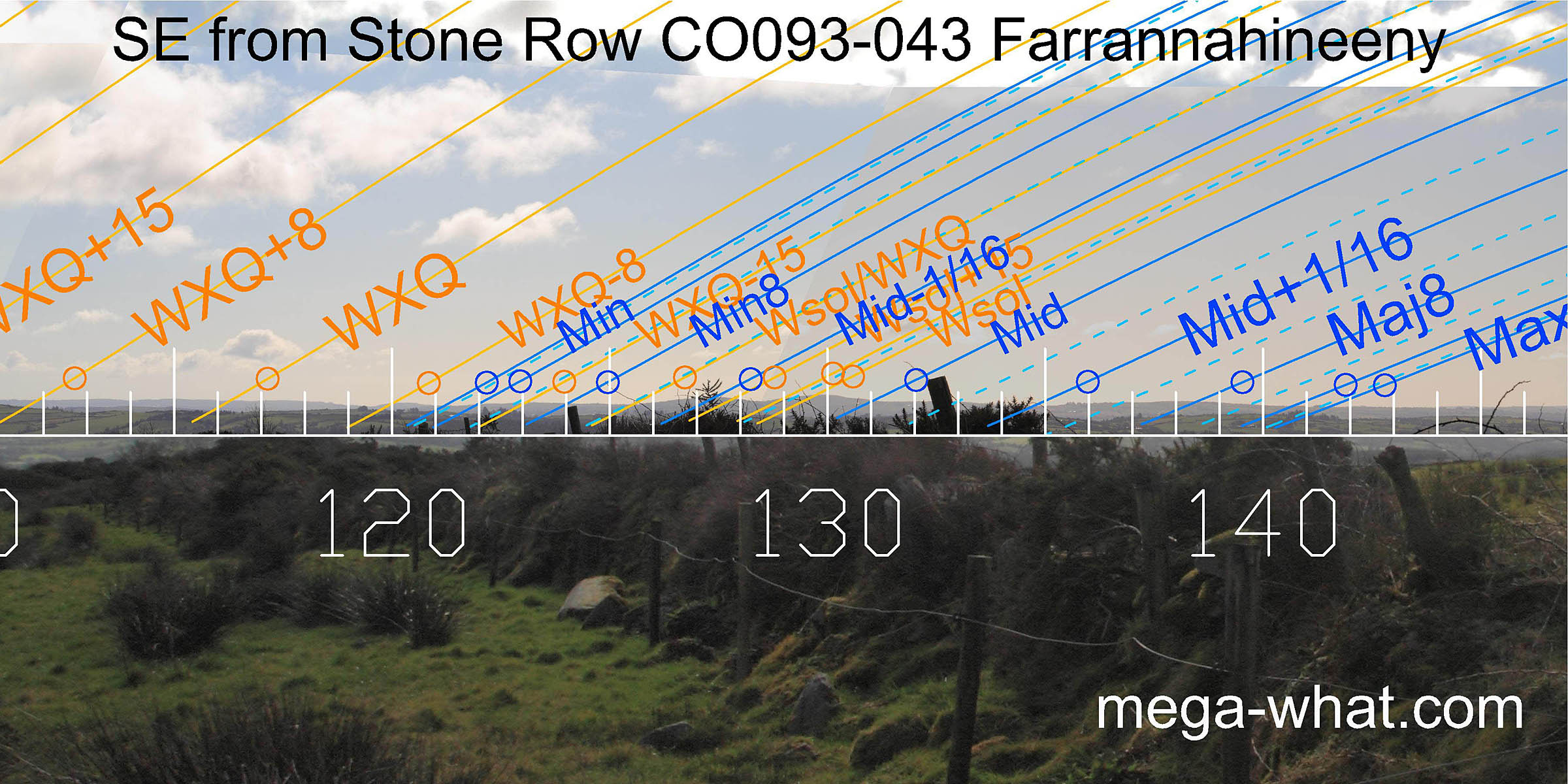 To the south-east, the distant horizon improves with the solstitial period marked by a pair of hills and the major end of the lunisticeLunistices are the most northerly and southerly moons of the month. The lunar equivalent of solstices - more.
zone spanning another one.
The nearer hills still provide additional markers.
To the south-east, the distant horizon improves with the solstitial period marked by a pair of hills and the major end of the lunisticeLunistices are the most northerly and southerly moons of the month. The lunar equivalent of solstices - more.
zone spanning another one.
The nearer hills still provide additional markers.

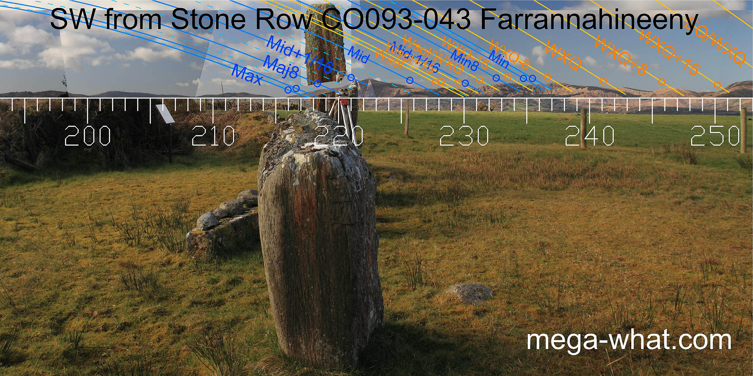 The south-western hills are closer and so exact observer position could make a difference and have some relevance to the positioning of individual stones.
The row's axis is towards the major end of the lunisticeLunistices are the most northerly and southerly moons of the month. The lunar equivalent of solstices - more.
zone in this direction.
The south-western hills are closer and so exact observer position could make a difference and have some relevance to the positioning of individual stones.
The row's axis is towards the major end of the lunisticeLunistices are the most northerly and southerly moons of the month. The lunar equivalent of solstices - more.
zone in this direction.
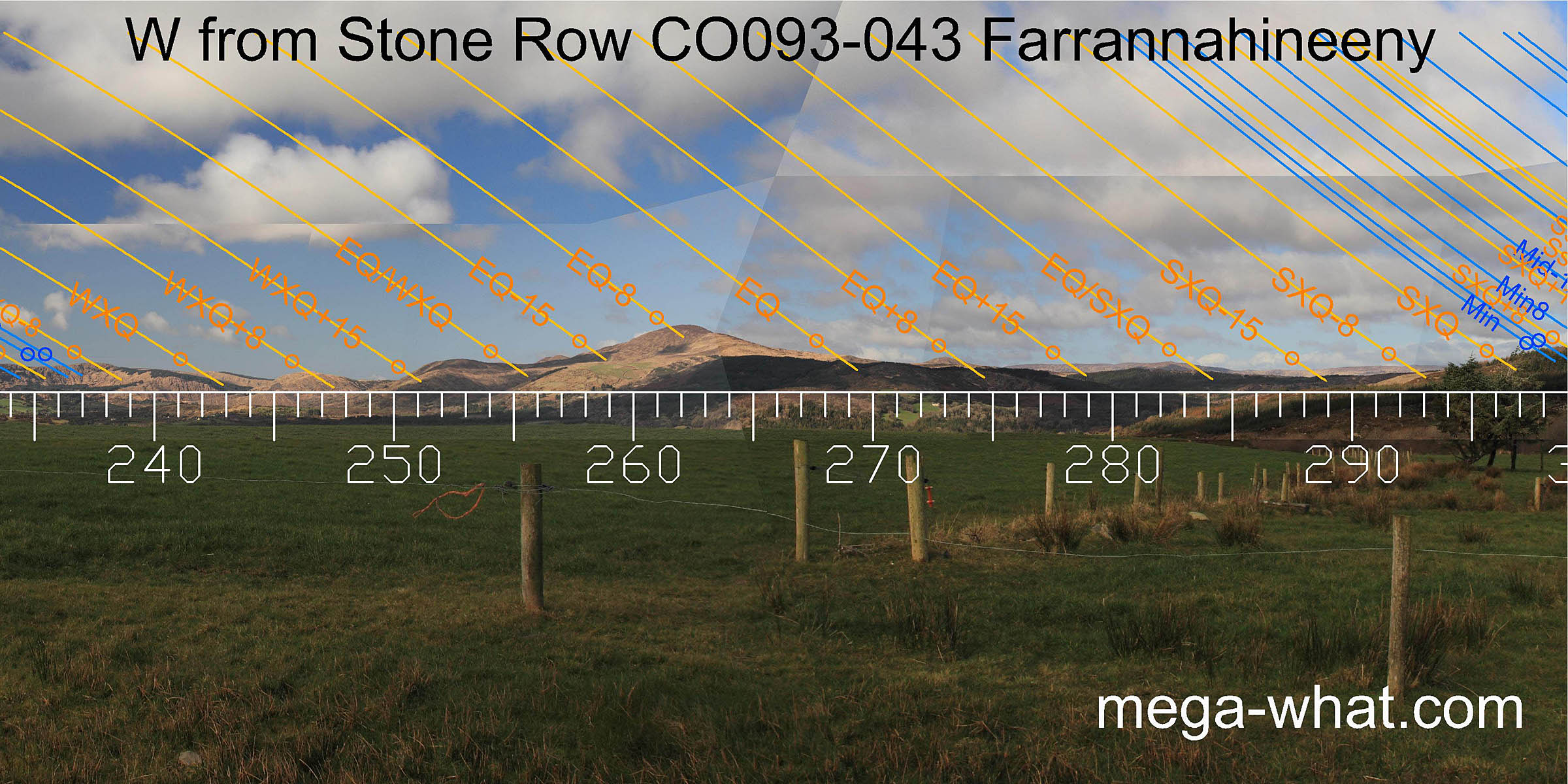 To the west, the quarter-months either side of the equinox get better markers than the equinox itself. The times half-way between the equinox and the cross-quarters also have good marks.
 In the north-west, once again summer cross-quarters are at the bottom of the local hill with the lunisticeLunistices are the most northerly and southerly moons of the month. The lunar equivalent of solstices - more.
zone running up the lower slope.
In the north-west, once again summer cross-quarters are at the bottom of the local hill with the lunisticeLunistices are the most northerly and southerly moons of the month. The lunar equivalent of solstices - more.
zone running up the lower slope.
- Coolmountain Stone Circle is 2.3km west (269°)
- Turnaspidogy Stone Row is 7km north-west (335°) but is unsurveyed.
- Behagullane Stone Row is c.7.5km south-east (123°) is the nearest surveyed stone row.
- Cullenagh Stone Row at 11km south-west (214°) is the next nearest surveyed stone row.
- Castlenalact Stone Row at 27km east (89°) is the nearest row in that direction but is unsurveyed.
References
- Archaeological Survey of Ireland, record details. www.archaeology.ie/archaeological-survey-ireland
- POWER, D. et al. 1992 Archaeological Inventory of County Cork, Volume 1: West Cork. Dublin: Stationary Office. p35, no.151.
- Ó'NUALLÁIN, SEÁN 1988 Stone Rows in the South of Ireland. Proceedings of the Royal Irish Academy 88c:179-256, p235, no.35.
- RUGGLES, C.L.N. 1999 Astronomy in Prehistoric Britain and Ireland. Newhaven & London: Yale University Press. CKR61.