
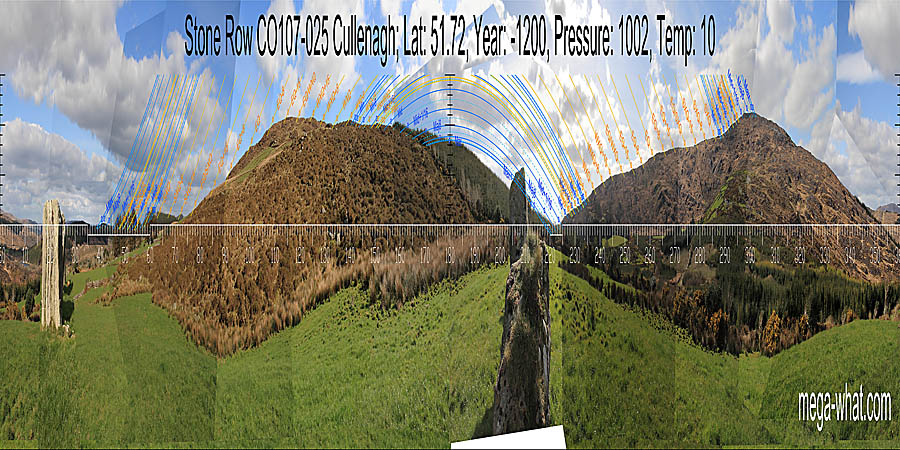
 Survey was mainly from the north-east end but, as the row is about 9m long, a few comparisons were made from the south-west end.
South is at the right-hand end of a hilltop and more or less coincides with major standstillLunistice positions vary cyclically over an 18.6 year period but are fairly static for more than a year at either end of the range moonrise position [Pic].
![[Pic].](CullenaghRow-S.jpg)
North is close to a hilltop within a larger dip [Pic].
![[Pic].](CullenaghRow-N.jpg)
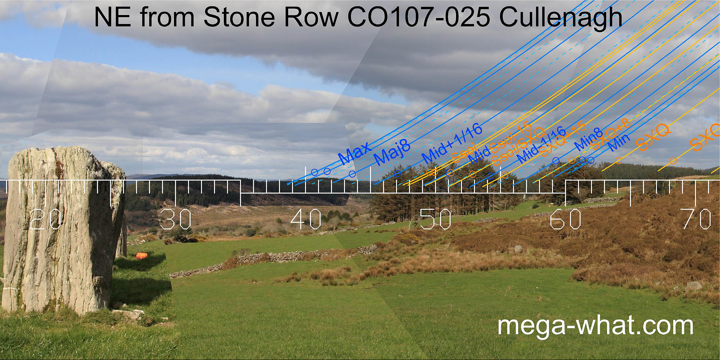 The north-eastern horizon is unfortunately afflicted by trees but it is plain that, in this direction, the axis of this three stone row indicates declinations well beyond the lunar limit
which is actually marked by a distant hilltop and its intersection with a nearer hill.
The major eighth falls on the slope of this hill, with both the hilltop and the base of the slope marking the thirtysecondths that delimit the period.
The north-eastern horizon is unfortunately afflicted by trees but it is plain that, in this direction, the axis of this three stone row indicates declinations well beyond the lunar limit
which is actually marked by a distant hilltop and its intersection with a nearer hill.
The major eighth falls on the slope of this hill, with both the hilltop and the base of the slope marking the thirtysecondths that delimit the period.
the lunar minor eighth is at the intersection of distant horizons with a nearer hill that has the minor lunar limit on its top. Lastly, just before local ground, another hilltop marks the half-month south of the cross-quarter.
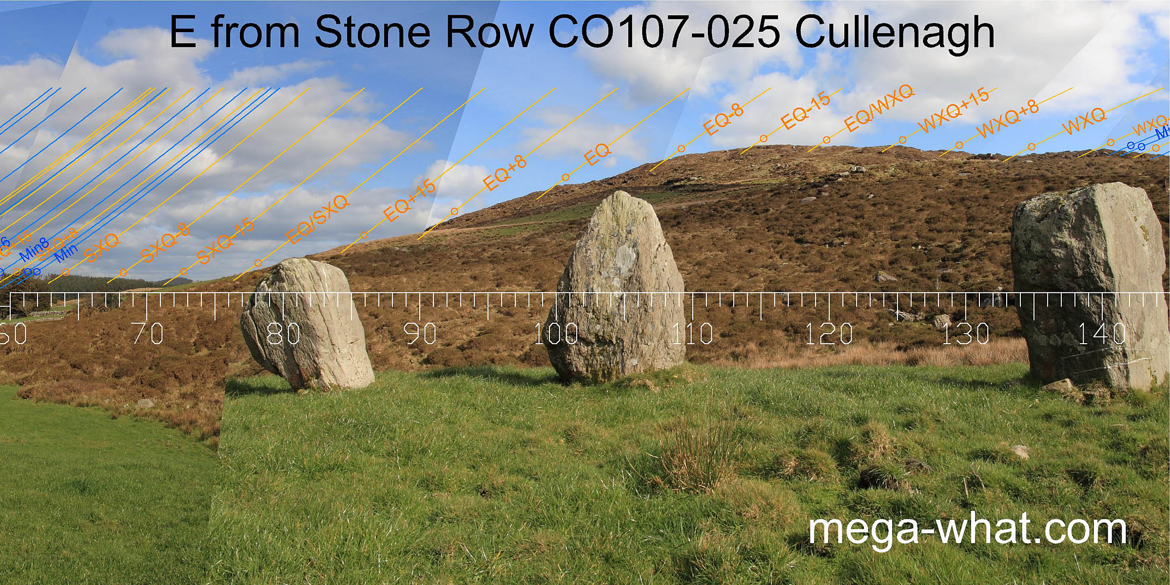 To the east and south-east is a high hill.
Moving from one end of the row to the other can shift a point there by as much as 2 or 3 degrees of azimuth because the row is long and the hill is very close.
This view shows the relationship of the row to the hill but the horizon is configured as if seen from the primary survey position, about 1.2m axially behind the NE end of the row.
To the east and south-east is a high hill.
Moving from one end of the row to the other can shift a point there by as much as 2 or 3 degrees of azimuth because the row is long and the hill is very close.
This view shows the relationship of the row to the hill but the horizon is configured as if seen from the primary survey position, about 1.2m axially behind the NE end of the row.
The equinox falls on an obvious hump in the middle of the northern slope and has clear markers either side for both the quarter and half month brackets, with the last one being at the top of the slope. The first good mark on the southern slope, on top of an obvious rise, is the half-month bracket for the cross-quarter which itself occurs at the foot of the slope.
 The cross-quarters are at the left foot of a hump which has their quarter-month bracket on the top and the lunar minor eighth at its southern foot.
Beyond that the hill becomes relatively featureless and masked by forestry.
The cross-quarters are at the left foot of a hump which has their quarter-month bracket on the top and the lunar minor eighth at its southern foot.
Beyond that the hill becomes relatively featureless and masked by forestry.
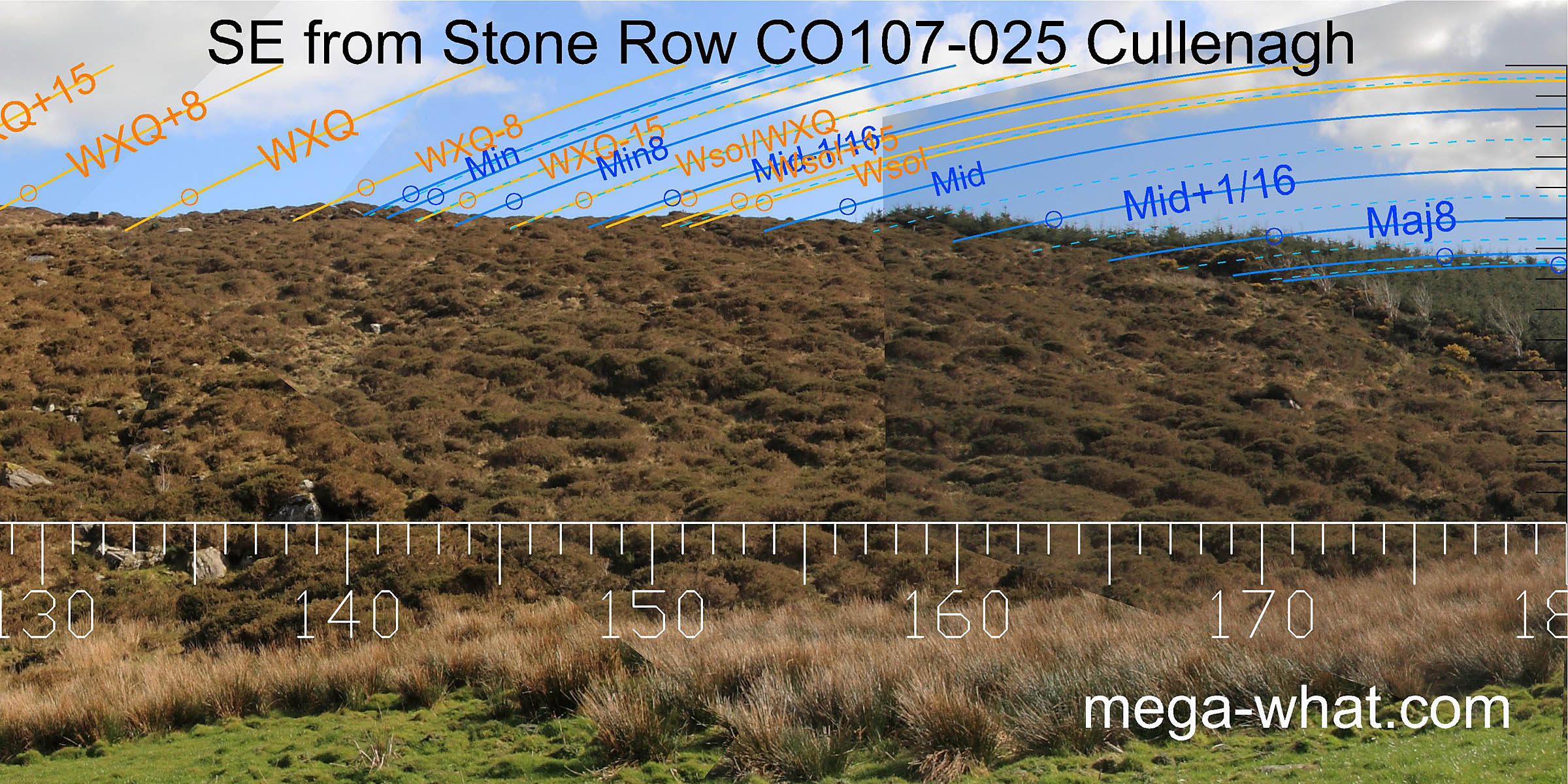
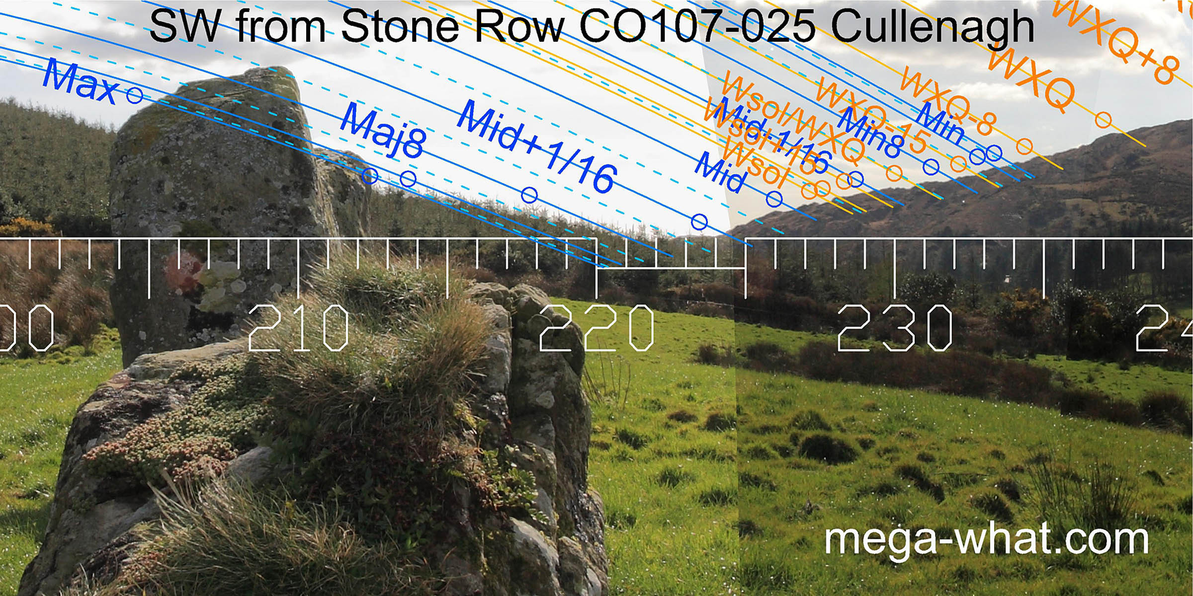
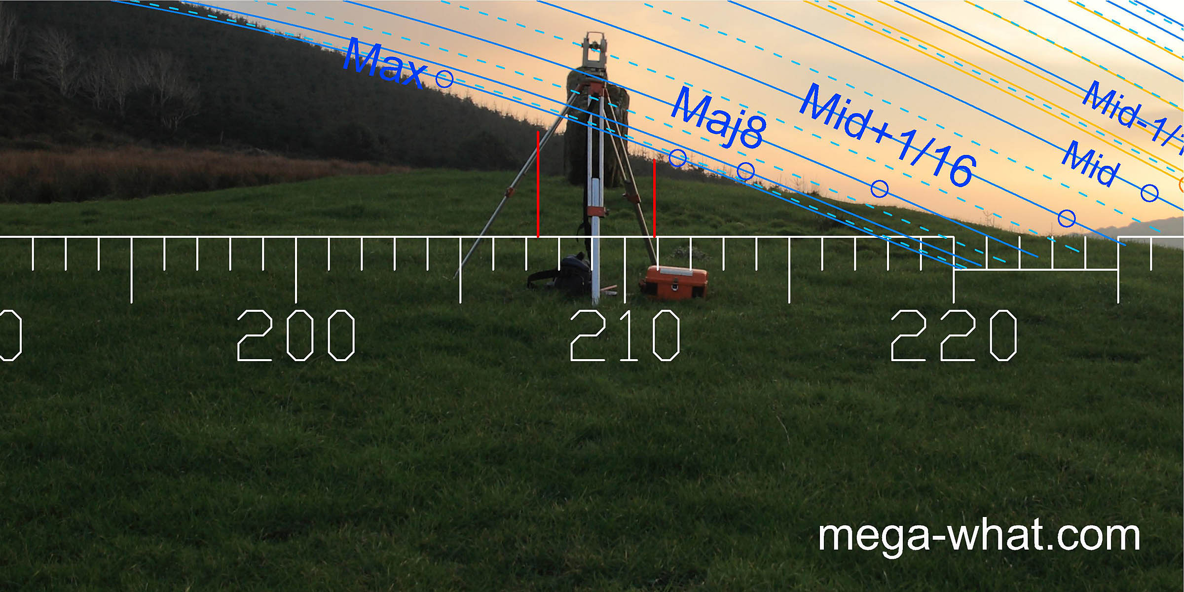 The south-western axis of the row is towards a fairly local slope, nevertheless the stones are arranged so that they indicate the major
standstillLunistice positions vary cyclically over an 18.6 year period but are fairly static for more than a year at either end of the range.
This view is from further away but the horizon is set as measured from the theodolite position which was 12m from the row.
The red lines indicate the width of the row when viewed from that point.
The south-western axis of the row is towards a fairly local slope, nevertheless the stones are arranged so that they indicate the major
standstillLunistice positions vary cyclically over an 18.6 year period but are fairly static for more than a year at either end of the range.
This view is from further away but the horizon is set as measured from the theodolite position which was 12m from the row.
The red lines indicate the width of the row when viewed from that point.
 The southern foot of the rocky slopes of Nowen Hill marks a sixteenth on the major side of the lunar midpoint. Above that the profile is rugged enough to provide many markers.
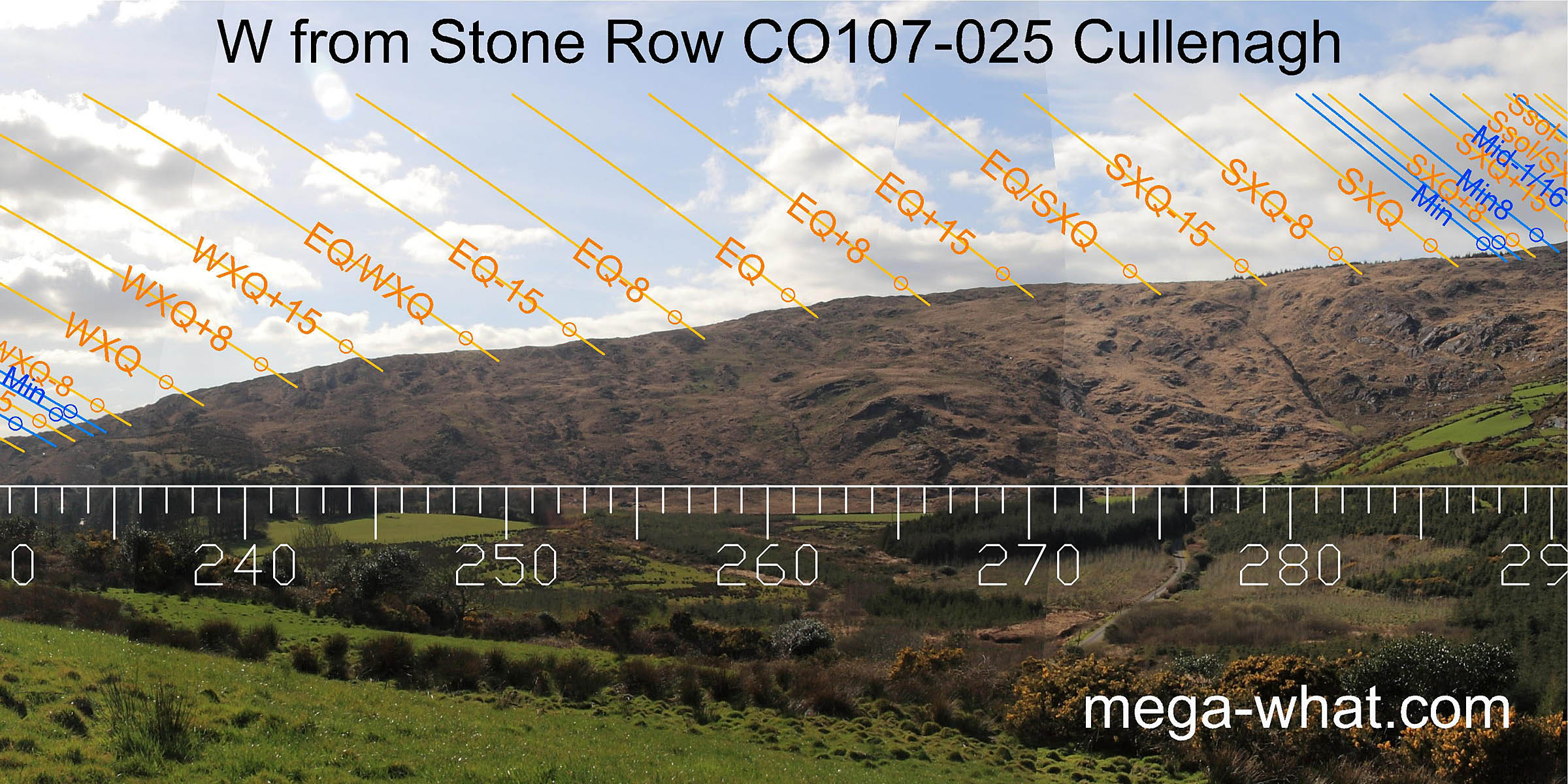 Higher up the profile is smoother but half month brackets for the cross-quarter and the equinox as well as the equinox itself all fall on obvious points.
Moving from one end of the row to the other can shift points on the western horizon by 0.5° azimuth or so, which is roughly a lunar/solar diameter.
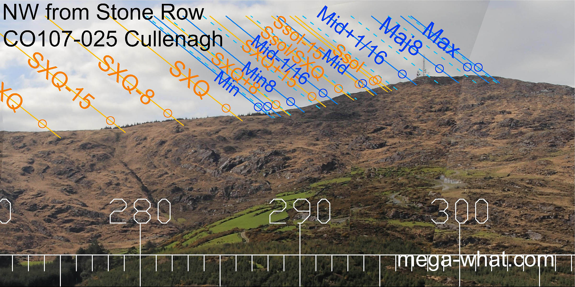 Higher again, marks may be found for the summer cross-quarters and their southern half-month bracket while the midpoint between cross-quarter and solstice is at a break halfway up the final slope.
The minor end of the lunisticeLunistices are the most northerly and southerly moons of the month. The lunar equivalent of solstices - more.
range is at the foot of this final southern slope while the major standstillLunistice positions vary cyclically over an 18.6 year period but are fairly static for more than a year at either end of the range
is at the top of the northern slope.
Curiously, the summit itself is a lunar thirtysecondth with usable markers for the sixteenth and eighth on either side of it.
Higher again, marks may be found for the summer cross-quarters and their southern half-month bracket while the midpoint between cross-quarter and solstice is at a break halfway up the final slope.
The minor end of the lunisticeLunistices are the most northerly and southerly moons of the month. The lunar equivalent of solstices - more.
range is at the foot of this final southern slope while the major standstillLunistice positions vary cyclically over an 18.6 year period but are fairly static for more than a year at either end of the range
is at the top of the northern slope.
Curiously, the summit itself is a lunar thirtysecondth with usable markers for the sixteenth and eighth on either side of it.
There was another stone to the west of the middle stone of this three stone row on the 1842 OS map but there is no visible trace of it now. Basal peat from a test pit c.5m north of the row yielded a not particularly useful 14C date of 975 ± 45 bp or about 1117 A.D. (Lynch 1981: 111-113).
- Cullenagh Five Stone Circle is just 400m to the south-west (232°)
- Leitry Stone Row is 2.9km to the south-west (211°)
- Coomleagh Stone Row is over the ridge 3.7km to the west (292°)
- Standing Stone Pair CO107-026 is 800m to the north-east but in a thicket on the edge of a gravel pit and unsurveyable.
- Dromdrasil Four Stone Row, 4km to the north-north-east in the Bandon headwaters is a National Monument but overgrown and unsurveyable.
- Farrannahineeny Stone Row at 11km north-east (214°) is the nearest surveyed stone row in that direction.
References
- Archaeological Survey of Ireland, record details. www.archaeology.ie/archaeological-survey-ireland
- LYNCH, ANN 1981 Man and the Environment in South-West Ireland, 4000 BC-AD 800. BAR British Series 85. Oxford: British Archaeological Reports.
- Ó'NUALLÁIN, SEÁN 1988 Stone Rows in the South of Ireland. Proceedings of the Royal Irish Academy 88c:179-256, p236, no.42.
- POWER, D. et al. 1992 Archaeological Inventory of County Cork, Volume 1: West Cork. Dublin: Stationary Office. p35, no.145.
- RUGGLES, C.L.N. 1999 Astronomy in Prehistoric Britain and Ireland. Newhaven & London: Yale University Press. CKR73.
- RUGGLES, C.L.N. 1996 Stone Rows of Three or More Stones in South-West Ireland. Archaeoastronomy 21 (Journal of the History of Astronomy xxvii) S55-S71.
- RUGGLES, C.L.N. & Burl, H.A.W. 1995 Astronomical Influences on Prehistoric Ritual Architecture in North-Western Europe: The Case of the Stone Rows. Vistas in Astronomy 39:517-528. Oxford: Elsevier Science Ltd.