
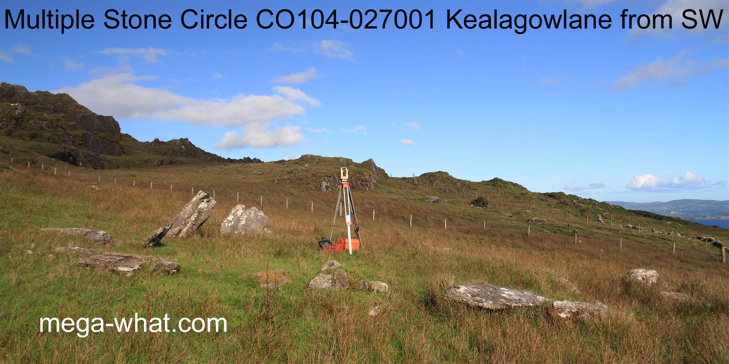
 Kealagowlane Multiple Stone Circle is on the south side of Sugarloaf Mountain. It is 30m or so north of the Beara Way footpath but entrance to its paddock is considerably further west.
Probably an eleven stone circle but very damaged with only three stones more or less upright and in place.
Kealagowlane Multiple Stone Circle is on the south side of Sugarloaf Mountain. It is 30m or so north of the Beara Way footpath but entrance to its paddock is considerably further west.
Probably an eleven stone circle but very damaged with only three stones more or less upright and in place.
The theodolite marks the position of a boulder-burial that is now almost completely covered, visible as a stone slab in the ground just north of the circle's centre.
 Local ground occupies more than half the horizon.
South is roughly indicated by a far dip but is precisely at a step in a hilltop to the right of it [Pic]. Cairn CO104-014 Derreenacarrin is visible on top of Knocknacarrin but is currently unsurveyed.
![[Pic]](Kealagowlane-S.jpg)
North is roughly indicated by the local hilltop but is precisely at a step to the right of it [Pic].
![[Pic]](Kealagowlane-N.jpg)
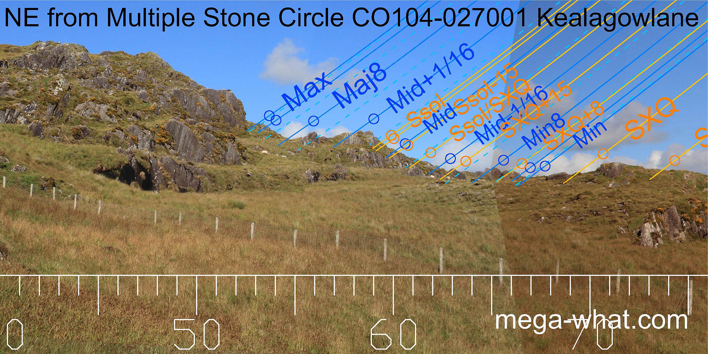 A big step indicates major standstillLunistice positions vary cyclically over an 18.6 year period but are fairly static for more than a year at either end of the range
but this very local horizon provides many markers.
All adjustable by exact observer position. Survey was from the boulder-burial, just north of the circle's centre
A big step indicates major standstillLunistice positions vary cyclically over an 18.6 year period but are fairly static for more than a year at either end of the range
but this very local horizon provides many markers.
All adjustable by exact observer position. Survey was from the boulder-burial, just north of the circle's centre
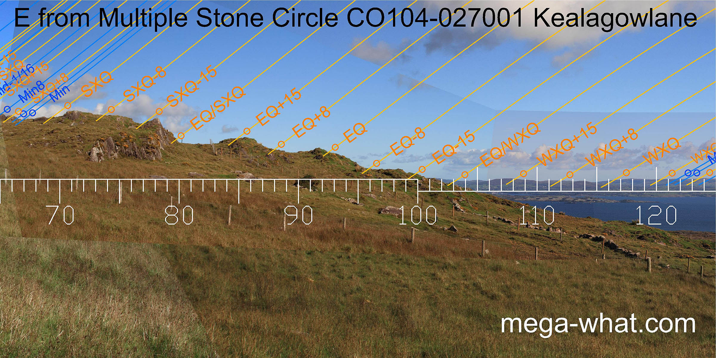 The equinox gets a minor mark but (as is not unusual) the periods around it get better ones. Equinox / cross-quarter midpoints are at a local big step and the first dip of the far horizon.
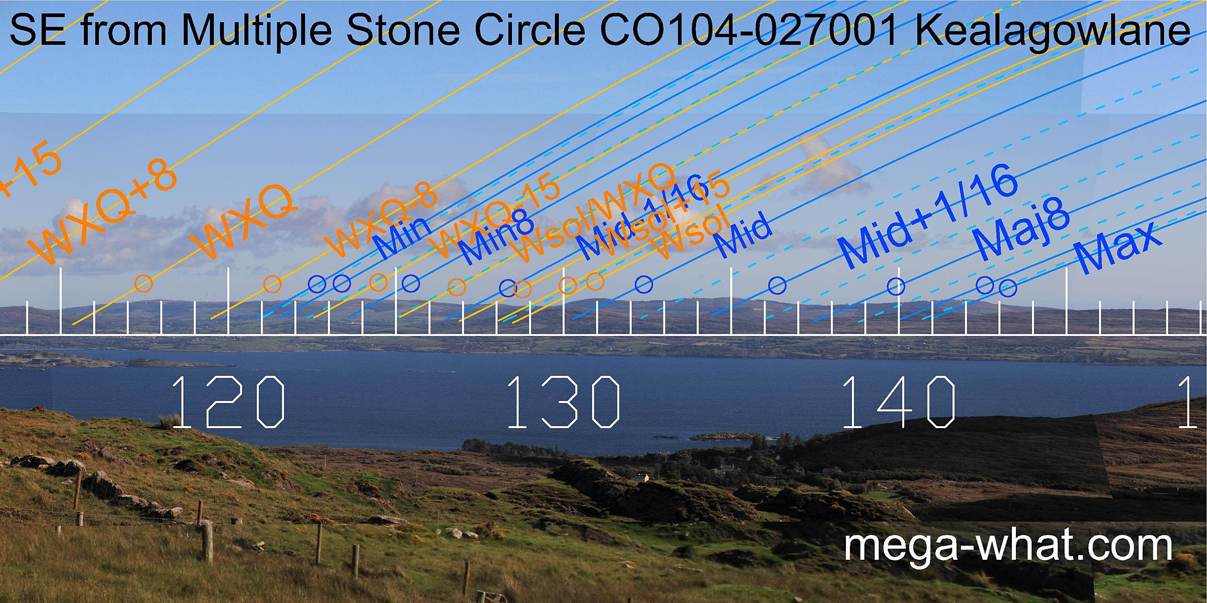 South-east minor standstillLunistice positions vary cyclically over an 18.6 year period but are fairly static for more than a year at either end of the range
is at a dip in a block of high ground. Winter solstice is in a dip that is an intersect of far and distant.
Major standstillLunistice positions vary cyclically over an 18.6 year period but are fairly static for more than a year at either end of the range
is at the other end of the same block of distant high ground.
South-east minor standstillLunistice positions vary cyclically over an 18.6 year period but are fairly static for more than a year at either end of the range
is at a dip in a block of high ground. Winter solstice is in a dip that is an intersect of far and distant.
Major standstillLunistice positions vary cyclically over an 18.6 year period but are fairly static for more than a year at either end of the range
is at the other end of the same block of distant high ground.
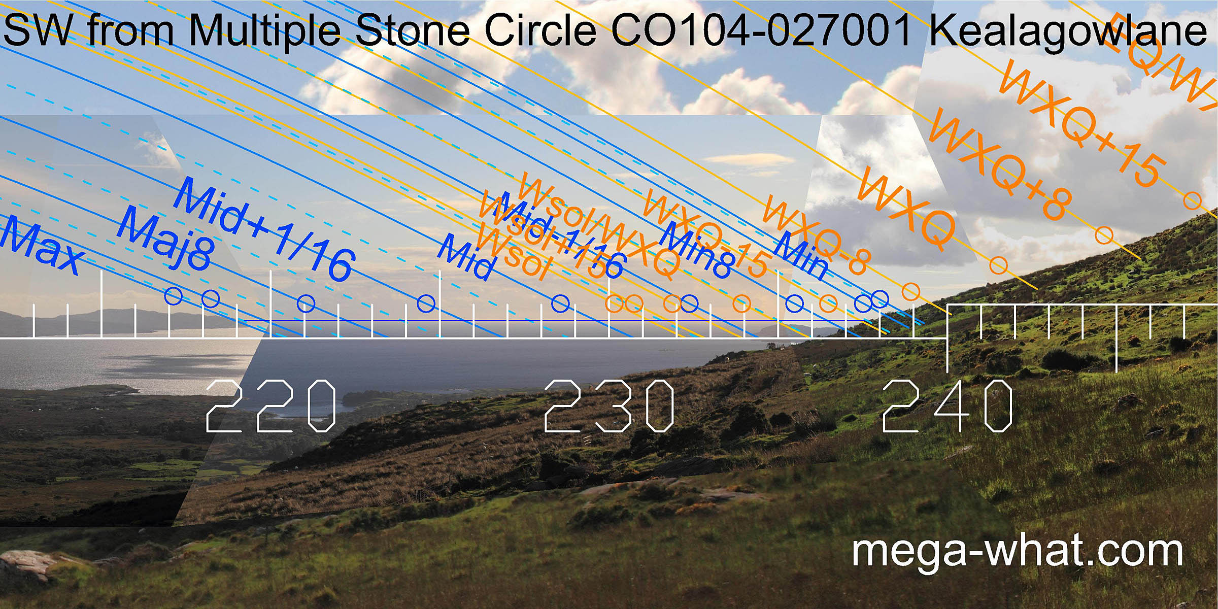 The end of the bay marks the south-western lunisticeLunistices are the most northerly and southerly moons of the month. The lunar equivalent of solstices - more.
range and the top of Bear Island is half-way between winter solstice and winter cross-quarters.
The swell of the local slope is subtle but a fit is there to be found.
The end of the bay marks the south-western lunisticeLunistices are the most northerly and southerly moons of the month. The lunar equivalent of solstices - more.
range and the top of Bear Island is half-way between winter solstice and winter cross-quarters.
The swell of the local slope is subtle but a fit is there to be found.
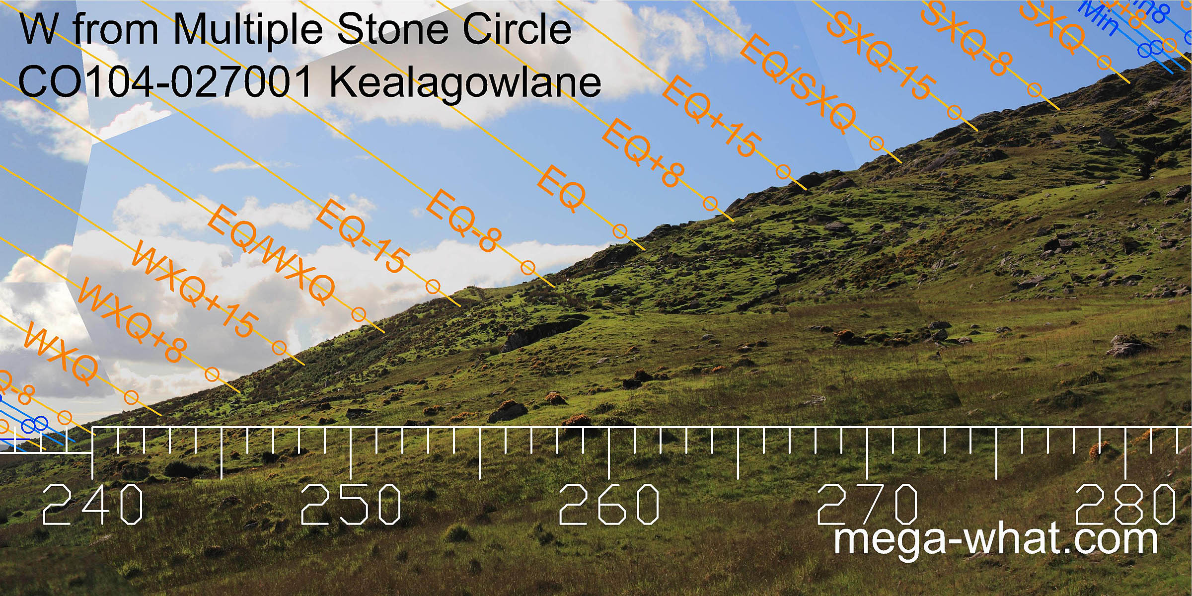 Westwards there is nothing obvious on the local slope but there are many useful markers nonetheless.
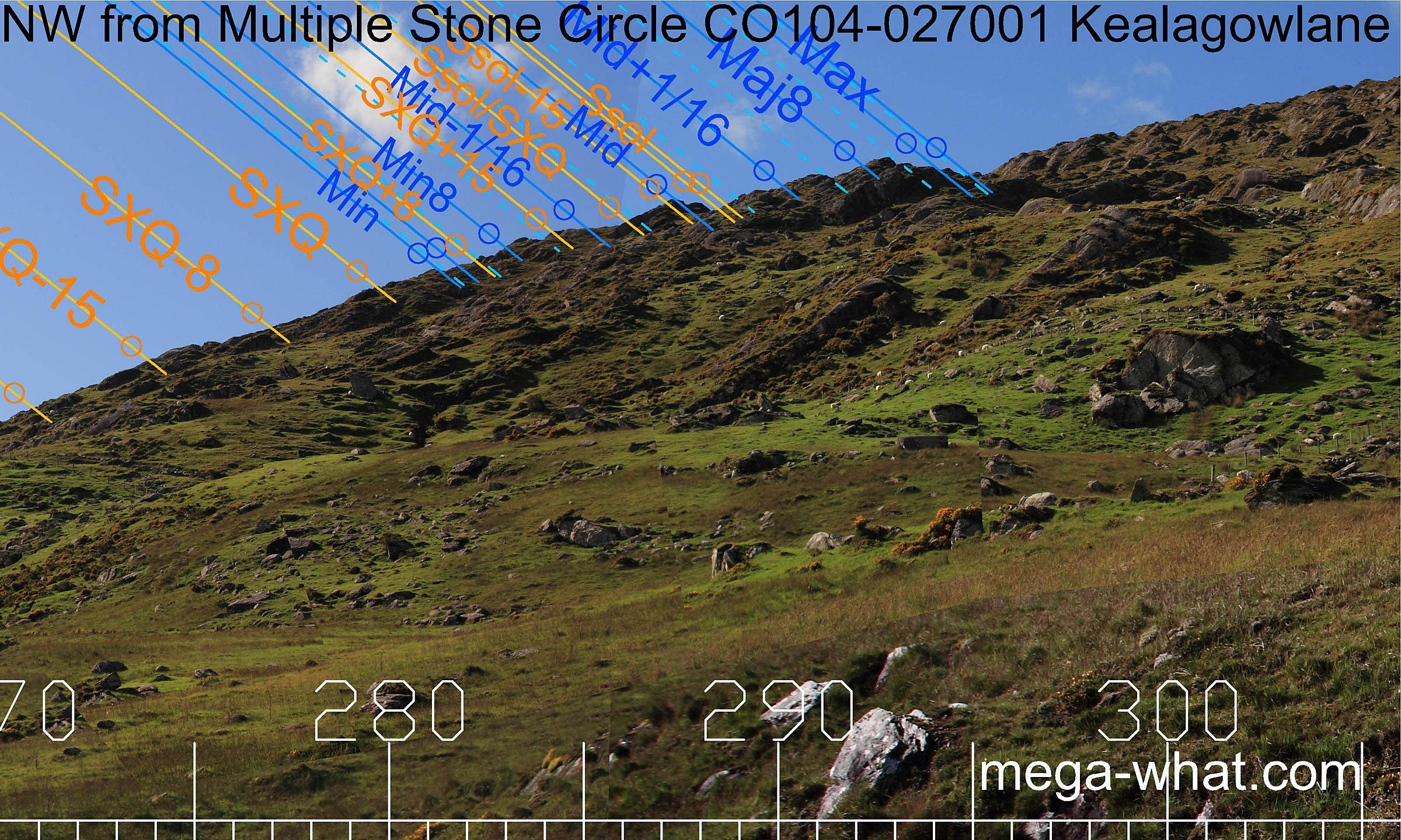 The north-western lunisticeLunistices are the most northerly and southerly moons of the month. The lunar equivalent of solstices - more.
range is set over a craggy block of ground that is of high utility with major standstillLunistice positions vary cyclically over an 18.6 year period but are fairly static for more than a year at either end of the range
at an obvious endstop and winter solstice at another.
The north-western lunisticeLunistices are the most northerly and southerly moons of the month. The lunar equivalent of solstices - more.
range is set over a craggy block of ground that is of high utility with major standstillLunistice positions vary cyclically over an 18.6 year period but are fairly static for more than a year at either end of the range
at an obvious endstop and winter solstice at another.
- Canrooska Five Stone Circle & Stone Row are key sites in the nearest surveyed monument group - c.8.5km north-east (44°)
- Dromkeal Multiple Stone Circle & Boulder-Burial are the nearest of similar type - c.13km east (79°) but unsurveyed
- Derreenataggart Multiple Stone Circle is c.22km west (253°) and easily accessible
References
- Archaeological Survey of Ireland, record details. www.archaeology.ie/archaeological-survey-ireland
- RONAN, S. et al. 2009 Archaeological Inventory of County Cork, Volume 5: West Cork. Dublin: Stationary Office. p10, no.15326.