
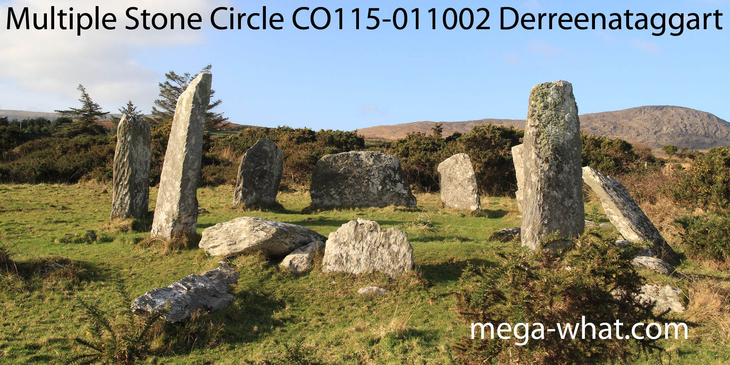
 Derreenataggart Stone Circle is about 1.5km west of Castletown Bere; close to the road and open to the public.
It is about 8m in diameter and twelve stones (eight upright) of a probable fifteen survive.
Thirty metres south-west of the circle, site CO115-011001 is "a raised sub-circular area of rough ground with a recent rectangular depression at its western edge".
Derreenataggart Stone Circle is about 1.5km west of Castletown Bere; close to the road and open to the public.
It is about 8m in diameter and twelve stones (eight upright) of a probable fifteen survive.
Thirty metres south-west of the circle, site CO115-011001 is "a raised sub-circular area of rough ground with a recent rectangular depression at its western edge".
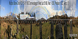 South is at the western edge of a bay [Pic].
![[Pic].](Derreenataggart-S.jpg)
North is on a hilltop [Pic].
![[Pic].](Derreenataggart-N.jpg)
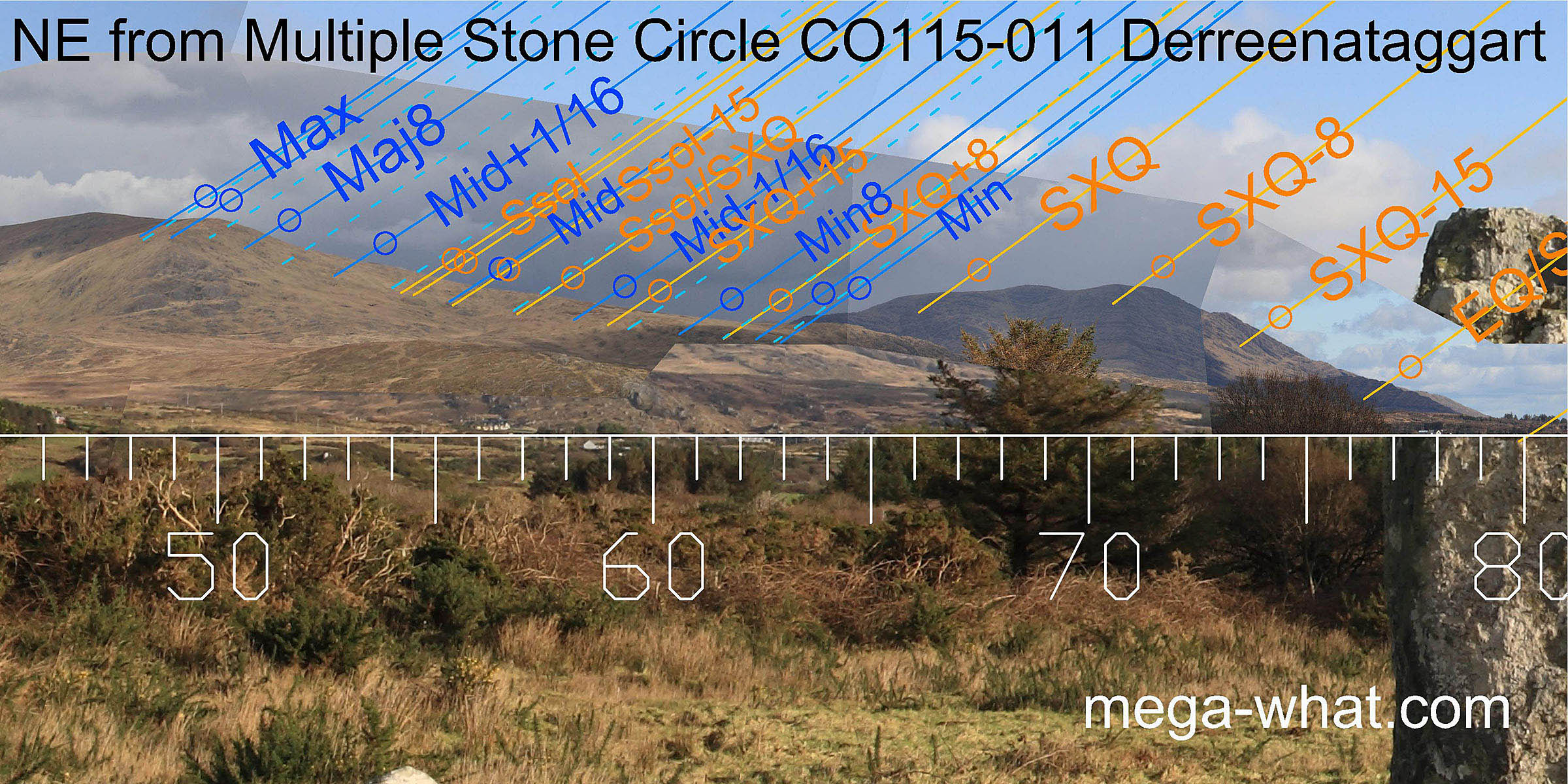 The north-east has been arranged so that the lunisticeLunistices are the most northerly and southerly moons of the month. The lunar equivalent of solstices - more.
range is marked by a slope. At the top, the sixteenth is on the high point and the standstillLunistice positions vary cyclically over an 18.6 year period but are fairly static for more than a year at either end of the range
in the dip just beyond it.
At the bottom, a low rocky eminence has the quarter-month from the cross-quarter and the lunar sixteenth at its northern end and the
standstillLunistice positions vary cyclically over an 18.6 year period but are fairly static for more than a year at either end of the range
to its south. Both ends of the cycle are thus well equipped to measure small differences in lunar position.
The north-east has been arranged so that the lunisticeLunistices are the most northerly and southerly moons of the month. The lunar equivalent of solstices - more.
range is marked by a slope. At the top, the sixteenth is on the high point and the standstillLunistice positions vary cyclically over an 18.6 year period but are fairly static for more than a year at either end of the range
in the dip just beyond it.
At the bottom, a low rocky eminence has the quarter-month from the cross-quarter and the lunar sixteenth at its northern end and the
standstillLunistice positions vary cyclically over an 18.6 year period but are fairly static for more than a year at either end of the range
to its south. Both ends of the cycle are thus well equipped to measure small differences in lunar position.
A section of a more distant rocky ridge may be seen over the middle of the slope and its upper limit marks a lunar sixteenth while the summer solstice sunrise is at its bottom end.
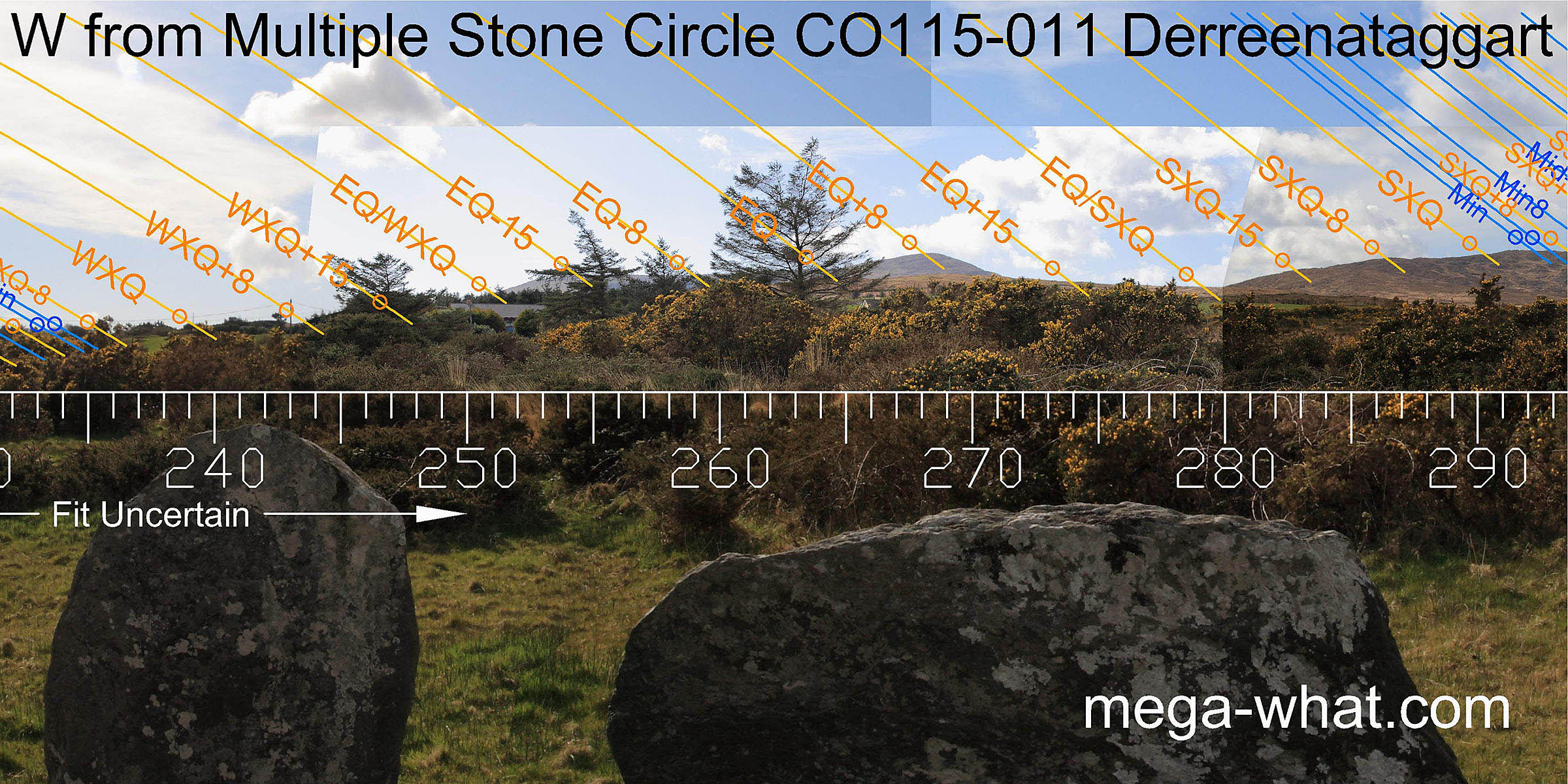
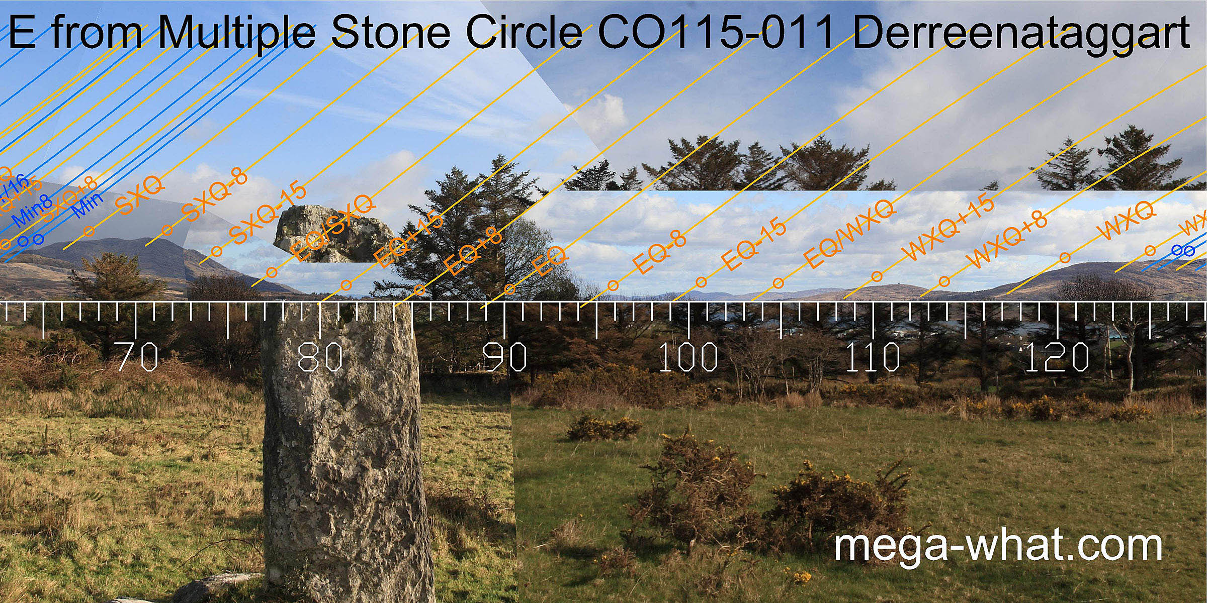 Hungry Hill occupies the horizon from the quarter-month north of the cross-quarters to almost a half-month from the equinox but the significant dates do not fall on the most obvious points.
Detail is largely obscured but the axis is set for spring equinox [Pic].
Hungry Hill occupies the horizon from the quarter-month north of the cross-quarters to almost a half-month from the equinox but the significant dates do not fall on the most obvious points.
Detail is largely obscured but the axis is set for spring equinox [Pic].
![[Pic]](Derreenataggart-Eax.jpg)
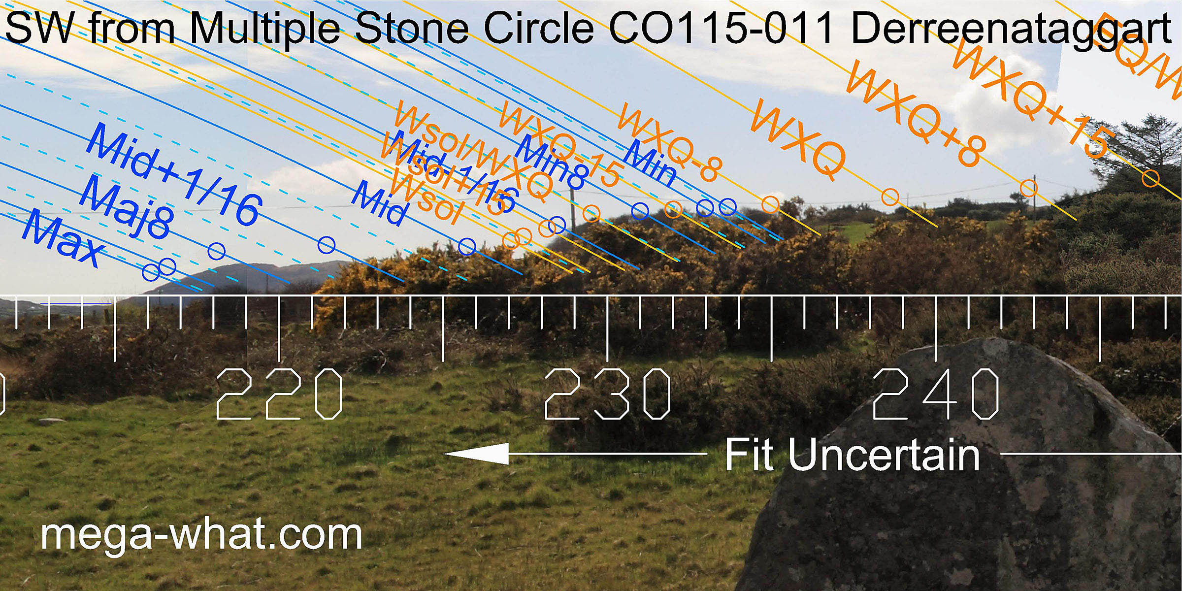
 Bear Island occupies the south-east horizon but trees get in the way a bit.
The lunisticeLunistices are the most northerly and southerly moons of the month. The lunar equivalent of solstices - more.
zone spans a dip with both ends of the cycle and the sixteenths either side of the midpoint getting good markers.
Bear Island occupies the south-east horizon but trees get in the way a bit.
The lunisticeLunistices are the most northerly and southerly moons of the month. The lunar equivalent of solstices - more.
zone spans a dip with both ends of the cycle and the sixteenths either side of the midpoint getting good markers.
 Due south is marked by the intersect of sea horizon with a prominent hill [Pic].
At the other side of that hill, some more sea horizon is just visible through a dip and at its western end the major standstillLunistice positions vary cyclically over an 18.6 year period but are fairly static for more than a year at either end of the range moon would have set into the hillslope about a diameter above the sea.
The next hilltop is the major eighth and the one after that is a sixteenth then the horizon becomes obscured by vegetation.
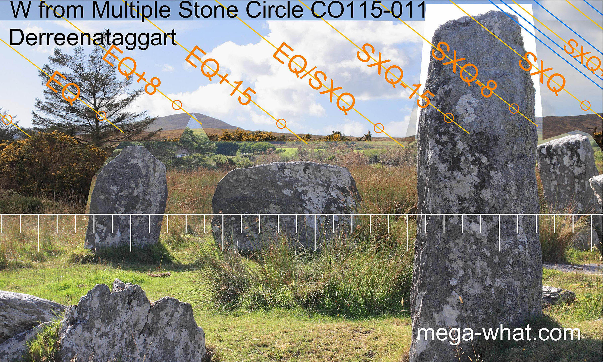
 Westwards, a long hill above the axial stone is again largely obscured but the equinox is at the basal break of the northern summit
which is a quarter-month further north and the southern top is a half-month south of the equinox.
Westwards, a long hill above the axial stone is again largely obscured but the equinox is at the basal break of the northern summit
which is a quarter-month further north and the southern top is a half-month south of the equinox.
Note that this is not an exact axial view. See the view over the axial stone from between the portals here.
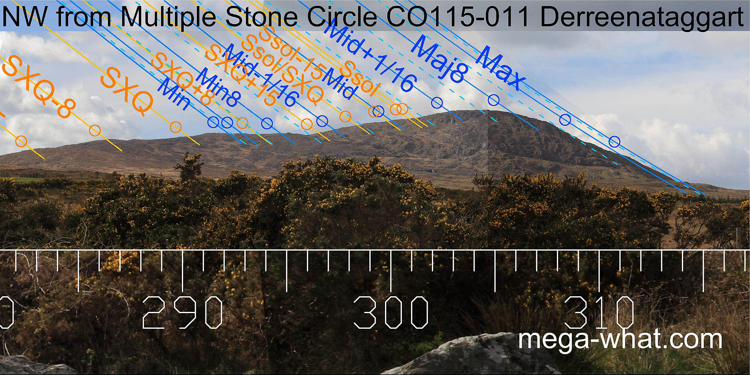 After a stretch of nearer ground another rocky mountain marks out the remainder of the year with the solstice at the obvious break before the summit.
The northern slope has been used to stretch out 5/32 of the lunisticeLunistices are the most northerly and southerly moons of the month. The lunar equivalent of solstices - more.
range with the major standstillLunistice positions vary cyclically over an 18.6 year period but are fairly static for more than a year at either end of the range
at its foot and the half-way point between the major eighth and the lunar mid-cycle on the summit.
After a stretch of nearer ground another rocky mountain marks out the remainder of the year with the solstice at the obvious break before the summit.
The northern slope has been used to stretch out 5/32 of the lunisticeLunistices are the most northerly and southerly moons of the month. The lunar equivalent of solstices - more.
range with the major standstillLunistice positions vary cyclically over an 18.6 year period but are fairly static for more than a year at either end of the range
at its foot and the half-way point between the major eighth and the lunar mid-cycle on the summit.
Due north is marked by a mountain top and there is a very large stone, now fallen, to indicate this axis. Unfortunately its southern counterpart is now missing.
- Knockoura Stone Row c.4km west-south-west (250°) is the nearest surveyed monument
- Barrees Standing Stone Pair is c.6km north.
- Shronebirrane Multiple Stone Circle is c.13km north-east.
- Kealagowlane Stone Circle & Boulder-Burial are c.22km east (73°)
References
- Archaeological Survey of Ireland, record details. www.archaeology.ie/archaeological-survey-ireland
- Ó'NUALLÁIN, SEÁN 1975 The Stone Circle Complex of Cork and Kerry. Journal of the Royal Society of Antiquaries of Ireland 105:83-131, no.15.
- Ó'NUALLÁIN, SEÁN 1984 A Survey of Stone Circles in Cork and Kerry. Proceedings of the Royal Irish Academy 84c:1-77, p20, no.26.
- POWER, D. et al. 1992 Archaeological Inventory of County Cork, Volume 1: West Cork. Dublin: Stationary Office. p21, no.50.
- RUGGLES, C.L.N. 1999 Astronomy in Prehistoric Britain and Ireland. Newhaven & London: Yale University Press. No.ASC40.
- RUGGLES, C.L.N. & PRENDERGAST, F. 1996 A New Archaeoastronomical Investigation of the Irish Axial-Stone Circles. Proceedings of the 2nd SEAC [European Society for Astronomy in Culture] Conference, Bochum, 1994. Bochum: Astronomisches Institut der Ruhr-Universität, 5-13.