
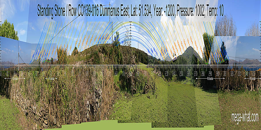
 Dunmanus Stone Row is on the north side of the Mizen peninsula, 12km or so south-west of Durrus and about 2km north of Toormore.
The site is in a saddle from where one may look down to a Boulder-Burial 1100m away on the edge of Dunmanus Bay.
Dunmanus Stone Row is on the north side of the Mizen peninsula, 12km or so south-west of Durrus and about 2km north of Toormore.
The site is in a saddle from where one may look down to a Boulder-Burial 1100m away on the edge of Dunmanus Bay.
South is on a slope [Pic]. North looks to be marked by an intersect notch but trees prevent accurate survey [Pic]. Green lines approximate hidden horizons.
![[Pic].](DunmanusRow-S.jpg)
![[Pic].](DunmanusRow-N.jpg)
 Officially listed as a Standing Stone, this was a three-stone row but now only the centre stone is upright and leaning badly.
Against it lies the south-western stone and the north-east one lies roughly where it should be but pointing along the row axis.
The visible parts of the three stones (from SW to NE) measure 200x110x20cm, 245x150x20cm & 250x140x20cm.
Officially listed as a Standing Stone, this was a three-stone row but now only the centre stone is upright and leaning badly.
Against it lies the south-western stone and the north-east one lies roughly where it should be but pointing along the row axis.
The visible parts of the three stones (from SW to NE) measure 200x110x20cm, 245x150x20cm & 250x140x20cm.
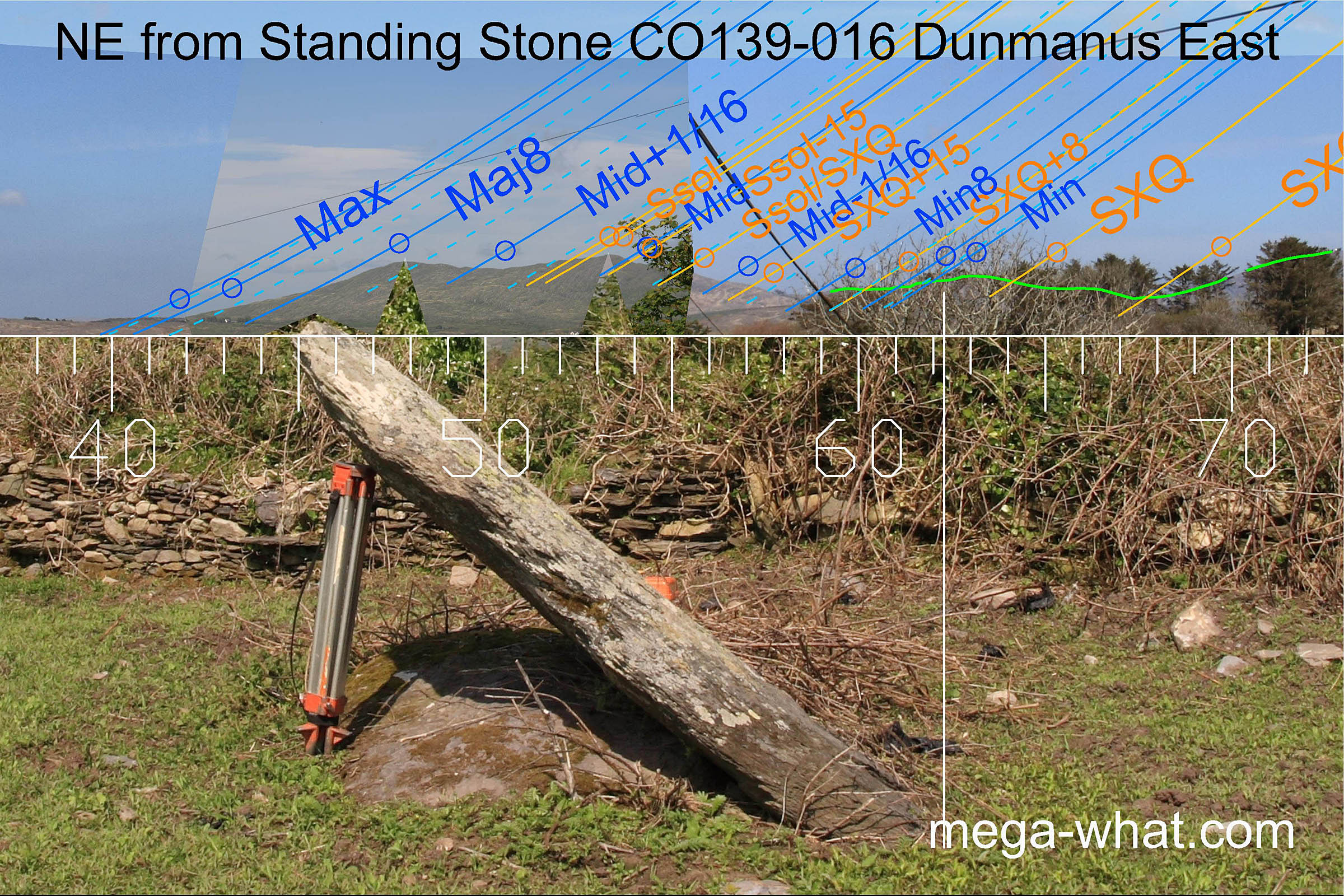
North-eastwards is Knockaughna, which has the lunar limit at its north basal step and provides a number of useful markers. the lunar minor eighth is at its southern foot though summer growth obscures the view. Minor standstillLunistice positions vary cyclically over an 18.6 year period but are fairly static for more than a year at either end of the range would appear to be on a lower hilltop.
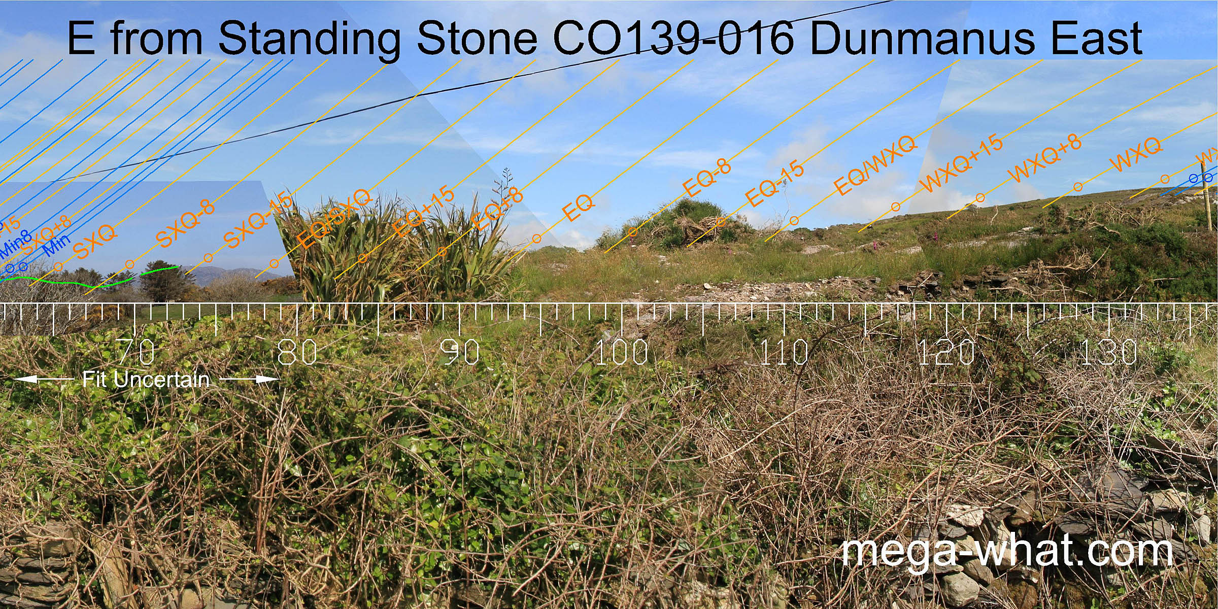 A good part of the east is obscured by nearby vegetation. Beyond the local ground some undulations of the rising slope make useful markers.
 The lunisticeLunistices are the most northerly and southerly moons of the month. The lunar equivalent of solstices - more.
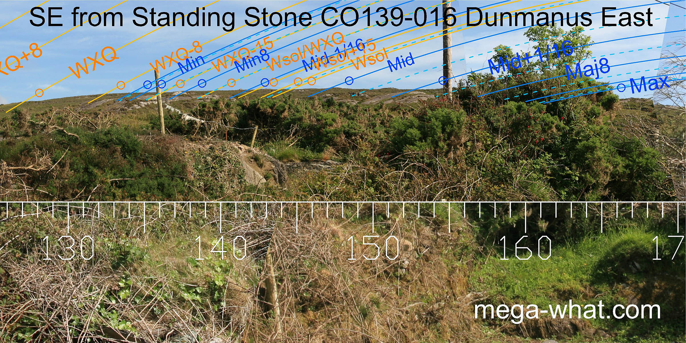
range spans the south-eastern hill, with the lunar midpoint and the solstice on the highest part.
The lunisticeLunistices are the most northerly and southerly moons of the month. The lunar equivalent of solstices - more.
range spans the south-eastern hill, with the lunar midpoint and the solstice on the highest part.
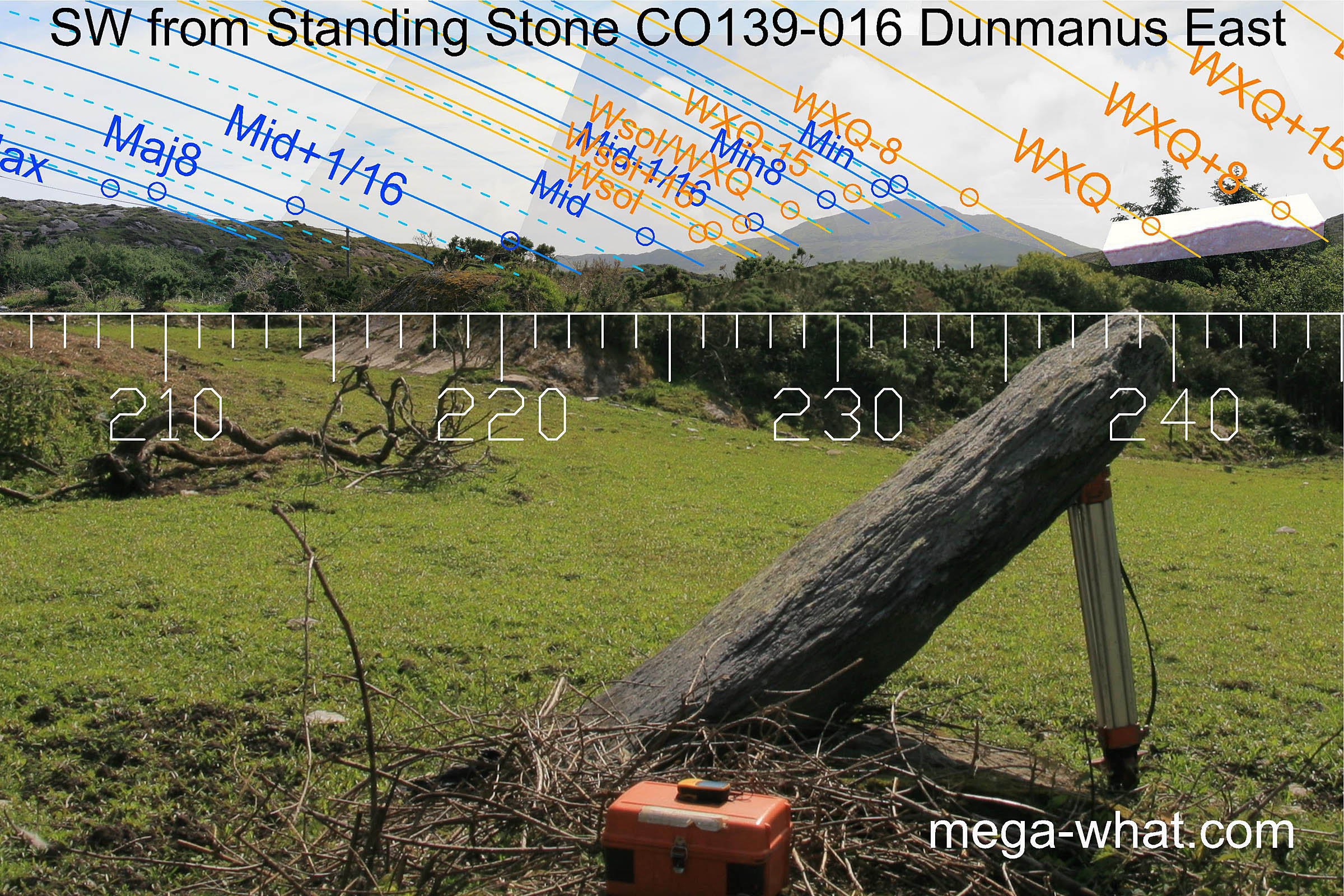 South-west is Knockaphuca, the summit of which is good mark for the minor end of the lunisticeLunistices are the most northerly and southerly moons of the month. The lunar equivalent of solstices - more.
range.
The solstice is at the south base of the hill, marked by an obvious rock knob. The lunar midpoint is marked by another larger one.
South-west is Knockaphuca, the summit of which is good mark for the minor end of the lunisticeLunistices are the most northerly and southerly moons of the month. The lunar equivalent of solstices - more.
range.
The solstice is at the south base of the hill, marked by an obvious rock knob. The lunar midpoint is marked by another larger one.
To the north of the hill the quarter-month brackets for the winter cross-quarter both get better markers than the cross-quarter itself.
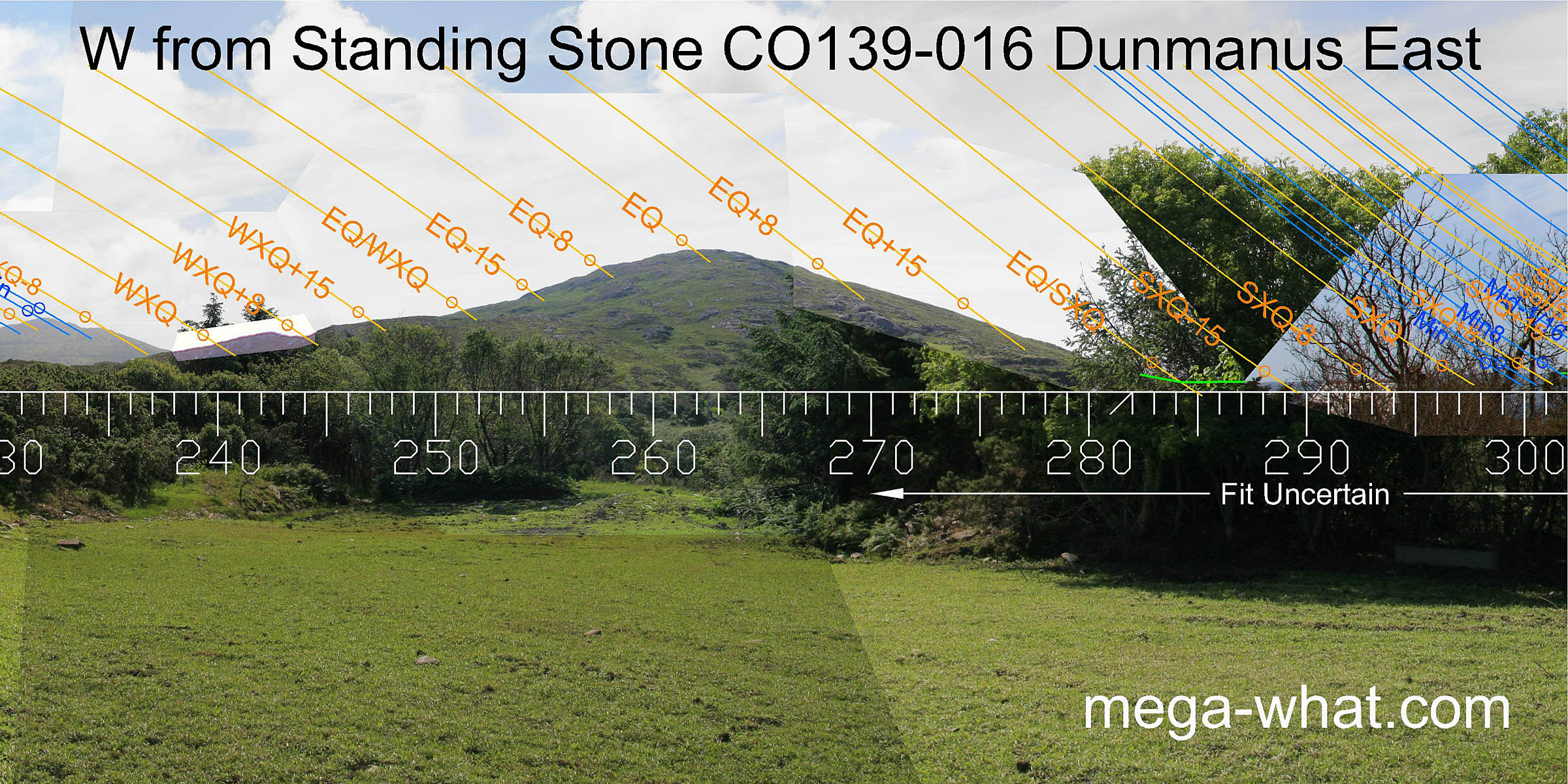 Westwards the local hilltop of Dunmanus West has the equinoctial sunset on its top and maybe the equinox / cross-quarter midpoint at its northern intersect with more distant horizons.
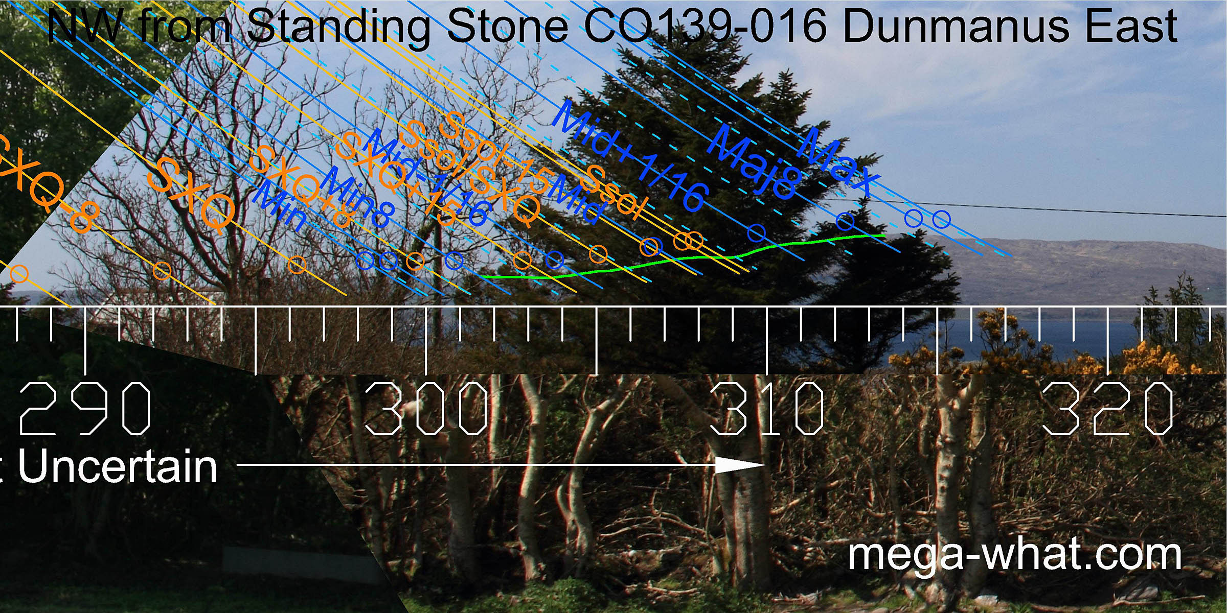 The north-west is largely obscured by trees but it looks as though the lunar sets run up a hillslope, with the eighths at bottom and top. The solstice would seem to be at a step.
The nearest extant Stone Rows are:
- Farranamanagh across Dunmanus bay on the Sheep's Head.
- Murrahin a bit inland from Roaringwater Bay.
References
- Archaeological Survey of Ireland, record details. www.archaeology.ie/archaeological-survey-ireland
- POWER, D. et al. 1992 Archaeological Inventory of County Cork, Volume 1: West Cork. Dublin: Stationary Office. p56, no.359.