
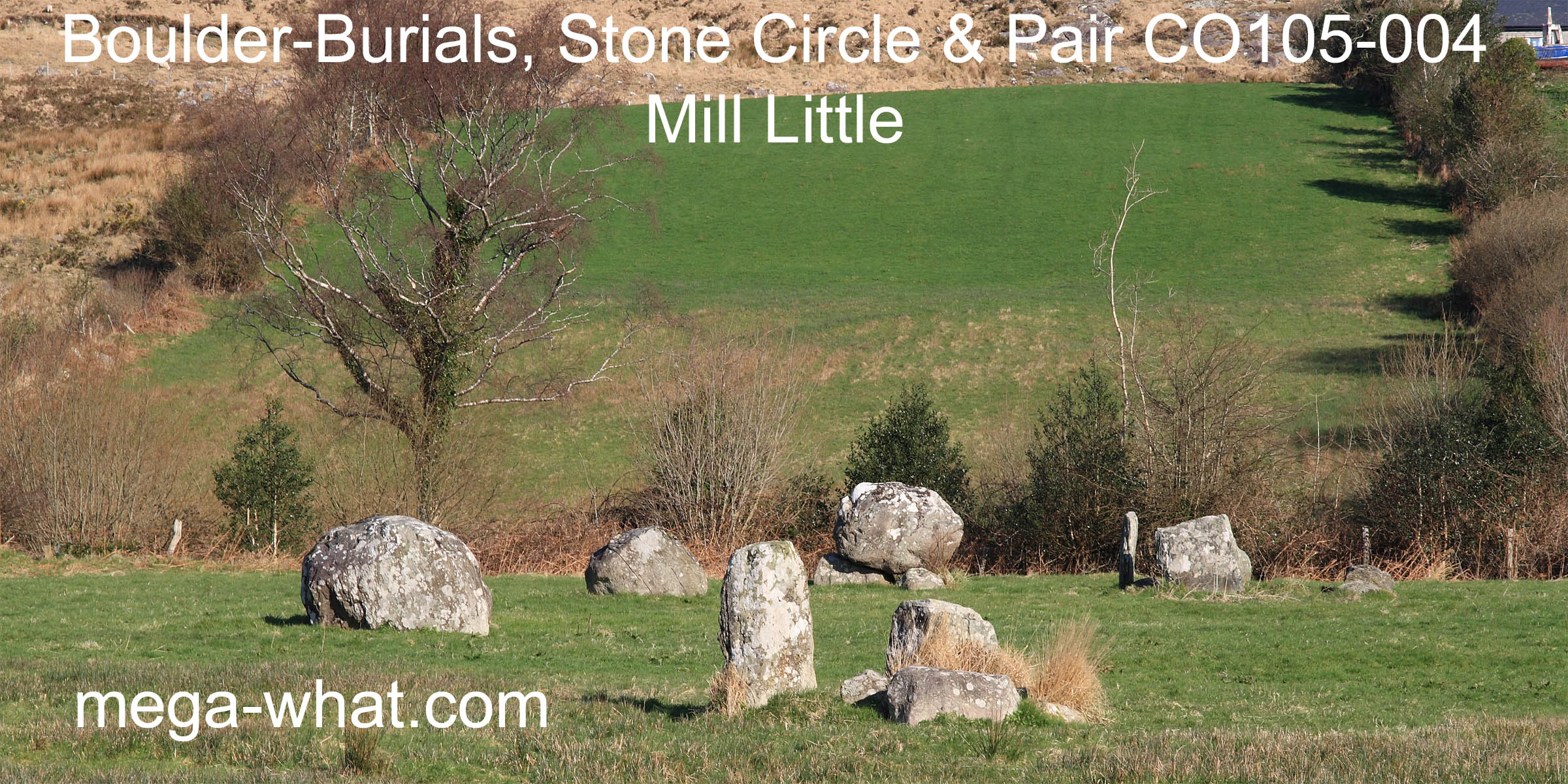
 Mill Little Boulder-Burials, Stone Circle & Stone Pair are in Coomhola, about 4km north of Ballylicky as the crow flies.
South is indicated by a saddle from the Circle [Pic], the South Boulder-Burial [Pic] but only from the Stone Pair [Pic] is it exactly at the bottom.
![[Pic]](MillLittleNB-S.jpg)
![[Pic]](MillLittleSB-S.jpg)
![[Pic]](MillLittlePR-S.jpg)
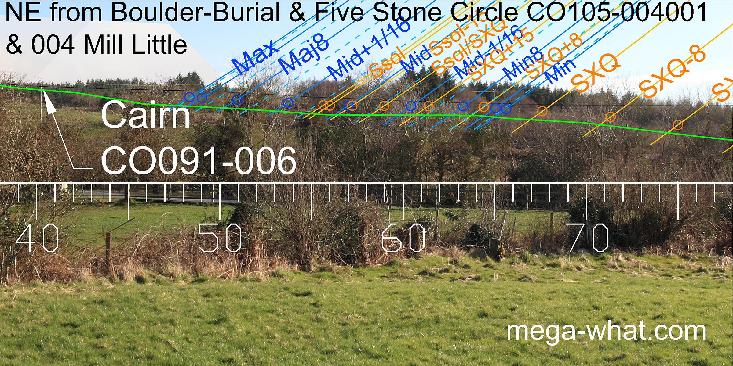
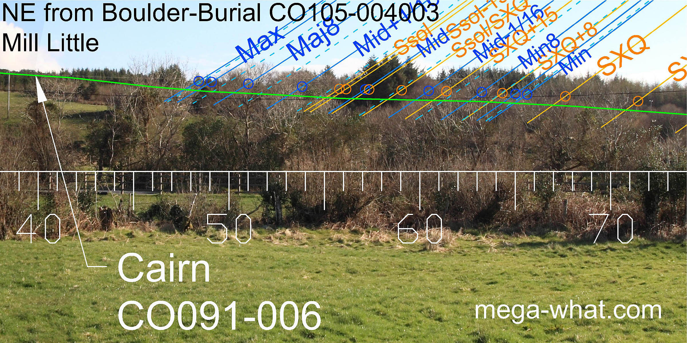
North is on the right side of a dip from the Circle [Pic], the South Boulder-Burial [Pic] and the Stone Pair [Pic] but with varying degrees of precision. Green lines approximate hidden horizons.
![[Pic]](MillLittleNB-N.jpg)
![[Pic]](MillLittleSB-N.jpg)
![[Pic]](MillLittlePR-N.jpg)
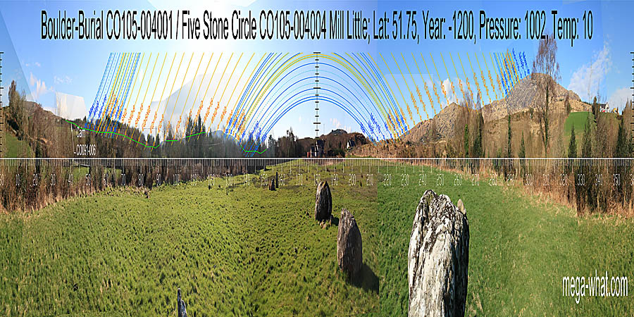
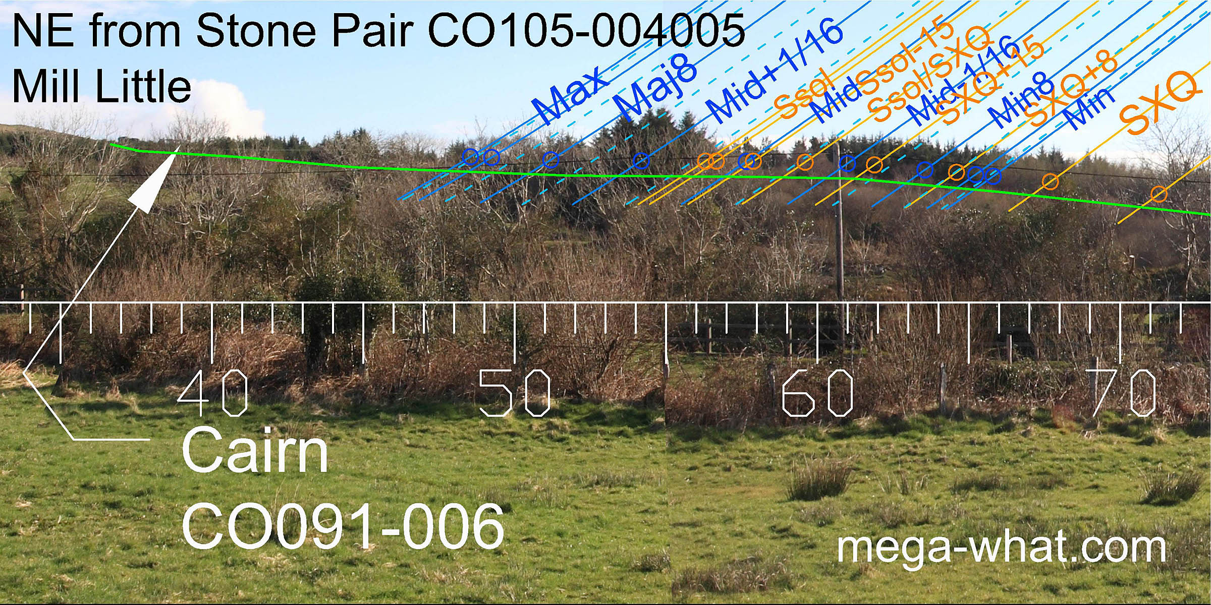
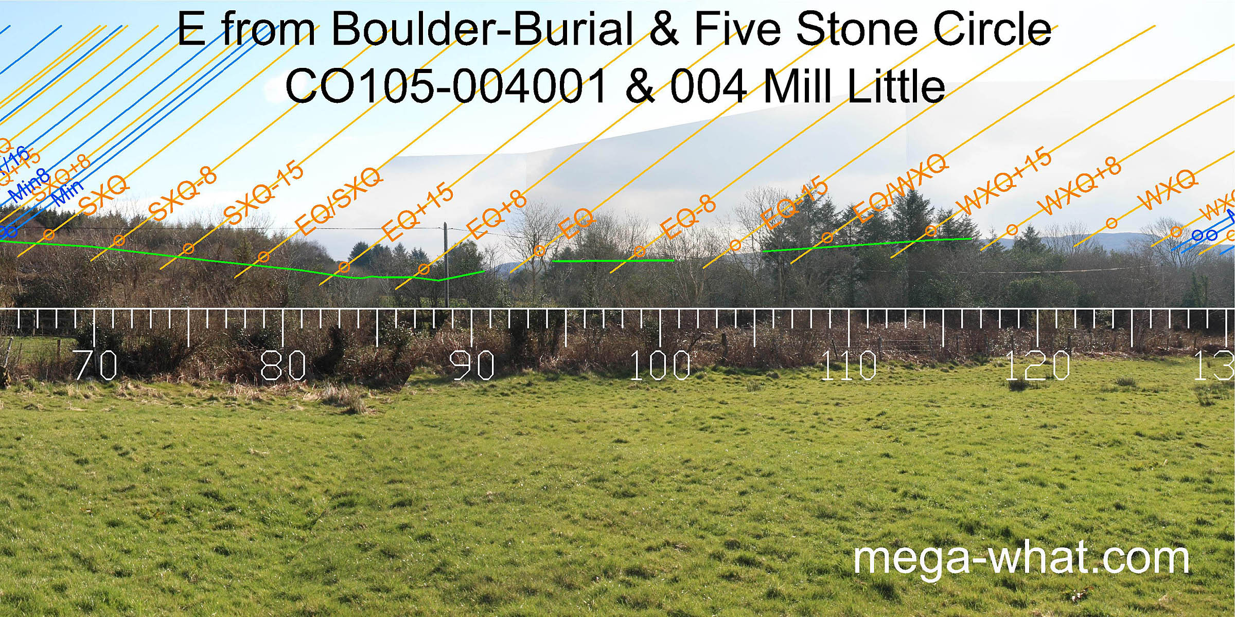
 There are three boulder-burials. The north-most has a five-stone circle with radially set portals beside it, effectively in the same place.
From the northern boulder, the south-most one is 37m to the south-south-east (169°) and a Standing Stone pair is 52m to the south-east (134°).
There are three boulder-burials. The north-most has a five-stone circle with radially set portals beside it, effectively in the same place.
From the northern boulder, the south-most one is 37m to the south-south-east (169°) and a Standing Stone pair is 52m to the south-east (134°).
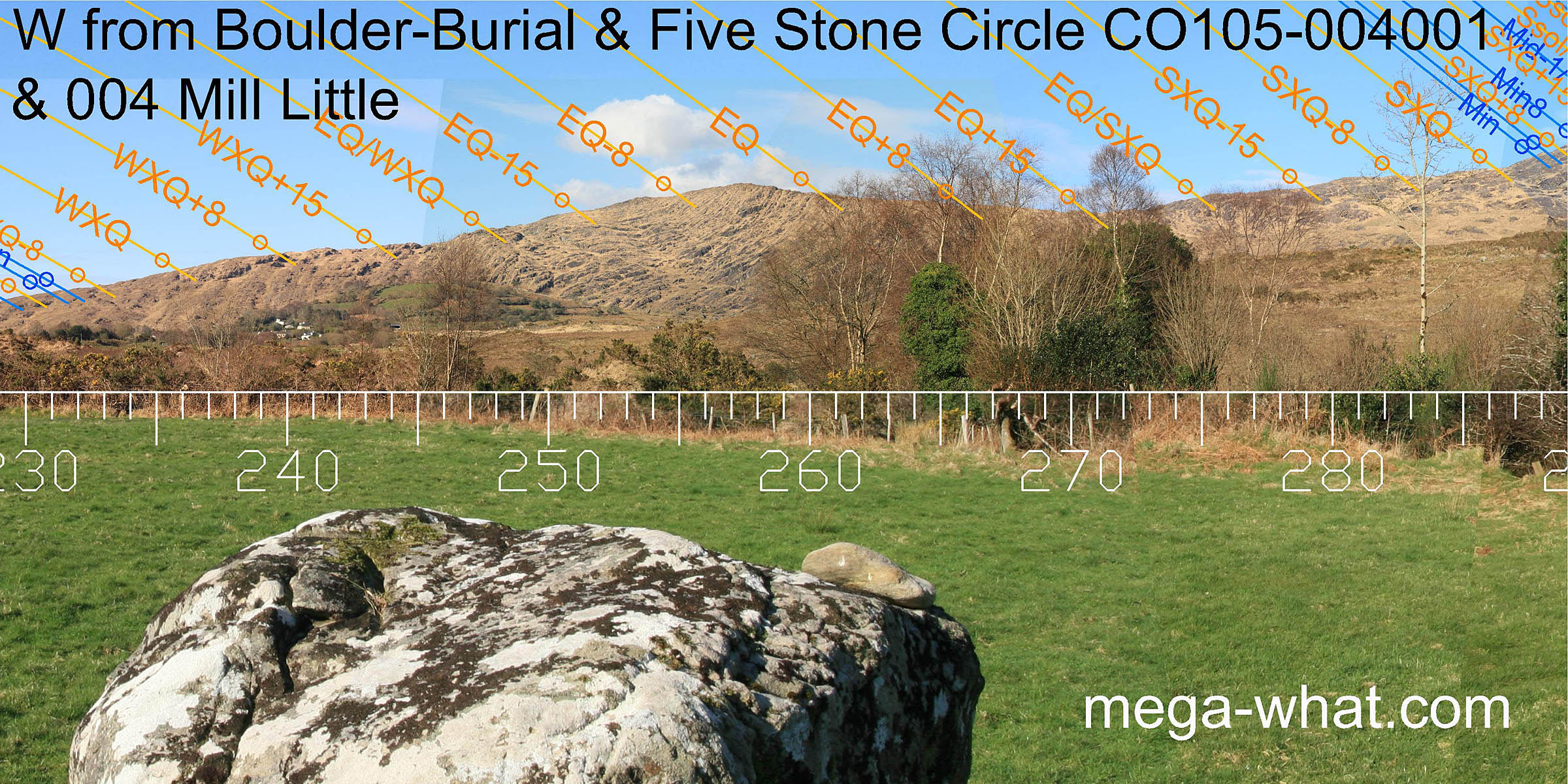
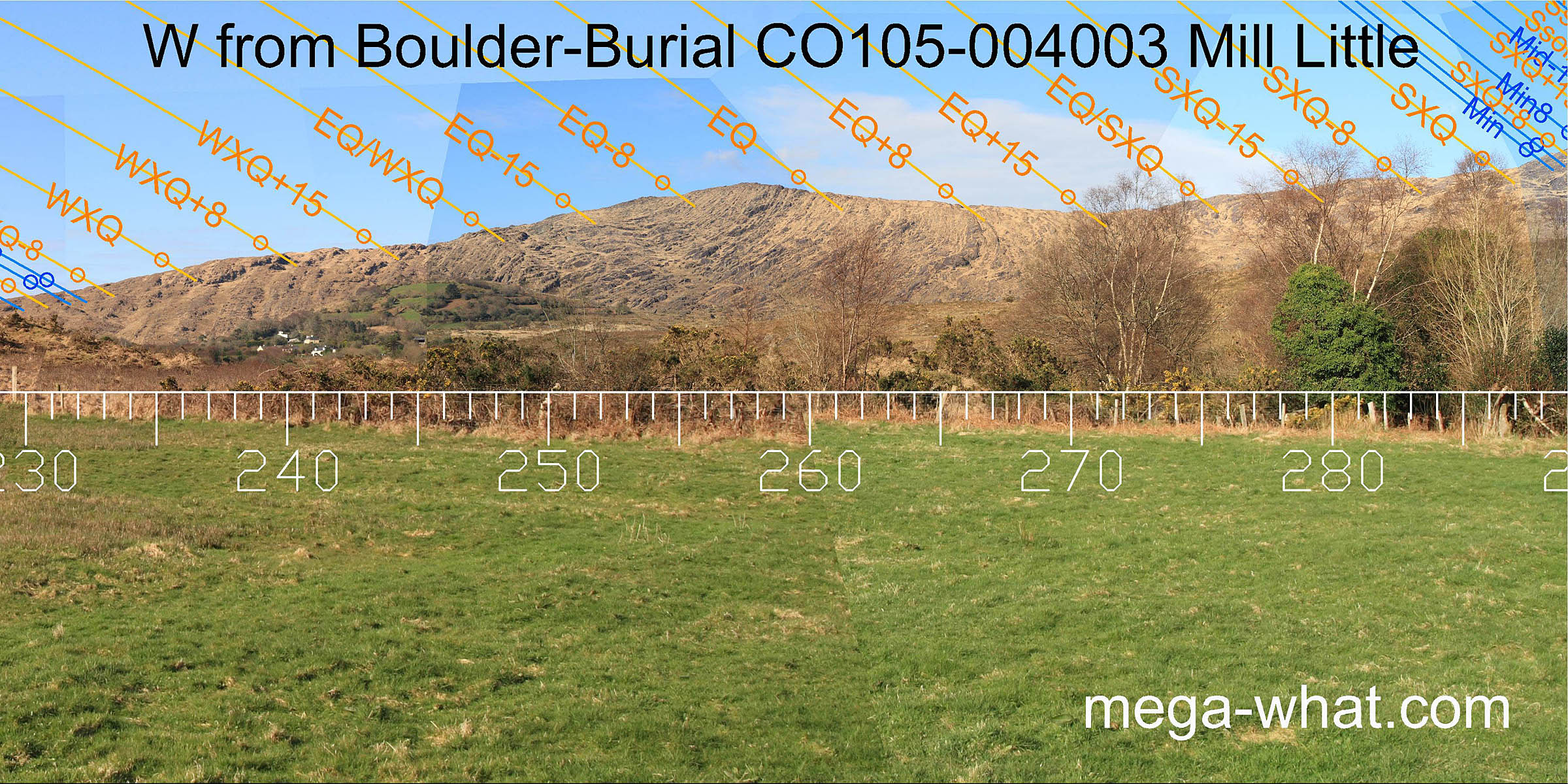
To the north-east, Carran Cairn is on the horizon but beyond the lunar limit. The remainder of the quadrant is obscured by trees, as is the east although there is clearly a dip a week or two north of the equinox [Mill Little page 2].
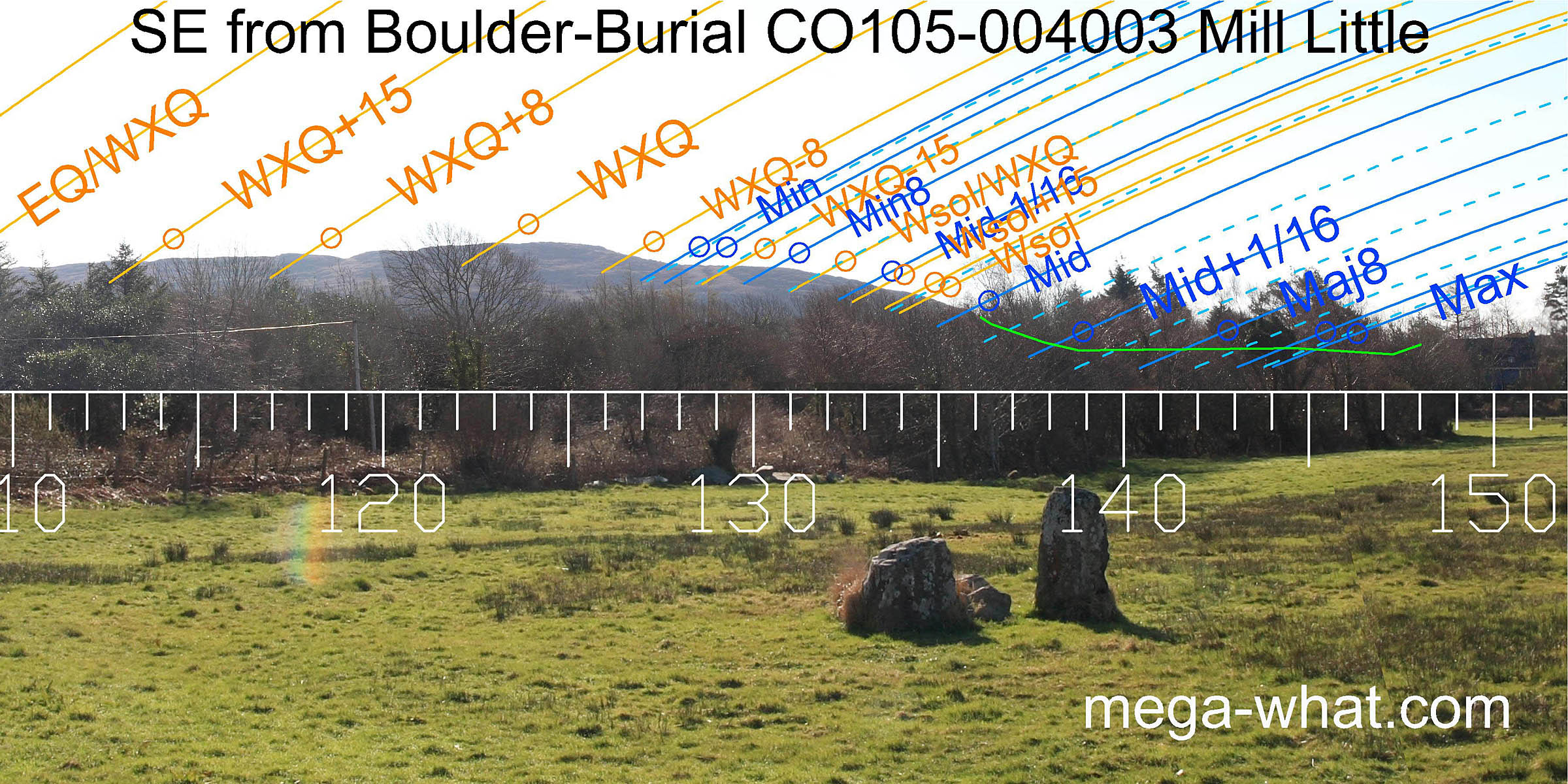
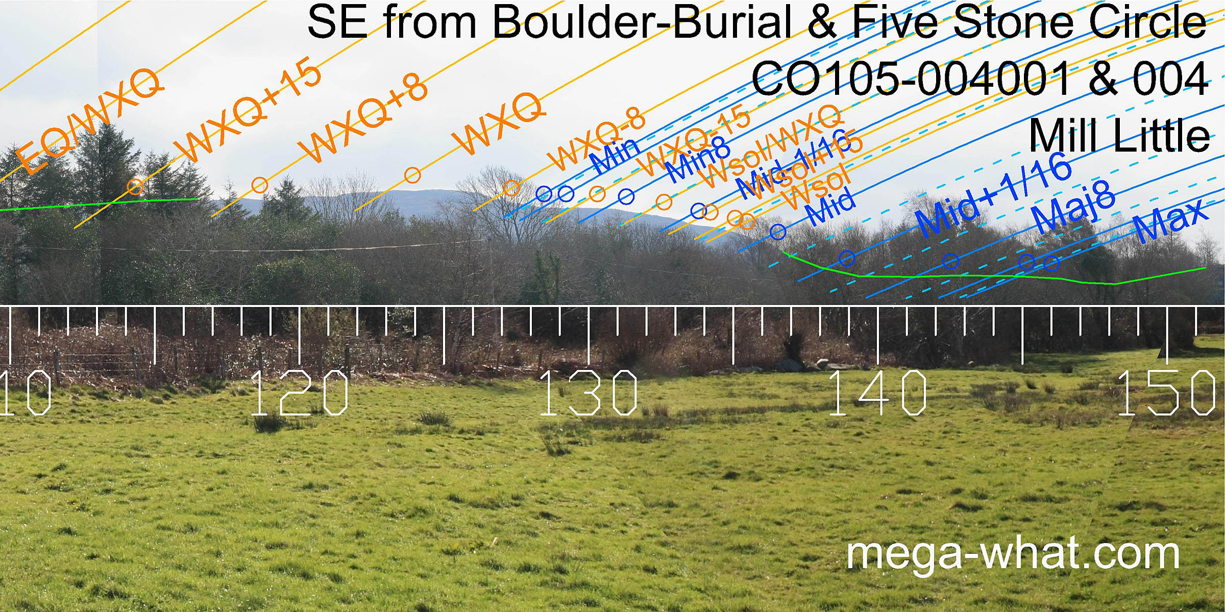 Part of the south-east horizon is visible and the differences there are slight but critical and informative.
Most apparently significant is the minor end of the lunisticeLunistices are the most northerly and southerly moons of the month. The lunar equivalent of solstices - more.
range.
Part of the south-east horizon is visible and the differences there are slight but critical and informative.
Most apparently significant is the minor end of the lunisticeLunistices are the most northerly and southerly moons of the month. The lunar equivalent of solstices - more.
range.
From the northern boulder, a small but sharp notch, barely visible in the photo but clear to the eye, exactly marks the sixteenth adjacent to the minor standstillLunistice positions vary cyclically over an 18.6 year period but are fairly static for more than a year at either end of the range. From the pair, the same notch exactly marks the minor standstillLunistice positions vary cyclically over an 18.6 year period but are fairly static for more than a year at either end of the range itself. This last is also true from the southern boulder but is not quite as accurate.
 The major end of the lunisticeLunistices are the most northerly and southerly moons of the month. The lunar equivalent of solstices - more.
range was obviously in the dip that is now full of trees.
The moon would then, at its most southerly extreme, rise at the eastern foot of the hill which forms the southern horizon and set at its western foot.
The major end of the lunisticeLunistices are the most northerly and southerly moons of the month. The lunar equivalent of solstices - more.
range was obviously in the dip that is now full of trees.
The moon would then, at its most southerly extreme, rise at the eastern foot of the hill which forms the southern horizon and set at its western foot.
 From the pair another dip, further back along the ridge, changes declination by a whole degree to become an accurate half-month bracket for the winter cross-quarters.
Again, the southern boulder is the same but slightly less accurate.
From the pair another dip, further back along the ridge, changes declination by a whole degree to become an accurate half-month bracket for the winter cross-quarters.
Again, the southern boulder is the same but slightly less accurate.
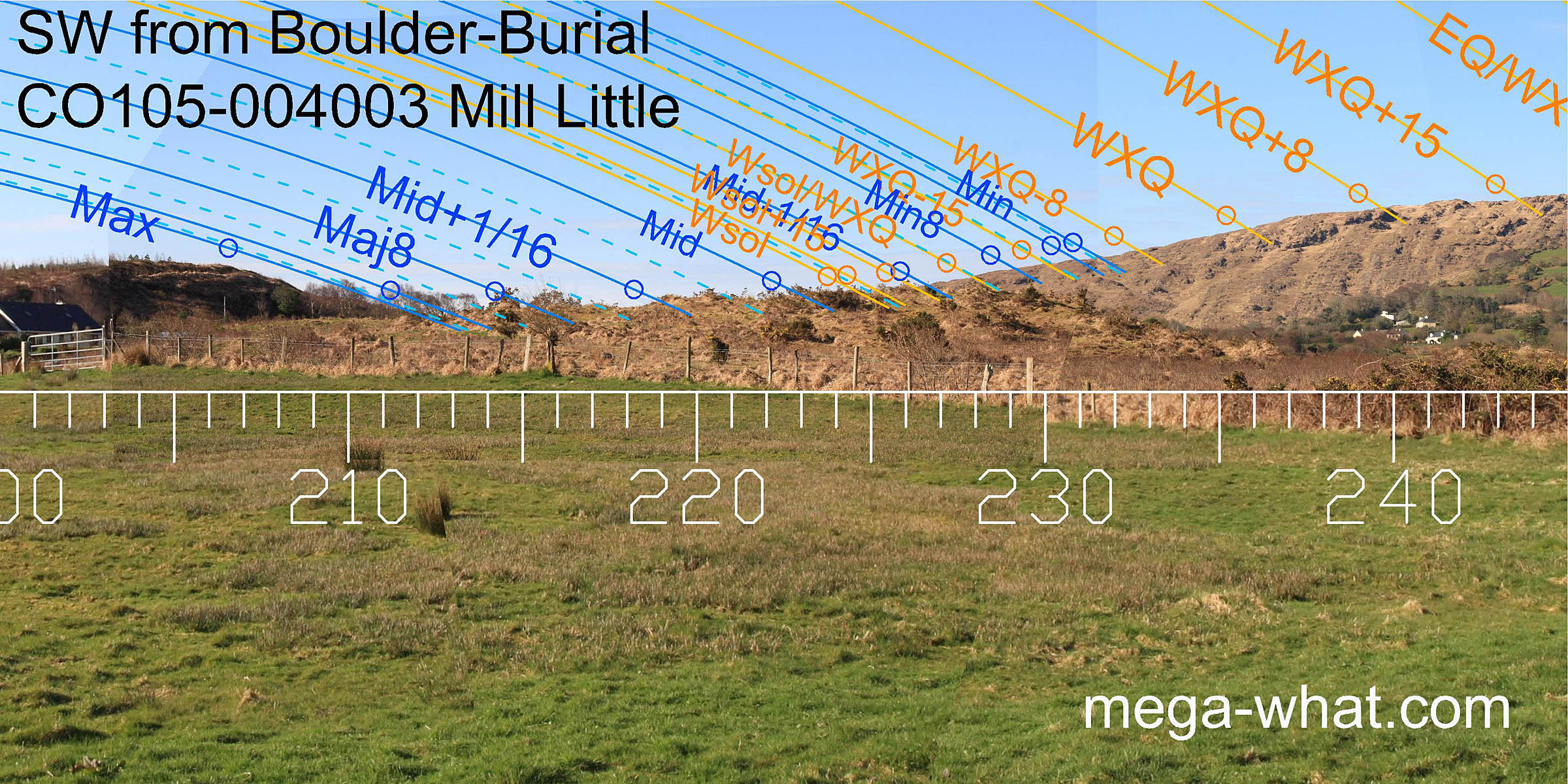
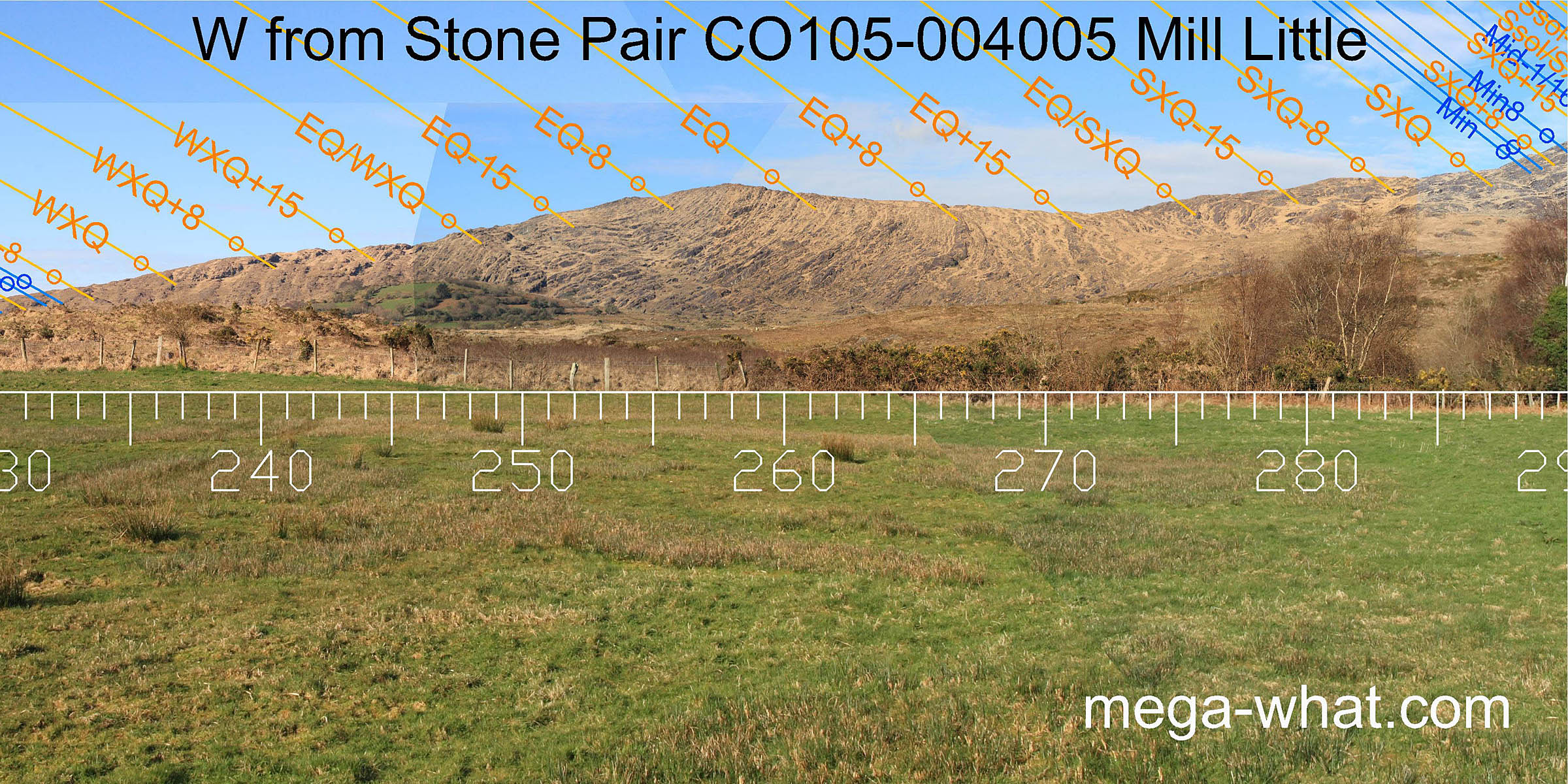
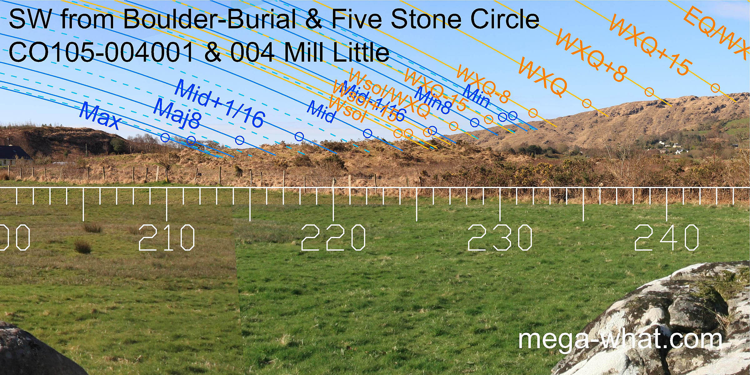 To the south-west, a local rise cuts the further horizon. From the northern boulder a sharply pointed outcrop marks WXQ-8 and the last hump of the far slope is Wsol+15.
The solstice itself falls on the local ground and the major standstillLunistice positions vary cyclically over an 18.6 year period but are fairly static for more than a year at either end of the range
is at the intersect with the southern hill.
To the south-west, a local rise cuts the further horizon. From the northern boulder a sharply pointed outcrop marks WXQ-8 and the last hump of the far slope is Wsol+15.
The solstice itself falls on the local ground and the major standstillLunistice positions vary cyclically over an 18.6 year period but are fairly static for more than a year at either end of the range
is at the intersect with the southern hill.
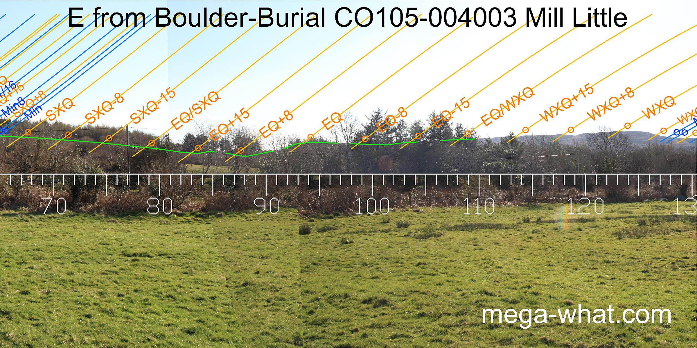
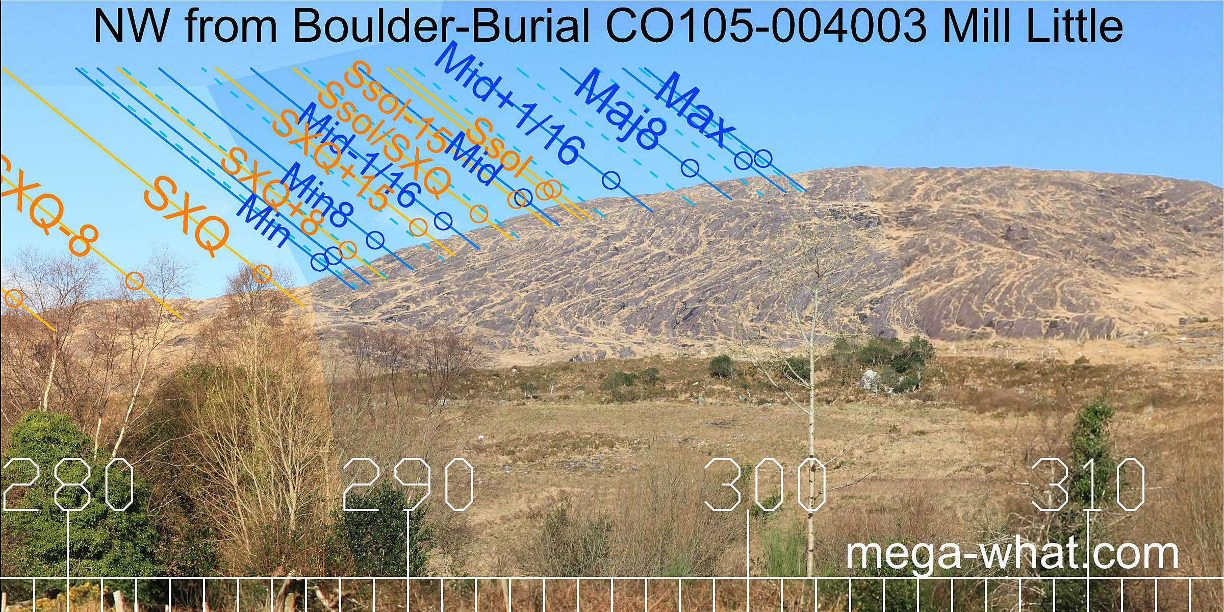
 From the southern boulder the sharply pointed outcrop marks the minor standstillLunistice positions vary cyclically over an 18.6 year period but are fairly static for more than a year at either end of the range.
The solstitial half-month bracket is again just at the end of the far ridge though the hump is no longer visible.
The major standstillLunistice positions vary cyclically over an 18.6 year period but are fairly static for more than a year at either end of the range
now skims the edge of the southern hill a little more closely. There are other subtle differences in this quadrant but nothing significant.
From the southern boulder the sharply pointed outcrop marks the minor standstillLunistice positions vary cyclically over an 18.6 year period but are fairly static for more than a year at either end of the range.
The solstitial half-month bracket is again just at the end of the far ridge though the hump is no longer visible.
The major standstillLunistice positions vary cyclically over an 18.6 year period but are fairly static for more than a year at either end of the range
now skims the edge of the southern hill a little more closely. There are other subtle differences in this quadrant but nothing significant.
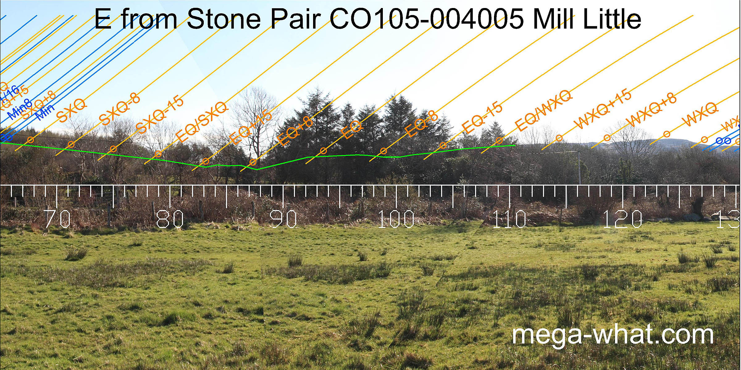
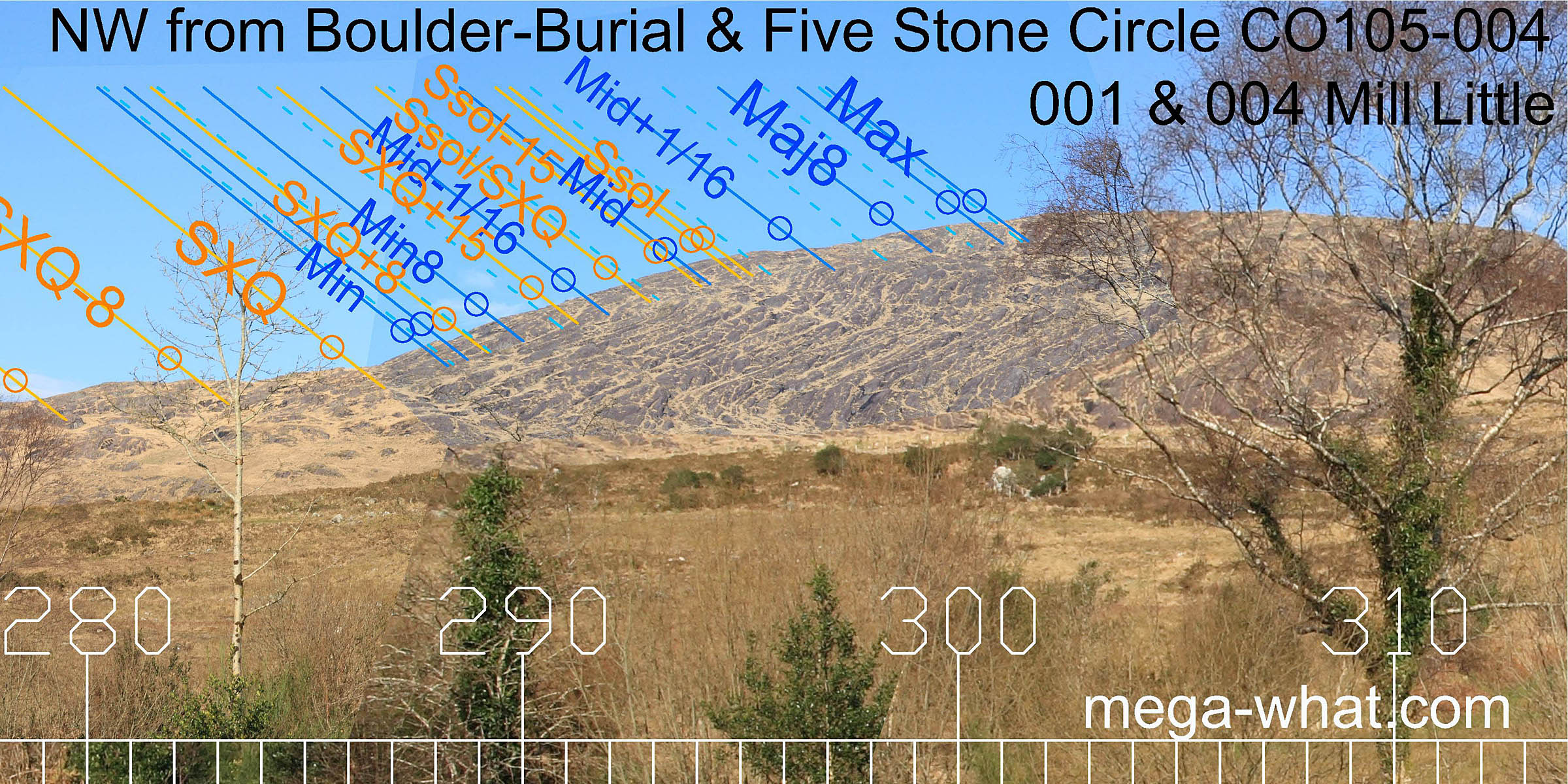
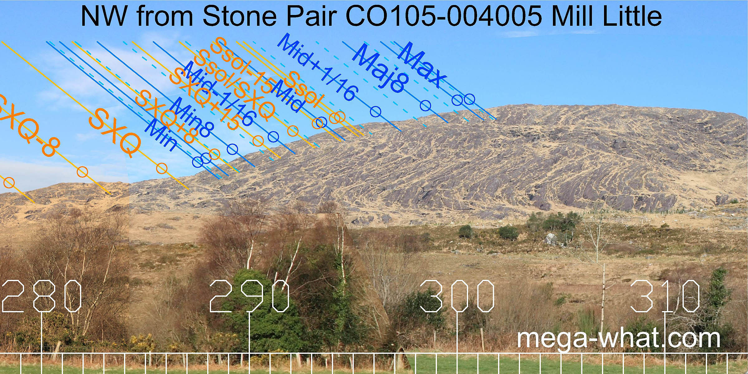
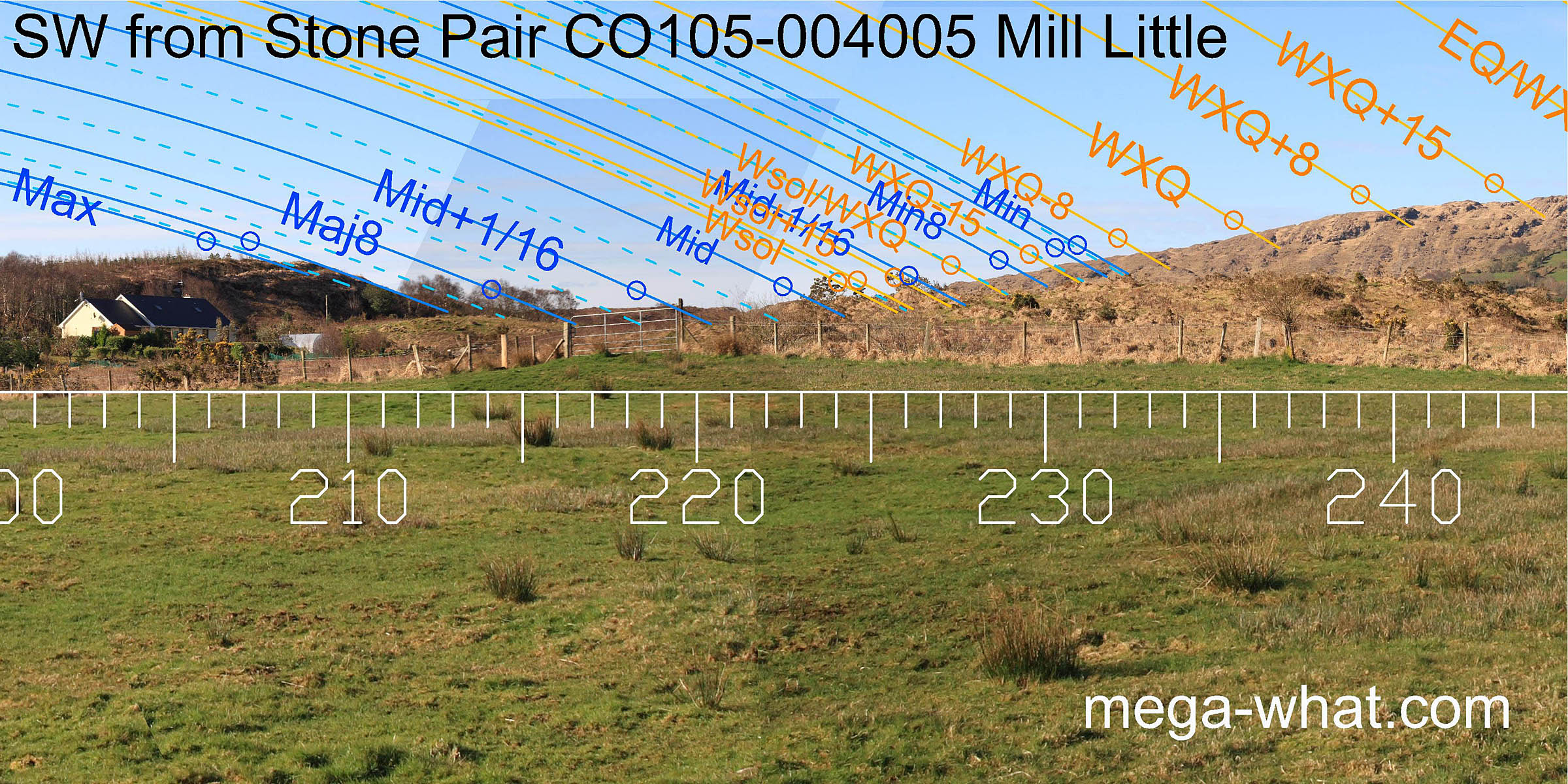 The stone pair offers a significant shift with the sharply pointed outcrop not being used at all.
Local ground now barely cuts the further horizon but the solstice is on it again.
The slope of the southern hill has become a very precise indicator for the sixteenth adjacent to the major standstillLunistice positions vary cyclically over an 18.6 year period but are fairly static for more than a year at either end of the range.
The major eighth, the lunar midpoint and the sixteenth between them all now fall on key points of the far horizon.
The axis of the pair is about 19° clockwise of due south and of no obvious celestial significance.
The stone pair offers a significant shift with the sharply pointed outcrop not being used at all.
Local ground now barely cuts the further horizon but the solstice is on it again.
The slope of the southern hill has become a very precise indicator for the sixteenth adjacent to the major standstillLunistice positions vary cyclically over an 18.6 year period but are fairly static for more than a year at either end of the range.
The major eighth, the lunar midpoint and the sixteenth between them all now fall on key points of the far horizon.
The axis of the pair is about 19° clockwise of due south and of no obvious celestial significance.
 Both boulder one and the circle beside it seem to indicate the direction of a half-month south of the equinox
[Pic].
This horizon segment is very similar from all the monuments and this part of the year requires the least precision as the sun is moving quite rapidly.
Note that the western hilltop is not used as a marker but the steps either side of it are.
Both boulder one and the circle beside it seem to indicate the direction of a half-month south of the equinox
[Pic].
This horizon segment is very similar from all the monuments and this part of the year requires the least precision as the sun is moving quite rapidly.
Note that the western hilltop is not used as a marker but the steps either side of it are.
![[Pic].](MillLittleNB-Wax.jpg)
 North-westwards, the most notable difference is that the prominent step at the foot of the hill is accurate for the cross-quarters
from the northern boulder but not the southern one or the Standing Stone pair.
North-westwards, the most notable difference is that the prominent step at the foot of the hill is accurate for the cross-quarters
from the northern boulder but not the southern one or the Standing Stone pair.
This site is interesting for the subtly different ways that the same landscape has been utilised from slightly different positions. There are no other major monuments in the area but there are a number of Standing Stones nearby to the west and north-west. It seems likely that these provide additional observing positions and were erected by the same people. A possible connection between boulder-burials, skyline cairns, and standing stones has become apparent during this project and, while Carran Cairn is not astronomically significant from here, it marks lunar major standstill from the nearest Standing Stone, at Farranfadda.
For more pics & info about axial orientations etc, see Mill Little page 2.
- Canrooska Five Stone Circle & Stone Row are 5.7km west (286°)
- Breeny More Stone Circle & Boulder-Burials are 6.2km east (101°)
- Kealkill Five Stone Circle, Pair & Cairn are 6.5km east (98°)
- Derrynafinchin Multi Stone Circle & Boulder-Burial are 8.1km north-east (45°)
Other Standing Stone pairs with extreme axes occur at:
- Dromasta near Drimoleague.
- Rathcool near Schull on the Mizen peninsula.
- Kilcrohane on the Sheep's Head peninsula.
References
The national site number is CO105-004 but the final digits indicating a specific monument are 01 etc in the printed inventory, 001 etc in the online database.
- Archaeological Survey of Ireland, record details. www.archaeology.ie/archaeological-survey-ireland
- Ó'NUALLÁIN, SEÁN 1975 The Stone Circle Complex of Cork and Kerry. Journal of the Royal Society of Antiquaries of Ireland 105:83-131, no.82.
- Ó'NUALLÁIN, SEÁN 1978 Boulder-Burials. Proceedings of the Royal Irish Academy 78c:75-114, p87, no.11.
- Ó'NUALLÁIN, SEÁN 1984 A Survey of Stone Circles in Cork and Kerry. Proceedings of the Royal Irish Academy 84c:1-77, p40, no.80.
- Ó'NUALLÁIN, SEÁN 1988 Stone Rows in the South of Ireland. Proceedings of the Royal Irish Academy 88c:179-256, p246, no.118.
- POWER, D. et al. 1992 Archaeological Inventory of County Cork, Volume 1: West Cork. Dublin: Stationary Office. p33:no.81, p25:no.129, p44:no.198.