
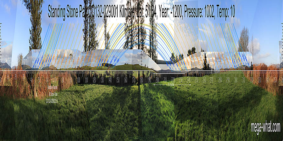
 Kilmore Standing Stone Pair is 2km or so south of Drimoleague. It is on a low hilltop and c.95m west-south-west of
four Boulder-Burials and a Stone Row but on the other side of a property boundary.
Kilmore Standing Stone Pair is 2km or so south of Drimoleague. It is on a low hilltop and c.95m west-south-west of
four Boulder-Burials and a Stone Row but on the other side of a property boundary.
South is indicated by a hill but is not on the top [Pic].
![[Pic].](KilmorePair-S.jpg)
North is on a hill in the centre of a block of high ground [Pic].
![[Pic].](KilmorePair-N.jpg)
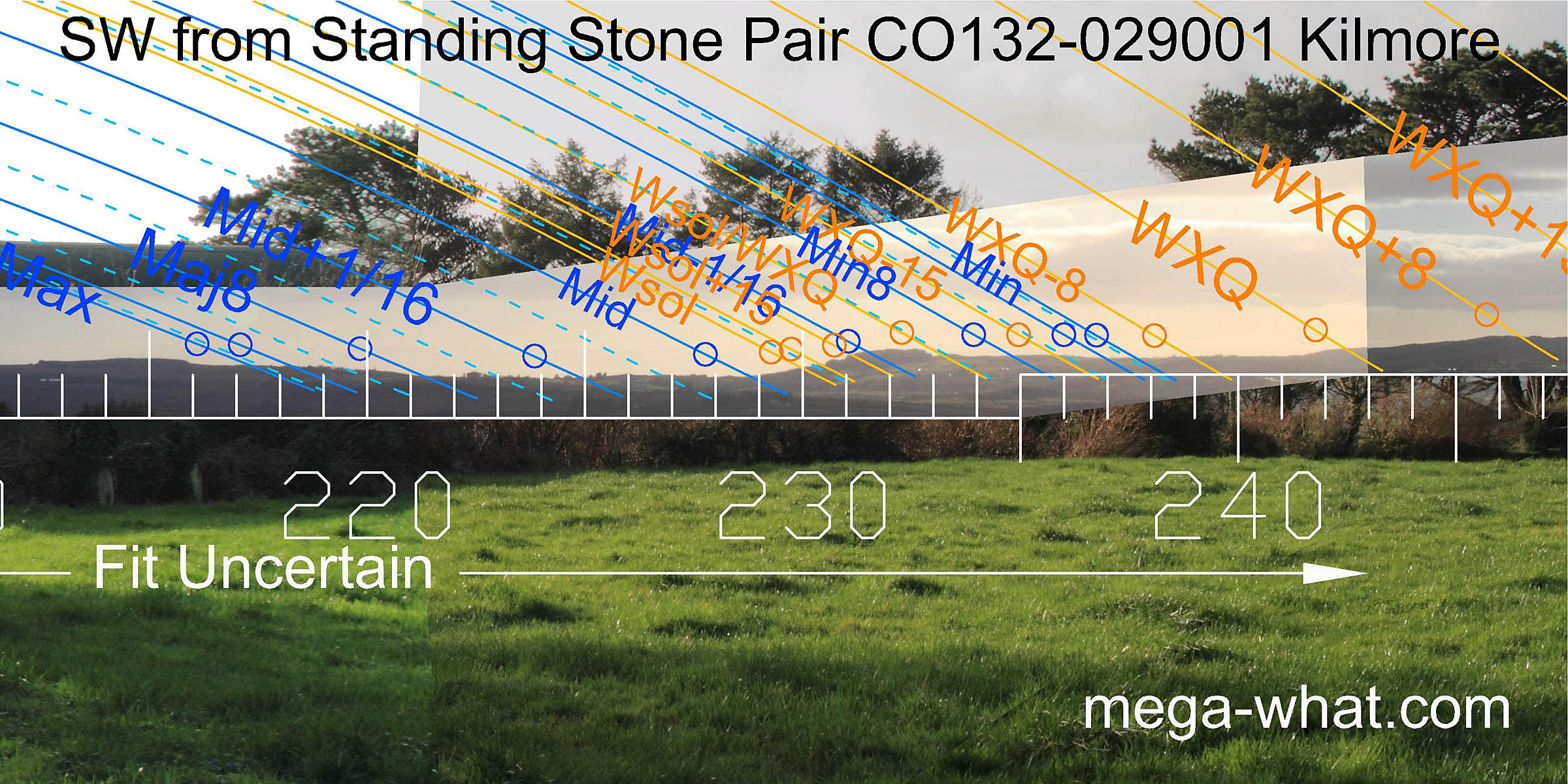 Views to the south-west are mostly obscured by farm buildings, hedges and trees. The view from beyond the farmyard has been patched in but its accuracy must be suspect.
The low hill marking the lunar minor eighth and a half-month bracket of the cross-quarter should be OK as it could just be made out through the trees.
Views to the south-west are mostly obscured by farm buildings, hedges and trees. The view from beyond the farmyard has been patched in but its accuracy must be suspect.
The low hill marking the lunar minor eighth and a half-month bracket of the cross-quarter should be OK as it could just be made out through the trees.
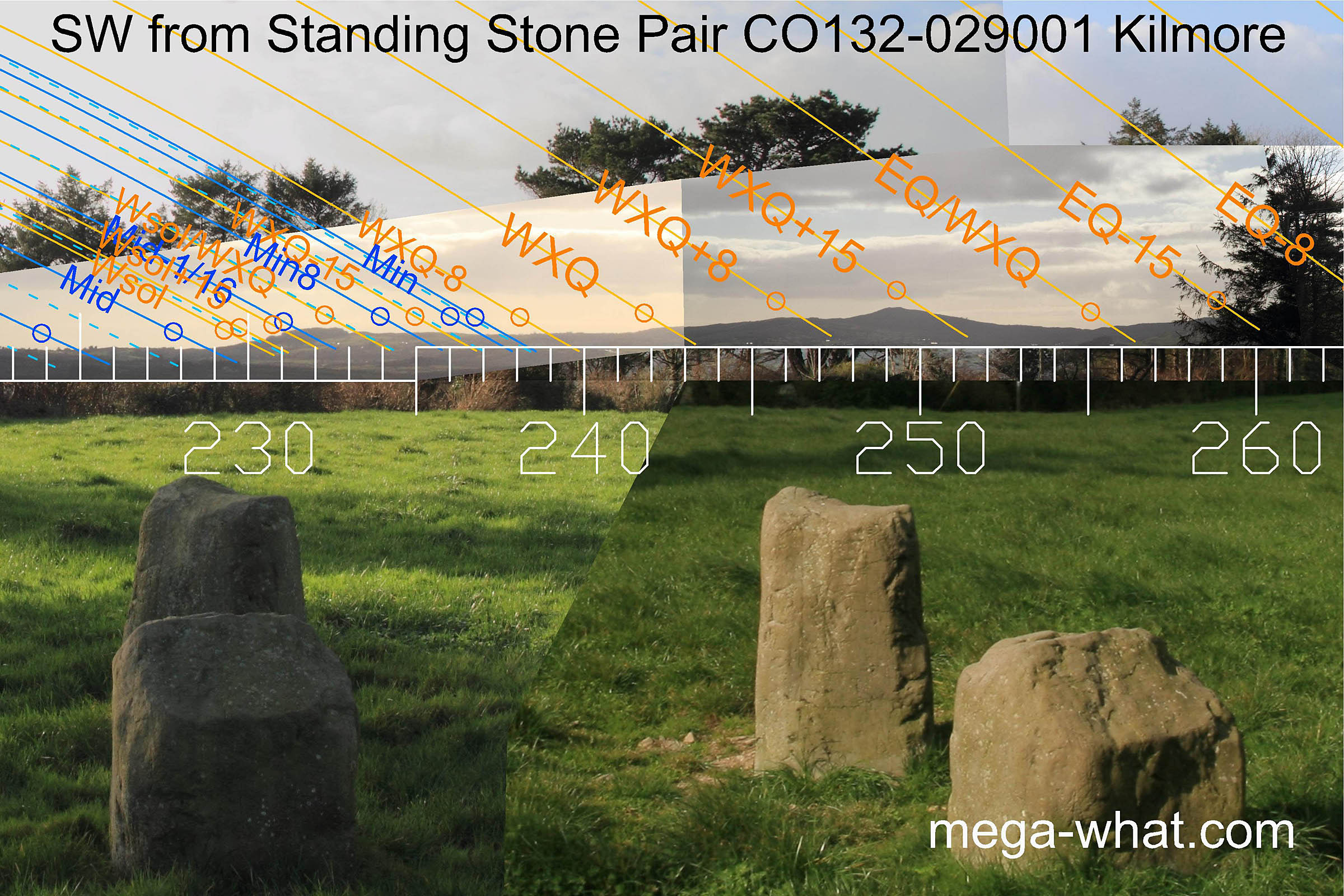 This pair of low wide stones has an overall axis that indicates the general direction of winter solstice or lunar midpoint.
The axis of the north-east stone is similar to that of the pair though slightly more extreme.
The axis of the south-west stone is quite different, indicating Mt Kid and the half-month north of the cross-quarter.
This pair of low wide stones has an overall axis that indicates the general direction of winter solstice or lunar midpoint.
The axis of the north-east stone is similar to that of the pair though slightly more extreme.
The axis of the south-west stone is quite different, indicating Mt Kid and the half-month north of the cross-quarter.
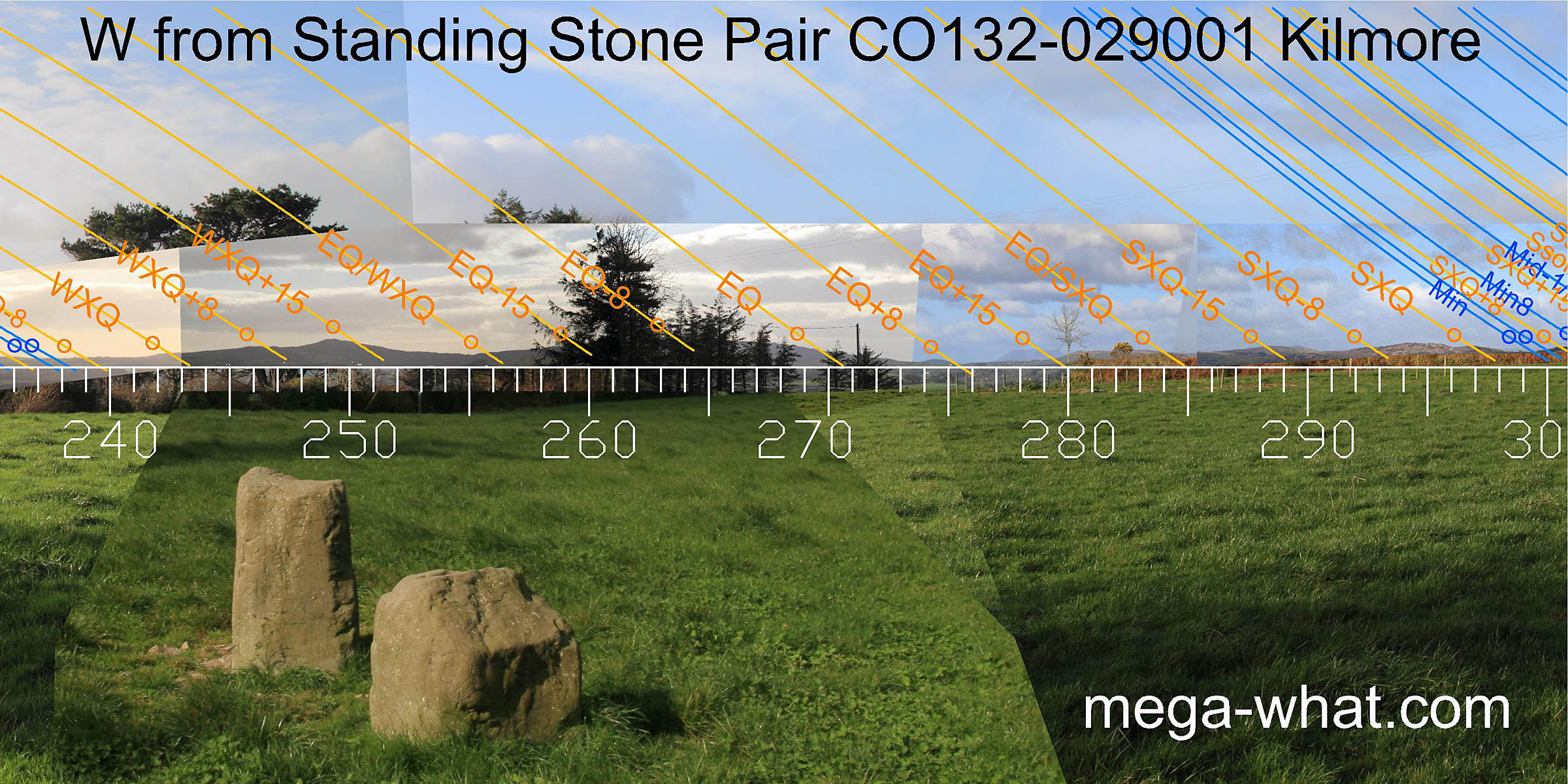 Westwards, the unsurveyably obscured Coomnagoragh Mt runs smoothly down to a wide dip where some distant hills give markers for the period north of the equinox.
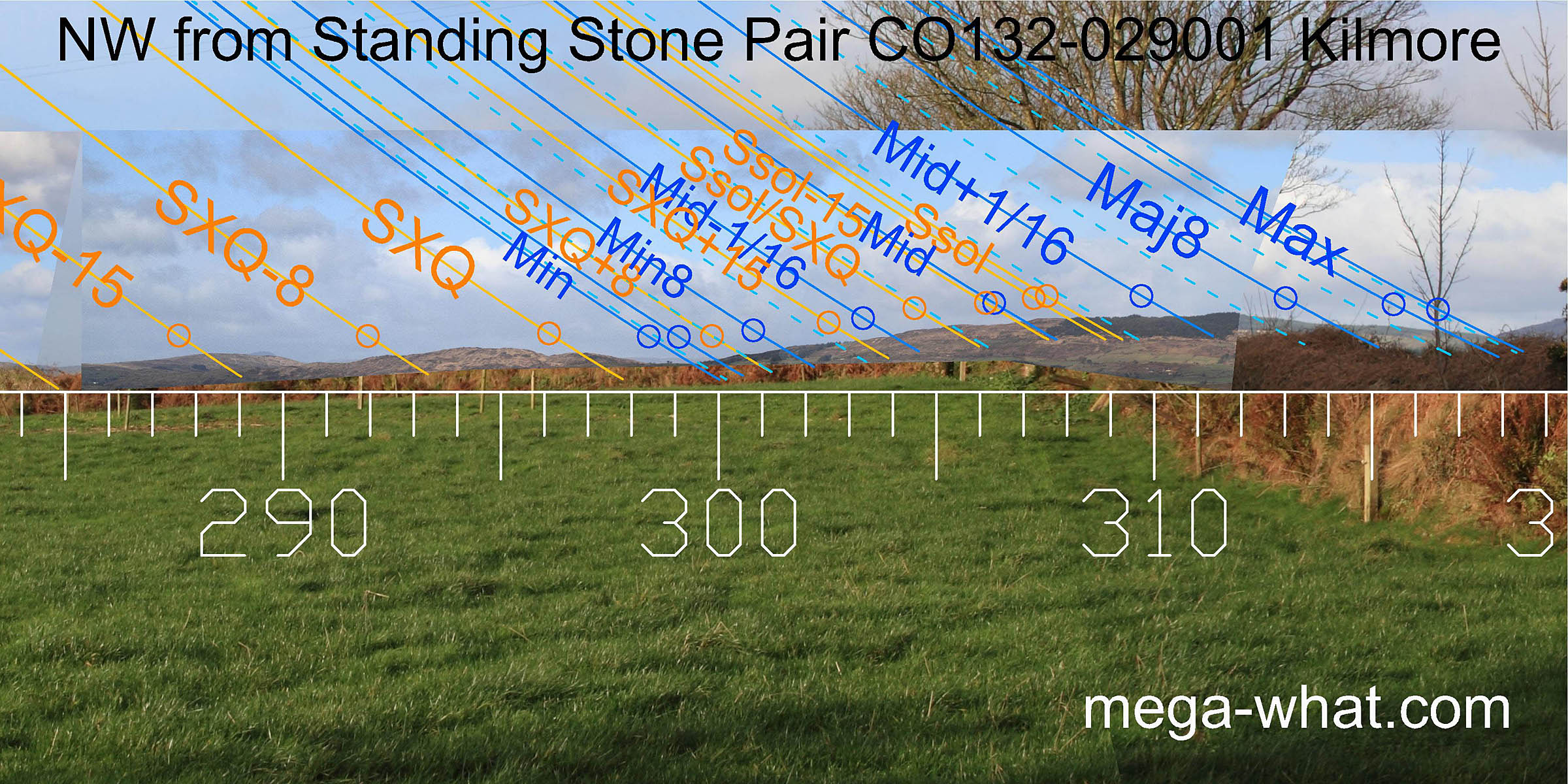 A local field boundary now obscures some of the north-western view but the lunisticeLunistices are the most northerly and southerly moons of the month. The lunar equivalent of solstices - more.
range spans a hill, much as it does from the boulder-burials.
A local field boundary now obscures some of the north-western view but the lunisticeLunistices are the most northerly and southerly moons of the month. The lunar equivalent of solstices - more.
range spans a hill, much as it does from the boulder-burials.
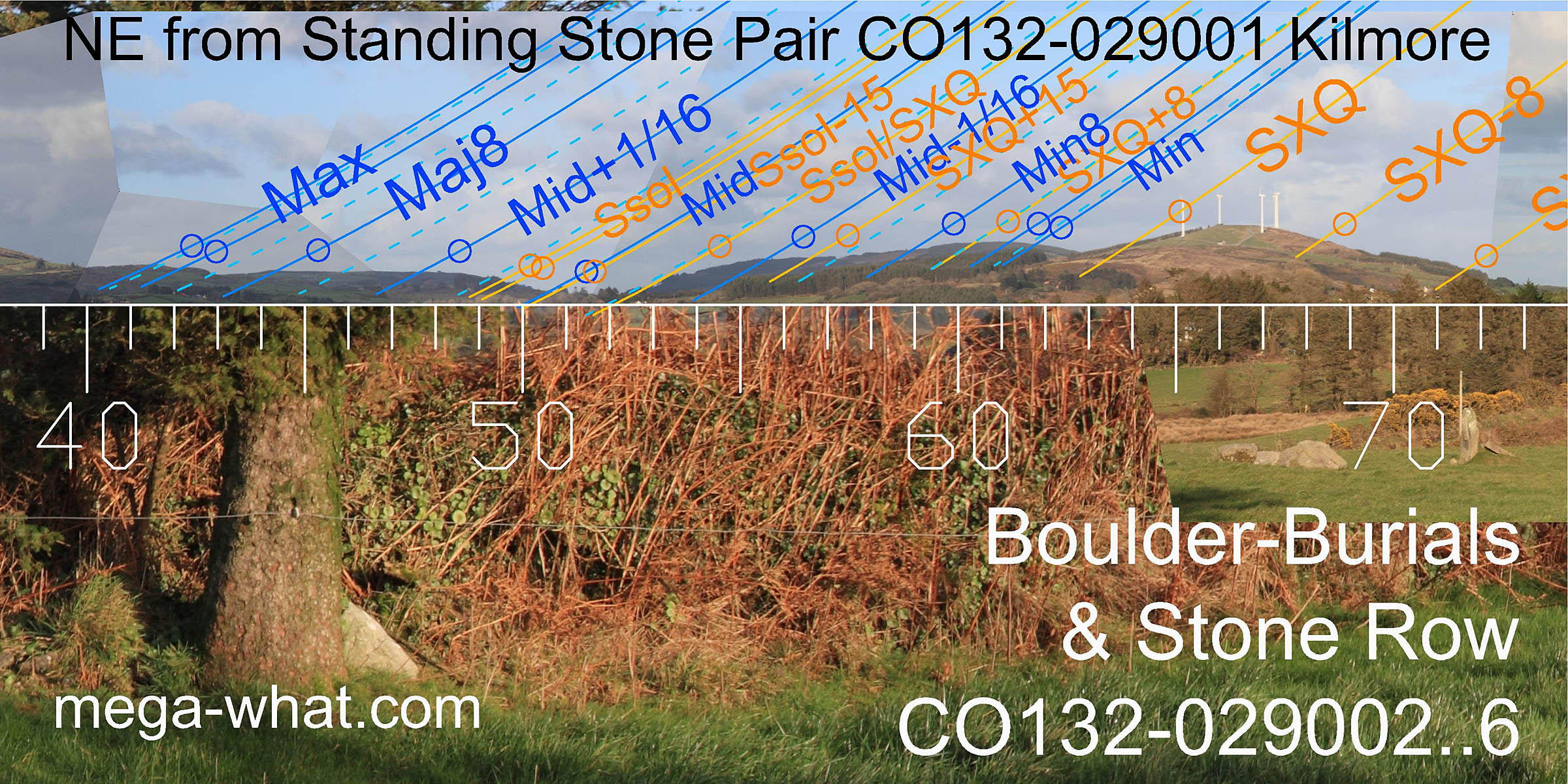 The view north-eastwards from here is very similar to that from the Boulder-Burials and Stone Row and marks the lunisticeLunistices are the most northerly and southerly moons of the month. The lunar equivalent of solstices - more.
zone well.
The notch between further and nearer hills is closer to the summer cross-quarter from here than from the other sites.
The view north-eastwards from here is very similar to that from the Boulder-Burials and Stone Row and marks the lunisticeLunistices are the most northerly and southerly moons of the month. The lunar equivalent of solstices - more.
zone well.
The notch between further and nearer hills is closer to the summer cross-quarter from here than from the other sites.
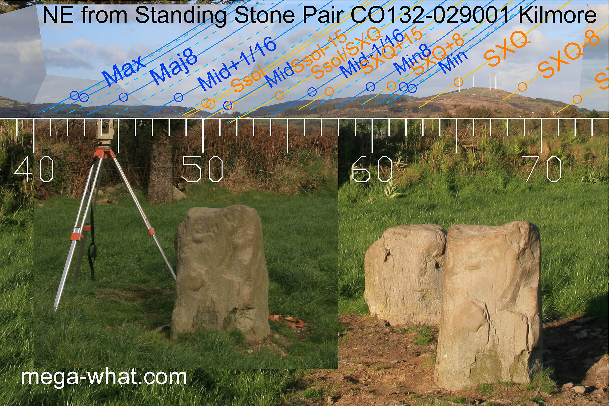 The axis of the Pair again indicates the solstice to the north-east. The axis of the south-west stone indicates a hill that marks the half-month on the equinoctial side of the cross-quarter.
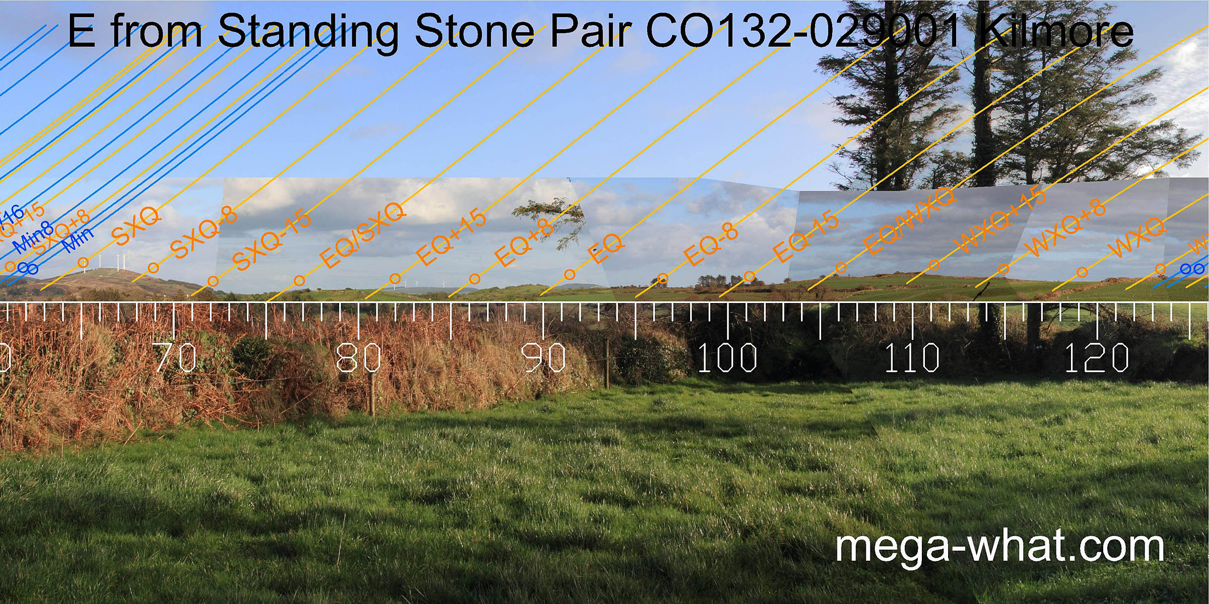 Further south there are good markers for the period up to and including the equinox. To the east the zone around the equinox is well marked.
Further south, a hilltop is a half-month from the winter cross-quarter which itself is in the following dip.
Further south there are good markers for the period up to and including the equinox. To the east the zone around the equinox is well marked.
Further south, a hilltop is a half-month from the winter cross-quarter which itself is in the following dip.
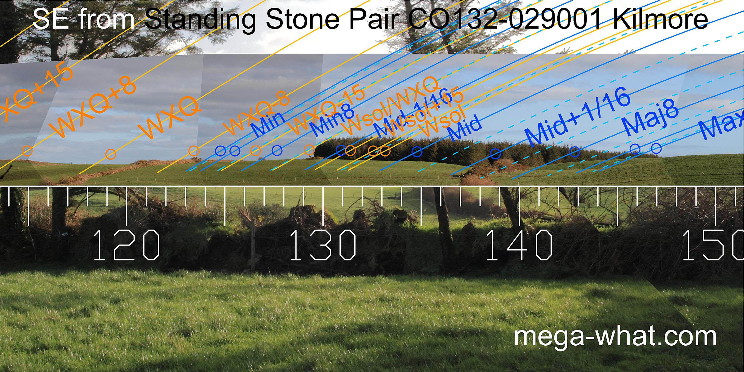 The south-east is partly obscured by trees but the overall pattern is still obvious.
- Clodagh Stone Pair & Circle are 6.9km north (22°)
- Cullomane East Standing Stone/Pair is 8.9km west (279°)
- Gurteenaduige Stone Pair is 9.1km south-east (118°)
References
- Archaeological Survey of Ireland, record details. www.archaeology.ie/archaeological-survey-ireland
- Ó'NUALLÁIN, SEÁN 1988 Stone Rows in the South of Ireland. Proceedings of the Royal Irish Academy 88c:179-256, p248, no.138.
- POWER, D. et al. 1992 Archaeological Inventory of County Cork, Volume 1: West Cork. Dublin: Stationary Office. p41, no.193.