
 This Standing Stone at Cullomane (Colomane) is between Bantry and Drimoleague, 2km or so west of Dromore.
First officially listed as a Standing Stone it has become a Stone Row in the online register.
This Standing Stone at Cullomane (Colomane) is between Bantry and Drimoleague, 2km or so west of Dromore.
First officially listed as a Standing Stone it has become a Stone Row in the online register.
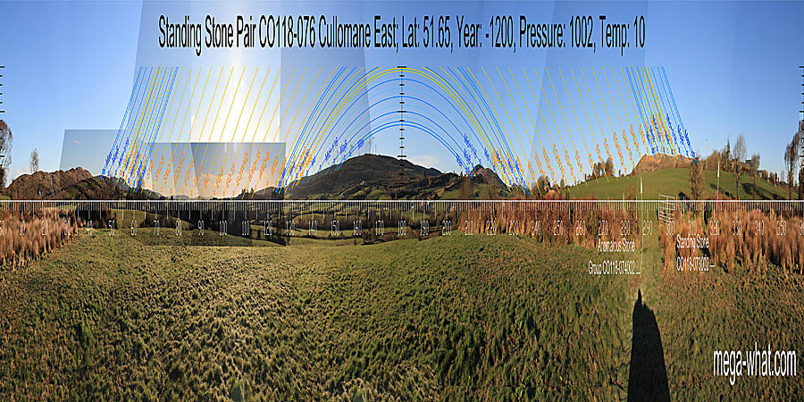
On the 1944 OS map two stones were shown here, about 10m apart, with a generally north-west / south-east orientation between them. The 1845 map (1842 survey) also shows two stones but with a rather more east-west overall orientation.
So this would actually seem to be the site of an Anomalous Stone Pair such that two stones some distance apart have individual axes dissimilar to the overall monument axis.
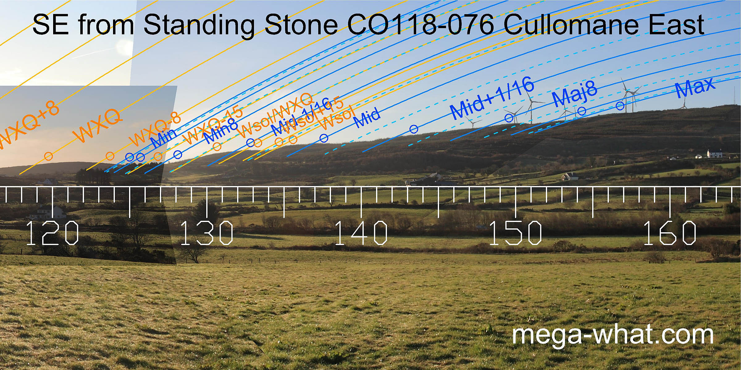
South is on a rise that is on the eastern slope of a dip [Pic]. To the left, lunar minor standstillLunistice positions vary cyclically over an 18.6 year period but are fairly static for more than a year at either end of the range is in the dip before the next hilltop. To the right its major standstillLunistice positions vary cyclically over an 18.6 year period but are fairly static for more than a year at either end of the range. The following dips are: To the left equinoctial, right winter cross-quarters. Then, equinox/ cross-quarter midpoints are at either end of the dip (left) and either end of a slope (right). Major standstillLunistice positions vary cyclically over an 18.6 year period but are fairly static for more than a year at either end of the range is on a high point to the left and, to the right, in the following dip. North is in a dip [Pic].
![[Pic].](ColomaneSTST-S.jpg)
![[Pic].](ColomaneSTST-N.jpg)
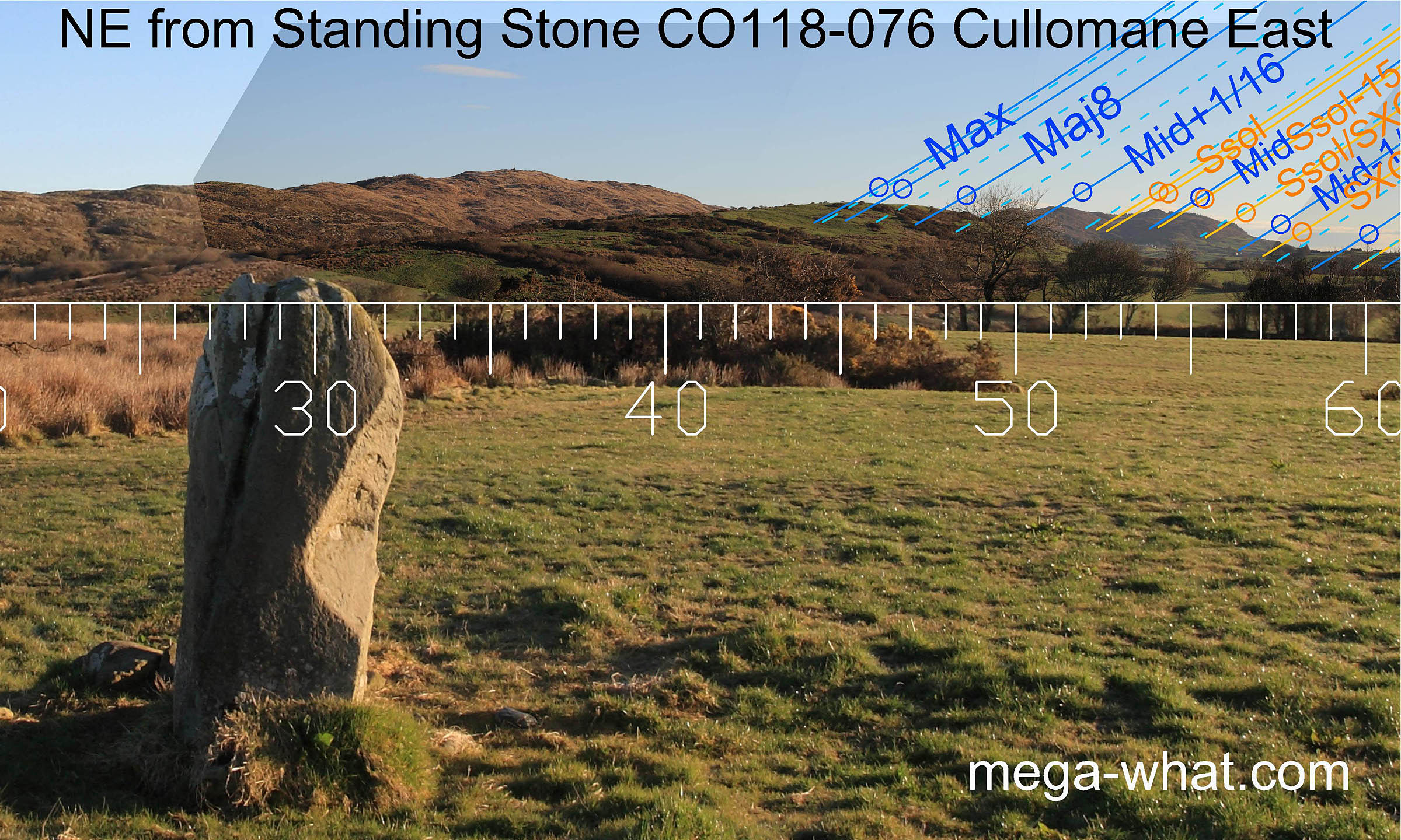
 The north-east horizon has been optimised for the lunisticeLunistices are the most northerly and southerly moons of the month. The lunar equivalent of solstices - more.
range, with major standstillLunistice positions vary cyclically over an 18.6 year period but are fairly static for more than a year at either end of the range
on nearby Inchybegga Hill and minor standstillLunistice positions vary cyclically over an 18.6 year period but are fairly static for more than a year at either end of the range
marked by a small hump
(concealed behind a tree in this photo but clearly visible from the adjacent site from where it marks the cross-quarter).
Between these endpoints, Glanatnaw Hill gives other lunar markers as well as having the summer solstice sunrise in its central dip.
The north-east horizon has been optimised for the lunisticeLunistices are the most northerly and southerly moons of the month. The lunar equivalent of solstices - more.
range, with major standstillLunistice positions vary cyclically over an 18.6 year period but are fairly static for more than a year at either end of the range
on nearby Inchybegga Hill and minor standstillLunistice positions vary cyclically over an 18.6 year period but are fairly static for more than a year at either end of the range
marked by a small hump
(concealed behind a tree in this photo but clearly visible from the adjacent site from where it marks the cross-quarter).
Between these endpoints, Glanatnaw Hill gives other lunar markers as well as having the summer solstice sunrise in its central dip.
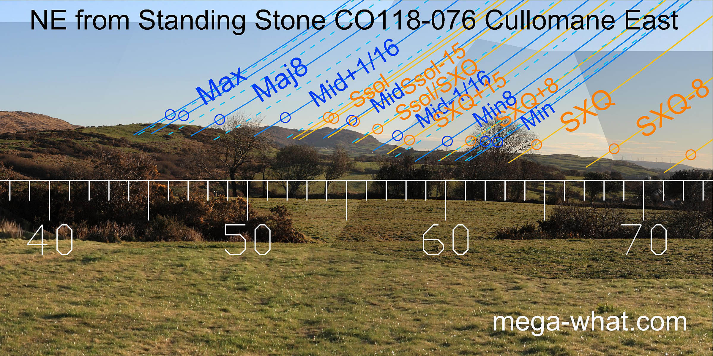
 The eastern horizon is distant and provides many good markers.
The equinox is marked by a hill. To either side, equinox/cross-quarter midpoints are marked by dips.
Further to the south-east, the winter cross-quarters are bracketed quarter-months at hill top and foot.
 The long eastern slope of Coomnagoragh mountain measures out the lunisticeLunistices are the most northerly and southerly moons of the month. The lunar equivalent of solstices - more.
zone, from the dip at its base to a prominent notch towards its top.
The long eastern slope of Coomnagoragh mountain measures out the lunisticeLunistices are the most northerly and southerly moons of the month. The lunar equivalent of solstices - more.
zone, from the dip at its base to a prominent notch towards its top.
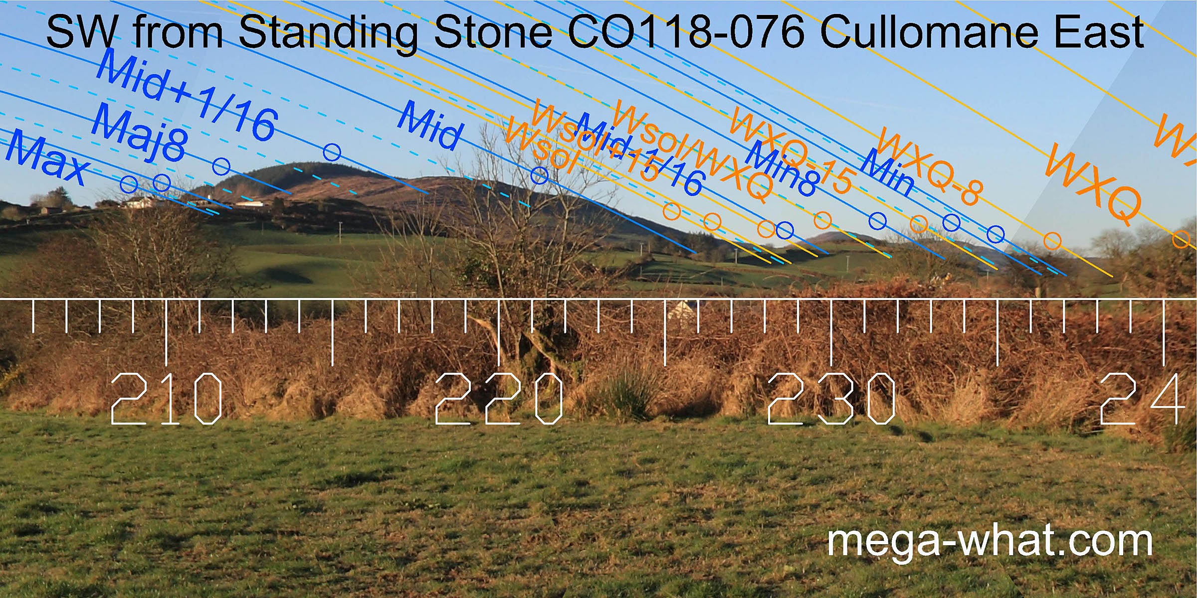 South-westwards, the major standstillLunistice positions vary cyclically over an 18.6 year period but are fairly static for more than a year at either end of the range
is at a prominent step on the south side of Derryvahalla mountain and the dip in its top is a lunar sixteenth.
Minor standstillLunistice positions vary cyclically over an 18.6 year period but are fairly static for more than a year at either end of the range
is at the far base of the ridge, with the lunar minor eighth in the notch between the last pair of hills. The east base of that pair is a half-month off winter solstice.
South-westwards, the major standstillLunistice positions vary cyclically over an 18.6 year period but are fairly static for more than a year at either end of the range
is at a prominent step on the south side of Derryvahalla mountain and the dip in its top is a lunar sixteenth.
Minor standstillLunistice positions vary cyclically over an 18.6 year period but are fairly static for more than a year at either end of the range
is at the far base of the ridge, with the lunar minor eighth in the notch between the last pair of hills. The east base of that pair is a half-month off winter solstice.
The stone axis points just beyond major standstillLunistice positions vary cyclically over an 18.6 year period but are fairly static for more than a year at either end of the range [Pic].
![[Pic].](ColomaneSTST-SWax.jpg)
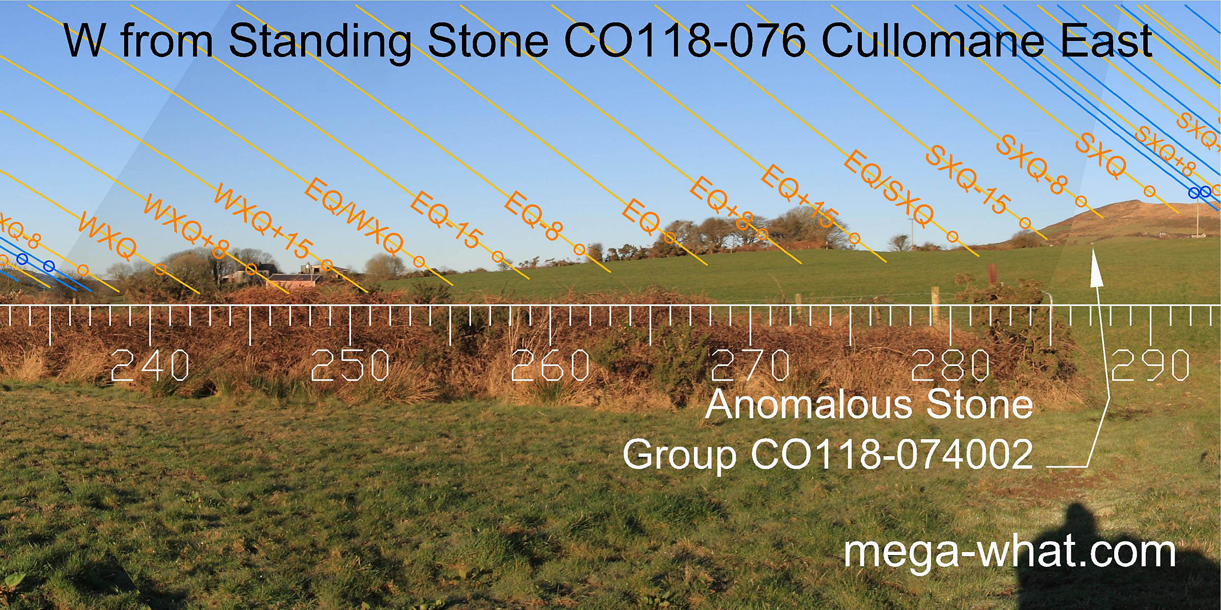 To the west, winter cross-quarters are in the lowest dip and equinox/summer cross-quarter midpoint is at the next slope base.
Summer cross-quarter fails to hit the hilltop in favour of minor standstillLunistice positions vary cyclically over an 18.6 year period but are fairly static for more than a year at either end of the range
being at the foot of the following upslope.
To the west, winter cross-quarters are in the lowest dip and equinox/summer cross-quarter midpoint is at the next slope base.
Summer cross-quarter fails to hit the hilltop in favour of minor standstillLunistice positions vary cyclically over an 18.6 year period but are fairly static for more than a year at either end of the range
being at the foot of the following upslope.
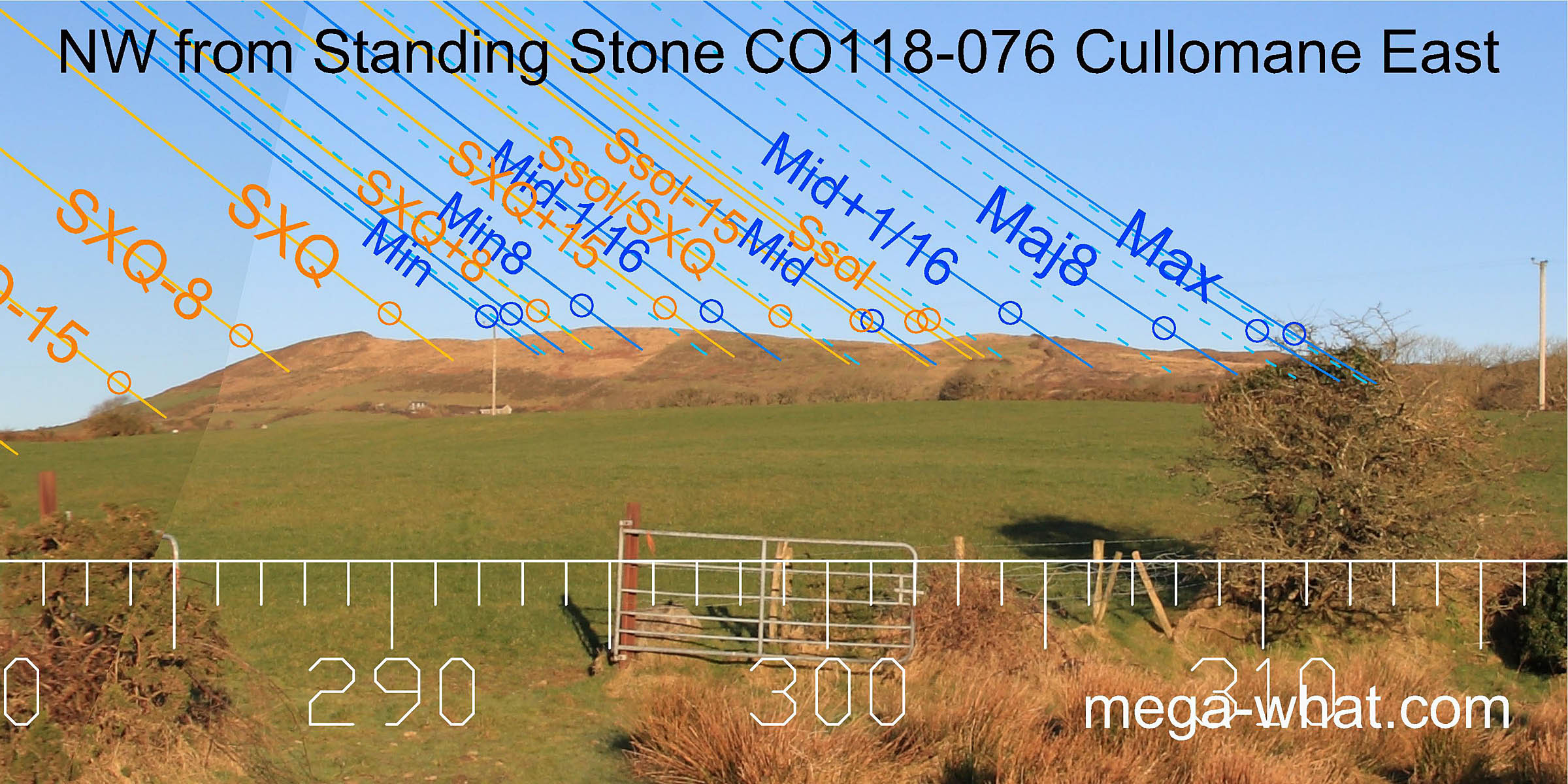 On the north-western horizon, the obvious notch in the centre of the ridge is both lunar midpoint and a half-month off the summer solstice.
Either side of it, the lunar limits and eighths fall very conveniently.
On the north-western horizon, the obvious notch in the centre of the ridge is both lunar midpoint and a half-month off the summer solstice.
Either side of it, the lunar limits and eighths fall very conveniently.
This is lowest and south-east-most of a local group of monuments that utilise these same horizons in slightly different ways from positions about 200m apart. The nearest is: Anomalous Stone Group CO118-074002.
A further variant usage of Glanatnaw Hill to the north-east may be seen from Inchybegga Stone Circle, 1.3km nearer to it.
Other anomalous Standing Stone pairs of the same general type may be found at:
- Cappagh More 6.6km to the south.
- Glanbrack 23.2km to the east.
A Stone Axe was found, not far from here, in 2005, See Details
References
- Archaeological Survey of Ireland, record details. www.archaeology.ie/archaeological-survey-ireland
- POWER, D. et al. 1992 Archaeological Inventory of County Cork, Volume 1: West Cork. Dublin: Stationary Office. p53, no.290.