
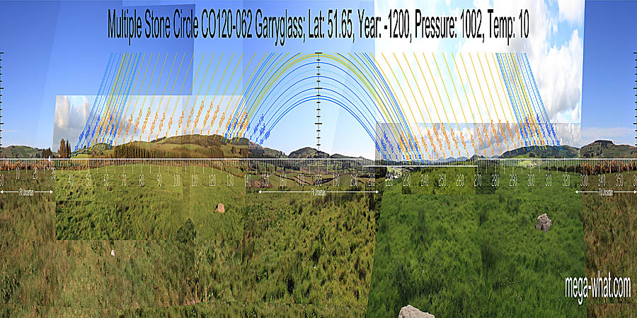
 It is at the given GPS location but exactly how that compares to the original position of the circle is uncertain.
Survey was from just south of the fallen stone.
It is at the given GPS location but exactly how that compares to the original position of the circle is uncertain.
Survey was from just south of the fallen stone.
North is in a saddle of a ridge [Pic].
![[Pic].](Garryglass-N.jpg)
South is at a break in a hilltop, on the left side of a wide dip [Pic].
![[Pic].](Garryglass-S.jpg)
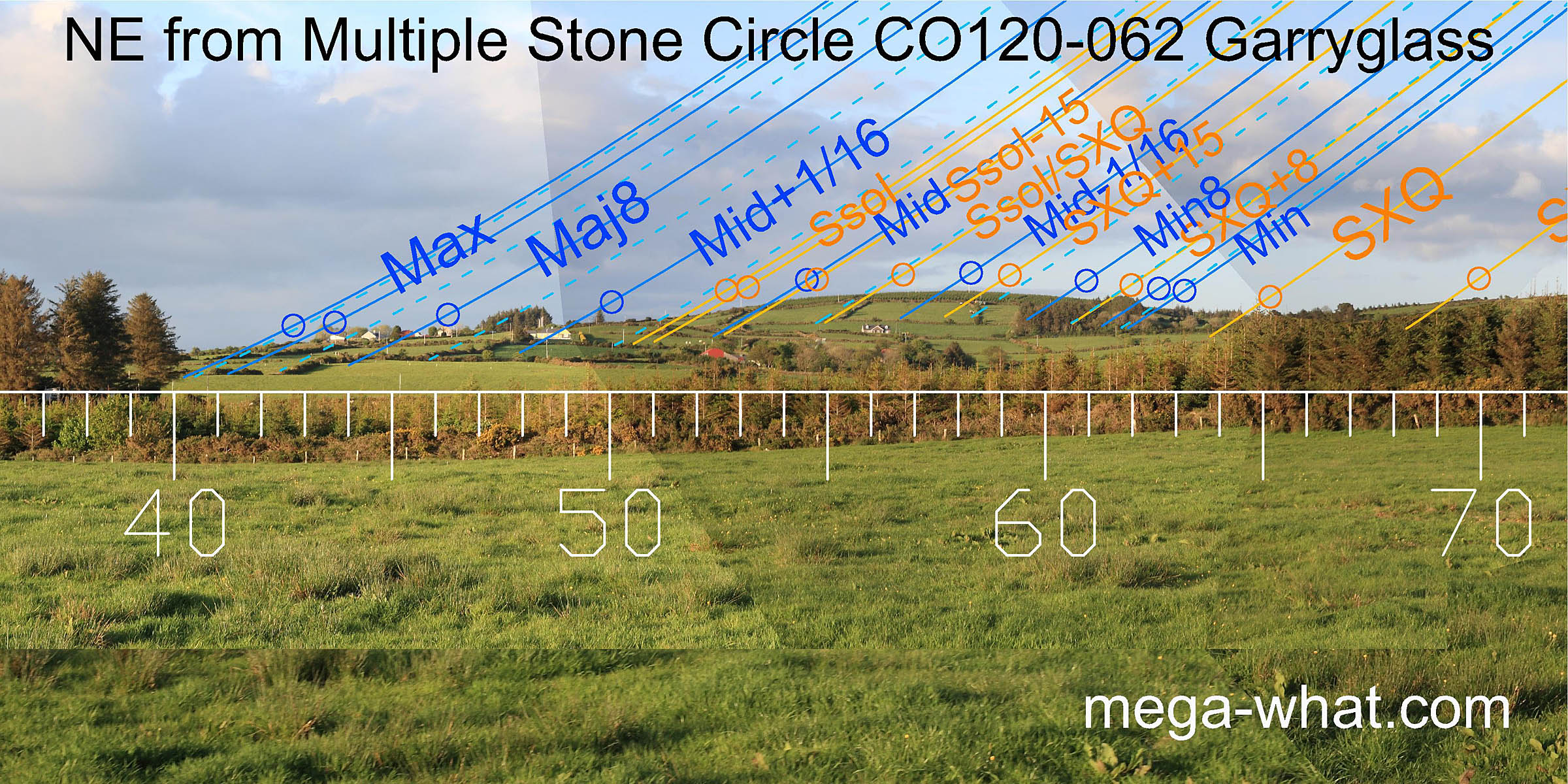 To the north-east the cross-quarter is in a dip to the south of a hill and the solstice is at the hilltop's northern basal break.
The minor end of the lunisticeLunistices are the most northerly and southerly moons of the month. The lunar equivalent of solstices - more.
range is at the bottom of the southern slopes and the hilltop is a sixteenth.
To the north-east the cross-quarter is in a dip to the south of a hill and the solstice is at the hilltop's northern basal break.
The minor end of the lunisticeLunistices are the most northerly and southerly moons of the month. The lunar equivalent of solstices - more.
range is at the bottom of the southern slopes and the hilltop is a sixteenth.
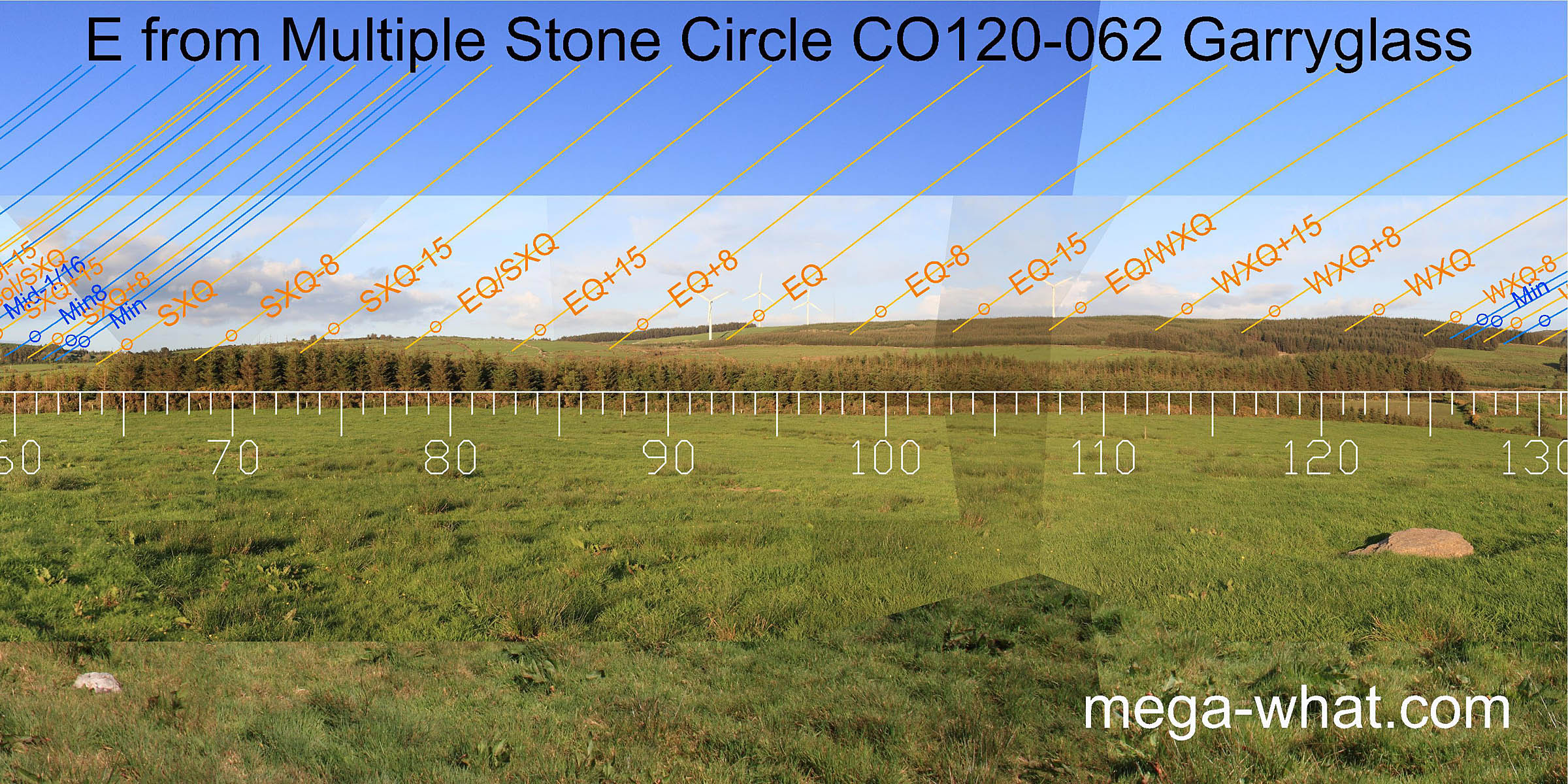 East is a long ridge with summer cross-quarters at its north basal dip, winter cross-quarters at its southern high point.
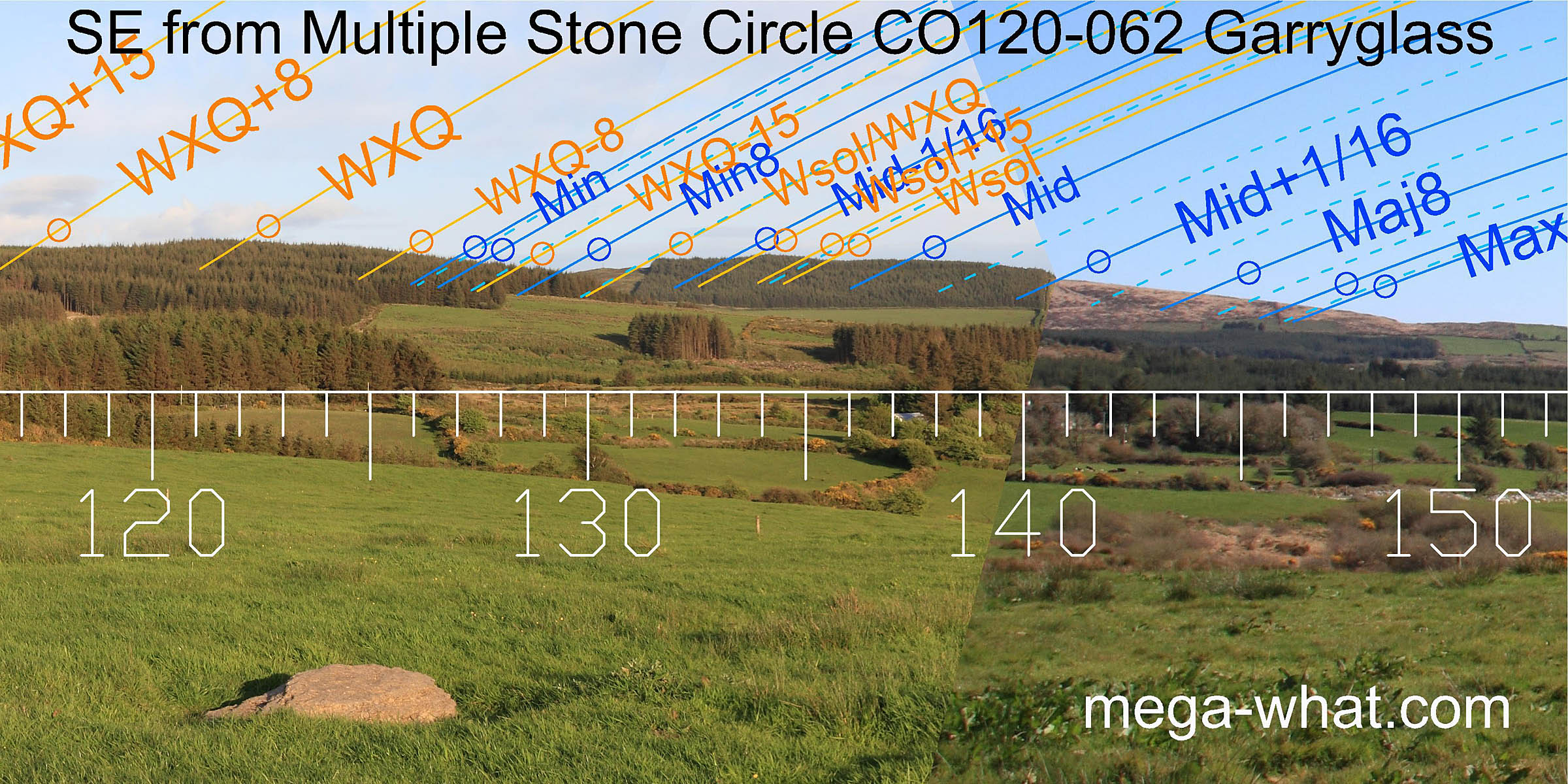 To the south-east, Carrig Fadda is prominent with the lunisticeLunistices are the most northerly and southerly moons of the month. The lunar equivalent of solstices - more.
range across it, the lunar minor eighth being accurately marked by the notch of its intersect with the eastern ridge.
To the south-east, Carrig Fadda is prominent with the lunisticeLunistices are the most northerly and southerly moons of the month. The lunar equivalent of solstices - more.
range across it, the lunar minor eighth being accurately marked by the notch of its intersect with the eastern ridge.
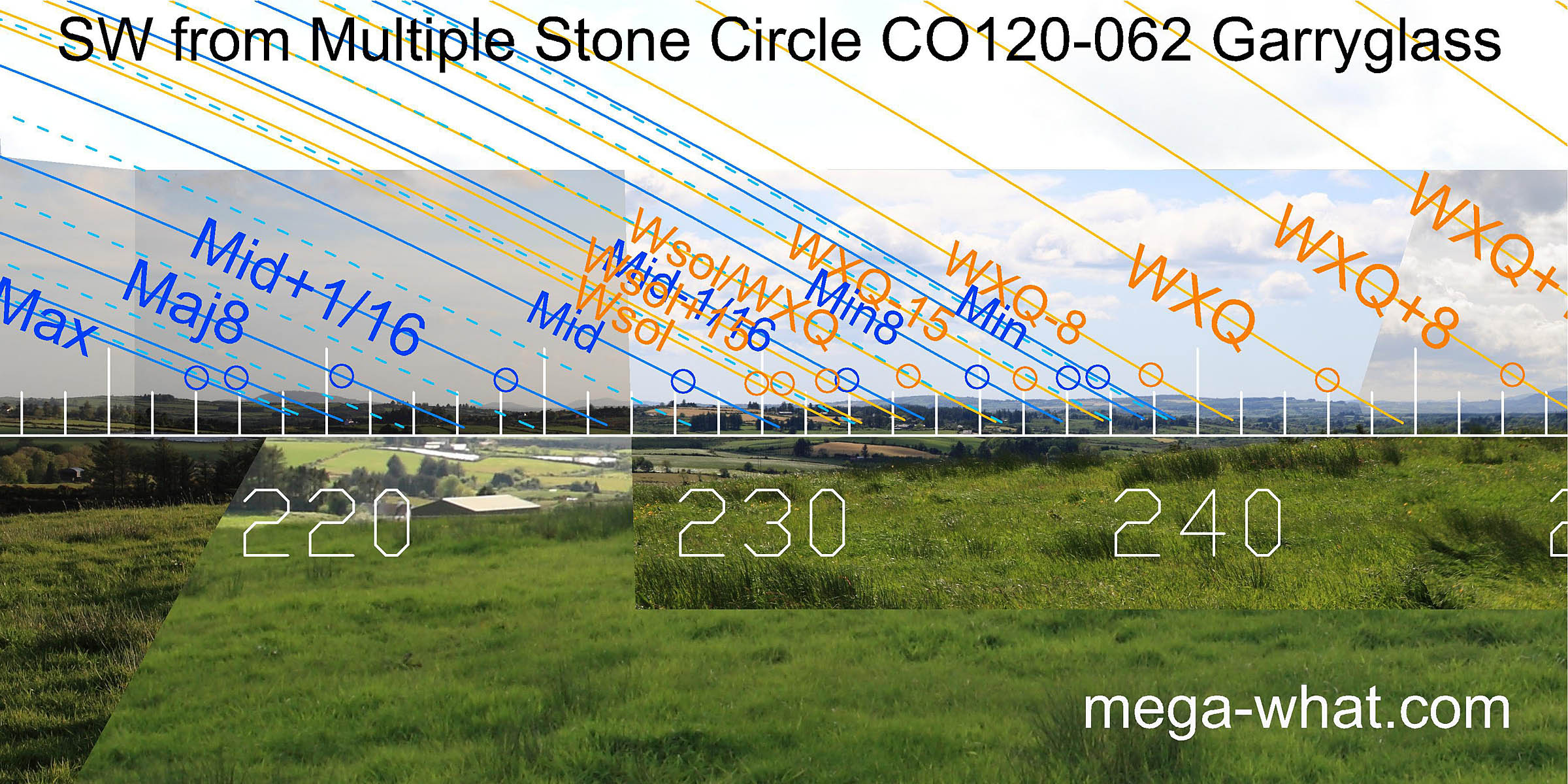 The south-western horizon is very distant and thus difficult to photograph well.
The major end of the lunisticeLunistices are the most northerly and southerly moons of the month. The lunar equivalent of solstices - more.
range falls across Knockomagh and the rest of the skyline is sufficiently varied to be useful.
Winter solstice is in a dip and the solstice / cross-quarter midpoint is on a hilltop.
The next hilltop is a quarter-month south of the winter cross-quarters which lie on the first of another group of distant hills.
The south-western horizon is very distant and thus difficult to photograph well.
The major end of the lunisticeLunistices are the most northerly and southerly moons of the month. The lunar equivalent of solstices - more.
range falls across Knockomagh and the rest of the skyline is sufficiently varied to be useful.
Winter solstice is in a dip and the solstice / cross-quarter midpoint is on a hilltop.
The next hilltop is a quarter-month south of the winter cross-quarters which lie on the first of another group of distant hills.
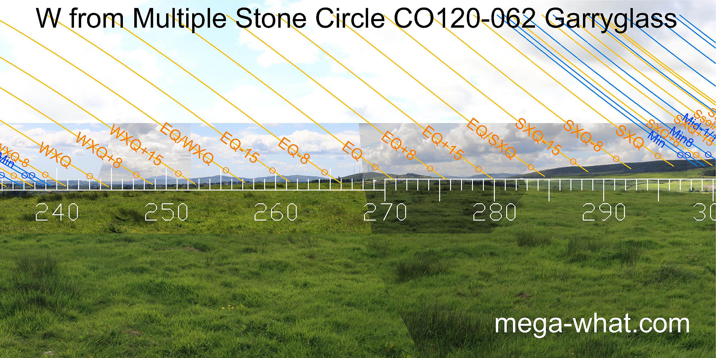 The quarter-month north of winter cross-quarters are at the intersect of far and middle distance horizons, the quarter-month south of the equinox at the intersect of middle distance and nearer ones.
This prominent nearer hill marks the equinox and the days either side of it but the quarter-month north of the equinox is on a distant mountain top.
The quarter-month north of winter cross-quarters are at the intersect of far and middle distance horizons, the quarter-month south of the equinox at the intersect of middle distance and nearer ones.
This prominent nearer hill marks the equinox and the days either side of it but the quarter-month north of the equinox is on a distant mountain top.
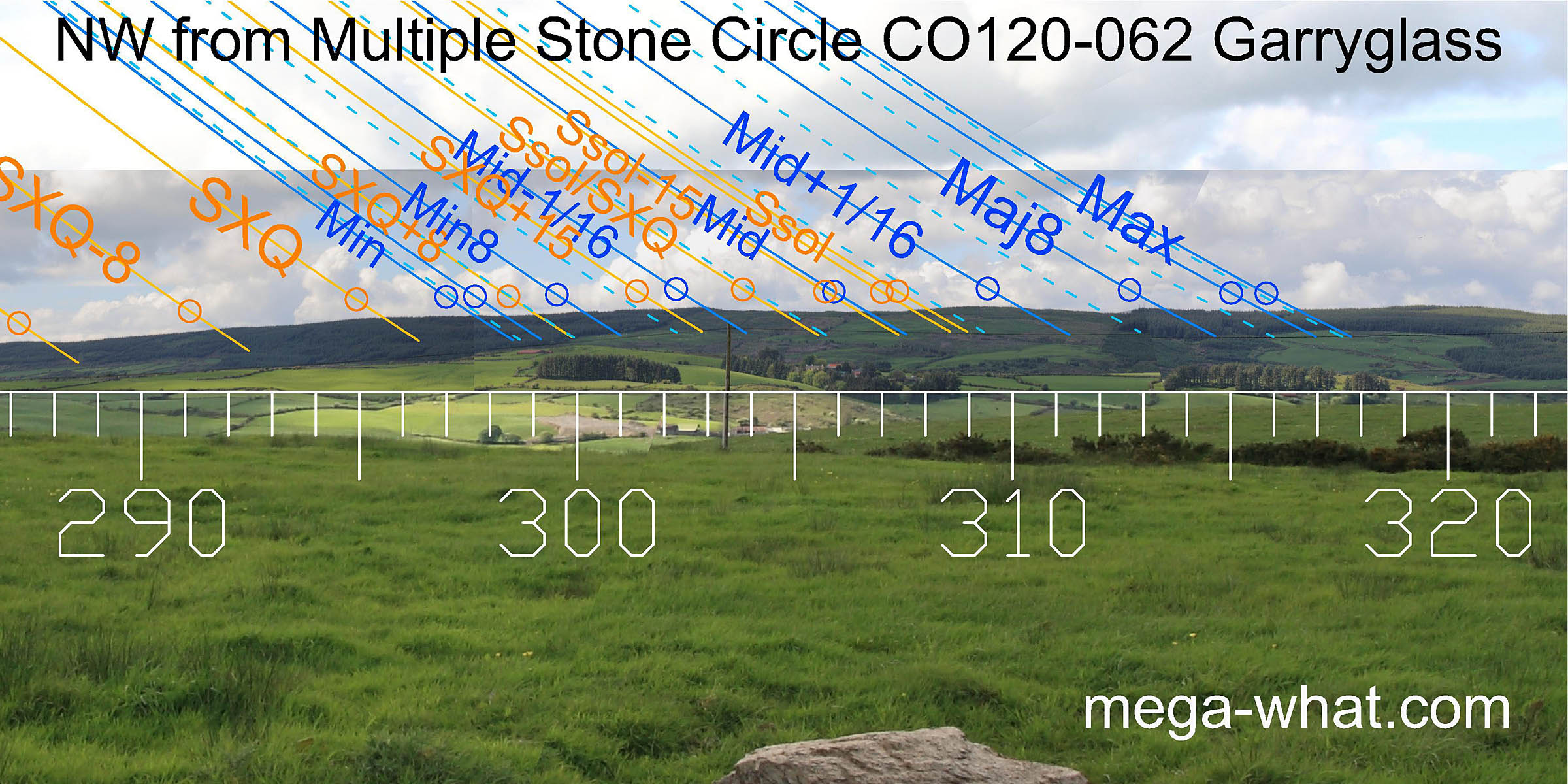 North-west is a long flattish ridge with the solstice in a dip. The top of Nowen Hill just peeps over the ridge to mark the major eighth but is being obscured by the growing forestry.
This is an isolated monument at the north-western limit of a southern cluster of Multiple Stone Circles. Carrigagrenane, 3.7km to the south-east is the nearest member of that group. CO093-013 Coolmountain and CO094-046 Gortroe (unsurveyed) are the next nearest Multiple Stone Circles, almost 16km away at 12° west and east of north respectively.
Equidistant at 3.9km to the east are the Five Stone Circles of Carrigagrenane and Lettergorman. The nearest member of the "main sequence" of these Five Stone Circles is at Clodagh, 8.4km to the north-west.
References
- Archaeological Survey of Ireland, record details. www.archaeology.ie/archaeological-survey-ireland
- Ó'NUALLÁIN, SEÁN 1975 The Stone Circle Complex of Cork and Kerry. Journal of the Royal Society of Antiquaries of Ireland 105:83-131, no.23.
- Ó'NUALLÁIN, SEÁN 1984 A Survey of Stone Circles in Cork and Kerry. Proceedings of the Royal Irish Academy 84c:1-77, p20, no.27.
- POWER, D. et al. 1992 Archaeological Inventory of County Cork, Volume 1: West Cork. Dublin: Stationary Office. p22, no.55.
- RUGGLES, C.L.N. 1999 Astronomy in Prehistoric Britain and Ireland. Newhaven & London: Yale University Press. No.ASC42.