
 Stepped Barrow CL008-062 is on the top of Stoolery Hill which is above Doolin village and south of the R479 / R459 junction.
It is the west-most of a local group of seven barrows and there is a Standing Stone inside it.
Stepped Barrow CL008-062 is on the top of Stoolery Hill which is above Doolin village and south of the R479 / R459 junction.
It is the west-most of a local group of seven barrows and there is a Standing Stone inside it.
South is at a step in a hilltop [Pic].
![[Pic].](DoolinB62-S.jpg)
North is on a slope of nearer ground, framed by more distant hills [Pic].
![[Pic].](DoolinB62-N.jpg)
 To the north-east a ridge of higher ground effectively indicates the lunisticeLunistices are the most northerly and southerly moons of the month. The lunar equivalent of solstices - more.
range with the major limit being at the foot of the hill and the minor limit just beyond the end of the ridge.
To the north-east a ridge of higher ground effectively indicates the lunisticeLunistices are the most northerly and southerly moons of the month. The lunar equivalent of solstices - more.
range with the major limit being at the foot of the hill and the minor limit just beyond the end of the ridge.
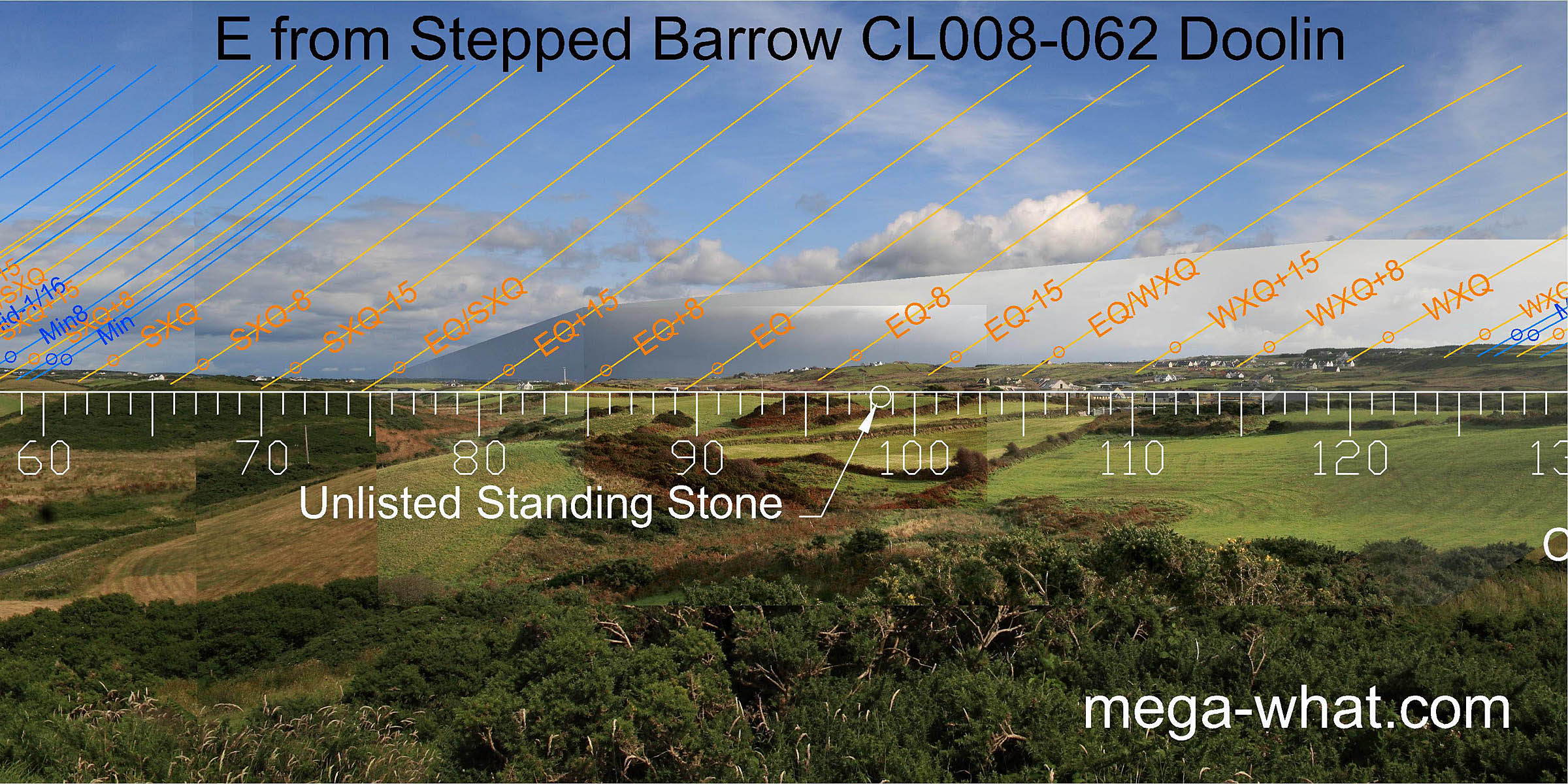 The lowest point of the eastern horizon, a quarter-month north of the equinox, is at the foot of a hill.
The hilltop's north basal step is the equinox itself and the south basal step is a half-month to the south of the equinox.
The lowest point of the eastern horizon, a quarter-month north of the equinox, is at the foot of a hill.
The hilltop's north basal step is the equinox itself and the south basal step is a half-month to the south of the equinox.
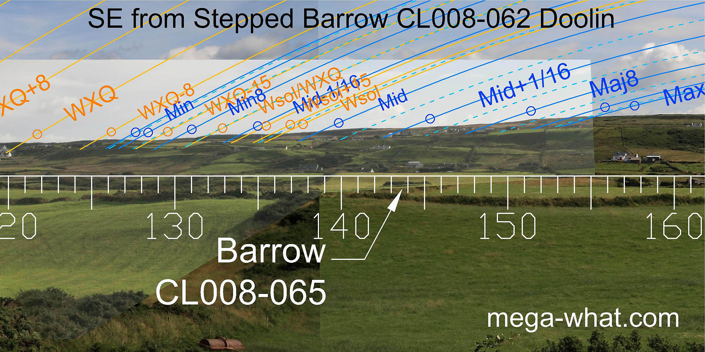 The south-east horizon is rather lacking in obvious significant features.
Nonetheless, the minor end of the lunisticeLunistices are the most northerly and southerly moons of the month. The lunar equivalent of solstices - more.
range turns around a dip and slight breaks provide several other useful markers.
The south-east horizon is rather lacking in obvious significant features.
Nonetheless, the minor end of the lunisticeLunistices are the most northerly and southerly moons of the month. The lunar equivalent of solstices - more.
range turns around a dip and slight breaks provide several other useful markers.
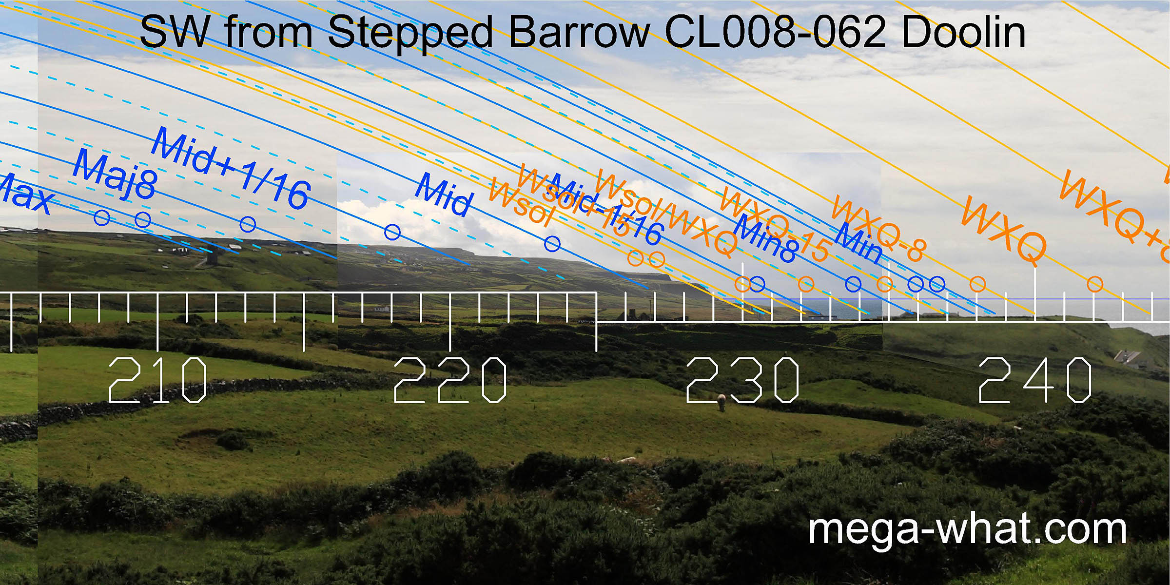 South-westwards, the cliffs make high precision markers for the winter solstice. The lunar midpoint is also well favoured.
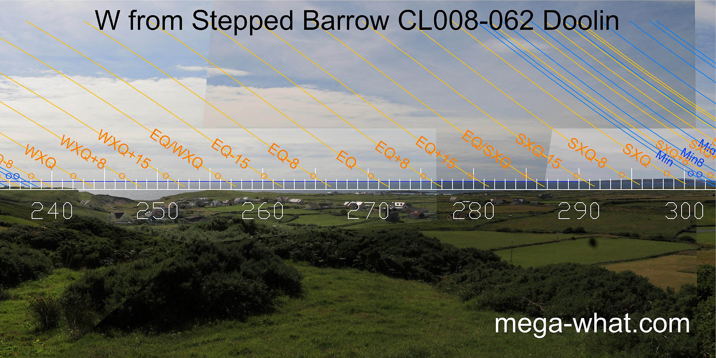
 The west is largely sea horizon which extends round to the south end of the Arran Islands.
The sea/land intersect there is a marker for the half-month to the south of the summer cross-quarters.
The west is largely sea horizon which extends round to the south end of the Arran Islands.
The sea/land intersect there is a marker for the half-month to the south of the summer cross-quarters.
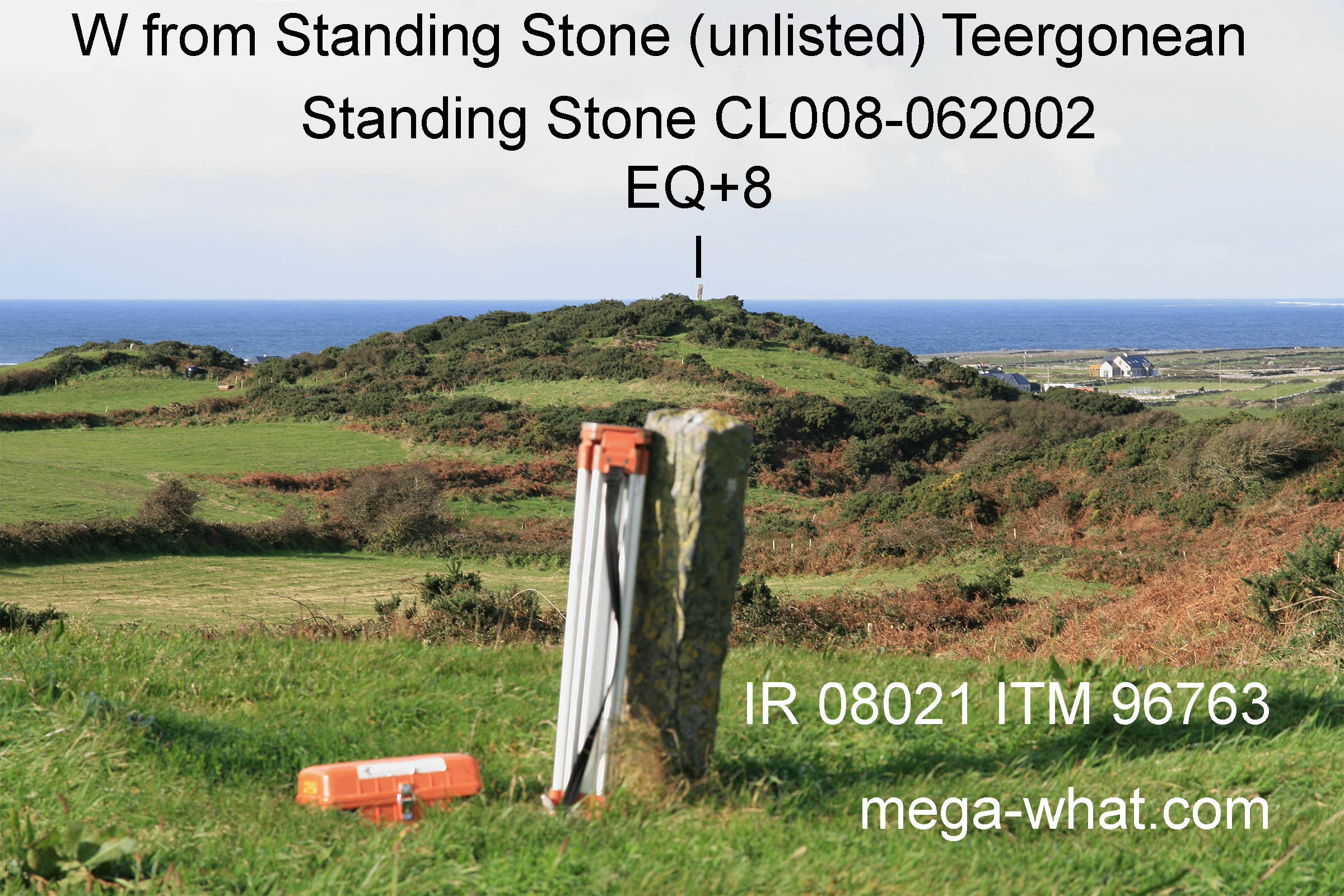 An unlisted Standing Stone is 365m away, near Barrow CL008-067. From the position (IR 08021 ITM 96763) of the unlisted Standing Stone,
the Standing Stone here, on top of this Stepped Barrow, cuts the sea horizon and marks the quarter-month north of the equinox.
An unlisted Standing Stone is 365m away, near Barrow CL008-067. From the position (IR 08021 ITM 96763) of the unlisted Standing Stone,
the Standing Stone here, on top of this Stepped Barrow, cuts the sea horizon and marks the quarter-month north of the equinox.
Both these Standing Stones cut the horizon when seen from Barrow CL008-071 and Barrow CL008-069001, which are both a further 365m or so to the east of the unlisted stone.
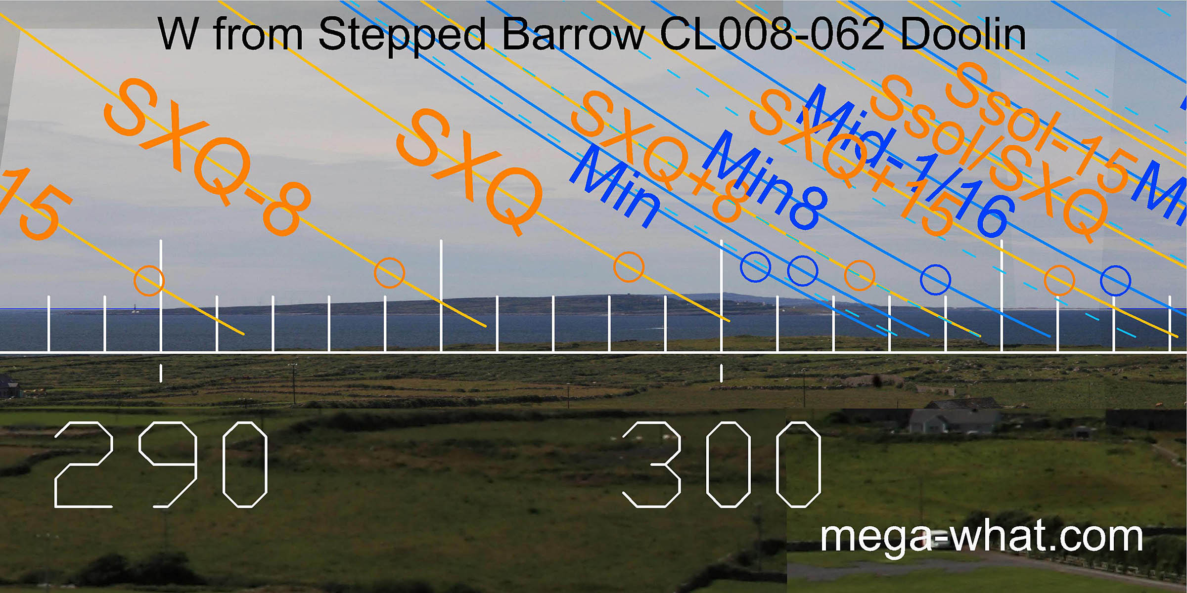
 Summer cross-quarter would be between the hilltops of the Arran Islands, and the northmost end of the islands is at about SXQ+15.
This means that their landmass as a whole has been used as a marker for the month centred on the cross-quarters [Enlargement].
Summer cross-quarter would be between the hilltops of the Arran Islands, and the northmost end of the islands is at about SXQ+15.
This means that their landmass as a whole has been used as a marker for the month centred on the cross-quarters [Enlargement].
It appears that the southmost end of Connamara marks the summer solstice with an offshore island for its half-month bracket and the lunar midpoint [Enlargement].
![[Enlargement].](DoolinB62-NWbig.jpg)
- Teergonean Ring Barrow CL008-069001 is c.570m east (92°)
- Teergonean Ring Barrow CL008-071 is c.665m east (100°)
- Teergonean Court Tomb is c.1.8km north-west (334°)
References
- Archaeological Survey of Ireland, record details. www.archaeology.ie/archaeological-survey-ireland