
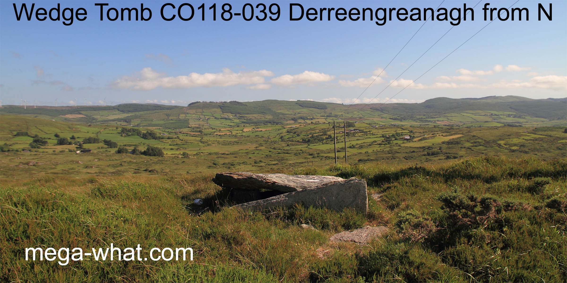
 Derreengreanagh Wedge Tomb is known locally as "The Queen's Table". Just that, no particular queen was ever specified by the locals.
Sitting atop the western ridge of Knocknaveagh it is about 2 km south-east of Bantry and accessible by marked footpath.
This footpath is one of the Sheep's Head Way eastern routes.
The tomb is quite damaged but a small backstone at the eastern end appears to be in situ and from that the original axis of the chamber would appear to have been roughly towards the west-south-west.
North is slightly right of the highest distant peak [Pic].
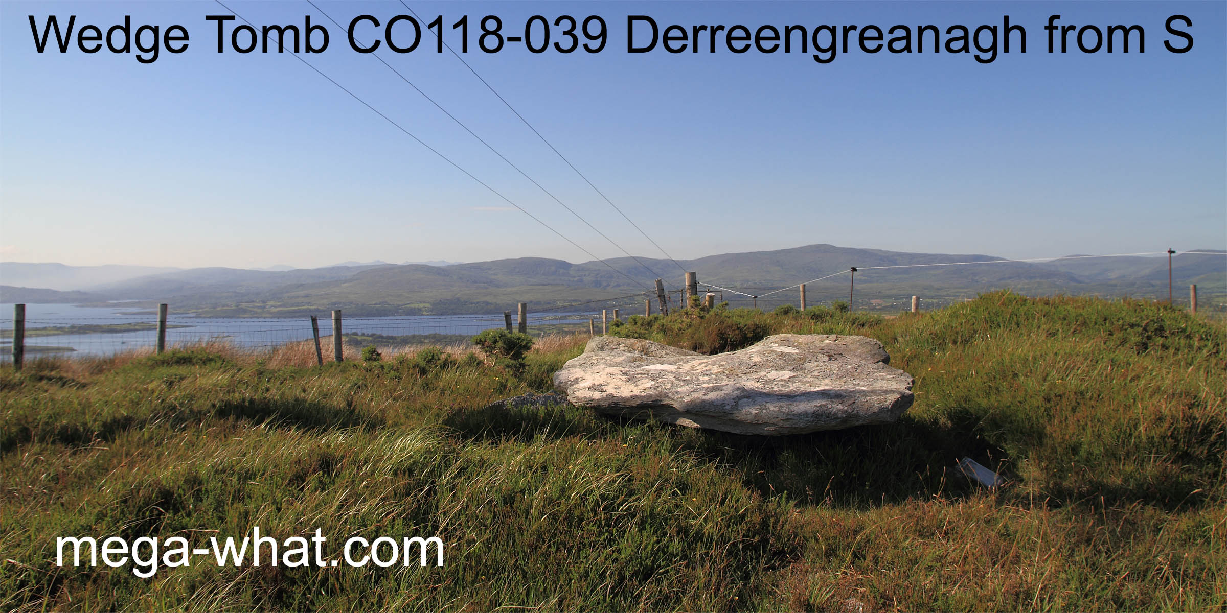
Derreengreanagh Wedge Tomb is known locally as "The Queen's Table". Just that, no particular queen was ever specified by the locals.
Sitting atop the western ridge of Knocknaveagh it is about 2 km south-east of Bantry and accessible by marked footpath.
This footpath is one of the Sheep's Head Way eastern routes.
The tomb is quite damaged but a small backstone at the eastern end appears to be in situ and from that the original axis of the chamber would appear to have been roughly towards the west-south-west.
North is slightly right of the highest distant peak [Pic].
![[Pic]](DerreengreanaghWedge-N.jpg)
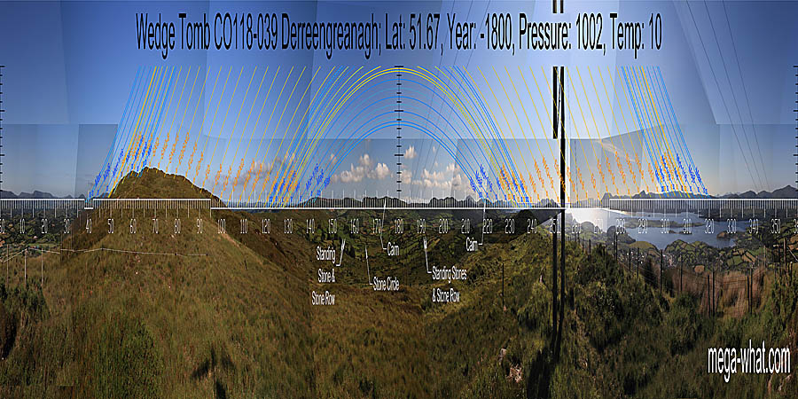
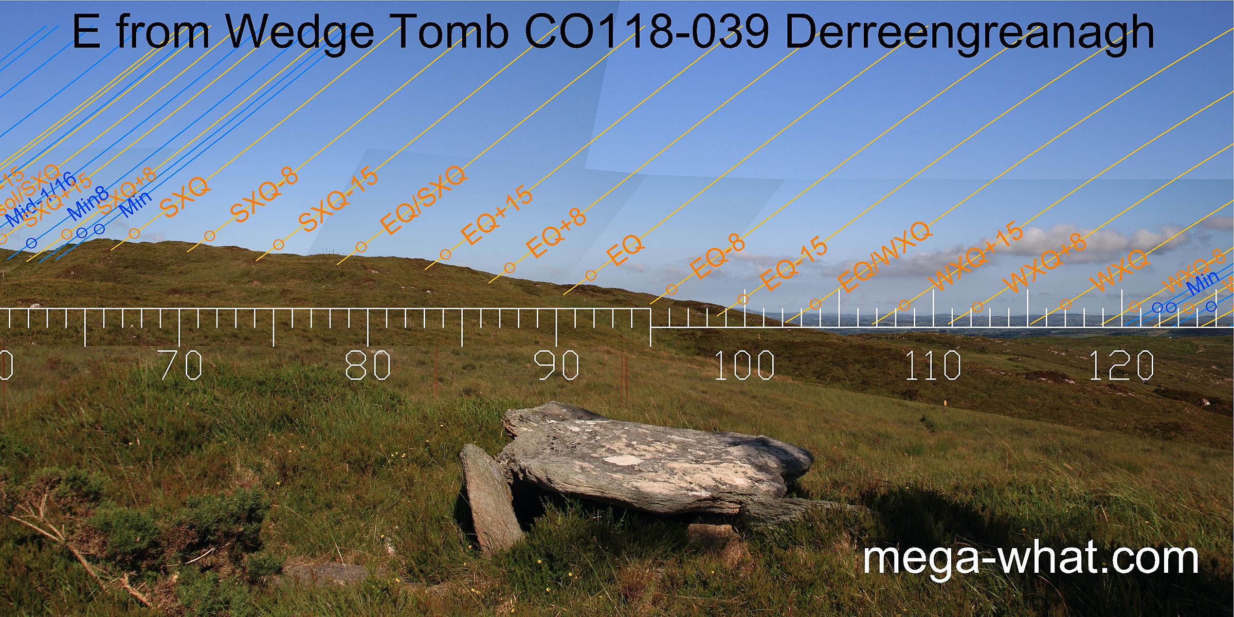
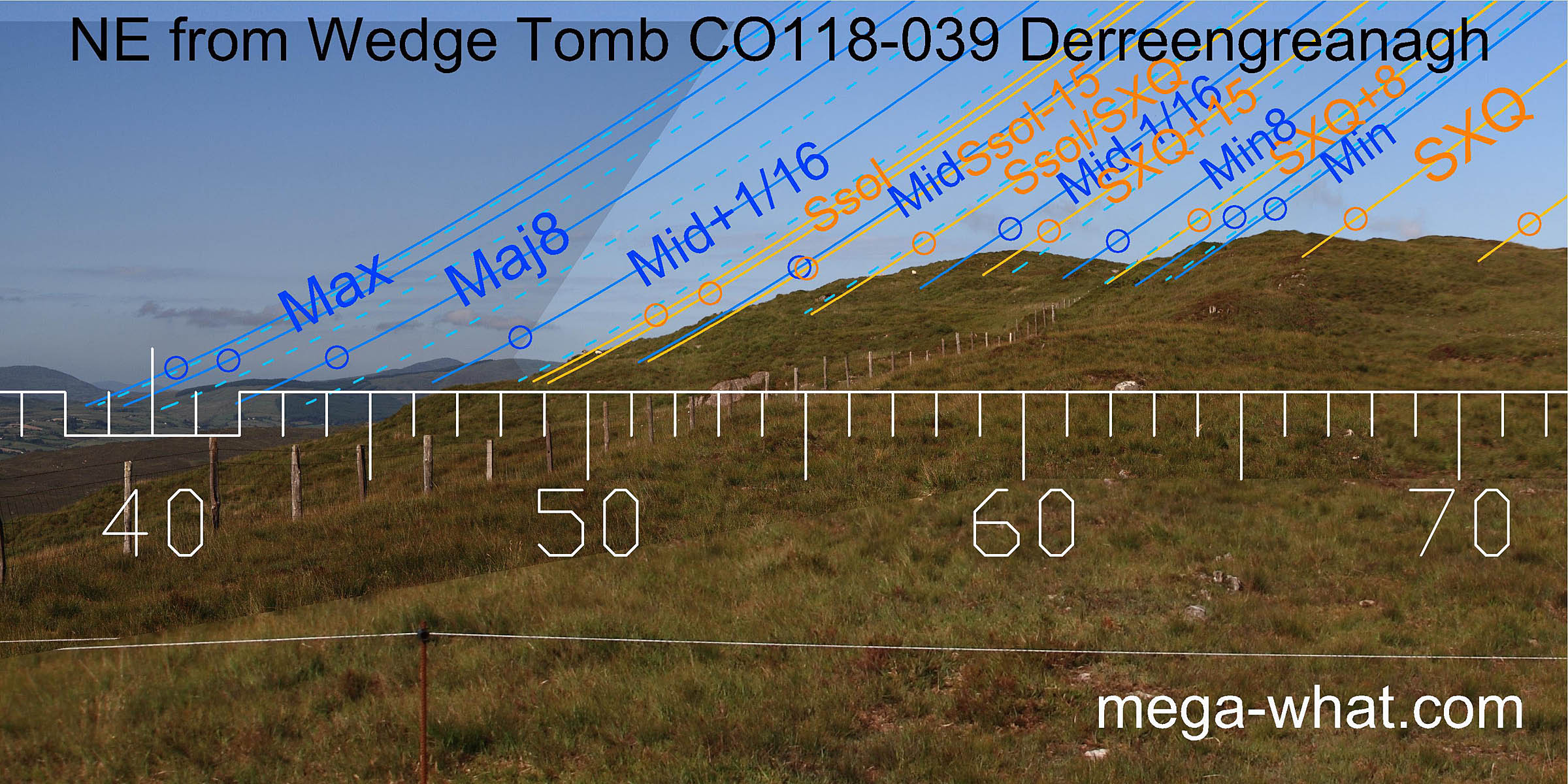 North-eastwards, the local hilltop marks lunar minor standstillLunistice positions vary cyclically over an 18.6 year period but are fairly static for more than a year at either end of the range
and the lunisticeLunistices are the most northerly and southerly moons of the month. The lunar equivalent of solstices - more.
zone runs down to major standstillLunistice positions vary cyclically over an 18.6 year period but are fairly static for more than a year at either end of the range
in a dip of the far horizon.
Summer solstice sunrise is at the intersect between them.
North-eastwards, the local hilltop marks lunar minor standstillLunistice positions vary cyclically over an 18.6 year period but are fairly static for more than a year at either end of the range
and the lunisticeLunistices are the most northerly and southerly moons of the month. The lunar equivalent of solstices - more.
zone runs down to major standstillLunistice positions vary cyclically over an 18.6 year period but are fairly static for more than a year at either end of the range
in a dip of the far horizon.
Summer solstice sunrise is at the intersect between them.
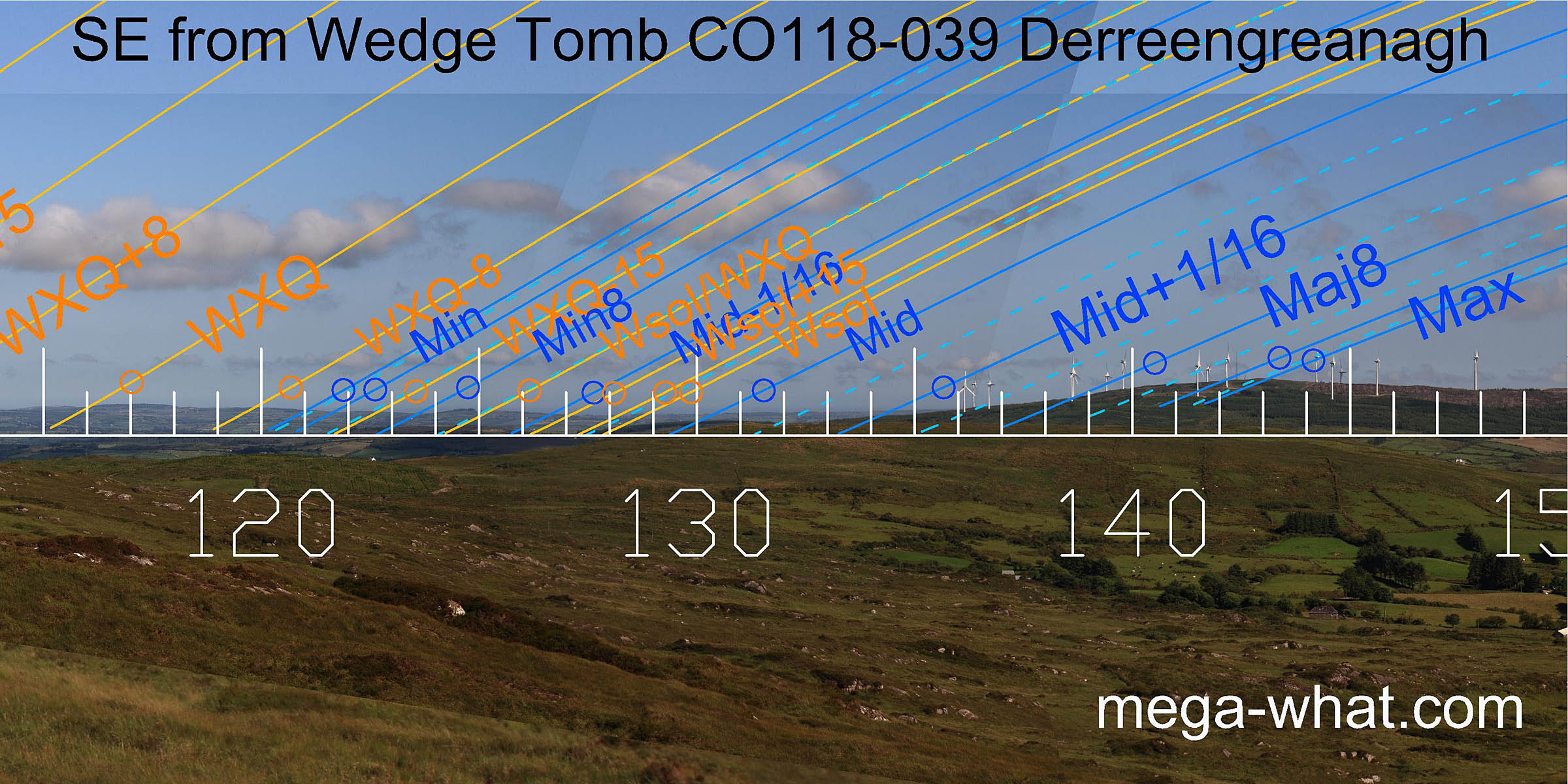
The equinox is at a step in the middle of a section of slope that defines the month centred on it. The south-east is low and distant but undulates enough to be useful, culminating with major standstillLunistice positions vary cyclically over an 18.6 year period but are fairly static for more than a year at either end of the range on a nearer hilltop.
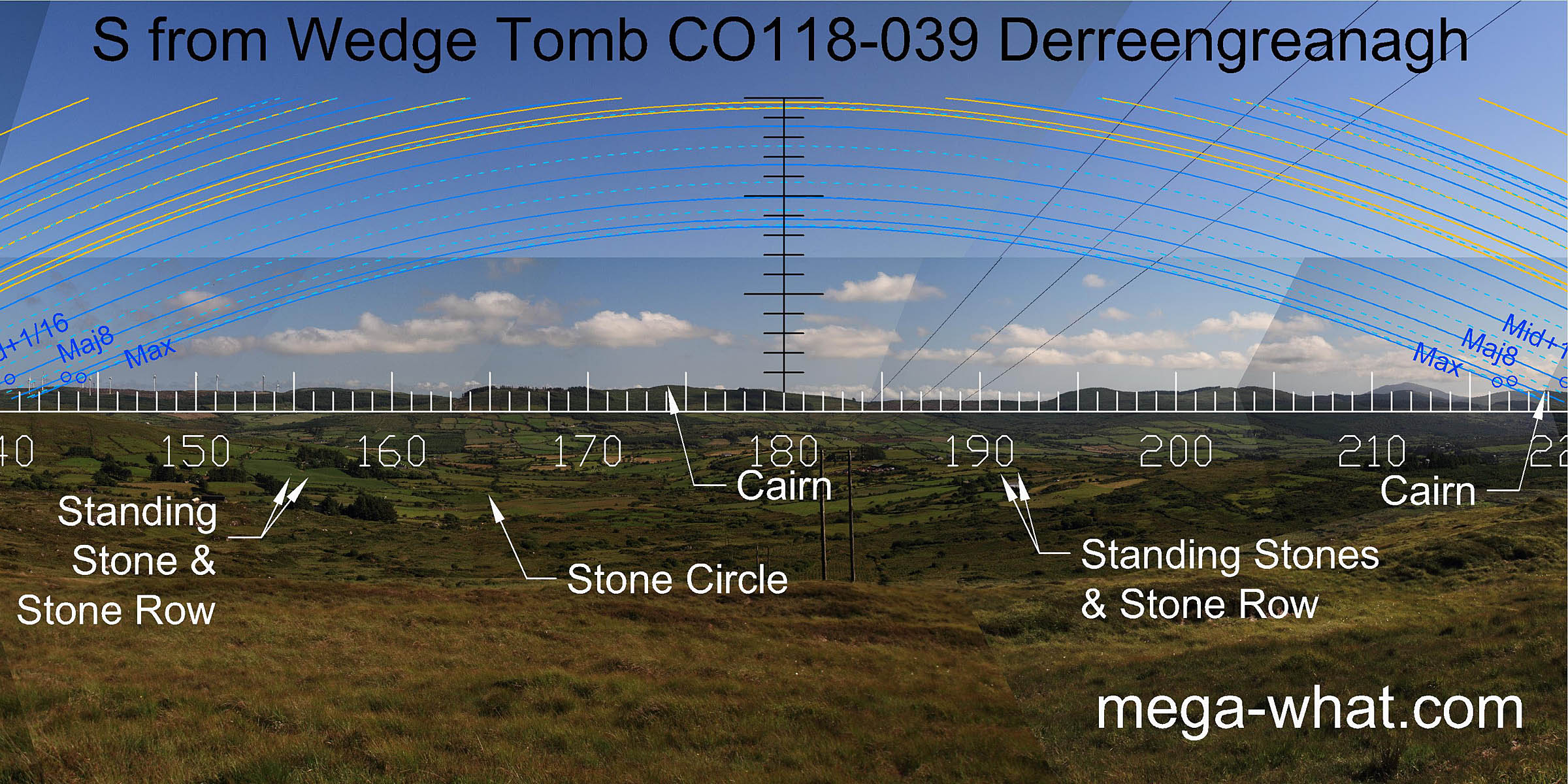 South is at the end of a ridge, left of a wide dip. A number of other monuments are visible:
- A Stone Row and Standing Stone.
- A Five Stone Circle.
- An Anomalous Stone Group that is really a Stone Row and Standing Stone.
- Hilltop cairns at Letterlicky and on Mt Corrin in the south-west.
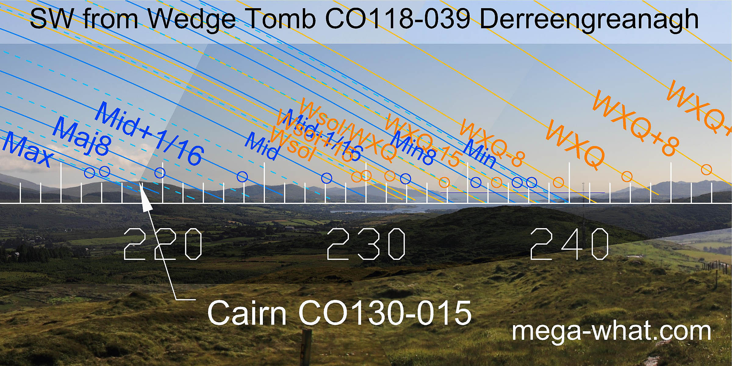
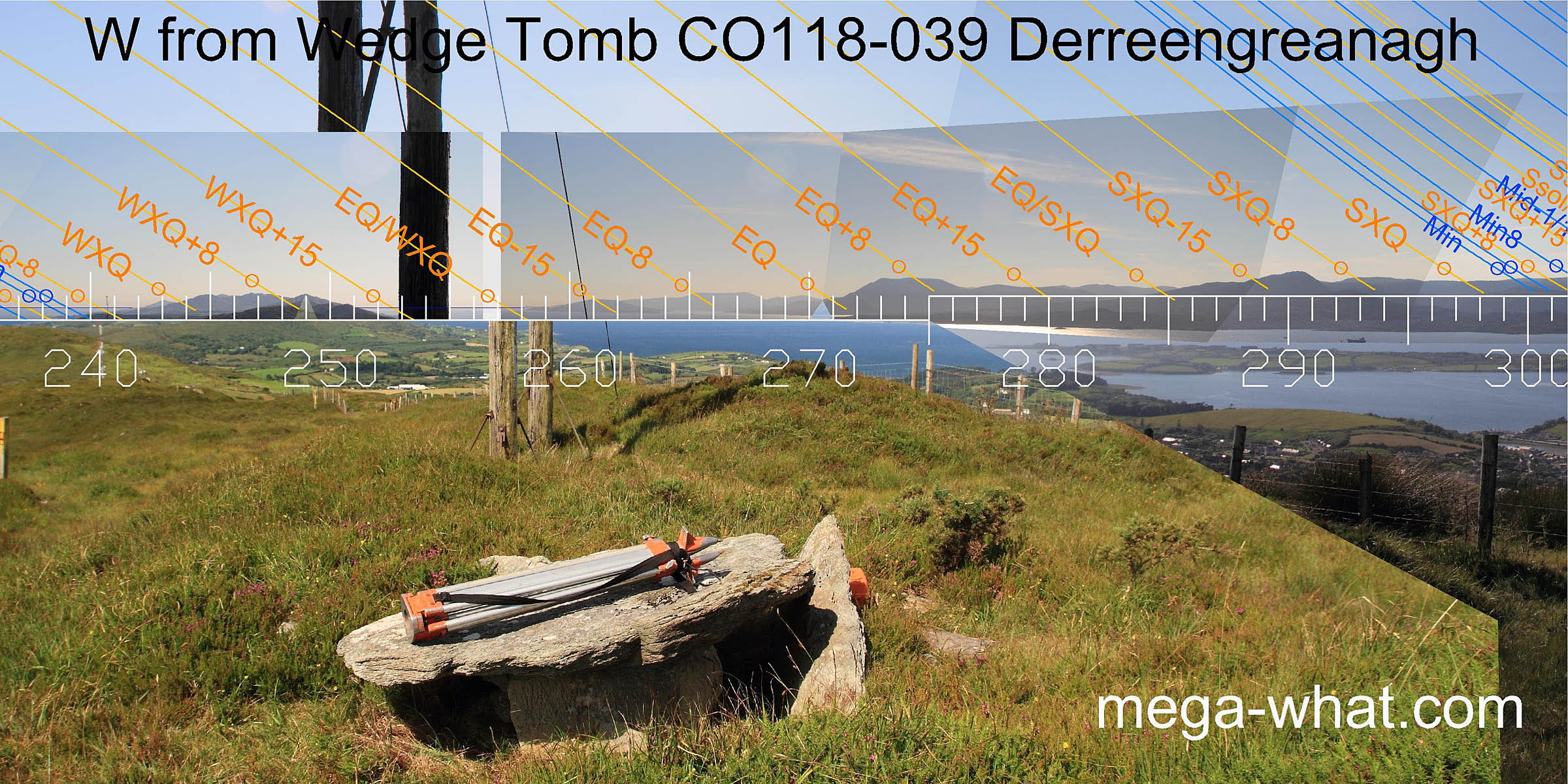
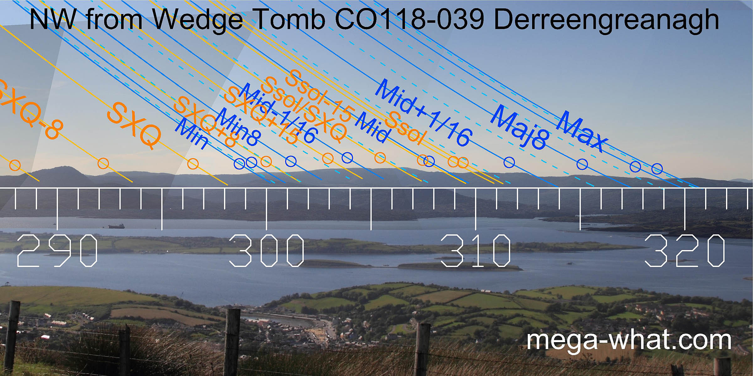 The western horizon is more distant and generally gives better precision. In the south-west, both major standstill and winter solstice sets are on hilltops.
The luni-solar sequence carries on around with many more useful correspondences.
The western horizon is more distant and generally gives better precision. In the south-west, both major standstill and winter solstice sets are on hilltops.
The luni-solar sequence carries on around with many more useful correspondences.
- Baurgorm Stone Circle & Stone Pair are a further 1.8km to the east (109°) along this footpath.
- Ardnageehy More Wedge Tomb is c.150m to the north but there is no access from here.
- Ratooragh c.18km to the south-west (224°) is the next nearest surveyed wedge tomb.
- Altar Wedge Tomb c.23km to the south-west (221°) is both surveyed and easily accessible.
References
- Archaeological Survey of Ireland, record details. www.archaeology.ie/archaeological-survey-ireland
- POWER, D. et al. 1992 Archaeological Inventory of County Cork, Volume 1: West Cork. Dublin: Stationary Office. p16, no.19.
- Ó'NUALLÁIN, S. 1989 Survey of the Megalithic Tombs of Ireland, Volume V: Sligo. Dublin: Stationary Office. p135, listed only.