
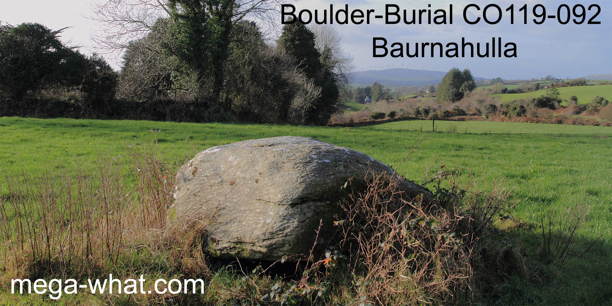
 Baurnahulla Boulder-Burial is 1km or so south-east of Drimoleague. It is a large, flattish, lozenge shaped boulder resting on three or four support stones
and its general thrust indicates the south-west. Sixty years ago a child could crawl under it, according to one who did so, but the cavity has been filled with field stones.
There may once have been a Standing Stone nearby (Nyhan,1930,99).
Baurnahulla Boulder-Burial is 1km or so south-east of Drimoleague. It is a large, flattish, lozenge shaped boulder resting on three or four support stones
and its general thrust indicates the south-west. Sixty years ago a child could crawl under it, according to one who did so, but the cavity has been filled with field stones.
There may once have been a Standing Stone nearby (Nyhan,1930,99).
 South is obscured but is on a ridge and looks to be in the vicinity of a bit of a dip [Pic].
![[Pic]](Baurnahulla-S.jpg)
North is close to the intersection of local and distant ground, at the west basal dip of the first far hill [Pic].
![[Pic]](Baurnahulla-N.jpg)
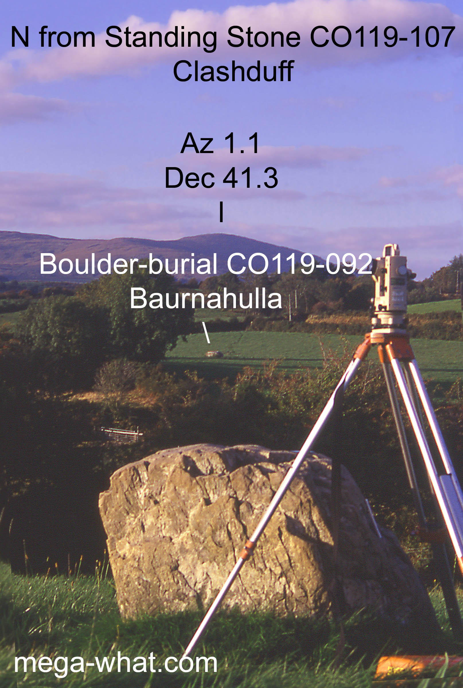 Almost due south of the boulder-burial, across the valley and intervisible with it is the Clashduff Possible Standing Stone.
This was recorded as a possible Standing Stone by the Archaeological Survey but has been demoted to the status of "redundant record".
Almost due south of the boulder-burial, across the valley and intervisible with it is the Clashduff Possible Standing Stone.
This was recorded as a possible Standing Stone by the Archaeological Survey but has been demoted to the status of "redundant record".
Archaeoastronomical survey cannot establish with certainty that it is a genuine bronze age Standing Stone but does demonstrate the likelihood of it.
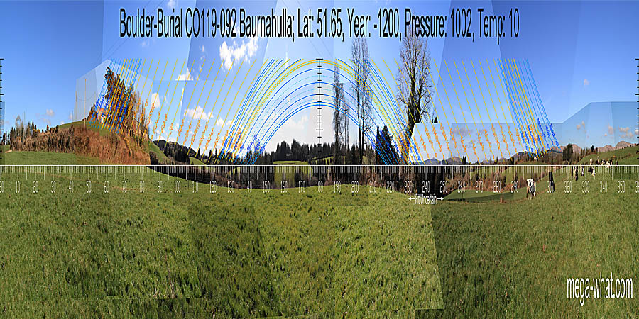
The boulder-burial's location, together with Nowen Hill to the north and the Clashduff Stone to the south, defines or makes obvious an axis of symmetry.
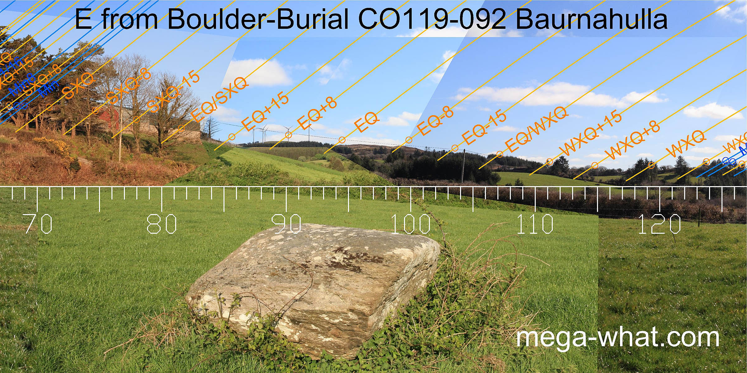 To the east, at right angles to this axis, a pair of hills may be seen down the valley.
The notch between them is equinoctial and the hilltops are a quarter month either side when viewed from the boulder-burial.
To the east, at right angles to this axis, a pair of hills may be seen down the valley.
The notch between them is equinoctial and the hilltops are a quarter month either side when viewed from the boulder-burial.
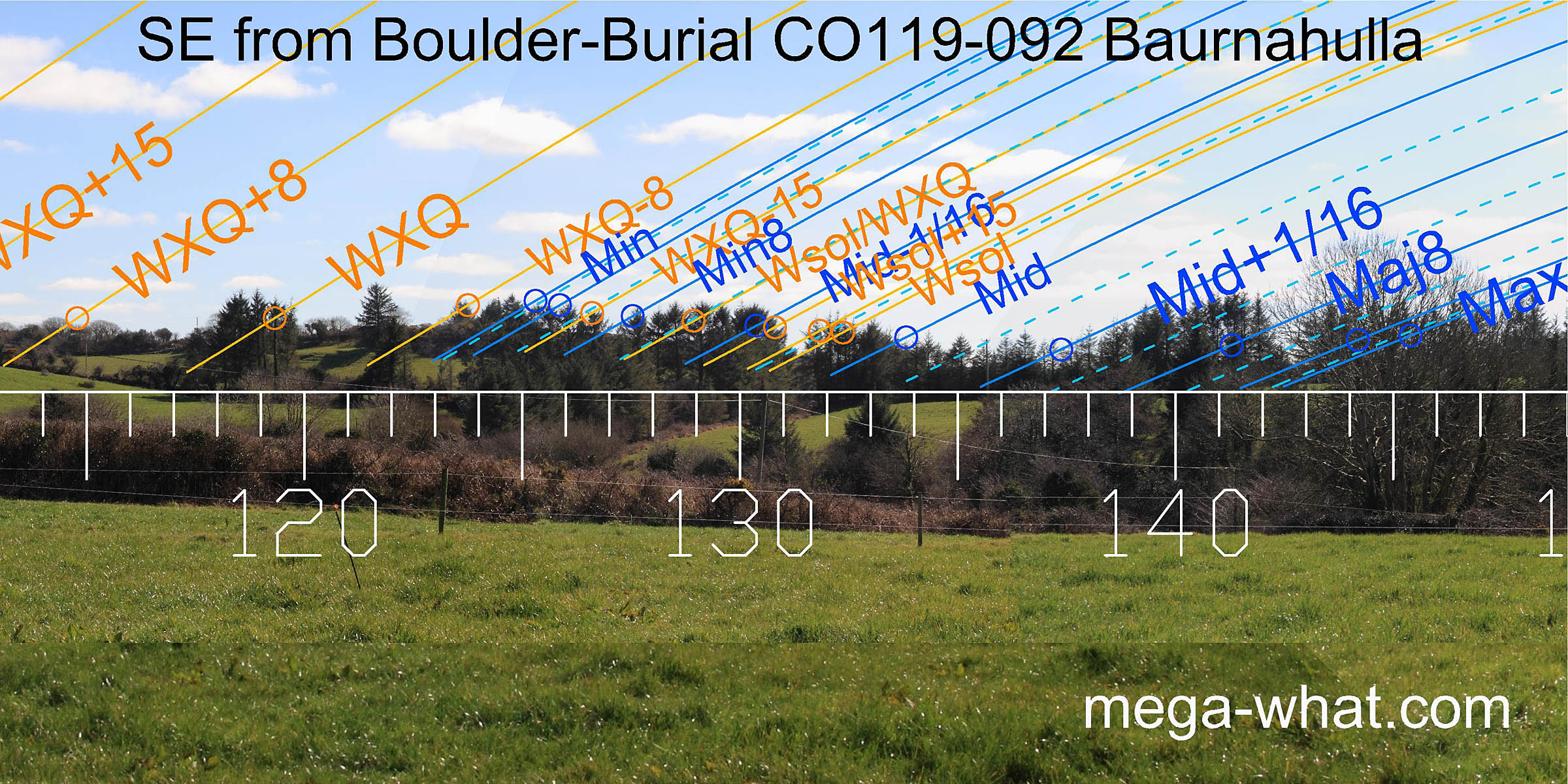 South-eastwards, an obvious dip has almost exactly the same declination as Mt Kid in the south-west. The next hilltop to the south marks the minor end of the
lunisticeLunistices are the most northerly and southerly moons of the month. The lunar equivalent of solstices - more. cycle.
The major end occurs at the intersect between more distant horizons and the east end of the local ridge that occupies the southern horizon.
South-eastwards, an obvious dip has almost exactly the same declination as Mt Kid in the south-west. The next hilltop to the south marks the minor end of the
lunisticeLunistices are the most northerly and southerly moons of the month. The lunar equivalent of solstices - more. cycle.
The major end occurs at the intersect between more distant horizons and the east end of the local ridge that occupies the southern horizon.
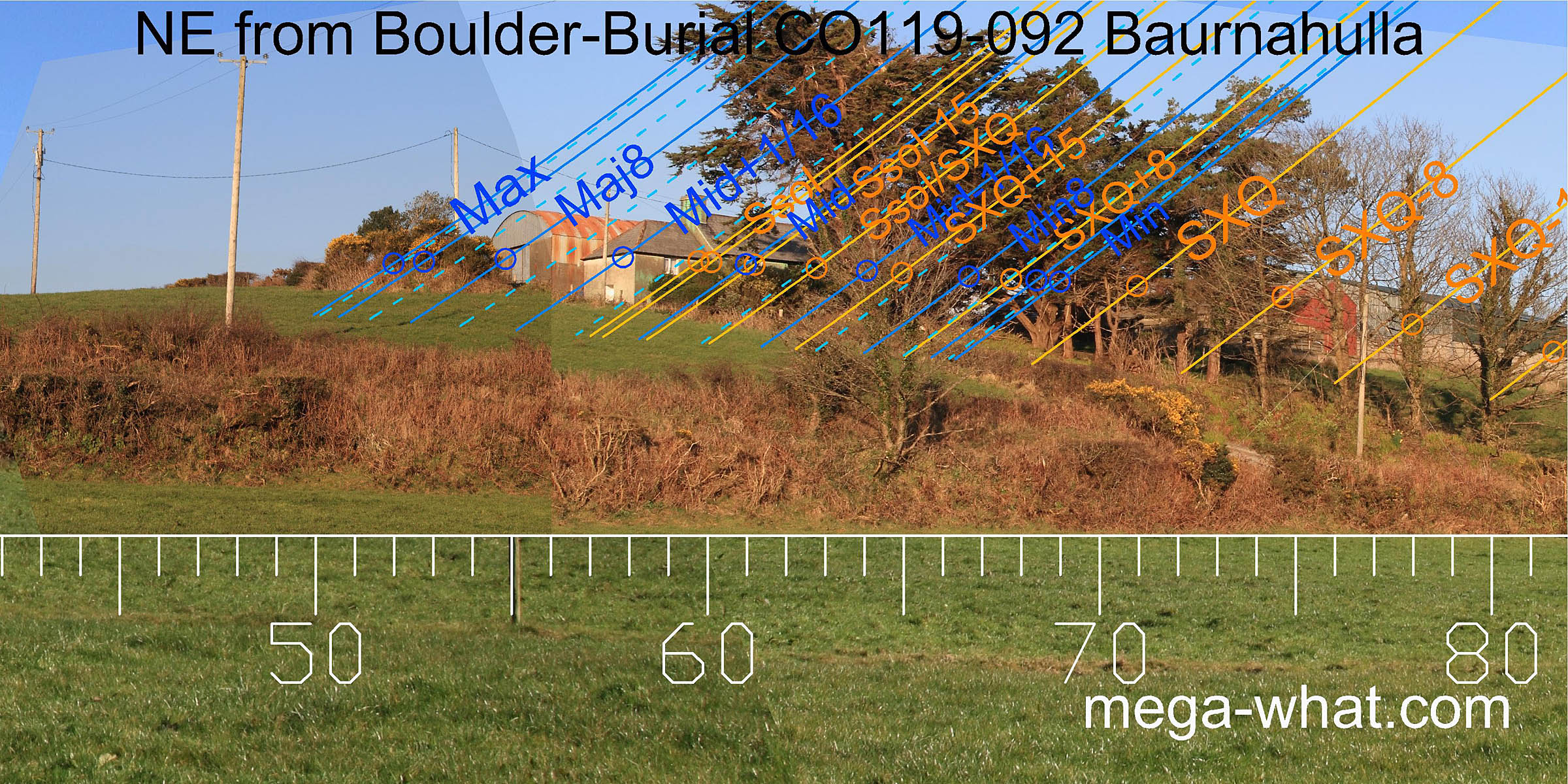 The north-east is rather obscured, being occupied by a farm and some trees but clearly the major standstill is on the hilltop.
This hill is very close and so it is easy to vary positions by a degree or so by moving from one side of the boulder to the other.
The north-east is rather obscured, being occupied by a farm and some trees but clearly the major standstill is on the hilltop.
This hill is very close and so it is easy to vary positions by a degree or so by moving from one side of the boulder to the other.
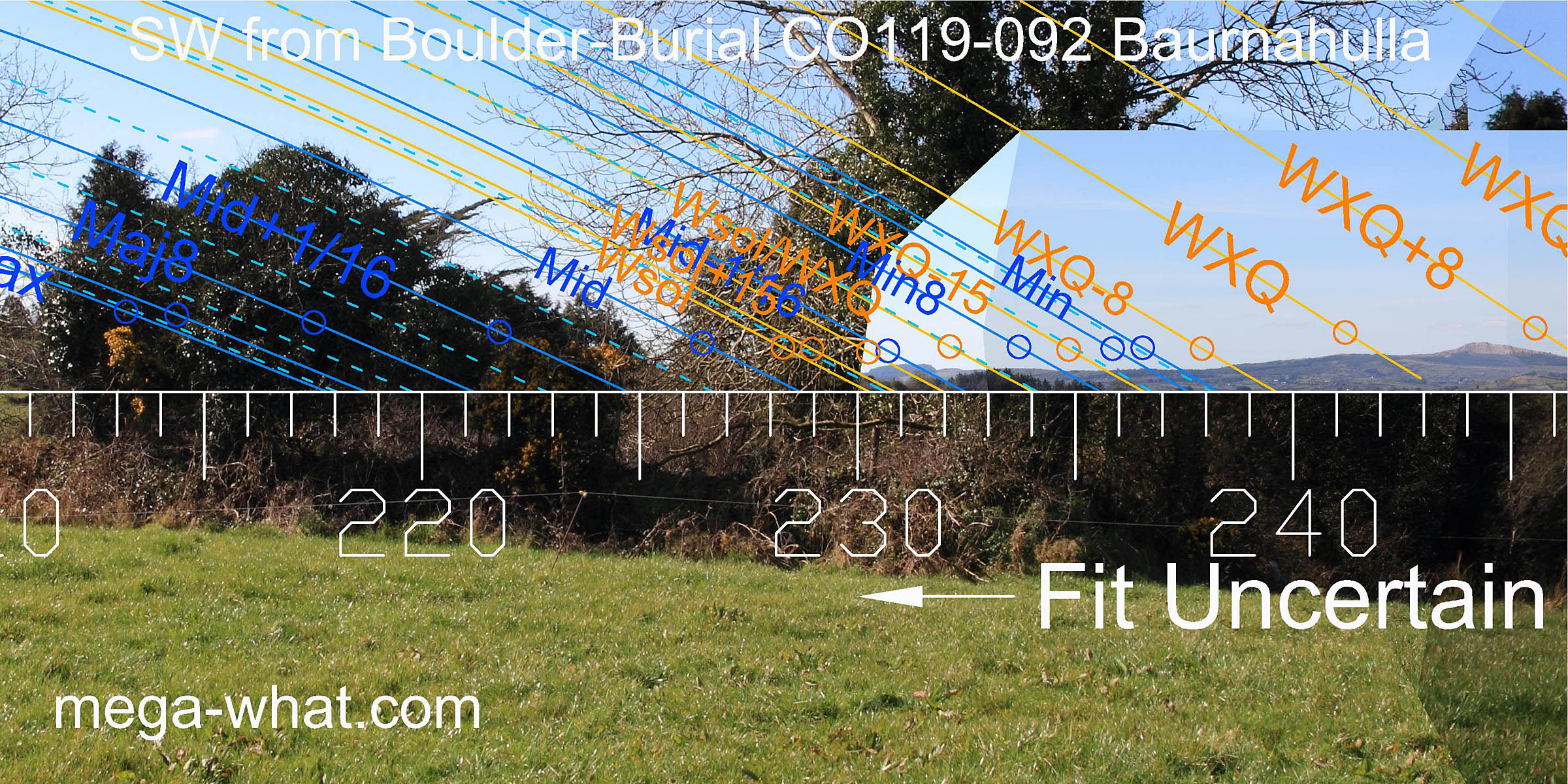 The south-west is obscured by trees and has not been surveyed but Mt. Kid is a bit north of the winter cross-quarters and
it looks as though the lunistice range would run up the western slope of the local hill that forms the south horizon from its intersect with the ridge south of Mt. Kid.
The south-west is obscured by trees and has not been surveyed but Mt. Kid is a bit north of the winter cross-quarters and
it looks as though the lunistice range would run up the western slope of the local hill that forms the south horizon from its intersect with the ridge south of Mt. Kid.
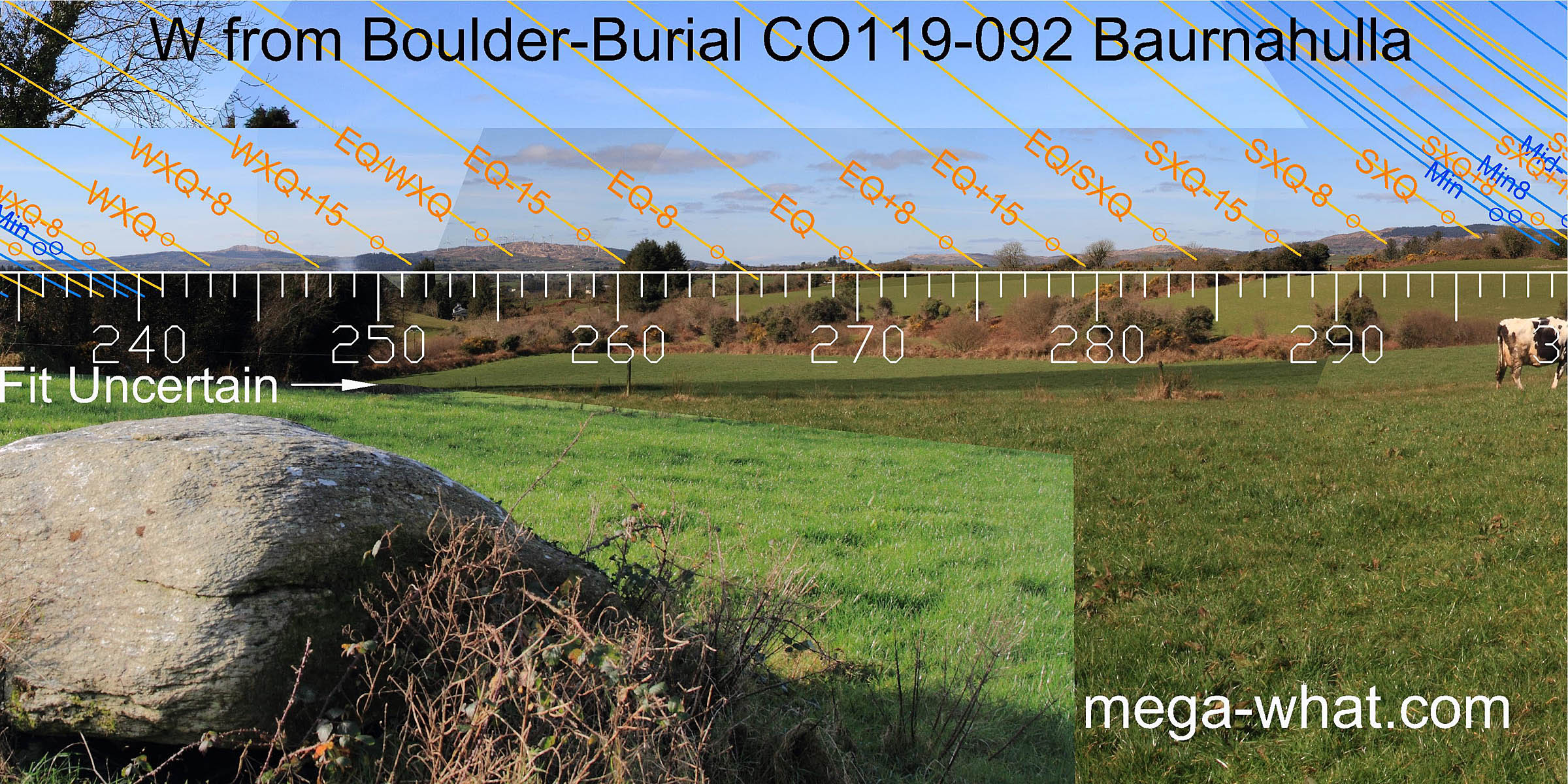 To the west, the south base of Spratt Hill is equinoctial while north of it, Dromore hilltop is half-way to the summer cross-quarters
and the winter equivalent is at the south basal step of the summit of Coomnagoragh Mountain.
To the west, the south base of Spratt Hill is equinoctial while north of it, Dromore hilltop is half-way to the summer cross-quarters
and the winter equivalent is at the south basal step of the summit of Coomnagoragh Mountain.
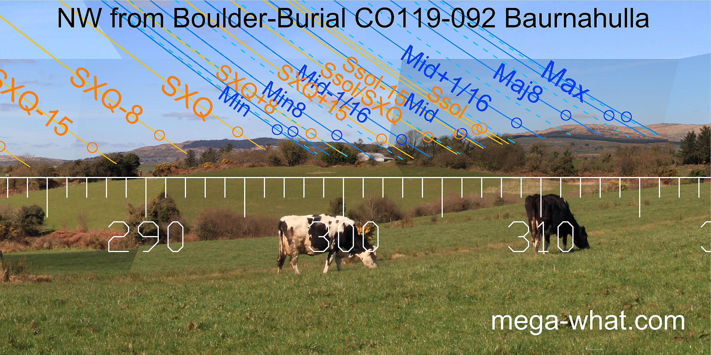 To the north-west, the cross-quarters and the minor end of the lunistice range occur at steps either side of a hilltop.
The major end is in a saddle of a higher hill but note that both these lunar markers are for the sixteenths, not the standstills themselves.
The major eighth gets a good hilltop marker while the solstice has an adequate one on the slope.
To the north-west, the cross-quarters and the minor end of the lunistice range occur at steps either side of a hilltop.
The major end is in a saddle of a higher hill but note that both these lunar markers are for the sixteenths, not the standstills themselves.
The major eighth gets a good hilltop marker while the solstice has an adequate one on the slope.
 From the Standing Stone 260m across the valley, the north-western view is noticeably different.
This time, the saddle south of the hilltop gives a half-month bracket for the cross-quarters and the saddle north of the hill gives both the cross-quarter/solstice midpoint and a lunar sixteenth.
- Kilmore Boulder-Burials are c.1.7km south-west (215°)
- Derryclough Boulder-Burial is c.4km east (111°)
- Cullomane Boulder-Burial is c.10km west (271°)
References
- Archaeological Survey of Ireland, record details. www.archaeology.ie/archaeological-survey-ireland
- NYHAN, DANIEL 1930 Historic Drimoleague. Journal of the Cork Historical and Archaeological Society 35:99-102.
- POWER, D. et al. 1992 Archaeological Inventory of County Cork, Volume 1: West Cork. Dublin: Stationary Office. p29, no.100.