
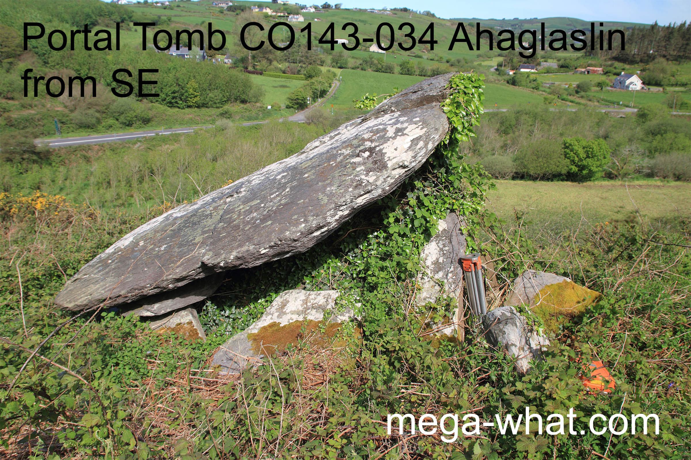
 About 20m above sea level and 1km up the Ownahinchy river from the sea, Ahaglaslin Portal Tomb is 2km or so east of Rosscarbery on a small platform near the top of a steep slope.
Visible from the N71, access is off a side road and through a farm.
About 20m above sea level and 1km up the Ownahinchy river from the sea, Ahaglaslin Portal Tomb is 2km or so east of Rosscarbery on a small platform near the top of a steep slope.
Visible from the N71, access is off a side road and through a farm.
Due perhaps to the tomb's precarious position, the portals have tilted north and the capstone has swung to the north-east, pivoting on the pair of padstones that support its rear end. Outside the portals are set another pair of stones which have not moved and neither has the backstone.
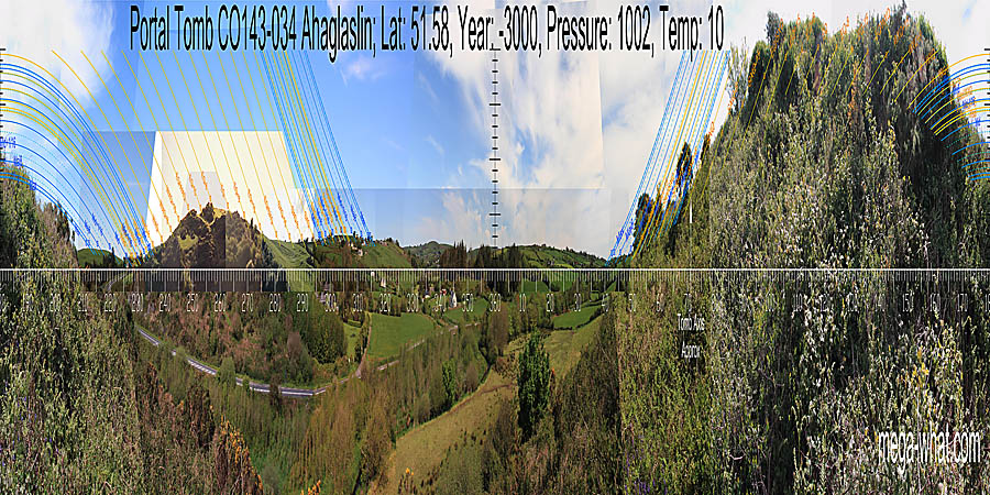
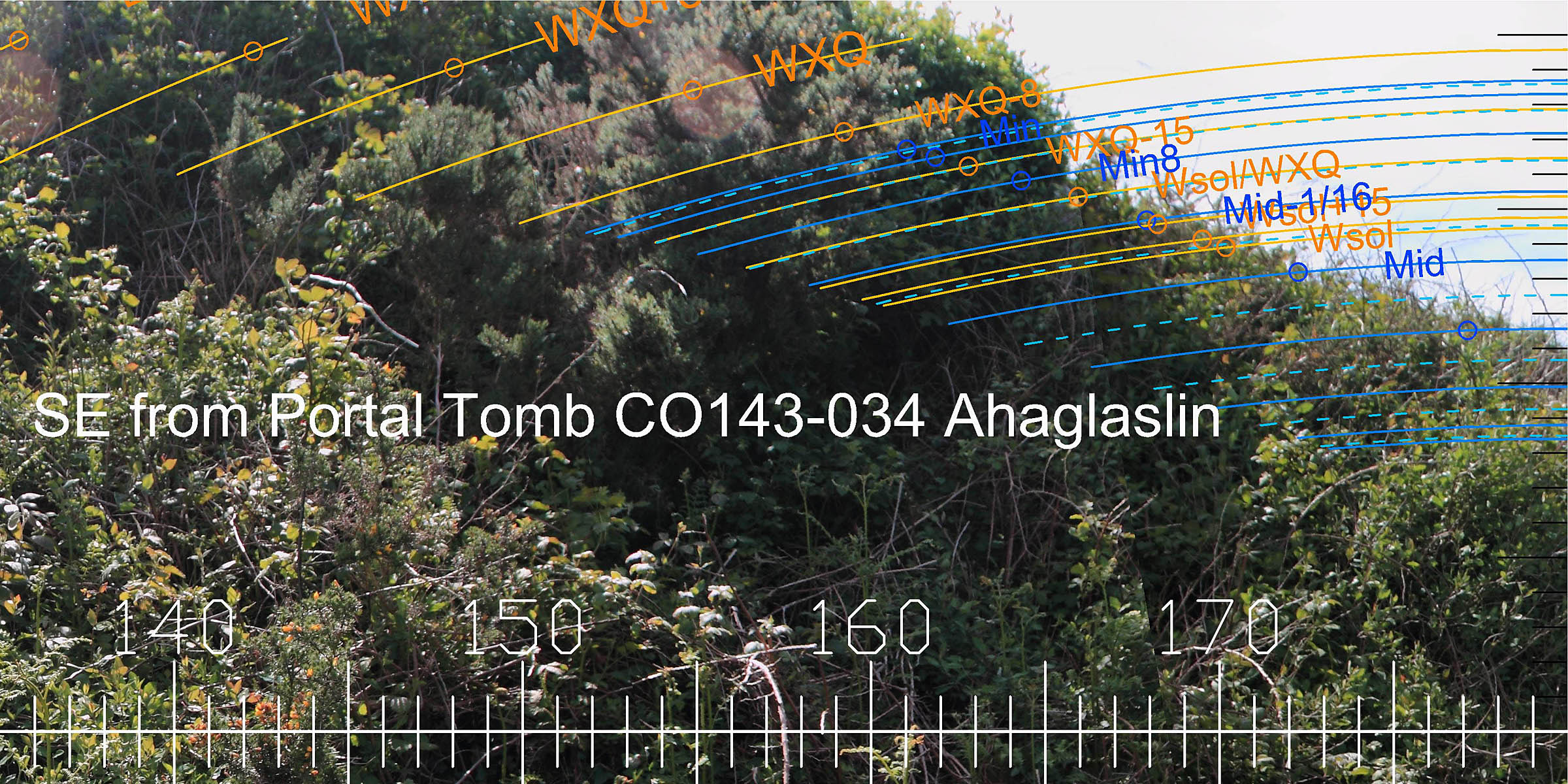
 To the north-east, the main skyline dip marks major standstill moonrise and the hill to its south marks the major eighth of the
lunisticeLunistices are the most northerly and southerly moons of the month. The lunar equivalent of solstices - more. cycle.
Views further south are cut off by the local slope. The tomb axis points up this slope in the general direction of summer cross-quarter / lunar minor standstill rises.
To the north-east, the main skyline dip marks major standstill moonrise and the hill to its south marks the major eighth of the
lunisticeLunistices are the most northerly and southerly moons of the month. The lunar equivalent of solstices - more. cycle.
Views further south are cut off by the local slope. The tomb axis points up this slope in the general direction of summer cross-quarter / lunar minor standstill rises.
This axis was determined by attaching a line to a small upright slab that is behind the backstone and set along the tomb axis. Then running it over the top of the backstone and out centrally between the portico stones [Tomb rear Pic].
![[Tomb rear Pic]](CO143-034-NE.jpg)
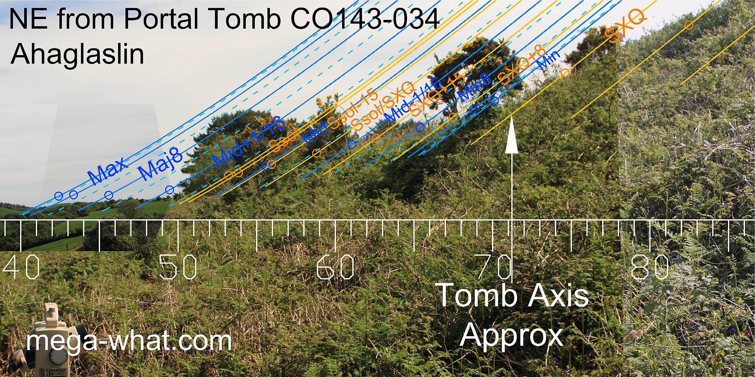
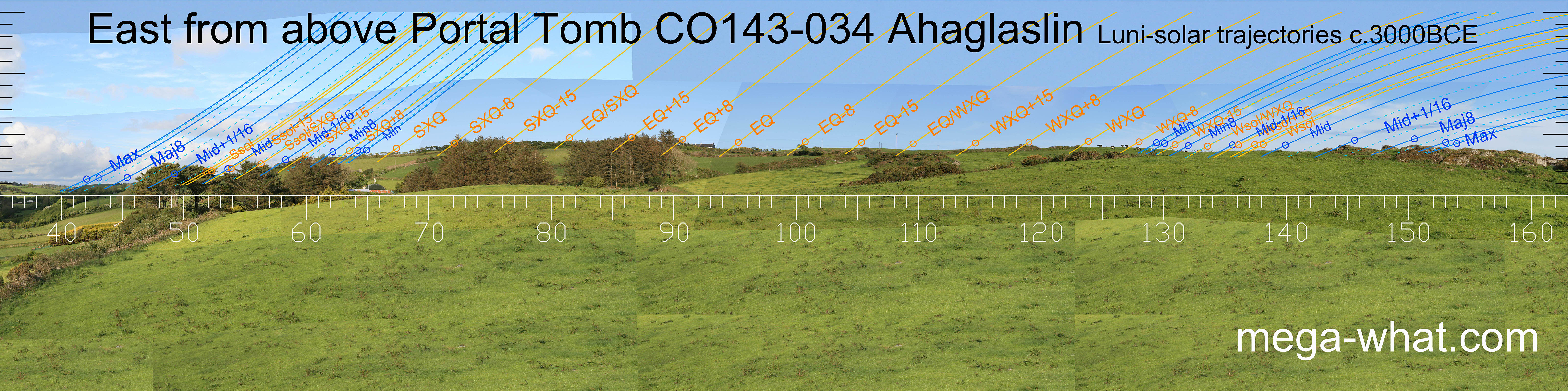
 The true profile of the eastern horizon is obscured but it is so close that exact observer position would be very significant.
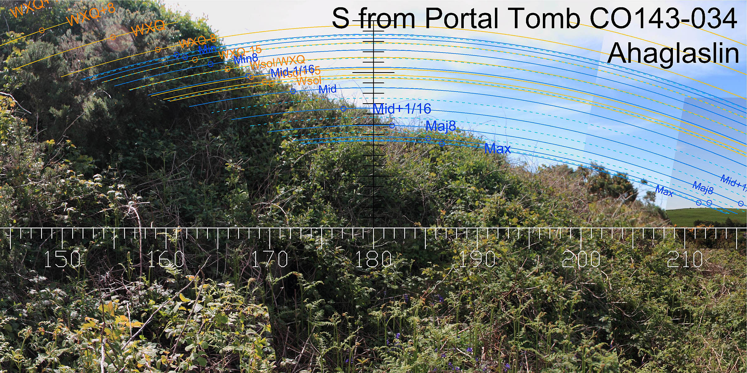 It looks likely that the true ground surface, major
standstillLunistice positions vary cyclically over an 18.6 year period but are fairly static for more than a year at either end of the range
moonrises and due south all coincide. Again, very position sensitive.
It looks likely that the true ground surface, major
standstillLunistice positions vary cyclically over an 18.6 year period but are fairly static for more than a year at either end of the range
moonrises and due south all coincide. Again, very position sensitive.
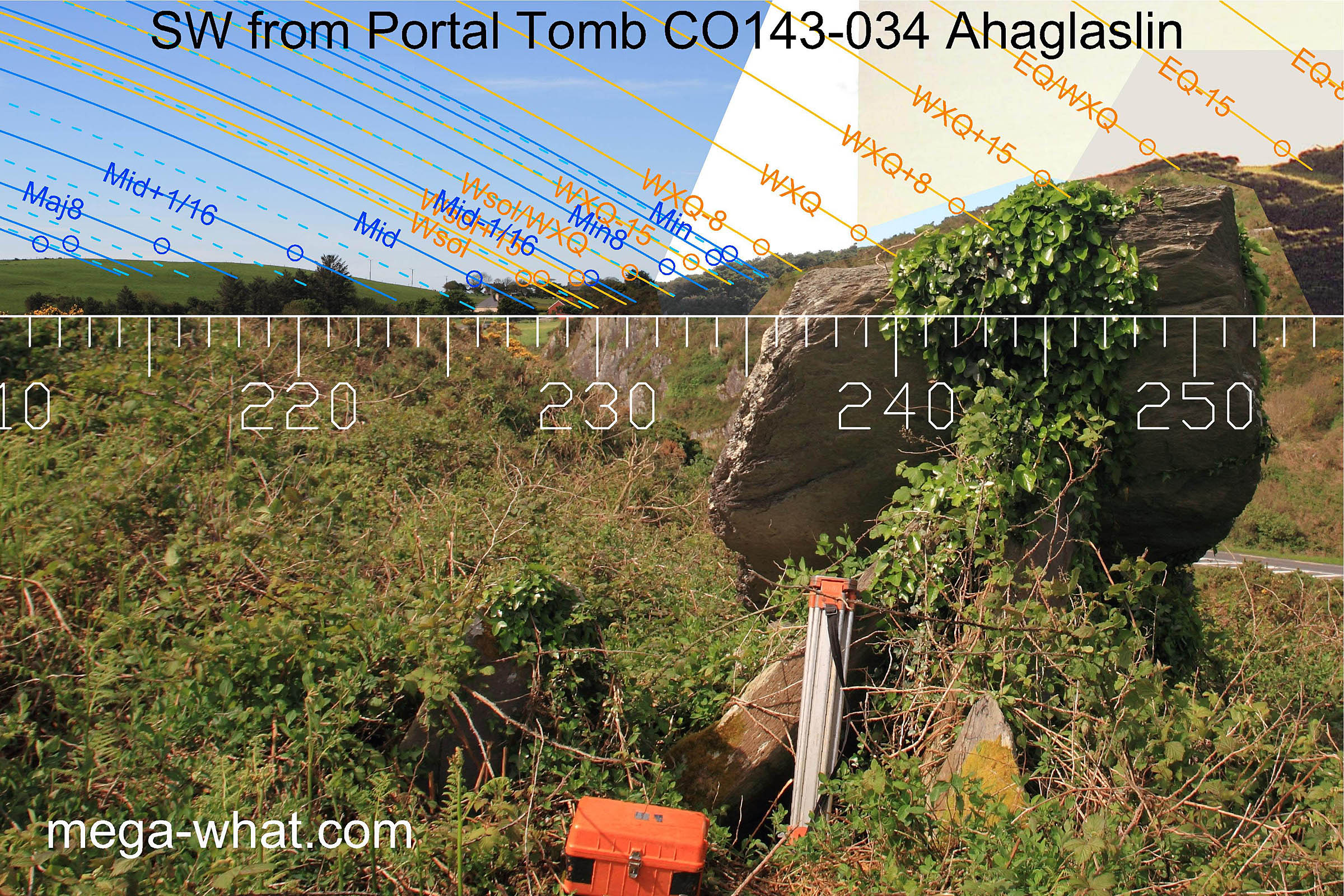
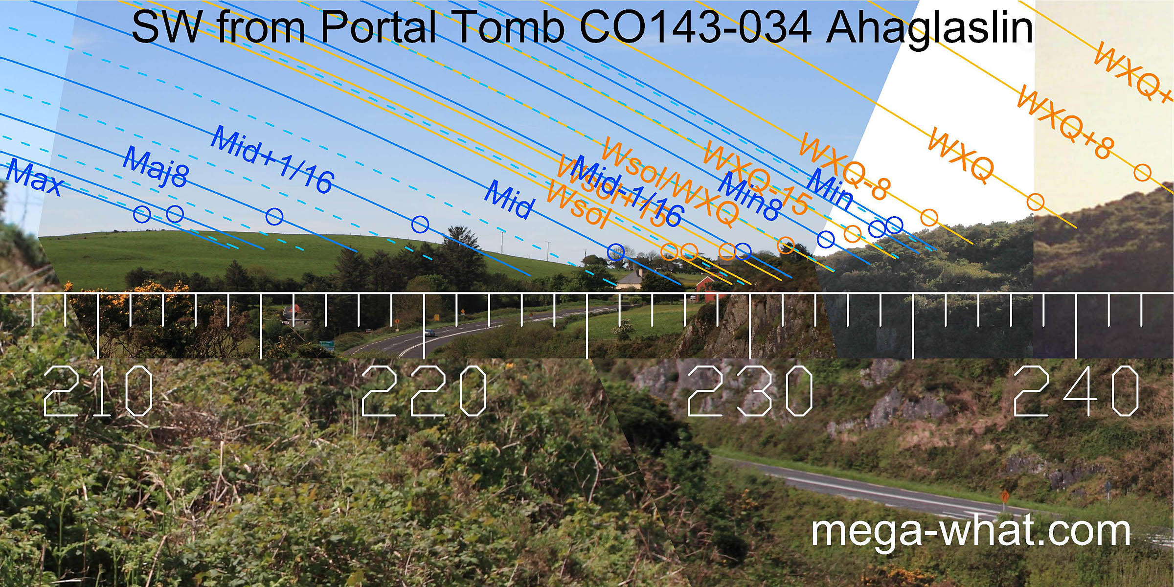
To the south-west is a more distant hill with two highpoints that mark lunar major standstill and the major eighth. The dip is generally solstitial and intersection of far ground with the nearer western hill is about half-way to the winter cross-quarter, which is at a break hillslope.
The south-western intersect of local and far has a declination c.-32° which roughly marks the zodiac limit.
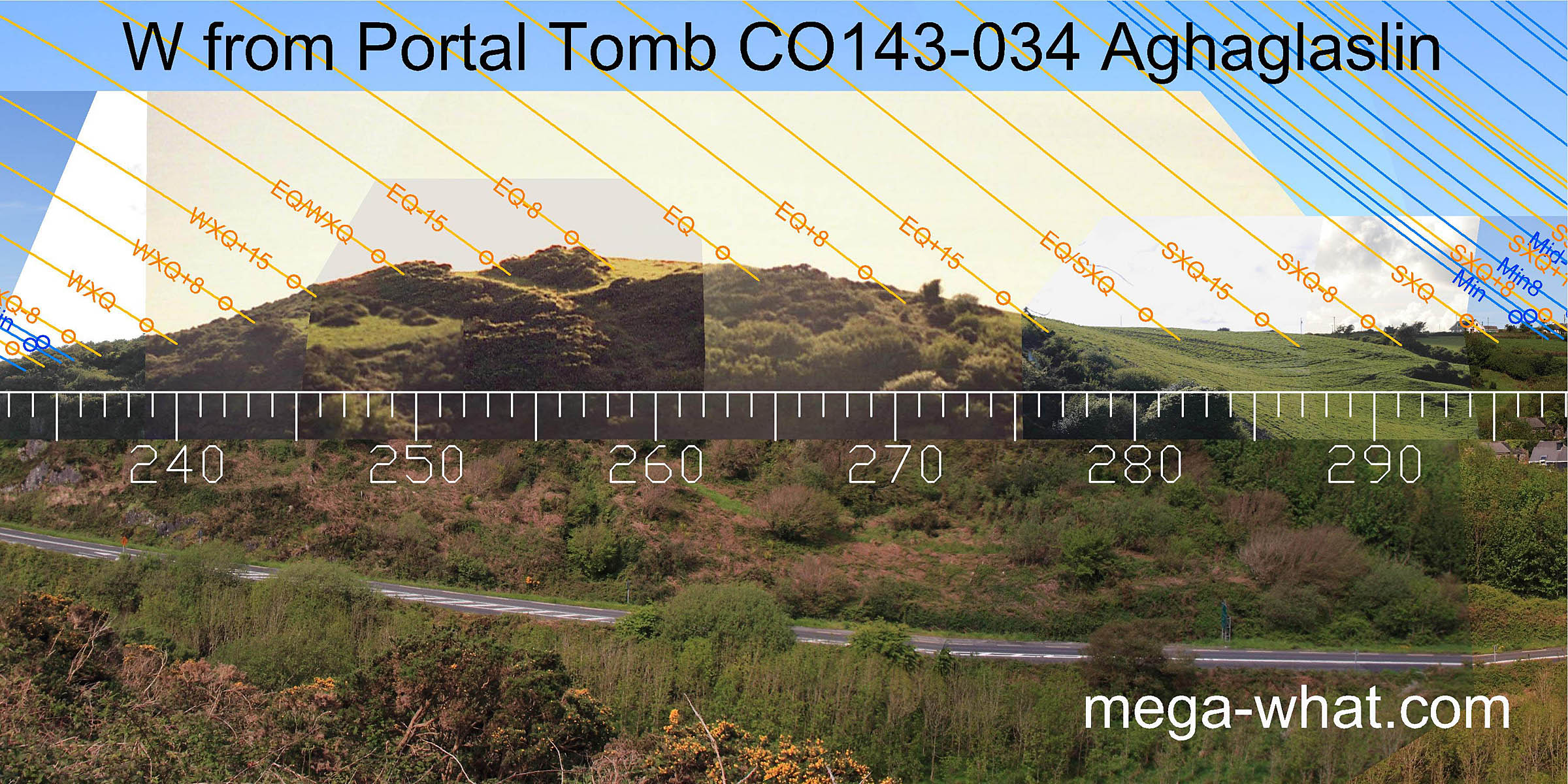 The western hill (now forested) has winter cross-quarter at a break on its south slope and the top of the slope is half-way to the equinox.
The hilltop is a quarter-month before spring equinox with the equinox itself relegated to the right-hand minor top.
The first rise beyond the hill's basal step is the equinox / summer cross-quarter midpoint.
The western hill (now forested) has winter cross-quarter at a break on its south slope and the top of the slope is half-way to the equinox.
The hilltop is a quarter-month before spring equinox with the equinox itself relegated to the right-hand minor top.
The first rise beyond the hill's basal step is the equinox / summer cross-quarter midpoint.
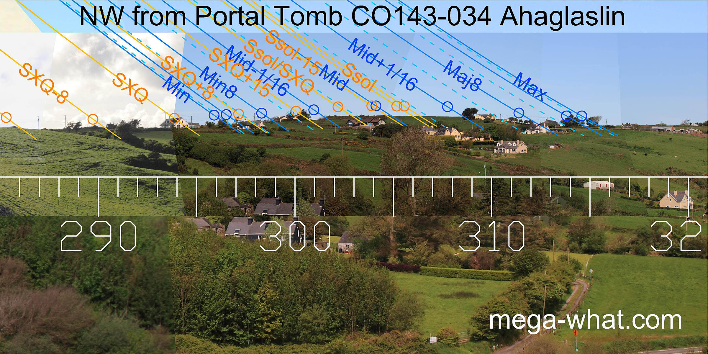 Summer solstice sunset is on the top of Burgatia Hill but the very highest point is a half-month from it and also marks lunar mid-cycle.
Lunar major eighth is at the north basal foot of the hilltop proper.
Summer solstice sunset is on the top of Burgatia Hill but the very highest point is a half-month from it and also marks lunar mid-cycle.
Lunar major eighth is at the north basal foot of the hilltop proper.
 The north-western intersect of local and far has a declination c.33°, roughly marking the zodiac limit.
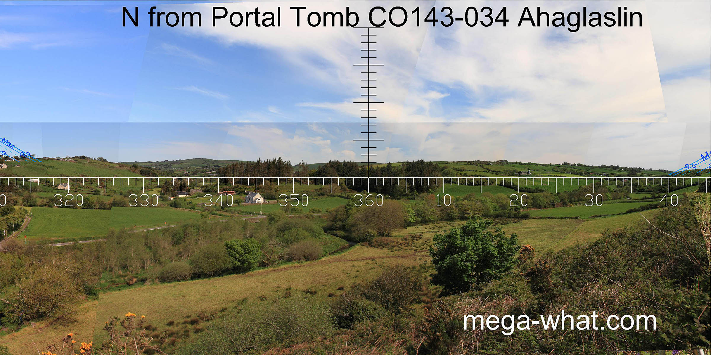
The northern horizon is fairly bland but fine for stargazing, with a notch not far from due north. It is distant enough that the presence or absence of trees would be of no significance.
As an aid to understanding the tomb's location, a trial observing position was selected on a natural high point at the top of a rock outcrop slightly east of the tomb. From this position at the top of the slope above the tomb, a full eastern horizon is visible in addition to the west and north. Perhaps this land was still uncleared when the tomb was built and that possibility might explain its position.
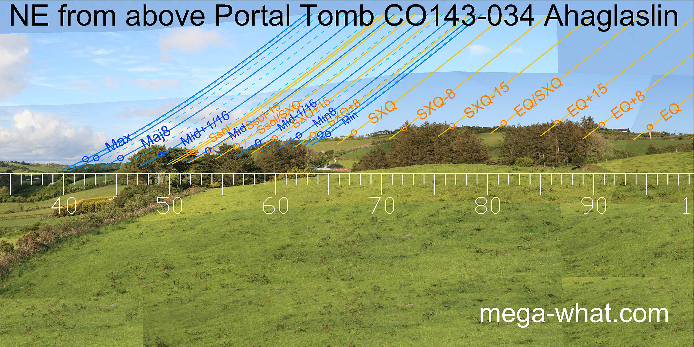 The north-eastern lunar limit and major eighth are as they were from the tomb.
The remainder of the lunistice cycle and the summer cross-quarters are on the north facing slope but no obvious markers are visible now.
The cross-quarter / equinox midpoint is on the hilltop and the equinox is in a noticeable dip on the slope,
then the half-way point to the winter cross-quarters are in the dip at the bottom of the slope.
The north-eastern lunar limit and major eighth are as they were from the tomb.
The remainder of the lunistice cycle and the summer cross-quarters are on the north facing slope but no obvious markers are visible now.
The cross-quarter / equinox midpoint is on the hilltop and the equinox is in a noticeable dip on the slope,
then the half-way point to the winter cross-quarters are in the dip at the bottom of the slope.
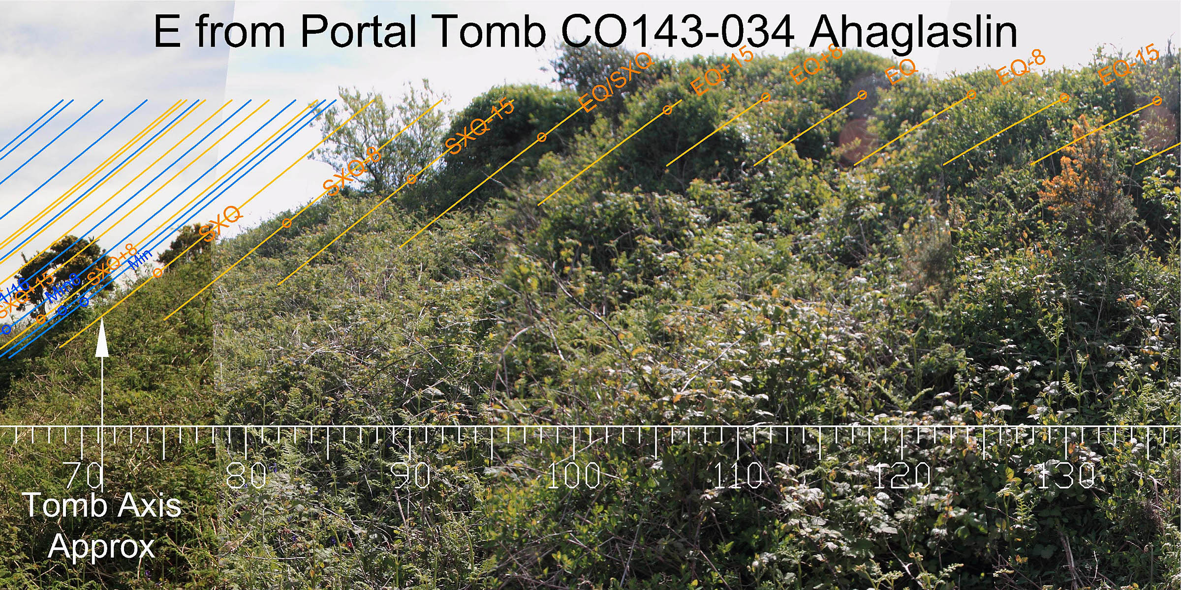
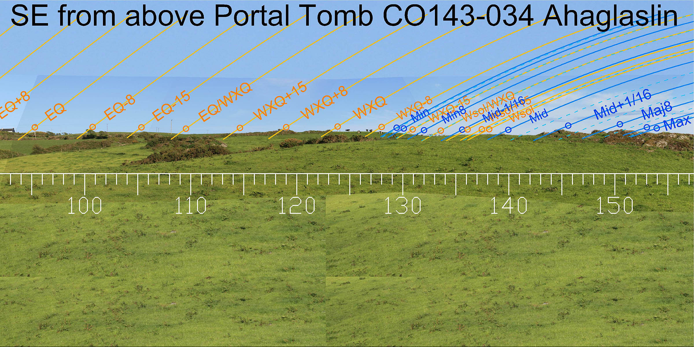 To the south-east, everything from winter cross-quarters to the lunar limit occurs on rather local ground.
The solstice/cross-quarter midpoint is at the eastern end of a rocky rib but this is quite close and small changes of observing position
would (perhaps usefully) make a significant difference to the placement of particular events.
To the south-east, everything from winter cross-quarters to the lunar limit occurs on rather local ground.
The solstice/cross-quarter midpoint is at the eastern end of a rocky rib but this is quite close and small changes of observing position
would (perhaps usefully) make a significant difference to the placement of particular events.
It thus seems possible that the eastern/south-eastern horizon was tree-free when the tomb was built and was part of the exploited territory, along with the western ridge and Burgatia Hill.
 From this observing position above the tomb, far south-western declinations are essentially the same as from the tomb.
The western hilltop has shifted south by a diameter or so but the intersect between far and near changes by nearly 10°.
Burgatia hilltop's declination is 0.65° less from here but could be adjusted by moving 15m or so further west.
From this observing position above the tomb, far south-western declinations are essentially the same as from the tomb.
The western hilltop has shifted south by a diameter or so but the intersect between far and near changes by nearly 10°.
Burgatia hilltop's declination is 0.65° less from here but could be adjusted by moving 15m or so further west.
It therefore seems likely that the reason for siting the tomb down on the slope was not just to get the half-month from summer solstice accurately on Burgatia Hill's highest point but also to fine tune the intersect of western hill and more distant south-western ground. Additionally, there is the approximate symmetry of the SW and NW intersects and the mirroring of the western hill by the eastern local hump.
There is only one other Portal Tomb in Co. Cork, 44km (as the crow flies) to the west, at Arderrawinny. Interestingly the two form a complementary pair and are similar in their use of very local ground.
- Bohonagh Stone Circle is nearby, to the north and across the valley
- Killickaforavane Passage Tomb is 36.4km south-west (246°) on Clear Island
References
- Archaeological Survey of Ireland, record details. www.archaeology.ie/archaeological-survey-ireland
- DE VALERA, RUAIDHRÍ & Ó'NUALLÁIN, SEÁN 1982 Survey of the Megalithic Tombs of Ireland, Volume IV: Cork, Kerry, Limerick and Tipperary. Dublin: Stationary Office. p37, no.55.
- POWER, D. et al. 1992 Archaeological Inventory of County Cork, Volume 1: West Cork. Dublin: Stationary Office. p13, no.1.