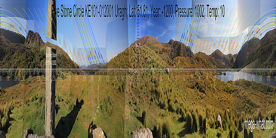
 North is left of a hilltop but over the top of the local rise and between two prominent boulders.
South is on the highest hilltop. The height of it means that south lunistices are not visible for about 8 years during the major half of the cycle.

Vertical scale x4, maxpic 3200x1600.
Orange lines mark the annual solar round. Lunistice positions over the 18.6 year lunar nodal cycle are blue. More about the Solar CalendarMore about the Lunar Calendar More about this placeLook South
Uragh Five Stone Circle: 360° N centred
 North is left of a hilltop but over the top of the local rise and between two prominent boulders.
South is on the highest hilltop. The height of it means that south lunistices are not visible for about 8 years during the major half of the cycle.
- Uragh Multiple Stone Circle & Boulder-Burials are c.800m south-west (235°) up the hill
- Another Five Stone Circle (damaged) is c.500m north-east (57°) beside the river
- Cooryeen Boulder-Burials & Standing Stone are c.700m north-east (72°) on the other side of the valley
- Drombohilly Stone Circle is c.5km south-west (236°)
| Home | Site Lists | Glossary | Survey Data |
Most archaeological monuments are on private property and where not otherwise indicated those wishing to visit a site should seek permission from the landowner.