
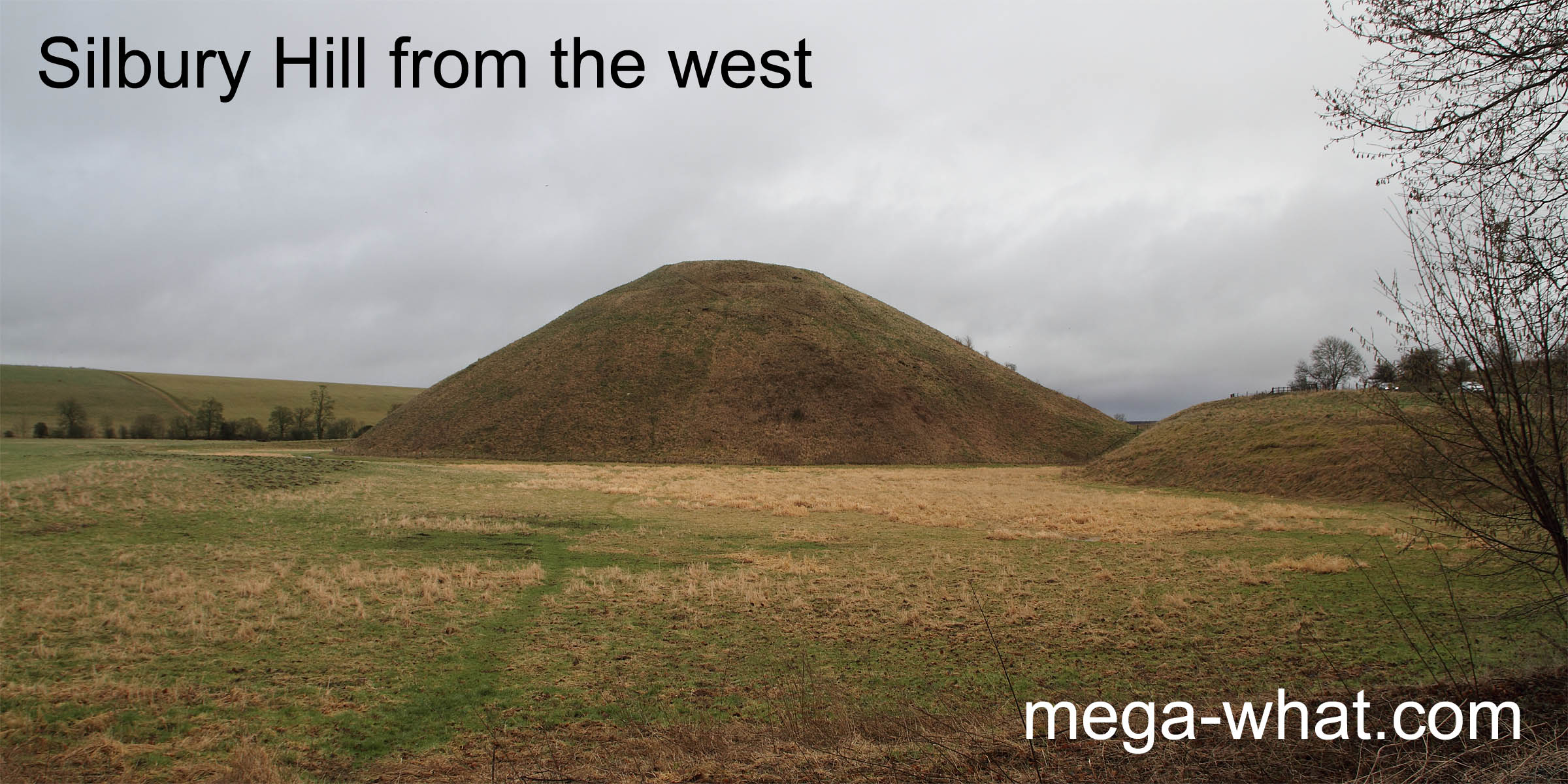
 At about 39m high & 168m in diameter, Silbury Hill is Europe's largest man-made prehistoric mound.
Three exploratory tunnels have been dug into it, the first in 1776, but no trace of any burial has ever been found.
Its purpose therefore was apparently not monumental at all but remains unknown.
At about 39m high & 168m in diameter, Silbury Hill is Europe's largest man-made prehistoric mound.
Three exploratory tunnels have been dug into it, the first in 1776, but no trace of any burial has ever been found.
Its purpose therefore was apparently not monumental at all but remains unknown.
The first picture shows that the flat-topped mound was built on low ground but has been made into the highest local feature. Why so? The suggestion made here is that Silbury Hill was deliberately constructed to act as the viewpoint for an all round calendrical view that was superior to any that could be found within the local natural environment.
Silbury Hill is now closed to the public due to the dual dangers of surface erosion and of subsidence caused by the tunnelling. Thus it has not been surveyed.
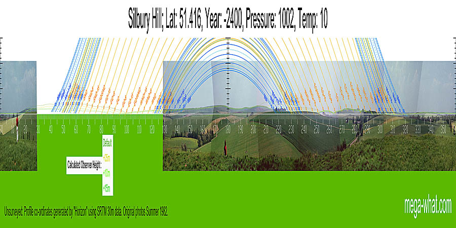
The view shown here was created using horizon data-points generated by a computer program using topographic data from NASA and should be regarded as indicative rather than accurate. The algorith seems to be good but the base data is insufficiently precise for certainty. Some old photographs have been fitted to it and show up some of the deficiencies that make the drawing of conclusions from simulated horizons a very risky business.
The default observer position (top line) is probably fairly accurate for the distant horizon but, in places, gives far too much elevation to the nearer hills. Indeed it was necessary to increase observer height by 15m (bottom line) to get a more realistic elevation for them. The resultant horizon profile should be fairly good and does seem to be very useful in a luni-solar calendrical sense but a full survey is still required.
- West Kennet Long Barrow is c.950m south-east (148° approx)
- Avebury Henge & Stone Circles are c.1.5km north (11° approx)
References