
 Avebury Henge & Stone Circles are part of a World Heritage Site and open to the public.
One of the largest known henges, this one is thought to have been built in the late neolithic, c.2500BCE.
Avebury Henge & Stone Circles are part of a World Heritage Site and open to the public.
One of the largest known henges, this one is thought to have been built in the late neolithic, c.2500BCE.
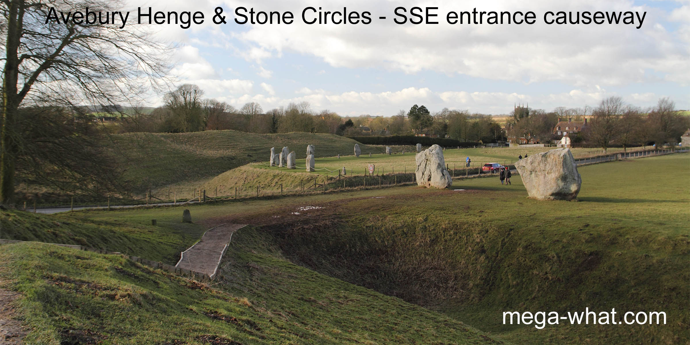
The approximately circular ditch and its outer bank, c.430m in diameter, enclose about 11.5ha. The ditch was originally 7m to 10m deep, 10m wide at the bottom and 23m or so at the top, while the bank was 22m to 30m wide at the base and up to 5m high. Antler picks and ox shoulder-blade shovels were used to excavate something like 200,000 tonnes of turf and chalk.
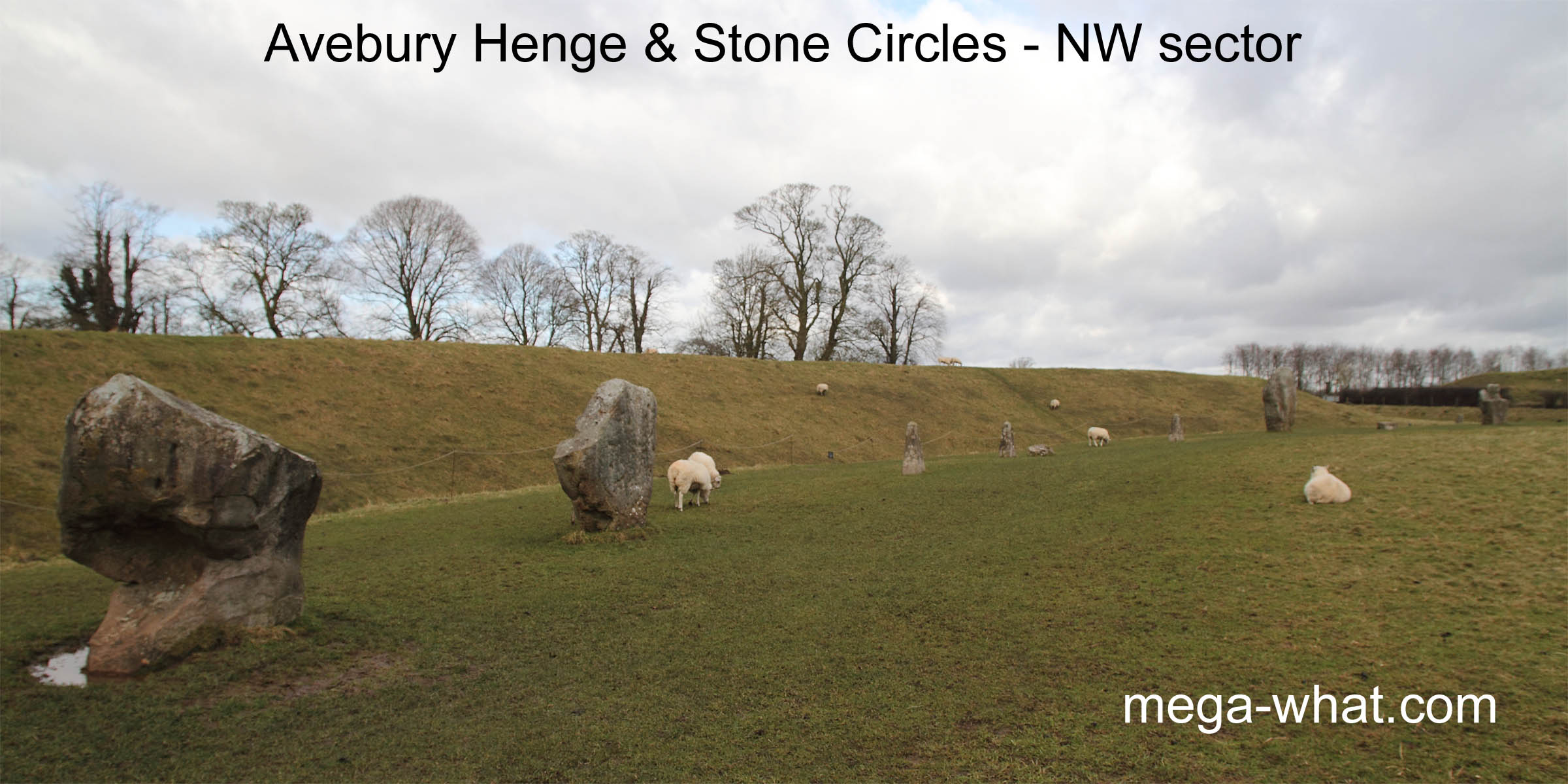
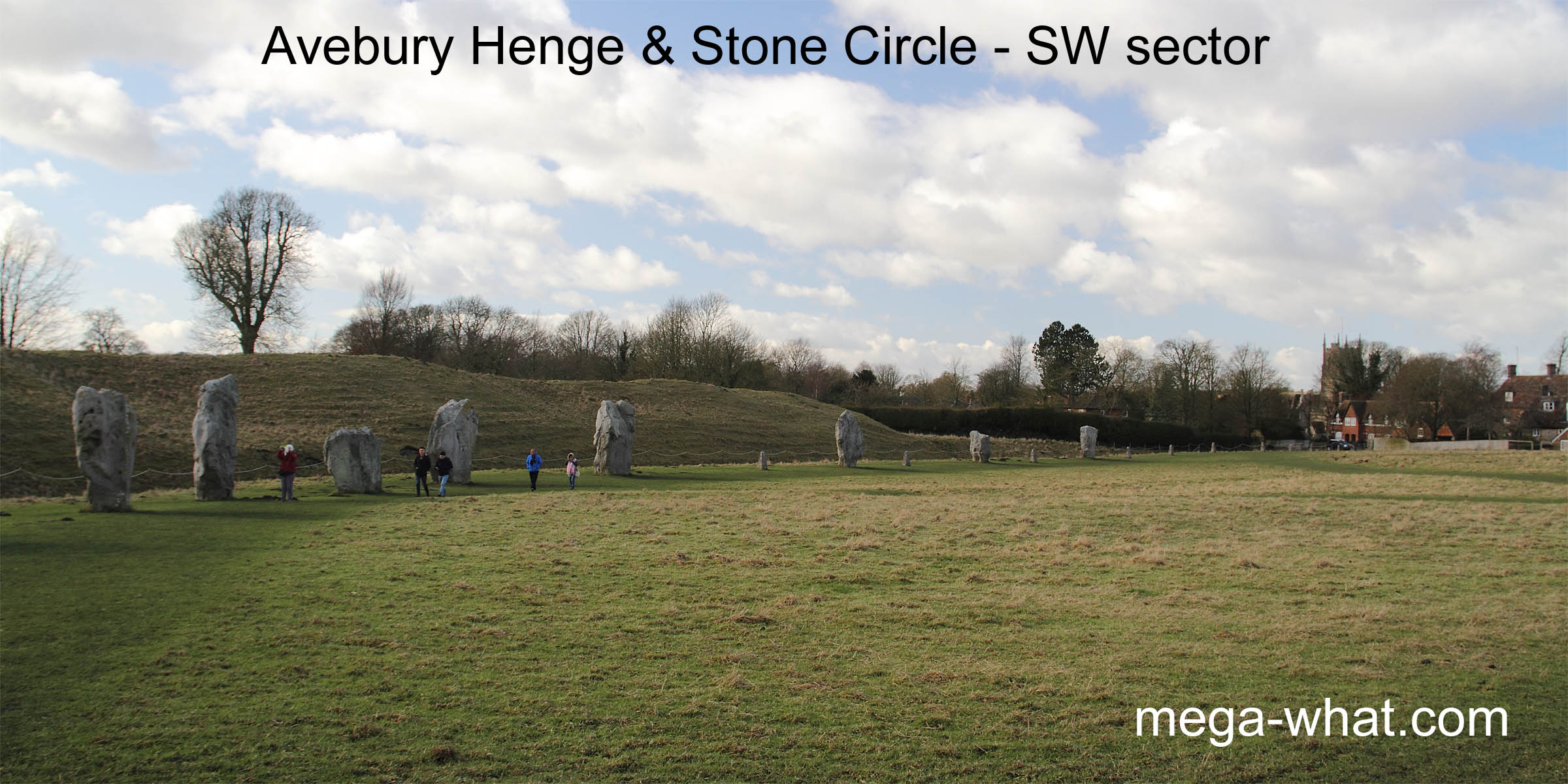
Four causewayed entrances gave access and they and they still do so, with the A361 and a minor road crossing the circle. They intersect near the Red Lion public house which is just one of the buildings within the enclosure. These four entrances are all c.20° anti-clockwise of the cardinal compass points. Just inside the ditch was a circle of about 100 large undressed stones though only around 30 remain, with concrete posts marking the known locations of some others. These posts are largely in the western half of the monument.
Inside the henge and outer stone circle were two other stone circles, both in the "eastern" half.
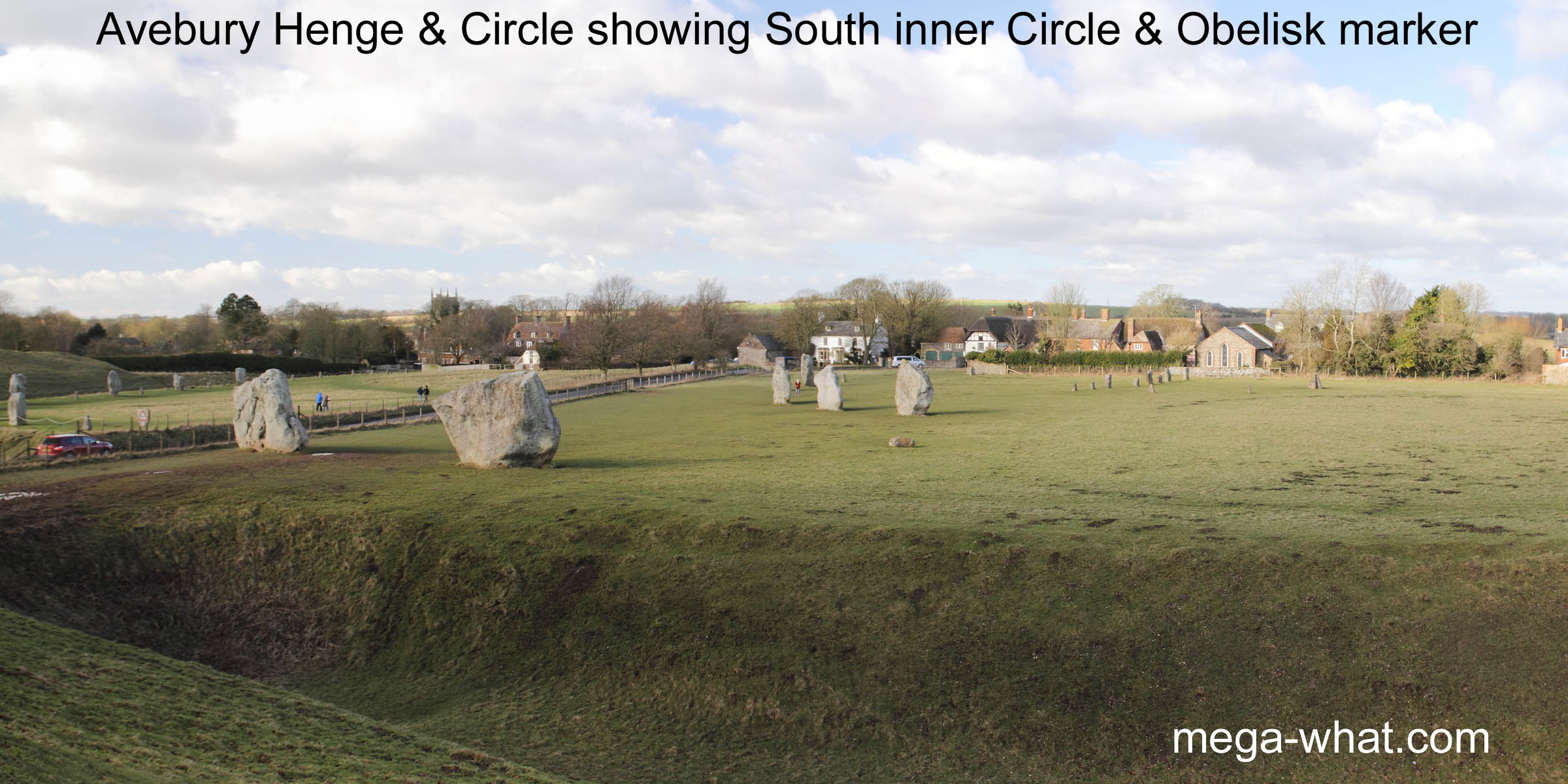
 The south stone circle had 29 stones in its perimeter, the number of whole days in a synodic monthOne full cycle of lunar phases (new moon to new moon) but only five remain.
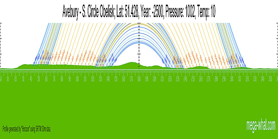
Inside it were a number of pits and more standing stones. Approximately central was a 6.4m tall stone, recorded by Stukely as the Obelisk. Its position is now marked by a large concrete pillar.
The south stone circle had 29 stones in its perimeter, the number of whole days in a synodic monthOne full cycle of lunar phases (new moon to new moon) but only five remain.
Inside it were a number of pits and more standing stones. Approximately central was a 6.4m tall stone, recorded by Stukely as the Obelisk. Its position is now marked by a large concrete pillar.
 The north stone circle had 27 stones in its perimeter, the number of whole days in both a
tropical monthPeriod in which the moon returns to the first point of Aries (or to the same lunistice)
and a siderial month.Period in which the moon returns to the same place as measured against the stars
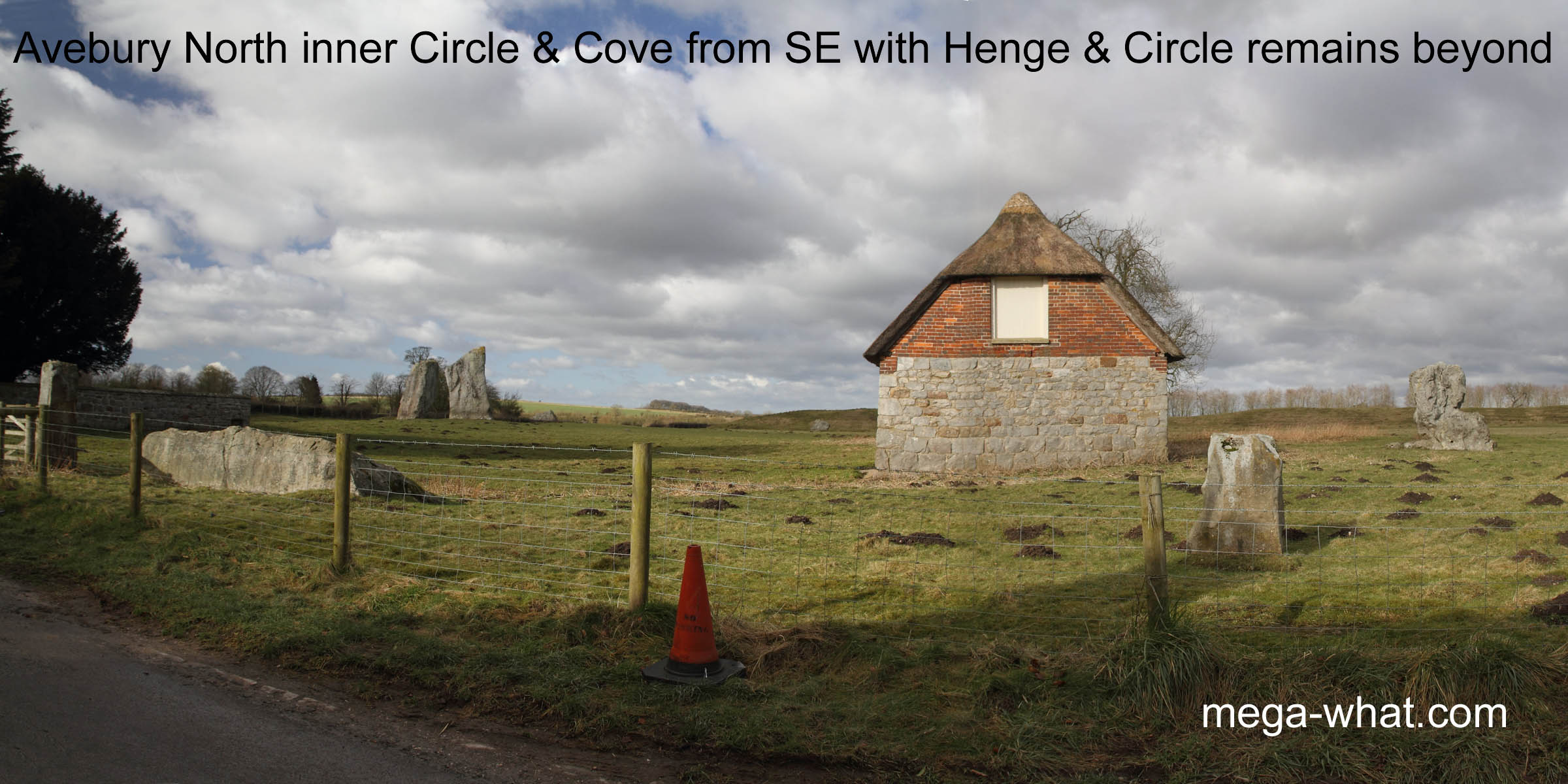
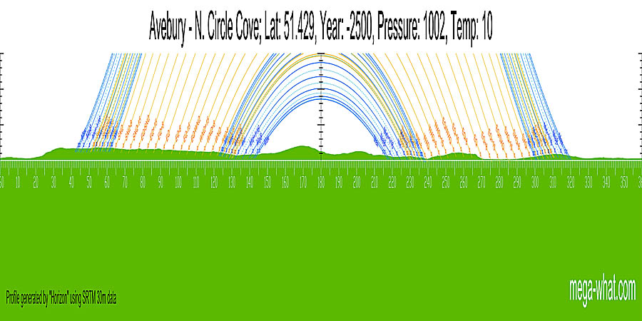
Approximately central was an arrangement of three stones known as the Cove. Two of its stones remain.
The north stone circle had 27 stones in its perimeter, the number of whole days in both a
tropical monthPeriod in which the moon returns to the first point of Aries (or to the same lunistice)
and a siderial month.Period in which the moon returns to the same place as measured against the stars
Approximately central was an arrangement of three stones known as the Cove. Two of its stones remain.
The two computer generated horizons should be regarded as indicative rather than accurate. Indeed they should be regarded with considerable caution. They appear to be quite calendrically useful and, as one would expect from two adjacent ritual locations, very similar but subtly different. The Horizon algorith seems to be good but the base data is insufficiently precise. In particular any effect of the henge's outer bank is unknown. Only accurate survey can resolve these issues but the site is complex and beyond the current scope of this study.
- Silbury Hill prehistoric mound is c.1.5km south (191° approx)
References