
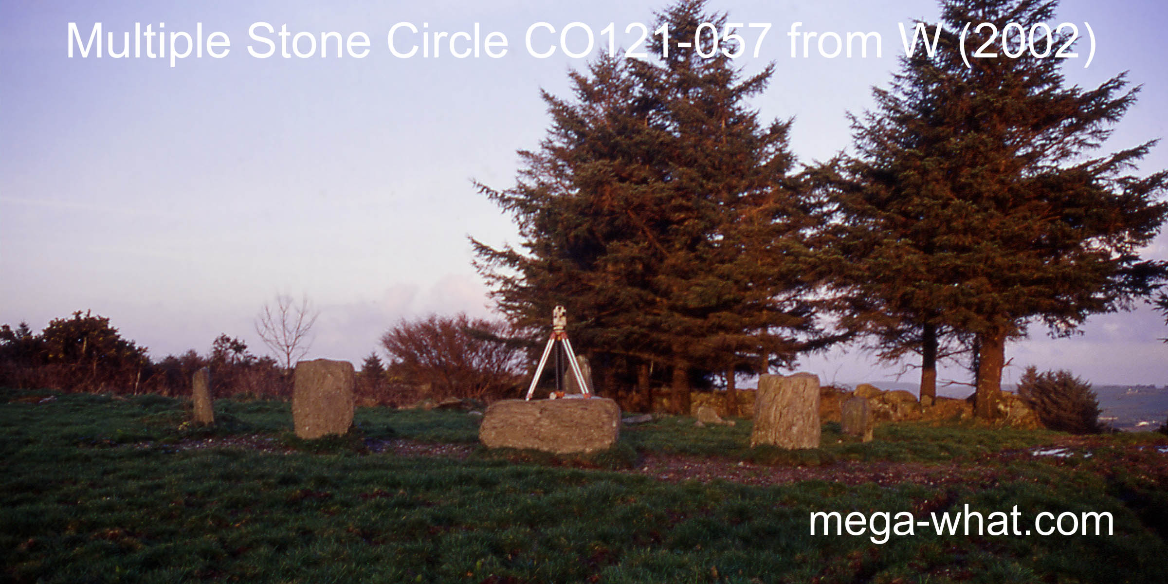
 Maulatanvally Stone Circle is about 4km south-west of Ballingurteen and seven of a probable eleven stones survive.
Inside the circle and just off centre is a quartzite block that looks rather like a boulder-burial but has not been so classified [Pic].
![[Pic].](Maulatanvally-NW2.jpg)
 South is in a bit of a dip and very close to Reenascreena Stone Circle
which would be on the skyline but for trees and hedges [Pic].
South is in a bit of a dip and very close to Reenascreena Stone Circle
which would be on the skyline but for trees and hedges [Pic].
![[Pic].](Maulatanvally-S.jpg)
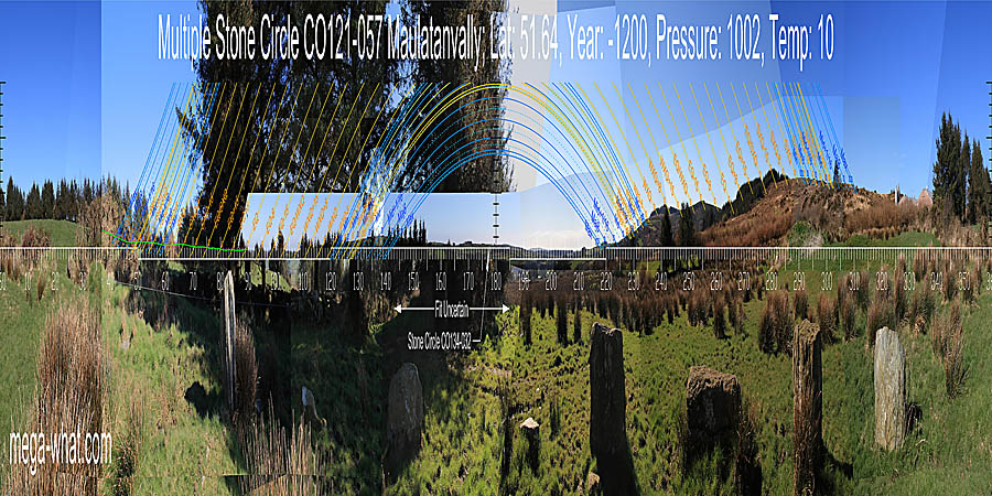
North seems to be indicated by the intersection of local and further skylines but the view is obscured [Pic]. Green lines approximate hidden horizons.
![[Pic].](Maulatanvally-N.jpg)
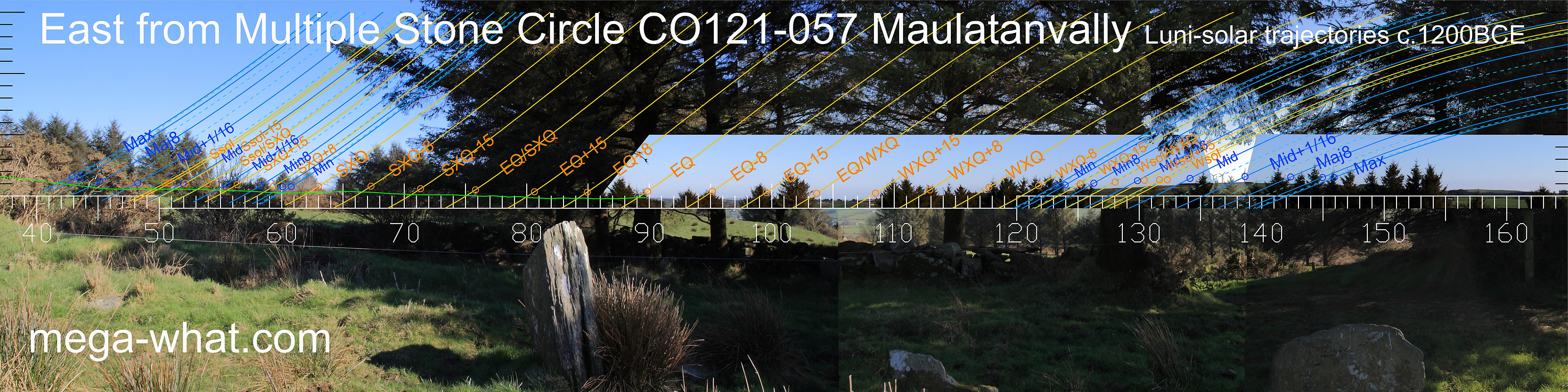 Views to the North-East [Pic] & East [Pic]
are largely obscured but clearly a distant undulating horizon lies between the nearer slopes.
The right edge of this dip is perhaps a couple of weeks from the winter cross-quarters while the left side may well involve close interactions between local ground and the distant horizon.
The green line should be regarded as indictative only.
Views to the North-East [Pic] & East [Pic]
are largely obscured but clearly a distant undulating horizon lies between the nearer slopes.
The right edge of this dip is perhaps a couple of weeks from the winter cross-quarters while the left side may well involve close interactions between local ground and the distant horizon.
The green line should be regarded as indictative only.
![[Pic]](Maulatanvally-NE.jpg)
![[Pic]](Maulatanvally-E.jpg)
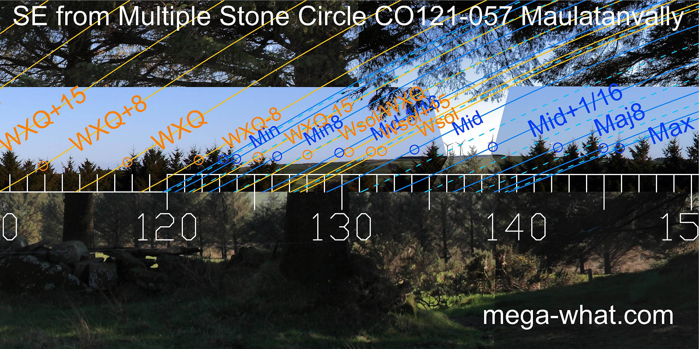 To the south-east it is possible to see some of the horizon and it looks like the minor end of the lunisticeLunistices are the most northerly and southerly moons of the month. The lunar equivalent of solstices - more.
range could be at a bit of a step, with the major end spreading over the hilltop.
To the south-east it is possible to see some of the horizon and it looks like the minor end of the lunisticeLunistices are the most northerly and southerly moons of the month. The lunar equivalent of solstices - more.
range could be at a bit of a step, with the major end spreading over the hilltop.
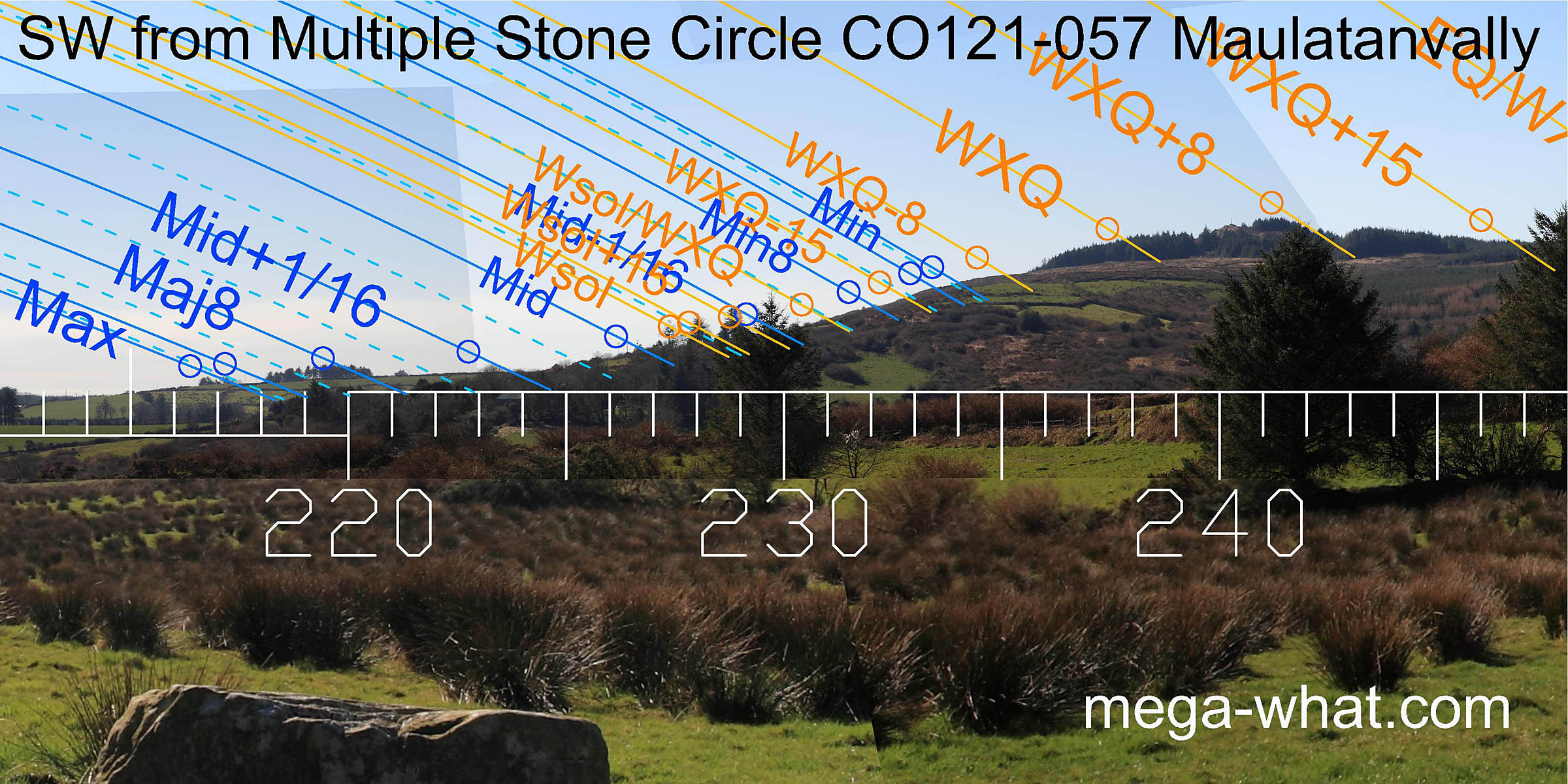 South-westwards, the major standstillLunistice positions vary cyclically over an 18.6 year period but are fairly static for more than a year at either end of the range
is at the south end of the lower slopes of Carrig Fadda and the basal step is a sixteenth beyond the lunar midpoint.
The step below the summit is a quarter-month south of the cross-quarters while the summit itself marks the quarter-month north of them.
South-westwards, the major standstillLunistice positions vary cyclically over an 18.6 year period but are fairly static for more than a year at either end of the range
is at the south end of the lower slopes of Carrig Fadda and the basal step is a sixteenth beyond the lunar midpoint.
The step below the summit is a quarter-month south of the cross-quarters while the summit itself marks the quarter-month north of them.
 On Carrig Fadda's north ridge, the dip that is south of the circle's axis is a half-month north of the winter cross-quarters and
indicated by the axis of the radially set portal(s) [Pic]. The circle axis itself indicates a rounded top that is a half-month south of the equinox.
On Carrig Fadda's north ridge, the dip that is south of the circle's axis is a half-month north of the winter cross-quarters and
indicated by the axis of the radially set portal(s) [Pic]. The circle axis itself indicates a rounded top that is a half-month south of the equinox.
![[Pic].](Maulatanvally-Wax.jpg)
North of the axis, the equinox falls somewhere close to the next dip, at the intersect with nearer ground, but that area is now shrouded in forestry.
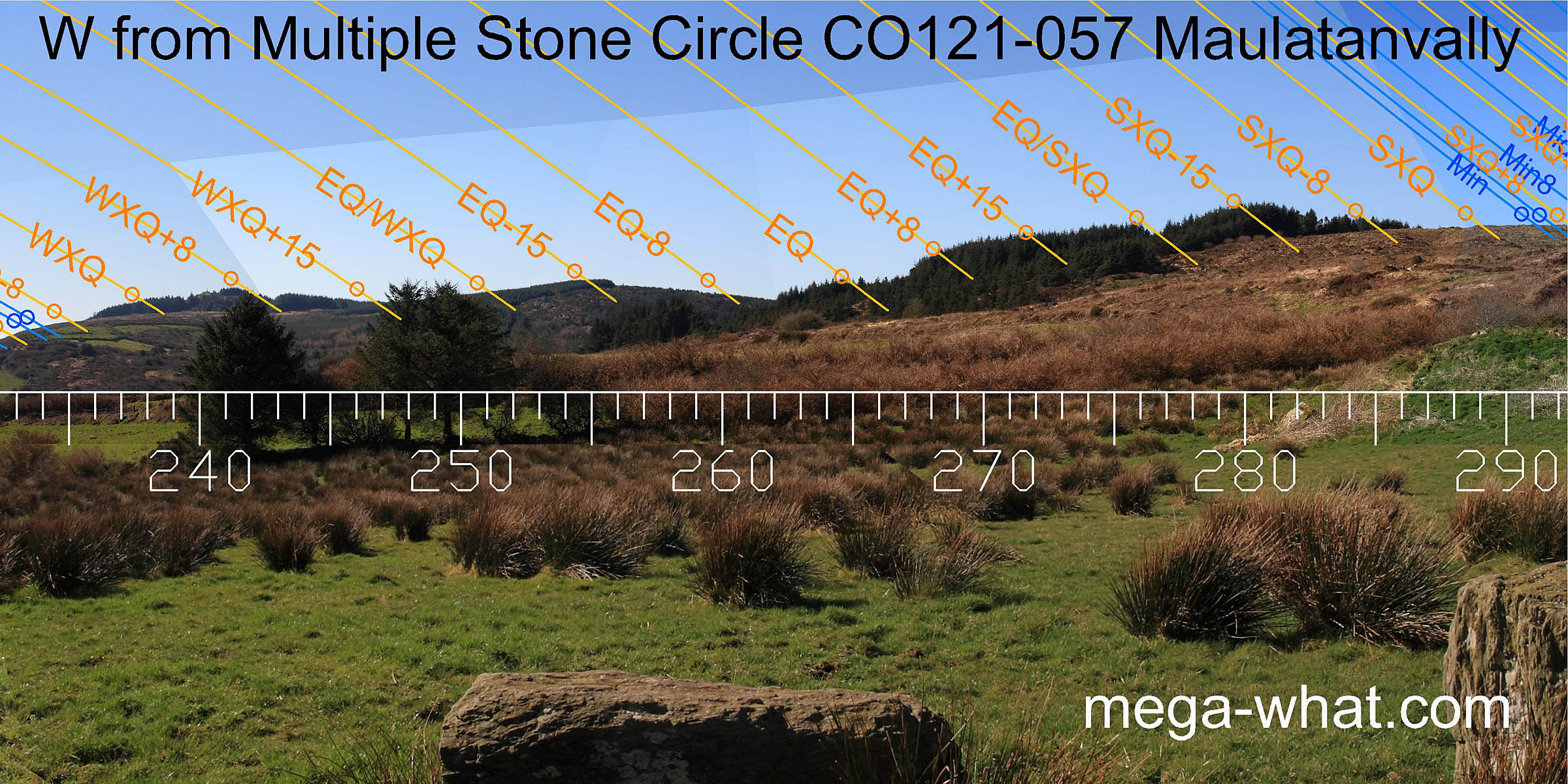
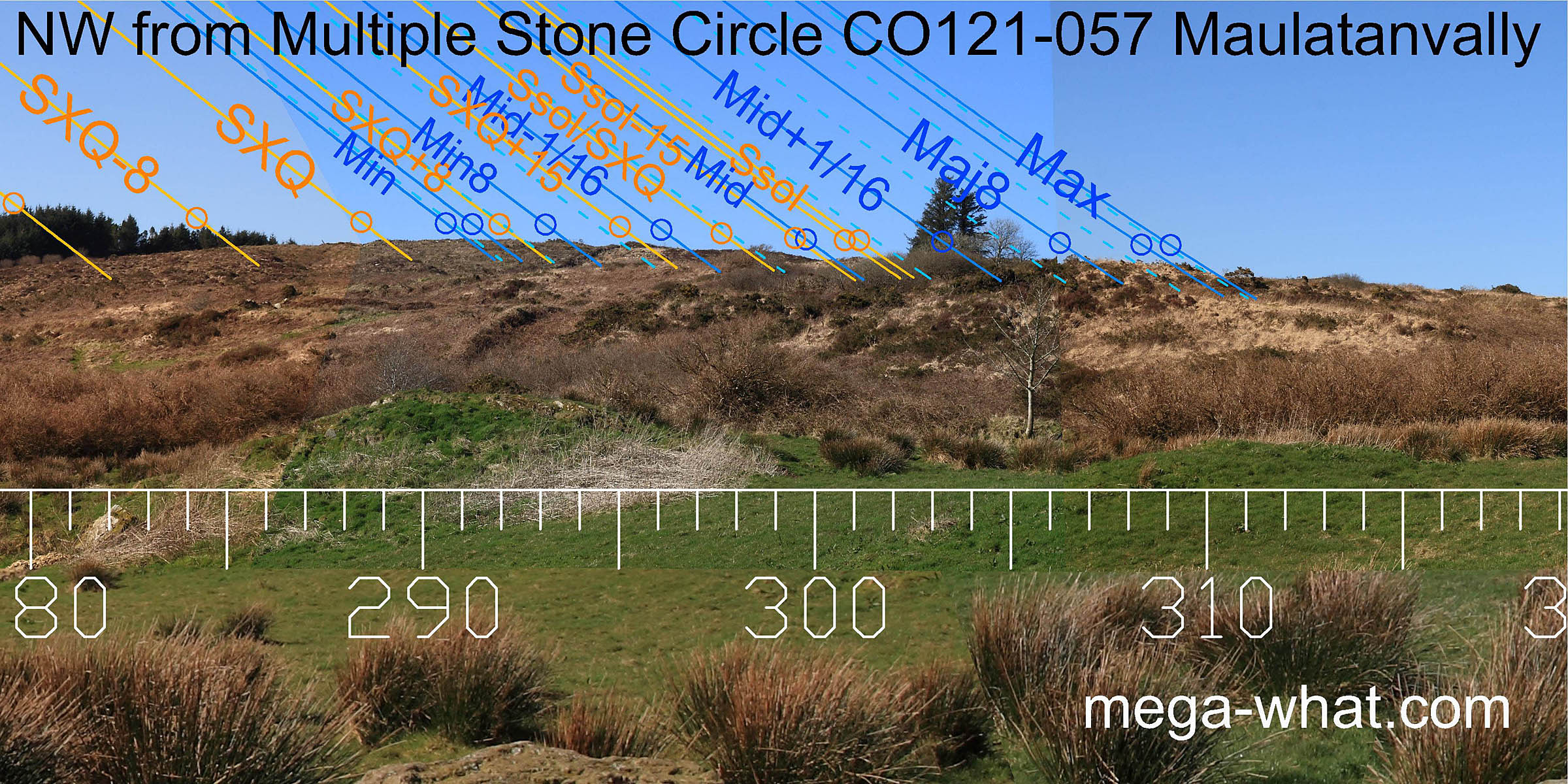 To the north-west, a fairly local ridge offers various humps and bumps which are well exploited as markers.
- Knocks (S) Multiple Stone Circle is 3.9km east (88°)
- Glanbrack Five Stone Circle is 840m east (74°)
- Carrigagrenane Five Stone Circle is 650m south-west (218°)
- Carrigagrenane Multiple Stone Circle is 1.4km south-west (222°)
- Reenascreena Multiple Stone Circle is on the southern skyline.
References
- Archaeological Survey of Ireland, record details. www.archaeology.ie/archaeological-survey-ireland
- BARBER, JOHN 1973 The Orientation of the recumbent-stone circles of the South-West of Ireland. Journal of the Kerry Historical and Archaeological Society 6:26-39, no.C15.
- Ó'NUALLÁIN, SEÁN 1975 The Stone Circle Complex of Cork and Kerry. Journal of the Royal Society of Antiquaries of Ireland 105:83-131, no.40.
- Ó'NUALLÁIN, SEÁN 1984 A Survey of Stone Circles in Cork and Kerry. Proceedings of the Royal Irish Academy 84c:1-77, p21, no.30.
- POWER, D. et al. 1992 Archaeological Inventory of County Cork, Volume 1: West Cork. Dublin: Stationary Office. p23, no.60.
- RUGGLES, C.L.N. 1999 Astronomy in Prehistoric Britain and Ireland. Newhaven & London: Yale University Press. No.ASC44.
- RUGGLES, C.L.N. & PRENDERGAST, F. 1996 A New Archaeoastronomical Investigation of the Irish Axial-Stone Circles. Proceedings of the 2nd SEAC [European Society for Astronomy in Culture] Conference, Bochum, 1994. Bochum: Astronomisches Institut der Ruhr-Universität. pp5-13.
- SOMERVILLE, BOYLE T. 1930 Five Stone Circles of West Cork. Journal of the Cork Historical and Archaeological Society 35:70-85.