
Views from the tomb are constrained by its position in a gulley and therefore it seems likely that there might have been some other observing position(s) in the area. Alternatively this may have been a deliberate ploy to use easily manipulated local skylines rather than having to clear large areas of woodland.
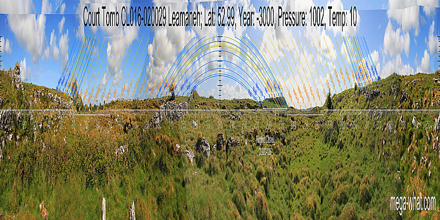
Unfortunately, accurate horizon analysis is now out of the question because the whole area around the tomb and the original profile of local skylines has been much disturbed by later activities. This preliminary survey has thus concentrated primarily on the visible distant horizon with only a few points checked in other directions to give a rough idea of the lay of the land. Nonetheless, the overall pattern is quite obvious. South is at a dip in local block of high ground [Pic]. North is at the eastern end of the local highest ground [Pic].
![[Pic].](Leamaneh-S.jpg)
![[Pic].](Leamaneh-N.jpg)
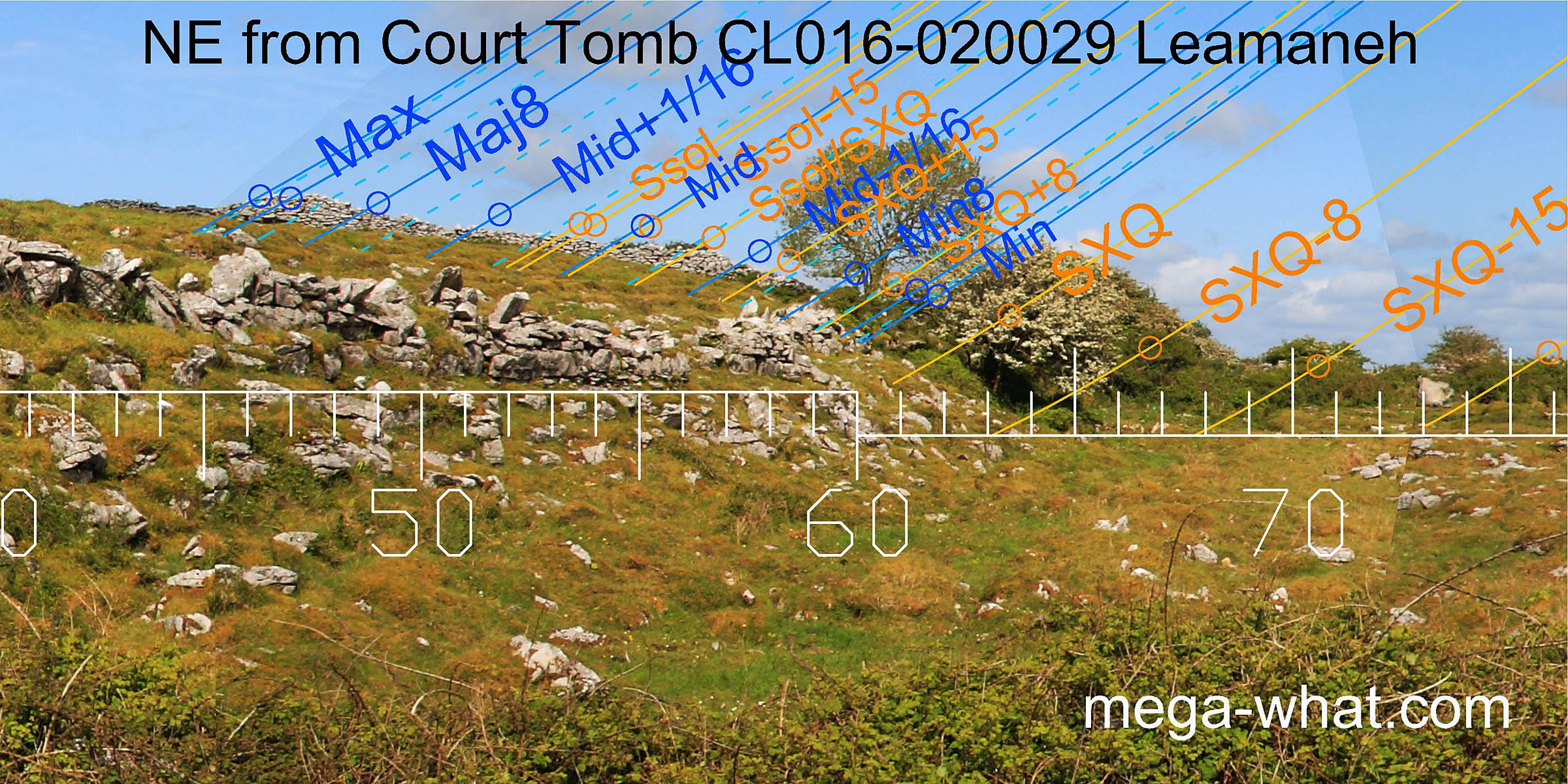 Possible views of distant horizons to the north-east and east have been obscured.
This horizon is now formed by the wall bounding a green road which forms a causeway across the tomb's gulley.
The major standstillLunistice positions vary cyclically over an 18.6 year period but are fairly static for more than a year at either end of the range
is clearly at the top of the local slope with a quarter-month bracket for the cross-quarter at the bottom.
Possible views of distant horizons to the north-east and east have been obscured.
This horizon is now formed by the wall bounding a green road which forms a causeway across the tomb's gulley.
The major standstillLunistice positions vary cyclically over an 18.6 year period but are fairly static for more than a year at either end of the range
is clearly at the top of the local slope with a quarter-month bracket for the cross-quarter at the bottom.
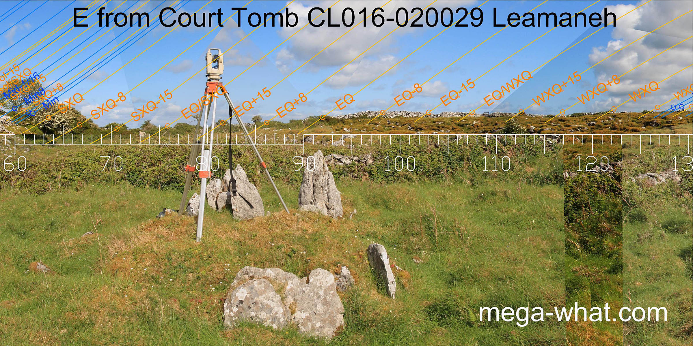 The tomb faces east and its axis is approximately equinoctial but there is some doubt about the exact fit here.
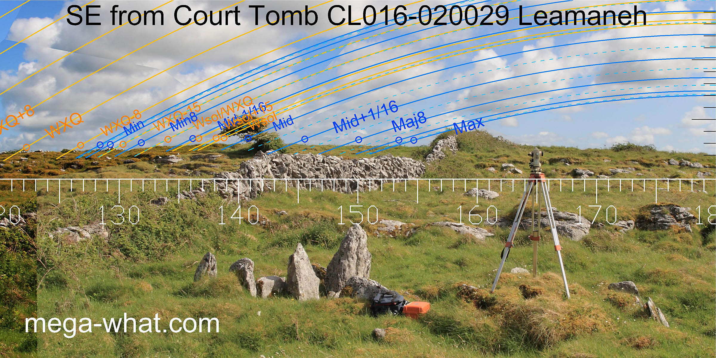 The south-east is perhaps the least disturbed of the local horizons but now offers very little in the form of landmarks.
The solstice and lunar midpoint would appear to be in the vicinity of a local high point.
The south-east is perhaps the least disturbed of the local horizons but now offers very little in the form of landmarks.
The solstice and lunar midpoint would appear to be in the vicinity of a local high point.
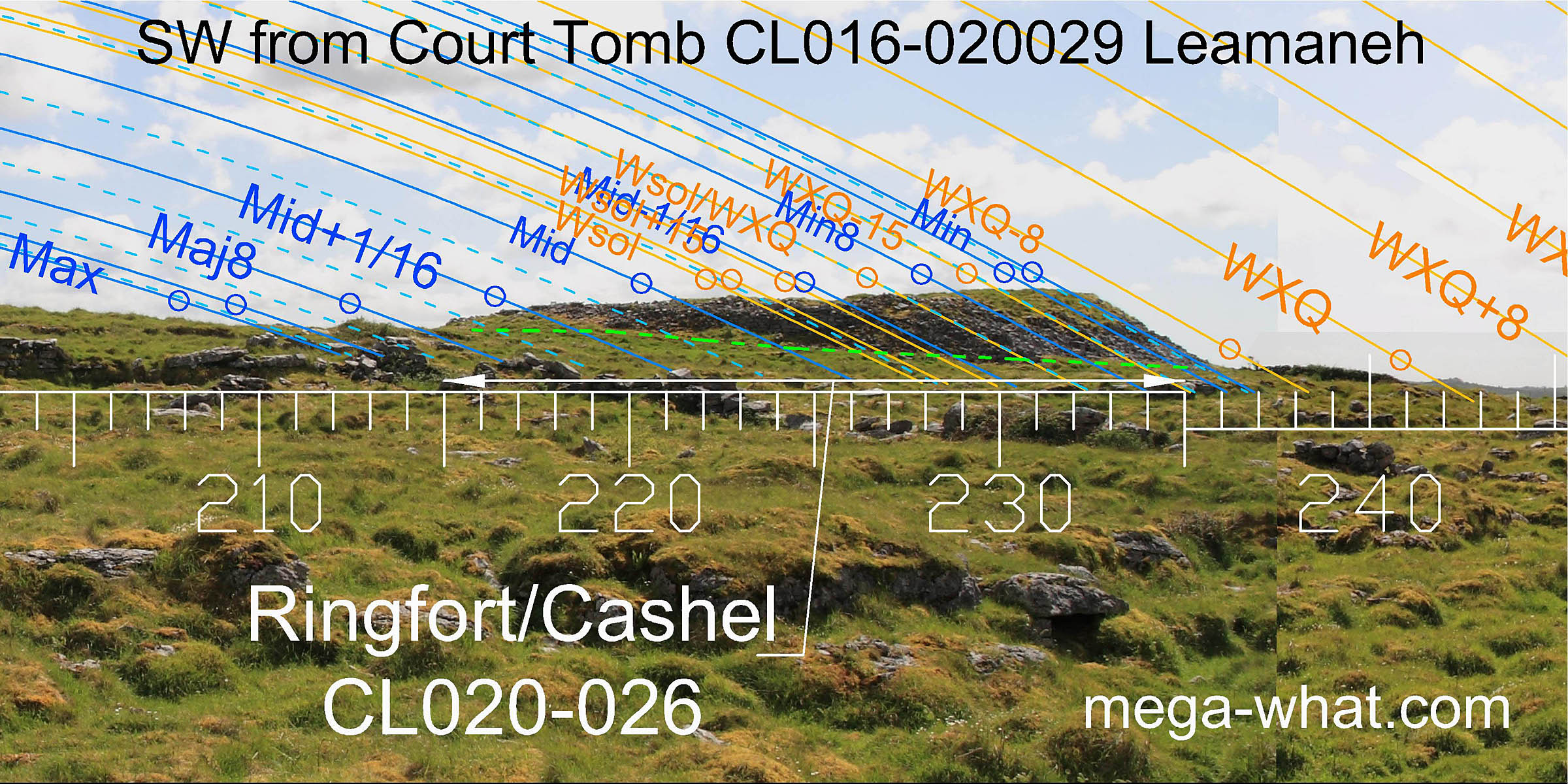 The south-west offers a view of distant hills that have been used to mark part of the solar cycle
but the solstitial zone and the entire lunisticeLunistices are the most northerly and southerly moons of the month. The lunar equivalent of solstices - more.
range occur on ground now occupied by a cashel and ruined buildings.
The coincidence between the location of the cashel and a significant part of the luni-solar calendar is very curious.
The south-west offers a view of distant hills that have been used to mark part of the solar cycle
but the solstitial zone and the entire lunisticeLunistices are the most northerly and southerly moons of the month. The lunar equivalent of solstices - more.
range occur on ground now occupied by a cashel and ruined buildings.
The coincidence between the location of the cashel and a significant part of the luni-solar calendar is very curious.
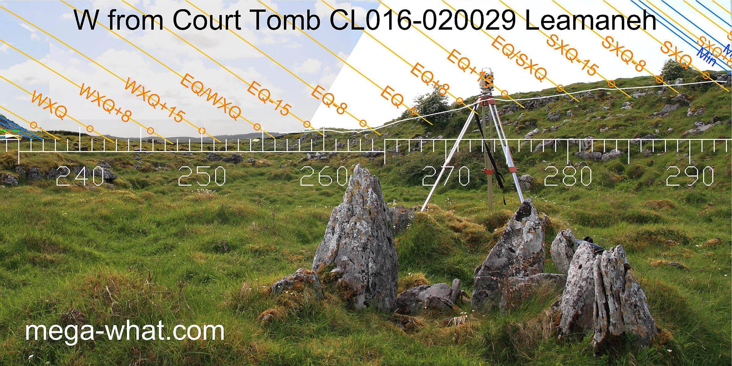 The view down the gully offers some distant horizon and this sector provides effective markers for the period between the winter cross-quarters
and the southern equinoctial quarter-month bracket. The equinox itself being on the rising local slope.
The white line here indicates the horizon profile as from the position of the theodolite rather than that of the camera which looks along the tomb axis.
The view down the gully offers some distant horizon and this sector provides effective markers for the period between the winter cross-quarters
and the southern equinoctial quarter-month bracket. The equinox itself being on the rising local slope.
The white line here indicates the horizon profile as from the position of the theodolite rather than that of the camera which looks along the tomb axis.
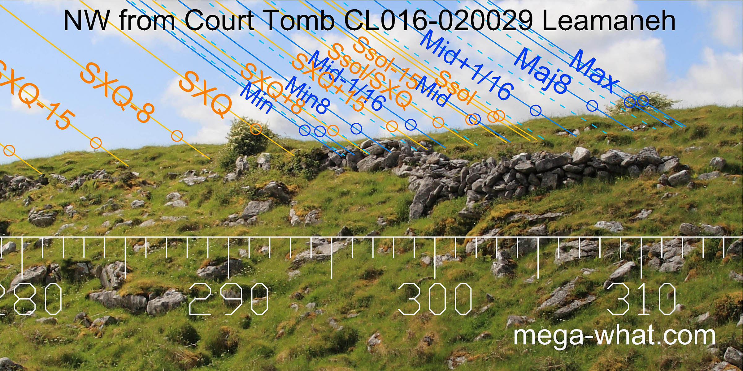 This very local ground to the west and north-west has been much modified by terracing and other activities.
- Teergonean Court Tomb is c.17km west
- Poulnabrone Portal Tomb is c.7km north
- Shanballyedmond Court Tomb is c.70km south-east
References
- Archaeological Survey of Ireland, record details. www.archaeology.ie/archaeological-survey-ireland