
 It is potentially early - the rocky ridge on which it stands and along which it looks would have been easy to clear of any scrub that it might have supported
and the remaining target horizons are distant enough that presence or absence of trees on them could never have been an issue.
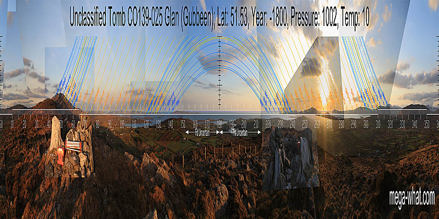
What remains is a polygonal arrangement of slabs, open to the north-east and set upon the level top of a rock rib. Traces of a cairn surround it.
It is potentially early - the rocky ridge on which it stands and along which it looks would have been easy to clear of any scrub that it might have supported
and the remaining target horizons are distant enough that presence or absence of trees on them could never have been an issue.
What remains is a polygonal arrangement of slabs, open to the north-east and set upon the level top of a rock rib. Traces of a cairn surround it.
South is on the sea, in a dip of both the actual horizon and the coastline [Pic]. North is in a dip [Pic].
![[Pic].](Gubbeen-S.jpg)
![[Pic].](Gubbeen-N.jpg)
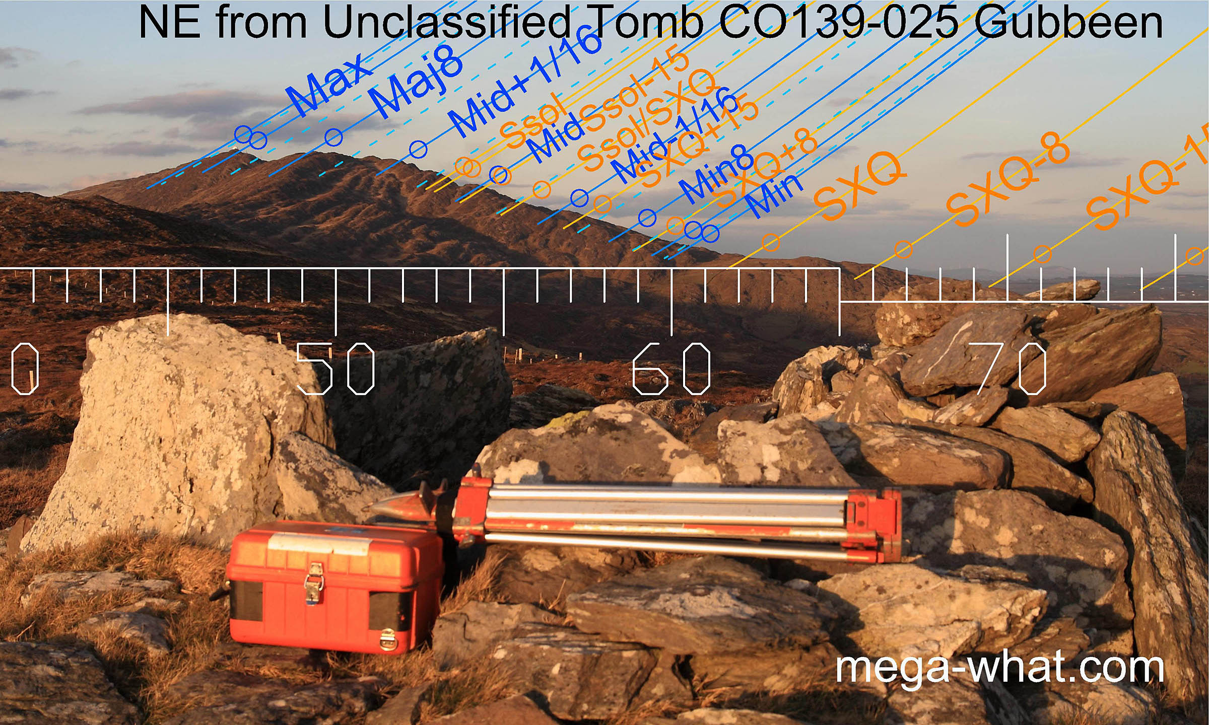 The view north-east towards Mt. Gabriel is a clear and simple example of horizon astronomy as the slope has been well fitted to the major zone of interest.
The summer cross-quarters are at the foot of the slope and the minor end of the lunisticeLunistices are the most northerly and southerly moons of the month. The lunar equivalent of solstices - more.
range just above it at a level step.
The prominent notch towards the top of the slope is accurate for a quarter-month off summer solstice,
which means that the solstice itself is when the sun's disc is just above it and the lunar midpoint is at the slope top just south of it.
The summit marks the most extreme northerly moonrise position such that the absolute maximum is when the disc just clears it completely, thus making it very accurate.
The radar dome wasn't there then of course!
The view north-east towards Mt. Gabriel is a clear and simple example of horizon astronomy as the slope has been well fitted to the major zone of interest.
The summer cross-quarters are at the foot of the slope and the minor end of the lunisticeLunistices are the most northerly and southerly moons of the month. The lunar equivalent of solstices - more.
range just above it at a level step.
The prominent notch towards the top of the slope is accurate for a quarter-month off summer solstice,
which means that the solstice itself is when the sun's disc is just above it and the lunar midpoint is at the slope top just south of it.
The summit marks the most extreme northerly moonrise position such that the absolute maximum is when the disc just clears it completely, thus making it very accurate.
The radar dome wasn't there then of course!
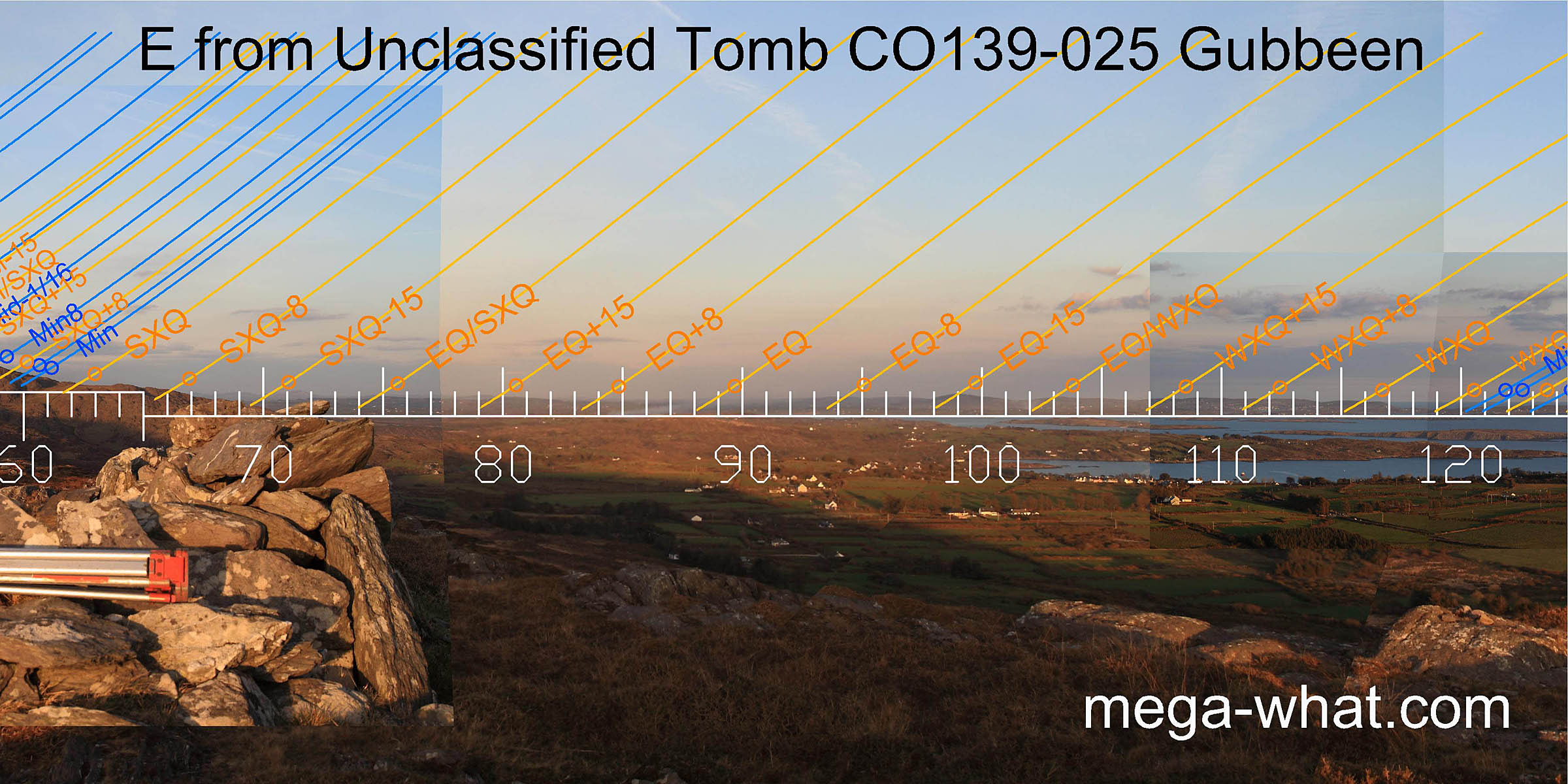 The eastern horizon is low and distant but the half month south of the summer cross-quarter and the half months both sides of the equinox all occur where there are noticeable hills to mark them.
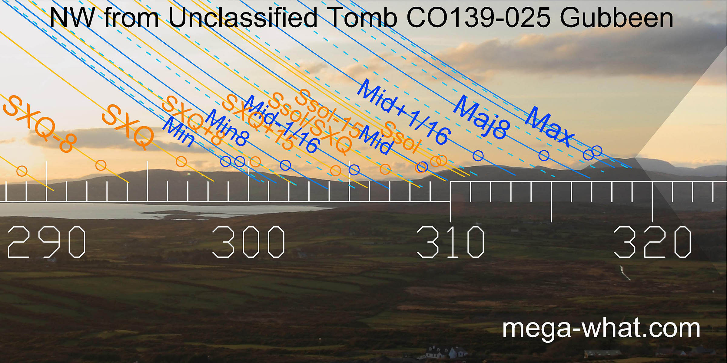
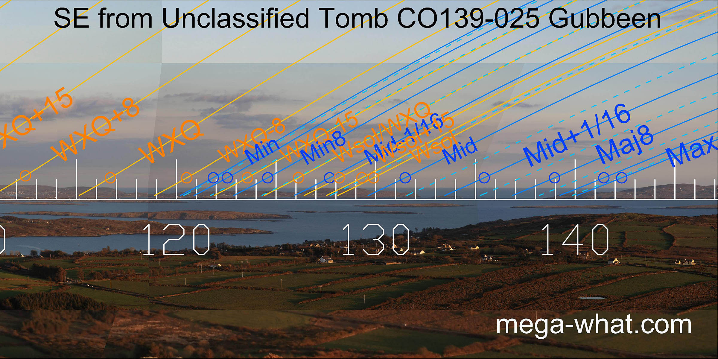 The south-eastern quadrant again provides more utility. Notably, the winter cross-quarters are at the end of the mainland,
winter solstice on the summit of Sherkin Island and the lunar maximum at the first highpoint of Clear Island with the zodiacal limits at its summit.
The south-eastern quadrant again provides more utility. Notably, the winter cross-quarters are at the end of the mainland,
winter solstice on the summit of Sherkin Island and the lunar maximum at the first highpoint of Clear Island with the zodiacal limits at its summit.
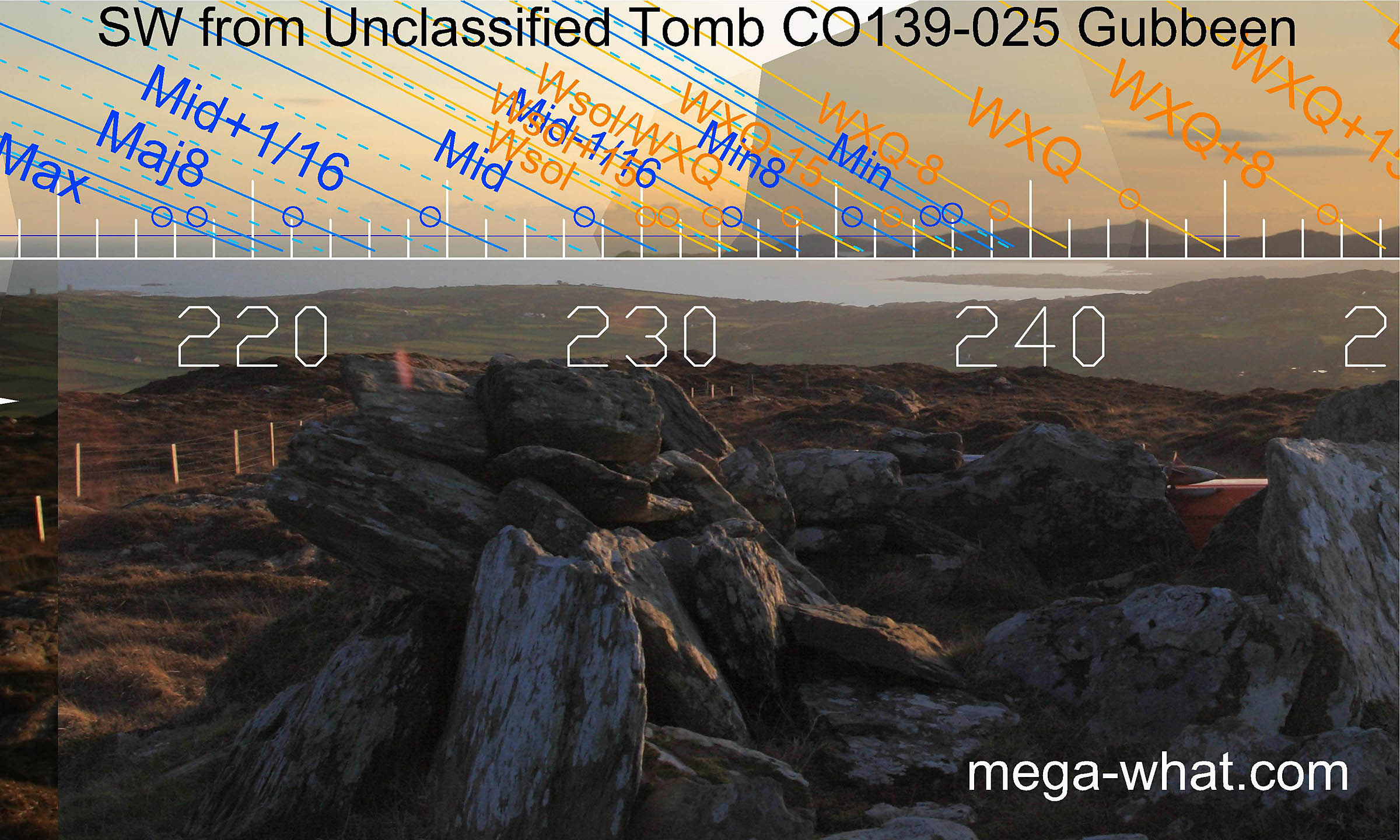 To the south-west, the Mizen peninsula has been well fitted to the solar year in particular, though it also serves for the minor half of the
lunisticeLunistices are the most northerly and southerly moons of the month. The lunar equivalent of solstices - more.
range.
The winter solstice and the major half of the lunisticeLunistices are the most northerly and southerly moons of the month. The lunar equivalent of solstices - more.
range occur on a sea horizon.
This is not a problem as positions may be judged using the coastline, especially in conjunction with beams of reflected light shining across the sea surface.
To the south-west, the Mizen peninsula has been well fitted to the solar year in particular, though it also serves for the minor half of the
lunisticeLunistices are the most northerly and southerly moons of the month. The lunar equivalent of solstices - more.
range.
The winter solstice and the major half of the lunisticeLunistices are the most northerly and southerly moons of the month. The lunar equivalent of solstices - more.
range occur on a sea horizon.
This is not a problem as positions may be judged using the coastline, especially in conjunction with beams of reflected light shining across the sea surface.
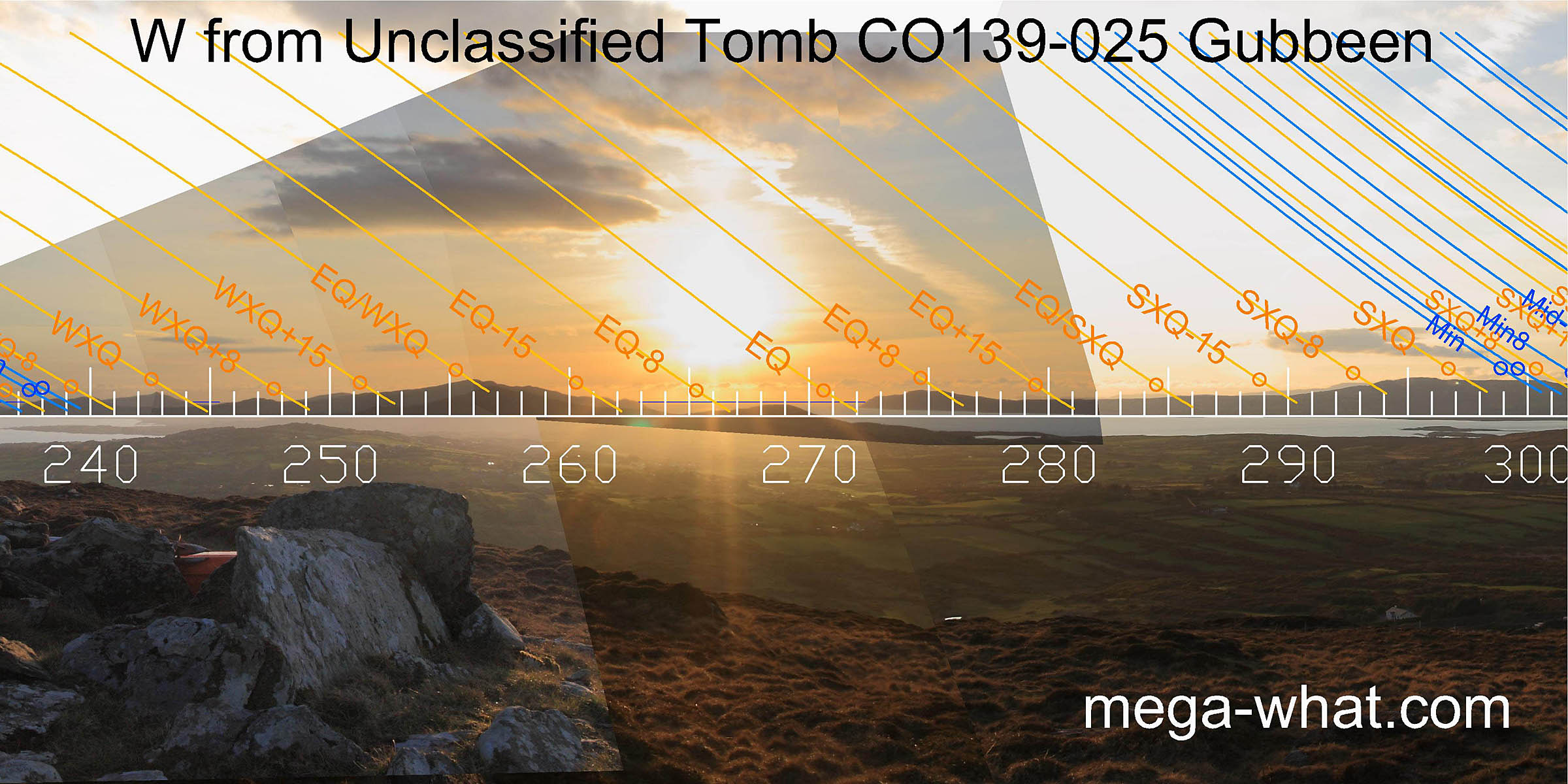 The equinox too is marked is marked by a beam of light across a narrow neck of water.
North of this, some distant mountains beyond the nearer skyline are barely visible in the photo then, approaching the cross-quarter and the most important sector, the quality improves again.
The equinox too is marked is marked by a beam of light across a narrow neck of water.
North of this, some distant mountains beyond the nearer skyline are barely visible in the photo then, approaching the cross-quarter and the most important sector, the quality improves again.
 This Tomb is visible on the horizon from
Ratooragh Wedge Tomb 2.9km to the north-west and
Arderrawinny Portal Tomb 3.4km to the south-west.
This Tomb is visible on the horizon from
Ratooragh Wedge Tomb 2.9km to the north-west and
Arderrawinny Portal Tomb 3.4km to the south-west.
These relationships are not astronomically significant and almost certainly coincidental.
References
- Archaeological Survey of Ireland, record details. www.archaeology.ie/archaeological-survey-ireland
- Ó'NUALLÁIN, S. 1989 Survey of the Megalithic Tombs of Ireland, Volume V: Sligo. Dublin: Stationary Office. Listed only: p141, Co.66.
- POWER, D. et al. 1992 Archaeological Inventory of County Cork, Volume 1: West Cork. Dublin: Stationary Office. p16, no.22.