
It has been excavated and restored since these images were created. That was in 2023 and nothing significant was found, other than an empty pit at the centre, reinforcing the theory that these were not burial monuments at all. The central "boulder-burial" was found to be just a boulder. See here.
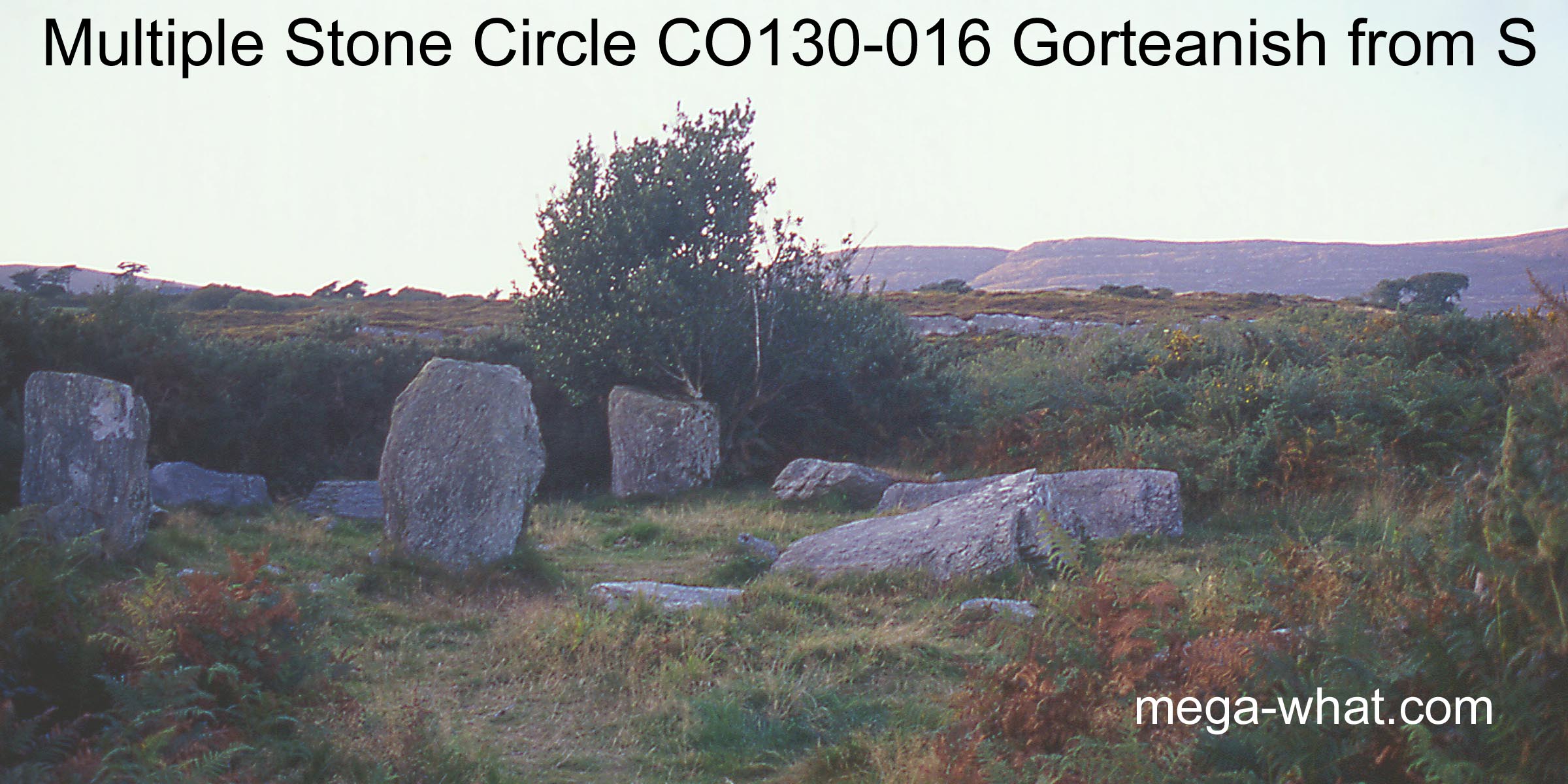 Only four stones remain upright of an original eleven. Unusually, some of the largest stones are in the south-east quadrant and there is a low, wide stone to the north-west.
This last might perhaps been broken off but even so could have indicated a secondary axis.
There are two Boulder-Burials: One inside the circle and one just outside it to the south-west, confirming that this was an important location.
Only four stones remain upright of an original eleven. Unusually, some of the largest stones are in the south-east quadrant and there is a low, wide stone to the north-west.
This last might perhaps been broken off but even so could have indicated a secondary axis.
There are two Boulder-Burials: One inside the circle and one just outside it to the south-west, confirming that this was an important location.
A rock to the east (both significantly shaped and large) is thought by some to be a fallen Standing Stone but this is unlikely to be so.
South is in a dip and marked by an intersection of far and near horizons though actually on the last south-western top [Pic].
![[Pic].](Gorteanish-S.jpg)
North is in a dip in a hilltop [Pic].
![[Pic].](Gorteanish-N.jpg)
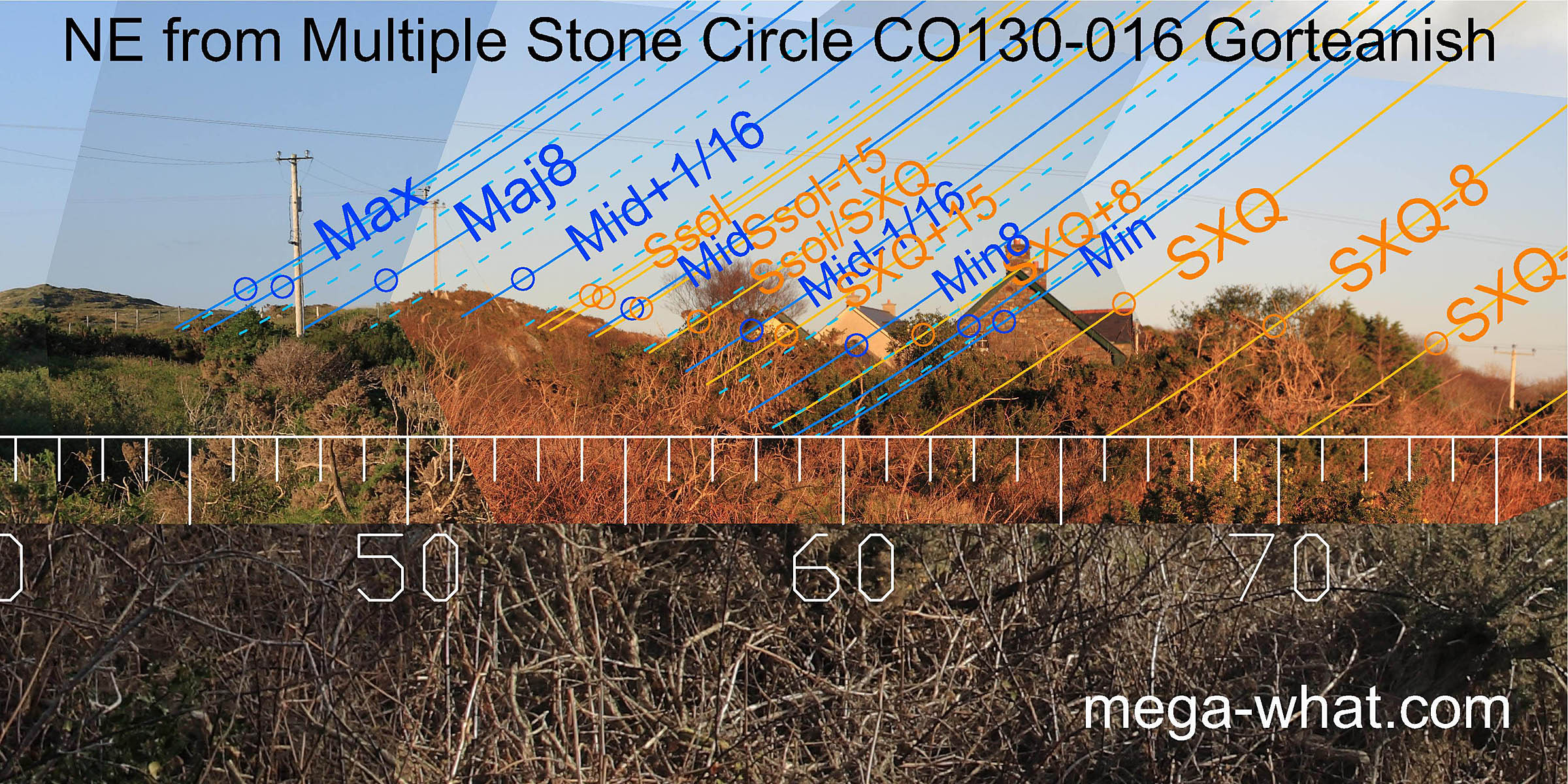 The north-east is local and now largely obscured but summer cross-quarters could be on a high point with minor standstillsLunistice positions vary cyclically over an 18.6 year period but are fairly static for more than a year at either end of the range
in the following dip.
Then the solstice is on a rising slope with major standstillLunistice positions vary cyclically over an 18.6 year period but are fairly static for more than a year at either end of the range
at the following dip again.
The north-east is local and now largely obscured but summer cross-quarters could be on a high point with minor standstillsLunistice positions vary cyclically over an 18.6 year period but are fairly static for more than a year at either end of the range
in the following dip.
Then the solstice is on a rising slope with major standstillLunistice positions vary cyclically over an 18.6 year period but are fairly static for more than a year at either end of the range
at the following dip again.
Both portals have fallen. The north one inwards, the south one outwards. The axis is thus somewhere in the summer solstice to solstice / cross-quarter midpoint region [Pic].
![[Pic]](Gorteanish-NEax.jpg)
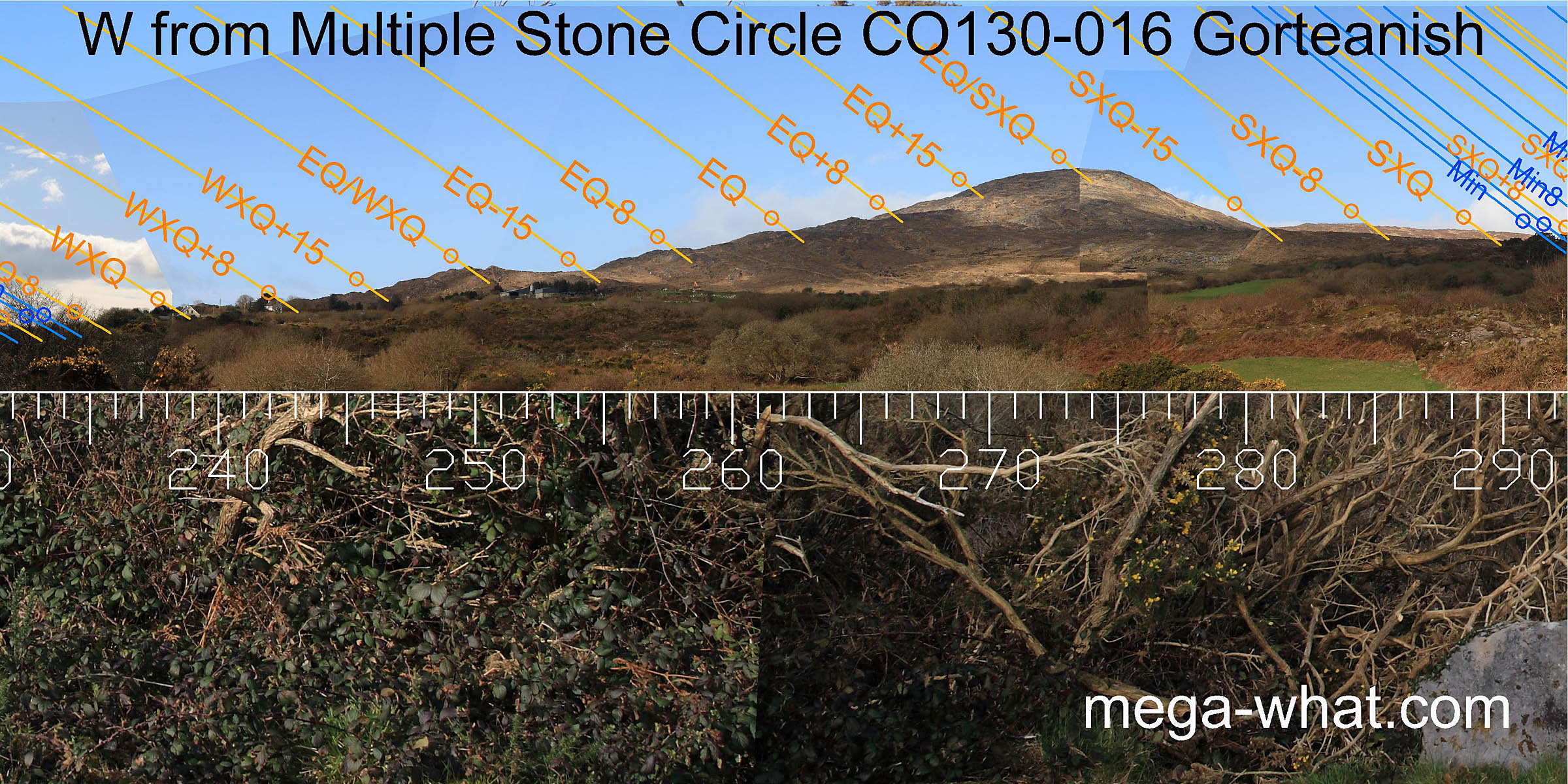
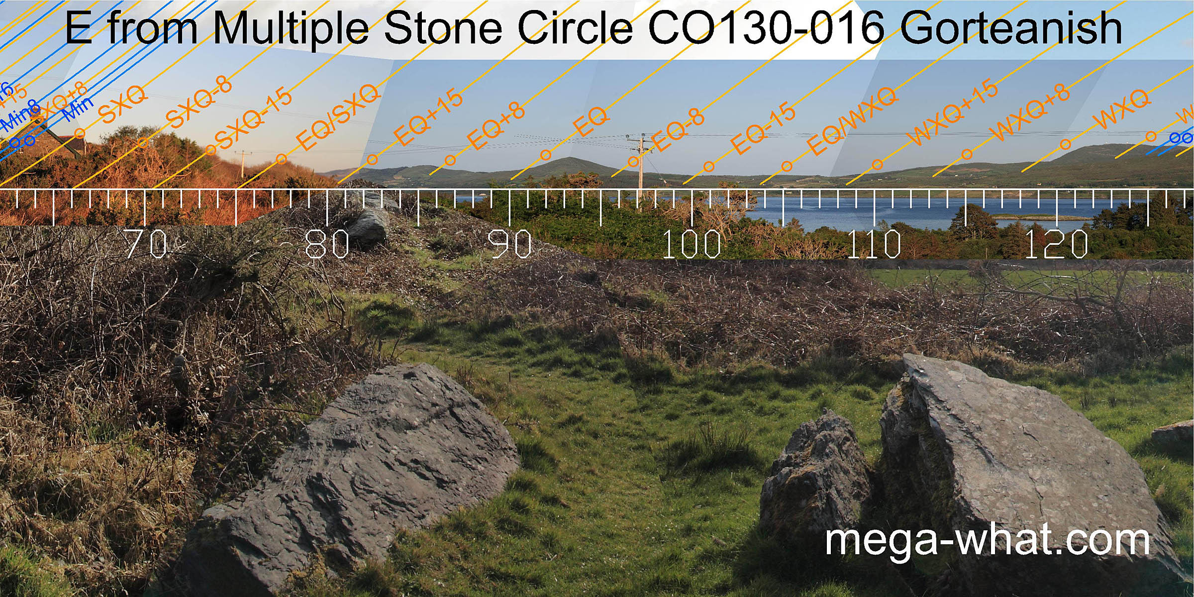 Equinox sunrise is at the north basal step of Mt. Corrin and winter cross-quarters are at the north basal step of Mt Gabriel.
The general utility of this sector is quite high.
Equinox sunrise is at the north basal step of Mt. Corrin and winter cross-quarters are at the north basal step of Mt Gabriel.
The general utility of this sector is quite high.
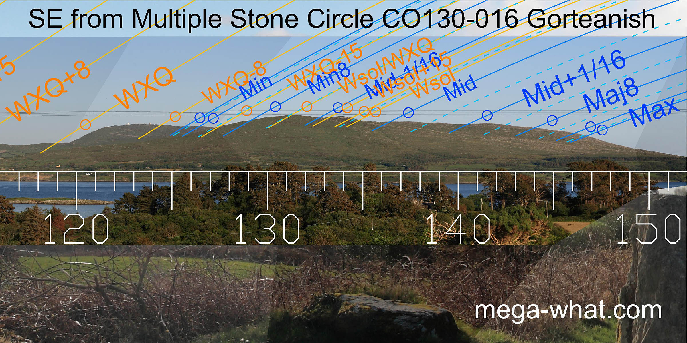 South-eastwards, the lunisticeLunistices are the most northerly and southerly moons of the month. The lunar equivalent of solstices - more.
range is marked by the block of high ground and runs from the south top of Mt. Gabriel to the west end of Knockaughna.
South-eastwards, the lunisticeLunistices are the most northerly and southerly moons of the month. The lunar equivalent of solstices - more.
range is marked by the block of high ground and runs from the south top of Mt. Gabriel to the west end of Knockaughna.
The winter part of the solar cycle is also clearly delineated, with the cross-quarter's half-month bracket at the intersect notch and the cross-quarter / solstice midpoint on the highest top.
Especially clear is the use of the large rocky knob to mark the winter solstice and the month surrounding it.
 The south-west is on a south facing slope and largely obscured by vegetation.
However, the solstice could be in a dip / at one end of a bit of a rise with lunar major standstillLunistice positions vary cyclically over an 18.6 year period but are fairly static for more than a year at either end of the range
at the other.
The south-west is on a south facing slope and largely obscured by vegetation.
However, the solstice could be in a dip / at one end of a bit of a rise with lunar major standstillLunistice positions vary cyclically over an 18.6 year period but are fairly static for more than a year at either end of the range
at the other.
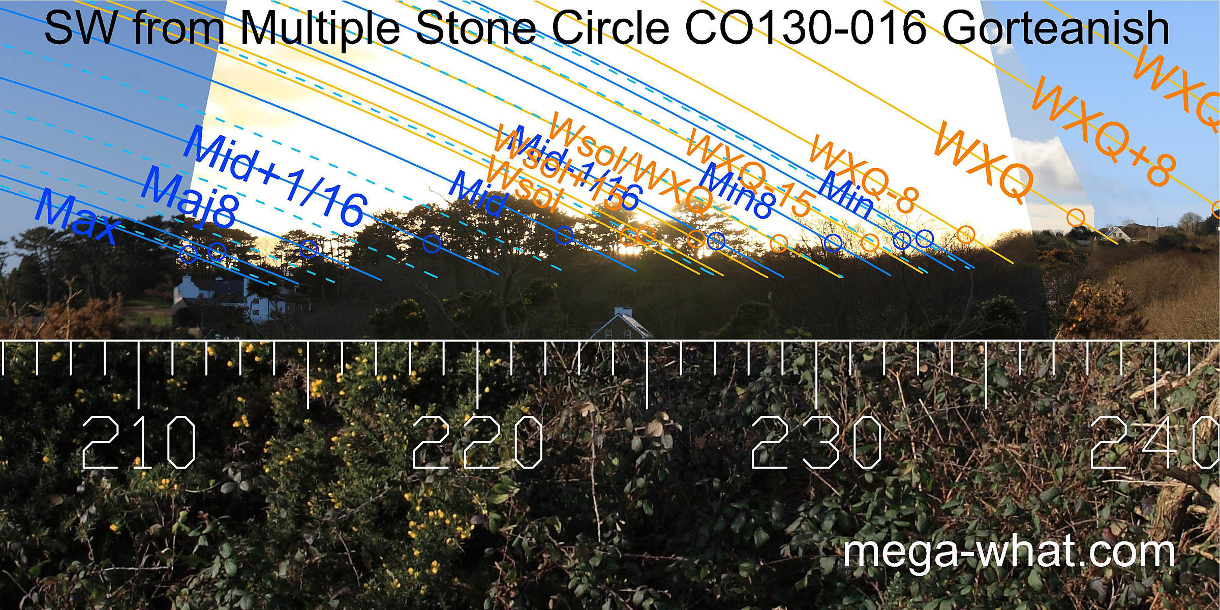
The axial stone has fallen inwards, both portals have fallen as well but nonetheless the axis would seem to have indicated the vicinity of winter cross-quarters [Pic].
![[Pic]](Gorteanish-SWax.jpg)
 Westwards, Rosskerrig Mountain rises so high that the equinox / summer cross-quarter midpoint
marked by its summit is much further south than usual.
The equinox / winter cross-quarter midpoint is at the top of the lower slope.
Westwards, Rosskerrig Mountain rises so high that the equinox / summer cross-quarter midpoint
marked by its summit is much further south than usual.
The equinox / winter cross-quarter midpoint is at the top of the lower slope.
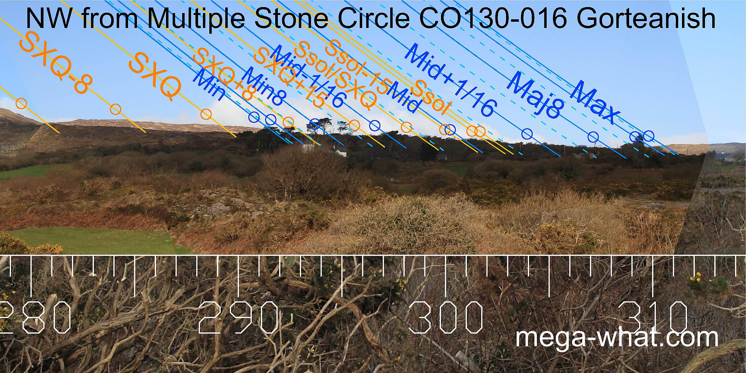 Rosskerrig Mountain's north foot is a half-month south of the summer cross-quarters.
Both the lunar eighths would seem to be at intersect notches, with the lunar extremes on the adjacent upslopes of a more distant ridge.
The central portion is unfortunately obscured by trees and buildings. Summer solstice sunset occurs above a low wide stone which may be a secondary axial.
Rosskerrig Mountain's north foot is a half-month south of the summer cross-quarters.
Both the lunar eighths would seem to be at intersect notches, with the lunar extremes on the adjacent upslopes of a more distant ridge.
The central portion is unfortunately obscured by trees and buildings. Summer solstice sunset occurs above a low wide stone which may be a secondary axial.
This circle is complementary to the one at Dunbeacon, 6.6km to the east across Dunmanus Bay. They are the only two in the area. Both use Mt. Corrin as an equinoctial marker and each provides, quite strikingly, what the other lacks.
Other nearby Boulder-Burials are at:
- Dunmanus across the bay to the south.
- Coolcoulaghta at the head of the bay.
The nearest bronze-age monument is c.4km to the west, a three-stone row at Farranamanagh.
References
- Archaeological Survey of Ireland, record details. www.archaeology.ie/archaeological-survey-ireland
- POWER, D. et al. 1992 Archaeological Inventory of County Cork, Volume 1: West Cork. Dublin: Stationary Office. p22, no.215.
- RONAN, S. et al. 2009 Archaeological Inventory of County Cork, Volume 5. Dublin: Stationary Office. p10, no.15325; p14, nos.15335 & 15336.