
 Gortanimill Stone Circle is about 7.75m in diameter. It has nine low stones, all still upright, and a quartzite monolith in the middle.
Three loose stones are also present but were probably never part of it. Access is a short distance from the public road, off a private driveway.
Gortanimill Stone Circle is about 7.75m in diameter. It has nine low stones, all still upright, and a quartzite monolith in the middle.
Three loose stones are also present but were probably never part of it. Access is a short distance from the public road, off a private driveway.
South is on a very local high point [Pic].
![[Pic]](Gortanimill-S.jpg)
North is on the left side of the highest distant hill and the right side of a nearer one [Pic].
![[Pic]](Gortanimill-N.jpg)
 The north-eastern lunisticeLunistices are the most northerly and southerly moons of the month. The lunar equivalent of solstices - more.
range spans some distant hills, with summer cross-quarters in the dip at the bottom and the solstice at a step at the top of that slope section.
The north-eastern lunisticeLunistices are the most northerly and southerly moons of the month. The lunar equivalent of solstices - more.
range spans some distant hills, with summer cross-quarters in the dip at the bottom and the solstice at a step at the top of that slope section.
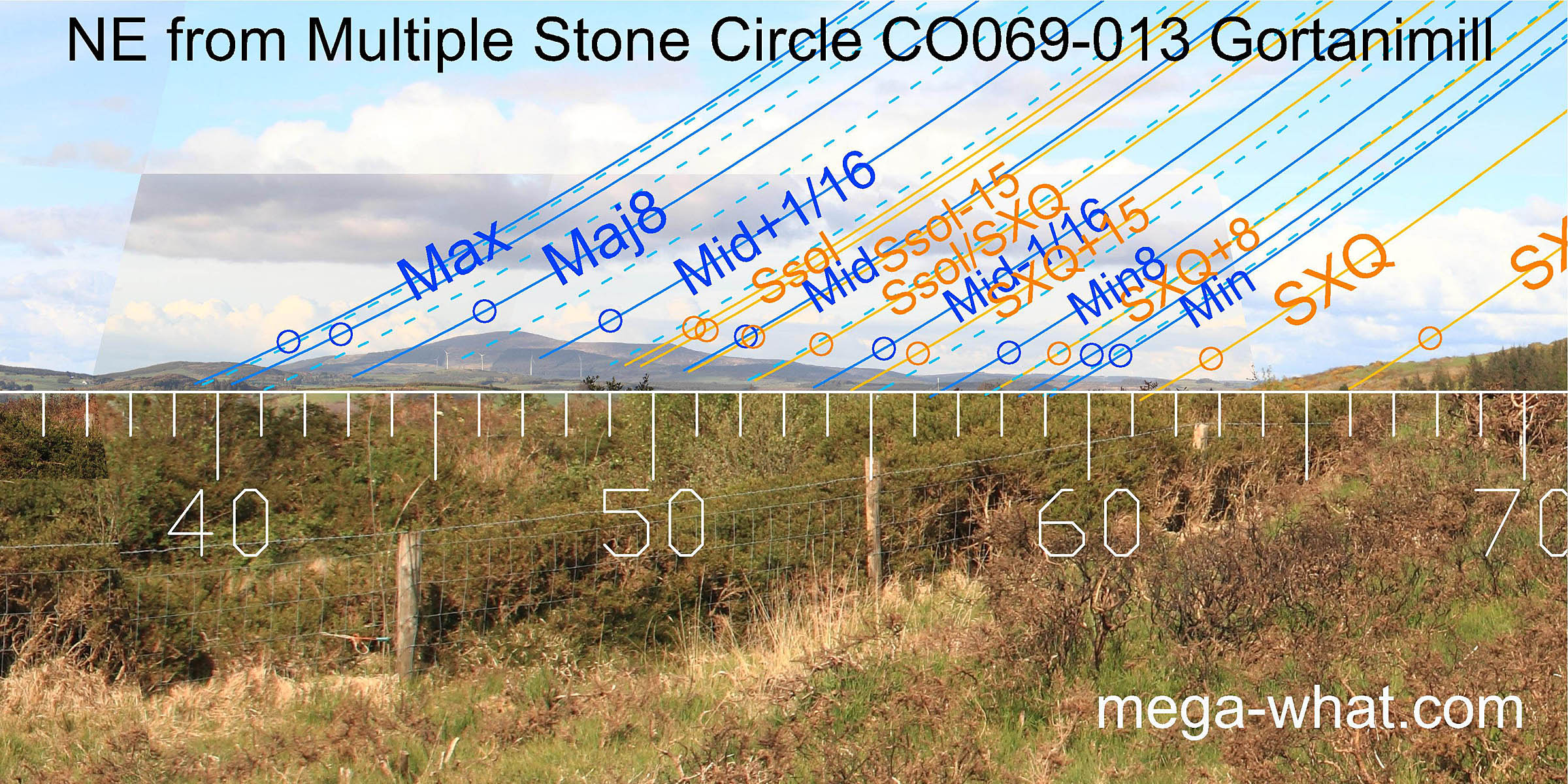
The circle axis is well beyond the lunar limit in this direction [Pic].
![[Pic]](Gortanimill-NEax.jpg)
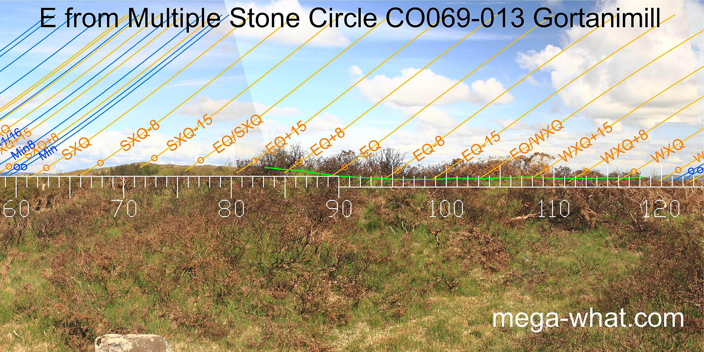 To the east there is a close interaction between near and far that is easily manipulated by change of position but vegetation that would have been closely controlled then confuses the issue now.
Perhaps the equinox is between a local dip and an intersect? The equinox / winter cross-quarter mid-point could be on a local top. A green line approximates the far horizon.
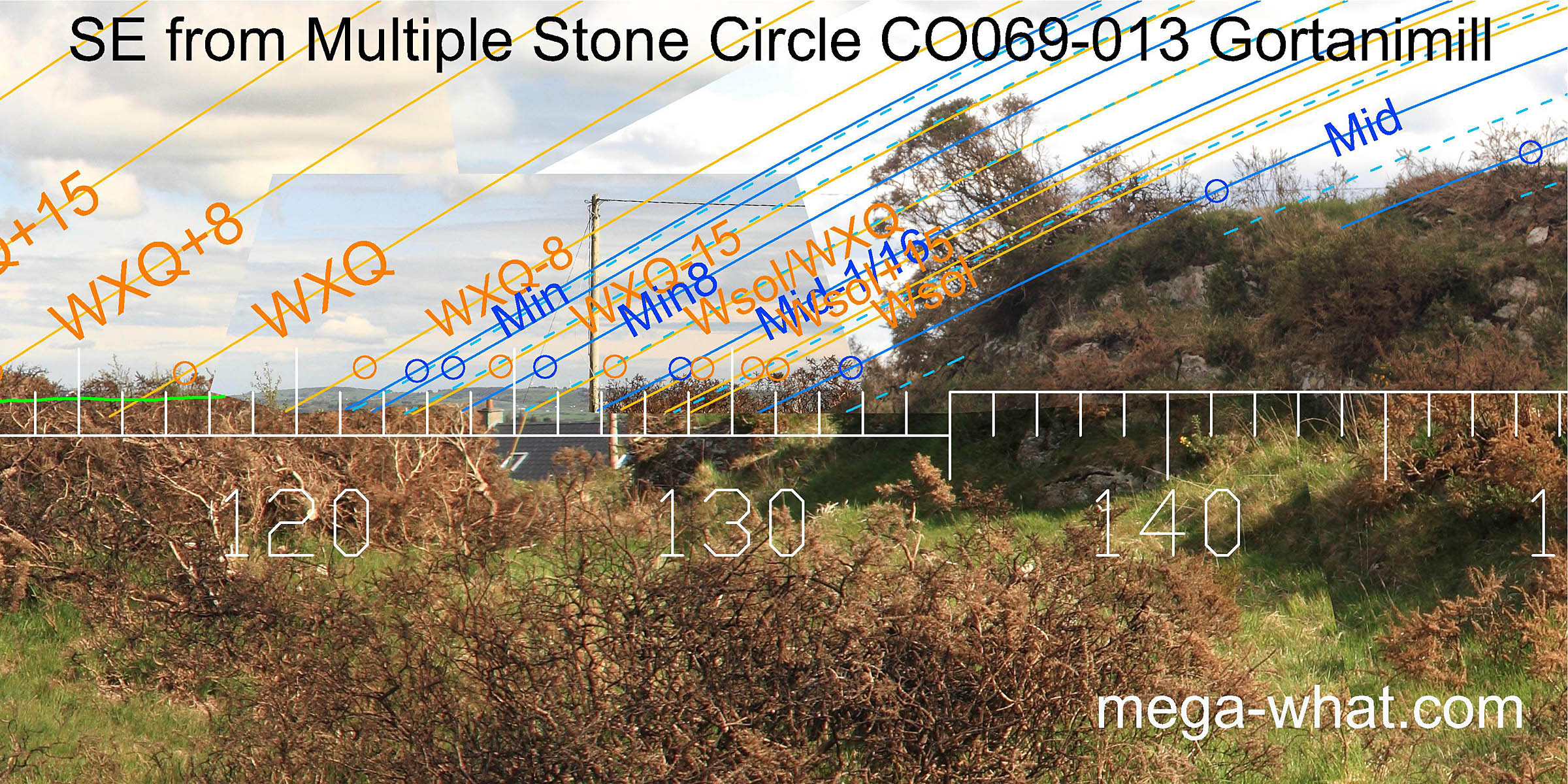 The minor half of the south-east lunisticeLunistices are the most northerly and southerly moons of the month. The lunar equivalent of solstices - more.
range and perhaps the winter cross-quarters too are on distant horizon but bushes obscure the detail.
The minor half of the south-east lunisticeLunistices are the most northerly and southerly moons of the month. The lunar equivalent of solstices - more.
range and perhaps the winter cross-quarters too are on distant horizon but bushes obscure the detail.
The major half of the lunisticeLunistices are the most northerly and southerly moons of the month. The lunar equivalent of solstices - more. range is on very local ground, with the highest part being due south [Pic].
There is an alternative axial stone here and this axis indicates lunar minor standstillLunistice positions vary cyclically over an 18.6 year period but are fairly static for more than a year at either end of the range [Pic].
![[Pic]](Gortanimill-SEax.jpg)
 The entirety of the south-western lunisticeLunistices are the most northerly and southerly moons of the month. The lunar equivalent of solstices - more.
range is also on the local high ground but vegetation and a field boundary obscure the true contour.
Clearly this horizon is very position sensitive, nevertheless, the circle axis indicates major standstillLunistice positions vary cyclically over an 18.6 year period but are fairly static for more than a year at either end of the range
[Pic].
The entirety of the south-western lunisticeLunistices are the most northerly and southerly moons of the month. The lunar equivalent of solstices - more.
range is also on the local high ground but vegetation and a field boundary obscure the true contour.
Clearly this horizon is very position sensitive, nevertheless, the circle axis indicates major standstillLunistice positions vary cyclically over an 18.6 year period but are fairly static for more than a year at either end of the range
[Pic].
![[Pic]](Gortanimill-SWax.jpg)
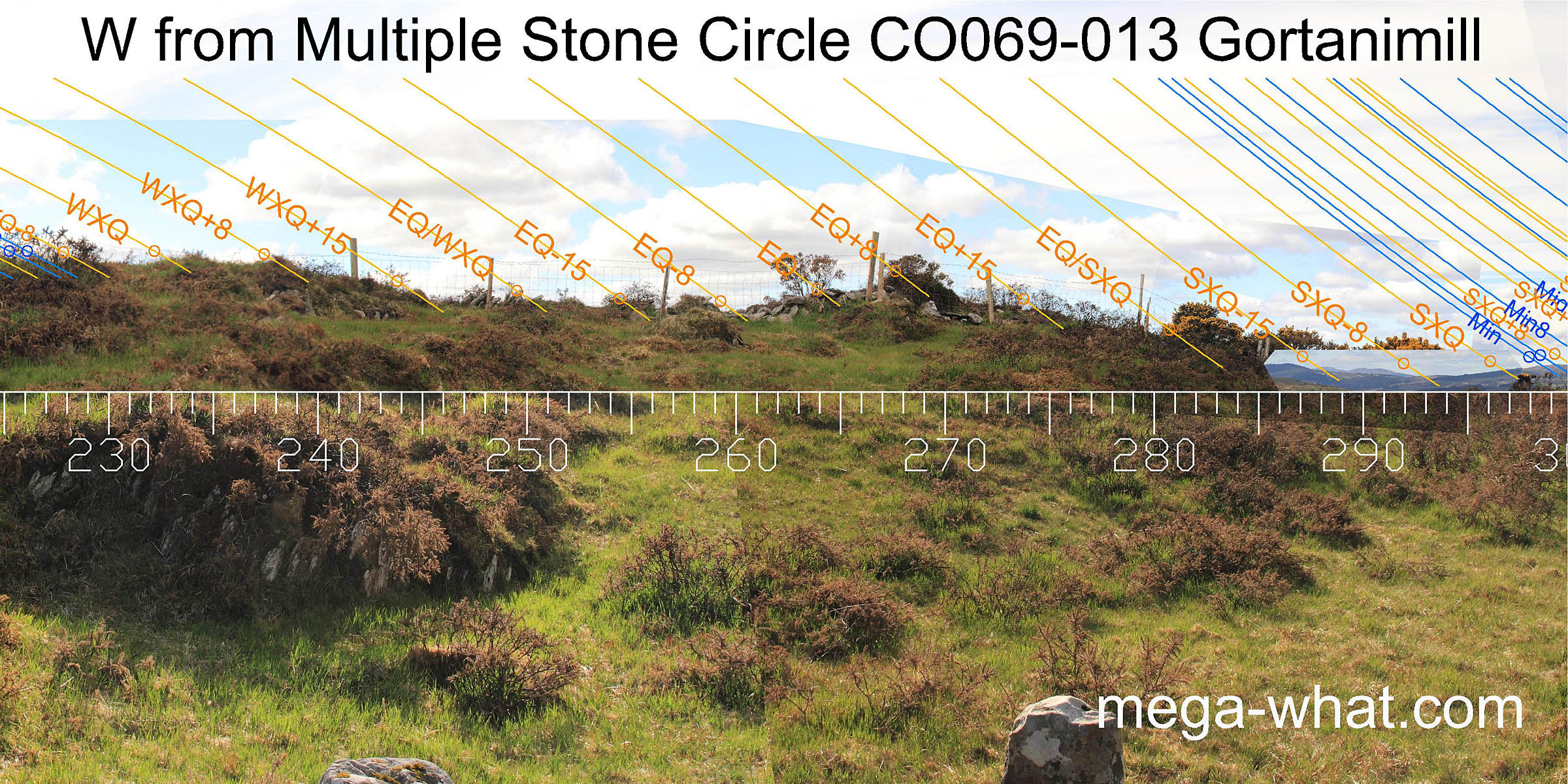 The local ground continues to the west where the equinox may be marked by a hump but, as with the east and south, this horizon sector is extremely position sensitive.
 To the north-west, the exact intersect between local and distant is uncertain but the lunisticeLunistices are the most northerly and southerly moons of the month. The lunar equivalent of solstices - more.
range spans a solstitial dip.
To the north-west, the exact intersect between local and distant is uncertain but the lunisticeLunistices are the most northerly and southerly moons of the month. The lunar equivalent of solstices - more.
range spans a solstitial dip.
The secondary axis would seem to be centred on the lunar minor eighth in this direction [Pic].
![[Pic]](Gortanimill-NWax.jpg)
There are many more megalithic sites in the area but the nearest surveyed ones are:
- Coolmountain Stone Circle is c.13km south (186°)
- Cappaboy Beg Stone Pair is c.18km south-west (218°)
- Gurteen Stone Circle is c.21km west (257°)
References
- Archaeological Survey of Ireland, record details. www.archaeology.ie/archaeological-survey-ireland
- POWER, D. et al. 1997 Archaeological Inventory of County Cork, Volume III: Mid Cork. Dublin: Stationary Office. p11, no.6443.
- Ó'NUALLÁIN, SEÁN 1984 A Survey of Stone Circles in Cork and Kerry. Proceedings of the Royal Irish Academy 84c:1-77, p14, no.10.
- RUGGLES, C.L.N. 1999 Astronomy in Prehistoric Britain and Ireland. Newhaven & London: Yale University Press. No.ASC11.