
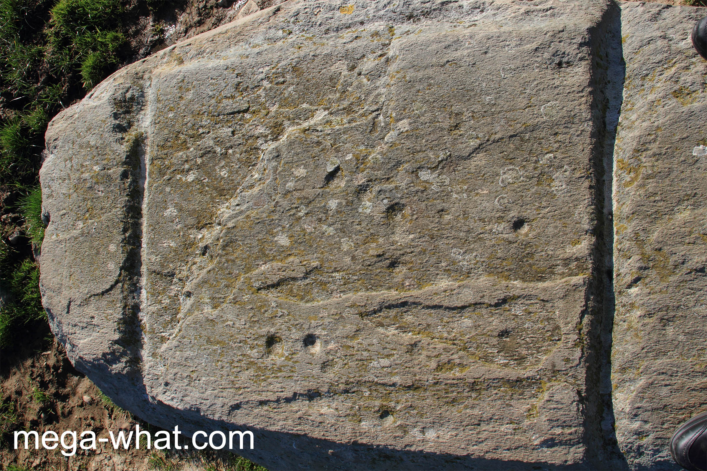
 Coorleigh South Mass Rock is between Clonakilty and Castlefreek. Its flat top is decorated with two prominent transverse grooves delimiting a central area containing perhaps thirteen cupmarks.
With visible support stones it certainly looks like a Boulder-Burial.
The classification as a mass rock is because it was a place where clandestine religious ceremonies were celebrated during "penal times"
when the practice of Roman Catholicism was illegal under British rule.
Coorleigh South Mass Rock is between Clonakilty and Castlefreek. Its flat top is decorated with two prominent transverse grooves delimiting a central area containing perhaps thirteen cupmarks.
With visible support stones it certainly looks like a Boulder-Burial.
The classification as a mass rock is because it was a place where clandestine religious ceremonies were celebrated during "penal times"
when the practice of Roman Catholicism was illegal under British rule.
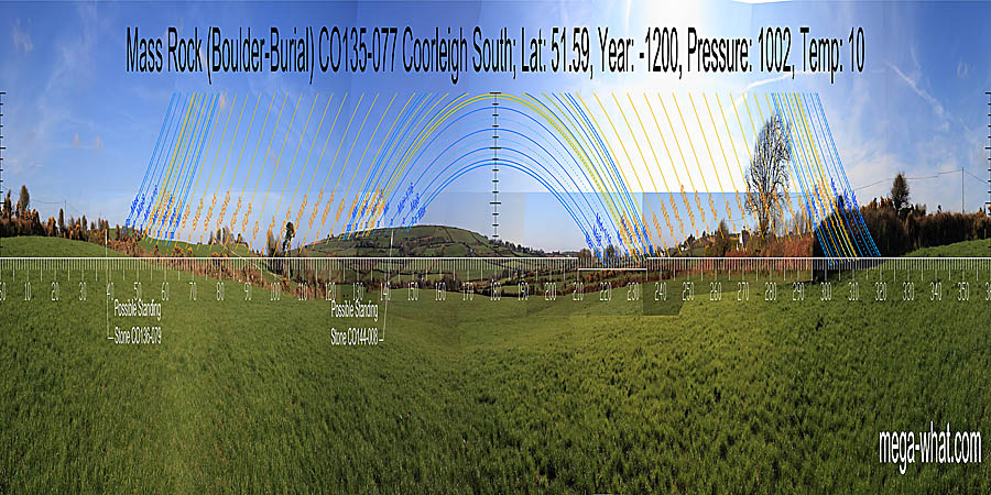
 Also interesting as another case of an extreme axis being a possible convention for drawing attention to the south-east while still indicating the south-west / north-east axis.
North appears to be on nearer high ground but is obscured [Pic].
![[Pic].](CoorleighSouth-N.jpg)
 The north basal dip of the southern hill marks most extreme southerly moonset position (major standstillLunistice positions vary cyclically over an 18.6 year period but are fairly static for more than a year at either end of the range
). Detail of the following upslope is now obscured by houses and vegetation but the minor end of the lunisticeLunistices are the most northerly and southerly moons of the month. The lunar equivalent of solstices - more.
range is at a bit of a break.
The north basal dip of the southern hill marks most extreme southerly moonset position (major standstillLunistice positions vary cyclically over an 18.6 year period but are fairly static for more than a year at either end of the range
). Detail of the following upslope is now obscured by houses and vegetation but the minor end of the lunisticeLunistices are the most northerly and southerly moons of the month. The lunar equivalent of solstices - more.
range is at a bit of a break.
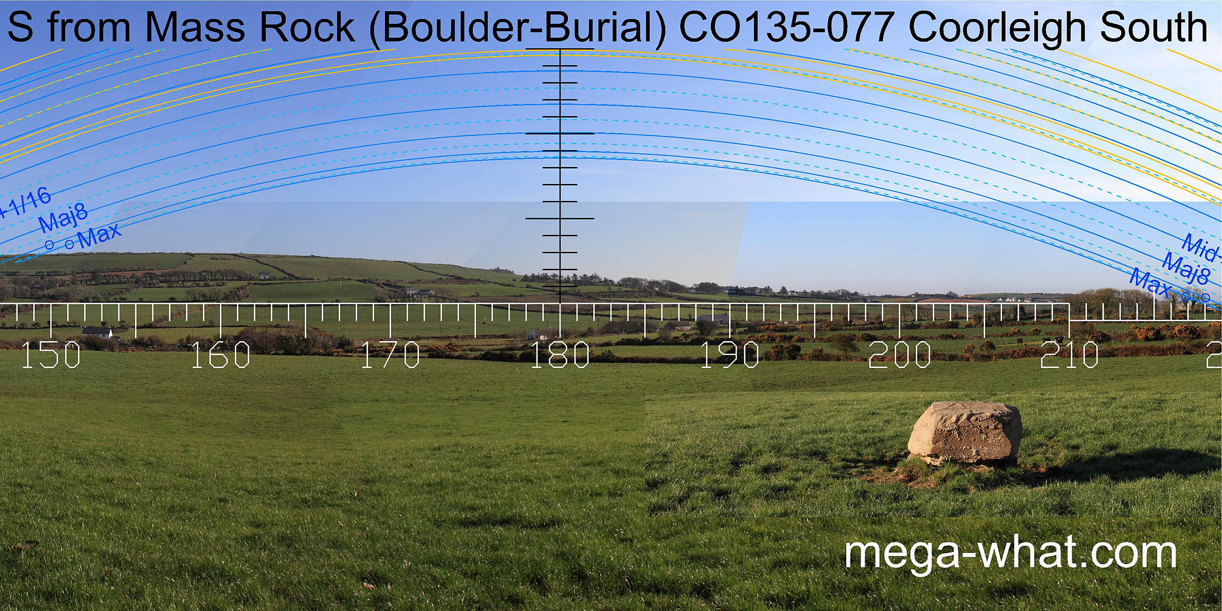
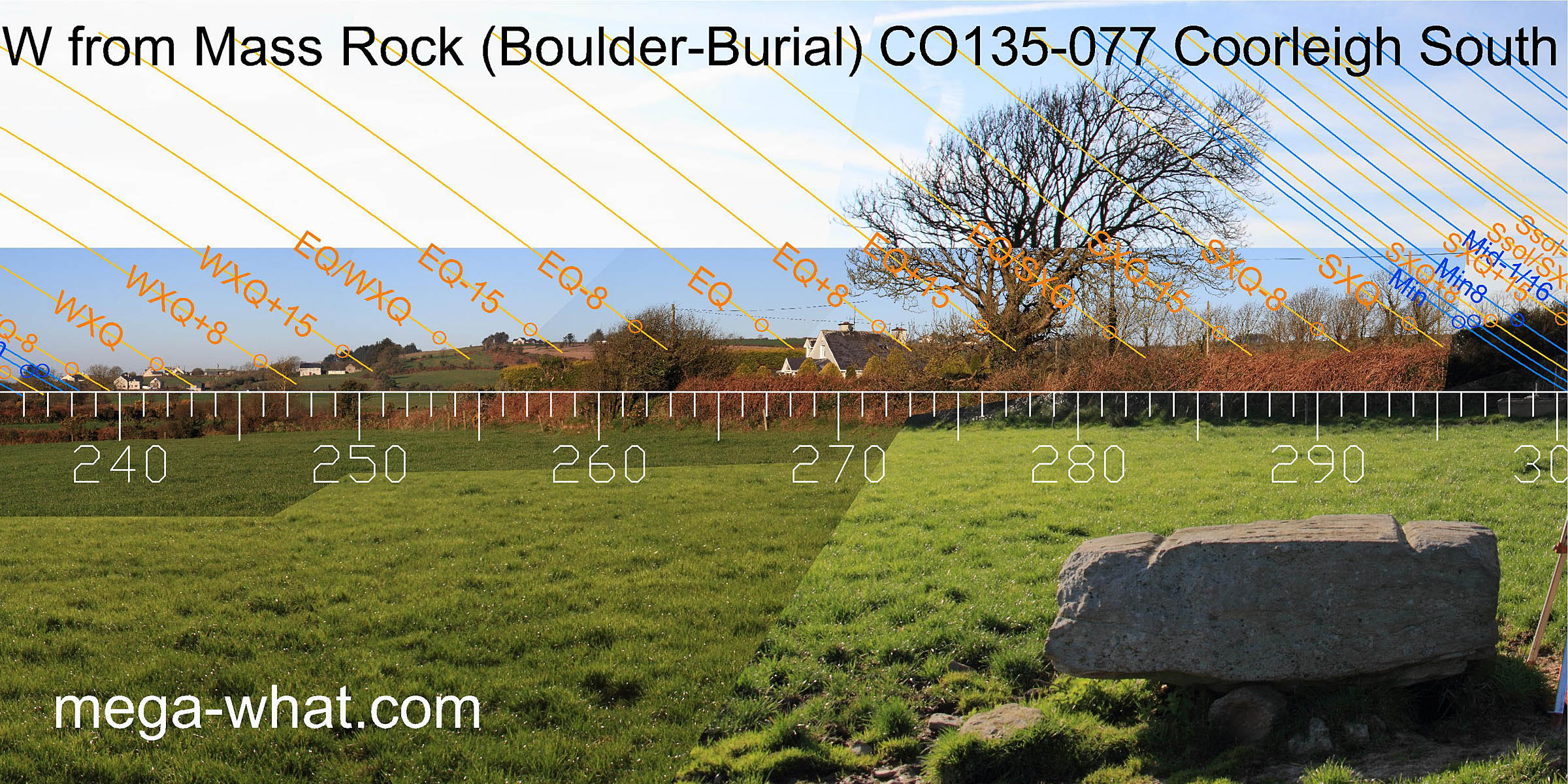 The next section of slope before a sharper rise spans a half-month centred on the winter cross-quarters. Above the step and spanning the high ground is the equinoctial zone.
The next dip may be a half-month beyond the equinox or half-way to the summer cross-quarters but detail is obscured.
The carved grooves indicate a period just the equinoctial side of summer cross-quarter.
The next section of slope before a sharper rise spans a half-month centred on the winter cross-quarters. Above the step and spanning the high ground is the equinoctial zone.
The next dip may be a half-month beyond the equinox or half-way to the summer cross-quarters but detail is obscured.
The carved grooves indicate a period just the equinoctial side of summer cross-quarter.
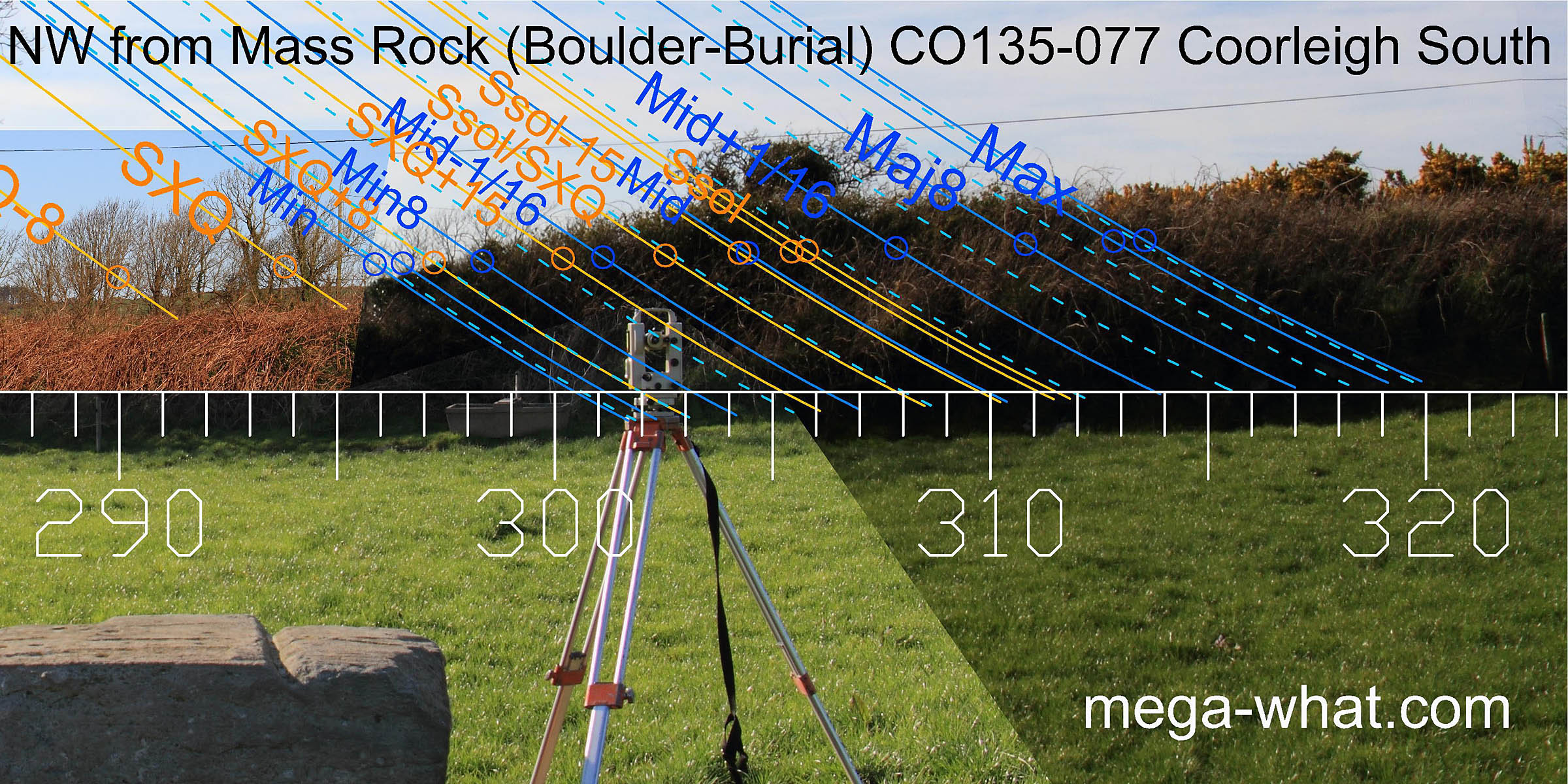 The north-west is completely obscured.
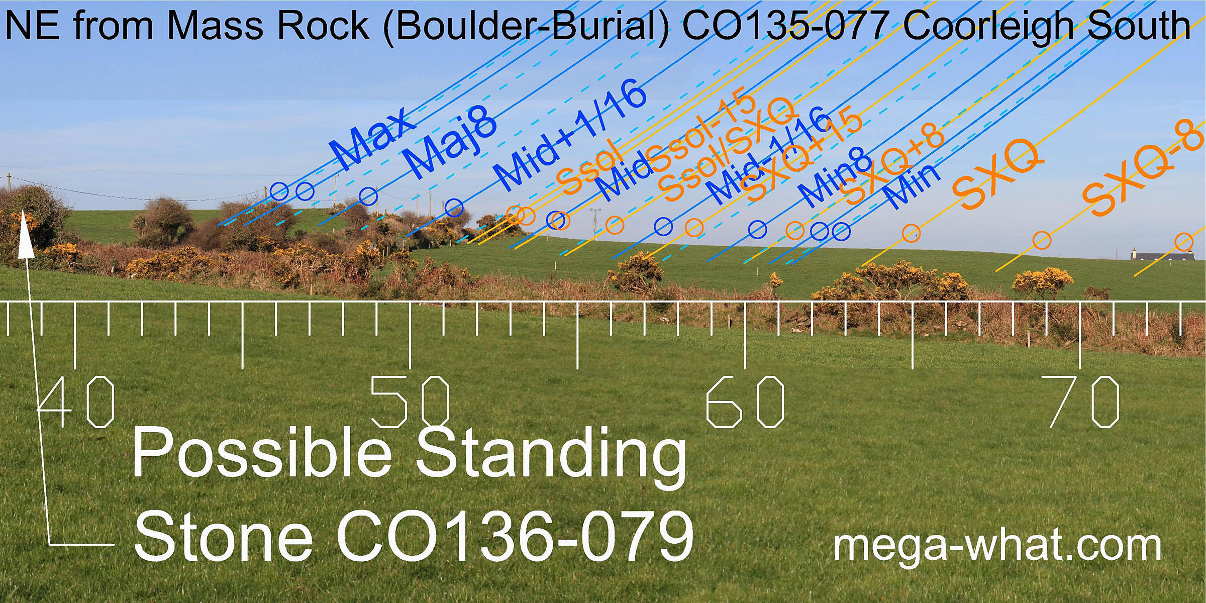 The possible site of a Standing Stone (CO135-079, recorded by the Ordnance Survey in 1842 but now gone) is 348m to the north-east, somewhat beyond the most extreme northerly moonrise position.
The step at the foot of the higher ground, now occupied by the road, is the lunar midpoint. There follows a long fairly flat section of thoroughly reclaimed good agricultural land.
The possible site of a Standing Stone (CO135-079, recorded by the Ordnance Survey in 1842 but now gone) is 348m to the north-east, somewhat beyond the most extreme northerly moonrise position.
The step at the foot of the higher ground, now occupied by the road, is the lunar midpoint. There follows a long fairly flat section of thoroughly reclaimed good agricultural land.
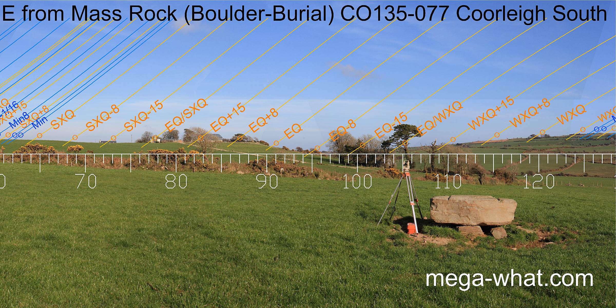 The quarter-month south of the summer cross-quarters is marked by a slight break and the intersect of local slope with further ground is a quarter-month south of the equinox.
The carved grooves indicate a period just the equinoctial side of winter cross-quarter.
The quarter-month south of the summer cross-quarters is marked by a slight break and the intersect of local slope with further ground is a quarter-month south of the equinox.
The carved grooves indicate a period just the equinoctial side of winter cross-quarter.
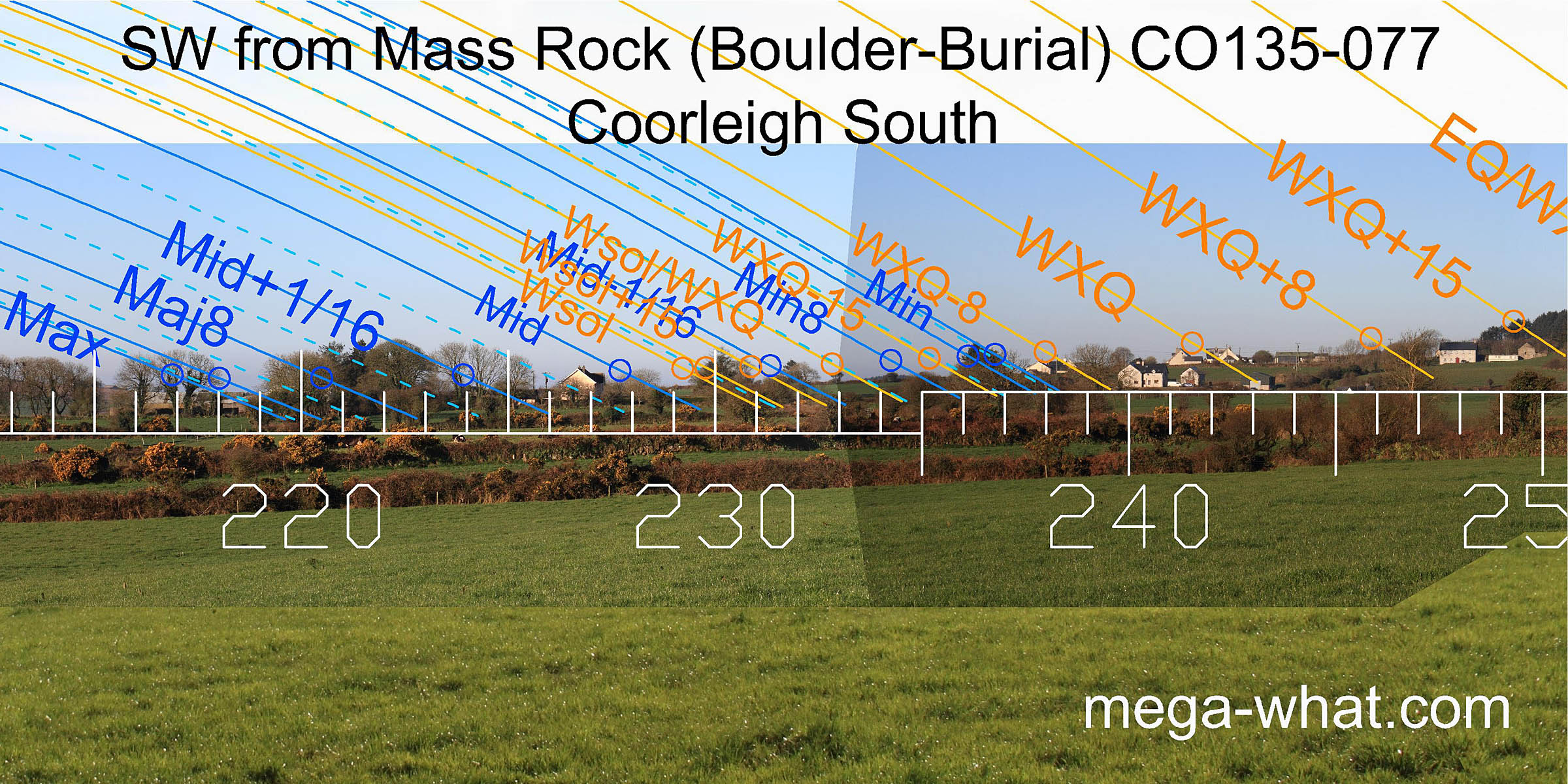
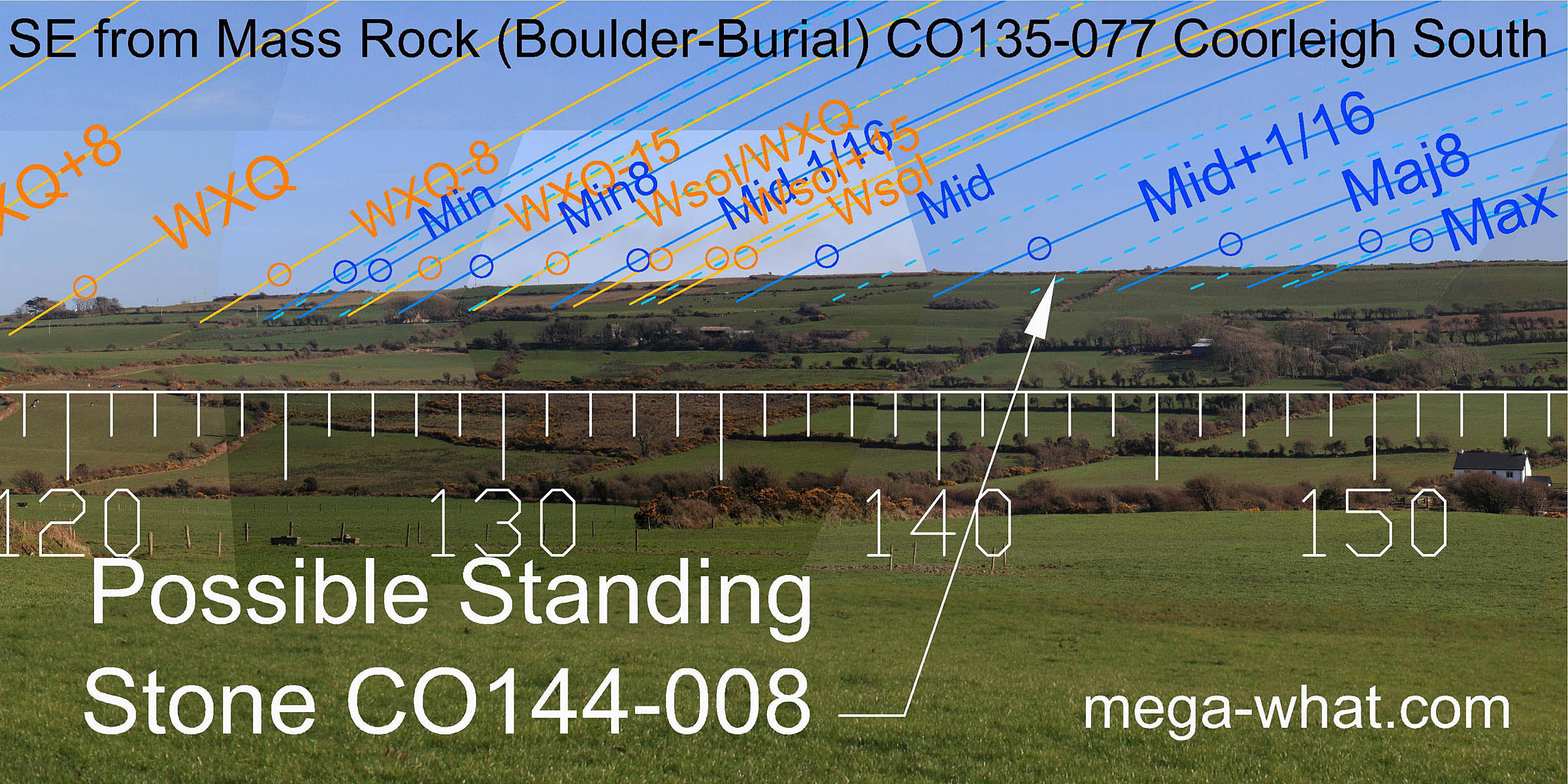 The south-east horizon is occupied by Corrabally hill.
A step on its east slope is a week south of the winter cross-quarter and a bit before the minor standstillLunistice positions vary cyclically over an 18.6 year period but are fairly static for more than a year at either end of the range
while the highest point is slightly beyond the major one.
Between these, Standing Stone CO144-008, recorded on the 1902 OS map, might once have been visible and significant but is now gone.
The south-east horizon is occupied by Corrabally hill.
A step on its east slope is a week south of the winter cross-quarter and a bit before the minor standstillLunistice positions vary cyclically over an 18.6 year period but are fairly static for more than a year at either end of the range
while the highest point is slightly beyond the major one.
Between these, Standing Stone CO144-008, recorded on the 1902 OS map, might once have been visible and significant but is now gone.
Gortnascarty, 1.2km to the north-east, is another "Boulder-Burial" site which is quite possibly related to this one and the Standing Stones.
Similar use of a long slope in the south-east quadrant may be seen at
- Cullomane East, a boulder-burial & four other sites.
- Glanbrack Five Stone Circle & Stone Pair.
References
- Archaeological Survey of Ireland, record details. www.archaeology.ie/archaeological-survey-ireland
- POWER, D. et al. 1992 Archaeological Inventory of County Cork, Volume 1: West Cork. Dublin: Stationary Office. p353, no.3263.