
 This Standing Stone is about 5km east of Bantry in Trawlebane (Tralibane) and 500m or so WNW of Standing Stone CO118-047.
About 1.2m high but 1.6m wide, its long axis is perhaps 20° anti-clockwise of north / south.
This Standing Stone is about 5km east of Bantry in Trawlebane (Tralibane) and 500m or so WNW of Standing Stone CO118-047.
About 1.2m high but 1.6m wide, its long axis is perhaps 20° anti-clockwise of north / south.
South is in the centre of a wide shallow dip/break [Pic]. North is too [Pic].
![[Pic]](TralibaneST94-S.jpg)
![[Pic]](TralibaneST94-N.jpg)
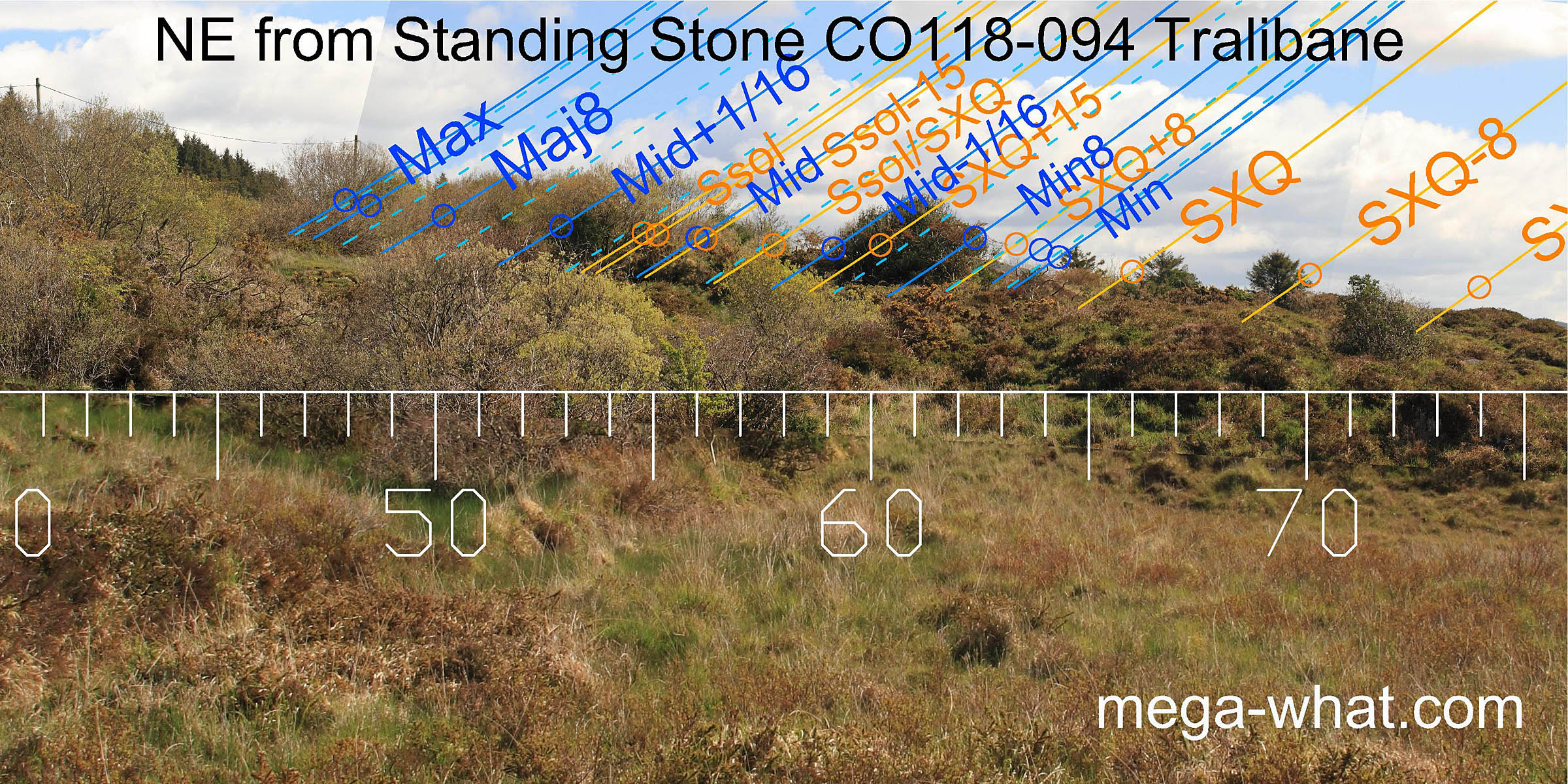 The north-east is rather obscured but cross-quarters are on top of the local hump with minor standstillsLunistice positions vary cyclically over an 18.6 year period but are fairly static for more than a year at either end of the range
at the start of a more distant slope.
The north-east is rather obscured but cross-quarters are on top of the local hump with minor standstillsLunistice positions vary cyclically over an 18.6 year period but are fairly static for more than a year at either end of the range
at the start of a more distant slope.
The stone indicates a period of about a half-month before Bealtaine / after Lughnasadh [Pic].
![[Pic]](TralibaneST94-NEax.jpg)
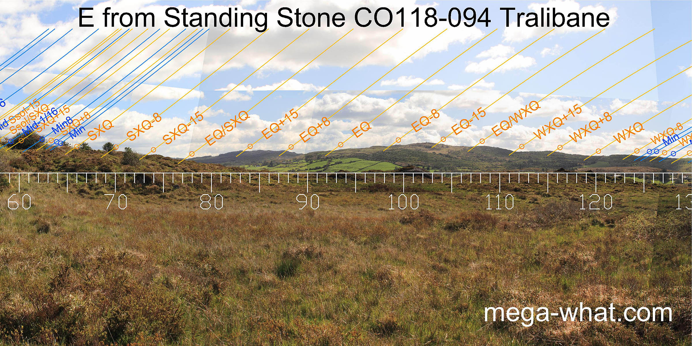 To the east, the dip at the head of the valley marks the equinox / summer cross-quarter midpoint. The winter equivalent is at a step, as is the equinox.
From about 65° to 75° the horizon is very local, being only 107m away.
To the east, the dip at the head of the valley marks the equinox / summer cross-quarter midpoint. The winter equivalent is at a step, as is the equinox.
From about 65° to 75° the horizon is very local, being only 107m away.
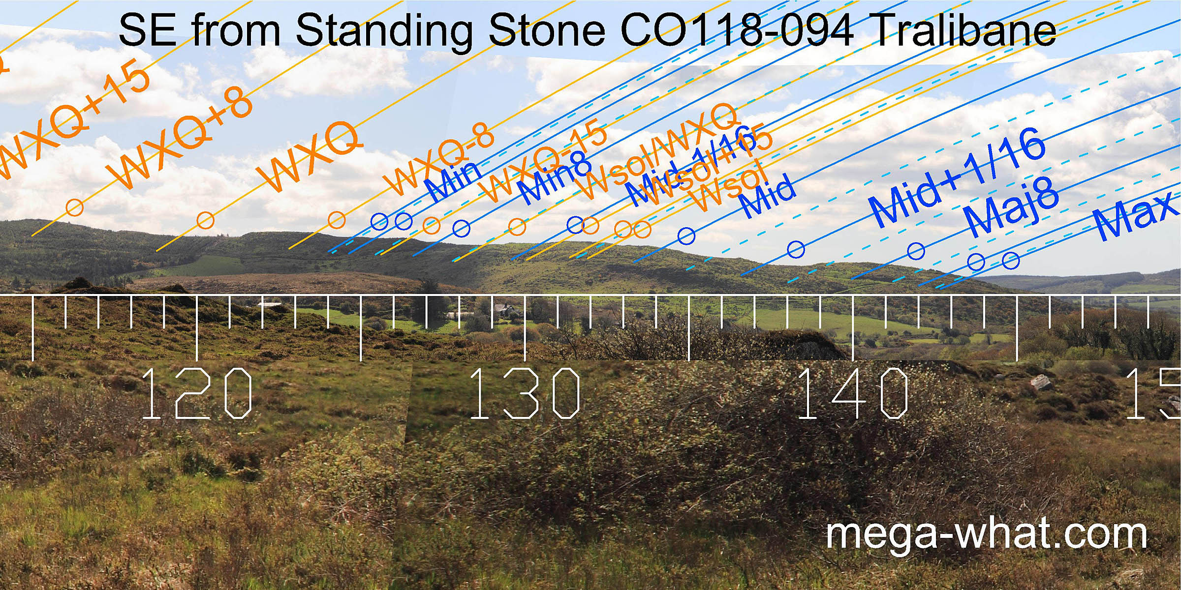 The stepped nature of the south-eastern ridge provides many useful markers with major standstillsLunistice positions vary cyclically over an 18.6 year period but are fairly static for more than a year at either end of the range
at the intersect with a more distant hill.
The stepped nature of the south-eastern ridge provides many useful markers with major standstillsLunistice positions vary cyclically over an 18.6 year period but are fairly static for more than a year at either end of the range
at the intersect with a more distant hill.
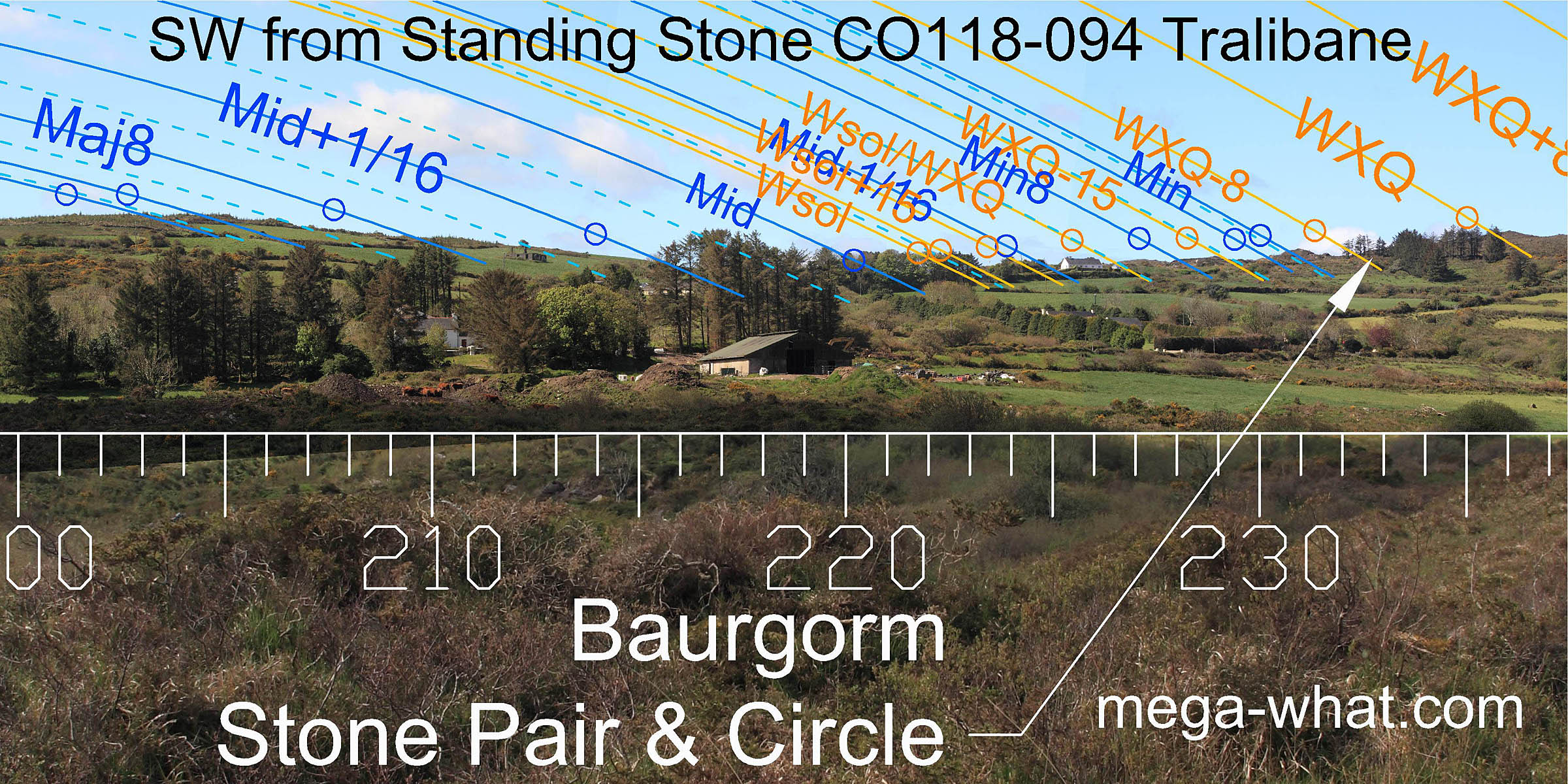 Trees obscure the central part of the south-western lunisticeLunistices are the most northerly and southerly moons of the month. The lunar equivalent of solstices - more.
range but major standstillsLunistice positions vary cyclically over an 18.6 year period but are fairly static for more than a year at either end of the range
are on a hilltop and minor ones at a pointed hump, as are the summer cross-quarters.
Trees obscure the central part of the south-western lunisticeLunistices are the most northerly and southerly moons of the month. The lunar equivalent of solstices - more.
range but major standstillsLunistice positions vary cyclically over an 18.6 year period but are fairly static for more than a year at either end of the range
are on a hilltop and minor ones at a pointed hump, as are the summer cross-quarters.
Baurgorm Stone Pair & Circle is c.1km to the south-west, just below the horizon.
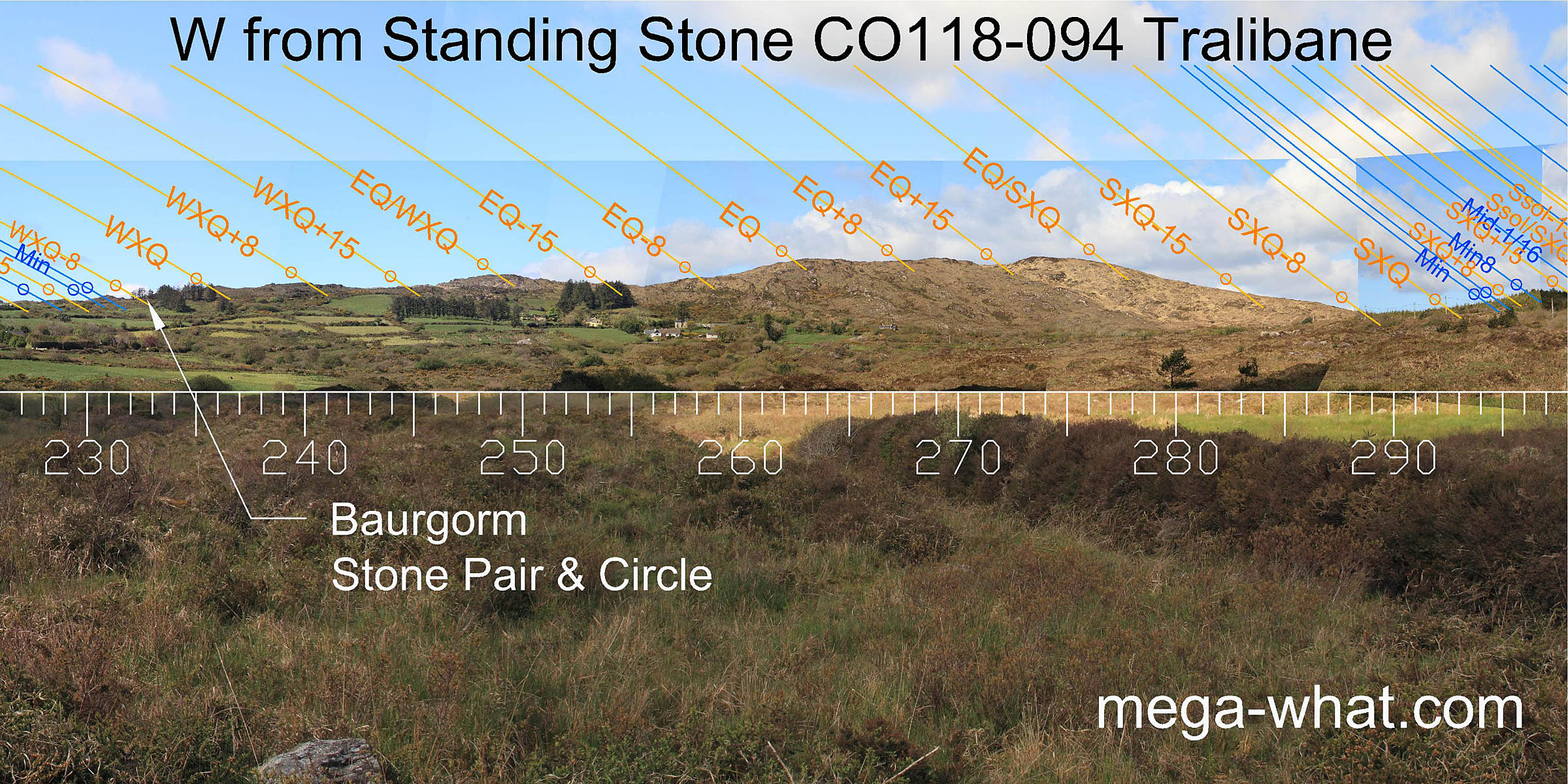 There are lots of useful markers for the half and quarter months on the western horizon but the equinoctial sun sets into a hilltop.
The equinox / winter cross-quarter midpoint is also on a top and the stone seems to indicate this region [Pic].
![[Pic]](TralibaneST94-SWax.jpg)
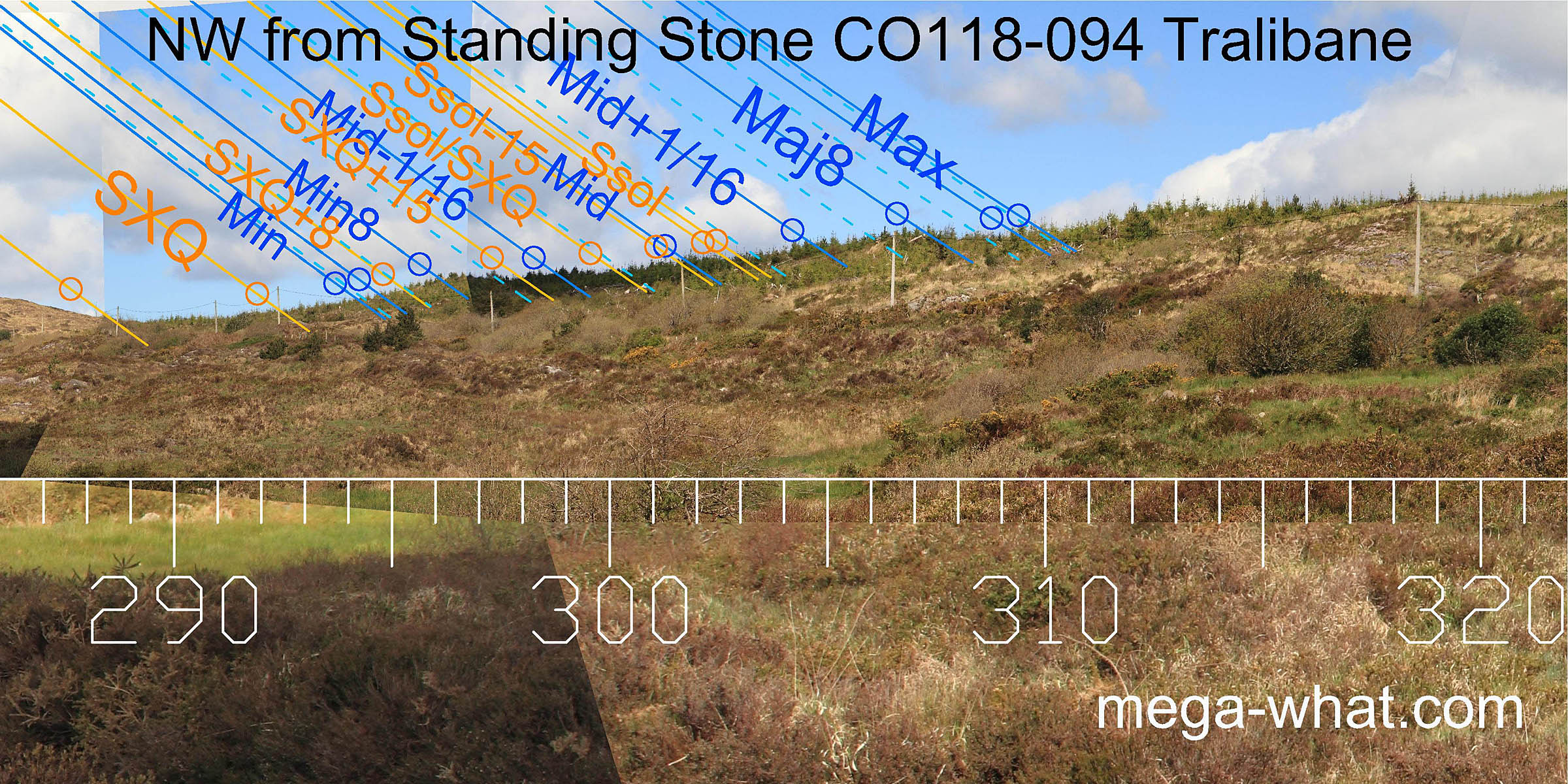 The north-western profile is confused by forestry but it looks like major standstillLunistice positions vary cyclically over an 18.6 year period but are fairly static for more than a year at either end of the range
is in a dip. Both major and minor eighths are marked by humps with summer cross-quarters possibly at a smaller one.
The north-western profile is confused by forestry but it looks like major standstillLunistice positions vary cyclically over an 18.6 year period but are fairly static for more than a year at either end of the range
is in a dip. Both major and minor eighths are marked by humps with summer cross-quarters possibly at a smaller one.
- Standing Stone CO118-047 is c.500m east-south-east (112°)
- Tralibane Stone Circle is c.1km to the east-north-east (79°)
- Baurgorm Stone Pair & Circle is just below the horizon c.1km to the south-west (233°)
References
- Archaeological Survey of Ireland, record details. www.archaeology.ie/archaeological-survey-ireland
- RONAN, S. et al. 2009 Archaeological Inventory of County Cork, Volume 5: West Cork. Dublin: Stationary Office.