
These sites were visited on 8th February 2018 but not surveyed. The panoramas were assembled by a commercial algorithm but due to cloud there is no absolute reference to reality and orientations are very approximate. Almost certainly wrong in absolute terms but, bearing that in mind, appreciate the overall relationship between site and horizon / sky.
King's Men Stone Circle
NGR: SP 29571 30866 (SP 29580 BNG 30876 / 51.97553, -1.57078) [Googlemap]
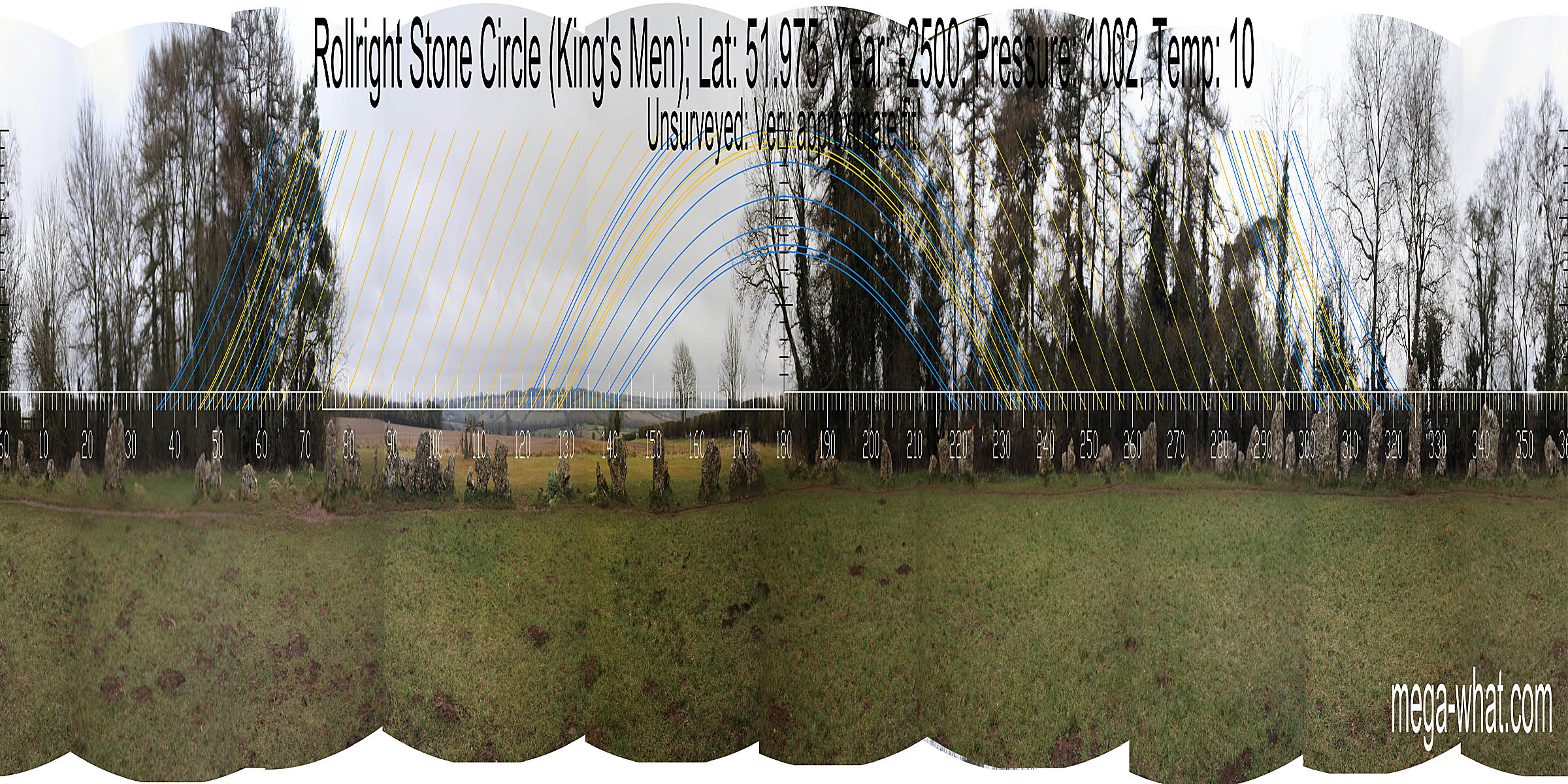 Rollright Stone Circle is the east-most stone circle in England and has an estimated late neolithic construction date of c.2500-2000BC.
About 70 stones remain today of a possible 100 or so, c.32m in diameter. There is an entrance portal pair (marked by two exterior stones) that are opposite the tallest stone.
Rollright Stone Circle is the east-most stone circle in England and has an estimated late neolithic construction date of c.2500-2000BC.
About 70 stones remain today of a possible 100 or so, c.32m in diameter. There is an entrance portal pair (marked by two exterior stones) that are opposite the tallest stone.
Rollright: Whispering Knights
NGR: SP 29930 30840 (SP 29935 BNG 30848 / 51.97526, -1.56562) [Googlemap]
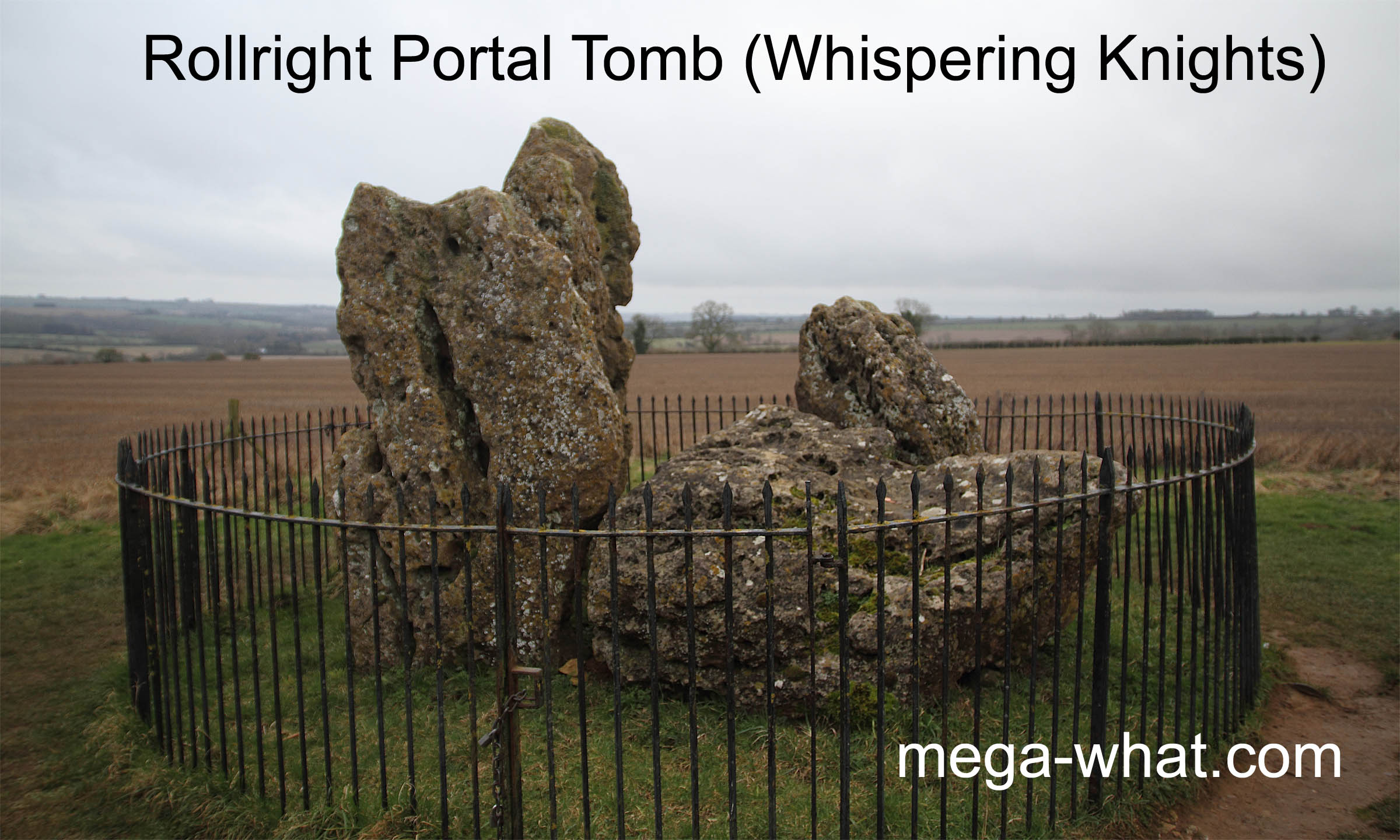
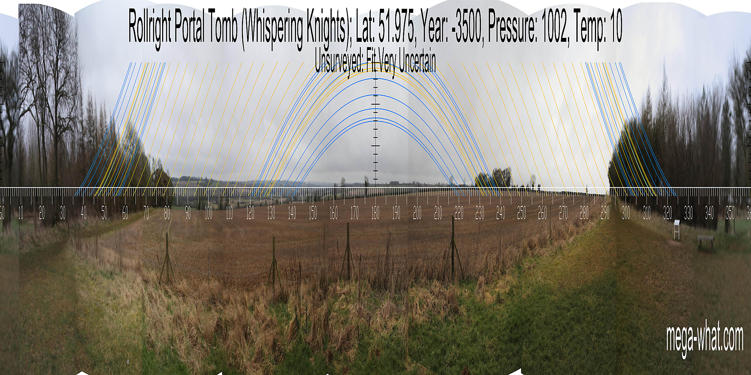 The Whispering Knights are the remains of a Portal Tomb (Portal Dolmen) from the early neolithic c.3800 - 3500BC.
This is the most easterly Portal Dolmen in Britain and is about 360m east of the stone circle.
The Whispering Knights are the remains of a Portal Tomb (Portal Dolmen) from the early neolithic c.3800 - 3500BC.
This is the most easterly Portal Dolmen in Britain and is about 360m east of the stone circle.
Rollright: King Stone
NGR: SP 29633 30993 (SP 29621 BNG 30958 / 51.97627, -1.57018) [Googlemap]
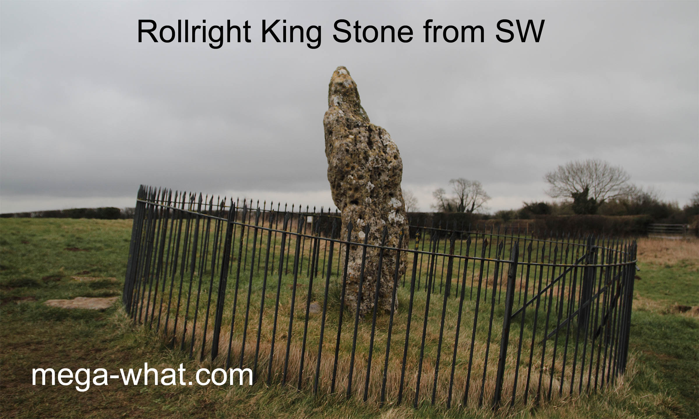
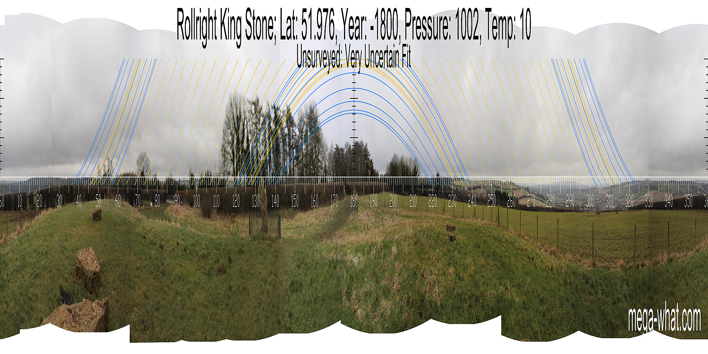 The King Stone is a standing stone of the early-mid bronze age c.1800BC and is c.70m north-east of the stone circle, on the other side of the road, in Warwickshire.
In the same area, a round cairn and a ditched round barrow of broadly similar date were excavated in 1982-3. The cairn could be older though as the dated deposits were secondary and the central chamber was not excavated.
This area has the advantage of westerly views of distant landscape rather than the ridge they stand upon, which is all that is visible from the other sites.
- Two English sites have been surveyed: Stoney Littleton Long Barrow & West Kennet Long Barrow
- Another visited but unsurveyed English site is Belas Knap Long Barrow
References / Links