
 Cwm Garw Standing Stone Pair is at the southern foot of the Preseli Hills, about 3km north of Mynaclog Ddu as the crow flies.
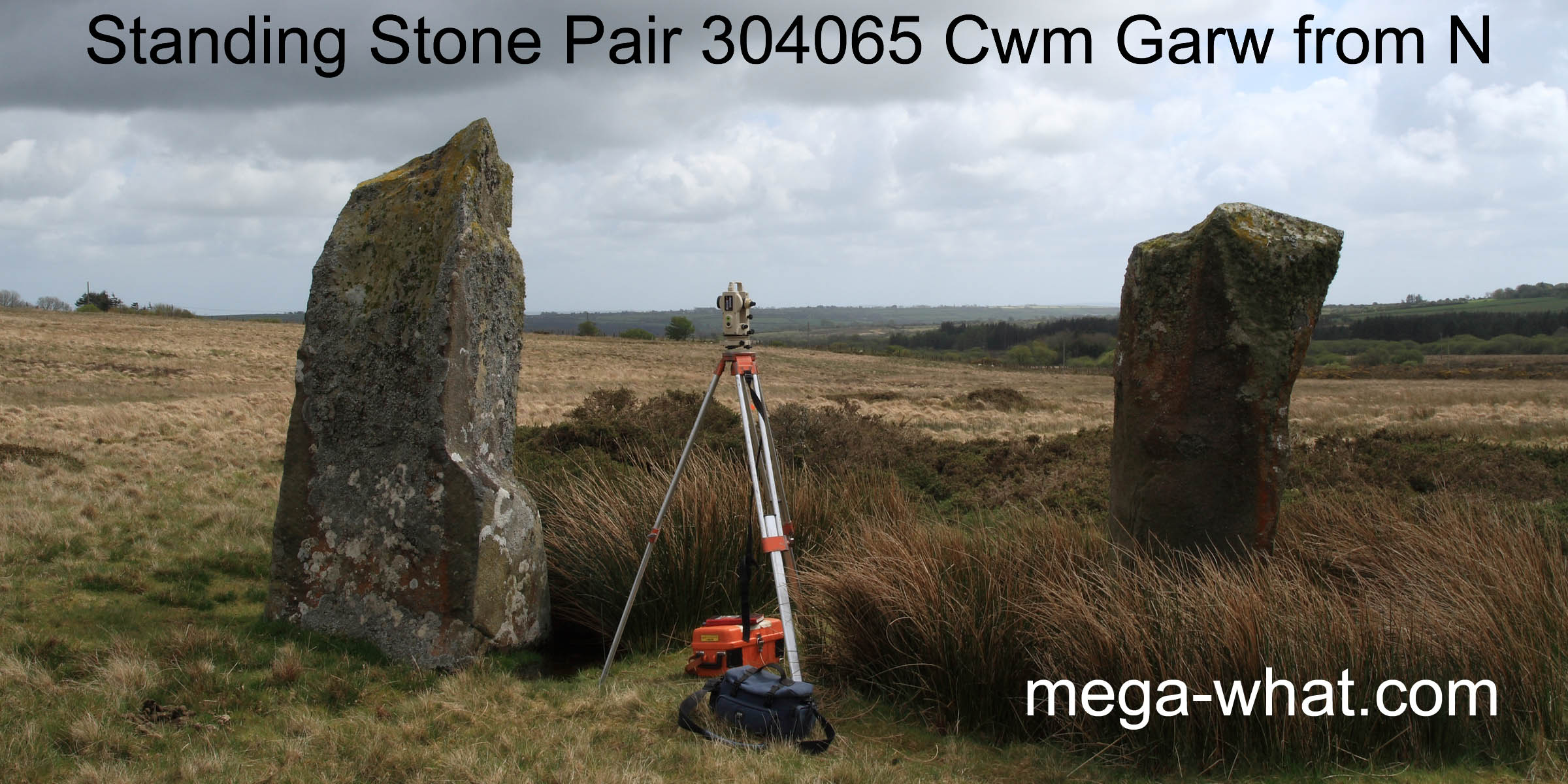
Both a little over 2m high, these stones are known as Cerrig Meibion Arthur - the Stones of the Sons of Arthur.
 South is at the western edge of a dip [Pic].
![[Pic].](CwmGarw-S.jpg)
North is close to the bottom of a dip [Pic].
![[Pic].](CwmGarw-N.jpg)
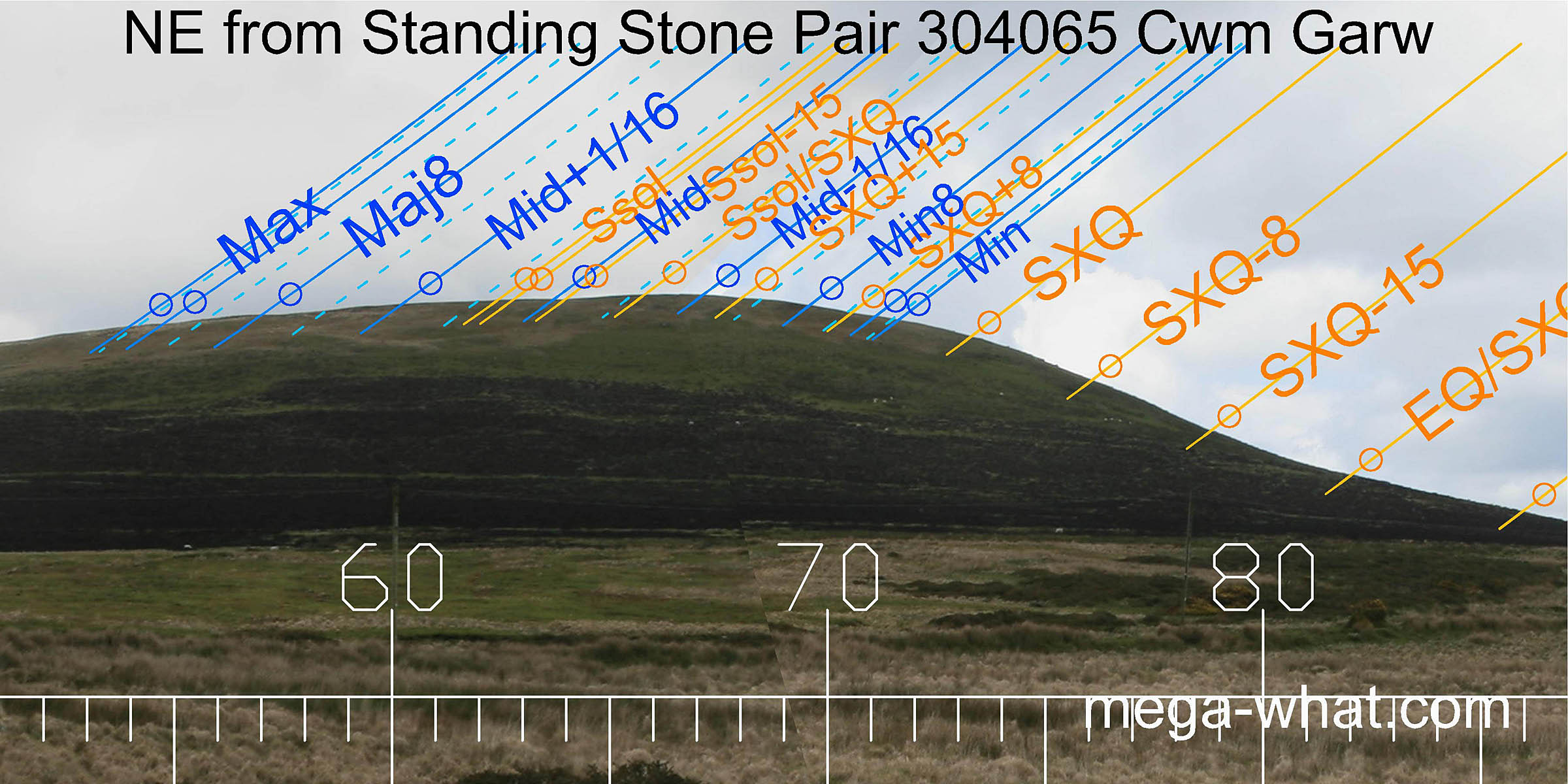 To the north-east, the solstice / cross-quarter midpoint and the sixteenth on the minor side of the lunar midpoint are either side of the highest point of the hill.
Further north along the ridge there are some subtle undulations in the profile that have been well exploited.
To the north-east, the solstice / cross-quarter midpoint and the sixteenth on the minor side of the lunar midpoint are either side of the highest point of the hill.
Further north along the ridge there are some subtle undulations in the profile that have been well exploited.
 The eastern horizon is rather smooth and lacking in obvious features but the cross-quarters are at the top of a series of outcropping rocks.
The pair axis may indicate a time about two "weeks" north of the equinox but the western stone is now leaning significantly.
The equinox itself is just south of the hill's basal step, near the start of a long smooth slope.
The eastern horizon is rather smooth and lacking in obvious features but the cross-quarters are at the top of a series of outcropping rocks.
The pair axis may indicate a time about two "weeks" north of the equinox but the western stone is now leaning significantly.
The equinox itself is just south of the hill's basal step, near the start of a long smooth slope.
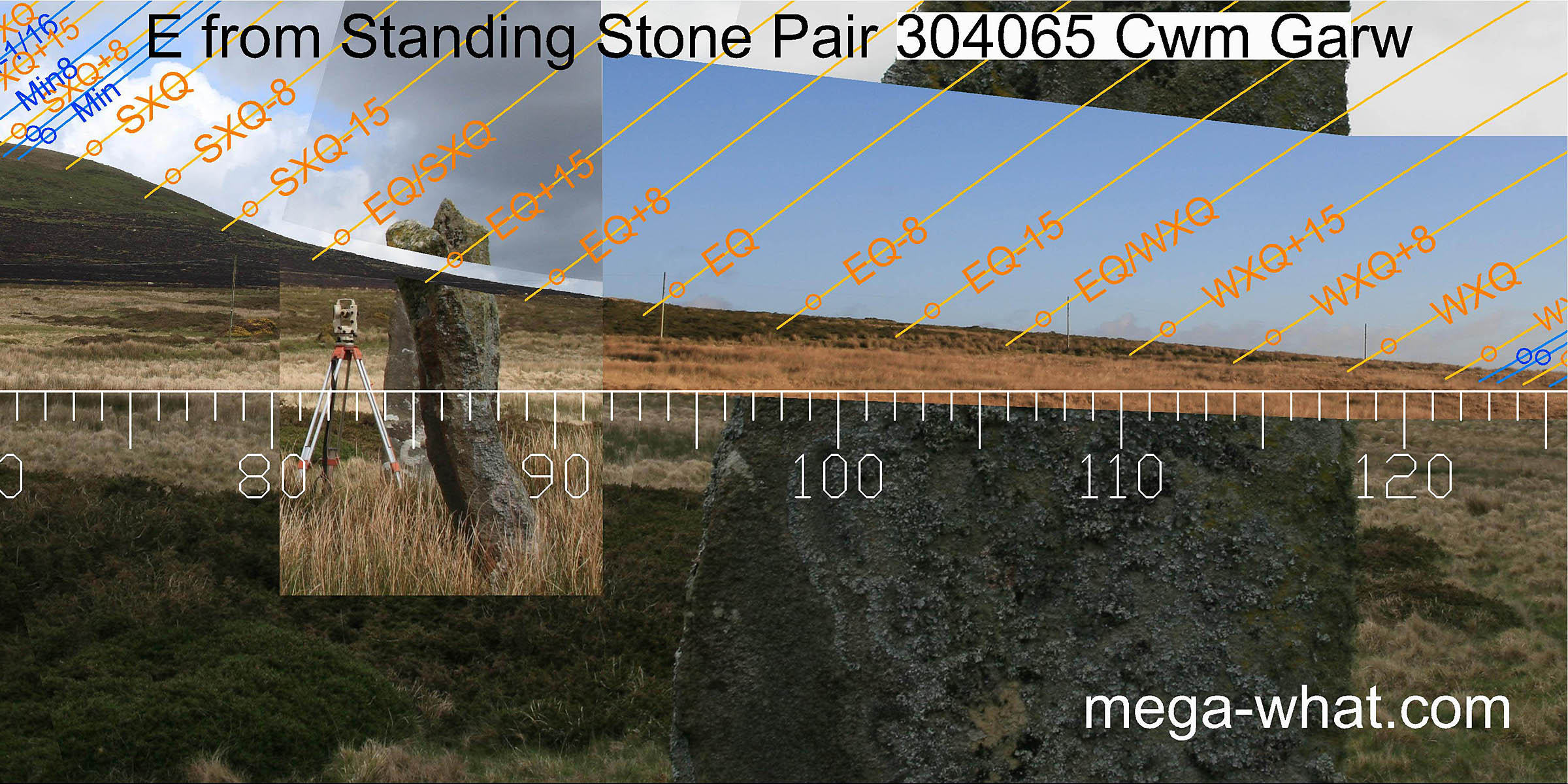
That's the eastern stone on the right, as seen from the theodolite position between the stones and slightly offset: as in the inset axial view shown to the left.
 The intersect of this local slope with a more distant horizon marks the lunar major eighth and then the lunar limit occurs over the top of the first distant hill.
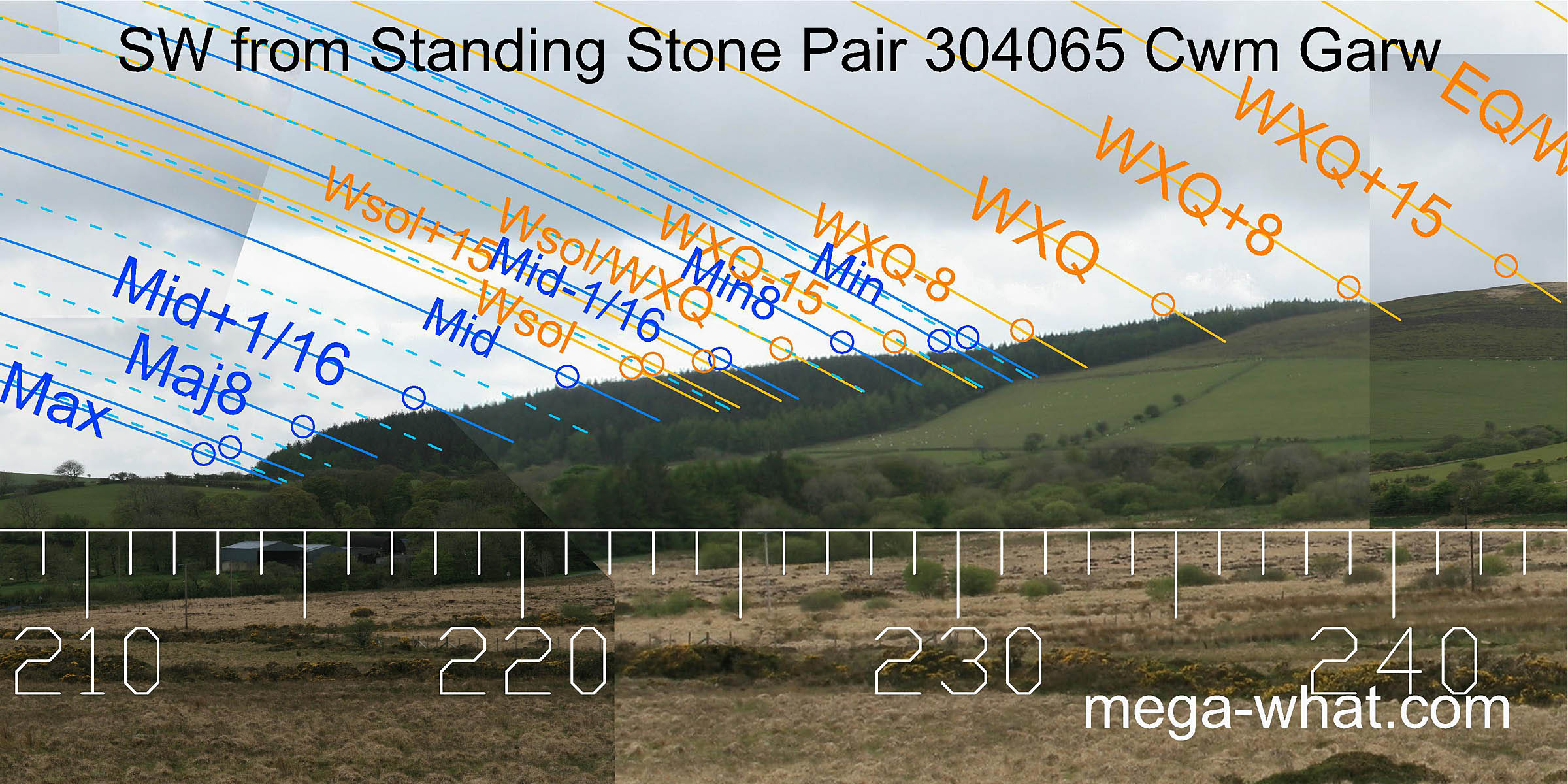 The location for this pair was obviously chosen to give a better south-western horizon than the flat slope obtainable from sites further to the south.
Forestry now masks the true profile but the lunisticeLunistices are the most northerly and southerly moons of the month. The lunar equivalent of solstices - more. range clearly starts at the bottom of the slope.
If the tree canopy roughly follows the shape of the land surface then the minor end of the lunisticeLunistices are the most northerly and southerly moons of the month. The lunar equivalent of solstices - more. range occurs in a dip.
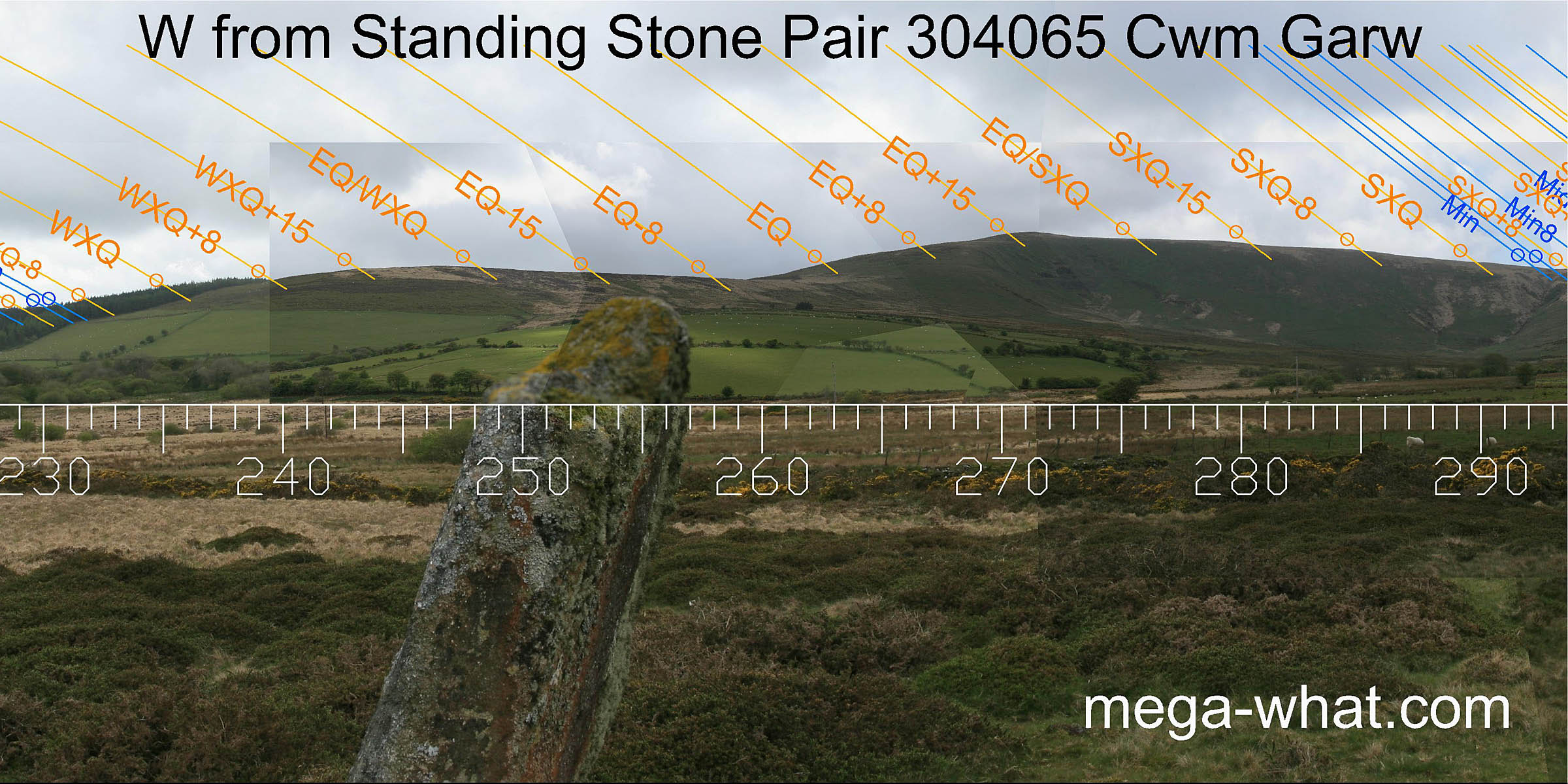 The western sector does offer some utility although it is somewhat lacking in obviously good correlations.
Orientation of the pair would seem to be roughly a week or so north of the equinox [Pic] but the south-western stone is considerably thinner so a range of possibilities exist.
![[Pic]](CwmGarw-Wax.jpg)
That's the western stone on the left, as seen from the theodolite position between the stones and slightly offset, with the inset axial view shown to the right.
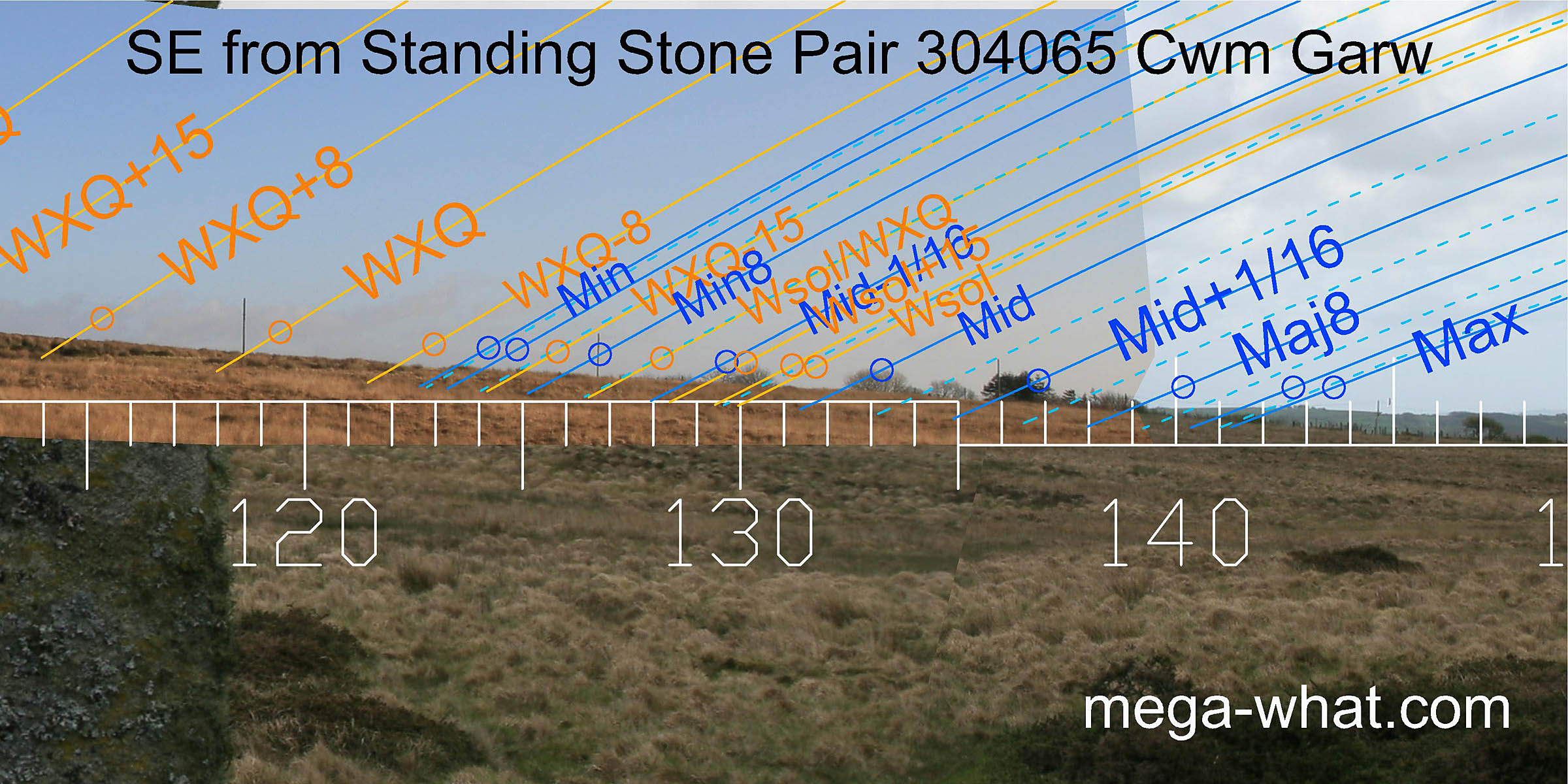
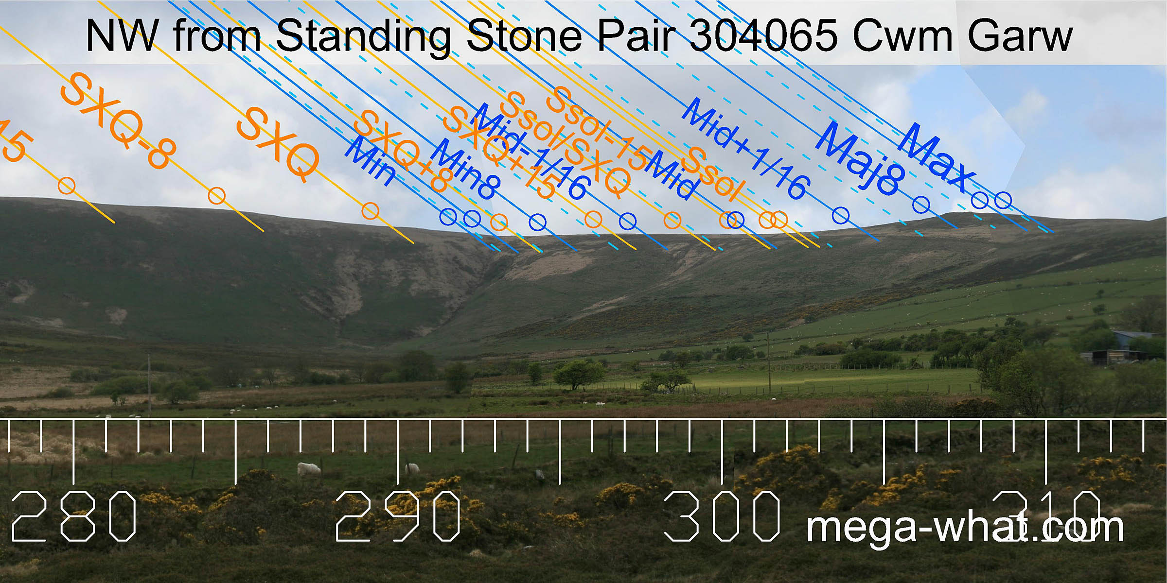 To the north-west, the basal step of Foel Cwmcerwyn marks the sixteenth adjacent to the minor
standstillLunistice positions vary cyclically over an 18.6 year period but are fairly static for more than a year at either end of the range.
The lunar midpoint is at the bottom of the dip with the solstice at the beginning of the upslope.
Then the next high point has the major eighth setting into its western side while its eastern end is three sixteenths from the major
standstillLunistice positions vary cyclically over an 18.6 year period but are fairly static for more than a year at either end of the range.
To the north-west, the basal step of Foel Cwmcerwyn marks the sixteenth adjacent to the minor
standstillLunistice positions vary cyclically over an 18.6 year period but are fairly static for more than a year at either end of the range.
The lunar midpoint is at the bottom of the dip with the solstice at the beginning of the upslope.
Then the next high point has the major eighth setting into its western side while its eastern end is three sixteenths from the major
standstillLunistice positions vary cyclically over an 18.6 year period but are fairly static for more than a year at either end of the range.
- Rhos Fach Standing Stone Pair is 1.6km to the east-south-east.
- Gors Fawr Standing Stone Pair is 2.3km to the south-east and close to Gors Fawr Stone Circle which is the only remaining circle in this area.
- WaunLwyd Standing Stone Pair is 4km to the east.
References
- National Monuments Record of Wales: Coflein database. Coflein database - site details.
- FIGGIS, N.P. 2001 Prehistoric Preseli a field guide. Machynlleth: Atelier Productions. p96, no.90A.